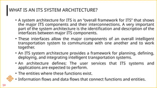
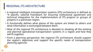
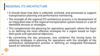
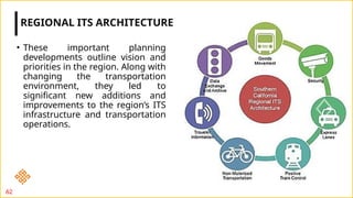
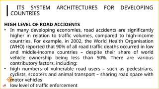
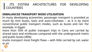
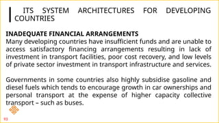
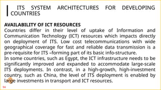
Download to read offline


![57
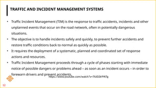
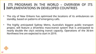
Australia [13] also leads in the field of Intelligent Transportation System. The main
motive of Australian’s ITS is to improve the traffic scenarios and enhancing the public
safety. The project team of Australian’s ITS recommended to adopt FRAME as its
architecture basis so that future enhancements and additions can be easily adopted
both in Australia and FRAME.
ITS in developed countries- Australia](https://image.slidesharecdn.com/b20eds725unit41-241212040819-ddbce3e2/85/ITS-4-1-Intelligent-transportation-System-57-320.jpg)
![58
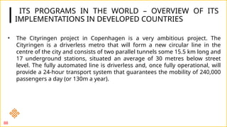
Australia [13] also leads in the field of Intelligent Transportation System. The main motive of
Australian’s ITS is to improve the traffic scenarios and enhancing the public safety. The project team of
Australian’s ITS recommended to adopt FRAME as its architecture basis so that future enhancements
and additions can be easily adopted both in Australia and FRAME.
ITS in developed countries- Australia](https://image.slidesharecdn.com/b20eds725unit41-241212040819-ddbce3e2/85/ITS-4-1-Intelligent-transportation-System-58-320.jpg)
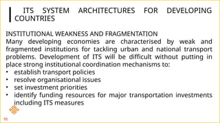


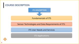
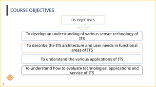
The document outlines the structure and contents of a course on Intelligent Transport Systems (ITS) for civil engineering students, approved by UGC and AICTE, with an academic focus for 2024-2025. It covers the importance of ITS, various sensor technology applications, traffic incident management, and strategies for sustainable mobility, while detailing course objectives, contents, and assessment methodologies. The document emphasizes the significance of ITS in enhancing transportation efficiency, safety, and environmental sustainability.


![Rotary_Roundabout_Sams_03.12.14 [Compatibility Mode].pdf](https://cdn.slidesharecdn.com/ss_thumbnails/rotaryroundaboutsams03-250423055821-6dd85e6b-thumbnail.jpg?width=640&height=640&fit=bounds)
![Origin-Destn Survey [Compatibility Mode].pdf](https://cdn.slidesharecdn.com/ss_thumbnails/o-dsurveycompatibilitymode-250423053753-1b143592-thumbnail.jpg?width=640&height=640&fit=bounds)


