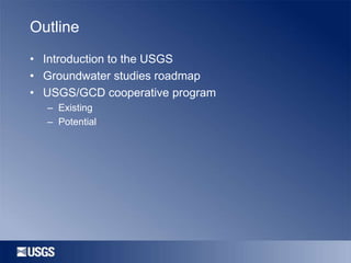
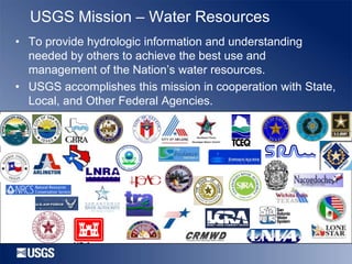
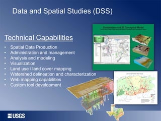
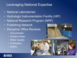
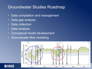
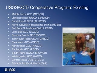
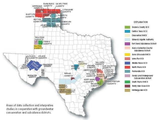
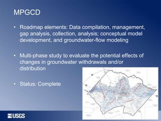
Introduction to the U.S. Geological Survey
and USGS-GCD Cooperative Studies
By Johnathan R. Bumgarner

February 2014
Outline
• Introduction to the USGS
• Groundwater studies roadmap
• USGS/GCD cooperative program
– Existing
– Potential
Introduction to USGS
• Dept. of Interior
• Founded in 1879
• Six Science Themes
– Ecosystems
– Energy, Minerals and Environmental Health
– Core Science Systems
– Climate and Land-Use Change
– Natural Hazards
– Water Resources
• Interdisciplinary scientific monitoring, assessment, and
research
• Employees in every state
USGS Mission – Water Resources
• To provide hydrologic information and understanding
needed by others to achieve the best use and
management of the Nation’s water resources.
• USGS accomplishes this mission in cooperation with State,
Local, and Other Federal Agencies.
Texas Water Science Center (TWSC)
Staffing Level
Austin
San Antonio
Houston
Fort Worth
San Angelo
Wichita Falls
Corpus Christi
Lubbock

68
29
23
20
14
7
1
3

Federal Occupational Series
Hydrologists – Geologists – Geographers – Hydrologic Technicians
Biologists – Hydraulic Engineers – Chemical Engineers – Chemists
Geophysicists – Physical Scientists
Core Capabilities
Analytical Techniques
•
•
•
•
•
•
•
•
•
•
•
•
•
•
•

Watershed modeling
Flood and low-flow frequency analysis
Sediment and chemical load
determination
Aquatic testing
Geographic Information Systems (GIS)
Acoustic Doppler velocity measurements
Ground-water age dating
Surface and borehole geophysics
Evapotranspiration analysis
Ground-water recharge modeling
Solute-transport modeling
Geochemical modeling
Ground-water flow modeling
Geodatabase development
Flood inundation modeling

Data Collection
•
•
•
•
•
•
•
•

Real time streamflow data
Continuous groundwater level
data
Water-quality data
Storm Surge data collection
Stream-sediment transport data
Meteorological data
Data Archival
Web services
Surface Water Gaging Network

527 – Real-time Stream Gage Sites
127 – Real-time Lake Sites
Water Quality Activities
•

Stream and reservoir data collection
• Real-time water quality monitoring
• Chemical/microbial source tracking
• Total maximum daily load (TMDL)
studies
• Biological indicator analyses
• Sediment coring /Age dating
• Trend analysis
• Historical database/archival
Groundwater Data Collection
Part per billion water quality
sampling protocols
Periodic and continuous
water level monitoring

Groundwater
studies and
investigations are
expanding
statewide
Geophysical Capabilities
• TWSC Capabilities
–
–
–
–
–
–

TDEM – Time-Domain Electro-magnetics
FDEM – Frequency-Domain Electro-magnetics
DC – Direct-Current Resistivity
CC – Capacitively Coupled Resistivity
MRS – Magnetic Resonance Soundings
Borehole Geophysics

• USGS –Denver Capabilities
– HEM – Helicopter Electro-magnetics (FDEM and
TDEM)
– CSAMT – Controlled Source Audio
Magnetotellurics
– GPR – Ground Penetrating Radar
– Seismic Refraction and Reflection
– Micro gravity station
– Magnetics
– IP – Induced Polarization
– SP – Spontaneous Potential
11
Data and Spatial Studies (DSS)

Technical Capabilities
•
•
•
•
•
•
•
•

Spatial Data Production
Administration and management
Analysis and modeling
Visualization
Land use / land cover mapping
Watershed delineation and characterization
Web mapping capabilities
Custom tool development
Leveraging National Expertise
•
•
•
•
•

National Laboratories
Hydrologic Instrumentation Facility (HIF)
National Research Program (NRP)
Publishing Network
Discipline Office Reviews
–
–
–
–
–

Groundwater
Surface Water
Water Quality
Publication
Safety
Groundwater Studies Roadmap
•
•
•
•
•
•

Data compilation and management
Data gap analysis
Data collection
Data analysis
Conceptual model development
Groundwater-flow modeling
USGS/GCD Cooperative Program: Existing
•
•
•
•
•
•
•
•
•
•
•
•
•
•
•

Middle Pecos GCD (MPGCD)
Llano Estacado UWCD (LEUWCD)
Sandy Land UWCD (SLUWCD)
Harris-Galveston Subsidence District (HGSD)
Fort Bend Subsidence District (FBSD)
Lone Star GCD (LSGCD)
Brazoria County GCD (BCGCD)
Trinity Glen Rose GCD (TGRBCD)
Clearwater GCD (CGCD)
North Plains GCD (NPGCD)
Panhandle GCD (PGCD)
South Plains UWCD (SPUWCD)
Wintergarden GCD (WGCD)
Central Texas GCD (CTGCD)
Edwards Aquifer Authority (EAA)
PGCD
• Roadmap elements: Data compilation and
management

• Geodatabase and data-entry software development
• Status: Complete
WGCD
• Roadmap elements: Data compilation, management,
and gap analysis
• Completed a well inventory and developed a
geodatabase for data management. Currently
compiling existing hydrogeologic data and completing
a field reconnaissance of some inventoried wells.
• Status: Ongoing
SPUWCD, LEUWCD, MPGCD
• Roadmap elements: Data collection and analysis

• Borehole geophysical log data are being collected
and used to assess well construction, geologic
properties, stratigraphic unit depth and thickness,
water quality of wellbore fluid, and hydraulic
properties such as ambient flow direction and
porosity
• Status: Complete
LSGCD
• Roadmap elements: Data collection and analysis

• Provide an initial geochemical baseline to
characterize water quality of groundwater obtained
from multiple public supply wells screened in the
Catahoula Sandstone aquifer
• Using geochemical data collection and analytical
techniques to quantify recharge rates

• Status: Ongoing
HGSD, FBSD, LSGCD, BCGCD
• Roadmap elements: Data compilation, management,
gap analysis, collection, analysis
• Collection and analysis of water-level altitudes and
changes and compaction data in the aquifer system
to assess the rate and magnitude of subsidence and
the relation of subsidence to groundwater
management activities
• Status: Ongoing
LEUWCD, SLUWCD
• Roadmap elements: Data compilation, management,
gap analysis, collection, analysis; and conceptual
model development
• Develop conceptual models of the Ogallala and
Edwards-Trinity (High Plains) aquifers
• Assess if declines in the saturated thickness increase
the potential for groundwater-quality degradation

• Status: Ongoing
MPGCD
• Roadmap elements: Data compilation, management,
gap analysis, collection, analysis; conceptual model
development, and groundwater-flow modeling
• Multi-phase study to evaluate the potential effects of
changes in groundwater withdrawals and/or
distribution
• Status: Complete
USGS/GCD Cooperative Program: Potential
• Brackish water resources
• Surface water data collection
– Spring flows
– Recharge studies

• Groundwater modeling
• Groundwater/surface-water interaction
Thank You
Bob Joseph
Director
Texas Water Science Center
512.927.3502
rljoseph@usgs.gov

Greg Stanton
Deputy Director of Studies
Texas Water Science Center
512.927.3558
gstanton@usgs.gov

George Ozuna
Senior Program Manager
Texas Water Science Center
210.691.9225
gbozuna@usgs.gov

John Bumgarner, P.G.
Chief, Hydrologic Studies
South Texas Program Office
210.691.9219
jbumgarner@usgs.gov

Introduction to the U.S. Geological Survey and USGS-GCD Cooperative Studies, Johnathan Bumgarner, USGS

  • 1.
    Introduction to theU.S. Geological Survey and USGS-GCD Cooperative Studies By Johnathan R. Bumgarner February 2014
  • 2.
    Outline • Introduction tothe USGS • Groundwater studies roadmap • USGS/GCD cooperative program – Existing – Potential
  • 3.
    Introduction to USGS •Dept. of Interior • Founded in 1879 • Six Science Themes – Ecosystems – Energy, Minerals and Environmental Health – Core Science Systems – Climate and Land-Use Change – Natural Hazards – Water Resources • Interdisciplinary scientific monitoring, assessment, and research • Employees in every state
  • 5.
    USGS Mission –Water Resources • To provide hydrologic information and understanding needed by others to achieve the best use and management of the Nation’s water resources. • USGS accomplishes this mission in cooperation with State, Local, and Other Federal Agencies.
  • 6.
    Texas Water ScienceCenter (TWSC) Staffing Level Austin San Antonio Houston Fort Worth San Angelo Wichita Falls Corpus Christi Lubbock 68 29 23 20 14 7 1 3 Federal Occupational Series Hydrologists – Geologists – Geographers – Hydrologic Technicians Biologists – Hydraulic Engineers – Chemical Engineers – Chemists Geophysicists – Physical Scientists
  • 7.
    Core Capabilities Analytical Techniques • • • • • • • • • • • • • • • Watershedmodeling Flood and low-flow frequency analysis Sediment and chemical load determination Aquatic testing Geographic Information Systems (GIS) Acoustic Doppler velocity measurements Ground-water age dating Surface and borehole geophysics Evapotranspiration analysis Ground-water recharge modeling Solute-transport modeling Geochemical modeling Ground-water flow modeling Geodatabase development Flood inundation modeling Data Collection • • • • • • • • Real time streamflow data Continuous groundwater level data Water-quality data Storm Surge data collection Stream-sediment transport data Meteorological data Data Archival Web services
  • 8.
    Surface Water GagingNetwork 527 – Real-time Stream Gage Sites 127 – Real-time Lake Sites
  • 9.
    Water Quality Activities • Streamand reservoir data collection • Real-time water quality monitoring • Chemical/microbial source tracking • Total maximum daily load (TMDL) studies • Biological indicator analyses • Sediment coring /Age dating • Trend analysis • Historical database/archival
  • 10.
    Groundwater Data Collection Partper billion water quality sampling protocols Periodic and continuous water level monitoring Groundwater studies and investigations are expanding statewide
  • 11.
    Geophysical Capabilities • TWSCCapabilities – – – – – – TDEM – Time-Domain Electro-magnetics FDEM – Frequency-Domain Electro-magnetics DC – Direct-Current Resistivity CC – Capacitively Coupled Resistivity MRS – Magnetic Resonance Soundings Borehole Geophysics • USGS –Denver Capabilities – HEM – Helicopter Electro-magnetics (FDEM and TDEM) – CSAMT – Controlled Source Audio Magnetotellurics – GPR – Ground Penetrating Radar – Seismic Refraction and Reflection – Micro gravity station – Magnetics – IP – Induced Polarization – SP – Spontaneous Potential 11
  • 12.
    Data and SpatialStudies (DSS) Technical Capabilities • • • • • • • • Spatial Data Production Administration and management Analysis and modeling Visualization Land use / land cover mapping Watershed delineation and characterization Web mapping capabilities Custom tool development
  • 13.
    Leveraging National Expertise • • • • • NationalLaboratories Hydrologic Instrumentation Facility (HIF) National Research Program (NRP) Publishing Network Discipline Office Reviews – – – – – Groundwater Surface Water Water Quality Publication Safety
  • 14.
    Groundwater Studies Roadmap • • • • • • Datacompilation and management Data gap analysis Data collection Data analysis Conceptual model development Groundwater-flow modeling
  • 15.
    USGS/GCD Cooperative Program:Existing • • • • • • • • • • • • • • • Middle Pecos GCD (MPGCD) Llano Estacado UWCD (LEUWCD) Sandy Land UWCD (SLUWCD) Harris-Galveston Subsidence District (HGSD) Fort Bend Subsidence District (FBSD) Lone Star GCD (LSGCD) Brazoria County GCD (BCGCD) Trinity Glen Rose GCD (TGRBCD) Clearwater GCD (CGCD) North Plains GCD (NPGCD) Panhandle GCD (PGCD) South Plains UWCD (SPUWCD) Wintergarden GCD (WGCD) Central Texas GCD (CTGCD) Edwards Aquifer Authority (EAA)
  • 17.
    PGCD • Roadmap elements:Data compilation and management • Geodatabase and data-entry software development • Status: Complete
  • 18.
    WGCD • Roadmap elements:Data compilation, management, and gap analysis • Completed a well inventory and developed a geodatabase for data management. Currently compiling existing hydrogeologic data and completing a field reconnaissance of some inventoried wells. • Status: Ongoing
  • 20.
    SPUWCD, LEUWCD, MPGCD •Roadmap elements: Data collection and analysis • Borehole geophysical log data are being collected and used to assess well construction, geologic properties, stratigraphic unit depth and thickness, water quality of wellbore fluid, and hydraulic properties such as ambient flow direction and porosity • Status: Complete
  • 21.
    LSGCD • Roadmap elements:Data collection and analysis • Provide an initial geochemical baseline to characterize water quality of groundwater obtained from multiple public supply wells screened in the Catahoula Sandstone aquifer • Using geochemical data collection and analytical techniques to quantify recharge rates • Status: Ongoing
  • 22.
    HGSD, FBSD, LSGCD,BCGCD • Roadmap elements: Data compilation, management, gap analysis, collection, analysis • Collection and analysis of water-level altitudes and changes and compaction data in the aquifer system to assess the rate and magnitude of subsidence and the relation of subsidence to groundwater management activities • Status: Ongoing
  • 23.
    LEUWCD, SLUWCD • Roadmapelements: Data compilation, management, gap analysis, collection, analysis; and conceptual model development • Develop conceptual models of the Ogallala and Edwards-Trinity (High Plains) aquifers • Assess if declines in the saturated thickness increase the potential for groundwater-quality degradation • Status: Ongoing
  • 24.
    MPGCD • Roadmap elements:Data compilation, management, gap analysis, collection, analysis; conceptual model development, and groundwater-flow modeling • Multi-phase study to evaluate the potential effects of changes in groundwater withdrawals and/or distribution • Status: Complete
  • 25.
    USGS/GCD Cooperative Program:Potential • Brackish water resources • Surface water data collection – Spring flows – Recharge studies • Groundwater modeling • Groundwater/surface-water interaction
  • 26.
    Thank You Bob Joseph Director TexasWater Science Center 512.927.3502 rljoseph@usgs.gov Greg Stanton Deputy Director of Studies Texas Water Science Center 512.927.3558 gstanton@usgs.gov George Ozuna Senior Program Manager Texas Water Science Center 210.691.9225 gbozuna@usgs.gov John Bumgarner, P.G. Chief, Hydrologic Studies South Texas Program Office 210.691.9219 jbumgarner@usgs.gov

Editor's Notes

  • #9 Surface water network is made up of 527 near real-time streamflow sites and 127 reservoirs. Full range discharge Partial record Reservoir elevation and contents