In all words the natural hazard can affect the life and the assets and make real bad impact that will
put the affected area and human in bad situation .The aim of this study was to explore the analyze the impact of
the floods in different cities in Saudi Arabia.
Western Saudi Arabia is one of the arid areas which occasionally subjected to flash flooding effects due to
excessive rainfall. The most important and holiest areas in this region are Makkah and El-Madeinah which are
of great importance not only to Saudi people, but also for whole Muslims all over the world are also affected by
such flooding disasters.
This piece also will present the cases of Jeddah 2009 floods and Riyadh 2010 floods and other events as the
most recent disasters in the region. These events were chosen since they are very recent, and have awakened
policy makers to shift their emergency preparedness efforts to a more active approach.
The results of this research present and idea about the looses in life and assets in case of the flood happen and
give the people the full awareness to try avoiding the danger of the foods which consider one of the very
dangerous natural hazard . Data were collected for this qualitative study between 1964 and 2015.
Country report of Cambodia Disaster Management Thành Nguyễn
This report describes the status of Cambodia on Disaster Management. Cambodia considers Disaster Management as a key component of its social and economic planning. Floods and droughts have caused serious damages and loss to Cambodia. It is clear that these natural calamities have worsened the poverty. Cambodia has taken several actions to deepen its efforts to reduce the disaster risks. Over the years it established a disaster management system, adapted and implemented the Hyogo Framework of action, and developed the National Action Plan and Strategy on Disaster Risk Reduction 2008-2013.
Different types of geological hazards such as earthquake, volcanic eruption, flooding, rock falls, sand
problems, and subsidence will endanger people and their properties in Saudi Arabia. Identification, evaluation
and mitigation of geo-hazards are a vital task that should be considered in the city planning, so, estimating the
frequency, magnitude and recurrence are considered the ways that help to mitigate the effects of the natural
hazard to people and assets.
In arid regions, flash floods often occur. Rainfalls which cause flash floods are a deadly and costly event that
can be exacerbated in arid environments.Consequence of excessive rainfall occasionally causing major loss of
property and life, floods are large events of relatively short duration.
In this study,the history of rainfall data are collected and analyzed to get an idea about the floodbehavior in
Makkahduring the previous years, the Weibull distribution is used for this purpose.
Integration between torrent protection gray infrastructures with constructed ...Ahmed Haron
Flooding and torrents are a seasonal phenomenon that hit a lot of cities every year around the world. As climate changes affect the world, cities are increasingly exposed to such threats especially those located on flood streams are most exposed to damages in the winter and the flooding season. In the past ten years, Egypt has been facing severe climate change effects like the increasing frequency of flooding in Egyptian cities.
Building Development Practice in Flood Prone Area: Case of Ogbaru Council Are...IJERA Editor
This study examined the practice of building development in flood prone areas and how it has contributed to the menace of flooding in Ogbaru Council Area of Anambra State Nigeria. It was a survey research where questionnaires were distributed to heads of the selected households, in addition to physical observations on buildings within the selected households. Four towns out of sixteen towns that made up Ogbaru Council Area of Anambra State were purposefully selected. From these towns, 96 households each were randomly selected and a total of 384 questionnaires were administered to the head of each household or their representative, whereas 242 copies were completed, returned and found useful, thus, giving a response rate of 62.92%. The study found that siting of buildings on waterways, flood channels/plains, inadequate/lack of drains in the compounds, lack of planning restriction/developmental control, size of the building/area occupied by the building among others contribute greatly to the incessant flood menace in the study area. The study therefore deduced that some building practices such as those identified above have the ability of exacerbating the velocity and rate of flooding in the area which turned into natural disaster, and thus, recommended strict enforcement of building and urban development laws and control in the state to reduce indiscriminate erecting of building structures on waterways, including planlessness of our emerging urban centres.
Corporate social responsibility and disaster management: a study of 2012 floo...Solomon Adetokunbo
The study examines the role of corporate social responsibility in disaster management; a study of the 2012 flood in Nigeria. Flood makes an enormous impact on the environment and society creating a tremendous monetary expense for governments, business and individuals alike, this therefore makes the management of flood or disaster an enormous task that the government cannot handle alone, prompting the need to reach out to corporate organizations. The objective of this study was to find out if CSR was used in managing the 2012 flood in Nigeria, examine the aspect of the management of the 2012 flood in Nigeria that CSR was employed, discover the reasons for the use of CSR in the management of the 2012 flood in Nigeria and to ascertain why corporate organizations where involved in the management of the 2012 flood in Nigeria. Relevant literature was reviewed for the study using the conceptual, empirical and theoretical framework, the Integrated Social contract theory by Donaldson was used for the research, the theory helps to explain the relationship between the society and organizations, stating the expectations of the society from the organizations and how the organization is expected to behave. Interview method was used to gather information, the population consist of all the corporate organizations in Nigeria, the sample was drawn using purposive sampling method, Four organizations; Dangote group, Globacom, Mouka foam and National Emergency Management agency (NEMA) were selected for the study. The findings of the research shows that CSR was employed in the management of the 2012 flood in Nigeria, CSR can play an important role in the management of disaster in Nigeria, however a great chasm still exist between the corporate organizations and statutory regulatory bodies that are in charge of disaster management . it was also observed that the participation of corporate bodies was borne mainly or to a large extent out of a strong and already existing company value for corporate philanthropy and social responsibility, the drive to benefit from the government tax incentive or both. It was therefore based on this findings that this research concludes that CSR can be effective in the management of disaster if well harnessed, it is therefore recommended that proper structure be put in place so as to harness the already existing CSR of corporate organizations and maximize it in the management of disasters.
City Level Resilient Development And Planning: A Comprehensive Disaster and C...Nilanjan Bal
Due to Disaster and Climate Change impact the cities are undergone some sorts of disbalance situations. The Direct impact over the urban amenities causes the living standard of the city residents miserable. To protect the allover city environment Resilient approach will encourage the city governing body to plan efficiently to reduce the vulnerability of the city residents and infrastructure when ever any disruptive situation arrises.
GENERATION OF IDF CURVES IN ARID AND SEMI-ARID AREAS: CASE STUDY HURGHADA, EGYPTIAEME Publication
Intensity-Duration-Frequency (IDF) curves are commonly used in water resources projects and hydrological analyses. One of the most important requirements for creating IDF curves is the actual distribution of rainfall intensity during the period of rainfall, but usually short-duration rainfall records are rare in arid regions while daily rainfall data are available. Hydrologists can generate short-duration rainfall data from daily rainfall data through using the Natural Resources Conservation Service (NRCS) standard synthetic rainfall distributions. The main purpose of this paper is to show the procedure to be followed in developing the IDF curves using the daily rainfall data recorded at the Hurghada weather station. Frequency analysis of the observed rainfall records was performed using HyfranPlus software. The gamma distribution is the most widely accepted probability distribution in this research.
Dr. Cynthia Rosenzweig, Senior Research Scientist, NASA Goddard Institute for Space Studies Senior Research Scientist, Earth Institute at Columbia University Co-Chair Mayor Bloomberg’s Climate Change Commission Co-Director Urban Climate Change Research Network (UCCRN); National Institute for Coastal & Harbor Infrastructure, John F. Kennedy Center, Boston, Nov. 12, 2013: "The Triple Threat of Rising Sea Levels, Extreme Storms and Aging Infrastructure: Coastal Community Responses and The Federal Role" See http://www.nichiusa.org or http://www.nichi.us
2017 MAIREINFRA Conference, Seoul, South Korea, July 19-21.Waheed Uddin
Keynote Lecture, Waheed Uddin:
Disaster Resilience Management and Flood Hazard Assessment of Infrastructure Using Computational Modeling and Geospatial Risk Mapping
Effect of the Year 2012 Flooding On Residential Properties Rental Value in Ka...iosrjce
One of the natural factors to be considered in determining property rental values is flood. Year 2012
flood was noticeable in many countries due to its severance with Nigeria not left out most especially Kaduna
metropolis. This paper aims at assessing the effect of this year’s flood on residential property values. Data were
sourced through both primary and secondary means. Systematic random sampling was used as the affected
areas list was made available by Kaduna State Agricultural Development Project. Findings revealed low rental
values in both years 2012 and 2013 but rose again due to some militating measures taken by the government
and developers. In addition, the cause was traced to the rivers’ setback encroachment and dumping of refuse
into the rivers. Recommendations made include putting in place permanent measures to check flood’s
reoccurrence in the metropolis, availability of flood plain area map and data on flood occurrence to the public
and enforcement of development control on developers
A Brief Survey on Impact of Flood on Children, Water Sanitation and Hygiene i...Dr. Amarjeet Singh
Considerable rainfall raises the water level. When
the water level is higher than the conduit bank, the water
diverts out from the stream, there will surge. Surges are
caused by atmosphere ponders and events that pass on more
precipitation to a waste bowl that can be immediately
absorbed or secured inside the bowl. Surges can be caused by
typical, natural or anthropogenic factors. There are a couple
of purposes behind surges and change from region to area.
Flood is coming to fruition in view of unprecedented
geophysical event to make an astounding danger to human
life and property. Surge occurring in thickly populated locale
can do most extraordinary mischief to life and property.
Country practices and deforestation have altogether changed
the condition in whole stream bowls. Passing, disease, harm,
expulsion of people and fiscal hardship are the standard
consequences of surge. So the purpose of this examination
work is to research the effect of flooding on children, water
sanitation and cleanliness.
Efforts made in many countries to stop the COVID-19 pandemic include vaccinations. However,
public skepticism about vaccines is a pressing issue for health authorities. With the COVID-19 vaccine
available,
SARS-CoV-2, as the causative agent of COVID-19, has spread throughout the world after becoming
a pandemic in March 2020. In the midst of the ongoing COVID-19 pandemic, we are also faced with another
serious health problem
More Related Content
Similar to Impact analysis for flooding AREA, In SAUDI ARABIA
Building Development Practice in Flood Prone Area: Case of Ogbaru Council Are...IJERA Editor
This study examined the practice of building development in flood prone areas and how it has contributed to the menace of flooding in Ogbaru Council Area of Anambra State Nigeria. It was a survey research where questionnaires were distributed to heads of the selected households, in addition to physical observations on buildings within the selected households. Four towns out of sixteen towns that made up Ogbaru Council Area of Anambra State were purposefully selected. From these towns, 96 households each were randomly selected and a total of 384 questionnaires were administered to the head of each household or their representative, whereas 242 copies were completed, returned and found useful, thus, giving a response rate of 62.92%. The study found that siting of buildings on waterways, flood channels/plains, inadequate/lack of drains in the compounds, lack of planning restriction/developmental control, size of the building/area occupied by the building among others contribute greatly to the incessant flood menace in the study area. The study therefore deduced that some building practices such as those identified above have the ability of exacerbating the velocity and rate of flooding in the area which turned into natural disaster, and thus, recommended strict enforcement of building and urban development laws and control in the state to reduce indiscriminate erecting of building structures on waterways, including planlessness of our emerging urban centres.
Corporate social responsibility and disaster management: a study of 2012 floo...Solomon Adetokunbo
The study examines the role of corporate social responsibility in disaster management; a study of the 2012 flood in Nigeria. Flood makes an enormous impact on the environment and society creating a tremendous monetary expense for governments, business and individuals alike, this therefore makes the management of flood or disaster an enormous task that the government cannot handle alone, prompting the need to reach out to corporate organizations. The objective of this study was to find out if CSR was used in managing the 2012 flood in Nigeria, examine the aspect of the management of the 2012 flood in Nigeria that CSR was employed, discover the reasons for the use of CSR in the management of the 2012 flood in Nigeria and to ascertain why corporate organizations where involved in the management of the 2012 flood in Nigeria. Relevant literature was reviewed for the study using the conceptual, empirical and theoretical framework, the Integrated Social contract theory by Donaldson was used for the research, the theory helps to explain the relationship between the society and organizations, stating the expectations of the society from the organizations and how the organization is expected to behave. Interview method was used to gather information, the population consist of all the corporate organizations in Nigeria, the sample was drawn using purposive sampling method, Four organizations; Dangote group, Globacom, Mouka foam and National Emergency Management agency (NEMA) were selected for the study. The findings of the research shows that CSR was employed in the management of the 2012 flood in Nigeria, CSR can play an important role in the management of disaster in Nigeria, however a great chasm still exist between the corporate organizations and statutory regulatory bodies that are in charge of disaster management . it was also observed that the participation of corporate bodies was borne mainly or to a large extent out of a strong and already existing company value for corporate philanthropy and social responsibility, the drive to benefit from the government tax incentive or both. It was therefore based on this findings that this research concludes that CSR can be effective in the management of disaster if well harnessed, it is therefore recommended that proper structure be put in place so as to harness the already existing CSR of corporate organizations and maximize it in the management of disasters.
City Level Resilient Development And Planning: A Comprehensive Disaster and C...Nilanjan Bal
Due to Disaster and Climate Change impact the cities are undergone some sorts of disbalance situations. The Direct impact over the urban amenities causes the living standard of the city residents miserable. To protect the allover city environment Resilient approach will encourage the city governing body to plan efficiently to reduce the vulnerability of the city residents and infrastructure when ever any disruptive situation arrises.
GENERATION OF IDF CURVES IN ARID AND SEMI-ARID AREAS: CASE STUDY HURGHADA, EGYPTIAEME Publication
Intensity-Duration-Frequency (IDF) curves are commonly used in water resources projects and hydrological analyses. One of the most important requirements for creating IDF curves is the actual distribution of rainfall intensity during the period of rainfall, but usually short-duration rainfall records are rare in arid regions while daily rainfall data are available. Hydrologists can generate short-duration rainfall data from daily rainfall data through using the Natural Resources Conservation Service (NRCS) standard synthetic rainfall distributions. The main purpose of this paper is to show the procedure to be followed in developing the IDF curves using the daily rainfall data recorded at the Hurghada weather station. Frequency analysis of the observed rainfall records was performed using HyfranPlus software. The gamma distribution is the most widely accepted probability distribution in this research.
Dr. Cynthia Rosenzweig, Senior Research Scientist, NASA Goddard Institute for Space Studies Senior Research Scientist, Earth Institute at Columbia University Co-Chair Mayor Bloomberg’s Climate Change Commission Co-Director Urban Climate Change Research Network (UCCRN); National Institute for Coastal & Harbor Infrastructure, John F. Kennedy Center, Boston, Nov. 12, 2013: "The Triple Threat of Rising Sea Levels, Extreme Storms and Aging Infrastructure: Coastal Community Responses and The Federal Role" See http://www.nichiusa.org or http://www.nichi.us
2017 MAIREINFRA Conference, Seoul, South Korea, July 19-21.Waheed Uddin
Keynote Lecture, Waheed Uddin:
Disaster Resilience Management and Flood Hazard Assessment of Infrastructure Using Computational Modeling and Geospatial Risk Mapping
Effect of the Year 2012 Flooding On Residential Properties Rental Value in Ka...iosrjce
One of the natural factors to be considered in determining property rental values is flood. Year 2012
flood was noticeable in many countries due to its severance with Nigeria not left out most especially Kaduna
metropolis. This paper aims at assessing the effect of this year’s flood on residential property values. Data were
sourced through both primary and secondary means. Systematic random sampling was used as the affected
areas list was made available by Kaduna State Agricultural Development Project. Findings revealed low rental
values in both years 2012 and 2013 but rose again due to some militating measures taken by the government
and developers. In addition, the cause was traced to the rivers’ setback encroachment and dumping of refuse
into the rivers. Recommendations made include putting in place permanent measures to check flood’s
reoccurrence in the metropolis, availability of flood plain area map and data on flood occurrence to the public
and enforcement of development control on developers
A Brief Survey on Impact of Flood on Children, Water Sanitation and Hygiene i...Dr. Amarjeet Singh
Considerable rainfall raises the water level. When
the water level is higher than the conduit bank, the water
diverts out from the stream, there will surge. Surges are
caused by atmosphere ponders and events that pass on more
precipitation to a waste bowl that can be immediately
absorbed or secured inside the bowl. Surges can be caused by
typical, natural or anthropogenic factors. There are a couple
of purposes behind surges and change from region to area.
Flood is coming to fruition in view of unprecedented
geophysical event to make an astounding danger to human
life and property. Surge occurring in thickly populated locale
can do most extraordinary mischief to life and property.
Country practices and deforestation have altogether changed
the condition in whole stream bowls. Passing, disease, harm,
expulsion of people and fiscal hardship are the standard
consequences of surge. So the purpose of this examination
work is to research the effect of flooding on children, water
sanitation and cleanliness.
Efforts made in many countries to stop the COVID-19 pandemic include vaccinations. However,
public skepticism about vaccines is a pressing issue for health authorities. With the COVID-19 vaccine
available,
SARS-CoV-2, as the causative agent of COVID-19, has spread throughout the world after becoming
a pandemic in March 2020. In the midst of the ongoing COVID-19 pandemic, we are also faced with another
serious health problem
This paper discusses the construction and implementation of a system for the measurement of
electrical power parameters; amperage and voltage of the hybrid system photovoltaic solar-wind, to evaluate
the system parameters and performance. The basis of the development of the measuring apparatus is the use of
an Arduino Mega 2560 to provide the interface between the electrical circuits of the sensors and the dynamics
of the voltage-amperage as well as collect data in an analog format as well as development of functional
dependence relationships. The collected data is converted into digital format and stored it in an Excel format
through the "PLX-DAQ Spreadsheet" that connects the Arduino and the PC for display and analysis of the
system parameters. The proposed technique for power measurements of AC and DC proved to be reliable and
can predict the power amperage and voltage within relative error of 1.63 % for AC and 4.16% for DC,
respectively.
The optimum speed required for mass-size reduction of shells to produce most sizes that are small
comparable with kernel sizes; coupled with retention of kernel wholeness in cracked palm nut mixture under
repeated impact was investigated. This is to enhance whole kernel separation by dry method, reduce maintenance
and production cost of palm kernel oil (PK0); and lower the risk of oil rancidity associated with split kernel
production and wet method of separation. A static nut cracker and centrifugal nut cracker were used in this study as
Test Rigs while sieves were used to grade cracked shells and whole kernels. The data generated were evaluated. A
model was developed for energy via speed required to retain kernels wholeness following repeated impact in the
crackers. Technical analysis revealed that the maximum allowable speed to retain kernel wholeness is 27.93 m/s;
the minimum allowable average speed to fragment cracked shells is 24.95 m/s. Further analysis showed that the
optimum speed and energy required for cracked nut mixture under repeated impact to have kernel wholeness
retention and production of small sizes of cracked shells relative to kernel sizes are 25.71 m/s and 0.4 J,
respectively.
This review was written to provide a comprehensive summary of the suggested etiologies of Chronic Kidney
Disease of Unknown Etiology (CKDu) in Sri Lanka. In this review, Chronic Kidney Disease (CKD) is explained
in detail and its known etiologies are discussed. CKDu is defined and its epidemiology is discussed, with the
compilation of statistic from over 15 research papers through the years 2000 to present.
This work contributes to the monitoring of water pollution of some selected Dams in Katsina
State, North western Nigeria by assessing the degree of heavy metal pollution in the Dams sediment samples.
The study was conducted in the year 2017 within some selected Dams in the State (Ajiwa, Zobe,
Sabke/Dannakola) that are beehives of fishing and Agricultural activities in Katsina State. Analysis for the
concentration of these heavy metals; Cr, Cd, Fe, Ni, Mn, Pb and Zn was conducted by the use of AAS (by
Atomic Absorption Spectrophotometry) method. Several indices were used to assess the metal contamination
levels in the sediment samples, namely; Geo-accumulation Index (Igeo), Enrichment Factor (EF),
Contamination Factor (CF), Degree of Contamination (Cd), Pollution Load Index (PLI) and Potential
Ecological Risk Index (PERI). The result of this study has shown that generally among the heavy metals
evaluated, the highest concentration was observed for Fe (range: 2.6718-4.2830 ppm), followed by Zn (range:
0.4265-0.7376 ppm), Cr (range: 0.1106-0.1836 ppm), Cd (range: 0.1333-0.1273 ppm) and Mn (range: 0.1136-
0.1271 ppm). While Pb has the lowest concentration (range: 0.0472-0.0598 ppm). For all the site sampled the
heavy metal Ni was below detection level (BDL). From the results of heavy metals I-geo values, according to
Muller’s classification, all the sediment samples from the selected dams were unpolluted (class 0). The result for
the enrichment factor has shown that for all the selected dam sediment samples the heavy metals show
deficiency to minimal enrichment. Also based on the contamination factors for all sediment samples the heavy
metal Cd has a CF values range of 0.5430-0.6665 (~1), indicating that the sediment samples are moderately
contaminated with Cd. In contrast, the rest of the heavy metals exhibit low contamination in general. The value
of PLI ranges from 0.2408 to 0.4935, indicating unpolluted to moderate pollution. The Eri values for all
samples are all < 40, presenting low ecological risk. The results suggest that the sediment samples from the
selected dams in Katsina state has low contamination by the heavy metals evaluated.
Using QR Decomposition to calculate the sum of squares of a model has a limitation that the number of rows,
which is also the number of observations or responses, has to be greater than the total number of parameters used in the
model. The main goal in the experimental design model, as a part of the Linear Model, is to analyze the estimable function
of the parameters used in the model. In order not to deal with generalized invers, partitioned design matrix may be used
instead. This partitioned design matrix method may be used to calculate the sum of squares of the models whenever the total
number of parameters is greater than the number of observations. It can also be used to find the degrees of freedom of each
source of variation components. This method is discussed in a Balanced Nested-Factorial Experimental Design.
Introduction:It has been proven twice that the Hambantota District has the highest life expectancy in male
population. This study focused to find and identify reasons for Hambantota District people to have high life
expectancy at birth.
Methodology: Research was carried out in both qualitative and quantitative phases in five MOH (Medical
Health Officer) divisions in HambantotaDistrict. Study focused on 3 age categories, 55-65 Years, 66-75 Years,
and above 76 Years. Main objectives and key information areas are Life Style and Social Behaviors, Food
Consumption and Diet, Familial Trait and Physical and Mental Health.
Findings: Majority of the male population have educated up to grade 5and most are engaged in the agriculture
while others engaged in fishery and self-employment etc. Almost everyone reachestheir workplaces by foot or by
bicycle. Many of them work less than six hours. They spend their free time with their family members and watch
TV. Most of them do not consume alcohol and smoke. Almost everyone take part in social activities. Majority eat
red rice for all three meals. Almost everyone eats fish every day. They have a high salt intake. Their parents and
ancestors have also have had a high life expectancy. Only a minority suffer from chronic illnesses. They all have
a good physical and mental health condition. They spend happy and relaxed lifestyle.
Conclusion: Healthy diet, low alcohols consumption and smoking, high iodine intake, physical activeness and
their social wellbeing effect for high life expectancy within the male population of selected five MOH divisions
in Hambantota District. They have a free and happy life. Genetics of these people also may contribute for high
life expectancy. Abundance of neem trees in this area also may effect on their high life expectancy.
A clay deposit in Chavakali of western Kenya was evaluated for its potential as refractory raw
material. The collected clay sample was crushed, sieved and the chemical composition determined in
percentage weight (wt %) of (SiO2, Al2O3, Fe2O3, etc) using Atomic Absorption Spectrophotometer (AAS). The
samples were moulded into rectangular shaped bricks of 40mm height, 40mm width and 80mm length, allowed
to dry and later fired up to a temperature of 10000C. Refractory properties like Compressive strength,
Hardness, Linear shrinkage on firing, Apparent porosity and Density were determined using standard
techniques. The result of chemical analysis indicated that the clay was composed of Silica (SiO2), 67.3%;
Alumina (Al2O3), 16.67%; Iron Oxide (Fe2O3), 3.87%; Calcium Oxide (CaO), 0.37%; Potassium Oxide (K2O),
2.30%; Sodium Oxide (Na2O), 1.39%; and other traces. The physical and mechanical tests show that the clay
has Cold Crushing Strength of 10.36MPa, Hardness of 40.080 GPa, Linear shrinkage of 6.17%, Apparent
Porosity of 32.71% and Bulk Density of 2.77g/cm3
. Chavakali clay can make better local refractory
Nihon University challenged world record of the human-powered aircraft flight based on the
regulation of Fédération Aérionautique Internationale in Kasumigaura Lake, Japan, 2014. The wing fell off in
midair immediately after take-off, the pilot landed to the lake for safety. So, the challenge failed. It guessed the
operational errors were correlated with the wing falling in midair, which had not happened in our experience.
The flight recording camera and the salvaged airplane were investigated. The fault tree analysis was conducted
for cause investigation. The wing falling was the result as the chain destruction starting from the coupling parts
being damaged in take-off. The defective take-off was caused by composite factors on only operational errors.
The risk that the ultralight airplane might disintegrate in midair by only operational error became apparent.
Due to the large-scale exploitation of mineral resources and the unreasonable human activities, the
geological disasters in Jiaozuo City have become increasingly prominent and the degree of harm increased. This
leds to a tremendous threat to human life and property safety. Jiaozuo City, the main types of geological
disasters, landslides, ground subsidence, debris flow and ground fissures. It has great significance to the
development of the city and the protection of people's life and property to explore the hidden dangers of
geological disasters and actively take preventive and control measures. The establishment of geological
hazard group measurement system of prevention and control to achieve the timely detection of geological
disasters, rapid early warning and effective avoidance.
Dangerous gas explosion accidents result in considerable amount of casualties and property damage.
Hence, an investigation on the generation of poisonous gases in gas explosions exerts important implications
for accident prevention and control and in the decision-making processes of fire rescue. Therefore, a gas
explosion piping test system is established in this paper. Experimental research on gas explosion is conducted by
selecting methane/air premixed gases with concentrations of 7%, 9%, 11%, 13%, and 15% in the gas explosive
range. This research aims to reveal the regularity of CO generation after gas explosion in pipelines.
Experimental results showed that when the gas concentration is small (< 9%), 1500–3000 ppm CO will be
produced. When the gas concentration is large (> 9%), the CO amount will reach 3000–40000 ppm. The
variation trend in CO concentration and the quantity of explosive gas are also obtained.
To evaluate the influence of the entry speed to flow field above the water surface on an object
high-speed entering into water, the flow field was measured experimentally by using an optical visualization
method. The entry speed was ranging from 0.2 to 1.5 km/s. In case that the entry speed was higher than the
sound speed of gas above the water surface, the vertical velocity of the tip of a water splash was linear to the
vertical location of the tip. The ratio between the initial vertical velocity of a water splash and the entry speed
was independent from the entry speed and was constant.A shock wave was driven above the water surface by the
entry even thoughthe entry speed was lower than the sound speed of gas above the water surface.A scaling law
for the propagation of a shock wave driven by explosion of an explosive was applicable to the propagation of
the shock wave driven by the water entry by using the kinetic energy of the entry object instead of the explosive
energy.
Pingdingshan Coal Mine district is one of the six mining areas of Henan Province, which is a
large coal base in China. After 60 years of exploitation, it has brought great benefits, at the same time,
serious geological disasters have been occurred. It has seriously damaged the normal production of the
masses, life, restricting the development of Pingdingshan coal mine economy. In this paper, the
geological disasters such as ground collapse, ground fissures and ground subsidence in Pingdingshan coal
mine are analyzed, and the degree of geological disasters in the mining area is analyzed in combination
with the severely affected mining area. Finally, reasonable and feasible countermeasures have been put
forward.
Kelud volcano is located in East Java Province, Indonesia. According to Geochemical study of
Kelud Volcano, it could be divided into 3 periods which are Kelud I (older than 100 ky BP), Kelud II (40 – 100
ky BP), and Kelud III (younger than 40 ky BP). A specific petrogenesis of Kelud are dominatad by magma
mixing and fractional crystalization. New petrological data from Kelud volcano was taken through products of
the eruption in 1990 (Vulkanian type), 2007 (Lava plug forming) and 2014 (Plinian type). Petrographic study
on these rocks showed that reverse and oscilatory zoning on plagioclases, Shieve-like and corroded textures on
plagioclases and pyroxenes are common. However, normal zoning textures were also found on plagioclases and
pyroxenes. Whole rock study on these rocks showed all rocks were classified into Basalt to Andesite in
composition with calc-alkaline group. The study indicated that their magma origin derrived from slab with
fractional crystallization during in the magma reservoir, and magma mixing processes are dominant expecially
in magma pockets. Concequently, the magma origin and petrogenesis of Kelud magma after the 1966 eruption
are still the same as those of old magma of Kelud.
Black cotton soils are among a group of soils termed as problematic soils. These soils have
undesirable characteristics in relation to construction works and therefore need some form of improvement
when encountered in construction projects. Techniques for improvement of black cotton soils include
replacement, moisture control or adding a stabilizer. Cement and/or lime has been commonly used in soil
stabilization for ages. However, due to the associated cost, required quality control and the need to utilize waste
materials in construction, new stabilizing materials are emerging. This paper presents a study on application of
quarry dust for improving properties of black cotton soil in Mbeya region, Tanzania. The targeted improvement
was to achieve minimum acceptable characteristics for road subgrade as per Tanzania standards. It was
determined that 40% by weight of quarry dust added to the black cotton soil was able to improve the
characteristics by increasing CBR value from 3.8 to 15.7 and reducing PI from 32% to 15%. It will be worthy
studying the cost implication of the suggested improvement in relation to other techniques before application of
the study findings.
High intensity rain and morphometri in Padang city cause at Arau. Morphometri
geomorphologi that is related to wide of, river network, stream pattern and gradien of river. The form wide
of DAS will be by stream pattern and level.This will influence to the number of rain. Make an index to
closeness of stream depict closeness of river stream at one particular DAS. Speed of river stream influenced
by storey, level steepness of river. Steepness storey, level is comparison of difference height of river
downstream and upstream. Ever greater of steepness of river stream, excelsior speed of river stream that
way on the contrary. High to lower speed of river stream influence occurence of floods, more than anything
else if when influenced by debit big. By using rainfall from year 2005 to year 2015, and use Thiessen method
got a rainfall. Use the DEM IFSAR, analysed sofware ARGIS, and with from earth map, the result got DAS
in at condition of floods gristle and sedimentation. There are band evakuasi for resident which data in
floods area.
The chemical (extractives and lignin) content and histological property (microscopic structure)
of tissues of Ricinodendron heudelotii (Baill, Pierre ex Pax), an angiosperm, were investigated for its potential
as a fibrous raw material for pulp and paper production. Bolts of about 70 cm were cut from the felled trees at
three different merchantable height levels of 10%, 50%, and 90% to obtain: corewood, middlewood and
outerwood samples. The fiber characteristics of the selected trees viz: the fiber length, fibre diameter and lumen
diameter were measured while the cell wall thickness was derived from the measured fibre dimensions. The
average fiber length, cell wall thickness, and lumen width, were 1.40 mm, 4.6 µm, and 32.3 µm, respectively.
The extractive and lignin contents were determined. Klason lignin content was about 30%. Extractive content of
R. heudelotii ranged from 0.41 to 0.5%. Based on these findings R. heudelotii is suitable for pulp and paper
production.
The prolific Niger Delta Basin is a mature petroleum province. Therefore, further prospectivity in
the basin lies within deeper plays which are high pressure and high temperature (HPHT) targets. One of the
main characteristics of the Niger Delta is its unique diachronous tripartite stratigraphy. Its gross onshore and
shallow offshore lithostratigraphy consists of the deep-seated Akata Formation and is virtually exclusively
shale, the petroliferous paralic Agbada Formation in which sand/shale proportion systematically increases
upward, and at the top the Benin Formation composed almost exclusively of sand. This stratigraphic pattern is
not exactly replicated in the deep offshore part of the delta.
A low-carbon steel wire of AISI 1022 is used to easily fabricate into self-drilling tapping screws,
which are widely used for construction works. The majority of carbonitriding activity is performed to improve
the wear resistance without affecting the soft, tough interior of the screws in self-drilling operation. In this
study, Taguchi technique is used to obtain optimum carbonitriding conditions to improve the mechanical
properties of AISI 1022 self-drilling tapping screws. The carbonitriding qualities of self-drilling tapping screws
are affected by various factors, such as quenching temperature, carbonitriding time, atmosphere composition
(carbon potential and ammonia level), tempering temperature and tempering time. The quality characteristics of
carbonitrided tapping screws, such as case hardness and core hardness, are investigated, and so are their
process capabilities. It is experimentally revealed that the factors of carbonitriding time and tempering
temperature are significant for case hardness. The optimum mean case hardness is 649.2HV. For the case
hardness, the optimum process-capability ratio increases by about 200% compared to the original result. The
new carbonitriding parameter settings evidently improve the performance measures over their values at the
original settings. The strength of the carbonitrided AISI 1022 self-drilling tapping screws is effectively improved.
More from International journal of scientific and technical research in engineering (IJSTRE) (20)
Sachpazis:Terzaghi Bearing Capacity Estimation in simple terms with Calculati...Dr.Costas Sachpazis
Terzaghi's soil bearing capacity theory, developed by Karl Terzaghi, is a fundamental principle in geotechnical engineering used to determine the bearing capacity of shallow foundations. This theory provides a method to calculate the ultimate bearing capacity of soil, which is the maximum load per unit area that the soil can support without undergoing shear failure. The Calculation HTML Code included.
Hybrid optimization of pumped hydro system and solar- Engr. Abdul-Azeez.pdffxintegritypublishin
Advancements in technology unveil a myriad of electrical and electronic breakthroughs geared towards efficiently harnessing limited resources to meet human energy demands. The optimization of hybrid solar PV panels and pumped hydro energy supply systems plays a pivotal role in utilizing natural resources effectively. This initiative not only benefits humanity but also fosters environmental sustainability. The study investigated the design optimization of these hybrid systems, focusing on understanding solar radiation patterns, identifying geographical influences on solar radiation, formulating a mathematical model for system optimization, and determining the optimal configuration of PV panels and pumped hydro storage. Through a comparative analysis approach and eight weeks of data collection, the study addressed key research questions related to solar radiation patterns and optimal system design. The findings highlighted regions with heightened solar radiation levels, showcasing substantial potential for power generation and emphasizing the system's efficiency. Optimizing system design significantly boosted power generation, promoted renewable energy utilization, and enhanced energy storage capacity. The study underscored the benefits of optimizing hybrid solar PV panels and pumped hydro energy supply systems for sustainable energy usage. Optimizing the design of solar PV panels and pumped hydro energy supply systems as examined across diverse climatic conditions in a developing country, not only enhances power generation but also improves the integration of renewable energy sources and boosts energy storage capacities, particularly beneficial for less economically prosperous regions. Additionally, the study provides valuable insights for advancing energy research in economically viable areas. Recommendations included conducting site-specific assessments, utilizing advanced modeling tools, implementing regular maintenance protocols, and enhancing communication among system components.
HEAP SORT ILLUSTRATED WITH HEAPIFY, BUILD HEAP FOR DYNAMIC ARRAYS.
Heap sort is a comparison-based sorting technique based on Binary Heap data structure. It is similar to the selection sort where we first find the minimum element and place the minimum element at the beginning. Repeat the same process for the remaining elements.
CW RADAR, FMCW RADAR, FMCW ALTIMETER, AND THEIR PARAMETERSveerababupersonal22
It consists of cw radar and fmcw radar ,range measurement,if amplifier and fmcw altimeterThe CW radar operates using continuous wave transmission, while the FMCW radar employs frequency-modulated continuous wave technology. Range measurement is a crucial aspect of radar systems, providing information about the distance to a target. The IF amplifier plays a key role in signal processing, amplifying intermediate frequency signals for further analysis. The FMCW altimeter utilizes frequency-modulated continuous wave technology to accurately measure altitude above a reference point.
Overview of the fundamental roles in Hydropower generation and the components involved in wider Electrical Engineering.
This paper presents the design and construction of hydroelectric dams from the hydrologist’s survey of the valley before construction, all aspects and involved disciplines, fluid dynamics, structural engineering, generation and mains frequency regulation to the very transmission of power through the network in the United Kingdom.
Author: Robbie Edward Sayers
Collaborators and co editors: Charlie Sims and Connor Healey.
(C) 2024 Robbie E. Sayers
Welcome to WIPAC Monthly the magazine brought to you by the LinkedIn Group Water Industry Process Automation & Control.
In this month's edition, along with this month's industry news to celebrate the 13 years since the group was created we have articles including
A case study of the used of Advanced Process Control at the Wastewater Treatment works at Lleida in Spain
A look back on an article on smart wastewater networks in order to see how the industry has measured up in the interim around the adoption of Digital Transformation in the Water Industry.
About
Indigenized remote control interface card suitable for MAFI system CCR equipment. Compatible for IDM8000 CCR. Backplane mounted serial and TCP/Ethernet communication module for CCR remote access. IDM 8000 CCR remote control on serial and TCP protocol.
• Remote control: Parallel or serial interface.
• Compatible with MAFI CCR system.
• Compatible with IDM8000 CCR.
• Compatible with Backplane mount serial communication.
• Compatible with commercial and Defence aviation CCR system.
• Remote control system for accessing CCR and allied system over serial or TCP.
• Indigenized local Support/presence in India.
• Easy in configuration using DIP switches.
Technical Specifications
Indigenized remote control interface card suitable for MAFI system CCR equipment. Compatible for IDM8000 CCR. Backplane mounted serial and TCP/Ethernet communication module for CCR remote access. IDM 8000 CCR remote control on serial and TCP protocol.
Key Features
Indigenized remote control interface card suitable for MAFI system CCR equipment. Compatible for IDM8000 CCR. Backplane mounted serial and TCP/Ethernet communication module for CCR remote access. IDM 8000 CCR remote control on serial and TCP protocol.
• Remote control: Parallel or serial interface
• Compatible with MAFI CCR system
• Copatiable with IDM8000 CCR
• Compatible with Backplane mount serial communication.
• Compatible with commercial and Defence aviation CCR system.
• Remote control system for accessing CCR and allied system over serial or TCP.
• Indigenized local Support/presence in India.
Application
• Remote control: Parallel or serial interface.
• Compatible with MAFI CCR system.
• Compatible with IDM8000 CCR.
• Compatible with Backplane mount serial communication.
• Compatible with commercial and Defence aviation CCR system.
• Remote control system for accessing CCR and allied system over serial or TCP.
• Indigenized local Support/presence in India.
• Easy in configuration using DIP switches.
We have compiled the most important slides from each speaker's presentation. This year’s compilation, available for free, captures the key insights and contributions shared during the DfMAy 2024 conference.
Student information management system project report ii.pdfKamal Acharya
Our project explains about the student management. This project mainly explains the various actions related to student details. This project shows some ease in adding, editing and deleting the student details. It also provides a less time consuming process for viewing, adding, editing and deleting the marks of the students.
Immunizing Image Classifiers Against Localized Adversary Attacksgerogepatton
This paper addresses the vulnerability of deep learning models, particularly convolutional neural networks
(CNN)s, to adversarial attacks and presents a proactive training technique designed to counter them. We
introduce a novel volumization algorithm, which transforms 2D images into 3D volumetric representations.
When combined with 3D convolution and deep curriculum learning optimization (CLO), itsignificantly improves
the immunity of models against localized universal attacks by up to 40%. We evaluate our proposed approach
using contemporary CNN architectures and the modified Canadian Institute for Advanced Research (CIFAR-10
and CIFAR-100) and ImageNet Large Scale Visual Recognition Challenge (ILSVRC12) datasets, showcasing
accuracy improvements over previous techniques. The results indicate that the combination of the volumetric
input and curriculum learning holds significant promise for mitigating adversarial attacks without necessitating
adversary training.
Forklift Classes Overview by Intella PartsIntella Parts
Discover the different forklift classes and their specific applications. Learn how to choose the right forklift for your needs to ensure safety, efficiency, and compliance in your operations.
For more technical information, visit our website https://intellaparts.com
Cosmetic shop management system project report.pdfKamal Acharya
Buying new cosmetic products is difficult. It can even be scary for those who have sensitive skin and are prone to skin trouble. The information needed to alleviate this problem is on the back of each product, but it's thought to interpret those ingredient lists unless you have a background in chemistry.
Instead of buying and hoping for the best, we can use data science to help us predict which products may be good fits for us. It includes various function programs to do the above mentioned tasks.
Data file handling has been effectively used in the program.
The automated cosmetic shop management system should deal with the automation of general workflow and administration process of the shop. The main processes of the system focus on customer's request where the system is able to search the most appropriate products and deliver it to the customers. It should help the employees to quickly identify the list of cosmetic product that have reached the minimum quantity and also keep a track of expired date for each cosmetic product. It should help the employees to find the rack number in which the product is placed.It is also Faster and more efficient way.
Cosmetic shop management system project report.pdf
Impact analysis for flooding AREA, In SAUDI ARABIA
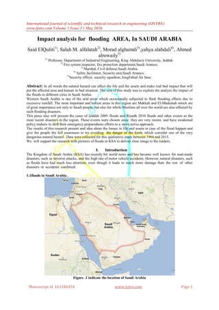
1. International journal of scientific and technical research in engineering (IJSTRE)
www.ijstre.com Volume 1 Issue 2 ǁ May 2016.
Manuscript id. 163186454 www.ijstre.com Page 1
Impact analysis for flooding AREA, In SAUDI ARABIA
Said ElQuliti1)
, Salah M. alfalatah2)
, Morad alghamdi3)
,yahya alabdali4)
, Ahmed
alrowaily5)
1)
Professor, Department of Industrial Engineering, King Abdulaziz University, Jeddah.
2)
Fire system inspector, fire protection department,Saudi Aramco.
3)
Marshal, Civil defense,Saudi Arabia.
4)
Safety facilitator, Security unit,Saudi Aramco .
5)
Security officer, security squadron, kingFahad Air base.
Abstract: In all words the natural hazard can affect the life and the assets and make real bad impact that will
put the affected area and human in bad situation .The aim of this study was to explore the analyze the impact of
the floods in different cities in Saudi Arabia.
Western Saudi Arabia is one of the arid areas which occasionally subjected to flash flooding effects due to
excessive rainfall. The most important and holiest areas in this region are Makkah and El-Madeinah which are
of great importance not only to Saudi people, but also for whole Muslims all over the world are also affected by
such flooding disasters.
This piece also will present the cases of Jeddah 2009 floods and Riyadh 2010 floods and other events as the
most recent disasters in the region. These events were chosen since they are very recent, and have awakened
policy makers to shift their emergency preparedness efforts to a more active approach.
The results of this research present and idea about the looses in life and assets in case of the flood happen and
give the people the full awareness to try avoiding the danger of the foods which consider one of the very
dangerous natural hazard . Data were collected for this qualitative study between 1964 and 2015.
We will support the research with pictures of floods in KSA to deliver clear image to the readers.
I. Introduction
The Kingdom of Saudi Arabia (KSA) has recently hit world news and has become well known for man-made
disasters, such as terrorist attacks, and the high rate of motor vehicle accidents. However, natural disasters, such
as floods have had much less attention, even though it leads to much more damage than the rest of other
disasters or accidents combined.
1.1floods in Saudi Arabia .
Figure .1 indicate the location of Saudi Arabia
2. Impact analysis for flooding AREA, In SAUDI ARABIA
Manuscript id. 163186454 www.ijstre.com Page 2
1985 flood: on 24 December 1985, heavy rains poured on north-western regions of Saudi Arabia, leading to
what has been described as the worst flood in the area in 50 years. Estimates of damage were not recorded,
except that there were at least 32 people killed from the flood.
Yanbu flood: heavy rains poured on western Saudi Arabia in January 1997, mainly affecting Yanbu and
peripheries of Jeddah. The rain lasted for 24 hours, killing 10 people and causing damage to an area of over
130,000 km2 of land.
Asir flood: Asir is a province in the Southwest of Saudi Arabia. On Monday 25 March 1997, heavy rains
poured on the region, leading to floods that resulted in 16 fatalities and damaged an area of just below 100,000
km2 of land.
Makkah 2002 flood:
heavy rains started falling on Makkah area on 8 April 2002 and lasted for a whole week. This led to flooding of
water in some areas, claiming the lives of 19 people; hundreds of Makkah residents were rescued that week.
Makkah 2003 flood: not quite recovered from previous year’s rain, Makkah experienced yet another heavy
shower described as the worst rains in Makkah in 25 years. Water levels were reported to have reached 6 meters.
Twelve people were killed; however, estimates of physical damage are not available.
Jizan 2004 floods: less than four months apart, two floods hit the Jizan region, leading to what has been
described as Jizan’s worst floods in 45 years. The floods left over 400 people homeless, killed 13 people and
devastated many roads and farms.
Medina 2005 flood: very heavy showers fell on Medina region in January 2005. This resulted in a flood that
caused the Yatamah dam to fail, killing 29 people. Seventeen people were injured, 50 were left homeless and 43
had to be evacuated.
Riyadh 2005 flood: heavy rains poured on the Riyadh region of Saudi Arabia, as well as on other areas in
neighboring countries (i.e. Oman and the United Arab Emirates). The resultant flood claimed the lives of seven
people; 700 people had to be evacuated by helicopters and another 700 were left homeless.
Jeddah 2009 flood
at around 6:30 a.m. on Wednesday 25 November 2009, rain started falling heavily in Jeddah, and continued for
around 12 hours. The amount of water in this relatively brief downpour (around 90 mm3) doubled the average
annual rainfall in Jeddah.
With a sound infrastructure and a proper drainage system lacking, this rain turned into the worst disaster that
Jeddah has experienced in 27 years or so. The downpour resulted in the formation of water tides coming from
the hills on the east of the city, heading west towards the Red Sea and cutting their way through the city.
3. Impact analysis for flooding AREA, In SAUDI ARABIA
Manuscript id. 163186454 www.ijstre.com Page 3
Major roads of the city were blocked by meters-high of water waves or by cars that have been washed out.
Power and telecommunication services were not spared either. As early as 11 a.m., floods had already resulted
in a temporary power outage on the whole western region of Saudi Arabia (i.e. Makkah, Medina and Jeddah).
Many people were not even able to call for help as communication with emergency services (e.g. civil defense
forces, police or emergency medical services) failed due to the overwhelmed network and power outage.
Overall, 161 people lost their lives as a result of the floods, either drowning or from car crashes. This disaster
had an estimated cost of around US$900 million to reconstruct Jeddah and help its victims.
Riyadh 2010 flood: on 3 May 2010, Riyadh city experienced a brief 45-minute water shower, accompanied by
light hail and winds gusting up to 24 km/hour. As brief as the downpour was, however, it resulted in floods and
car crashes across the city.
The state-run Saudi Press Agency reported earlier today that seasonal storms brought heavy rainfall in
central and eastern areas of the country, causing severe flooding in Riyadh and Al-Qassim Regions.
Saudi Arabia civil defense report that 1 person has died in the floods in the province of Rimah, Riyadh
Region, which is located about 120 kilometres north-east of the capital Riyadh.
Schools have been closed, roads blocked and in some cases flooding has forced drivers to abandon their
vehicles. Saudi Arabia civil defence say they have responded to dozens of emergency calls. The city of
Buraidah, Al-Qassim Region, is reported as one of the worst hit.
Hail 12 March, 2014
Two days of heavy rain brought flash flooding to parts of Hail (Ha’yel) Province in north west Saudi
Arabia.
Three children are reported to have died after drowning in flood water in the small village of Baida Natheel,
Hail Province.
The rain and flooding has been so severe, the Civil Defense and emergency services received nearly 1000 calls.
Schools have been closed in the area as a result of flooding.
Riyadh also saw some moderate to heavy rainfall over the last two days, with some flood incidents on several
roads reported, causing problems for the city’s drivers.
4. Impact analysis for flooding AREA, In SAUDI ARABIA
Manuscript id. 163186454 www.ijstre.com Page 4
22 November, 2013
According to the Saudi Press Agency, the Saudi Civil Defense department have announced that
flooding in the country that first struck over the weekend, have now killed as many as 11 people. Four other
people are missing. The deaths occurred in Riyadh, Araar, Al-Gunfuza and Al-Baha. The Civil Defense
department has been kept extra busy over the last week, rescuing 448 people caught up in the floods. 309
vehicles were also retrieved by the department.
One of the dead is believed to be a man who fell into a dam in Al-Baha while he was attempting to take
photographs of the raging flood waters.
II. Impact analysis
Change impact analysis (IA) is defined by Bohner and Arnold[1]
as "identifying the potential consequences of
a change, or estimating what needs to be modified to accomplish a change", and they focus on IA in terms of
scoping changes within the details of a design. In contrast, Pfleeger and Atlee[2]
focus on the risks associated
with changes and state that IA is: "the evaluation of the many risks associated with the change, including
estimates of the effects on resources, effort, and schedule". Both the design details and risks associated with
modifications are critical to performing IA within change management processes. A technical colloquial term is
also mentioned sometimes in this context, dependency hell.
Bohner and Arnold[4]
identify two classes of IA, traceability and dependency IA. In traceability IA,
links between requirements, specifications, design elements, and tests are captured, and these relationships can
be analysed to determine the scope of an initiating change.[5]
In dependency IA, linkages between parts,
variables, logic, modules etc. are assessed to determine the consequences of an initiating change. Dependency
IA occurs at a more detailed level than traceability IA. Within software design, static and dynamic algorithms
can be run on code to perform dependency IA.[6][7]
Static methods focus on the program structure, while
dynamic algorithms gather information about program behaviour at run-time.
Literature and engineering practice also suggest a third type of IA, experiential IA, in that the impact of
changes is often determined using expert design knowledge. Review meeting protocols,[8]
informal team
discussions, and individual engineering judgement[9]
can all be used to determine the consequences of a
modification.
At the below table , we indicate some affected area in Saudi Arabia by floods and the kind of the hazard , total
death and number of injured people , the looses after the disaster .
Floods are the most common natural disaster and the leading cause of natural disaster fatalities
worldwide. Risk of catastrophic losses due to flooding is significant given deforestation and the increasing
proximity of large populations to coastal areas, river basins and lakeshores. The objectives of this review were
to describe the impact of flood events on human populations in terms of mortality, injury, and disarticulation
and, to the extent possible, identify risk factors associated with these outcomes.
On the below table .1 and table .2 the team tray to compare between the flood disaster in some area in the word
and Saudi Arabia .
5. Impact analysis for flooding AREA, In SAUDI ARABIA
Manuscript id. 163186454 www.ijstre.com Page 5
Total
damage ($)
Total
affected
HomelessInjur
ed
AffectedTotal
death
Occuran
ce
Disaste
r type
Country
Name
year
500770610------7706102324FloodIndia1964
---------------1361FloodJapan1964
---30800025000---283000---1FloodBangladesh1982
---81614321000046436015004474FloodChina1982
---6255720005760500461FloodNepal1985
---5444------5444792FloodPhilippines1985
16000034480535334480003471FloodCambodia2000
315366762907535004077090004229FloodChina2000
---3668------3668---1FloodKazakhstan2001
940018758430000841575001242FloodKorea2001
---500000------50000021FloodSri Lanka2002
283642512990131248324FloodTajikistan2002
438428304383984148FloodIndonesia2003
83813701370---------1FloodIran2003
------------------1FloodBhutan2004
------------------1FloodCambodia2004
---1500------1500---1FloodUzbekistan2005
5400092393182053741851925FloodViet Nam2005
---3000------300021FloodIraq2009
---------------101FloodLao2009
---55785------557852FloodKorea2010
---8000------80001502FloodNepal2010
---1281097001103000622FloodAfghanistan2011
---1570559------1570559101FloodBangladesh2011
---85000------8500021FloodMyanmar2012
10005---5721FloodNepal2012
---25000------25000---2FloodGeorgia2013
13600003419473---4473341500064535FloodIndia2013
---1204029---291204000953FloodSri Lanka2014
---132234253812760202FloodTajikistan2014
---6805---680511FloodMalaysia2015
1090001114000------11140001102FloodMyanmar2015
Table 1 : indicate floods and impact in some area in the world .
Source : EM DAT Web Site
Table 2 summarizes the main natural disasters that occurred in KSAin thelastcentury. Itisobviousthat floodshave
been the most frequently encountered naturaldisaster in the country.
Year Disaster Type occurrence Total deaths Affected Injured Homeless Total affected Total damage($)
1964 Flood 1 20 1000 --- --- 1000
1985 Flood 1 32 --- --- 5000 5000 450000
2002 Flood 1 19 --- --- --- --- ---
2003 Flood 2 12 13000 50 --- 13050 ---
2004 Flood 1 5 400 30 --- 430 ---
2005 Flood 2 63 50 17 --- 67 ---
2009 Flood 1 161 --- --- 10000 10000 900000
2010 Flood 2 24 85 --- --- 85 ---
2011 Flood 1 11 --- --- --- --- 300000
2012 Flood 1 19 --- --- --- --- ---
2013 Flood 2 39 1021 --- 1021 ---
2015 Flood 2 23 --- --- --- --- ---
Table 2 : the floods and the impact in Saudi Arabia
Source : EM DAT web Site
III. Result and discussion
Number of the floods are increased because of the climate changes.
6. Impact analysis for flooding AREA, In SAUDI ARABIA
Manuscript id. 163186454 www.ijstre.com Page 6
Based on the average for the number of death in one year ,we figure out that number of death after 2009
less than number of death average in one year before 2009 flood . this is as result of care of the
government to find solution and put programs and centers to manage crisis and disaster .
The highest year that affected people was in 2003 . the flood of 2009 was more social impact because its
result of one flood for that year but on other hand there were 2 floods in 2003and no homeless at all
while in 2009 there was 10000 homeless .because of that, 2009 was the point of change for a lot of
decision in the government .
shortage of the residential area lead the people to use the Wadis which increase the rate of hazard and
affected person .
increasing of population growth rate in makkah region more than general rate in Saudi Arabia. Also ,
the attractive of makkah region for immigration may be affected to increase the number of affected
people in 2009 . The amount and the way of the inertial immigration between Saudi region. This study
mention The population growth ratein Makkah area more than general The population growth ratein
Saudi Arabia .And also the research indicate that Makkah more attractive area for immigration .
there is no any recorded of flood during hajj season in makkah city but ,base on the given reading in the
table .2 we can see increasing number of the floods and short period of time among theme will increase
the chance of floods to be happened during hajj season and lead to colossal disaster and crisis .
IV. Analysis figures
Figure .1 indicate total death of flood in Saudi Arabia .
Figure .2 indicate total Damage of flood in Saudi Arabia .
7. Impact analysis for flooding AREA, In SAUDI ARABIA
Manuscript id. 163186454 www.ijstre.com Page 7
Figure .3 indicate total affect of flood in Saudi Arabia .
V. Conclusion
Arid and semi arid regions are typically prone to flash floods in cases of occasional rainfall events
mainly due to the lack of undergrowth and poor infiltration capacity of the surface soils which results in the
generation of enormous volumes of surface run off. Manmade structures such as dams are also responsible for
causing flash floods in downstream areas when the dam gates are opened to maintain the reservoir entry limit or
in instances when there are dam failures.
In recent years flash floods have become an issue of concern in the major urban centers around the
world. The reasons are mostly the increasing population pressure which requires more infrastructural
development. This has often resulted in the construction of manmade structures in topographically low lying
regions which in turn has obstructed the natural rainwater drainage. At the same time the increase in the
constructed area has limited the natural land available for access thus resulting in the generation of more surface
runoff which at times exceeds the normal water behavior capacity of the urban sewer systems thereby causing
floods.
References
[1.] Bohner and Arnold, 1996, pg.3
[2.] Pfleeger and Atlee, 2006, pg.526
[3.] Kilpinen, 2008
[4.] Bohner and Arnold, 1996
[5.] Eisner, 2002, pg.236-237
[6.] Rajlich, 2000
[7.] Ren et al., 2005
[8.] Endres and Rombach, 2003, pg.17
[9.] Ambler, 2002, pg.24