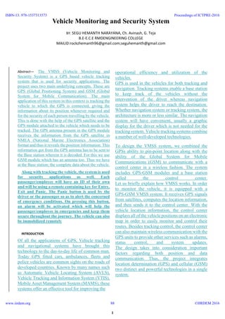
The document describes a Vehicle Monitoring and Security System (VMSS) that uses GPS and GSM technologies to track vehicles and ensure passenger security. The system tracks a vehicle's location using a GPS module and sends the location data via GSM to a base station. It also allows passengers to activate an alarm if emergency help is needed. The system supports monitoring vehicles throughout a journey by transmitting passenger and vehicle IDs along with location to the base station as the vehicle picks up and drops off passengers at different stages.
“Bus Tracking Application” is an application for Smart phones that works on Android Operating system.
This application uses the GPS function.
This application at a specific pickup point will send the current location of the bus to students when they request.
This app generate predictions of bus arrivals at stops along the route.
This application uses a variety of technologies to track the locations of buses in real time.
IoT BASED VEHICLE TRACKING AND TRAFFIC SURVIELLENCE SYSTEMjohn solomon j
ii
ABSTRACT GPS is one of the technologies that are used in a huge number of applications today. One of the applications is tracking your vehicle and keeps regular monitoring on them. This tracking system can inform you the location and route travelled by vehicle, and that information can be observed from any other remote location. It also includes the web application that provides you exact location of target and the exact speed the vehicle is moving which is used to generate bills for over speeding automatically. This system enables us to track target in any weather conditions. This system uses GPS and Zigbee technologies. This includes the hardware part which comprises of GPS, Zigbee, ATmega microcontroller and software part is used for interfacing all the required modules and a web application is also developed at the client side and visualize data from IoT. Main objective is to design a system that can be easily installed and to provide platform for further enhancement. KEYWORDS GPS, ZigBee, Tracking System, IoT
iii
Intelligent Bus Tracking System Using AndroidAM Publications
Intelligent bus tracking system using android is an application that tracks a bus and collects the distance to each station. Tracking system involves the installation of an electronic device in a bus, with an installed Android App on any smart phone to enable a user to track the bus location. There are two applications one for server and other for the client. The user can get flexibility of planning travel using the app, to decide on which bus to take or when to catch the bus. The waiting time of the user can be reduced. By using this application user get the information about buses, bus numbers, bus route, bus arrival and bus delay timing information etc [1]. It provides information about which bus coming to the stop. By the presently existing system we are dealing with three terminals, a device on bus, a device at bus stop and a device on the master bus stand so as to keep the track on the all city busses. By employing this tracking system the arrival of the bus is detected near the bus stop and also can be seen on the PC at the master bus stop. GSM modem can also transmit the bus information to the registered mobile numbers. Hence, we can control the bus traffic and can detect the arrival of particular bus at the bus stop.
Intelligent Traffic System for kajang city, Malaysia.Yousef Abujubba
The presentation is illustrating the common traffic difficulties in Kajang area and show suggested intelligent urban design plan to be settled in the future to solve out the traffic jam and rebuild the city to be sustainable.
Benefits of gps for ambulance servicesTracko.co.in
As GPS tracking system sets out day and night to fetch patients to hospitals, it becomes difficult for hospitals/managers to manage ambulance vehicles & fleets. GPS tracking system can help in managing ambulance fleets efficiently and optimise them in order to cater more patients.
#TrackoApp #mavericklabs #GPStracking #fleetmanagement #telematics #vehicletracking #ambulances #ambulancetracking
“Bus Tracking Application” is an application for Smart phones that works on Android Operating system. This application uses the GPS function. This application at a specific pickup point will send the current location of the bus to students when they request. This app generate predictions of bus arrivals at stops along the route. This application uses a variety of technologies to track the locations of buses in real time
Smart bus system pilot project (BUSKET)Minh S. Dao
BUSKET is a wireless system aimed at supporting the quality of bus transportation service in Brunei Darussalam. BUSKET exploits low-cost wireless technologies for the real-time estimation of the buses position throughout the road network and to communicate to the users when one bus approaches the bus stop. The goal of BUSKET is to make smarter the bus transportation system and to improve the user awareness about the status of the bus service. From the user perspective, BUSKET will reduce the waiting time of citizens at the bus stops, while from the bus management viewpoint will enable a more centralized and pervasive control of the whole transportation network. BUSKET will use commercial smartphones (already diffused among citizens) as well as low-cost wireless GPS sensors to enable the acquisition of position information and to communicate with the users.
BUSKET is the joint-research between UTB, ELEDIA, and AITI
IJRET-V1I1P4 - Vehicle Tracking System Using GPS Tracking MethodISAR Publications
A vehicle tracking system is an electronic device installed in a vehicle to enable the owner
or a third party to track the vehicle's location.Multi-tracking system is a real time tracking platform
which uses integration of technologies such as GPS.The device installed in the vehicle
continuously moves and other related information at each position and then transmit to tracking
server, thus storing it in the database. Currently almost of the public having an own vehicle, theft is
happening on parking and sometimes driving insecurity places. The safe of vehicles is extremely
essential for public vehicles. As more devices become GPS enabled, accuracy will increase and the
system's scale and global reach will benefit everyone. Wireless technology promises to be a key
element in any long-term solution. This design will continuously monitor a moving Vehicle and
report the status of the Vehicle on demand
Keywords — GPS Tracking System, Vehicle Tracker , Security System .
An autonomous vehicle is capable of sensing its environment and navigating without human input. Imbibing intelligence to these devices is through a system called embedded systems. Embedded Systems are combinations of hardware and software that are mounted on compact electronic circuit boards integrated into devices. Autonomous vehicles sense their surroundings with such techniques as radar, GPS, and computer vision. These systems are more intelligent and autonomous.
The challenge faced by this system is that; there are many possible ways for hacking the GPS. This system also contains alternate way for moving the car even if still the GPS is blocked. But the alternative ways are still focused on connection with the satellite. Now there needs to be a total security for preventing hackers from hacking the satellite. This is going to be done by encrypting the signal sent from car to the satellite. There are many ways of encrypting, among which we are going to use the concept of Secret key Encryption method. We use One-Time-Pad concept where the data is converted to cipher text and then it is going to be decrypted by the satellite. By this way, we could create a high level security where only that particular car and the satellite will have a common code and each time the car moves to a location, there is going to be a random key generated.
The current topic which we had chosen is one of a major problem in autonomous cars, which needs to be focused on. Our objective is to bring a complete security for the car and its owner.
Design and Implementation for Trucks Tracking System Using GPS Based on Seman...ijtsrd
This paper proposed design and implementation of trucks tracking system using GPS based on semantic web for vehicle tracking in real time. In-vehicle unit and a tracking server is used. The information is transmitted to tracking server using GSM/GPRS modem on GSM network by using SMS or using direct TCP/IP connection with tracking server through GPRS. The received SMS contain longitude and latitude that are used to locate the vehicle on the Google maps. Tracking server also has GSM/GPRS modem that receives vehicle location information via GSM network and stores this information in database. It has been explored that most of the GPS based tracking systems are user friendly, cost effective, reliable and can be easily validated through different experiments and simulations which means that tracking system will send notifications periodically to the main station about the current position of the vehicle . Moreover those tracking notifications (GPS) will be stored in the database for future revising or generating required reports.. The tracking system will be better for cars, trucks, trailers, railways, containers and boats that can be traced using GPS vehicle tracking. Yasser Ahmed Nada"Design and Implementation for Trucks Tracking System Using GPS Based on Semantic Web" Published in International Journal of Trend in Scientific Research and Development (ijtsrd), ISSN: 2456-6470, Volume-1 | Issue-4 , June 2017, URL: http://www.ijtsrd.com/papers/ijtsrd169.pdf http://www.ijtsrd.com/computer-science/artificial-intelligence/169/design-and-implementation-for-trucks-tracking-system-using-gps-based-on-semantic-web/yasser-ahmed-nada
A vehicle tracking system is very useful for tracking the movement of a vehicle from any location at any time. An efficient vehicle tracking system is designed and implemented for tracking the movement of any equipped vehicle from any location at any time. The proposed system made good use of popular technology that combines a smartphone with an Arduino UNO. This easy to make and inexpensive compared to others. The designed in vehicle device works using Global Positioning System GPS and Global System for Mobile Communication GSM technology that is one of the most common ways for vehicle tracking. The device is embedded inside a vehicle those positions is to be determined and tracked in real time. An Arduino UNO is used to control the GPS receiver and GSM module. The vehicle tracking system uses the GPS module to get geographic coordinates at regular time interval. The GSM module is used to transmit and update the vehicle location to a database. This paper gives minute by minute update about vehicle location by sending SMS through GSM modem. This SMS contain latitude and longitude of the location of vehicle. Arduino UNO gets the coordinates from GPS modem and then it sends this information to user in text SMS. GSM modem is used to send this information via SMS sent to the owner of the vehicle. Location is displayed on LCD. And then Google map displays location and name of the place on cell phone. Thus, user able to continuously monitor a moving vehicle on demand using smartphone and determine the estimated distance and time for the vehicle to arrive at a given destination. Ni Ni San Hlaing | Ma Naing | San San Naing ""GPS and GSM Based Vehicle Tracking System"" Published in International Journal of Trend in Scientific Research and Development (ijtsrd), ISSN: 2456-6470, Volume-3 | Issue-4 , June 2019, URL: https://www.ijtsrd.com/papers/ijtsrd23718.pdf
Paper URL: https://www.ijtsrd.com/engineering/electronics-and-communication-engineering/23718/gps-and-gsm-based-vehicle-tracking-system/ni-ni-san-hlaing
A GPS tracking system is a common way of getting real-time vehicle location data. GPS technology is often employed in modern car tracking systems, however other forms of autonomous vehicle location technologies can also be used. A GPS tracking system comprised of hardware, open-source software, a web server, and an easy-to-manage user interface via a web server with Google Map was presented. The goal of this project is to develop and build a hand-held wireless GPS tracking device that can be tracked remotely via the Internet. There are three parts to this research. A mobile device with GPS and a wireless Internet connection is the first component. Our hardware project, which contains an LCD, GPS, GSM, Arduino Uno, and sensor linked to service, is the second portion.
Novel based Approach Schema for Processing Vehicle Tracking System through GP...ijtsrd
In recent years many systems are approached to track the vehicles in order to find out movement of any equipped vehicle from any location at any time. This paper implements formalised schema to develop a tracking system that is much cost effective that available in the market. Various technologies utilised are GPS Global Positioning System module to get geographic coordinates at regular time intervals. The GSM GPRS Global System Positioning General Packet Radio Service module is used to transmit and update the vehicle location to a database. The Google Maps API is used to display the vehicle position on the map in the Smartphone application. The tracking system here helps to identify the location of the college bus through our smart phone when a SMS Short Message Service is sent to a personal number thus indicating the bus location via SMS. By incorporating a GPS and GSM modem the location of the device by sending a SMS to the number specified. No external server or internet connection is used in knowing the location at user end which in return reduces the cost. We can also use this technology to reduce our time whenever we are waiting for buses by knowing their location on our mobile phones. If vehicle has been stolen then also we can track our vehicles. Sermakani. A. M | Veena. T | Julia Faith. S "Novel based Approach Schema for Processing Vehicle Tracking System through GPS SMS Gateways" Published in International Journal of Trend in Scientific Research and Development (ijtsrd), ISSN: 2456-6470, Volume-3 | Issue-2 , February 2019, URL: https://www.ijtsrd.com/papers/ijtsrd20205.pdf
Paper URL: https://www.ijtsrd.com/computer-science/computer-network/20205/novel-based-approach-schema-for-processing-vehicle-tracking-system-through-gps-sms-gateways/sermakani-a-m
Overview of the fundamental roles in Hydropower generation and the components involved in wider Electrical Engineering.
This paper presents the design and construction of hydroelectric dams from the hydrologist’s survey of the valley before construction, all aspects and involved disciplines, fluid dynamics, structural engineering, generation and mains frequency regulation to the very transmission of power through the network in the United Kingdom.
Author: Robbie Edward Sayers
Collaborators and co editors: Charlie Sims and Connor Healey.
(C) 2024 Robbie E. Sayers
Saudi Arabia stands as a titan in the global energy landscape, renowned for its abundant oil and gas resources. It's the largest exporter of petroleum and holds some of the world's most significant reserves. Let's delve into the top 10 oil and gas projects shaping Saudi Arabia's energy future in 2024.
Water scarcity is the lack of fresh water resources to meet the standard water demand. There are two type of water scarcity. One is physical. The other is economic water scarcity.
Student information management system project report ii.pdfKamal Acharya
Our project explains about the student management. This project mainly explains the various actions related to student details. This project shows some ease in adding, editing and deleting the student details. It also provides a less time consuming process for viewing, adding, editing and deleting the marks of the students.
Sachpazis:Terzaghi Bearing Capacity Estimation in simple terms with Calculati...Dr.Costas Sachpazis
Terzaghi's soil bearing capacity theory, developed by Karl Terzaghi, is a fundamental principle in geotechnical engineering used to determine the bearing capacity of shallow foundations. This theory provides a method to calculate the ultimate bearing capacity of soil, which is the maximum load per unit area that the soil can support without undergoing shear failure. The Calculation HTML Code included.
Hierarchical Digital Twin of a Naval Power SystemKerry Sado
A hierarchical digital twin of a Naval DC power system has been developed and experimentally verified. Similar to other state-of-the-art digital twins, this technology creates a digital replica of the physical system executed in real-time or faster, which can modify hardware controls. However, its advantage stems from distributing computational efforts by utilizing a hierarchical structure composed of lower-level digital twin blocks and a higher-level system digital twin. Each digital twin block is associated with a physical subsystem of the hardware and communicates with a singular system digital twin, which creates a system-level response. By extracting information from each level of the hierarchy, power system controls of the hardware were reconfigured autonomously. This hierarchical digital twin development offers several advantages over other digital twins, particularly in the field of naval power systems. The hierarchical structure allows for greater computational efficiency and scalability while the ability to autonomously reconfigure hardware controls offers increased flexibility and responsiveness. The hierarchical decomposition and models utilized were well aligned with the physical twin, as indicated by the maximum deviations between the developed digital twin hierarchy and the hardware.
Hybrid optimization of pumped hydro system and solar- Engr. Abdul-Azeez.pdffxintegritypublishin
Advancements in technology unveil a myriad of electrical and electronic breakthroughs geared towards efficiently harnessing limited resources to meet human energy demands. The optimization of hybrid solar PV panels and pumped hydro energy supply systems plays a pivotal role in utilizing natural resources effectively. This initiative not only benefits humanity but also fosters environmental sustainability. The study investigated the design optimization of these hybrid systems, focusing on understanding solar radiation patterns, identifying geographical influences on solar radiation, formulating a mathematical model for system optimization, and determining the optimal configuration of PV panels and pumped hydro storage. Through a comparative analysis approach and eight weeks of data collection, the study addressed key research questions related to solar radiation patterns and optimal system design. The findings highlighted regions with heightened solar radiation levels, showcasing substantial potential for power generation and emphasizing the system's efficiency. Optimizing system design significantly boosted power generation, promoted renewable energy utilization, and enhanced energy storage capacity. The study underscored the benefits of optimizing hybrid solar PV panels and pumped hydro energy supply systems for sustainable energy usage. Optimizing the design of solar PV panels and pumped hydro energy supply systems as examined across diverse climatic conditions in a developing country, not only enhances power generation but also improves the integration of renewable energy sources and boosts energy storage capacities, particularly beneficial for less economically prosperous regions. Additionally, the study provides valuable insights for advancing energy research in economically viable areas. Recommendations included conducting site-specific assessments, utilizing advanced modeling tools, implementing regular maintenance protocols, and enhancing communication among system components.
CFD Simulation of By-pass Flow in a HRSG module by R&R Consult.pptxR&R Consult
CFD analysis is incredibly effective at solving mysteries and improving the performance of complex systems!
Here's a great example: At a large natural gas-fired power plant, where they use waste heat to generate steam and energy, they were puzzled that their boiler wasn't producing as much steam as expected.
R&R and Tetra Engineering Group Inc. were asked to solve the issue with reduced steam production.
An inspection had shown that a significant amount of hot flue gas was bypassing the boiler tubes, where the heat was supposed to be transferred.
R&R Consult conducted a CFD analysis, which revealed that 6.3% of the flue gas was bypassing the boiler tubes without transferring heat. The analysis also showed that the flue gas was instead being directed along the sides of the boiler and between the modules that were supposed to capture the heat. This was the cause of the reduced performance.
Based on our results, Tetra Engineering installed covering plates to reduce the bypass flow. This improved the boiler's performance and increased electricity production.
It is always satisfying when we can help solve complex challenges like this. Do your systems also need a check-up or optimization? Give us a call!
Work done in cooperation with James Malloy and David Moelling from Tetra Engineering.
More examples of our work https://www.r-r-consult.dk/en/cases-en/
Explore the innovative world of trenchless pipe repair with our comprehensive guide, "The Benefits and Techniques of Trenchless Pipe Repair." This document delves into the modern methods of repairing underground pipes without the need for extensive excavation, highlighting the numerous advantages and the latest techniques used in the industry.
Learn about the cost savings, reduced environmental impact, and minimal disruption associated with trenchless technology. Discover detailed explanations of popular techniques such as pipe bursting, cured-in-place pipe (CIPP) lining, and directional drilling. Understand how these methods can be applied to various types of infrastructure, from residential plumbing to large-scale municipal systems.
Ideal for homeowners, contractors, engineers, and anyone interested in modern plumbing solutions, this guide provides valuable insights into why trenchless pipe repair is becoming the preferred choice for pipe rehabilitation. Stay informed about the latest advancements and best practices in the field.
Welcome to WIPAC Monthly the magazine brought to you by the LinkedIn Group Water Industry Process Automation & Control.
In this month's edition, along with this month's industry news to celebrate the 13 years since the group was created we have articles including
A case study of the used of Advanced Process Control at the Wastewater Treatment works at Lleida in Spain
A look back on an article on smart wastewater networks in order to see how the industry has measured up in the interim around the adoption of Digital Transformation in the Water Industry.