

Recommended
More Related Content
What's hot
What's hot (20)
Similar to Hydrosphere 2 update
Similar to Hydrosphere 2 update (20)
More from Robin Seamon
More from Robin Seamon (20)
Recently uploaded
Recently uploaded (20)
Hydrosphere 2 update
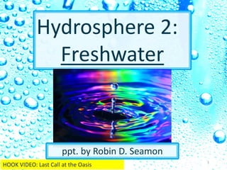
- 1. Hydrosphere 2: Freshwater ppt. by Robin D. Seamon 1 HOOK VIDEO: Last Call at the Oasis
- 2. E A R T H ’ S F R E S H W A T E R S Y S T E M S 2
- 3. Humans need freshwater sources • Rivers and coastlines influence human settlement • We learned to control water for our benefit: • Dams • Irrigation systems • Water treatment facilities 3
- 4. 4 D I S T R I B U T I O N http://www.sswm.info/category/concept/water-cycle VIDEO: Where We Get Our Water (3:46)
- 5. 5 Availability Scale 1. vulnerable 2. stressed 3. scarce VIDEO1: Struggle for Water (3min) VIDEO2: Freshwater Scarcity
- 6. 6 http://latestnewslink.com/2014/12/lack-of-access-to-clean-water-hampers-fight-against-aids-in-africa-trfn/ VIDEO: UN Water Video (10 min)
- 9. Potable Water LAB CLASS DEMONSTRATION & LESSON: Saltwater/freshwater demonstration Book: If the World Were a Village- by, Shelagh Armstrong; 2002 Belize, El Salvador, & Mexico stories/pictures HOMEWORK WRITING & ILLUSTRATION: Write a response to the book and demonstration from class about the world's water supply. Illustrate. CONSIDER- What percentage of the world’s water is potable? How does your water supply differ from people in other countries? Who’s responsibility is it to protect those drops of water? What can you do each day to protect the world’s water supply? BOOK- page 18- (as of 2002) ~ 75 % world's population has access to clean drinking water in home or within a short distance ~ 25% do not; must spend most of the day finding water; mostly girls and women ~ 60% world's population has to sanitation/sewage disposal- public or household ~ 40% do not ~ 68% world's population can breathe clean air ~ 32% breathe unhealthy, polluted air CLASS DEMONSTRATION SUMMARY- (numbers are approximated) ~ 2 L water on Planet Earth - salt and freshwater ~ 70 mL freshwater - about 3% of total water on Earth ~ 50 mL frozen - about 80% of freshwater frozen in icecaps & glaciers ~ 9 mL trapped underground - not all groundwater is reachable ~ 6 mL in atmosphere- part of the water cycle ~ 5 mL in plants & animals ? pollution ... 2 DROPS CLEAN, POTABLE DRINKING WATER FOR THE PLANET WIKI LINK 9
- 12. Water Cycle- 1. Water evaporates into the atmosphere 2. Condenses as it rises and cools 3. Falls back to Earth as precipitation 4. Traverses the landscape, picking up minerals, becoming stored in ground water, frozen in ice, or distributed into water reservoirs 5. Streams and rivers carry water back to ocean 12 Weathering: taking away of pieces of the crust in the flow of water, wind, or ice Deposition: dropping off of the sediments
- 13. 13 Water drops streams rivers Oceans http://waterstories.nestle-waters.com/environment/collecting-dew-during-water-shortages/
- 14. Tributary- stream that flows into a lake or larger stream/river Watershed- river systems are divided into watersheds; areas where water runs from higher elevations into lower basins according to the landscape • LARGEST in US: Mississippi watershed • OTHERS: Rio Grande watershed, Colorado watershed Divide- higher ground that separates watersheds 14ADVANCEVIDEO: What’s a Watershed (1min)
- 17. 17 River basin- portion of land drained into a river; river is the lowest elevation point of the basin Run-off: flow of water when an excess of rainwater, storm water, or snowmelt flows across the surface of the land ADVANCE
- 18. 18 Advance Yadkin-Pee Dee River Basin BACK
- 19. STREAM EROSION Channel- path a stream follows 1. narrow/steep 2. Rock sent downstream 3. Channel gets wider/deeper 4. Gets longer & wider= RIVER 19 Channel erosion http://www.montcalm.org/planningeduc0042.asp
- 20. 1. Gradient- measure of change in elevation over a certain distance • Gradient erosive Energy 20 http://surfacewater.wikispaces.com/River+Gradient
- 21. 2. Discharge- amount of water a river carries; storms, snowmelt • Discharge erosive Energy 21 http://www.bigelow.org/virtual/water_sub2.html
- 22. 3. Load- materials carried by stream • Fast moving water carries larger particles • Bed load- bounces larger pebbles or boulders • Suspended load- small rocks & soil in suspension (muddy) • Dissolved load- minerals (Na, Cl…) 22 http://www.indiana.edu/~g103/G103lectures/rivers/wk6.html*VIDEO: Stream Flow (7min)
- 23. F O R M A T I O N S Deposition- dropping of sediments (eroded rock/soil particles) Placer deposit- heavy minerals deposited where current slows (gold) Delta- mouth/end of a river, current slows, sediments drop (mud) - form new land, coast grows 23
- 25. Alluvial fan- stream over flat land, slows down, drops sediments Flood plains- high rain or snow melt overflows rivers; - sediment is deposited - rich farm land 25 http://www.thisoldearth.net/Geology_Online-1_Subchapters.cfm?Chapter=5&Row=4VIDEO: Bill Nye: Rivers & Streams (23min)
- 26. 26 1. dropping off of sediment due to erosion 2. water turning into gas form 3. stream that flows into lake or larger river system 4. path a stream follows 5. taking away pieces of the crust by water, wind, ice 6. higher ground that separates watersheds 7. water turning from gas to liquid 8. areas where water runs from higher elevations into lower basins according to the landscape 9. water falling as a liquid 10. flow of water when an excess of rain/storm water, snowmelt flows across land a. evaporation b. weathering c. precipitation d. tributary e. deposition f. condensation g. divide h. watershed i. channel j. run-off A Hydrosphere 2 UNIT CHECK 1 B C D E F G H I J
- 27. 27 1. amount of water a river carries 2. measure of change in elevation over a certain distance 3. materials carried by a stream 4. If discharge INCREASES what happens to the erosive energy? 5. If load DECREASES what happens to the erosive energy? 6. If gradient INCREASES what happens to the erosive energy? Hydrosphere 2 UNIT CHECK 2 UP or DOWN? a. load b. gradient c. discharge 7. 8. 9. d. dissolved load e. bed load f. suspended load C B A D F E Erosion amount goes UP Erosion amount goes DOWN Erosion amount goes UP
- 28. 28 WATER DISTRIBUTION REVIEW 1. What percentage of the globe is water? 2. What percentage of that is fresh water? 3. What is the water availability scale? 4. Name a country that has high water scarcity. 5. What is the name of our river basin? 6. ______- amount of water a river carries 7. ______- slope/ measure of change in elevation over distance 8. ______- materials carried by a stream/river 9. Which is chemically bound/joined- compound or mixture? 10 -12 Decide whether each is an element, compound, or mixture: Na ______ NaCl ______ NaCl plus H20 _______ Yadkin-PeeDee 3% vulnerable, stressed, scarce 70% discharge gradient load element compound Mixture (solution) Hydrosphere 2 UNIT CHECK 3
- 29. G R O U N D W A T E R • Zone of aeration- upper layer of soil & rock; water passes through • Zone of saturation- water collects- spaces between rock particles are filled with water • Water table- where those two zones meet; rises & lowers with rainfall & drought from above 29
- 31. Aquifer- sandstone, limestone, sand/gravel Rock layer that stores groundwater Percolation- how water filters through the ground Porosity- more open spaces/pores can hold water • Depends on the size of rock particles 1. Same sized particles= high porosity 2. Different sized particles= low porosity POROSITY DEMONSTRATION 31
- 33. Permeability- rock’s ability to let water pass • Larger particles increase permeability • Friction Recharge zone- ground surface where water enters an aquifer (how permeable?) 33http://rmccs.org/sitecharacterization/experimental3.html
- 34. Spring- water table reaches surface; can make a lake Artesian spring- spring whose water flows from crack in cap rock of aquifer • Sloping layer of permeable rock (aquifer) sandwiched between two layers of impermeable rock (cap rock) 34 http://www.health.state.mn.us/divs/eh/wells/waterquality/springs.html
- 35. Well- human-made hole, deeper than water table • Must be drilled deep enough so that when water table drops, well still has water 35VIDEO: What is groundwater? (5min)
- 36. 36 GROUNDWATER REVIEW 1. 2. 3. 4. Which jar has higher porosity? 5. Which jar has higher permeability? A B Label. Zone of aeration water table Zone of saturation B B Hydrosphere 1 UNIT CHECK 4
- 37. 37 W A T E R Q U A L I T Y
- 38. W A T E R Q U A L I T Y • 3 % of Earth’s water is freshwater (drinkable) • 75% of that is frozen • Pollution- introduction of harmful substances into the environment • Point-source pollution: pollution from one specific site (wastewater from a factory) • Nonpoint-source pollution: pollution comes from many sources (runoff from agriculture, urban areas, land clearing, construction, logging) 38 VIDEO: Nonpoint Source Pollution (5min)
- 39. 39 H E A L T H Y R I V E R S Water quality depends upon: • Habitat structure (riparian vegetation, width/depth, bank stability, channel morphology, gradient, instream cover, canopy, substrate, current) • Flow regime (ground water, land use, velocity, high/low extremes, precipitation, runoff) • Chemical variables (nutrients, pH, DO, temperature, organics, solubles, hardness, absorption, turbidity) • Biotic factors (disease, parasitism, feeding, predation, competition, reproduction) • Energy source (sunlight, nutrients, seasonal cycles, organic matter inputs)
- 40. 40 HOW DO YOU DESCRIBE THE WATER? Instream conditions: • Litter/garbage- • Algae- floating, attached, color • Water color- clear, muddy, milky, tea-colored, red, gray, green black • Water appearance- oily sheen, foam/bubbles, scum • Water odor- sewage, gas, rotten eggs, fishy, chlorine, soapy • Discharge pipes- storm drain, industry, municipal wastewater, sewer,
- 41. M O N I T O R I N G W A T E R Q U A L I T Y PHYSICAL turbidity, temperature CHEMICAL measure pH, nitrates, DO, metals BIOLOGICAL count species 41VIDEO: Ecosystems on the Edge (8min)
- 42. Turbidity- • Measure of the concentration of particles suspended in water • High turbidity = cloudy/ low light penetration • Suspended sediments of silt, clay, wastewater, high phytoplankton 42 PHYSICAL INDICATORS http://www.learnnc.org/lp/editions/mudcreek/6594 *VIDEO: Turbidity (5min)
- 43. 43 Habitat structure Natural river flow is more productive a habitat than man-made channels.
- 44. 44 Embeddedness: How much of the streambed that is under sediment
- 45. 45 Riparian Habitat: land/bank between the water & upland hills Vegetation on the bank decreases embededness
- 46. 46 Sediment impacts streams: • Heat is absorbed by particles • Clarity is lower • Organic material can change the chemistry • Extra fertilizer (phosphorus, nitrogen) causes HABs (harmful algal blooms) • Heavy metals leach into water ppm- parts per million *one inch in 16 miles *one ounce in 32 tons *one cent in $10,000 *one minute in two years THAT’s LIKE:
- 47. 47 DO- Dissolved Oxygen Temperature • Affects DO levels: • Cold water holds more O • Thermal pollution: Factories increase lake temperatures • Loss of shade trees on riparian bank REMEMBER: Colder water absorbs more gas 2 Habitat Assessment (14 min)
- 48. • Fish- respond to chemical, physical, biological change • Aquatic plants • Insects • Mussels • Leeches • worms 48 BIOLOGICAL INDICATORS
- 49. 49
- 50. 50*VIDEO: Biotic Index (11min)
- 51. 51 Pathogens Bacteria: e coli • Enter water systems when septic systems leak or municipal sewage systems fail & through factory farm waste http://www.cbsnews.com/news/20-sickened-by-e-coli-in-nc-toddler-dies/VIDEO: Ganges Pollution (1:30)
- 52. Dissolved oxygen (DO) • Organisms in water need oxygen • Low DO can stress/kill organisms • Pollution reduces DO • Anoxia- lack of oxygen 52 CHEMICAL INDICATORS 1. Temperature (lower temp, more O2) 2. Altitude (pressure affects gas) 3. Plant growth (respiration, transpiration, photosynthesis cycles gases) 4. Decay (cycles gases) 5. Turbulence (rough water, catches air bubbles) *VIDEO: Dissolved Oxygen (13 min)
- 53. 53 1. Temperature (lower temp, more O ) DO Thermal pollution DO changes with seasonal temp. changes 2. Altitude (pressure affects gas) 3. Plant growth (respiration, transpiration, photosynthesis cycles gases) • Time of Day: DO day b/c of plant respiration DO night 4. Decay (cycles gases) DO Lots of bacteria/decay 5. Turbulence (rough water, catches air bubbles) What time of the day/year will water have more DO due to temperature? What time of the day/year will water have more DO due to plants? When will there be more DO due to decay? 2
- 54. 54 pH- power of Hydrogen • The acid/base balance • Normal: 6.5-8.5 • Lower or higher pH disrupts availability of nutrients in water system VIDEO: Strengths & Weaknesses of acids & bases (3:50) VIDEO: Crash Course Chemistry#30 pH & pOH (11min)
- 55. 55 NEUTRAL Solubility of heavy metals Algal blooms More Hydrogen Less Hydrogen HIGHER TEMP. pH
- 56. 56 Polarity of water makes it an excellent solvent • As water molecules travel through the water system & over land, the minerals it comes into contact with are pulled apart by the polarizing affect of water & ‘dissolve’ into water solution W A T E R A N D S O L U T I O N S Polar- having a negative side and a positive side http://www.bbc.co.uk/bitesize/higher/chemistry/energy/bsp/revision/2/
- 57. 57 + ions pull toward negative side of water molecule Water surrounds charged particles and pulls them apart - ions pull toward positive side of water molecule http://www.chemistryland.com/CHM107/Water/WaterTutorial.htm# VIDEO: How polarity makes water behave strangely (4min) CC VIDEO #2 Water (10 min)
- 58. 58 Dissolved solutions of water can be hard to separate & so collect in Earth’s water supply. A lot of metals are TOXIC… can become dissolved into drinking water http://thisismyfinalyearproject.blogspot.com/2010/07/critique-2-research-and-analysis.html Industrial storage/contaminated land transpiration Manure spreading Uncovered road salt Septic tank Oil storage tanks Public Water Pesticides & fertilizers Gas station landfill Urban runoff Leaking sewers plowing
- 59. 59 Halogen: ‘salt’ ‘make’ (F, Cl, Br, I) When in contact with a metal-Group 1, they turn it into a powdery salt… can dissolve in water Halogens Alkali Metals
- 60. 60 Eutrophication- nutrient overload Nitrates • Soil particles • Decay • Man-made: • Detergents • Fertilizers • Industry waste
- 61. 61 Phosphates- http://reefkeeping.com/issues/2006-08/cj/testpop.htm?images/image003LG.jpg VIDEO 1: Eutrophication (2min) VIDEO 2: Haber Process
- 62. 62 WATER QUALITY REVIEW 1. Which bottle is most turbid? 2. How is temperature affected by high turbidity? A B C 3. Which river shows the healthiest habitat? 4. How does temperature affect dissolved oxygen content? 5. Will turbulence increase or decrease DO? 6. What is neutral on the pH scale? 7. What is nutrient overload? 8-9 Name two periodic table groups/families that join readily to make salt solutions in water. 10. How does man add nitrates into the water system? A B A Higher turbidity, higher temperature of water B Fertilizers on land join run-off increase 7 Run-off from farms, factories, lawns enter the stream causing HABs Halogens (grp 17) & Alkalis (grp 1) Cooler water holds more dissolved gases Hydrosphere 1 UNIT CHECK 5
- 63. 63 NEWS- Flint, Michigan • April 2014- Flint’s officials shift to Flint River water from Detroit system to save money • Foul-smelling tap-water reported; E.coli found; corrodes metal; city tells residents to boil water • Lead- anti-corrosive chemicals were not added to the water to prevent corrosion of old pipes • Lead poisoning & brain damage • Citizens on bottled water • Charges being issued for government failure in Flint
- 64. 64 LeeAnne Walters displays tap water samples at a public meeting in January 2015. Ryan Garza/Detroit Free Press/ZUMA FLINT VIDEO
- 65. Y O U R W A T E R 65
- 67. 67 Y A D K I N R I V E R ‘ S C U R R E N T I S S U E S Yadkin-PeeDee River currently supports 1.6 million people • Urbanization- building of roads, buildings, & parking lots replace natural vegetation and soil • High Rock Lake most threatened section • High levels of nutrients, chlorophyll, turbidity, DO, toxic levels of mercury in fish • Swimming advisories in upper watershed • Global climate change- droughts • Coal Ash- Duke Power
- 68. 68 SOURCES OF THE POLLUTION: • Point source- piped discharges from local municipal wastewater treatment plants, local industrial facilities, large storm water systems • Non-Point source- timber harvesting, agriculture, road, building & parking lot construction, failing septic systems
- 69. 69 Industry in the Yadkin-PeeDee Watershed • American Drew • Weyerhauser • ABTCO • RJR Tobaccoville • RJR Winston-Salem • ASMO • International Paper • Freightliner • Duke Power • Arteva Kosa • National Starch • AlCOA • Solite
- 70. 70 Coal Ash Spills- • Duke Power spilled 39,000 tons of coal ash into the Dan River Feb 2014 (Dan feeds into the Yadkin) • 2015- it was discovered that 200 seeps were occurring at 14 of Duke Power’s retired storage plants- seeping 3 million gallons a day of coal ash into the river http://www.nbcnews.com/news/us- news/82-000-tons-coal-ash-spill-plant- north-carolina-river-n23401 http://www.nytimes.com/2014/03/01/us/coal-ash-spill-reveals-transformation-of- north-carolina-agency.html?_r=0
- 71. 71 May 2015- • Duke pled guilty to 9 violations of federal Clean Water Act despite warnings of their pollution • Duke to pay $102 million in fines & restitutions • 32 ash dumps; 14 power plants: Eden, Moncure, Asheville, Goldsboro, Mt. Holly • Coal Ash Management Act 2014: Gives Duke until 2029 to shut down and cleanup all ash ponds • 60,000 tons being removed from Dan River site per month: ½ to landfill in Virginia; ½ stored on-site VIDEO 1 Toxic Waste Spill in NC pt 1 (16min) VIDEO 2 Toxic Waste Spill in NC pt 2 (10min)
- 72. 72
- 73. Fracking-the process of injecting water & chemicals at high pressure into underground shale to fissure and release natural gas 73 Could this enter our water supply? VIDEO: Fracking explained (5min)
- 75. 75VIDEO: Fracking in Lee County, NC (13min)
- 76. 76 S T E W A R D S H I P
- 77. 77 S T E W A R D S H I P Clean Water Act 1972- to restore and maintain the health of US waters to include wetlands by preventing point and nonpoint pollution Safe Drinking Water Act 1974- regulates US public drinking supply; amended in 1986 & 1996 to protect drinking water & its sources: rivers, lakes, reservoirs, springs & ground water wells
- 78. Sewage treatment plants- facilities that clean waste materials out of water 1. Primary treatment • Dirt, water passes through screens to catch solid objects • 2nd tank has smaller screens for smaller particles; sludge sinks to bottom; floating oils skimmed off top 78 W A T E R T R E A T M E N T
- 79. 2. Secondary treatment- • Water sent to aeration tank; mixed with oxygen & bacteria; bacteria eats wastes, use O2 • Water sent to chlorinator to disinfect • Water released into river, lake, ocean 79
- 80. 80http://water.me.vccs.edu/courses/env108/lesson1_2.htmVIDEO: Water Resource Recovery (10min)
- 81. W A T E R U S A G E 81 http://www.greenbiz.com/blog/2010/06/08/triple-threat-coming-water-crisis
- 83. Agriculture • Evaporation • Runoff • Sprinklers • BETTER: Drip irrigation systems- irrigate roots 83http://www.austinirrigationgroup.com/why-drip-irrigation-makes-perfect-sense-in- dry-climates/ Industry • 19% world water use • Manufacturing goods • Extract minerals • Generate electricity
- 84. C O N S E R V I N G W A T E R A T H O M E • Low-flow shower heads • Low-flush toilets • Native plants • Shorter showers • Turn off water while brushing teeth • Washing machine & dishwasher full before running 84VIDEO: Water Crisis (3min)
- 85. TURBIDITY Which water sample in Figure 1 has the highest turbidity? __ How can turbidity affect the temperature of the water? ___________________________________________ How can this affect dissolved oxygen levels? ___________ ___________________________________________ How can this affect live in this river? _______________ ___________________________________________ EMBEDDEDNESS Figure 2 shows a river bottom that has become embedded with sediment. Which picture shows the most embedded river bottom? ______________ Why is this a problem? ________________________ ___________________________________________ How can it be prevented? ________________________ ___________________________________________ pH Circle neutral on the pH scale. Label acids and bases. A B C D Figure 2 85 WATER QUALITY LAB HEADER ____________ ___________ DISSOLVED OXYGEN Which figure would MOSTL LIKELY have higher DO? __________________ Why? ___________ _________________________________ Figure 1 A B C Swamp Mountain River What time of the day will have the most DO due to temperature? ____________ Which month will have more DO due to plants in NC? (a) January (b) August How does temperature affect DO? ________________________ ________________________
- 86. 86 RESOURCES • Hoosier River Watch Website & Volunteer training manual http://www.in.gov/idem/riverwatch/files/volunteer_monitoring _manual.pdf • Carpenter, Brad, Scott Jackson, Hope Taylor-Guevara “A River in Jeopardy: The Yadkin & Pee Dee Rivers of NC” 2002. • NC Holt Science & Technology grade 8; Holt, Rinehart & Winston, Orlando 2005.