Roadside environments in New South Wales cover around 6% of the state's area and provide important habitat for biodiversity. They are managed by Roads and Maritime Services for main roads and local councils for minor roads. Best practice management involves assessing the conservation value of roadsides, planning management actions, implementing those actions, and monitoring their effectiveness in a continuous cycle. Key implementation actions include appropriate maintenance, community education, and restoration projects tailored to high, medium, and low conservation value roadsides. Signage is used to identify areas requiring special care or management.
Roadside environments in New South Wales cover approximately 6% of the state's area and contain significant native biodiversity and ecological communities. They provide important habitat and connectivity for wildlife. Managing roadsides involves balancing conservation needs with other considerations like safety, infrastructure, and community uses. A holistic planning approach using Roadside Vegetation Management Plans can help identify high value conservation areas and better manage risks to natural assets. The document outlines key threats like fire management and safety that should be addressed in these management plans.
Advancing Guyana’s National Ambition Mangrove ManagementCIFOR-ICRAF
Presented by Adiola Walcott (Technical Officer-Mitigation Office of Climate Change Ministry of the Presidency Guyana) on 25 September 2019 at Blue Carbon Regional Workshop, Merida, Yucatan.
The ADB Capacity Development Technical Assistance project Promoting Climate Resilient Rural Infrastructure in Northern Vietnam is demonstrating how non-conventional engineering solutions can strengthen rural infrastructure, resisting the hazards associated with climate change and providing opportunities to enhance community livelihoods. The project focuses on bioengineering as a low-cost alternative to conventional slope stabilization and protection techniques
This presentation was delivered by Dr. Jeremy Carew-Reid, Director of ICEM at the International Forum on Sustainable Infrastructure on Integrating Climate Resilience and Natural Capital into Transport Infrastructure Planning and Design in Hanoi, Vietnam on 17 and 18 May 2017. It presents a case study from the ADB project Promoting Climate Resilient Rural Infrastructure in Northern Mountains of Vietnam on how non-conventional engineering, or bioengineering, solutions, can be used as a low-cost alternative to strengthen infrastructure, to resist the hazards associated with climate change and to provide opportunities to enhance community livelihoods.
Implementation of ecosystem approach for improving wetlands management in kaz...Nurgul Alipinova
The document summarizes an assessment of biodiversity and ecosystems in three wetland sites in Kazakhstan based on an ecosystem approach. Key findings included identifying 59-116 ecosystems in each site, expanding protected areas, and establishing monitoring. Functional zoning and management practices were developed to reduce pressures on ecosystems and improve habitat while supporting sustainable development and community benefits from ecosystem services.
The document outlines the terms of reference for supporting watershed management and agroforestry activities in Myanmar's dry zone. Key points:
- The project will establish community forestry on 1,458 hectares, natural forest conservation on 3,913 hectares, and watershed management on 661 hectares.
- Activities will include forming user groups, capacity building, watershed rehabilitation through reforestation, establishing agroforestry plots, and introducing drought-resilient farming methods.
- The implementation partner will carry out tasks like verifying project sites, developing management plans, implementing activities, and reporting on progress.
The NSW Roadside Environment Committee (REC) helps manage NSW's linear reserve environments like roadsides, stock routes, and rail corridors, which cover around two-thirds of the state's land area. The REC provides support and resources to managers of these areas, promotes best practices, and educates the community on their importance. It aims to achieve high quality and consistent environmental management across NSW's linear reserves by engaging stakeholders and addressing management issues. The REC helps develop Roadside Vegetation Management Plans and provides services, resources, and contacts to support the management of linear reserve environments.
Workshop on Alignment & implementation of National Action programmes with the UNCCD 10-year Strategy in the Arab Region
League of Arab States (18- 20 June 2014), Dubai - UAE
Sudan: Mrs. Alawia yousif MOHAMED
The ADB Capacity Development Technical Assistance project Promoting Climate Resilient Rural Infrastructure in Northern Vietnam is demonstrating how non-conventional engineering solutions can strengthen rural infrastructure, resisting the hazards associated with climate change and providing opportunities to enhance community livelihoods. The project focuses on bioengineering as a low-cost alternative to conventional slope stabilization and protection techniques
The role of local governance towards facilitating sustainable peatland manage...CIFOR-ICRAF
Presented by Diah Suradiredja, Policy Senior Advisor, Indonesia Biodiversity Trust Fund (KEHATI), at Webinar "A Synthesis and Way Forward", 17 December 2020.
In this session, the speaker explained the common understanding of peatland restoration. This session also underlined the importance of finding the balance between conservation and sustainable use through the multi-stakeholder and cooperation including the local engagement. Speaker also shared the potential criteria and indicators that can be useful in peatland monitoring and assessment such as improving participation, profitability, and productivity of smallholders, reducing social conflict, reducing deforestation and degradation, stock areas, and reducing fire and haze.
Progress and Achievements of the Kagera River Basin Transboundary Agroecosyst...FAO
http://www-test.fao.org/kagera
This presentation gives the progress and achievements of the Kagera TAMP project for its first three years of implementation.
The document discusses the MedPartnership project which aims to assist countries in implementing regional and national actions to reduce pollution from land-based sources and conserve biological diversity in the Mediterranean Sea. It is a 5-year, $12.9 million project funded by the Global Environment Facility and involves 13 countries. The project has 4 components: integrated coastal zone management; pollution reduction; conservation of marine diversity; and project coordination. It includes over 100 demonstration projects and aims to develop integrated management plans while reducing industry pollution and creating more marine protected areas. The project is on track to achieve results in coastal planning, pollution control, protected areas management, and other areas.
This document summarizes the global achievements and ongoing work of the Forests, Trees and Agroforestry program from 2011-2014. It discusses key outputs including over 10 million people benefiting from improved livelihoods and around 15 million hectares of forests and agroforests better managed. It also highlights several ongoing spatial monitoring and data sharing initiatives. Finally, it provides examples of projects in Latin America focusing on issues like climate change mitigation, forest management, and support for smallholder farmers.
The of solid waste has become an increasingly important global issue over the last decade due to the escalating growth in world population and large increase in waste production. This increase in solid waste generation poses numerous questions concerning the adequacy of conventional waste management systems and their environmental effects. Landfill disposal is the most generation commonly waste management method worldwide. Modern landfills are well-engineered facilities that are located, designed, operated, and monitored to ensure compliance with federal regulations. Solid waste landfills must be designed to protect the environment from contaminants which may be present in the solid waste stream. The landfill siting plan prevents the siting of landfills in environmentally-sensitive areas while on-site environmental monitoring systems monitor for any sign of groundwater contamination and for landfill gas, and provides additional safeguards. In addition, many new landfills collect potentially harmful landfill gas emissions and convert the gas into energy.
The Runoff Reduction Method (RRM) provides a three-step approach for complying with stormwater regulations that incentivizes minimizing runoff from development sites. Step 1 focuses on better site planning to reduce impervious surfaces. Step 2 uses BMPs like permeable pavement and rain gardens to further reduce runoff volumes. Step 3 employs additional BMPs to treat any remaining runoff. The RRM calculates a site-specific treatment volume based on cover types and soil conditions to quantify BMP performance in reducing runoff. It provides incentives to conserve forests and limit soil disturbance to reduce runoff.
This document discusses conservation and development efforts in Eastern Visayas, Philippines. It outlines the DENR's framework to balance these priorities through programs like protected areas establishment, watershed management, agroforestry, tenure instruments, and capacity building. Statistics on land cover, conservation areas, and biodiversity indicate the region's natural wealth and interventions implemented. The key is adopting an integrated approach across sectors and stakeholders to ensure human well-being and environmental sustainability.
This presentation was given at the 2019 Catchment Management Notwork meeting, which was held on the 11 October in Tullamore. All our local authorities and other bodies responsible for implementing the Water Framework Directive in Ireland attended to share knowledge and learn from each other.
Paper: Evaluation of the effectiveness of Australian early warning systemsNeil Dufty
Early warning systems in Australia have been developed for floods, bushfires, tropical cyclones and tsunamis. These systems aim to provide timely information to enable communities to take action to reduce risk and prepare for response. An evaluation of early warning systems in Australia since 2005 found that:
1. Flood warning systems improved following major reforms and investments after significant flooding events in the late 2000s/early 2010s.
2. Bushfire warning systems have been enhanced through reforms emphasizing shared responsibility between agencies and communities.
3. Tropical cyclone warning services perform well but could be improved through better communication with at-risk communities.
4. Tsunami warning systems are effective but education is needed
Are Australian early warning systems working?Neil Dufty
Presentation to the 2014 International Disaster Reduction Conference in Kaohsiung, Taiwan on the effectiveness of Australian early warning systems and how they could be improved
How to determine safety clear zones on minor roads that have remnant vegetationNeil Dufty
A presentation to the 2015 Works Conference run by the Institute of Public Works Engineering Australasia held in Parramatta, NSW, Australia on 19-20 May 2015. A clear zone is the width of roadside that is made available for an errant vehicle to take corrective action in an emergency. However, many roadsides have important biodiversity and thus the safety requirements (clear zones) must be resolved with environments. Research initiated by the NSW Roadside Environment Committee provides guidance and a tool for land managers to balance safety and the environment.
These guidelines have been prepared for local councils seeking to achieve best practice in roadside environmental management through the use of Roadside Vegetation Management Plans (RVMPs). However, the guidelines will also be of relevance to managers of other linear reserves which, by nature of their shape and issues, have similar management requirements.
This guide outlines the fourth stage in developing a RVMP - planning.
The role of education in changing behaviour for sustainabilityNeil Dufty
Behaviour is what people do. People perform a host of environmentally appropriate and inappropriate behaviours every day.
Governments around the world have made numerous legal agreements that commit their countries to take responsibility for a suite of actions to change and move society towards sustainability. Such progress to sustainability depends on the behaviour of people in all walks of life, requiring changes in their way of thinking, living and working.
These background notes provide a theoretical framework for developing education programs that lead to behaviour change for sustainability.
Paper: What is disaster resilience education?Neil Dufty
Paper Presented at the
Australian and New Zealand Disaster and Emergency Management Conference
Surfers Paradise, Gold Coast (QLD), 5-7 May 2014
Community disaster education, communication and engagement (ECE) is an integral component of emergency management in Australia and around the world. Its main goal is to promote public safety and, to a lesser extent, reduce damages. However, many governments around the world, including Australia, aim to also build community disaster resilience, with learning viewed as a critical mechanism. There is therefore a need to examine current community disaster ECE practices with a view to aligning them to the broader goal of disaster resilience. To attempt this, an exploratory research methodology was utilised to examine possible education content and processes that could be used by emergency agencies and other organisations to design plans, programs and activities that build disaster resilience in local communities.
The research found that disaster resilience ECE content should not only cover preparedness and response aspects, but also learning about speedy and effective recovery for people, organisations (e.g. businesses) and communities. It found that disaster resilience ECE should also involve learning about the community itself, including how to reduce vulnerabilities and connect communities through social capital formation.
As a result of the research, opportunities for disaster resilience ECE were identified in the main learning domains: behavioural, cognitive, affective and social. The findings demonstrated that many current disaster ECE programs are only using limited parts of this learning ‘spectrum’, although this would be significantly increased by further embracing social media as a disaster resilience learning medium. The research also identified a framework to design disaster resilience ECE programs that can be used for any community. The framework includes guiding principles, ‘palettes’ from which to choose appropriate learning content and processes, and a series of ‘filters’ to tailor the programs to specific disaster-impacted communities.
How can we make stormwater education more effective?Neil Dufty
Education has been viewed by many organisations as an important non-structural stormwater management tool with considerable investment made to support it.
Stormwater education activities have included media campaigns, signage, stormwater drain stenciling and industry training courses. They aim to change the behaviour of sectors of the community whose activities are thought to impact on stormwater quality (and quantity) and the health of waterways.
Yet, have these stormwater education programs been effective in changing behaviour and achieve water quality improvements? According to research, the answer is ‘in some cases’. However, there is certainly a formula for effective stormwater education - this is developed in this paper.
NSW linear reserve environmental management forum proceedings 2012Neil Dufty
Road reserves and other linear reserves such as travelling stock routes cover about six percent of the area of New South Wales, Australia. In some parts of the State they comprise the only remnants of native vegetation due to clearing for broadacre farming.
A forum was recently organised by the NSW Roadside Environment Committee to inform linear reserve land managers and other interested groups about best practices to manage these environments. The proceedings provide some excellent best practice case studies that can be used elsewhere in Australia and across the world.
Towards a learning for disaster resilience approachNeil Dufty
- The document discusses exploring content and process for a Learning for Disaster Resilience (LfDR) approach to improve current disaster education.
- It suggests LfDR content should cover both external hazards and internal factors like community vulnerability/resilience, urban planning, and social capital.
- In terms of process, it reviews current disaster learning delivery approaches and identifies gaps, suggesting disaster education could benefit from drawing more on education theory and evaluation.
The document provides tips for caring for the planet by reducing waste and energy consumption. Some key tips include separating rubbish into different containers, turning off lights and electric devices when not in use, taking shorter showers, using public transportation or active modes of travel when possible, and choosing energy efficient light bulbs and appliances. Proper recycling and reuse of materials like paper, plastic bags, and batteries is also encouraged.
Using new technologies to help build community flood resilienceNeil Dufty
A presentation to Wimmera Catchment Management Authority and the Victorian State Emergency Service (Australia). The presentation outlined ways to combine 'new' technologies such social media, GIS mapping and smartphones to help build community flood resilience through learning.
The document lists different monsters and their typical actions, including ghosts appearing and disappearing, vampires drinking blood and sleeping in coffins, witches flying on brooms, werewolves transforming at the full moon, mummies wearing bandages, and pirates attacking and stealing from ships. It also lists what children commonly do on Halloween: trick-or-treating, wearing costumes, and watching scary movies.
Community response to Lake Macquarie flood and sea level projectionsNeil Dufty
This is a report we wrote on community responses to a flood study and flood risk management plan for the foreshore of Lake Macquarie, situated on the east coast of Australia. The Lake foreshore is particularly vulnerable to sea level rise and this issue was significant throughout the community consultation that we designed and facilitated. More information can be found at http://www.lakemac.com.au/page.aspx?pid=1303&vid=14
These guidelines have been prepared for local councils seeking to achieve best practice in roadside environmental management through the use of Roadside Vegetation Management Plans (RVMPs). However, the guidelines will also be of relevance to managers of other linear reserves which, by nature of their shape and issues, have similar management requirements.
This guide outlines the first stage in developing a RVMP - assessment.
Item 3. Current initiatives, new proposals and next steps on GSP pillar 1Soils FAO-GSP
The document outlines a proposed regional project to promote sustainable soil management (SSM) practices in the Maghreb region of North Africa. The project would establish a decision support system for SSM planning and implementation, demonstrate SSM best practices across forest, rangeland and cropland ecosystems, and work to scale up successful approaches nationally and regionally. The goal is to prevent and reduce land degradation, improve soil health, increase productivity and livelihoods, and provide climate change mitigation benefits through widespread adoption of SSM practices.
This document summarizes the keynote presentation on designing and planning for climate-smart communities given by Nancy Somerville and Neil Weinstein to the ASLA Blue Ribbon Panel on Climate Change and Resilience. The presentation outlines core principles and design approaches for creating healthy, climate-smart, and resilient communities. It recommends public policies that support approaches using green infrastructure, transit-oriented development, protection of natural systems and vulnerable communities, among others. The document provides an overview of the presentation content including climate adaptation challenges and opportunities for landscape architects.
Managing linear reserve environments in NSWNeil Dufty
Linear reserves (roadsides, travelling stock reserves, utility easements, rail corridors) cover about 6% of the state of New South Wales, Australia. This presentation was delivered to the 2022 Conservation in Action Conference and describes ways to manage these environments and the role of the NSW Roadside Environment Committee.
This document summarizes different approaches to developing strategic thinking around tree planting, habitat restoration, and greenhouse gas removal in the UK. It discusses principles from organizations like the Natural Capital Committee, Wildlife and Countryside Link, Friends of the Earth, and the Surrey Nature Partnership. Key points discussed include the need to consider biodiversity, soil and habitat impacts, long-term management and resilience, and ensuring the "right tree is planted in the right place." Monitoring and understanding trade-offs is also emphasized.
Nitrogen deposition: exploring strategic approaches from policy to modelling ...IES / IAQM
This document discusses strategic approaches to addressing nitrogen deposition from air pollution. It outlines the UK's goals to improve air quality and habitat protection. Methods discussed include emission regulations, monitoring of pollution effects, and providing guidance and incentives to reduce ammonia and nitrogen oxide emissions. The document also notes that most protected habitats in England exceed critical nitrogen loads and emphasizes the need for national emission reductions complemented by local mitigation efforts and habitat restoration. Modeling approaches could better account for emission reductions from policies and local mitigation projects.
EMP (Environment Management Plan . .pptxSarmad Naeem
This document outlines the development of an ecological management plan for a selected area. It discusses the key elements of an ecological management plan including assessment and inventory of the ecosystem, stakeholder involvement, goal setting, ecological zoning, threat analysis, action planning, monitoring and evaluation, and a legal framework. The plan aims to balance human activities with conservation of biodiversity through sustainable resource use and engaging local communities. Some challenges to effective management are implementation difficulties, complexity, uncertainty, and lack of enforcement.
This document outlines the development of an ecological management plan for a selected area. It discusses the key elements of an ecological management plan including assessment and inventory of the ecosystem, stakeholder involvement, goal setting, ecological zoning, threat analysis, action planning, monitoring and evaluation, and a legal framework. The plan aims to balance human activities with conservation of biodiversity through sustainable resource use and preserving habitats. Some challenges to implementing such a plan include complexity, resistance to change, and lack of enforcement.
socio-economic impact and its assessment in coastal zoneRaja rajan
This document discusses socio-economic impact assessment in integrated coastal zone management. It describes assessing the vulnerability of coastal areas to various human activities through tools like socio-economic analysis and geographic information systems modeling. Several key human activities that impact coastal areas are described, including residence, fisheries, aquaculture, shipping, tourism, land use, and climate change. The document outlines a four-phase approach to conducting use and conflict analysis to identify suitable sites for coastal activities and inform management.
This document provides a summary of beneficial management practices for land development in Alberta. It outlines management practices for energy development from documents such as the Alberta Energy and Utilities Board Native Prairie Guidelines. It also summarizes management practices for agriculture from the Alberta Agriculture Environmental Manual for Livestock Producers. The document is intended to help land trusts identify appropriate management practices to address conservation goals and make informed choices when practices may conflict. It notes that best practices evolve as knowledge increases and vary between ecoregions.
The document discusses sustainable soil management in the Bahamas. It notes the Bahamas has over 700 islands with varied landscapes and four main soil types. Major challenges to soils include illegal dumping, uncontrolled burning, and unsustainable farming practices. Opportunities include encouraging organic farming and conservation incentives. Priorities are to review legislation, implement best practices, identify sensitive areas, develop educational tools, and address issues like land clearing and pollution. The long term focus is sustainable development, avoidance of environmental impacts, and identifying suitable land uses.
This document discusses developing maps of landscape restoration potential in Kenya, specifically for bamboo. It outlines the Restoration Opportunity Assessment Method (ROAM) process, which involves identifying land use challenges and landscape restoration options through stakeholder consultation. National land use challenges and restoration options are identified, including regulating soil quality, erosion control, and carbon sequestration. Priority restoration options for mapping include afforestation, rehabilitation, farm forestry/woodlots, and bamboo plantations. Maps are presented showing opportunities to scale up farm forestry/woodlots and lowland bamboo based on criteria like crop intensity, tree cover, altitude and temperature ranges.
This document provides an overview of landfill basics, including:
- Principles of landfill design such as containment and controlled waste placement
- Key processes like microbial degradation, settling, and gas and leachate management
- Design considerations like liner systems, gas collection, leachate collection, and cover types
- Emerging technologies like bioreactor landfills, forced aeration, closed designs using steel covers, and offshore disposal sites
This presentation was delivered by Dr. Jeremy Carew-Reid, Director General of ICEM at the 5th Greater Mekong Subregion Environment Minister's Meeting in Chiang Mai, Thailand from 30 January to 1 February 2018. The presentation demonstrates how green infrastructure can enhance resilience and sustainability in urban areas and across rural landscapes.
The document discusses management of Ainsdale Dunes Reserve, a fragile coastline. Two aspects of management are discussed: visitor management, which involves zoning areas for public access, and ecosystem management, which involves removing invasive species and managing grazing to control plant overgrowth. The document also discusses future management strategies like Shoreline Management Plans, which use hard and soft coastal defenses, and Integrated Coastal Zone Management, which aims to balance environmental protection with social and economic activities. Coastal realignment is also discussed, where sea defenses are removed to allow controlled flooding and create buffer zones to reduce flood risk.
The document summarizes Massachusetts' development of a comprehensive ocean management plan as required by the 2008 Oceans Act. Key points:
- The plan will govern ocean uses and protect resources as mandated by the Oceans Act, using spatial data and analysis to inform compatible siting of allowed uses like renewable energy and fishing.
- A screening process analyzed ecological data to identify protected areas and constraints, and suitable sites for offshore wind while avoiding conflicts with important habitats and uses.
- The draft plan designates renewable energy siting areas, prohibited areas, and allows some uses elsewhere subject to siting standards to protect sensitive resources.
This document contains recommendations for the Diridon Station Area Plan in San Jose to improve environmental sustainability and community benefits. Key recommendations include:
1. Establishing riparian corridor setbacks based on wildlife habitat needs and restoring riparian habitats.
2. Integrating bird-friendly building design and increasing native plants to improve biodiversity, flood control, air quality and reduce greenhouse gases.
3. Requiring affordable housing to be located throughout the Diridon station area, not just in the southern portion, to promote a more walkable and integrated community.
The International Centre for Environmental Management (ICEM) led this session on using green infrastructure as nature based solutions to create resilience and sustainability in development of Mekong countries. The session gave an overview of the different types of green infrastructure and their potentials for resilience, citing examples in Myanmar and the Mekong.
Similar to Guide: Managing roadside environments 3 - Implementation (20)
A Visual Guide to 1 Samuel | A Tale of Two HeartsSteve Thomason
These slides walk through the story of 1 Samuel. Samuel is the last judge of Israel. The people reject God and want a king. Saul is anointed as the first king, but he is not a good king. David, the shepherd boy is anointed and Saul is envious of him. David shows honor while Saul continues to self destruct.
Philippine Edukasyong Pantahanan at Pangkabuhayan (EPP) CurriculumMJDuyan
(𝐓𝐋𝐄 𝟏𝟎𝟎) (𝐋𝐞𝐬𝐬𝐨𝐧 𝟏)-𝐏𝐫𝐞𝐥𝐢𝐦𝐬
𝐃𝐢𝐬𝐜𝐮𝐬𝐬 𝐭𝐡𝐞 𝐄𝐏𝐏 𝐂𝐮𝐫𝐫𝐢𝐜𝐮𝐥𝐮𝐦 𝐢𝐧 𝐭𝐡𝐞 𝐏𝐡𝐢𝐥𝐢𝐩𝐩𝐢𝐧𝐞𝐬:
- Understand the goals and objectives of the Edukasyong Pantahanan at Pangkabuhayan (EPP) curriculum, recognizing its importance in fostering practical life skills and values among students. Students will also be able to identify the key components and subjects covered, such as agriculture, home economics, industrial arts, and information and communication technology.
𝐄𝐱𝐩𝐥𝐚𝐢𝐧 𝐭𝐡𝐞 𝐍𝐚𝐭𝐮𝐫𝐞 𝐚𝐧𝐝 𝐒𝐜𝐨𝐩𝐞 𝐨𝐟 𝐚𝐧 𝐄𝐧𝐭𝐫𝐞𝐩𝐫𝐞𝐧𝐞𝐮𝐫:
-Define entrepreneurship, distinguishing it from general business activities by emphasizing its focus on innovation, risk-taking, and value creation. Students will describe the characteristics and traits of successful entrepreneurs, including their roles and responsibilities, and discuss the broader economic and social impacts of entrepreneurial activities on both local and global scales.
Leveraging Generative AI to Drive Nonprofit InnovationTechSoup
In this webinar, participants learned how to utilize Generative AI to streamline operations and elevate member engagement. Amazon Web Service experts provided a customer specific use cases and dived into low/no-code tools that are quick and easy to deploy through Amazon Web Service (AWS.)
This presentation was provided by Rebecca Benner, Ph.D., of the American Society of Anesthesiologists, for the second session of NISO's 2024 Training Series "DEIA in the Scholarly Landscape." Session Two: 'Expanding Pathways to Publishing Careers,' was held June 13, 2024.
This presentation was provided by Racquel Jemison, Ph.D., Christina MacLaughlin, Ph.D., and Paulomi Majumder. Ph.D., all of the American Chemical Society, for the second session of NISO's 2024 Training Series "DEIA in the Scholarly Landscape." Session Two: 'Expanding Pathways to Publishing Careers,' was held June 13, 2024.
This document provides an overview of wound healing, its functions, stages, mechanisms, factors affecting it, and complications.
A wound is a break in the integrity of the skin or tissues, which may be associated with disruption of the structure and function.
Healing is the body’s response to injury in an attempt to restore normal structure and functions.
Healing can occur in two ways: Regeneration and Repair
There are 4 phases of wound healing: hemostasis, inflammation, proliferation, and remodeling. This document also describes the mechanism of wound healing. Factors that affect healing include infection, uncontrolled diabetes, poor nutrition, age, anemia, the presence of foreign bodies, etc.
Complications of wound healing like infection, hyperpigmentation of scar, contractures, and keloid formation.
2. Why are roadside environments important?
There are approximately 180,000 km of public roads in New South Wales (NSW). Coupled with other linear reserves such as
travelling stock reserves (TSRs), rail corridors and infrastructure easements (including electricity lines, gas pipelines), it is
estimated that NSW linear reserves cover about 6% of the State’s area.
Apart from covering a large area, the State’s roadside reserves contain significant native biodiversity, including ecological
communities that are not represented in national parks, public reserves or private land. In rural areas, roadside reserves may
constitute the only remaining intact natural environment in the district due to extensive clearing for broadacre farming and
other land uses.
Roadside reserves provide invaluable wildlife habitats and corridors, especially when linked with other native vegetation
remnants in the landscape and provide connectivity which may assist in addressing threats, including those associated
with climate change. Other values of roadside reserves include:
• Transport routes (e.g. for stock)
• Agistment during drought
• Fire control lines
• Carbon sinks
• Places of Indigenous culture and heritage
• Sites of historic heritage
• Geological heritage
• Aesthetic appeal and recreational opportunities
• Sites for research and education.
Managing roadside environments in NSW
Reserves along main roads in NSW are managed by the NSW Roads and Maritime Services; local councils are responsible
for the management of local (minor) roads and their reserves.
Managing roadside areas is complex due to a number of competing values and issues. Conservation needs must be
balancedwithroadsafety,soilstability,waterrunoff,legalrequirements,bushfirerisk,infrastructurecorridors(water,power,
telecommunications), cultural values, firewood collection, grazing, recreational values (horse riding, hiking, bike riding),
educational values and development needs.
The NSW Environmental Planning and Assessment Act 1979 outlines requirements for environmental assessment in
relation to roads in NSW. Works on existing roadsides will be covered under the Local Environment Plan (LEP) and no
permit is required. However, local councils do have a responsibility to undertake due diligence in relation to managing
environmental values, including threatened species, usually by way of an assessment called a Review of Environmental
Factors (REF), and are their own consent authority in this regard.
If it is considered that a significant environmental impact may occur, then further assessment and mitigation measures are
required and the assessment may be directed to the Environment Minister (NSW and/or Commonwealth) for determina-
tion. Note that for main roads, the NSW government agency Roads and Maritime Services is the determining authority.
There are other legislative requirements relating to specific aspects of roadside reserve management including:
• Bushfire management (NSW Rural Fires Act 1997)
• Threatened species (NSW Threatened Species Conservation Act 1995, Commonwealth Environmental Protection
and Biodiversity Conservation Act 1999)
The update to this document was made possible through funding provided by the NSW Environmental Trust, through
the Roadside Vegetation Implementation Project managed by the Local Government NSW.
Implementation
2
3. • Weed management (NSW Noxious Weeds Act 1993)
• Protection of public lands (NSW Local Government Act 1993)
• Pollution of land or waterways (NSW Protection of the Environment Operations Act 1997).
In addition to carrying out the legislative requirements, local councils are encouraged to take a more proactive approach
toroadsideenvironmentalmanagement.ThisapproachinvolvestheuseofRoadsideVegetationManagementPlans(RVMPs)
orsimilar.Theseplansenabletheidentificationofimportantroadsideenvironmentsandcoordinatedstrategiestoconservethem.
This holistic planning approach means that the risks to the important natural assets are understood and better managed.
These guidelines have been prepared for local councils seeking to achieve best practice in roadside environmental man-
agement through the use of RVMPs. However, the guidelines will also be of relevance to managers of other linear reserves
which, by nature of their shape and issues, have similar management requirements.
Towards best practice in roadside environmental management
There are four stages that lead to best practice in roadside environmental management:
1. Assessment
2. Planning
3. Implementation
4. Monitoring and evaluation
The stages should be carried out in a cycle as shown below.
This guide outlines the third stage in best practice - implementation.
Implementation
3
The four stages in best practice roadside environmental management
4. Management actions
As identified in ‘Managing Roadsides 2: Planning’, there are four main categories of actions that could be included in the
management action plan in the RVMP:
1. Actions relating to legislative requirements for road construction and widening.
2. Actions relating to other legislative requirements such as weed management, and bushfire management.
3. Actions to minimise the impacts of threats and resolve issues.
4. Actions to better manage high, medium and low conservation value roadsides, particularly highest priority sites.
This guide primarily covers the fourth category of actions, as the first two are directed by legislation and the third is
localised and is partly covered by the other three categories.
A good guide to management actions related to clearing and maintenance is the ‘Biodiversity Guidelines’ issued by the
NSW Roads and Maritime Services. The Guidelines are available at: www.rms.nsw.gov.au/environment/downloads/
biodiversity_guidelines.pdf
The Hunter and Central Coast Regional Environmental Management Strategy (HCCREMS) has produced a series of useful
guides to implementation practices and a Review of Environmental Factors (REF) template. These resources are available
at: www.hccrems.com.au/Programs/Roadside-Environments/Roadside-Environment-Resources.aspx.
Implementing the management actions
Actions relating to the management of high, medium and low conservation value roadsides could include:
• Appropriate maintenance of roadsides
• Signage and markers
• Training
• Community education
• Regulation
• Stakeholder engagement and partnerships
• Funding opportunities
• Restoration and rehabilitation projects
To best manage roadside environments it is important that council staff and contractors use appropriate maintenance
regimes for high, medium and low value conservation sites.
Maintenance of high conservation value roadsides
Consider the following techniques to protect and/or enhance these areas:
• Restrict stock from these areas. Consider fencing, limiting agistment, or diverting travelling stock during certain times
such as flowering and seed set.
• Create vegetation corridors connecting adjacent remnant vegetation areas.
• Undertake a weed strategy, to restrict the impact of encroaching weeds.
• Limit weed spraying and slashing within these sites.
• Encourage managers of adjacent land to minimise impact on the roadside.
• Restrict or redirect road maintenance and development activities to other areas.
• Educate motorists and road workers about the importance of the site by erecting signs and providing training.
• Encourage firebreaks on adjoining land rather than through the roadside.
Implementation
4
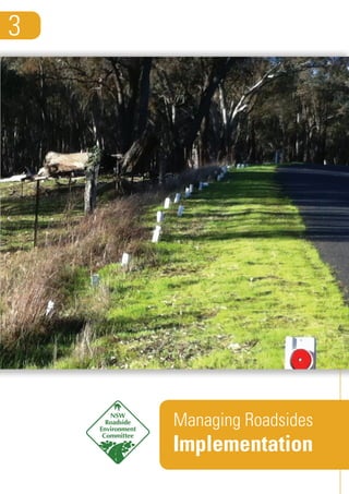
5. • For those roadsides in Management Categories B and C, attempt to rehabilitate them to Category A (see ‘Managing
Roadsides 1: Assessment’ for an explanation of categories).
• Identify and attempt to minimise threatening processes relating to threatened species and Endangered Ecological
Communities.
• Conduct rehabilitation work on the highest priority areas if opportunities for funding of projects arise.
Maintenance of medium conservation value roadsides
Consider the following management options:
• Identify those areas capable of being protected from grazing and road works by restricting stock access or fencing
the area. Other areas may need to be allocated as routes for travelling stock, to maintain access.
• Encourage regeneration of natural vegetation, by managing grazing, burning or light cultivation.
• Set up an integrated weed control strategy to manage the impact of existing or encroaching weeds.
Maintenance of low conservation value roadsides
Ensure that activities are managed effectively to avoid further degradation. Consider the following management:
• Prioritise these areas for travelling stock and grazing, ensuring that this does not lead to further roadside degradation,
such as erosion or weed infestation.
• Control weeds which impact on the roadside and adjacent land.
• Rehabilitate the land if opportunities exist to create a strategic connection with other remnant vegetation, or to help
control salinity and erosion.
• Use for activities which are not appropriate in high and medium conservation value roadsides, for example, stockpiles,
spoil dumps and machinery parking.
Signage and markers
There are two main ways used in NSW to identify high
conservation value roadsides and signal the various man-
agement regimes for all roadsides.
1. Significant Roadside Environment Area Signs
2. Roadside markers
Significant Roadside Environment Area Signs
Roads are regularly used by everyone in the community.
Placing signs on roadsides will create interest in the
roadside environment. Signs also alert roadside users
and works crews to areas which need special care par-
ticularly those high priority sites within high conservation
value roadsides.
The NSW Roadside Environment Committee (REC) encourages identification of significant roadside environment areas
(SREA) and provides a template to be used to identify such areas. Sites of significance can be based on ecological,
historical, geological or cultural attributes, or a combination of all of these.
Example of a Significant Roadside Environment Area sign
(photo: Orange City Council)
Implementation
5
6. The SREA signs identify areas to:
• warn roadside workers to take care when operating in the area
• highlight the features of the roadside to the public and promote awareness
• provide a contact for further information.
Local councils are encouraged to produce and erect SREA signs along high priority roadsides. Guidelines for erecting SREA
signs can be found at: www.lgnsw.org.au/policy/roadside-vegetation-implementation-project/grant-reporting-process.
Roadside markers
Roadside markers can be used to provide clear instructions for council staff undertaking roadside management activities
within identified ecologically sensitive sites. A marker scheme involves colour-coded stickers being placed on existing or
new white marker posts that will alert council staff to the presence and nature of ecologically sensitive roadside sites
of high conservation value. These stickers provide a clear coded link to supporting Field Guides that specify appropriate
management practices for protecting ecological values on that site.
Some individual councils have developed their own marker schemes. The Hunter and Central Coast Regional Environmental
Management Strategy (HCCREMS) has developed a roadside marker scheme for their region, and provides consistency
across councils in its region. The marker scheme will significantly reduce the risk of inadvertently damaging threatened
species and communities protected by Commonwealth and State legislation. Some 250 sites of ecological significance
have been identified and documented across 14 councils in the region.
Ecologically sensitive sites are defined as:
• Intact remnant native vegetation which may be significant at local or regional levels.
• Endangered Ecological Communities as identified in the Threatened Species Conservation Act 1995 and the
Environment Protection and Biodiversity Conservation Act 2000.
• Habitat for a range of significant flora and fauna species. The roadside environment may contain features including
bush rock, fallen logs or trees with hollows that provide important habitat for a range of ground dwelling and arboreal
animals.
• Roadsides adjoining or intersecting with wetlands, creeks and rivers which provide habitat for aquatic fauna and flora.
Many creeks, rivers and wetlands intersect with roads or occur immediately along the roadside. These sites are an
important food source and refuge for a range of native plants and animals. Impacts such as upstream erosion from road
related activities may have detrimental impacts on these fragile habitats.
• Corridors and key habitats providing linkages for fauna movements in the area.
More details about the HCCREMS roadside marker scheme can be found at: www.hccrems.com.au/Programs/
Roadside-Environments/Current-Activities.aspx.
Training
Training for local council staff is the best way to raise awareness of the RVMP across council, generating interest and
skill and encouraging staff to make informed decisions about resource management on roadsides. Training of staff should
include everyone from grader drivers, to administrators and elected representatives. The RVMP should also be supported
by other organisations with an interest in roadside management, such as bush fire brigades and utility providers. It is an
advantage to mix staff from these organisations in training sessions.
Training should address ecological principles, management of vegetation, soil and water, heritage areas, legislation, plan-
ning, threats to vegetation and engineering practices.
Implementation
6
7. It is most important to train council maintenance staff and contractors in appropriate maintenance practices as outlined
above, and the purpose of the SREA signs or road markers.
The REC encourages the following learning outcomes for council staff training:
• Explain the importance of managing the roadside environment including vegetation
• Explain competing uses of roadsides, for example road construction, road safety, environment and other uses.
• Identify issues in managing roadside environments, for example bushfire management, weed management, sediment
and erosion control.
• Identify appropriate council plans and assessments, for example roadside vegetation management plans and REFs that
guide roadside works.
• Identify roadside works from these plans and assessments that may impact on roadside environments.
• Describe appropriate roadside works in high conservation value areas across the following: road construction and
maintenance; roadside rehabilitation; fire prevention works; slashing and spraying; firewood collection; livestock
movement and grazing; road reserve boundary fencing; and, property access.
• Describe any community consultation measures for the appropriate roadside works.
• Describe reporting and communication requirements for the appropriate roadside works.
• Conduct maintenance and construction activities along roadsides using environmentally sensitive and
sustainable practices.
For details of training organisations and trainers contact the REC Executive Officer (see below).
Community education
An interested community will assist in implementing the RVMP by being more aware of their impact on the roadside, be-
having sensitively themselves and observing others. Involving the community in roadside activities will also help and can
save time and money.
There are many ways of educating communities about the value of roadsides and appropriate management including of
high conservation value areas. These include:
• Local newspapers and radio to highlight positive outcomes
• SREA signs and road markers
• Advertising through rate notices and council publications
• Pamphlets
• Maps
• Use of social media, including council’s Facebook and Twitter
• Content on council and stakeholder websites
• Presentations to community groups and schools.
The REC produces a quarterly ‘REC Newsletter’ which highlights best practices in linear reserve environmental manage-
ment. To subscribe, contact the REC Executive Officer (details below). Previous editions are available from the REC web-
site: www.rms.nsw.gov.au/environment/downloads/rec_newsletters_dl1.html
Implementation
7
8. Regulation
The methods outlined so far use persuasion to encourage people to look after their roadsides. Local councils and other
authorities have rangers who regularly use the roads and monitor activities on the roadside. The LEP or DCP will have
policies which can be regulated. Legislation at the State or Commonwealth level also provides for regulatory powers.
The effectiveness of regulation and legislative control is dependent on people knowing about it. Upon implementing any
controls, they must be advertised in the local press and radio.
Stakeholder engagement and partnerships
Resources to implement the RVMP can come in the form of people, money or expertise.
Community groups or local businesses can be encouraged to contribute to the maintenance of roadsides through an
‘Adopt-a-road’ scheme. Already, there are examples in NSW where local communities have adopted lengths of road and
undertaken to plant trees, raise awareness, and keep those areas free of litter and noxious weeds. Roadsides which are
well cared for and in good condition contribute to the economy of a region by attracting tourism. Some local councils in
NSW have established tourist trails in their LGAs to highlight roadsides, including those high conservation value areas.
Private businesses, schools, service and community groups can be involved in tree planting, weeding, litter removal or
other activities on roadsides. Acknowledgement of the work of these groups is a good idea and could be achieved through
erecting signage.
Landcare groups may also be interested in helping to manage a roadside environment. Roadsides often offer a group the
opportunity to manage an area of remnant vegetation which contributes to catchment health and provides valuable experi-
ence.
Some groups specialise in community involvement of natural resource management activities. Organisations such as
Greening Australia, Landcare, Coastcare, Clean Up Australia, Keep Australia Beautiful Council have expertise in getting
the community involved. Schools, service groups such as Rotary, Lions and Apex, other sporting groups, local businesses
and government departments can also become involved in roadside activities.
There are many organisations that use roadsides or have an interest in their management and can assist with the
implementation of the RVMP. Gas, electricity and telecommunication suppliers may contribute to implementation. County
Councils certainly need to be involved. Fire planning and protection assistance is available through fire control officers and
the local bush fire management committee.
Funding opportunities
As highlighted, it is important for local councils to identify high priority sites for rehabilitation. Funds for these activities
may not be included in council budgets, and assistance is sought through grants and other funding opportunities. Funds
in the past have been provided for roadside rehabilitation and restoration projects by the NSW Environmental Trust and
other funding providers.
Sponsorship can contribute to implementation of the plan. This can be in the form of money, goods or in-kind support. A
local business may provide financial support or donate materials to do the works, or assist through the provision of services
of a consultant. Sponsorship such as this needs wider acknowledgement and promotion, and the expectations from the
sponsor and council should be negotiated up front in the project.
Restoration and rehabilitation projects
Funding for restoration and rehabilitation projects can be sourced from council budgets or from external sources such as a
grants and sponsorship. In-kind support can be obtained from council staff, other agencies and not-for-profit groups.
Implementation
8
9. There are several best practice guides to restoration and rehabilitation projects that can be used for roadside reserves.
These guides include:
• The IUCN’s Ecological Restoration for Protected Areas www.data.iucn.org/dbtw-wpd/edocs/PAG-018.pdf
• Best practice guidelines provided by the NSW Office of Environment and Heritage
www.environment.nsw.gov.au/Search.
There are also many contractors that specialise in restoration and rehabilitation works. Their contact details can be
readily accessed from the internet.
Examples
Examples of RVMP implementation projects can be found at: www.lgnsw.org.au/policy/roadside-vegetation-implementa-
tion-project/resources-and-case-studies.
The Roadside Environment Committee
The NSW Roadside Environment Committee (REC) was established in 1994 by the NSW Government in recognition of the
environmental values of linear reserves including roadsides. The REC is an umbrella body of state agencies and environ-
ment groups that promotes and coordinates leading practice in linear reserve environmental management across the
State. The REC identifies issues, and with land managers, works towards solutions.
The REC has taken a strategic approach to improving linear reserve environmental management in NSW. To do this, it has
developed, implemented and evaluated a series of three-year strategic plans.
The objectives of the current REC strategic plan are:
• to achieve consistent, high quality of environmental management of NSW linear reserves
• to engage with key stakeholders and communities to improve linear reserve environmental management in NSW
• to address issues related to the management of linear reserve environments in NSW.
The REC website is at www.rms.nsw.gov.au/environment/roadsideenvironcommittee.
For more information
Ifyouwouldlikemoreinformationonroadsideenvironmentalplanningandmanagement,fundingopportunitiesforprojectsor
contacts within other organisations please contact the Executive Officer of the NSW Roadside Environment Committee.
Neil Dufty
REC Executive Officer
Phone: (02) 9354 0300
Mobile: 0437 130 283
Email: ndufty@molinostewart.com.au
This program has been assisted by the New South Wales Government through its Environmental Trust.
Implementation
9