These guidelines have been prepared for local councils seeking to achieve best practice in roadside environmental management through the use of Roadside Vegetation Management Plans (RVMPs). However, the guidelines will also be of relevance to managers of other linear reserves which, by nature of their shape and issues, have similar management requirements.
This guide outlines the fourth stage in developing a RVMP - planning.
Roadside environments in New South Wales cover approximately 6% of the state's area and contain significant native biodiversity and ecological communities. They provide important habitat and connectivity for wildlife. Managing roadsides involves balancing conservation needs with other considerations like safety, infrastructure, and community uses. A holistic planning approach using Roadside Vegetation Management Plans can help identify high value conservation areas and better manage risks to natural assets. The document outlines key threats like fire management and safety that should be addressed in these management plans.
Roadside environments in New South Wales cover around 6% of the state's area and provide important habitat for biodiversity. They are managed by Roads and Maritime Services for main roads and local councils for minor roads. Best practice management involves assessing the conservation value of roadsides, planning management actions, implementing those actions, and monitoring their effectiveness in a continuous cycle. Key implementation actions include appropriate maintenance, community education, and restoration projects tailored to high, medium, and low conservation value roadsides. Signage is used to identify areas requiring special care or management.
Pakistan earthquake - water and sanitation reconstruction strategyMurtaza Malik
This paper describes the experiences of development of the strategy for rehabilitation and reconstruction of water and sanitation infrastructure in Pakistan destroyed by the 2005 earthquake.
This document discusses the interaction between spatial planning and river basin management in Ireland. It outlines the functions of planning authorities, including developing county development plans and managing development applications. It emphasizes that planning must ensure compatibility with River Basin Management Plans to promote sustainable development. Key policies like Strategic Environmental Assessment and Appropriate Assessment are used to align plans, policies and projects. The document also discusses stakeholders in the planning process, and how river basin management influences planning policy, guidelines, and development decisions to protect water quality.
This presentation was given at the 2019 Catchment Management Notwork meeting, which was held on the 11 October in Tullamore. All our local authorities and other bodies responsible for implementing the Water Framework Directive in Ireland attended to share knowledge and learn from each other.
Fairfax County: A Commitment to Environmental/ Energy ConservationFairfax County
Fairfax County has committed to environmental conservation and energy efficiency through various programs and initiatives. The county has environmental goals outlined in documents like the Board's Environmental Agenda and Environmental Improvement Program. These goals are implemented through initiatives focused on areas like solid waste management, air quality, transportation, energy efficiency, growth and land use, conservation, and water quality. The county also coordinates with regional organizations and has received national recognition for its environmental leadership and programs.
Chesapeake Bay Watershed Implementation Planning ProcessMarti Donley
Presentation given May 16, 2011 by Asst. Secretary of Natural Resources Anthony Moore to GWRC Board of Directors.
In the above presentation, Asst. Secretary Moore discussed the State’s Watershed Implementation Plan process to comply with the federal Chesapeake Bay TMDL. The State has asked all 16 PDCs in the Chesapeake Bay watershed (including GWRC) to consider assisting the Va. Dept. of Conservation and Recreation by supporting “Community Conservation Information (CCI)” review by local governments and SWCDs of input data (i.e. land cover and installed Best Management Practices) and the preliminary local Total Maximum Daily Load (TMDL) allocations from the Chesapeake Bay Water Quality Model developed by the US EPA and other federal agencies. A meeting was held on May 17th with local storm water management program staff, environmental planners, representatives of the Hanover-Caroline SWCD and Tri-County/City SWCD, the Rappahannock River Basin Commission and the Friends of the Rappahannock to hear a presentation by DCR staff and discuss the merits of regional coordination of the WIP/TMDL data review process. The group consensus was that regional facilitation of the review had merit, but the selection of implementation measures and investments should be developed locally.
DCR staff have indicated that revised Chesapeake Bay Water Quality model results are anticipated in late June 2011 that will reflect enhancements to the model and the resulting revised TMDL allocation data will be distributed to local governments, SWCDs and PDCs. The State is developing also an on-line tool to facilitate the sensitivity testing of the effect of changing the inventory and mix of BMPs that exist in each community to help communities prioritize where to place implementation program emphasis based on the pollution reduction goals they are assigned in the WIP process.
This presentation was given at the Catchment Management Network meeting on February 24th 2017. The Catchment Management Network consists of the EPA, all of Ireland's Local Authorities, and other public bodies involved in looking after Ireland's catchments, sub-catchments and water bodies. For more information about this work see www.catchments.ie
Eecom june 2011, lu vca, barry - ee, conservation, aucca, csr (gary's modif...bmitschke
1. The document discusses the need for a regional conservation strategy in Saskatchewan to protect natural systems and biodiversity that span multiple municipalities.
2. It proposes establishing large protected natural areas and corridors connected by stepping stones and special sites, and integrating conservation and development planning through a regional framework.
3. Challenges include the need for multi-jurisdictional cooperation and revenue sharing given varying municipal capacities, and the document argues the provincial government should strengthen regional planning.
Martina Hennessy, Informatics Manager, EPA delivered this presentation on managing and visualising the EPA's water data on September 10th 2015 at a Compass Informatics workshop.
This presentation was given at the 2019 Catchment Management Notwork meeting, which was held on the 11 October in Tullamore. All our local authorities and other bodies responsible for implementing the Water Framework Directive in Ireland attended to share knowledge and learn from each other.
This document discusses sustainability in discretionary review processes. It highlights the environmental risks of climate change and over-reliance on fossil fuels. It examines how sustainable various cities are and provides tools for conducting sustainability reviews of plans, policies, regulations and development projects. These include impact modeling, checklist and guidelines. The document also outlines best practices for adapting to changing conditions, becoming self-sufficient and solving larger problems. It provides examples from the City of San Diego's general plan and sustainability efforts.
Synergies between climate change adaptation and biodiversityNAP Events
Presentation by: Annie Cung
3.4 Synergy between climate change adaptation and other issues
The session will introduce approaches for facilitating synergy and inter-linkages in the implementation of climate change adaptation actions in the context of the formulation and implementation of NAPs, and relevant actions on biodiversity and desertification/land degradation. It will discuss the existing arrangements and opportunities, including capacity-building, and how can countries build on these to explore synergy between the three issues. It will also include practical experiences from countries.
Green week presentation eu rivers - Chris BakerRESTORE
This document discusses opportunities and challenges for richer river environments through ecological restoration. It outlines that river restoration aims to restore natural river functioning and provides ecosystem services. Existing policies like the Water Framework Directive and Habitats Directive support some restoration but it is typically small in scale and focused on specific goals. The document calls for more innovative, landscape-scale restoration that provides multiple benefits and complements water management. It suggests leveraging agricultural policies and developing green infrastructure to advance restoration goals. Challenges include ensuring policy cross-compliance, implementation support through incentives and capacity building, and quantifying costs and benefits.
Fairfax County: A Commitment to Environmental/Energy ConservationFairfax County
Fairfax County has a strong commitment to the environment and energy conservation. The Fairfax County vision elements include maintaining safe and caring communities, building livable spaces, connecting people and places, maintaining healthy economies, practicing environmental stewardship, creating a culture of engagement, and exercising corporate stewardship.
This presentation was given at the Catchment Management Network meeting on February 3rd 2017. The Catchment Management Network consists of the EPA, all of Ireland's Local Authorities, and other public bodies involved in looking after Ireland's catchments, sub-catchments and water bodies. For more information about this work see www.catchments.ie
The two countries in southern Africa have classic configuration of being located in transboundary basins. There are many similarities as regards their interdependence on riparians. The presentation summarises possible complementarity and consistency in transboundary water management. The findings are based on almost 30 months of work in the region.
The document summarizes a presentation on vulnerability assessment and adaptation options appraisal for water resource management in Uganda. It provides context on Uganda's climate, population trends, water resources and three target catchment areas. It then analyzes the vulnerability of livelihoods and ecosystems in each catchment due to factors like subsistence agriculture, land degradation, population growth and limited climate information. Finally, it outlines a participatory process for appraising adaptation options based on addressing key challenges and complementing existing initiatives. The overall aim is to support integration of climate resilience in Uganda's development planning.
Donal Daly, EPA Catchment Science and Management Unit outlines a possible approach to integrating Water Framework Directive and Biodiversity goals at the catchment scale.
UNDP MT EbA Learning Brief 3 FINAL web vs 05.01.16Tine Rossing
The document discusses using cost-benefit analysis to evaluate Ecosystem-based Adaptation (EbA) measures implemented by the Global EbA in Mountain Ecosystems Programme in Nepal, Peru, and Uganda from 2011-2015. It provides an example case study of a cost-benefit analysis conducted on cultivating broom grass in Nepal to control erosion and provide livelihoods. The analysis found the EbA intervention of broom grass cultivation was more economically viable than a business-as-usual approach, with net present value nine times higher and a benefit-cost ratio above 1, supporting investment in the EbA measure.
This presentation was given at the 2019 Catchment Management Notwork meeting, which was held on the 11 October in Tullamore. All our local authorities and other bodies responsible for implementing the Water Framework Directive in Ireland attended to share knowledge and learn from each other.
Natural Capital Accounting in the Caribbean eftec January 2021iweco-project
This presentation, made at a UNEP GEF IWEco Project Partners' Webinar in January 2021, gave context on the conceptual underpinnings of natural capital accounting, and the general process by which the accounts are built. Links to international initiatives, such as the United Nations System of Environmental-Economic Accounting - Ecosystem Accounts (UN SEEA-EA), which provide a standardised understanding of how accounts should be produced (such as by National Statistics Offices), and the Sustainable Development Goals, were also explored. The practical application of natural capital accounting in the Caribbean was demonstrated through the UK Government funded “Caribbean Overseas Territories Regional Natural Capital Accounting Programme”. This programme is building capacity for natural capital accounting in the five Caribbean UK Overseas Territories, working with local government departments, and other local organisations, to collect data and produce environmental statistics within the natural capital accounting framework. These statistics will be able to sit alongside other national economic indicators, such as GDP, to help support better decision making in the region.
Advancing Guyana’s National Ambition Mangrove ManagementCIFOR-ICRAF
Presented by Adiola Walcott (Technical Officer-Mitigation Office of Climate Change Ministry of the Presidency Guyana) on 25 September 2019 at Blue Carbon Regional Workshop, Merida, Yucatan.
Experiences in Nutrient Pollution Control Planning, Implementation and Evalua...Iwl Pcu
Thomas Simpson, University of Maryland and The World Bank Group
Presented at the Black Sea – Danube Regional Conference on Nutrient Pollution Control in Chisinau, Moldova – October 2006
Presented by IWMI's Liza Debevec at a Roundtable on Building Resilience to Climate Change through Community Dialogues held in Addis Ababa, Ethiopia, September 20, 2016.
The document summarizes AGEDI's 4-year Climate Change Programme assessing climate change impacts, vulnerability and adaptation for Abu Dhabi, UAE and the Arabian Peninsula. The programme includes 12 sub-projects in 5 thematic areas (regional climate change, environment, water resources, coastal zones, and socio-economic systems) across 3 spatial regions. The sub-projects will develop climate modeling, assess impacts on ecosystems, water resources, coastal areas, and socio-economic systems. The program aims to provide high-quality environmental data and information to support decision-making on adapting to climate change impacts in the region.
This report summarizes the results of a 2014 survey of 108 municipalities in Southeast Florida regarding their implementation of recommendations from the Southeast Florida Regional Climate Action Plan (RCAP). Fifty-five municipalities responded to the survey (51% response rate). The report finds that municipalities have implemented recommendations related to urban tree canopy maintenance, energy efficient lighting, stormwater management, and climate-resilient planning. Coconut Creek reported implementing the most recommendations at 66, followed by Key West at 65.
http://inarocket.com
Learn BEM fundamentals as fast as possible. What is BEM (Block, element, modifier), BEM syntax, how it works with a real example, etc.
The document discusses how personalization and dynamic content are becoming increasingly important on websites. It notes that 52% of marketers see content personalization as critical and 75% of consumers like it when brands personalize their content. However, personalization can create issues for search engine optimization as dynamic URLs and content are more difficult for search engines to index than static pages. The document provides tips for SEOs to help address these personalization and SEO challenges, such as using static URLs when possible and submitting accurate sitemaps.
How to Build a Dynamic Social Media PlanPost Planner
Stop guessing and wasting your time on networks and strategies that don’t work!
Join Rebekah Radice and Katie Lance to learn how to optimize your social networks, the best kept secrets for hot content, top time management tools, and much more!
Watch the replay here: bit.ly/socialmedia-plan
Lightning Talk #9: How UX and Data Storytelling Can Shape Policy by Mika Aldabaux singapore
How can we take UX and Data Storytelling out of the tech context and use them to change the way government behaves?
Showcasing the truth is the highest goal of data storytelling. Because the design of a chart can affect the interpretation of data in a major way, one must wield visual tools with care and deliberation. Using quantitative facts to evoke an emotional response is best achieved with the combination of UX and data storytelling.
These guidelines have been prepared for local councils seeking to achieve best practice in roadside environmental management through the use of Roadside Vegetation Management Plans (RVMPs). However, the guidelines will also be of relevance to managers of other linear reserves which, by nature of their shape and issues, have similar management requirements.
This guide outlines the first stage in developing a RVMP - assessment.
2020-21 Annual Report of the NSW Roadside Environment CommitteeNeil Dufty
The 2020-21 annual report of the NSW Roadside Environment Committee which promotes the good practice in the environmental management of linear reserves (roadsides, travelling stock reserves, rail corridors, utility easements) across the state of New South Wales, NSW.
2018-19 Annual Report of the NSW Roadside Environment Committee. The NSW Roadside Environment Committee (REC) was established in 1994 by the New South Wales Government in recognition of the environmental values of linear reserves. The REC is an umbrella body of state agencies and environment groups that promotes and coordinates leading practice in linear reserve environmental management across the State. Neil Dufty is the Executive Officer of the REC.
2021-22 Annual Report of the NSW Roadside Environment CommitteeNeil Dufty
The NSW Roadside Environment Committee (REC) was established in 1994 by the NSW Government in recognition of the environmental values of linear reserves. The REC is an umbrella body of state agencies and environment groups that promotes and coordinates leading practice in linear reserve environmental management across the State.
The vision of the REC is:
"Environmental values of linear corridors are actively managed in balance with other functional needs."
The REC currently comprises thirteen organisations with interests in the environmental management of roadside and other linear reserves in NSW.
This is the 2021-22 REC Annual Report covering the REC's activities in that year.
Wetland conservation in China and Asia: Protection, management, and restoration.
Presentation given at a wetland conservation workshop in Heilongjiang, China. Prepared in connection with the UNDP CBPF Main Streams of Life (MSL) project, Strengthening the Management Effectiveness of the Protected Area Landscape in the Altai Mountains and Wetlands.
Yass Valley Council Strategy for the Management of onsite sewage systemstmdominko
This document outlines Yass Shire Council's strategy for managing on-site sewage systems. It was produced in response to new regulations requiring councils to develop sewage management strategies. The strategy aims to minimize pollution impacts and protect public health and the environment. It details plans to register existing systems, educate homeowners, inspect high risk systems, and ensure new systems meet performance standards. The strategy establishes approval processes and fees for on-site sewage management in the Shire.
Presentation by Alaine Clarke MIPI Physical Planner
Objectives:
Appreciate existing linkages between catchment management and the planning system
Recognise that the planning system is a key tool to implementation of River Basin Management Plans
Understand what is needed to deliver a water-friendly planning system
Structure of presentation:
Policy Context
Legislative context as it relates to planning & RBMPs
What guidance is out there?
Existing RBMPs + interaction with planning system
Developing appropriate & measurable policies
Next cycle of RBMPs
20100407 kostelec green_infrastructure_webTranspo Group
This document summarizes a conference on integrating green infrastructure into regional planning. It discusses defining green infrastructure to include both natural and built environments. It provides examples of green infrastructure networks and policies to support them. Speakers discussed state-of-the-practice techniques, assessing green infrastructure at a regional scale, and impacts of stormwater. Street connectivity was presented as a green infrastructure practice, and metrics like route directness index were discussed to measure connectivity.
The NSW Roadside Environment Committee (REC) helps manage NSW's linear reserve environments like roadsides, stock routes, and rail corridors, which cover around two-thirds of the state's land area. The REC provides support and resources to managers of these areas, promotes best practices, and educates the community on their importance. It aims to achieve high quality and consistent environmental management across NSW's linear reserves by engaging stakeholders and addressing management issues. The REC helps develop Roadside Vegetation Management Plans and provides services, resources, and contacts to support the management of linear reserve environments.
Introduction: Air Quality and Ecological Impact AssessmentIES / IAQM
This document summarizes a discussion meeting on assessing the impacts of development on habitats protected by the Habitats Directive. It describes a case study of Wealden District Council, which adopted a policy preventing development within 7km of Ashdown Forest due to recreational and air quality impacts. The policy was later challenged. There is ongoing debate around using the DMRB scoping criteria to assess impacts, the need for extensive monitoring in Appropriate Assessments, and defining "de minimis" impact levels. The meeting aims to discuss improving such assessments and potential new guidance.
NAP Expo 2015 Session VII, II National strategies on integrating CCA, VietnamNAP Events
Vietnam has developed several national strategies and policies to integrate climate change adaptation, including the National Strategy on Climate Change, National Target Program to Respond to Climate Change, and National Action Plan on Climate Change. The strategies establish a 5-step process for mainstreaming climate change adaptation into development plans at all levels. The steps include screening, selecting adaptation measures, integrating measures into plans, implementing adapted plans, and monitoring. Key sectors that have integrated adaptation include agriculture and water resources. Challenges remain in strengthening guidance, capacity, and regional coordination of adaptation planning.
This document discusses integrated coastal management (ICM) and marine pollution prevention programs in East Asian seas. It summarizes ICM programs from 1994-2004 that involved 11 countries and total funding of $24.2 million. The key aspects covered include implementing international conventions through multi-stakeholder participation, poverty alleviation, local governance, and ecosystem-based management. ICM employs an integrated approach across sectors and agencies to balance human and ecosystem needs through collaborative planning and management.
Global framework for the Five Years of Action for the Development of Mountain.Christina Parmionova
This document outlines a global framework for action on mountain development from 2023-2027 as proclaimed by the UN General Assembly. It proposes four pathways to contribute to the long-term impacts of conserving mountain ecosystems, increasing resilience to climate change, and improving quality of life in mountains. The pathways are to scale up nature-based solutions, improve access to services and infrastructure, enhance cooperation and governance, and empower mountain communities. It identifies areas for action and lists initiatives by organizations that contribute to the pathways and impacts. The framework is intended to guide and coordinate efforts to support sustainable mountain development over the five years.
1. The document discusses sustainable development planning for large regeneration projects. It emphasizes community leadership, long-term thinking, and considering impacts beyond project boundaries.
2. A sustainability checklist is presented as a tool for evaluating projects against criteria like climate change, resources, and placemaking.
3. Case studies are described that used the checklist and focused on conservation of historic features, use of native plants, and protecting local biodiversity like the black redstart species.
This document provides an overview of the development plan process in Ireland to promote community participation. It discusses the importance of development plans, challenges facing planning, and how to get involved by making a submission and following up. The key points are that development plans guide land use and development, community participation is important for creating an agreed vision and environmental contract, and tips are provided on effectively making a submission and ensuring views are considered in the plan.
Indicators are data or combinations of data used to measure and communicate complex phenomena for policy purposes. They simplify complex issues and provide early warnings. Developing good indicators requires defining policy goals, identifying available data sources, selecting appropriate indicators, and testing them. Biodiversity, socioeconomic, and governance indicators are needed at local and regional scales. Key steps in developing indicators include defining goals, identifying data sources, selecting indicators, and ensuring communication and agreement across countries and scales. Sources of uncertainty can arise from assumptions, models, linking evaluation to action, implementation, and mismatches across temporal and spatial scales.
2019-20 Annual Report of the NSW Roadside Environment CommitteeNeil Dufty
The 2019-20 Annual report of the NSW Roadside Environment Committee, a State government committee that promotes good practices in the management of linear reserve environments (e.g. roadsides, rail corridors, travelling stock reserves, utility easements) in New South Wales, Australia.
Similar to Guide: Managing roadside environments 4 - Monitoring & Evaluation (20)
Level 3 NCEA - NZ: A Nation In the Making 1872 - 1900 SML.pptHenry Hollis
The History of NZ 1870-1900.
Making of a Nation.
From the NZ Wars to Liberals,
Richard Seddon, George Grey,
Social Laboratory, New Zealand,
Confiscations, Kotahitanga, Kingitanga, Parliament, Suffrage, Repudiation, Economic Change, Agriculture, Gold Mining, Timber, Flax, Sheep, Dairying,
Leveraging Generative AI to Drive Nonprofit InnovationTechSoup
In this webinar, participants learned how to utilize Generative AI to streamline operations and elevate member engagement. Amazon Web Service experts provided a customer specific use cases and dived into low/no-code tools that are quick and easy to deploy through Amazon Web Service (AWS.)
How to Setup Warehouse & Location in Odoo 17 InventoryCeline George
In this slide, we'll explore how to set up warehouses and locations in Odoo 17 Inventory. This will help us manage our stock effectively, track inventory levels, and streamline warehouse operations.
This presentation was provided by Rebecca Benner, Ph.D., of the American Society of Anesthesiologists, for the second session of NISO's 2024 Training Series "DEIA in the Scholarly Landscape." Session Two: 'Expanding Pathways to Publishing Careers,' was held June 13, 2024.
Temple of Asclepius in Thrace. Excavation resultsKrassimira Luka
The temple and the sanctuary around were dedicated to Asklepios Zmidrenus. This name has been known since 1875 when an inscription dedicated to him was discovered in Rome. The inscription is dated in 227 AD and was left by soldiers originating from the city of Philippopolis (modern Plovdiv).
🔥🔥🔥🔥🔥🔥🔥🔥🔥
إضغ بين إيديكم من أقوى الملازم التي صممتها
ملزمة تشريح الجهاز الهيكلي (نظري 3)
💀💀💀💀💀💀💀💀💀💀
تتميز هذهِ الملزمة بعِدة مُميزات :
1- مُترجمة ترجمة تُناسب جميع المستويات
2- تحتوي على 78 رسم توضيحي لكل كلمة موجودة بالملزمة (لكل كلمة !!!!)
#فهم_ماكو_درخ
3- دقة الكتابة والصور عالية جداً جداً جداً
4- هُنالك بعض المعلومات تم توضيحها بشكل تفصيلي جداً (تُعتبر لدى الطالب أو الطالبة بإنها معلومات مُبهمة ومع ذلك تم توضيح هذهِ المعلومات المُبهمة بشكل تفصيلي جداً
5- الملزمة تشرح نفسها ب نفسها بس تكلك تعال اقراني
6- تحتوي الملزمة في اول سلايد على خارطة تتضمن جميع تفرُعات معلومات الجهاز الهيكلي المذكورة في هذهِ الملزمة
واخيراً هذهِ الملزمة حلالٌ عليكم وإتمنى منكم إن تدعولي بالخير والصحة والعافية فقط
كل التوفيق زملائي وزميلاتي ، زميلكم محمد الذهبي 💊💊
🔥🔥🔥🔥🔥🔥🔥🔥🔥
A Visual Guide to 1 Samuel | A Tale of Two HeartsSteve Thomason
These slides walk through the story of 1 Samuel. Samuel is the last judge of Israel. The people reject God and want a king. Saul is anointed as the first king, but he is not a good king. David, the shepherd boy is anointed and Saul is envious of him. David shows honor while Saul continues to self destruct.
Andreas Schleicher presents PISA 2022 Volume III - Creative Thinking - 18 Jun...EduSkills OECD
Andreas Schleicher, Director of Education and Skills at the OECD presents at the launch of PISA 2022 Volume III - Creative Minds, Creative Schools on 18 June 2024.
2. Why are roadside environments important?
There are approximately 180,000 km of public roads in New South Wales (NSW). Coupled with other linear reserves such as
travelling stock reserves (TSRs), rail corridors and infrastructure easements (including electricity lines, gas pipelines), it is
estimated that NSW linear reserves cover about 6% of the State’s area.
Apart from covering a large area, the State’s roadside reserves contain significant native biodiversity, including ecological
communities that are not represented in national parks, public reserves or private land. In rural areas, roadside reserves may
constitute the only remaining intact natural environment in the district due to extensive clearing for broadacre farming and
other land uses.
Roadside reserves provide invaluable wildlife habitats and corridors, especially when linked with other native vegetation
remnants in the landscape and provide connectivity which may assist in addressing threats, including those associated
with climate change. Other values of roadside reserves include:
• Transport routes (e.g. for stock)
• Agistment during drought
• Fire control lines
• Carbon sinks
• Places of Indigenous culture and heritage
• Sites of historic heritage
• Geological heritage
• Aesthetic appeal and recreational opportunities
• Sites for research and education.
Managing roadside environments in NSW
Reserves along main roads in NSW are managed by the NSW Roads and Maritime Services; local councils are responsible
for the management of local (minor) roads and their reserves.
Managing roadside areas is complex due to a number of competing values and issues. Conservation needs must be
balancedwithroadsafety,soilstability,waterrunoff,legalrequirements,bushfirerisk,infrastructurecorridors(water,power,
telecommunications), cultural values, firewood collection, grazing, recreational values (horse riding, hiking, bike riding),
educational values and development needs.
The NSW Environmental Planning and Assessment Act 1979 outlines requirements for environmental assessment in
relation to roads in NSW. Works on existing roadsides will be covered under the Local Environment Plan (LEP) and no
permit is required. However, local councils do have a responsibility to undertake due diligence in relation to managing
environmental values, including threatened species, usually by way of an assessment called a Review of Environmental
Factors (REF), and are their own consent authority in this regard.
If it is considered that a significant environmental impact may occur, then further assessment and mitigation measures are
required and the assessment may be directed to the Environment Minister (NSW and/or Commonwealth) for determina-
tion. Note that for main roads, the NSW government agency Roads and Maritime Services is the determining authority.
There are other legislative requirements relating to specific aspects of roadside reserve management including:
• Bushfire management (NSW Rural Fires Act 1997)
• Threatened species (NSW Threatened Species Conservation Act 1995, Commonwealth Environmental Protection
and Biodiversity Conservation Act 1999)
The update to this document was made possible through funding provided by the NSW Environmental Trust, through
the Roadside Vegetation Implementation Project managed by the Local Government NSW.
Monitoring&Evaluation
2
3. • Weed management (NSW Noxious Weeds Act 1993)
• Protection of public lands (NSW Local Government Act 1993)
• Pollution of land or waterways (NSW Protection of the Environment Operations Act 1997).
In addition to carrying out the legislative requirements, local councils are encouraged to take a more proactive approach
toroadsideenvironmentalmanagement.ThisapproachinvolvestheuseofRoadsideVegetationManagementPlans(RVMPs)
orsimilar.Theseplansenabletheidentificationofimportantroadsideenvironmentsandcoordinatedstrategiestoconservethem.
This holistic planning approach means that the risks to the important natural assets are understood and better managed.
These guidelines have been prepared for local councils seeking to achieve best practice in roadside environmental man-
agement through the use of RVMPs. However, the guidelines will also be of relevance to managers of other linear reserves
which, by nature of their shape and issues, have similar management requirements.
Towards best practice in roadside environmental management
There are four stages that lead to best practice in roadside environmental management:
1. Assessment
2. Planning
3. Implementation
4. Monitoring and evaluation
The stages should be carried out in a cycle as shown below.
This guide outlines the fourth stage in best practice – monitoring and evaluation (M&E).
Monitoring&Evaluation
3
The four stages in best practice roadside environmental management
4. The need for M&E
M&E is an essential part of the Monitoring, Evaluation, Reporting and Improvement (MERI) process encouraged by the
Australian and NSW Governments for natural resource management plans, programs and projects. They are simple
concepts that, when applied, help in the understanding of what is being achieved and can identify possible improvements.
A definition of each part of MERI is provided in the graphic below.
It should be noted that for reporting, the Integrated Planning and Reporting Framework requires that the NSW local coun-
cils prepare annual reports which will include reporting on environmental objectives in their Community Strategic Plans.
A State of the Environment Report must be included in the annual report only in the year in which a council election is
held. Elections occur every four years, with the next one planned for 2016. These reports should include M&E for the three
stages in best practice roadside environmental management.
The MERI for the council’s roadside environmental management could be conducted by a new or existing committee which
may include membership from across some of the divisions or departments of council, such as works, environment, com-
munications and community engagement. Other stakeholders including a community representative, or government agency
representative would add value to the M&E committee.
M&E for Stage 1 - Assessment
As outlined in ‘Managing Roadsides 1: Assessment’, there are four suggested steps in the environmental assessment for
the development of RVMPs:
1. Collecting existing information
2. Conducting the assessment in the field
3. GIS mapping
4. Identification of conservation status
Each of these four steps should be monitored and regularly evaluated, at least annually. For example, a new Threatened
Species or Threatened Ecological Community listing by the NSW Scientific Committee may result in further assessment
and mapping information which could alter the conservation value status of a roadside. This may result in a change in pri-
ority from ‘Medium’ or ‘Low’ conservation status to ‘High’. This new conservation value status should be reflected through
amendments of the RVMP.
Monitoring should also be conducted for other new information, such as GIS layers, new environment reports and REFs.
This information should be evaluated for its relevance to the RVMP and included in updates if relevant.
Monitoring&Evaluation
4
Components of the MERI approach to natural resource management.
Source: Australian Government
5. Every ten years, a reassessment of roadside environments should be undertaken. This is necessary to ensure major changes
to roadsides due to impacts such as weed invasion, fires, road construction and climate change can be incorporated. This
reassessment should be compared with the existing assessment and changes included in a major revision of the RVMP.
New GIS layers would result and enable the evaluation of the conservation value status of the roadside areas.
M&E for Stage 2 - Planning
All plans need to be monitored and evaluated to remain relevant and respond to changing conditions. Changes may include
a shift in community attitudes, economic changes may make it impossible to achieve some of the goals in the plan and
development and infrastructure requirements will change. Plans must be evaluated to ensure they are current and sup-
ported by the community and the council.
After three years, it is a good idea to formally evaluate the RVMP (see ‘Managing Roadsides 2: Planning’). This will provide
the M&E committee with a way of ensuring the plan remains flexible and workable. Adjustments to time lines, changing
community expectations or changes in conditions of the roadside environment are common and should be monitored on a
regular basis. M&E should focus on the following elements of the RVMP as described in ‘Managing Roadsides 2: Planning’:
1. Vision. Is this still appropriate?
2. Objectives. Are these still appropriate and consistent with Council’s environmental objectives?
3. Relevant legislation. Is there new relevant legislation? If so, what impacts will it have on the RVMP and its
implementation?
4. Links with Council systems and planning. Are the links between the RVMP and Council systems and planning still in
place? Can they be better formed?
5. Description of roadside vegetation and other environment values. Are there changes as a result of the M&E for
Assessment as described above?
6. Local roadside environmental management threats and issues. Have the threats and issues changed over
the past three years? If so, what impact have they had on local roadside environments?
7. Community interests, values and activities. Have community values, attitudes and behaviours regarding roadside
environments changed? If so, what impact will this have on actions in the RVMP and their implementation?
8. Conservation values. As described in ‘Managing Roadsides 1: Assessment’, the process below was used to determine
high, medium and low conservation value roadsides. As noted, new information such as listings of Threatened Species
may change the conservation value status of roadsides, prompting an amendment of that section of the RVMP and
possibly resultant actions. An overall re-assessment, within ten years will trigger a revision of the RVMP.
9. Roadsideenvironmentalmanagementprioritysites.Asfortheconservationvaluestatus,newinformationshouldbe
monitored and amendments to the RVMP conducted to prioritise projects and programs in high conservation value areas.
10. Management action plan. There are four main categories of actions emanating from the RVMP:
• Actions relating to legislative requirements for road construction and widening.
• Actions relating to other legislative requirements, such as weed managements, threatened species, and,
bushfire management.
• Actions to minimise the impacts of threats and resolve issues
• Actions to better manage high, medium and low conservation value roadsides and, in particular, those high priority
sites. Details of recommended management actions for sites can be found in ‘Managing Roadsides 3: Implementation’.
Monitoring&Evaluation
5
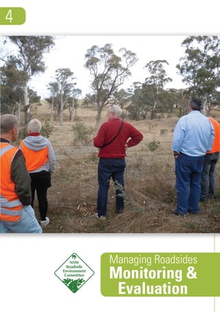
6. Actions in each of the four categories should be monitored and evaluated. Some pertinent evaluation questions include:
• Effectiveness: Were the planned actions performed, and to the standard required?
• Impact: What is the outcome, or result of having done the planned actions? Consider what changes in the condition of
environmental assets, changes in management practices and/or changes in institutions can be observed.
• Appropriateness: Was this the best way to have addressed the problem? Did the activities and the way they were
undertaken align with stakeholder needs and expectations? Were they consistent with relevant legislation and council
systems and planning?
• Efficiency: Did the action achieve the desired results within budget? To what extent did the action attain the highest
value from available resources and could the same outcomes be achieved more simply and for less cost next time?
• Legacy: Will the action continue to have an impact after its completion?
M&E for Stage 3 - Implementation
Some general guidelines for monitoring and evalu-
ation of management actions are provided above.
However, further guidance is provided here for ac-
tions to better manage high, medium and low con-
servation value roadsides and, in particular, those
highest priority sites. It is these actions which may
discriminate the RVMP from some other council envi-
ronmental management plans.
Details of recommended management actions for
these areas and sites can be found in ‘Managing
Roadsides 3: Implementation’. Thus monitoring and
evaluation should be related to:
• Appropriate maintenance of roadsides
How is maintenance quality being monitored? Is there a community complaints register being used? Is the maintenance
regime appropriate to the conservation value status of the roadside? Is it effective and efficient?
• Signage and markers
Is the signage or markers effective in educating council maintenance staff/contractors and the community?
• Training
Based on training feedback sheets and other monitoring, was the training appropriate and effective? Has it left a
lasting legacy of best practice? When will the training program need to be updated and for participants to update their
training?
• Community education
From community feedback such as a survey, is the community aware of the importance of roadsides and particularly
those of high conservation value? Has there been a reduction of illegal behaviours as a result of the community
education actions?
• Regulation
Are enforcement activities working? How well are they being coupled with community education?
• Stakeholder engagement and partnerships
Are those being engaged still appropriate? Are there partnerships in place to effectively implement the management
actions?
• Funding opportunities
Are funds such as grants and sponsorships being sought? How successful has council been in obtaining funding?
What are the critical success factors and what are the barriers to obtaining internal and external funding?
• Restoration and rehabilitation projects
Have the planned project outputs and outcomes been achieved? If not, why not? Have these funded projects/programs
been completed to deadline, within budget? Were there any unexpected outcomes? How will the project outputs be
monitored and evaluated in the future to ensure that they are still in place? What learnings and improvements are there
for future projects?
Members of the NSW Roadside Environment Committee inspecting roadside
environmental management initiatives in the Tumut area
Monitoring&Evaluation
6
7. In relation to restoration and rehabilitation projects, there are a range of techniques to monitor vegetation condition before
and after the projects are implemented. Suggested techniques include:
1. Photo-points: This technique involves taking before, during and after photographs at the same location and direction to
compare the difference in the condition of vegetation. An example of how to undertake this is available at:
http://www.hcr.cma.nsw.gov.au/uploads/res/Publications/photopointprotocol.pdf
2. Step-point monitoring: The step-point method is where the plants in contact with the toe of your boot are recorded
as you take each step. These steps can be along a fixed path which acts as a line-transect. This method can be used to
monitor changes before, during and after a restoration and rehabilitation project.
3. Windscreen assessment: As described in ‘Managing Roadsides 1: Assessment’, a windscreen assessment of
roadsideenvironmentsisrecommendedusingtheRoadsideAssessmentSheetprovided.Aftertheprojectiscompleted,itis
suggested that the Roadside Assessment Sheet be used to gauge changes in vegetation condition as a result of the
project. The Roadside Assessment Sheet is available as an Excel spreadsheet at: www.rms.nsw.gov.au/
environment/roadsideenvironcommittee.
Further details of appropriate M&E techniques can be found at www.dpi.nsw.gov.au/__data/assets/pdf_file/
0011/299360/Guidelines-for-monitoring-weed-control-and-recovery-of-native-vegetation.pdf
The Roadside Environment Committee
The NSW Roadside Environment Committee (REC) was established in 1994 by the NSW Government in recognition of the
environmental values of linear reserves including roadsides. The REC is an umbrella body of state agencies and environ-
ment groups that promotes and coordinates leading practice in linear reserve environmental management across the
State. The REC identifies issues, and with land managers, works towards solutions.
The REC has taken a strategic approach to improving linear reserve environmental management in NSW. To do this, it has
developed, implemented and evaluated a series of three-year strategic plans.
The objectives of the current REC strategic plan are:
• to achieve consistent, high quality of environmental management of NSW linear reserves
• to engage with key stakeholders and communities to improve linear reserve environmental management in NSW
• to address issues related to the management of linear reserve environments in NSW.
The REC website is at www.rms.nsw.gov.au/environment/roadsideenvironcommittee.
For more information
If you would like more information on roadside environmental planning and management, funding opportunities for projects
or contacts within other organisations please contact the Executive Officer of the NSW Roadside Environment Committee.
Neil Dufty
REC Executive Officer
Phone: (02) 9354 0300
Mobile: 0437 130 283
Email: ndufty@molinostewart.com.au
This program has been assisted by the New South Wales Government through its Environmental Trust.
Monitoring&Evaluation
7