The document discusses the Global Positioning System (GPS). GPS is a satellite-based navigation system that determines precise position and time using radio signals from satellites. It is comprised of three segments - the space segment of satellites in orbit, the ground segment of control and monitoring stations, and the user segment of receiver equipment. The space segment consists of 24 satellites in six orbital planes. The ground segment tracks and maintains the satellites and calculates their orbits. The user segment performs navigation and timing functions using GPS receivers, which can be categorized based on their capabilities.
Brilliant Lecture delivered to me in Alagappa Engineering college Workshop.
The Global Positioning System (GPS) is a satellite
based radio navigation system provided by the
United States Department of Defence. It gives
unequaled accuracy and flexibility in positioning
for navigation, surveying and GIS data collection.
Jskkgkemgkdigieig
Re igkrkg
U
H
T
Rieogkskkfkfkeokdkdlwd
Feor. Eit eir r rid tnekt rb r r eir jekfkvkvind djcjejd bdicjebskjdbd skocck neb dkckcjcjjebd. Ksjsbd ekebenks d dndke. D dkdmm
It depicts the basic information about GPS technology and its various uses in engineering and other fields. May be useful for students of engineering and for presentation.
It depicts the basic information about GPS technology and its various uses in engineering and other fields. May be useful for students of engineering and for presentation.
The French Revolution, which began in 1789, was a period of radical social and political upheaval in France. It marked the decline of absolute monarchies, the rise of secular and democratic republics, and the eventual rise of Napoleon Bonaparte. This revolutionary period is crucial in understanding the transition from feudalism to modernity in Europe.
For more information, visit-www.vavaclasses.com
Synthetic Fiber Construction in lab .pptxPavel ( NSTU)
Synthetic fiber production is a fascinating and complex field that blends chemistry, engineering, and environmental science. By understanding these aspects, students can gain a comprehensive view of synthetic fiber production, its impact on society and the environment, and the potential for future innovations. Synthetic fibers play a crucial role in modern society, impacting various aspects of daily life, industry, and the environment. ynthetic fibers are integral to modern life, offering a range of benefits from cost-effectiveness and versatility to innovative applications and performance characteristics. While they pose environmental challenges, ongoing research and development aim to create more sustainable and eco-friendly alternatives. Understanding the importance of synthetic fibers helps in appreciating their role in the economy, industry, and daily life, while also emphasizing the need for sustainable practices and innovation.
Instructions for Submissions thorugh G- Classroom.pptxJheel Barad
This presentation provides a briefing on how to upload submissions and documents in Google Classroom. It was prepared as part of an orientation for new Sainik School in-service teacher trainees. As a training officer, my goal is to ensure that you are comfortable and proficient with this essential tool for managing assignments and fostering student engagement.
How to Make a Field invisible in Odoo 17Celine George
It is possible to hide or invisible some fields in odoo. Commonly using “invisible” attribute in the field definition to invisible the fields. This slide will show how to make a field invisible in odoo 17.
How to Create Map Views in the Odoo 17 ERPCeline George
The map views are useful for providing a geographical representation of data. They allow users to visualize and analyze the data in a more intuitive manner.
Unit 8 - Information and Communication Technology (Paper I).pdfThiyagu K
This slides describes the basic concepts of ICT, basics of Email, Emerging Technology and Digital Initiatives in Education. This presentations aligns with the UGC Paper I syllabus.
The Indian economy is classified into different sectors to simplify the analysis and understanding of economic activities. For Class 10, it's essential to grasp the sectors of the Indian economy, understand their characteristics, and recognize their importance. This guide will provide detailed notes on the Sectors of the Indian Economy Class 10, using specific long-tail keywords to enhance comprehension.
For more information, visit-www.vavaclasses.com
The Roman Empire A Historical Colossus.pdfkaushalkr1407
The Roman Empire, a vast and enduring power, stands as one of history's most remarkable civilizations, leaving an indelible imprint on the world. It emerged from the Roman Republic, transitioning into an imperial powerhouse under the leadership of Augustus Caesar in 27 BCE. This transformation marked the beginning of an era defined by unprecedented territorial expansion, architectural marvels, and profound cultural influence.
The empire's roots lie in the city of Rome, founded, according to legend, by Romulus in 753 BCE. Over centuries, Rome evolved from a small settlement to a formidable republic, characterized by a complex political system with elected officials and checks on power. However, internal strife, class conflicts, and military ambitions paved the way for the end of the Republic. Julius Caesar’s dictatorship and subsequent assassination in 44 BCE created a power vacuum, leading to a civil war. Octavian, later Augustus, emerged victorious, heralding the Roman Empire’s birth.
Under Augustus, the empire experienced the Pax Romana, a 200-year period of relative peace and stability. Augustus reformed the military, established efficient administrative systems, and initiated grand construction projects. The empire's borders expanded, encompassing territories from Britain to Egypt and from Spain to the Euphrates. Roman legions, renowned for their discipline and engineering prowess, secured and maintained these vast territories, building roads, fortifications, and cities that facilitated control and integration.
The Roman Empire’s society was hierarchical, with a rigid class system. At the top were the patricians, wealthy elites who held significant political power. Below them were the plebeians, free citizens with limited political influence, and the vast numbers of slaves who formed the backbone of the economy. The family unit was central, governed by the paterfamilias, the male head who held absolute authority.
Culturally, the Romans were eclectic, absorbing and adapting elements from the civilizations they encountered, particularly the Greeks. Roman art, literature, and philosophy reflected this synthesis, creating a rich cultural tapestry. Latin, the Roman language, became the lingua franca of the Western world, influencing numerous modern languages.
Roman architecture and engineering achievements were monumental. They perfected the arch, vault, and dome, constructing enduring structures like the Colosseum, Pantheon, and aqueducts. These engineering marvels not only showcased Roman ingenuity but also served practical purposes, from public entertainment to water supply.
2. INRODUCTION
• Navigation is defined as the science of getting a craft or person from one place to another.
Each of us conducts some form of navigation in our daily lives. Driving to work or walking to
a place requires that we employ fundamental navigation skills. For most of us, these skills
require utilizing our eyes, common sense, and landmarks. However, in some cases where a
more accurate knowledge of our position, intended course, or transit time to a desired
destination is required, navigation aids other than landmarks are used.
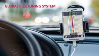
• The Global Positioning System (GPS) is a satellite-based navigation and surveying system for
determination of precise position and time, using radio signals from the satellites, in real-
time or in post-processing mode
3. GPS SYSTEM SEGMENTS
• GPS is comprised of three segments:
• Satellite constellation
• The satellite constellation is the set of satellites in orbit that provide the ranging signals and data
messages to the user equipment
• Its also called Space segment
• Ground-control/monitoring network
• The control segment (CS) tracks and maintains the satellites in space
• Its also called Ground segment
• User receiving equipment
• The user receiver equipment performs the navigation, timing, or other related functions
• Its also called User segment
4. SPACE SEGMENT
• 12 Hourly orbits
— In view for 4-5 hours
• Designed to last 7.5 years
• Different Classifications
- Block 1, 2, 2A, 2R & 2F
• 24 Satellites
4 satellites in 6 Orbital
Planes inclined at 55 Degrees
• 20200 Km above the Earth Orbits
5. CONTROL SEGMENT
Master Control Station
Responsible for collecting tracking data from the monitoring stations
and calculating satellite orbits and clock parameters
5 Monitoring Stations
Responsible for measuring pseudo range data. This orbital tracking
network is used to determine the broadcast ephemeris and satellite
clock modeling
Ground Control Stations
Responsible for upload of information to the satellites
6. USER SEGMENT
The most visible segment
GPS receivers are found in
many locations and
applications
7. GPS RECIEVERS
• Receivers are generally categorized by their physical characteristics, the elements of the GPS signal they
can use with advantage, and by the claims about their accuracy. There are receivers that use only the
C/A code on the L1 frequency and receivers that cross-correlate with the P(Y) There are L1 carrier phase
tracking receivers, dual-frequency and multi-frequency carrier phase tracking receivers, receivers that
track all in view, and GPS/GNSS receivers. The more aspects of the GPS signal a receiver can employ, the
greater its flexibility, but so, too, the greater its cost. It is important to understand receiver capabilities
and limitations to ensure that the systematic capability of a receiver is matched to the required outcome
of a project. it is possible to divide receivers into three categories. They are; Recreation, Mapping, and
Surveying.