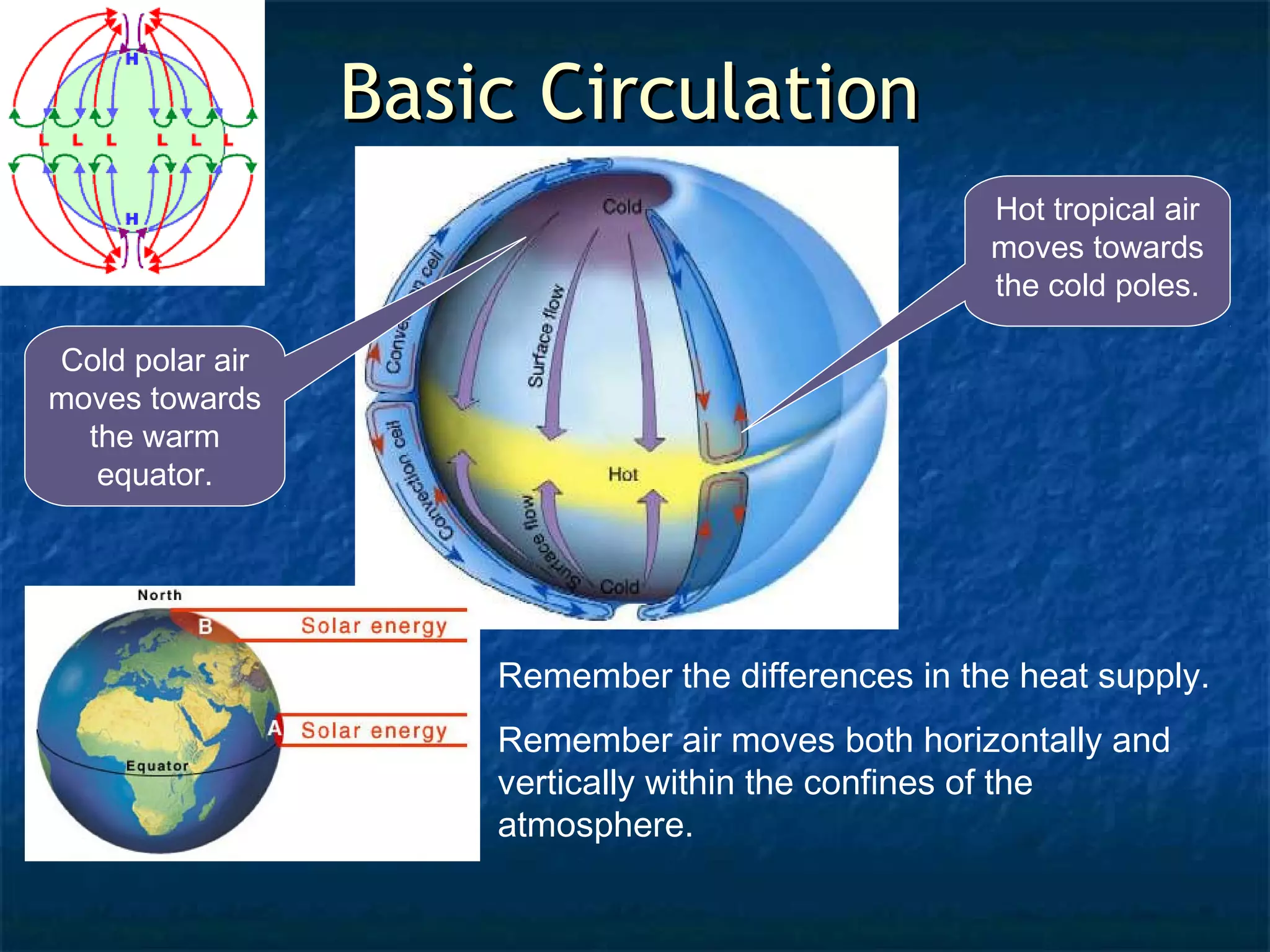
BBaassiicc CCiirrccuullaattiioonn
Coldpolar air
moves towards
the warm
equator.
Hot tropical air
moves towards
the cold poles.
Remember the differences in the heat supply.
Remember air moves both horizontally and
vertically within the confines of the
atmosphere.
6.
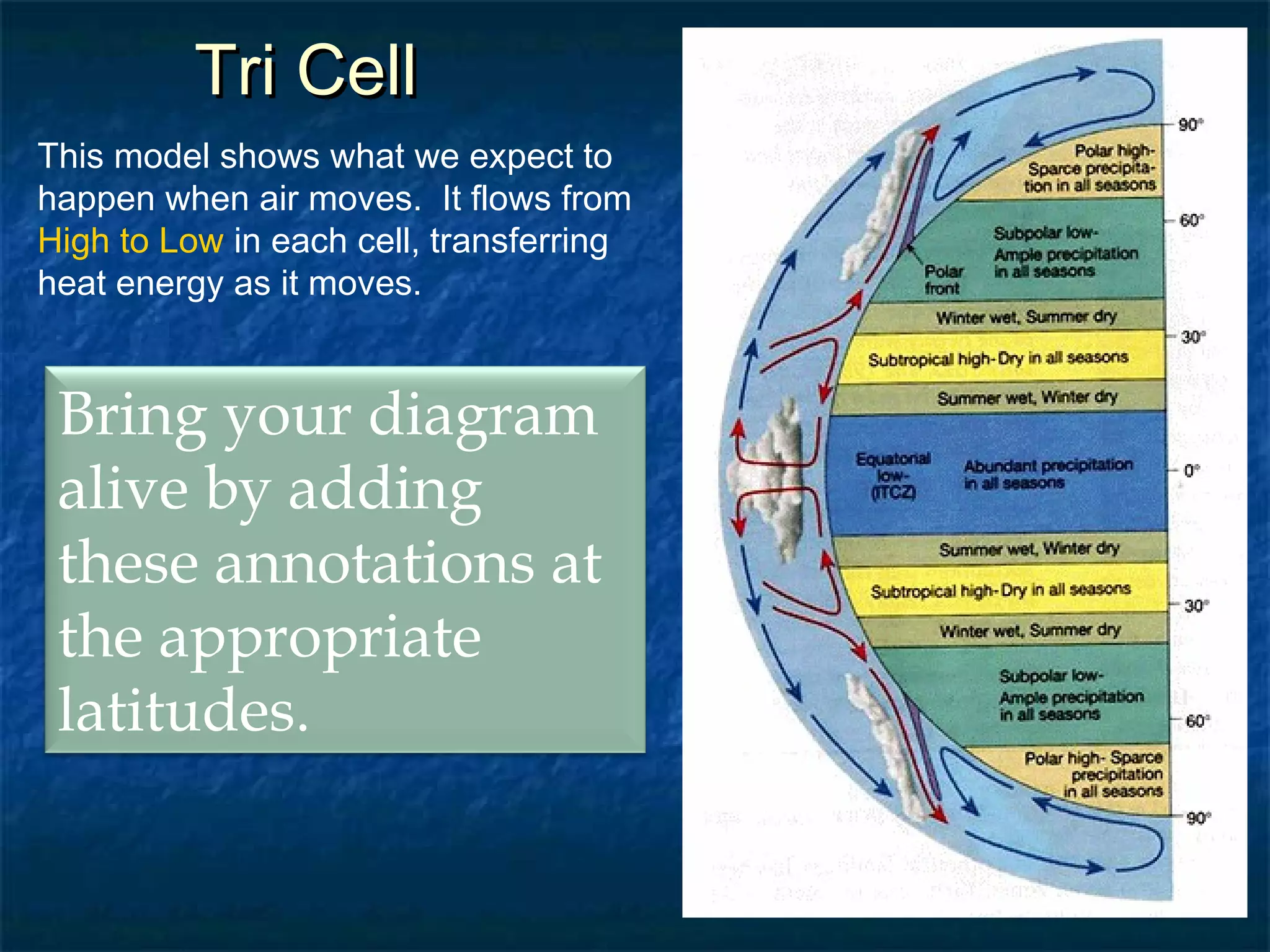
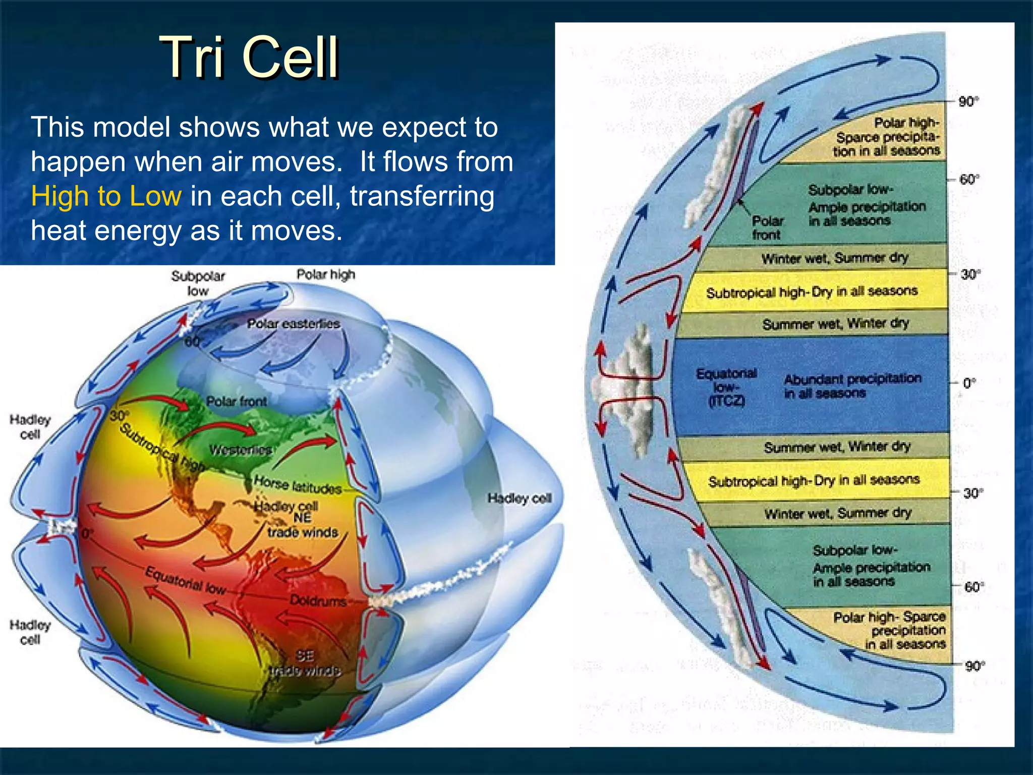
TTrrii CCeellll
Thismodel shows what we expect to
happen when air moves. It flows from
High to Low in each cell, transferring
heat energy as it moves.
Bring your diagram
alive by adding
these annotations at
the appropriate
latitudes.
7.
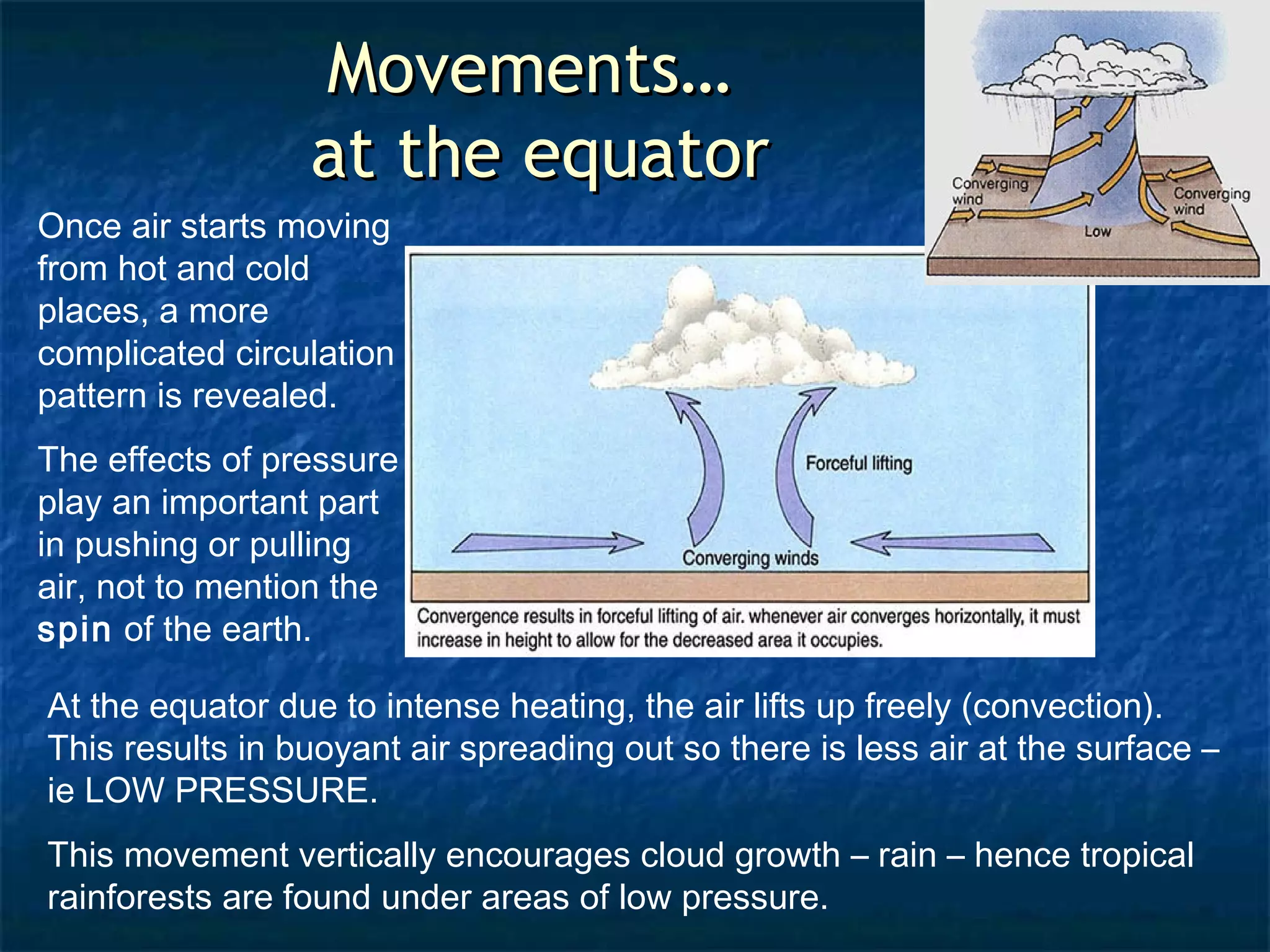
MMoovveemmeennttss……
aatt tthheeeeqquuaattoorr
Once air starts moving
from hot and cold
places, a more
complicated circulation
pattern is revealed.
The effects of pressure
play an important part
in pushing or pulling
air, not to mention the
spin of the earth.
At the equator due to intense heating, the air lifts up freely (convection).
This results in buoyant air spreading out so there is less air at the surface –
ie LOW PRESSURE.
This movement vertically encourages cloud growth – rain – hence tropical
rainforests are found under areas of low pressure.
8.
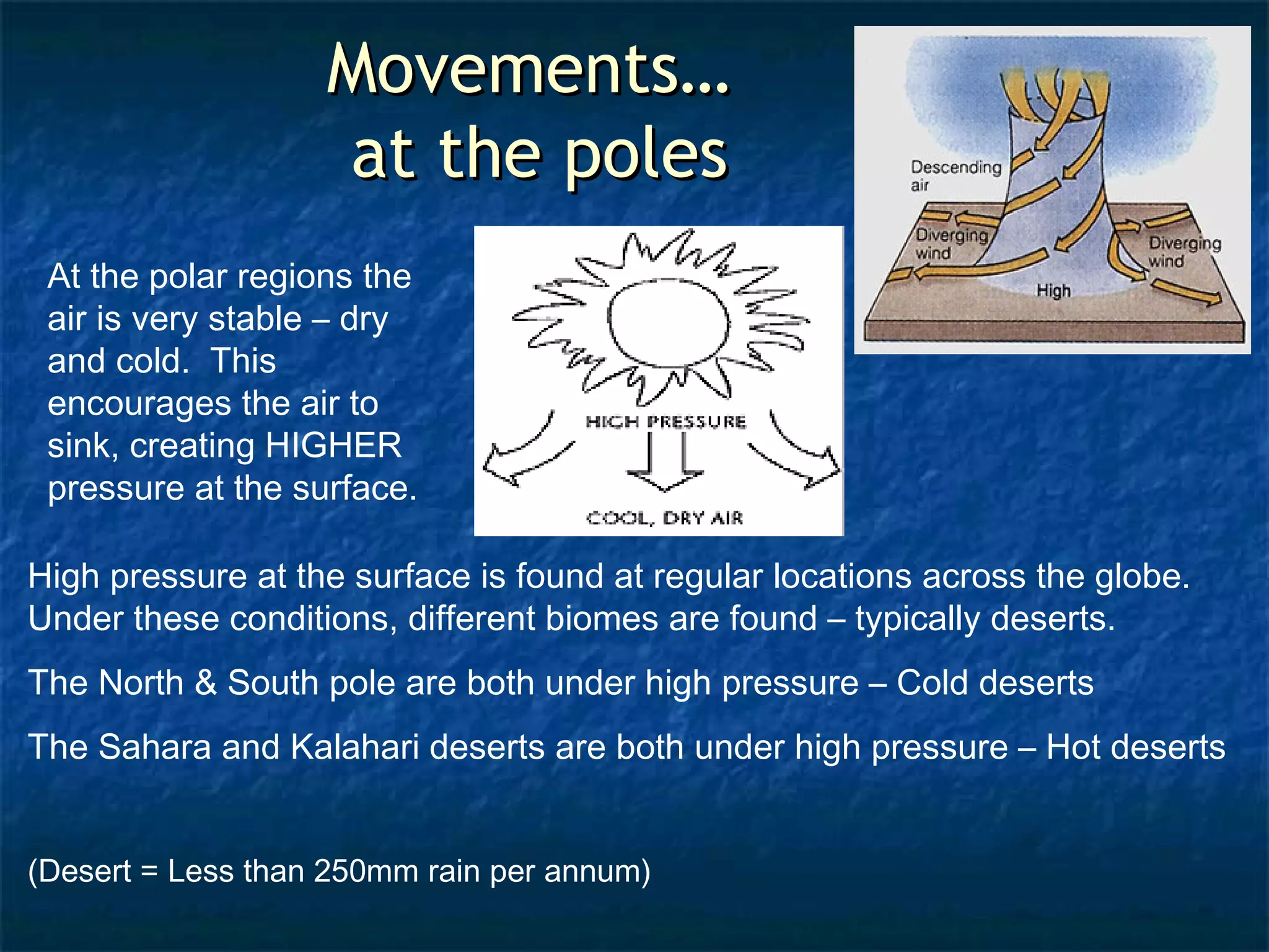
MMoovveemmeennttss……
aatt tthheeppoolleess
At the polar regions the
air is very stable – dry
and cold. This
encourages the air to
sink, creating HIGHER
pressure at the surface.
High pressure at the surface is found at regular locations across the globe.
Under these conditions, different biomes are found – typically deserts.
The North & South pole are both under high pressure – Cold deserts
The Sahara and Kalahari deserts are both under high pressure – Hot deserts
(Desert = Less than 250mm rain per annum)
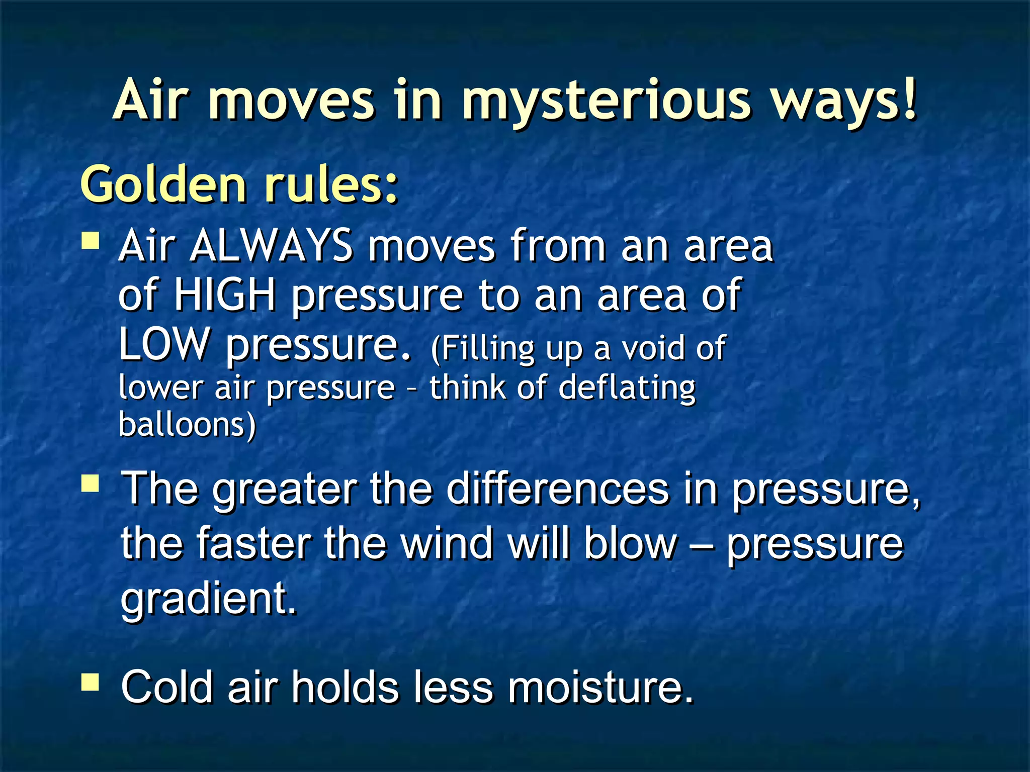
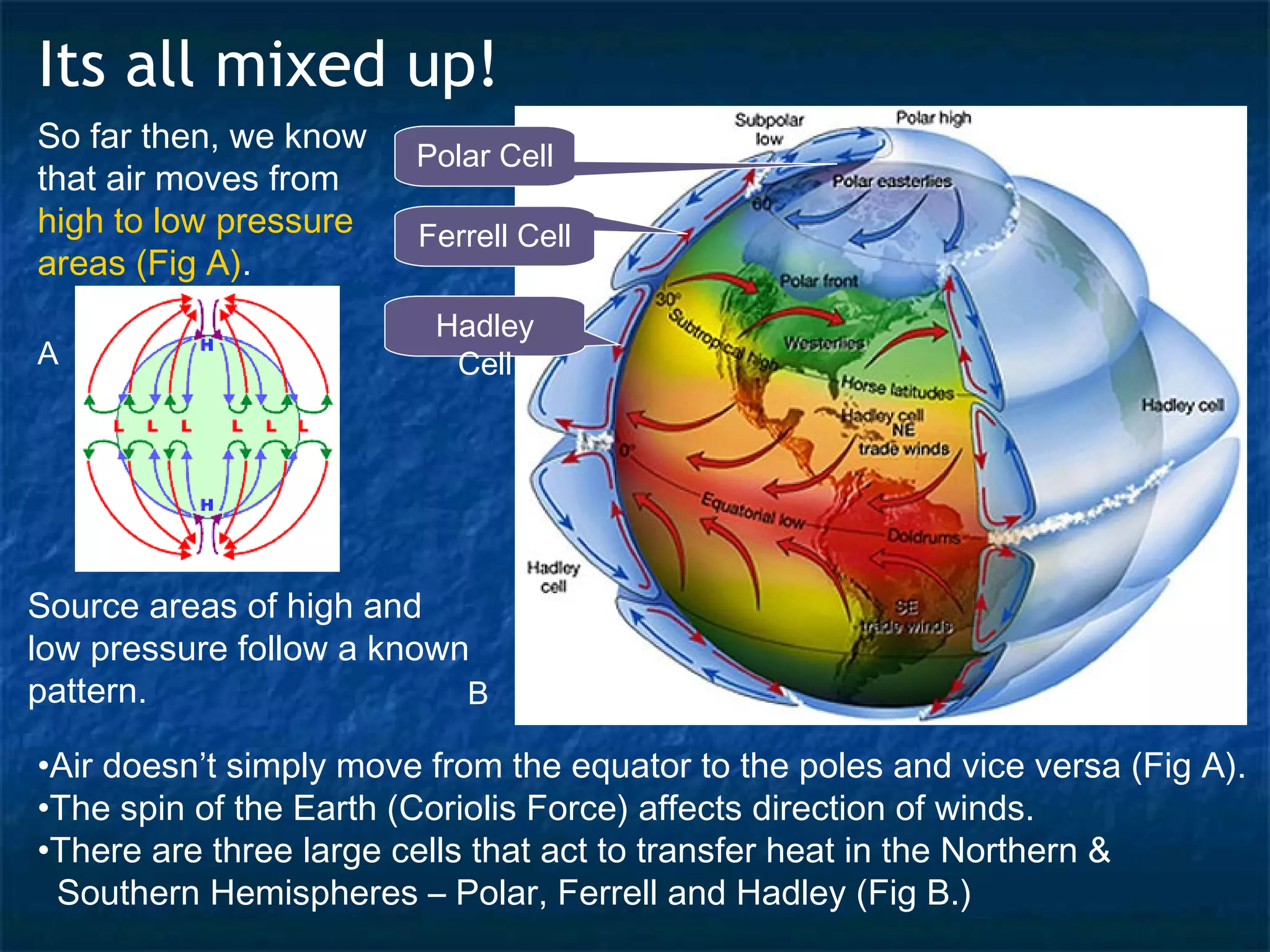
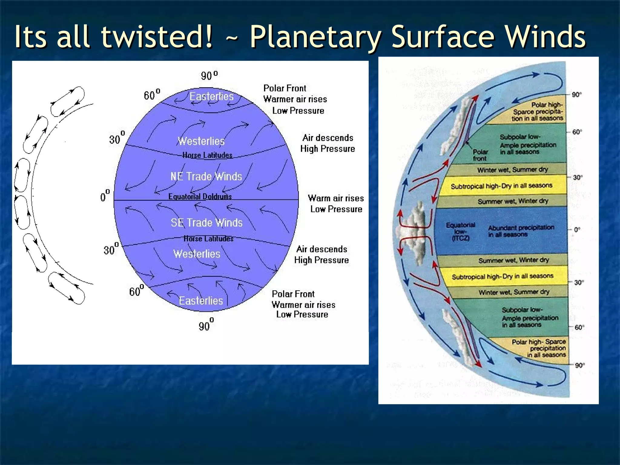
Its all mixedup!
So far then, we know
that air moves from
high to low pressure
areas (Fig A).
Polar Cell
Ferrell Cell
Hadley
Cell
A
Source areas of high and
low pressure follow a known
pattern.
B
•Air doesn’t simply move from the equator to the poles and vice versa (Fig A).
•The spin of the Earth (Coriolis Force) affects direction of winds.
•There are three large cells that act to transfer heat in the Northern &
Southern Hemispheres – Polar, Ferrell and Hadley (Fig B.)
13.
TTrrii CCeellll
Thismodel shows what we expect to
happen when air moves. It flows from
High to Low in each cell, transferring
heat energy as it moves.