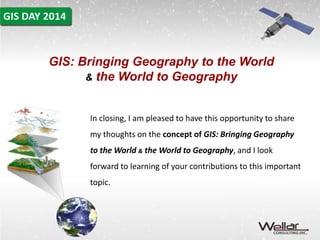
GIS: 
Bringing Geography to the 
World & the World to 
Geography 
Slides for a presentation by 
Dr. Barry Wellar
GIS: Bringing Geography to the World 
& the World to Geography 
The ideas and the title for this 2014 GIS Day presentation 
came to me while preparing presentations for the 
Research Colloquium on Using the Retrospective 
Approach to Mine for GIS Nuggets.
GIS: Bringing Geography to the World 
& the World to Geography 
The first presentation is based on the concept of the Doomsday 
Map, which I initially presented circa 30 years ago to students in the 
School of Planning and in Geography at the University of Ottawa. 
“Abuse v. Care of Land, Water, and Air, 1990-2015: The Doomsday 
Map Concept as a Compelling Argument to Retrospectively Mine 
the Popular Literature for GIS Nuggets”.
GIS: Bringing Geography to the World 
& the World to Geography 
The second presentation had its origins in research and policy 
advising that I did in the 1970s, while at the federal Ministry of State 
for Urban Affairs. 
“Searching for GIS Nuggets: Mining Annual Reports by Canada’s 
Commissioner of Environment and Sustainable Development”
GIS: Bringing Geography to the World 
& the World to Geography 
The third presentation, “Searching for GIS Nuggets: Mining Annual 
Reports and Advisories by Ontario’s Commissioner of 
Environment” reflects four decades of involvement in planning, 
transportation, GIS, and other matters in Ontario. It will also be 
posted at: 
http://wellar.ca/wellarconsulting/
GIS: Bringing Geography to the World 
Prior to the advent of GIS technology, and even during the early 
years of GIS evolution, Geography was primarily represented to the 
world by such means as: individual maps and collections of maps; 
individual photographs and collections of photographs or other 
images; globes; and, various kinds of text documents, including field 
notes, tables of numbers, essays, reports, atlases, and books.
GIS: Bringing Geography to the World 
All in all, pretty boring stuff for many people, so it is small wonder 
that much of the world limited its interest in Geography to names of 
oceans, continents, really big islands, countries, capital cities, major 
rivers, and mountain ranges.
GIS: Bringing Geography to the World 
Small wonder that much of the world paid relatively little attention to 
the fundamentals of Geography involving such geographic factors as: 
accessibility, adjacency, barriers, boundaries, buffers, closeness, 
clusters, compactness, concentration, congestion, connectivity, 
contiguity, density, diffusion, dispersion, distance, elevation, 
encroachment, form, intensification, interaction, isolation, location, 
migration, mobility, morphology, movement, nearness, networks, 
patterns, proximity, scale, segregation, separation, shape, sprawl, 
spread, surfaces, territory, and topography.
GIS: Bringing Geography to the World 
And then along came serious advances in GIS technology. KABOOM! 
In a span of about 35 years, beginning circa 1980, and via the “G” of 
GIS, geographic factors, functions, and structures such as those 
noted above have come to occupy a front-and-center position in 
countries around the world in a wide range of venues: governments 
at all levels; NGOs,; research institutes covering a variety of 
disciplines, trades, and professions; businesses of all sizes; the 
media; and in universities, colleges, and schools.
GIS: Bringing Geography to the World 
Now, it appears fair to say, GIS is more than a window 
bringing Geography to the world, 
it is the window.
GIS: Bringing Geography to the World 
By increasing ease of access to and use of spatial data and 
information about the built and natural environments, GIS brings 
“the world” to various fields of Geography, including climatology, 
energy, environment, geomorphology, glaciology, planning, remote 
sensing, research methodology, resource management, sustainable 
development, transportation, and urban development.
GIS: Bringing Geography to the World 
There are limits to how much GIS technology can do to bring the 
world to Geography, which leads to such questions as: 
“What contribution is Geography making to serve the development 
and use of GIS technology and GIScience methods, techniques, and 
operations by governments, NGOs, business, researchers, 
academe, the media, and interest groups?”
Contributing Inputs from Geography to GIS 
GIS Day is a special occasion, whereby we express what we 
are thinking and doing in our GIS research, education, 
training, and applications activities.
Contributing Inputs from Geography to GIS 
“Guide for Papers on Using the Retrospective Approach to Mine for 
GIS Nuggets” 
Figure 1. GIS nuggets defined 
Table 1. Examples of doing in research and doing in GIS upon 
which to base conference papers 
Table 3. An indicative list of principal GIS topics for the 
Conference on Using the Retrospective Approach to Mine for 
GIS Nuggets 
Table 4. A list of question-based topics for the Conference on 
Using the Retrospective Approach to Mine for GIS Nuggets
Contributing Inputs from Geography to GIS 
“Abuse v. Care of Land, Water, and Air, 1990-2015: The Doomsday 
Map Concept as a Compelling Argument to Retrospectively Mine 
the Popular Literature for GIS Nuggets” 
Figure 11. Another look at Doomsday Map headlines 
circa 25 years later: How well are we doing now? 
Figure 12. Questions investigating the role of GIS in decisions 
affecting the state of land, water, and air resources 
Table 2. An indicative list of oversight agencies with 
responsibilities for informing about the state of land, water, 
and air resources
Contributing Inputs from Geography to GIS 
“Searching for GIS Nuggets: Mining Annual Reports by Canada’s 
Commissioner of Environment and Sustainable Development” 
Table 3. Federal departments and agencies required 
to prepare a sustainable development strategy 
and respond to environmental petitions 
Exhibit 4: Reports to Parliament by the Commissioner 
Exhibit 11. Implementing sustainable development strategies 
Exhibit 13. Information for decision making 
Exhibit 14. Engaging Canadians
GIS: Bringing Geography to the World 
& the World to Geography 
In closing, I am pleased to have this opportunity to share 
my thoughts on the concept of GIS: Bringing Geography 
to the World & the World to Geography, and I look 
forward to learning of your contributions to this important 
topic.

GIS: Bringing Geography to the World & the World to Geography; Slide Presentation

  • 1.
    GIS: Bringing Geographyto the World & the World to Geography Slides for a presentation by Dr. Barry Wellar
  • 2.
    GIS: Bringing Geographyto the World & the World to Geography The ideas and the title for this 2014 GIS Day presentation came to me while preparing presentations for the Research Colloquium on Using the Retrospective Approach to Mine for GIS Nuggets.
  • 3.
    GIS: Bringing Geographyto the World & the World to Geography The first presentation is based on the concept of the Doomsday Map, which I initially presented circa 30 years ago to students in the School of Planning and in Geography at the University of Ottawa. “Abuse v. Care of Land, Water, and Air, 1990-2015: The Doomsday Map Concept as a Compelling Argument to Retrospectively Mine the Popular Literature for GIS Nuggets”.
  • 4.
    GIS: Bringing Geographyto the World & the World to Geography The second presentation had its origins in research and policy advising that I did in the 1970s, while at the federal Ministry of State for Urban Affairs. “Searching for GIS Nuggets: Mining Annual Reports by Canada’s Commissioner of Environment and Sustainable Development”
  • 5.
    GIS: Bringing Geographyto the World & the World to Geography The third presentation, “Searching for GIS Nuggets: Mining Annual Reports and Advisories by Ontario’s Commissioner of Environment” reflects four decades of involvement in planning, transportation, GIS, and other matters in Ontario. It will also be posted at: http://wellar.ca/wellarconsulting/
  • 6.
    GIS: Bringing Geographyto the World Prior to the advent of GIS technology, and even during the early years of GIS evolution, Geography was primarily represented to the world by such means as: individual maps and collections of maps; individual photographs and collections of photographs or other images; globes; and, various kinds of text documents, including field notes, tables of numbers, essays, reports, atlases, and books.
  • 7.
    GIS: Bringing Geographyto the World All in all, pretty boring stuff for many people, so it is small wonder that much of the world limited its interest in Geography to names of oceans, continents, really big islands, countries, capital cities, major rivers, and mountain ranges.
  • 8.
    GIS: Bringing Geographyto the World Small wonder that much of the world paid relatively little attention to the fundamentals of Geography involving such geographic factors as: accessibility, adjacency, barriers, boundaries, buffers, closeness, clusters, compactness, concentration, congestion, connectivity, contiguity, density, diffusion, dispersion, distance, elevation, encroachment, form, intensification, interaction, isolation, location, migration, mobility, morphology, movement, nearness, networks, patterns, proximity, scale, segregation, separation, shape, sprawl, spread, surfaces, territory, and topography.
  • 9.
    GIS: Bringing Geographyto the World And then along came serious advances in GIS technology. KABOOM! In a span of about 35 years, beginning circa 1980, and via the “G” of GIS, geographic factors, functions, and structures such as those noted above have come to occupy a front-and-center position in countries around the world in a wide range of venues: governments at all levels; NGOs,; research institutes covering a variety of disciplines, trades, and professions; businesses of all sizes; the media; and in universities, colleges, and schools.
  • 10.
    GIS: Bringing Geographyto the World Now, it appears fair to say, GIS is more than a window bringing Geography to the world, it is the window.
  • 11.
    GIS: Bringing Geographyto the World By increasing ease of access to and use of spatial data and information about the built and natural environments, GIS brings “the world” to various fields of Geography, including climatology, energy, environment, geomorphology, glaciology, planning, remote sensing, research methodology, resource management, sustainable development, transportation, and urban development.
  • 12.
    GIS: Bringing Geographyto the World There are limits to how much GIS technology can do to bring the world to Geography, which leads to such questions as: “What contribution is Geography making to serve the development and use of GIS technology and GIScience methods, techniques, and operations by governments, NGOs, business, researchers, academe, the media, and interest groups?”
  • 13.
    Contributing Inputs fromGeography to GIS GIS Day is a special occasion, whereby we express what we are thinking and doing in our GIS research, education, training, and applications activities.
  • 14.
    Contributing Inputs fromGeography to GIS “Guide for Papers on Using the Retrospective Approach to Mine for GIS Nuggets” Figure 1. GIS nuggets defined Table 1. Examples of doing in research and doing in GIS upon which to base conference papers Table 3. An indicative list of principal GIS topics for the Conference on Using the Retrospective Approach to Mine for GIS Nuggets Table 4. A list of question-based topics for the Conference on Using the Retrospective Approach to Mine for GIS Nuggets
  • 15.
    Contributing Inputs fromGeography to GIS “Abuse v. Care of Land, Water, and Air, 1990-2015: The Doomsday Map Concept as a Compelling Argument to Retrospectively Mine the Popular Literature for GIS Nuggets” Figure 11. Another look at Doomsday Map headlines circa 25 years later: How well are we doing now? Figure 12. Questions investigating the role of GIS in decisions affecting the state of land, water, and air resources Table 2. An indicative list of oversight agencies with responsibilities for informing about the state of land, water, and air resources
  • 16.
    Contributing Inputs fromGeography to GIS “Searching for GIS Nuggets: Mining Annual Reports by Canada’s Commissioner of Environment and Sustainable Development” Table 3. Federal departments and agencies required to prepare a sustainable development strategy and respond to environmental petitions Exhibit 4: Reports to Parliament by the Commissioner Exhibit 11. Implementing sustainable development strategies Exhibit 13. Information for decision making Exhibit 14. Engaging Canadians
  • 17.
    GIS: Bringing Geographyto the World & the World to Geography In closing, I am pleased to have this opportunity to share my thoughts on the concept of GIS: Bringing Geography to the World & the World to Geography, and I look forward to learning of your contributions to this important topic.