SlideShare a Scribd company logo
1 of 58
III Encuentro Internacional de TIC en la Cooperación el Desarrollo
  III International Meeting of ICT for Development Cooperation


  From Bows &
Arrows to Laptops
Limitaciones y capacidades:
               Mission
           Mision y Vision
“The mission of the Amazon
Conservation Team is to
work in partnership with
indigenous people in
conserving
biodiversity, health and
culture in tropical America
by combining traditional
knowledge with the latest
science and technology.”
Ethnomapping
Ethnomapping
Mapping
Suriname             1999-2010     10 million hectares
Xingu Park           2001-2004     2.7 million hectares
Tumucumaque Park        2002       4.2 million hectares

Surui                2006 & 2009    242,000 hectares

Diahui                  2009        40,000 hectares

Kaxuyana                2009       1.2 million hectares

Wai Wai              2009-2010     9.6 million hectares
III Encuentro Internacional de TIC en la Cooperación el Desarrollo
III International Meeting of ICT for Development Cooperation
III Encuentro Internacional de TIC en la Cooperación el Desarrollo
III International Meeting of ICT for Development Cooperation
III Encuentro Internacional de TIC en la Cooperación el Desarrollo
III International Meeting of ICT for Development Cooperation
Next Steps
• Combine with scientific survey and diagnostic techniques.
• Use of methodologies as a basis for Ethno-zoning, REDD/PES
  projects, management/protection plans, education and health
  programs, etc.
• Training of others in how to implement this methodology.
• Develop additional technological tools to increase the efficiency
  and reach of mapping work (Example: Google partnership).
Technology Partnerships

http://www.visuamundo.com          http://www.rhizalabs.com/


http://earth.google.com/outreach
Community Use
• Load point features from a GPX-file
• Display the features in Google Earth Plug-In
• Edit the Name, Icon and Description of the
  points
   o Choose from 12 predefined Icons
   o Use a WYSIWYG-editor to style the HTML-
     CSS-balloon
• Save the information as KML
Visualization
Surui Carbon Project
Components:
• Reforestation
• REDD – “Avoided Deforestation”

If the Surui forests burned today (over 600,000 acres)
they would release the equivalent of ten years of
Chicago’s annual carbon emissions.
Partners for Surui Projects
Carbon Credit Payments, Avoided Deforestation and
                     REDD
Partners for Surui Projects
Partners: Metareila, Forest
Trends, Kaninde, ACT, Aguaverde, IDESAM, Google Earth

Coordination: Forest Trends
REDD: IDESAM/ECODECISIONS
Technical/Mapping: ACT and Google Earth
Reforestation: Metareila, Aguaverde, Kaninde

Partial results: Legal Framework, Governance, Technical report
Next Steps: …
2020
2030
2040
2050
Surui Carbon Project


                       Data Collection Challenges

                       •   accuracy
                       •   ease of use
                       •   speed
                       •   transparency of process/data
                       •   accessibility of results
Surui Carbon Project


                               Google Earth, other
                                   GIS Apps


 Easy web-based tool for
    composing story
                             Many other
                           common formats

More Related Content

What's hot

Progress of land ecosystem studies with geo information and space technology ...
Progress of land ecosystem studies with geo information and space technology ...Progress of land ecosystem studies with geo information and space technology ...
Progress of land ecosystem studies with geo information and space technology ...Institute of Space Knowledge Development
 
ESA Ramani Huria: Mapping for Flood Resilience, Fusing Remote Sensing and Com...
ESA Ramani Huria: Mapping for Flood Resilience, Fusing Remote Sensing and Com...ESA Ramani Huria: Mapping for Flood Resilience, Fusing Remote Sensing and Com...
ESA Ramani Huria: Mapping for Flood Resilience, Fusing Remote Sensing and Com...Mark Iliffe
 
Ramani Huria, East Africa Open Data Conference
Ramani Huria, East Africa Open Data ConferenceRamani Huria, East Africa Open Data Conference
Ramani Huria, East Africa Open Data ConferenceMark Iliffe
 
Palestine West Bank Free Map Introduction
Palestine West Bank Free Map IntroductionPalestine West Bank Free Map Introduction
Palestine West Bank Free Map Introductionmikel_maron
 
Palestine West Bank Free Map Introduction
Palestine West Bank Free Map IntroductionPalestine West Bank Free Map Introduction
Palestine West Bank Free Map Introductionguest6d104a
 
COBWEB Smart Technology = Smart Data? Citizen Science in the Dyfi Biosphere R...
COBWEB Smart Technology = Smart Data? Citizen Science in the Dyfi Biosphere R...COBWEB Smart Technology = Smart Data? Citizen Science in the Dyfi Biosphere R...
COBWEB Smart Technology = Smart Data? Citizen Science in the Dyfi Biosphere R...COBWEB Project
 
Global Soil Information Facilities - current status - by H. I. Reuter
Global Soil Information Facilities - current status - by H. I. ReuterGlobal Soil Information Facilities - current status - by H. I. Reuter
Global Soil Information Facilities - current status - by H. I. ReuterFAO
 
AGI Presentation for NRSC USER MEET- final
AGI Presentation for NRSC USER MEET- finalAGI Presentation for NRSC USER MEET- final
AGI Presentation for NRSC USER MEET- finalYogita Shukla
 
Maps are not just for geographers: Use cases for getting the most out of Digimap
Maps are not just for geographers: Use cases for getting the most out of DigimapMaps are not just for geographers: Use cases for getting the most out of Digimap
Maps are not just for geographers: Use cases for getting the most out of DigimapEDINA, University of Edinburgh
 
Utsav soni - Resume
Utsav soni - ResumeUtsav soni - Resume
Utsav soni - ResumeUtsav Soni
 
Geological Society Higher Education Network (HEN 2012) meeting - 18 Jan 2012 ...
Geological Society Higher Education Network (HEN 2012) meeting - 18 Jan 2012 ...Geological Society Higher Education Network (HEN 2012) meeting - 18 Jan 2012 ...
Geological Society Higher Education Network (HEN 2012) meeting - 18 Jan 2012 ...Liz FitzGerald
 
EPA H2020 SC5 Info Day: TURAS and OPERA: Urban transitioning with nature-base...
EPA H2020 SC5 Info Day: TURAS and OPERA: Urban transitioning with nature-base...EPA H2020 SC5 Info Day: TURAS and OPERA: Urban transitioning with nature-base...
EPA H2020 SC5 Info Day: TURAS and OPERA: Urban transitioning with nature-base...Environmental Protection Agency, Ireland
 
Pisces Kyla Edison
Pisces Kyla EdisonPisces Kyla Edison
Pisces Kyla EdisonILOAHawaii
 
GeoDem Digital Geography - part 2
GeoDem Digital Geography - part 2GeoDem Digital Geography - part 2
GeoDem Digital Geography - part 2Karl Donert
 
Spatial diagnostic model by introducing sattelite imagery
Spatial diagnostic model by introducing  sattelite imagerySpatial diagnostic model by introducing  sattelite imagery
Spatial diagnostic model by introducing sattelite imageryAntonis Antoniou
 
From geovisualisation to neocartography: Maps in a digital world
From geovisualisation to neocartography: Maps in a digital worldFrom geovisualisation to neocartography: Maps in a digital world
From geovisualisation to neocartography: Maps in a digital worldBenjamin Hennig
 

What's hot (20)

Progress of land ecosystem studies with geo information and space technology ...
Progress of land ecosystem studies with geo information and space technology ...Progress of land ecosystem studies with geo information and space technology ...
Progress of land ecosystem studies with geo information and space technology ...
 
ESA Ramani Huria: Mapping for Flood Resilience, Fusing Remote Sensing and Com...
ESA Ramani Huria: Mapping for Flood Resilience, Fusing Remote Sensing and Com...ESA Ramani Huria: Mapping for Flood Resilience, Fusing Remote Sensing and Com...
ESA Ramani Huria: Mapping for Flood Resilience, Fusing Remote Sensing and Com...
 
Ramani Huria, East Africa Open Data Conference
Ramani Huria, East Africa Open Data ConferenceRamani Huria, East Africa Open Data Conference
Ramani Huria, East Africa Open Data Conference
 
Web tools for redd monitoring and planning
Web tools for redd monitoring and planning  Web tools for redd monitoring and planning
Web tools for redd monitoring and planning
 
Palestine West Bank Free Map Introduction
Palestine West Bank Free Map IntroductionPalestine West Bank Free Map Introduction
Palestine West Bank Free Map Introduction
 
Palestine West Bank Free Map Introduction
Palestine West Bank Free Map IntroductionPalestine West Bank Free Map Introduction
Palestine West Bank Free Map Introduction
 
COBWEB Smart Technology = Smart Data? Citizen Science in the Dyfi Biosphere R...
COBWEB Smart Technology = Smart Data? Citizen Science in the Dyfi Biosphere R...COBWEB Smart Technology = Smart Data? Citizen Science in the Dyfi Biosphere R...
COBWEB Smart Technology = Smart Data? Citizen Science in the Dyfi Biosphere R...
 
Global Soil Information Facilities - current status - by H. I. Reuter
Global Soil Information Facilities - current status - by H. I. ReuterGlobal Soil Information Facilities - current status - by H. I. Reuter
Global Soil Information Facilities - current status - by H. I. Reuter
 
INSPIRE Flyer
INSPIRE FlyerINSPIRE Flyer
INSPIRE Flyer
 
AGI Presentation for NRSC USER MEET- final
AGI Presentation for NRSC USER MEET- finalAGI Presentation for NRSC USER MEET- final
AGI Presentation for NRSC USER MEET- final
 
20150317CIU2015seto
20150317CIU2015seto20150317CIU2015seto
20150317CIU2015seto
 
Maps are not just for geographers: Use cases for getting the most out of Digimap
Maps are not just for geographers: Use cases for getting the most out of DigimapMaps are not just for geographers: Use cases for getting the most out of Digimap
Maps are not just for geographers: Use cases for getting the most out of Digimap
 
Utsav soni - Resume
Utsav soni - ResumeUtsav soni - Resume
Utsav soni - Resume
 
Geological Society Higher Education Network (HEN 2012) meeting - 18 Jan 2012 ...
Geological Society Higher Education Network (HEN 2012) meeting - 18 Jan 2012 ...Geological Society Higher Education Network (HEN 2012) meeting - 18 Jan 2012 ...
Geological Society Higher Education Network (HEN 2012) meeting - 18 Jan 2012 ...
 
EPA H2020 SC5 Info Day: TURAS and OPERA: Urban transitioning with nature-base...
EPA H2020 SC5 Info Day: TURAS and OPERA: Urban transitioning with nature-base...EPA H2020 SC5 Info Day: TURAS and OPERA: Urban transitioning with nature-base...
EPA H2020 SC5 Info Day: TURAS and OPERA: Urban transitioning with nature-base...
 
Pisces Kyla Edison
Pisces Kyla EdisonPisces Kyla Edison
Pisces Kyla Edison
 
Land use planning
Land use planningLand use planning
Land use planning
 
GeoDem Digital Geography - part 2
GeoDem Digital Geography - part 2GeoDem Digital Geography - part 2
GeoDem Digital Geography - part 2
 
Spatial diagnostic model by introducing sattelite imagery
Spatial diagnostic model by introducing  sattelite imagerySpatial diagnostic model by introducing  sattelite imagery
Spatial diagnostic model by introducing sattelite imagery
 
From geovisualisation to neocartography: Maps in a digital world
From geovisualisation to neocartography: Maps in a digital worldFrom geovisualisation to neocartography: Maps in a digital world
From geovisualisation to neocartography: Maps in a digital world
 

Similar to From Bows & Arrows to Laptops

CeRDI Research RUN Vietnam Agriculture Group
CeRDI Research RUN Vietnam Agriculture GroupCeRDI Research RUN Vietnam Agriculture Group
CeRDI Research RUN Vietnam Agriculture GroupHelen Thompson
 
Regional Universities Nework (RUN) Vietnam Agriculture Group
Regional Universities Nework (RUN) Vietnam Agriculture GroupRegional Universities Nework (RUN) Vietnam Agriculture Group
Regional Universities Nework (RUN) Vietnam Agriculture GroupHelen Thompson
 
RUN Regional Futures Conference
RUN Regional Futures ConferenceRUN Regional Futures Conference
RUN Regional Futures ConferenceHelen Thompson
 
INSPIRE - ensuring access or continuity of access?
INSPIRE - ensuring access or continuity of access?INSPIRE - ensuring access or continuity of access?
INSPIRE - ensuring access or continuity of access?Martin Donnelly
 
Presentation on INSPIRE and Higher Education (1 of 2)
Presentation on INSPIRE and Higher Education (1 of 2)Presentation on INSPIRE and Higher Education (1 of 2)
Presentation on INSPIRE and Higher Education (1 of 2)JISC GECO
 
CeRDI Research - Presentation for Local Government Victoria
CeRDI Research - Presentation for Local Government VictoriaCeRDI Research - Presentation for Local Government Victoria
CeRDI Research - Presentation for Local Government VictoriaHelen Thompson
 
Great South Coast Digital Strategy
Great South Coast Digital StrategyGreat South Coast Digital Strategy
Great South Coast Digital StrategyHelen Thompson
 
Post globe 2010 pci geomatics
Post globe 2010 pci geomaticsPost globe 2010 pci geomatics
Post globe 2010 pci geomaticsONEIA
 
Post globe 2010 pci geomatics
Post globe 2010 pci geomaticsPost globe 2010 pci geomatics
Post globe 2010 pci geomaticsONEIA
 
Collaborative by Nature - Chris Higgins, IGIBS & EDINA
Collaborative by Nature - Chris Higgins, IGIBS & EDINACollaborative by Nature - Chris Higgins, IGIBS & EDINA
Collaborative by Nature - Chris Higgins, IGIBS & EDINAJISC GECO
 
Ramage EO4SDG keynote August 2019
Ramage EO4SDG keynote August 2019Ramage EO4SDG keynote August 2019
Ramage EO4SDG keynote August 2019Steven Ramage
 
2015 FOSS4G Track: Developing, Exploring, and Utilizing a National Web-Based ...
2015 FOSS4G Track: Developing, Exploring, and Utilizing a National Web-Based ...2015 FOSS4G Track: Developing, Exploring, and Utilizing a National Web-Based ...
2015 FOSS4G Track: Developing, Exploring, and Utilizing a National Web-Based ...GIS in the Rockies
 
Advanced technologies and research presentation 15 Oct 2015
Advanced technologies and research presentation 15 Oct 2015Advanced technologies and research presentation 15 Oct 2015
Advanced technologies and research presentation 15 Oct 2015Helen Thompson
 
RINPAS Data for Decisions - Big Data and Data Communities
RINPAS Data for Decisions - Big Data and Data CommunitiesRINPAS Data for Decisions - Big Data and Data Communities
RINPAS Data for Decisions - Big Data and Data CommunitiesHelen Thompson
 
[Day 1] Welcome, Looking Back, and Agenda
[Day 1] Welcome, Looking Back, and Agenda[Day 1] Welcome, Looking Back, and Agenda
[Day 1] Welcome, Looking Back, and Agendacsi2009
 
Esri UK Road Ahead Welsh Conference
Esri UK Road Ahead Welsh ConferenceEsri UK Road Ahead Welsh Conference
Esri UK Road Ahead Welsh ConferenceEsri UK
 
Kickoff Meeting for the Interoperable Geographic Information for Biosphere St...
Kickoff Meeting for the Interoperable Geographic Information for Biosphere St...Kickoff Meeting for the Interoperable Geographic Information for Biosphere St...
Kickoff Meeting for the Interoperable Geographic Information for Biosphere St...EDINA, University of Edinburgh
 
CeRDI Research | EPA Victoria presentation
CeRDI Research | EPA Victoria presentation CeRDI Research | EPA Victoria presentation
CeRDI Research | EPA Victoria presentation Helen Thompson
 

Similar to From Bows & Arrows to Laptops (20)

CeRDI Research RUN Vietnam Agriculture Group
CeRDI Research RUN Vietnam Agriculture GroupCeRDI Research RUN Vietnam Agriculture Group
CeRDI Research RUN Vietnam Agriculture Group
 
Regional Universities Nework (RUN) Vietnam Agriculture Group
Regional Universities Nework (RUN) Vietnam Agriculture GroupRegional Universities Nework (RUN) Vietnam Agriculture Group
Regional Universities Nework (RUN) Vietnam Agriculture Group
 
RUN Regional Futures Conference
RUN Regional Futures ConferenceRUN Regional Futures Conference
RUN Regional Futures Conference
 
INSPIRE - ensuring access or continuity of access?
INSPIRE - ensuring access or continuity of access?INSPIRE - ensuring access or continuity of access?
INSPIRE - ensuring access or continuity of access?
 
Presentation on INSPIRE and Higher Education (1 of 2)
Presentation on INSPIRE and Higher Education (1 of 2)Presentation on INSPIRE and Higher Education (1 of 2)
Presentation on INSPIRE and Higher Education (1 of 2)
 
CeRDI Research - Presentation for Local Government Victoria
CeRDI Research - Presentation for Local Government VictoriaCeRDI Research - Presentation for Local Government Victoria
CeRDI Research - Presentation for Local Government Victoria
 
Great South Coast Digital Strategy
Great South Coast Digital StrategyGreat South Coast Digital Strategy
Great South Coast Digital Strategy
 
Critique and Reflections on Open Data Initiatives
Critique and Reflections on  Open Data  InitiativesCritique and Reflections on  Open Data  Initiatives
Critique and Reflections on Open Data Initiatives
 
Post globe 2010 pci geomatics
Post globe 2010 pci geomaticsPost globe 2010 pci geomatics
Post globe 2010 pci geomatics
 
Post globe 2010 pci geomatics
Post globe 2010 pci geomaticsPost globe 2010 pci geomatics
Post globe 2010 pci geomatics
 
Collaborative by Nature - Chris Higgins, IGIBS & EDINA
Collaborative by Nature - Chris Higgins, IGIBS & EDINACollaborative by Nature - Chris Higgins, IGIBS & EDINA
Collaborative by Nature - Chris Higgins, IGIBS & EDINA
 
Ramage EO4SDG keynote August 2019
Ramage EO4SDG keynote August 2019Ramage EO4SDG keynote August 2019
Ramage EO4SDG keynote August 2019
 
2015 FOSS4G Track: Developing, Exploring, and Utilizing a National Web-Based ...
2015 FOSS4G Track: Developing, Exploring, and Utilizing a National Web-Based ...2015 FOSS4G Track: Developing, Exploring, and Utilizing a National Web-Based ...
2015 FOSS4G Track: Developing, Exploring, and Utilizing a National Web-Based ...
 
Advanced technologies and research presentation 15 Oct 2015
Advanced technologies and research presentation 15 Oct 2015Advanced technologies and research presentation 15 Oct 2015
Advanced technologies and research presentation 15 Oct 2015
 
RINPAS Data for Decisions - Big Data and Data Communities
RINPAS Data for Decisions - Big Data and Data CommunitiesRINPAS Data for Decisions - Big Data and Data Communities
RINPAS Data for Decisions - Big Data and Data Communities
 
[Day 1] Welcome, Looking Back, and Agenda
[Day 1] Welcome, Looking Back, and Agenda[Day 1] Welcome, Looking Back, and Agenda
[Day 1] Welcome, Looking Back, and Agenda
 
Esri UK Road Ahead Welsh Conference
Esri UK Road Ahead Welsh ConferenceEsri UK Road Ahead Welsh Conference
Esri UK Road Ahead Welsh Conference
 
Presentación webinar 2017 Panamá
Presentación webinar 2017 PanamáPresentación webinar 2017 Panamá
Presentación webinar 2017 Panamá
 
Kickoff Meeting for the Interoperable Geographic Information for Biosphere St...
Kickoff Meeting for the Interoperable Geographic Information for Biosphere St...Kickoff Meeting for the Interoperable Geographic Information for Biosphere St...
Kickoff Meeting for the Interoperable Geographic Information for Biosphere St...
 
CeRDI Research | EPA Victoria presentation
CeRDI Research | EPA Victoria presentation CeRDI Research | EPA Victoria presentation
CeRDI Research | EPA Victoria presentation
 

More from COOPERACION 2.0 2009

Poster Portal Desarrollo Humano Local
Poster Portal Desarrollo Humano LocalPoster Portal Desarrollo Humano Local
Poster Portal Desarrollo Humano LocalCOOPERACION 2.0 2009
 
Evolution of the Sahana Open Source Project
Evolution of  the Sahana Open Source ProjectEvolution of  the Sahana Open Source Project
Evolution of the Sahana Open Source ProjectCOOPERACION 2.0 2009
 
WAPGRID: Savings Lives by Protecting Medicines
WAPGRID: Savings Lives by Protecting MedicinesWAPGRID: Savings Lives by Protecting Medicines
WAPGRID: Savings Lives by Protecting MedicinesCOOPERACION 2.0 2009
 
ICTs for social and economic development
ICTs for social and economic developmentICTs for social and economic development
ICTs for social and economic developmentCOOPERACION 2.0 2009
 
Achieving digital inclusion: ICT R&D from a community perspective
Achieving digital inclusion:  ICT R&D from a community perspectiveAchieving digital inclusion:  ICT R&D from a community perspective
Achieving digital inclusion: ICT R&D from a community perspectiveCOOPERACION 2.0 2009
 
Sistemas De Monitorizacin De Información
Sistemas De Monitorizacin De InformaciónSistemas De Monitorizacin De Información
Sistemas De Monitorizacin De InformaciónCOOPERACION 2.0 2009
 
Red actores TICS del Caribe (CIVIC): una organización 2.0 mucho antes de la w...
Red actores TICS del Caribe (CIVIC): una organización 2.0 mucho antes de la w...Red actores TICS del Caribe (CIVIC): una organización 2.0 mucho antes de la w...
Red actores TICS del Caribe (CIVIC): una organización 2.0 mucho antes de la w...COOPERACION 2.0 2009
 
Escenarios de Innovación Educativa Piloto 1 A 1. Escuela Nuestra Señora de Fá...
Escenarios de Innovación Educativa Piloto 1 A 1. Escuela Nuestra Señora de Fá...Escenarios de Innovación Educativa Piloto 1 A 1. Escuela Nuestra Señora de Fá...
Escenarios de Innovación Educativa Piloto 1 A 1. Escuela Nuestra Señora de Fá...COOPERACION 2.0 2009
 
Paola Daniela Pérez - Accesibilidad Inadvertida, elemento clave para mejorar ...
Paola Daniela Pérez - Accesibilidad Inadvertida, elemento clave para mejorar ...Paola Daniela Pérez - Accesibilidad Inadvertida, elemento clave para mejorar ...
Paola Daniela Pérez - Accesibilidad Inadvertida, elemento clave para mejorar ...COOPERACION 2.0 2009
 
Jorge Martin (CENATIC) - Proyecto Gong
Jorge Martin (CENATIC) - Proyecto GongJorge Martin (CENATIC) - Proyecto Gong
Jorge Martin (CENATIC) - Proyecto GongCOOPERACION 2.0 2009
 
Stephane Boyera Telefonos MóViles Para El Desarrollo Humano
Stephane Boyera Telefonos MóViles Para El Desarrollo HumanoStephane Boyera Telefonos MóViles Para El Desarrollo Humano
Stephane Boyera Telefonos MóViles Para El Desarrollo HumanoCOOPERACION 2.0 2009
 
Sandra Perez Cooperación Tic Universidad
Sandra Perez   Cooperación Tic UniversidadSandra Perez   Cooperación Tic Universidad
Sandra Perez Cooperación Tic UniversidadCOOPERACION 2.0 2009
 
Jon Legarrea Sistemas De MonitorizacióN De La InformacióN
Jon Legarrea Sistemas De MonitorizacióN De La InformacióNJon Legarrea Sistemas De MonitorizacióN De La InformacióN
Jon Legarrea Sistemas De MonitorizacióN De La InformacióNCOOPERACION 2.0 2009
 
Nuria Castejon Observatorio De CooperacióN Universitaria Al Desarrollo
Nuria Castejon Observatorio De CooperacióN Universitaria Al DesarrolloNuria Castejon Observatorio De CooperacióN Universitaria Al Desarrollo
Nuria Castejon Observatorio De CooperacióN Universitaria Al DesarrolloCOOPERACION 2.0 2009
 
Santiago Palacios De Unidad En Unidad
Santiago Palacios De Unidad En UnidadSantiago Palacios De Unidad En Unidad
Santiago Palacios De Unidad En UnidadCOOPERACION 2.0 2009
 
Sulma Farfan Sossa - Las Universidades Bolivianas En la Red
Sulma Farfan Sossa - Las Universidades Bolivianas En la RedSulma Farfan Sossa - Las Universidades Bolivianas En la Red
Sulma Farfan Sossa - Las Universidades Bolivianas En la RedCOOPERACION 2.0 2009
 

More from COOPERACION 2.0 2009 (20)

Poster Portal Desarrollo Humano Local
Poster Portal Desarrollo Humano LocalPoster Portal Desarrollo Humano Local
Poster Portal Desarrollo Humano Local
 
Recopilacion Posters
Recopilacion PostersRecopilacion Posters
Recopilacion Posters
 
Evolution of the Sahana Open Source Project
Evolution of  the Sahana Open Source ProjectEvolution of  the Sahana Open Source Project
Evolution of the Sahana Open Source Project
 
WAPGRID: Savings Lives by Protecting Medicines
WAPGRID: Savings Lives by Protecting MedicinesWAPGRID: Savings Lives by Protecting Medicines
WAPGRID: Savings Lives by Protecting Medicines
 
Ushahidi: mobile crisis reporting
Ushahidi: mobile crisis reportingUshahidi: mobile crisis reporting
Ushahidi: mobile crisis reporting
 
ICTs for social and economic development
ICTs for social and economic developmentICTs for social and economic development
ICTs for social and economic development
 
Achieving digital inclusion: ICT R&D from a community perspective
Achieving digital inclusion:  ICT R&D from a community perspectiveAchieving digital inclusion:  ICT R&D from a community perspective
Achieving digital inclusion: ICT R&D from a community perspective
 
Coop 2.0 2010 Vers7
Coop 2.0 2010 Vers7Coop 2.0 2010 Vers7
Coop 2.0 2010 Vers7
 
Sistemas De Monitorizacin De Información
Sistemas De Monitorizacin De InformaciónSistemas De Monitorizacin De Información
Sistemas De Monitorizacin De Información
 
Red actores TICS del Caribe (CIVIC): una organización 2.0 mucho antes de la w...
Red actores TICS del Caribe (CIVIC): una organización 2.0 mucho antes de la w...Red actores TICS del Caribe (CIVIC): una organización 2.0 mucho antes de la w...
Red actores TICS del Caribe (CIVIC): una organización 2.0 mucho antes de la w...
 
Escenarios de Innovación Educativa Piloto 1 A 1. Escuela Nuestra Señora de Fá...
Escenarios de Innovación Educativa Piloto 1 A 1. Escuela Nuestra Señora de Fá...Escenarios de Innovación Educativa Piloto 1 A 1. Escuela Nuestra Señora de Fá...
Escenarios de Innovación Educativa Piloto 1 A 1. Escuela Nuestra Señora de Fá...
 
Paola Daniela Pérez - Accesibilidad Inadvertida, elemento clave para mejorar ...
Paola Daniela Pérez - Accesibilidad Inadvertida, elemento clave para mejorar ...Paola Daniela Pérez - Accesibilidad Inadvertida, elemento clave para mejorar ...
Paola Daniela Pérez - Accesibilidad Inadvertida, elemento clave para mejorar ...
 
Miriam Ruiz - Debian And Ubuntu
Miriam Ruiz - Debian And UbuntuMiriam Ruiz - Debian And Ubuntu
Miriam Ruiz - Debian And Ubuntu
 
Jorge Martin (CENATIC) - Proyecto Gong
Jorge Martin (CENATIC) - Proyecto GongJorge Martin (CENATIC) - Proyecto Gong
Jorge Martin (CENATIC) - Proyecto Gong
 
Stephane Boyera Telefonos MóViles Para El Desarrollo Humano
Stephane Boyera Telefonos MóViles Para El Desarrollo HumanoStephane Boyera Telefonos MóViles Para El Desarrollo Humano
Stephane Boyera Telefonos MóViles Para El Desarrollo Humano
 
Sandra Perez Cooperación Tic Universidad
Sandra Perez   Cooperación Tic UniversidadSandra Perez   Cooperación Tic Universidad
Sandra Perez Cooperación Tic Universidad
 
Jon Legarrea Sistemas De MonitorizacióN De La InformacióN
Jon Legarrea Sistemas De MonitorizacióN De La InformacióNJon Legarrea Sistemas De MonitorizacióN De La InformacióN
Jon Legarrea Sistemas De MonitorizacióN De La InformacióN
 
Nuria Castejon Observatorio De CooperacióN Universitaria Al Desarrollo
Nuria Castejon Observatorio De CooperacióN Universitaria Al DesarrolloNuria Castejon Observatorio De CooperacióN Universitaria Al Desarrollo
Nuria Castejon Observatorio De CooperacióN Universitaria Al Desarrollo
 
Santiago Palacios De Unidad En Unidad
Santiago Palacios De Unidad En UnidadSantiago Palacios De Unidad En Unidad
Santiago Palacios De Unidad En Unidad
 
Sulma Farfan Sossa - Las Universidades Bolivianas En la Red
Sulma Farfan Sossa - Las Universidades Bolivianas En la RedSulma Farfan Sossa - Las Universidades Bolivianas En la Red
Sulma Farfan Sossa - Las Universidades Bolivianas En la Red
 

From Bows & Arrows to Laptops

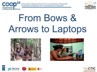
  • 1. III Encuentro Internacional de TIC en la Cooperación el Desarrollo III International Meeting of ICT for Development Cooperation From Bows & Arrows to Laptops
  • 2. Limitaciones y capacidades: Mission Mision y Vision “The mission of the Amazon Conservation Team is to work in partnership with indigenous people in conserving biodiversity, health and culture in tropical America by combining traditional knowledge with the latest science and technology.”
  • 3.
  • 6.
  • 7.
  • 8.
  • 9.
  • 10.
  • 11.
  • 12.
  • 13.
  • 14.
  • 15.
  • 16.
  • 17.
  • 18.
  • 19.
  • 20.
  • 21.
  • 22.
  • 23.
  • 24. Mapping Suriname 1999-2010 10 million hectares Xingu Park 2001-2004 2.7 million hectares Tumucumaque Park 2002 4.2 million hectares Surui 2006 & 2009 242,000 hectares Diahui 2009 40,000 hectares Kaxuyana 2009 1.2 million hectares Wai Wai 2009-2010 9.6 million hectares
  • 25.
  • 26. III Encuentro Internacional de TIC en la Cooperación el Desarrollo III International Meeting of ICT for Development Cooperation
  • 27. III Encuentro Internacional de TIC en la Cooperación el Desarrollo III International Meeting of ICT for Development Cooperation
  • 28. III Encuentro Internacional de TIC en la Cooperación el Desarrollo III International Meeting of ICT for Development Cooperation
  • 29.
  • 30.
  • 31. Next Steps • Combine with scientific survey and diagnostic techniques. • Use of methodologies as a basis for Ethno-zoning, REDD/PES projects, management/protection plans, education and health programs, etc. • Training of others in how to implement this methodology. • Develop additional technological tools to increase the efficiency and reach of mapping work (Example: Google partnership).
  • 32. Technology Partnerships http://www.visuamundo.com http://www.rhizalabs.com/ http://earth.google.com/outreach
  • 33.
  • 34.
  • 35.
  • 36.
  • 37. Community Use • Load point features from a GPX-file • Display the features in Google Earth Plug-In • Edit the Name, Icon and Description of the points o Choose from 12 predefined Icons o Use a WYSIWYG-editor to style the HTML- CSS-balloon • Save the information as KML
  • 38.
  • 39.
  • 40.
  • 42. Surui Carbon Project Components: • Reforestation • REDD – “Avoided Deforestation” If the Surui forests burned today (over 600,000 acres) they would release the equivalent of ten years of Chicago’s annual carbon emissions.
  • 43. Partners for Surui Projects
  • 44. Carbon Credit Payments, Avoided Deforestation and REDD Partners for Surui Projects Partners: Metareila, Forest Trends, Kaninde, ACT, Aguaverde, IDESAM, Google Earth Coordination: Forest Trends REDD: IDESAM/ECODECISIONS Technical/Mapping: ACT and Google Earth Reforestation: Metareila, Aguaverde, Kaninde Partial results: Legal Framework, Governance, Technical report Next Steps: …
  • 45. Carbon Credit Payments, Avoided Deforestation and REDD Partners for Surui Projects Partners: Metareila, Forest Trends, Kaninde, ACT, Aguaverde, IDESAM, Google Earth Coordination: Forest Trends REDD: IDESAM/ECODECISIONS Technical/Mapping: ACT and Google Earth Reforestation: Metareila, Aguaverde, Kaninde Partial results: Legal Framework, Governance, Technical report Next Steps: …
  • 46.
  • 47. 2020
  • 48. 2030
  • 49. 2040
  • 50. 2050
  • 51. Surui Carbon Project Data Collection Challenges • accuracy • ease of use • speed • transparency of process/data • accessibility of results
  • 58. Surui Carbon Project Google Earth, other GIS Apps Easy web-based tool for composing story Many other common formats