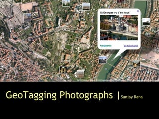
Geotagging Photographs By Sanjay Rana
•Download as PPT, PDF•
3 likes•1,424 views
Presentation proposes a formal approach to represent and analyse tag clouds, using the principles of cartography and graph theory.
Report
Share
Report
Share
![Contents ,[object Object],[object Object],[object Object],[object Object],[object Object]](data:image/gif;base64,R0lGODlhAQABAIAAAAAAAP///yH5BAEAAAAALAAAAAABAAEAAAIBRAA7)
Recommended
Geotagging Social Media Content with a Refined Language Modelling Approach
Presentation of a geotagging approach for social media content with a refined language modelling approach. Presented at PAISI workshop, co-located with PA-KDD 2015, Ho Chi Minh City, Vietnam
Real Time Myanmar Traffic Sign Recognition System using HOG and SVM
Traffic sign recognition is one of the most important research topics for enabling autonomous vehicle driving systems. In order to be deployed in driving environments, intelligent transport system must be able to recognize and respond to exceptional road conditions such as traffic signs, highway work zones and imminent road works automatically. In this paper, Real time Myanmar Traffic Sign Recognition System RMTSRS is proposed. The incoming video stream is fed into computer vision. Then each incoming frames are segmented using color threshold method for traffic sign detection. A Histogram of Oriented Gradients HOG technique is used to extract the features from the segmented traffic sign and then RMTSRS classifies traffic sign types using Support Vector Machine SVM . The system achieves classification accuracy up to 98 . Myint Tun | Thida Lwin "Real-Time Myanmar Traffic Sign Recognition System using HOG and SVM" Published in International Journal of Trend in Scientific Research and Development (ijtsrd), ISSN: 2456-6470, Volume-3 | Issue-5 , August 2019, URL: https://www.ijtsrd.com/papers/ijtsrd27929.pdfPaper URL: https://www.ijtsrd.com/computer-science/real-time-computing/27929/real-time-myanmar-traffic-sign-recognition-system-using-hog-and-svm/myint-tun
Searching Images: Recent research at Southampton
Intelligence, Agents, Multimedia Seminar series. University of Southampton. 7th March 2011.
Southampton has a long history of research in the areas of multimedia information analysis. This talk will focus on some of the recent work we have been involved with in the area of image search. The talk will
start by looking at how image content can be represented in ways analogous to textual information and how techniques developed for indexing text can be adapted to images. In particular, the talk will introduce ImageTerrier, a research platform for image retrieval that is built around the University of Glasgow's Terrier text retrieval software. The talk will also cover some of our recent work on image classification and image search result diversification.
Searching Images: Recent research at Southampton
Information Retrieval group seminar series. The University of Glasgow. 21st February 2011.
Southampton has a long history of research in the areas of multimedia information analysis. This talk will focus on some of the recent work we have been involved with in the area of image search. The talk will start by looking at how image content can be represented in ways analogous to textual information and how techniques developed for indexing text can be adapted to images. In particular, the talk will introduce ImageTerrier, a research platform for image retrieval that is built around Glasgow's Terrier software. The talk will also cover some of our recent work on image classification and image search result diversification.
Scale Saliency: Applications in Visual Matching,Tracking and View-Based Objec...
Distributed Multimedia Systems 2003 / Visual Information Systems 2003, Florida International University, Miami, Florida, USA, 24 - 26 Sep 2003.
http://eprints.soton.ac.uk/258295/
In this paper, we introduce a novel technique for image matching and feature-based tracking. The technique is based on the idea of using the Scale-Saliency algorithm to pick a sparse number of ‘interesting’ or ‘salient’ features. Feature vectors for each of the salient regions are generated and used in the matching process. Due to the nature of the sparse representation of feature vectors generated by the technique, sub-image matching is also accomplished. We demonstrate the techniques robustness to geometric transformations in the query image and suggest that the technique would be suitable for view-based object recognition. We also apply the matching technique to the problem of feature tracking across multiple video frames by matching salient regions across frame pairs. We show that our tracking algorithm is able to explicitly extract the 3D motion vector of each salient region during the tracking process, using a single uncalibrated camera. We illustrate the functionality of our tracking algorithm by showing results from tracking a single salient region in near real-time with a live camera input.
Individual movements and geographical data mining. Clustering algorithms for ...
Individual movements and geographical data mining. Clustering algorithms for highlighting hotspots in personal navigation routes.
Giuseppe Borruso, Gabriella Schoier - University of Trieste
GTSRB Traffic Sign recognition using machine learning
analysis of various machine learning algorithms over the present day problem of traffic sign recognition.
Automatic Building detection for satellite Images using IGV and DSM
Detecting of buildings from satellite images.
Remote sensing e course (Geohydrology)
Short course in remote sensing subject, based on e-learning using WizIQ.
Unsupervised semi-supervised object detection
unsupervised, semi-supervised, pseudo label, teacher-student, constrastive learning, open world, active learning, domain adaptation, uncertainty modeling, 3-D object detection
Improving search time for contentment based image retrieval via, LSH, MTRee, ...
http://www.iosrjournals.org/iosr-jce/pages/v13i3.html
Digital Heritage Documentation Via TLS And Photogrammetry Case Study
In the last decade, several manual tradition measurement techniques were used to document the heritage buildings around the word; however, some of these techniques take a long time, often lack completeness, and may sometimes give unreliable information. In contrast, terrestrial laser scanning “TLS” surveys and Photogrammetry have already been undertaken in several heritage sites in the United Kingdom and other countries of Europe as a new method of documenting heritagesites. This paper focuses on using the TLS and Photogrammetry methods to document one of the important houses in Historic Jeddah, Saudi Arabia, which is Nasif Historical House, as an example of Digital Heritage Documentation (DHD).
Text extraction using document structure features and support vector machines
In order to successfully locate and retrieve document images such as technical articles and newspapers, a text localization technique must be employed. The proposed method detects and extracts homogeneous text areas in document images indifferent to font types and size by using connected components analysis to detect blocks of foreground objects. Next, a descriptor that consists of a set of structural features is extracted from the merged blocks and used as input to a trained Support Vector Machines (SVM). Finally, the output of the SVM classifies the block as text or not.
Real-time Object Tracking
Related article: Wonsang You, M.S. Houari Sabirin, and Munchurl Kim, "Real-time detection and tracking of multiple objects with partial decoding in H.264/AVC bitstream domain," Proceedings of SPIE, N. Kehtarnavaz and M.F. Carlsohn, San Jose, CA, USA: SPIE, 2009, pp. 72440D-72440D-12.
Fast Feature Pyramids for Object Detection
IEEE TRANSACTIONS ON PATTERN ANALYSIS AND MACHINE INTELLIGENCE, VOL. 36, NO. 8, AUGUST 2014
Piotr Dollar, Ron Appel, Serge Belongie, and Pietro Perona
A smart guidance navigation robot using petri net, database location, and rad...
The objective of this research is, to explain a new framework to navigate the movement of the robot towards a target goal. This involves the need for the robot to move from the initial position to 1 out of 30 rooms. Therefore the strategy used involves the combination of the room database stored in the RFID data using the petri net (PN) method to simulate and model the movement of the robot for navigation after which the dynamic behavior of the robot is moving to the desired location was analyzed. The process started from the creation of an environmental map determined by the user followed by modeling through PN and the result was used to produce a marking value which explains and navigates the movement of the robot towards the selected room. The marking value was also used as the database for the robot's movement and later substituted with the RFID to be used as the sensor input in the implementation stage. It was concluded that the robot has the ability to move to the target position according to the database stored in RFID and designed to move forward and turn left and right. For example, it followed the marking value M1 M2 M3M13M12 M11 M10 M9 M8 to Room 1 and M1 M2 M46 M47 to Room 29.
Scene Text Detection on Images using Cellular Automata
Textual information in images constitutes a very rich source of high-level semantics for retrieval and indexing. In this paper, a new approach is proposed using Cellular Automata (CA) which strives towards identifying scene text on natural images. Initially, a binary edge map is calculated. Then, taking advantage of the CA flexibility, the transition rules are changing and are applied in four consecutive steps resulting in four time steps CA evolution. Finally, a post-processing technique based on edge projection analysis is employed for high density edge images concerning the elimination of possible false positives. Evaluation results indicate considerable performance gains without sacrificing text detection accuracy.
Segmentation - based Historical Handwritten Word Spotting using document-spec...
Segmentation - based Historical Handwritten Word Spotting using document-spec...Konstantinos Zagoris
Many word spotting strategies for the modern documents are not directly applicable to historical handwritten documents due to writing styles variety and intense degradation. In this paper, a new method that permits effective word spotting in handwritten documents is presented that relies upon document-specific local features which take into account texture information around representative keypoints. Experimental work on two historical handwritten datasets using standard evaluation measures shows the improved performance achieved by the proposed methodology.Objects Clustering of Movie Using Graph Mining Technique
Objects Clustering of Movie Using Graph Mining TechniqueInternational Journal of Engineering Inventions www.ijeijournal.com
http://www.ijeijournal.com/pages/v2i2.htmlDepth Fusion from RGB and Depth Sensors II
depth fusion, camera, lidar, point cloud, completion, upsampling, inpainting, guided, interpolation, prediction, color, stereo
Interpretability Evaluation of Annual Mosaic Image of MTB Model for Land Cove...
To verify whether the annual mosaic image of MTB model is acceptable for further digital
analysis, it is necessary to evaluate the visual interpretability. The MTB model is an effort to integrate
multi-scene and multi-temporal data, to obtain a minimum cloud cover mosaic image in locations that are
often covered by clouds and haze. This study is to evaluate the interpretability of the annual mosaic image
for analysis of the land cover changes. The data used are the images of 2015, 2016, and 2017 covers a
part of central Sumatra. Visual interpretations with a series of steps are used, starting with identification of
the objects using interpretation keys, followed by spectral band correlations, scattergram analysis, and
ended by consistency assessment. The consistency assessment step is performed to determine the level
of clearness and easiness of the object recognition in the annual mosaic images. The results showed that
the most optimal spectral bands used for RGB combinations for visual interpretation were Band SWIR-1,
Band NIR, and Band Red. Based on the evaluation results, the annual mosaic image o f MTB model
performed the consistent results of the clearness objects and the easiness of the object recognition. Thus
the annual mosaic image of MTB model of 0.02x0.02 degree tile is acceptable for further digital processing
as well as digital land cover analysis.
Detection and Tracking of Moving Object: A Survey
Object tracking is the process of locating moving object or multiple objects in sequence of frames. Object
tracking is basically a challenging problem. Difficulties in tracking of an object may arise due to abrupt changes
in environment, motion of object, noise etc. To overcome such problems different tracking algorithms have been
proposed. This paper presents various techniques related to object detection and tracking..The goal of this paper
is to present a survey of these techniques.
APPLYING R-SPATIOGRAM IN OBJECT TRACKING FOR OCCLUSION HANDLING
Object tracking is one of the most important problems in computer vision. The aim of video tracking is to extract the trajectories of a target or object of interest, i.e. accurately locate a moving target in a video sequence and discriminate target from non-targets in the feature space of the sequence. So, feature descriptors can have significant effects on such discrimination. In this paper, we use the basic idea of many trackers which consists of three main components of the reference model, i.e., object modeling, object detection and localization, and model updating. However, there are major improvements in our system. Our forth component, occlusion handling, utilizes the r-spatiogram to detect the best target candidate. While spatiogram contains some moments upon the coordinates of the pixels, r-spatiogram computes region-based compactness on the distribution of the given feature in the image that captures richer features to represent the objects. The proposed research develops an efficient and robust way to keep tracking the object throughout video sequences in the presence of significant appearance variations and severe occlusions. The proposed method is evaluated on the Princeton RGBD tracking dataset considering sequences with different challenges and the obtained results demonstrate the effectiveness of the proposed method.
Parking detection system using background subtraction and HSV color segmentation
Manual system vehicle parking makes finding vacant parking lots difficult, so it has to check directly to the vacant space. If many people do parking, then the time needed for it is very much or requires many people to handle it. This research develops a real-time parking system to detect parking. The system is designed using the HSV color segmentation method in determining the background image. In addition, the detection process uses the background subtraction method. Applying these two methods requires image preprocessing using several methods such as grayscaling, blurring (low-pass filter). In addition, it is followed by a thresholding and filtering process to get the best image in the detection process. In the process, there is a determination of the ROI to determine the focus area of the object identified as empty parking. The parking detection process produces the best average accuracy of 95.76%. The minimum threshold value of 255 pixels is 0.4. This value is the best value from 33 test data in several criteria, such as the time of capture, composition and color of the vehicle, the shape of the shadow of the object’s environment, and the intensity of light. This parking detection system can be implemented in real-time to determine the position of an empty place.
More Related Content
What's hot
Remote sensing e course (Geohydrology)
Short course in remote sensing subject, based on e-learning using WizIQ.
Unsupervised semi-supervised object detection
unsupervised, semi-supervised, pseudo label, teacher-student, constrastive learning, open world, active learning, domain adaptation, uncertainty modeling, 3-D object detection
Improving search time for contentment based image retrieval via, LSH, MTRee, ...
http://www.iosrjournals.org/iosr-jce/pages/v13i3.html
Digital Heritage Documentation Via TLS And Photogrammetry Case Study
In the last decade, several manual tradition measurement techniques were used to document the heritage buildings around the word; however, some of these techniques take a long time, often lack completeness, and may sometimes give unreliable information. In contrast, terrestrial laser scanning “TLS” surveys and Photogrammetry have already been undertaken in several heritage sites in the United Kingdom and other countries of Europe as a new method of documenting heritagesites. This paper focuses on using the TLS and Photogrammetry methods to document one of the important houses in Historic Jeddah, Saudi Arabia, which is Nasif Historical House, as an example of Digital Heritage Documentation (DHD).
Text extraction using document structure features and support vector machines
In order to successfully locate and retrieve document images such as technical articles and newspapers, a text localization technique must be employed. The proposed method detects and extracts homogeneous text areas in document images indifferent to font types and size by using connected components analysis to detect blocks of foreground objects. Next, a descriptor that consists of a set of structural features is extracted from the merged blocks and used as input to a trained Support Vector Machines (SVM). Finally, the output of the SVM classifies the block as text or not.
Real-time Object Tracking
Related article: Wonsang You, M.S. Houari Sabirin, and Munchurl Kim, "Real-time detection and tracking of multiple objects with partial decoding in H.264/AVC bitstream domain," Proceedings of SPIE, N. Kehtarnavaz and M.F. Carlsohn, San Jose, CA, USA: SPIE, 2009, pp. 72440D-72440D-12.
Fast Feature Pyramids for Object Detection
IEEE TRANSACTIONS ON PATTERN ANALYSIS AND MACHINE INTELLIGENCE, VOL. 36, NO. 8, AUGUST 2014
Piotr Dollar, Ron Appel, Serge Belongie, and Pietro Perona
A smart guidance navigation robot using petri net, database location, and rad...
The objective of this research is, to explain a new framework to navigate the movement of the robot towards a target goal. This involves the need for the robot to move from the initial position to 1 out of 30 rooms. Therefore the strategy used involves the combination of the room database stored in the RFID data using the petri net (PN) method to simulate and model the movement of the robot for navigation after which the dynamic behavior of the robot is moving to the desired location was analyzed. The process started from the creation of an environmental map determined by the user followed by modeling through PN and the result was used to produce a marking value which explains and navigates the movement of the robot towards the selected room. The marking value was also used as the database for the robot's movement and later substituted with the RFID to be used as the sensor input in the implementation stage. It was concluded that the robot has the ability to move to the target position according to the database stored in RFID and designed to move forward and turn left and right. For example, it followed the marking value M1 M2 M3M13M12 M11 M10 M9 M8 to Room 1 and M1 M2 M46 M47 to Room 29.
Scene Text Detection on Images using Cellular Automata
Textual information in images constitutes a very rich source of high-level semantics for retrieval and indexing. In this paper, a new approach is proposed using Cellular Automata (CA) which strives towards identifying scene text on natural images. Initially, a binary edge map is calculated. Then, taking advantage of the CA flexibility, the transition rules are changing and are applied in four consecutive steps resulting in four time steps CA evolution. Finally, a post-processing technique based on edge projection analysis is employed for high density edge images concerning the elimination of possible false positives. Evaluation results indicate considerable performance gains without sacrificing text detection accuracy.
Segmentation - based Historical Handwritten Word Spotting using document-spec...
Segmentation - based Historical Handwritten Word Spotting using document-spec...Konstantinos Zagoris
Many word spotting strategies for the modern documents are not directly applicable to historical handwritten documents due to writing styles variety and intense degradation. In this paper, a new method that permits effective word spotting in handwritten documents is presented that relies upon document-specific local features which take into account texture information around representative keypoints. Experimental work on two historical handwritten datasets using standard evaluation measures shows the improved performance achieved by the proposed methodology.Objects Clustering of Movie Using Graph Mining Technique
Objects Clustering of Movie Using Graph Mining TechniqueInternational Journal of Engineering Inventions www.ijeijournal.com
http://www.ijeijournal.com/pages/v2i2.htmlDepth Fusion from RGB and Depth Sensors II
depth fusion, camera, lidar, point cloud, completion, upsampling, inpainting, guided, interpolation, prediction, color, stereo
Interpretability Evaluation of Annual Mosaic Image of MTB Model for Land Cove...
To verify whether the annual mosaic image of MTB model is acceptable for further digital
analysis, it is necessary to evaluate the visual interpretability. The MTB model is an effort to integrate
multi-scene and multi-temporal data, to obtain a minimum cloud cover mosaic image in locations that are
often covered by clouds and haze. This study is to evaluate the interpretability of the annual mosaic image
for analysis of the land cover changes. The data used are the images of 2015, 2016, and 2017 covers a
part of central Sumatra. Visual interpretations with a series of steps are used, starting with identification of
the objects using interpretation keys, followed by spectral band correlations, scattergram analysis, and
ended by consistency assessment. The consistency assessment step is performed to determine the level
of clearness and easiness of the object recognition in the annual mosaic images. The results showed that
the most optimal spectral bands used for RGB combinations for visual interpretation were Band SWIR-1,
Band NIR, and Band Red. Based on the evaluation results, the annual mosaic image o f MTB model
performed the consistent results of the clearness objects and the easiness of the object recognition. Thus
the annual mosaic image of MTB model of 0.02x0.02 degree tile is acceptable for further digital processing
as well as digital land cover analysis.
Detection and Tracking of Moving Object: A Survey
Object tracking is the process of locating moving object or multiple objects in sequence of frames. Object
tracking is basically a challenging problem. Difficulties in tracking of an object may arise due to abrupt changes
in environment, motion of object, noise etc. To overcome such problems different tracking algorithms have been
proposed. This paper presents various techniques related to object detection and tracking..The goal of this paper
is to present a survey of these techniques.
APPLYING R-SPATIOGRAM IN OBJECT TRACKING FOR OCCLUSION HANDLING
Object tracking is one of the most important problems in computer vision. The aim of video tracking is to extract the trajectories of a target or object of interest, i.e. accurately locate a moving target in a video sequence and discriminate target from non-targets in the feature space of the sequence. So, feature descriptors can have significant effects on such discrimination. In this paper, we use the basic idea of many trackers which consists of three main components of the reference model, i.e., object modeling, object detection and localization, and model updating. However, there are major improvements in our system. Our forth component, occlusion handling, utilizes the r-spatiogram to detect the best target candidate. While spatiogram contains some moments upon the coordinates of the pixels, r-spatiogram computes region-based compactness on the distribution of the given feature in the image that captures richer features to represent the objects. The proposed research develops an efficient and robust way to keep tracking the object throughout video sequences in the presence of significant appearance variations and severe occlusions. The proposed method is evaluated on the Princeton RGBD tracking dataset considering sequences with different challenges and the obtained results demonstrate the effectiveness of the proposed method.
Parking detection system using background subtraction and HSV color segmentation
Manual system vehicle parking makes finding vacant parking lots difficult, so it has to check directly to the vacant space. If many people do parking, then the time needed for it is very much or requires many people to handle it. This research develops a real-time parking system to detect parking. The system is designed using the HSV color segmentation method in determining the background image. In addition, the detection process uses the background subtraction method. Applying these two methods requires image preprocessing using several methods such as grayscaling, blurring (low-pass filter). In addition, it is followed by a thresholding and filtering process to get the best image in the detection process. In the process, there is a determination of the ROI to determine the focus area of the object identified as empty parking. The parking detection process produces the best average accuracy of 95.76%. The minimum threshold value of 255 pixels is 0.4. This value is the best value from 33 test data in several criteria, such as the time of capture, composition and color of the vehicle, the shape of the shadow of the object’s environment, and the intensity of light. This parking detection system can be implemented in real-time to determine the position of an empty place.
What's hot (20)
Improving search time for contentment based image retrieval via, LSH, MTRee, ...
Improving search time for contentment based image retrieval via, LSH, MTRee, ...
Digital Heritage Documentation Via TLS And Photogrammetry Case Study
Digital Heritage Documentation Via TLS And Photogrammetry Case Study
Text extraction using document structure features and support vector machines
Text extraction using document structure features and support vector machines
A smart guidance navigation robot using petri net, database location, and rad...
A smart guidance navigation robot using petri net, database location, and rad...
Scene Text Detection on Images using Cellular Automata
Scene Text Detection on Images using Cellular Automata
Segmentation - based Historical Handwritten Word Spotting using document-spec...
Segmentation - based Historical Handwritten Word Spotting using document-spec...
Objects Clustering of Movie Using Graph Mining Technique
Objects Clustering of Movie Using Graph Mining Technique
Interpretability Evaluation of Annual Mosaic Image of MTB Model for Land Cove...
Interpretability Evaluation of Annual Mosaic Image of MTB Model for Land Cove...
APPLYING R-SPATIOGRAM IN OBJECT TRACKING FOR OCCLUSION HANDLING
APPLYING R-SPATIOGRAM IN OBJECT TRACKING FOR OCCLUSION HANDLING
Parking detection system using background subtraction and HSV color segmentation
Parking detection system using background subtraction and HSV color segmentation
Viewers also liked
Geotagging, user generated content and social networks
8Motions presentation for 2007 LBS Conference. More on http://blog.8motions.com and http://www.8motions.com
Practical Applications of GPS Technology
A brief look at GPS and GIS tech, for the Pacific Northwest Intertribal Agriculture Conference, August 2012, Fort Hall, Idaho.
Seminar on GPS by Haleem
GPS is a satellite based radio navigation system which provides continuous, all weather, worldwide navigation capability for sea, land and air applications.
http://itspiders.net
Viewers also liked (10)
Geotagging, user generated content and social networks
Geotagging, user generated content and social networks
Similar to Geotagging Photographs By Sanjay Rana
Logo Matching for Document Image Retrieval Using SIFT Descriptors
In current trends the logos are playing a vital role in industrial and all commercial applications. Fundamentally the logo is defined as it’s a graphic entity which contains colors textures, shapes and text etc., which is organized in some special visible format. But unfortunately it is very difficult thing to save their brand logos from duplicates. In practical world there are several systems available for logo reorganization and detection with different kinds of requirements. Two dimensional global descriptors are used for logo matching and reorganization. The concept of Shape descriptors based on Shape context and the global descriptors are based on the logo contours. There is an algorithm which is implemented for logo detection is based on partial spatial context and spatial spectral saliency (SSS). The SSS is able to keep away from the confusion effect of background and also speed up the process of logo detection. All such methods are useful only when the logo is visible completely without noise and not subjected to change. We contribute, through this paper, to the design of a novel variation framework able to match and recognize multiple instances of multiple reference logos in image archives. Reference logos and test images are seen as constellations of local features (interest points, regions, etc.) and matched by minimizing an energy function mixing: 1) a fidelity term that measures the quality of feature matching, 2) a neighborhood criterion that captures feature co-occurrence geometry, and 3) a regularization term that controls the smoothness of the matching solution. We also introduce a detection/recognition procedure and study its theoretical consistency
On the Navigability of Social Tagging Systems
We investigate if and to what extent tag clouds - a popular mechanism for interacting with social media - are useful for navigation.
Manual Segmentation and semantic-based hierarchical tagginf od 3d models
Today 3D objects have become widely available in different application domains, thus it is becoming fundamental to use, integrate and develop techniques for extracting and maintaining their implicit knowledge. These techniques should be encapsulated in intelligent systems able to semantically annotate the 3D models, thus improving their usability and indexing, especially in innovative web cooperative environments. In our work, we are moving in this direction, by defining and developing data structures, methods and interfaces for structuring and semantically annotating 3D complex models (and scenes), even changing over time, according to ontology-driven metadata. In this paper, we focus on tools and methods for manually segmenting manifold 3D models and on the underline structural representation that we build and manipulate. We present also an interface from which the user can inspect and browse the segmentation, describing also the first prototype of an annotation tool which allows a hierarchical semantic-driven tagging of the segmented model.
Geometric Deep Learning
For non-grid 3D images like point clouds and meshes, and inherently graph-based data.
Inherently graph-based data include for example brain connectivity analysis, scientific article citation networks, (social) network analysis, etc.
Alternative download link:
https://www.dropbox.com/s/2o3cofcd6d6e2qt/geometricGraph_deepLearning.pdf?dl=0
Panel: Social Tagging and Folksonomies: Indexing, Retrieving... and Beyond?
...
Panel presentation from ASIST'2011 panel: Social Tagging and Folksonomies: Indexing, Retrieving…and Beyond?
Jacek Gwizdka's presentation on cognitive load during search and browsing via tag clouds. And on he role of tags in information search and navigation between documents.
Evolving social data mining and affective analysis
Evolving social data mining and affective analysis
methodologies, framework and applications - Web 2.0 facts and social data
Social associations and all kinds of graphs
Evolving social data mining
Emotion-aware social data analysis
Frameworks and Applications
Visual Network Narrations
DigiMeth festival, Centre of Interdisciplinary Methodologies at the University of Warwick.
December 9, 2022.
https://warwick.ac.uk/fac/cross_fac/cim/events/digi-meth/
Workshop facilitators: Janna Joceli Omena, Beatrice Gobbo
Abstract:
This workshop offers methodological guidance for narrating networks through visual network analysis (VNA) (Venturini et al. 2021) and a technicity perspective to the practice of digital methods (Omena 2021). It is divided into two parts. First, we will introduce what questions we should ask to make sense of network building and the key principles of VNA. Second, students will work on digital and printed recommendation networks aiming at narrating what they see.
Main takeaways
Students will be able to explore and identify the main components of a digital network
Students will reflect on the distinction between what is network exploration (description tasks) and network narration (insights, findings)
Students will develop the ability to tell a story about the topic under investigation and what constitutes the network.
Requirements:
Please bring your own computer and get familiar with
Retina (https://ouestware.gitlab.io/retina/beta/)
An example of a network 👉 link.
Related projects
Venturini, T., Jacomy, M., & Jensen, P. (2021). What do we see when we look at networks: Visual network analysis, relational ambiguity, and force-directed layouts. Big Data & Society, 8(1). https://doi.org/10.1177/20539517211018488
Omena, J.J.(2021). Digital Methods and Technicity-of-the-Mediums. From Regimes of Functioning to Digital Research. [Doctoral Dissertation, Nova University Lisbon]. Repositório da Universidade Nova de Lisboa. http://hdl.handle.net/10362/127961
Venturini, Tommaso & Bounegru, Liliana & Jacomy, Mathieu & Gray, Jonathan. (2017). 11. How to Tell Stories with Networks Exploring the Narrative Affordances of Graphs with the Iliad: Studying Culture through Data. 10.1515/9789048531011-014.
Networks, Hashtags, Memes: A Quali-Quantitative Approach for Exploring Social...
Workshop at CAIS (Center of Advanced Internet Studies), in Bochum. 24 July 2019.
Part 1: Studying Hashtag Engagement through
Digital Networks (and Methods!)
Janna Joceli Omena
Part 2: Situating Internet Memes as Mediators &
Techno-Social Multiplicities
Elena Pilipets
Mind the Gap: Another look at the problem of the semantic gap in image retrieval
Multimedia Content Analysis, Management and Retrieval 2006, San Jose, California, USA, 17 - 19 Jan 2006
http://eprints.soton.ac.uk/261887/
This paper attempts to review and characterise the problem of the semantic gap in image retrieval and the attempts being made to bridge it. In particular, we draw from our own experience in user queries, automatic annotation and ontological techniques. The first section of the paper describes a characterisation of the semantic gap as a hierarchy between the raw media and full semantic understanding of the media's content. The second section discusses real users' queries with respect to the semantic gap. The final sections of the paper describe our own experience in attempting to bridge the semantic gap. In particular we discuss our work on auto-annotation and semantic-space models of image retrieval in order to bridge the gap from the bottom up, and the use of ontologies, which capture more semantics than keyword object labels alone, as a technique for bridging the gap from the top down.
Geohistory-Géohistoire Canada: Developing a partnership for historical GIS an...
NACIS 2016 Presentation
Byron Moldofsky, GIS and Cartography Office, Department of Geography and Planning, University of Toronto
Marcel Fortin, Map and Data Library, University of Toronto
The Canadian Historical Geographic Information Systems (HGIS) Partnership Development Project is a diverse group of geographers, historians, librarians, research NGOs, GIS companies, and members of the public. We are working to improve our collective ability to research historical subjects using GIS, and map them, primarily on the web. We are reaching out to the larger HGIS community to consolidate knowledge about what kinds of resources are currently available, and what will be needed in the future - not only to build historical GIS data and tools, but also to facilitate collaboration and data-sharing. In the first year of this two-year project we are laying the groundwork by reviewing current capabilities and needs, including doing a user needs survey for HGIS web-mapping. This presentation will present preliminary results from this study, and will discuss plans for pilot projects in the coming year.
IRJET- Efficient Geo-tagging of images using LASOM
https://www.irjet.net/archives/V5/i3/IRJET-V5I3780.pdf
PhD defense : Multi-points of view semantic enrichment of folksonomies
This thesis, set at the crossroads of Social Web and Semantic Web, is an attempt to bridge Social tagging-based systems with structured representations such as thesauri or ontologies (in the informatics sense). Folksonomies resulting from the use of social tagging systems suffer from a lack of precision that hinders their potentials to retrieve or exchange information. This thesis proposes supporting the use of folksonomies with formal languages and ontologies from the Semantic Web. Automatic processing of tags allows bootstraping the process by using a combination of a custom method analyzing tags' labels and adapted methods analyzing the structure of folksonomies. The contributions of users are described thanks to our model SRTag, which allows supporting diverging points of view, and captured thanks to our user friendly interface allowing the users to structure tags while searching the folksonomy. Conflicts between individual points of view are detected, solved, and then exploited to help a referent user maintain a global and coherent structuring of the folksonomy, which is in return used to garanty the coherence while enriching individual contributions with the others' contributions. The result of our method allows enhancing the navigation within tag-based knowledge systems, but can also serve as a basis for building thesauri fed by a truly bottom up process.
Ic3414861499
International Journal of Engineering Research and Applications (IJERA) is an open access online peer reviewed international journal that publishes research and review articles in the fields of Computer Science, Neural Networks, Electrical Engineering, Software Engineering, Information Technology, Mechanical Engineering, Chemical Engineering, Plastic Engineering, Food Technology, Textile Engineering, Nano Technology & science, Power Electronics, Electronics & Communication Engineering, Computational mathematics, Image processing, Civil Engineering, Structural Engineering, Environmental Engineering, VLSI Testing & Low Power VLSI Design etc.
A Study on Data Visualization Techniques of Spatio Temporal Data
Data visualization is an important tool to analyze complex Spatio Temporal data. The spatio-temporal data
can be visualized using 2D, 3D or any other type of maps. Cartography is the major technique used in
mapping. The data can also be visualized by placing different layers of maps one on other, which is done by
using GIS. Many data visualization techniques are in trend but the usage of the techniques must be decided
by considering the application requirements.
Workshop on 3D Knowledge Technologies for Cultural Heritage Applications: Int...
Workshop on 3D Knowledge Technologies for Cultural Heritage Applications: Introduction and position statements.
Similar to Geotagging Photographs By Sanjay Rana (20)
Logo Matching for Document Image Retrieval Using SIFT Descriptors
Logo Matching for Document Image Retrieval Using SIFT Descriptors
Manual Segmentation and semantic-based hierarchical tagginf od 3d models
Manual Segmentation and semantic-based hierarchical tagginf od 3d models
Archaeology & cultural heritage application working group part 2
Archaeology & cultural heritage application working group part 2
Panel: Social Tagging and Folksonomies: Indexing, Retrieving... and Beyond?
...
Panel: Social Tagging and Folksonomies: Indexing, Retrieving... and Beyond?
...
Evolving social data mining and affective analysis
Evolving social data mining and affective analysis
Networks, Hashtags, Memes: A Quali-Quantitative Approach for Exploring Social...
Networks, Hashtags, Memes: A Quali-Quantitative Approach for Exploring Social...
Mind the Gap: Another look at the problem of the semantic gap in image retrieval
Mind the Gap: Another look at the problem of the semantic gap in image retrieval
Geohistory-Géohistoire Canada: Developing a partnership for historical GIS an...
Geohistory-Géohistoire Canada: Developing a partnership for historical GIS an...
IRJET- Efficient Geo-tagging of images using LASOM
IRJET- Efficient Geo-tagging of images using LASOM
Archaeology and cultural heritage application working group
Archaeology and cultural heritage application working group
PhD defense : Multi-points of view semantic enrichment of folksonomies
PhD defense : Multi-points of view semantic enrichment of folksonomies
A Study on Data Visualization Techniques of Spatio Temporal Data
A Study on Data Visualization Techniques of Spatio Temporal Data
Workshop on 3D Knowledge Technologies for Cultural Heritage Applications: Int...
Workshop on 3D Knowledge Technologies for Cultural Heritage Applications: Int...
Recently uploaded
DevOps and Testing slides at DASA Connect
My and Rik Marselis slides at 30.5.2024 DASA Connect conference. We discuss about what is testing, then what is agile testing and finally what is Testing in DevOps. Finally we had lovely workshop with the participants trying to find out different ways to think about quality and testing in different parts of the DevOps infinity loop.
Video Streaming: Then, Now, and in the Future
In his public lecture, Christian Timmerer provides insights into the fascinating history of video streaming, starting from its humble beginnings before YouTube to the groundbreaking technologies that now dominate platforms like Netflix and ORF ON. Timmerer also presents provocative contributions of his own that have significantly influenced the industry. He concludes by looking at future challenges and invites the audience to join in a discussion.
LF Energy Webinar: Electrical Grid Modelling and Simulation Through PowSyBl -...
Do you want to learn how to model and simulate an electrical network from scratch in under an hour?
Then welcome to this PowSyBl workshop, hosted by Rte, the French Transmission System Operator (TSO)!
During the webinar, you will discover the PowSyBl ecosystem as well as handle and study an electrical network through an interactive Python notebook.
PowSyBl is an open source project hosted by LF Energy, which offers a comprehensive set of features for electrical grid modelling and simulation. Among other advanced features, PowSyBl provides:
- A fully editable and extendable library for grid component modelling;
- Visualization tools to display your network;
- Grid simulation tools, such as power flows, security analyses (with or without remedial actions) and sensitivity analyses;
The framework is mostly written in Java, with a Python binding so that Python developers can access PowSyBl functionalities as well.
What you will learn during the webinar:
- For beginners: discover PowSyBl's functionalities through a quick general presentation and the notebook, without needing any expert coding skills;
- For advanced developers: master the skills to efficiently apply PowSyBl functionalities to your real-world scenarios.
Pushing the limits of ePRTC: 100ns holdover for 100 days
At WSTS 2024, Alon Stern explored the topic of parametric holdover and explained how recent research findings can be implemented in real-world PNT networks to achieve 100 nanoseconds of accuracy for up to 100 days.
Securing your Kubernetes cluster_ a step-by-step guide to success !
Today, after several years of existence, an extremely active community and an ultra-dynamic ecosystem, Kubernetes has established itself as the de facto standard in container orchestration. Thanks to a wide range of managed services, it has never been so easy to set up a ready-to-use Kubernetes cluster.
However, this ease of use means that the subject of security in Kubernetes is often left for later, or even neglected. This exposes companies to significant risks.
In this talk, I'll show you step-by-step how to secure your Kubernetes cluster for greater peace of mind and reliability.
Epistemic Interaction - tuning interfaces to provide information for AI support
Paper presented at SYNERGY workshop at AVI 2024, Genoa, Italy. 3rd June 2024
https://alandix.com/academic/papers/synergy2024-epistemic/
As machine learning integrates deeper into human-computer interactions, the concept of epistemic interaction emerges, aiming to refine these interactions to enhance system adaptability. This approach encourages minor, intentional adjustments in user behaviour to enrich the data available for system learning. This paper introduces epistemic interaction within the context of human-system communication, illustrating how deliberate interaction design can improve system understanding and adaptation. Through concrete examples, we demonstrate the potential of epistemic interaction to significantly advance human-computer interaction by leveraging intuitive human communication strategies to inform system design and functionality, offering a novel pathway for enriching user-system engagements.
Removing Uninteresting Bytes in Software Fuzzing
Imagine a world where software fuzzing, the process of mutating bytes in test seeds to uncover hidden and erroneous program behaviors, becomes faster and more effective. A lot depends on the initial seeds, which can significantly dictate the trajectory of a fuzzing campaign, particularly in terms of how long it takes to uncover interesting behaviour in your code. We introduce DIAR, a technique designed to speedup fuzzing campaigns by pinpointing and eliminating those uninteresting bytes in the seeds. Picture this: instead of wasting valuable resources on meaningless mutations in large, bloated seeds, DIAR removes the unnecessary bytes, streamlining the entire process.
In this work, we equipped AFL, a popular fuzzer, with DIAR and examined two critical Linux libraries -- Libxml's xmllint, a tool for parsing xml documents, and Binutil's readelf, an essential debugging and security analysis command-line tool used to display detailed information about ELF (Executable and Linkable Format). Our preliminary results show that AFL+DIAR does not only discover new paths more quickly but also achieves higher coverage overall. This work thus showcases how starting with lean and optimized seeds can lead to faster, more comprehensive fuzzing campaigns -- and DIAR helps you find such seeds.
- These are slides of the talk given at IEEE International Conference on Software Testing Verification and Validation Workshop, ICSTW 2022.
Generative AI Deep Dive: Advancing from Proof of Concept to Production
Join Maher Hanafi, VP of Engineering at Betterworks, in this new session where he'll share a practical framework to transform Gen AI prototypes into impactful products! He'll delve into the complexities of data collection and management, model selection and optimization, and ensuring security, scalability, and responsible use.
State of ICS and IoT Cyber Threat Landscape Report 2024 preview
The IoT and OT threat landscape report has been prepared by the Threat Research Team at Sectrio using data from Sectrio, cyber threat intelligence farming facilities spread across over 85 cities around the world. In addition, Sectrio also runs AI-based advanced threat and payload engagement facilities that serve as sinks to attract and engage sophisticated threat actors, and newer malware including new variants and latent threats that are at an earlier stage of development.
The latest edition of the OT/ICS and IoT security Threat Landscape Report 2024 also covers:
State of global ICS asset and network exposure
Sectoral targets and attacks as well as the cost of ransom
Global APT activity, AI usage, actor and tactic profiles, and implications
Rise in volumes of AI-powered cyberattacks
Major cyber events in 2024
Malware and malicious payload trends
Cyberattack types and targets
Vulnerability exploit attempts on CVEs
Attacks on counties – USA
Expansion of bot farms – how, where, and why
In-depth analysis of the cyber threat landscape across North America, South America, Europe, APAC, and the Middle East
Why are attacks on smart factories rising?
Cyber risk predictions
Axis of attacks – Europe
Systemic attacks in the Middle East
Download the full report from here:
https://sectrio.com/resources/ot-threat-landscape-reports/sectrio-releases-ot-ics-and-iot-security-threat-landscape-report-2024/
Elevating Tactical DDD Patterns Through Object Calisthenics
After immersing yourself in the blue book and its red counterpart, attending DDD-focused conferences, and applying tactical patterns, you're left with a crucial question: How do I ensure my design is effective? Tactical patterns within Domain-Driven Design (DDD) serve as guiding principles for creating clear and manageable domain models. However, achieving success with these patterns requires additional guidance. Interestingly, we've observed that a set of constraints initially designed for training purposes remarkably aligns with effective pattern implementation, offering a more ‘mechanical’ approach. Let's explore together how Object Calisthenics can elevate the design of your tactical DDD patterns, offering concrete help for those venturing into DDD for the first time!
Essentials of Automations: The Art of Triggers and Actions in FME
In this second installment of our Essentials of Automations webinar series, we’ll explore the landscape of triggers and actions, guiding you through the nuances of authoring and adapting workspaces for seamless automations. Gain an understanding of the full spectrum of triggers and actions available in FME, empowering you to enhance your workspaces for efficient automation.
We’ll kick things off by showcasing the most commonly used event-based triggers, introducing you to various automation workflows like manual triggers, schedules, directory watchers, and more. Plus, see how these elements play out in real scenarios.
Whether you’re tweaking your current setup or building from the ground up, this session will arm you with the tools and insights needed to transform your FME usage into a powerhouse of productivity. Join us to discover effective strategies that simplify complex processes, enhancing your productivity and transforming your data management practices with FME. Let’s turn complexity into clarity and make your workspaces work wonders!
UiPath Community Day Dubai: AI at Work..
Welcome to the first live UiPath Community Day Dubai! Join us for this unique occasion to meet our local and global UiPath Community and leaders. You will get a full view of the MEA region's automation landscape and the AI Powered automation technology capabilities of UiPath. Also, hosted by our local partners Marc Ellis, you will enjoy a half-day packed with industry insights and automation peers networking.
📕 Curious on our agenda? Wait no more!
10:00 Welcome note - UiPath Community in Dubai
Lovely Sinha, UiPath Community Chapter Leader, UiPath MVPx3, Hyper-automation Consultant, First Abu Dhabi Bank
10:20 A UiPath cross-region MEA overview
Ashraf El Zarka, VP and Managing Director MEA, UiPath
10:35: Customer Success Journey
Deepthi Deepak, Head of Intelligent Automation CoE, First Abu Dhabi Bank
11:15 The UiPath approach to GenAI with our three principles: improve accuracy, supercharge productivity, and automate more
Boris Krumrey, Global VP, Automation Innovation, UiPath
12:15 To discover how Marc Ellis leverages tech-driven solutions in recruitment and managed services.
Brendan Lingam, Director of Sales and Business Development, Marc Ellis
Transcript: Selling digital books in 2024: Insights from industry leaders - T...
The publishing industry has been selling digital audiobooks and ebooks for over a decade and has found its groove. What’s changed? What has stayed the same? Where do we go from here? Join a group of leading sales peers from across the industry for a conversation about the lessons learned since the popularization of digital books, best practices, digital book supply chain management, and more.
Link to video recording: https://bnctechforum.ca/sessions/selling-digital-books-in-2024-insights-from-industry-leaders/
Presented by BookNet Canada on May 28, 2024, with support from the Department of Canadian Heritage.
The Art of the Pitch: WordPress Relationships and Sales
Clients don’t know what they don’t know. What web solutions are right for them? How does WordPress come into the picture? How do you make sure you understand scope and timeline? What do you do if sometime changes?
All these questions and more will be explored as we talk about matching clients’ needs with what your agency offers without pulling teeth or pulling your hair out. Practical tips, and strategies for successful relationship building that leads to closing the deal.
Elizabeth Buie - Older adults: Are we really designing for our future selves?
Elizabeth Buie - Older adults: Are we really designing for our future selves?
Recently uploaded (20)
LF Energy Webinar: Electrical Grid Modelling and Simulation Through PowSyBl -...
LF Energy Webinar: Electrical Grid Modelling and Simulation Through PowSyBl -...
Pushing the limits of ePRTC: 100ns holdover for 100 days
Pushing the limits of ePRTC: 100ns holdover for 100 days
Securing your Kubernetes cluster_ a step-by-step guide to success !
Securing your Kubernetes cluster_ a step-by-step guide to success !
Epistemic Interaction - tuning interfaces to provide information for AI support
Epistemic Interaction - tuning interfaces to provide information for AI support
Generative AI Deep Dive: Advancing from Proof of Concept to Production
Generative AI Deep Dive: Advancing from Proof of Concept to Production
State of ICS and IoT Cyber Threat Landscape Report 2024 preview
State of ICS and IoT Cyber Threat Landscape Report 2024 preview
FIDO Alliance Osaka Seminar: FIDO Security Aspects.pdf
FIDO Alliance Osaka Seminar: FIDO Security Aspects.pdf
Elevating Tactical DDD Patterns Through Object Calisthenics
Elevating Tactical DDD Patterns Through Object Calisthenics
Monitoring Java Application Security with JDK Tools and JFR Events
Monitoring Java Application Security with JDK Tools and JFR Events
Secstrike : Reverse Engineering & Pwnable tools for CTF.pptx
Secstrike : Reverse Engineering & Pwnable tools for CTF.pptx
Essentials of Automations: The Art of Triggers and Actions in FME
Essentials of Automations: The Art of Triggers and Actions in FME
Transcript: Selling digital books in 2024: Insights from industry leaders - T...
Transcript: Selling digital books in 2024: Insights from industry leaders - T...
The Art of the Pitch: WordPress Relationships and Sales
The Art of the Pitch: WordPress Relationships and Sales
Elizabeth Buie - Older adults: Are we really designing for our future selves?
Elizabeth Buie - Older adults: Are we really designing for our future selves?
Geotagging Photographs By Sanjay Rana
- 1. GeoTagging Photographs | Sanjay Rana
- 28. Simple Tag Cloud Source: ManyEyes Project Keywords For Photographs Of Dubai
- 29. Advanced Tag Cloud Elastic Tag Maps by Moritz Stefaner Source: well-formed-data.net
- 30. Cartogram Number of Internet Users in 2002 Source: WorldMapper.Org
- 31. Visual Variables Source: How Maps Work (MacEachren, 2004)
- 32. Dynamic Maps Source: GeoVista, University of Pennsylvania
- 33. Scale-Free Network Is it the case that there are a few tags that exist in a lot of photographs while most photographs have dissimilar tags – Scale Free Network and Small-World Networks ?
- 34. Misinformation How to Lie with Maps (Monmonier 1996) = How to lie with Photographs or How to lie with geo-tags…?