Download to read offline
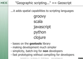
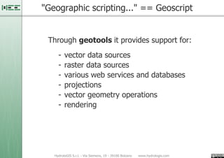
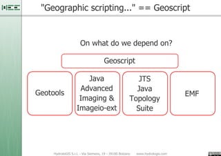
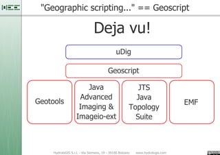
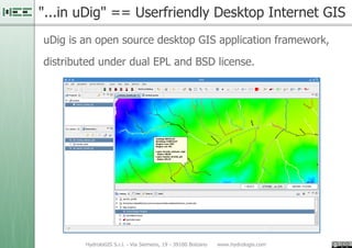
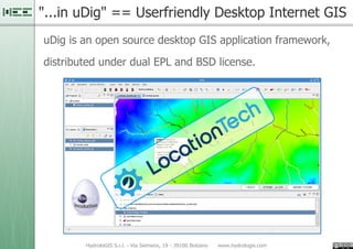
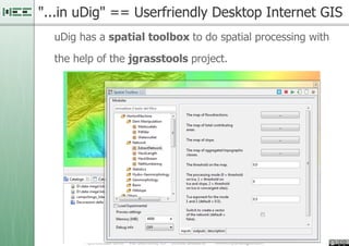
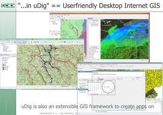
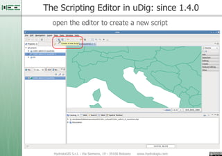
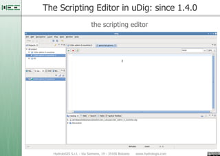
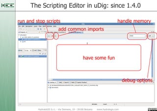
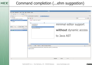
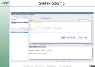
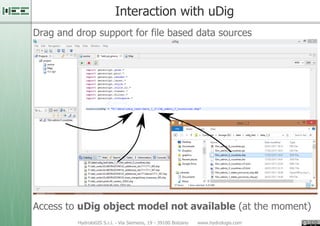
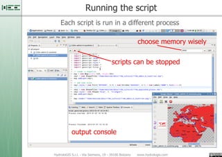
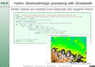
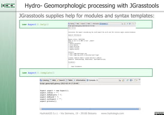
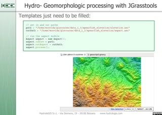

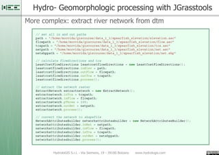
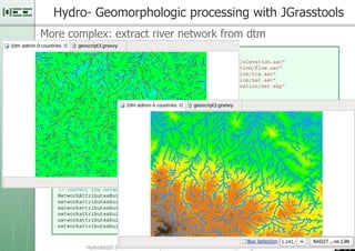

1. Geoscript allows the addition of spatial capabilities to scripting languages like Groovy and Python through the Geotools library, making GIS development simpler through batching and fast prototyping. 2. uDig is an open source desktop GIS application that supports geoscripting and spatial processing through tools like JGrasstools, and provides a scripting editor to write and run geoscripts. 3. Geoscripts in uDig can access vector and raster data, perform spatial operations, and use tools like JGrasstools for hydrological modeling tasks through a simple template-based process.


![[FOSS4G Seoul 2015] New Geoprocessing Toolbox in uDig Desktop GIS](https://cdn.slidesharecdn.com/ss_thumbnails/foss4g2015newgeoprocessingtoolboxinudigdesktopapplicationframework-150917042904-lva1-app6892-thumbnail.jpg?width=640&height=640&fit=bounds)


![[FOSS4G 2017 Boston]Development of an extension of Geoserver for handling 3D ...](https://cdn.slidesharecdn.com/ss_thumbnails/v2oglr9ztj6rozsfllyr-signature-7a758961d3f50ce339111f96a982ffa97fdeafa443a72eaf3f00f44b1d62f961-poli-170822063420-thumbnail.jpg?width=640&height=640&fit=bounds)


![[FOSS4G Korea 2016] Workshop - Advanced GeoServer](https://cdn.slidesharecdn.com/ss_thumbnails/foss4gkorea2016workshop-geoserver-mapplus-20160902-160905154517-thumbnail.jpg?width=640&height=640&fit=bounds)

![[제86회 Open Technet]OGC 표준 기반의 공간자료 분석과 시각화 기술 개발](https://cdn.slidesharecdn.com/ss_thumbnails/ogc-20161019-161020053210-thumbnail.jpg?width=640&height=640&fit=bounds)


![[FOSS4G Korea 2014] Making Base Maps with Open Data](https://cdn.slidesharecdn.com/ss_thumbnails/makingbasemapswithopendataminpalee20140827-140828022647-phpapp02-thumbnail.jpg?width=640&height=640&fit=bounds)


![[FOSS4G KOREA 2014] Introduce uDig](https://cdn.slidesharecdn.com/ss_thumbnails/foss4gintroduceudig-140828074849-phpapp01-thumbnail.jpg?width=640&height=640&fit=bounds)