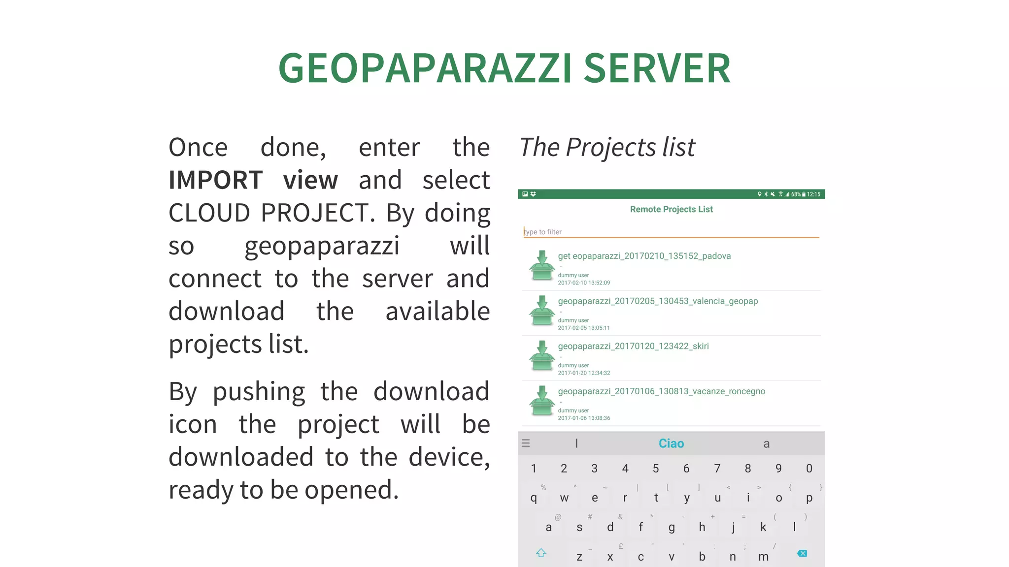
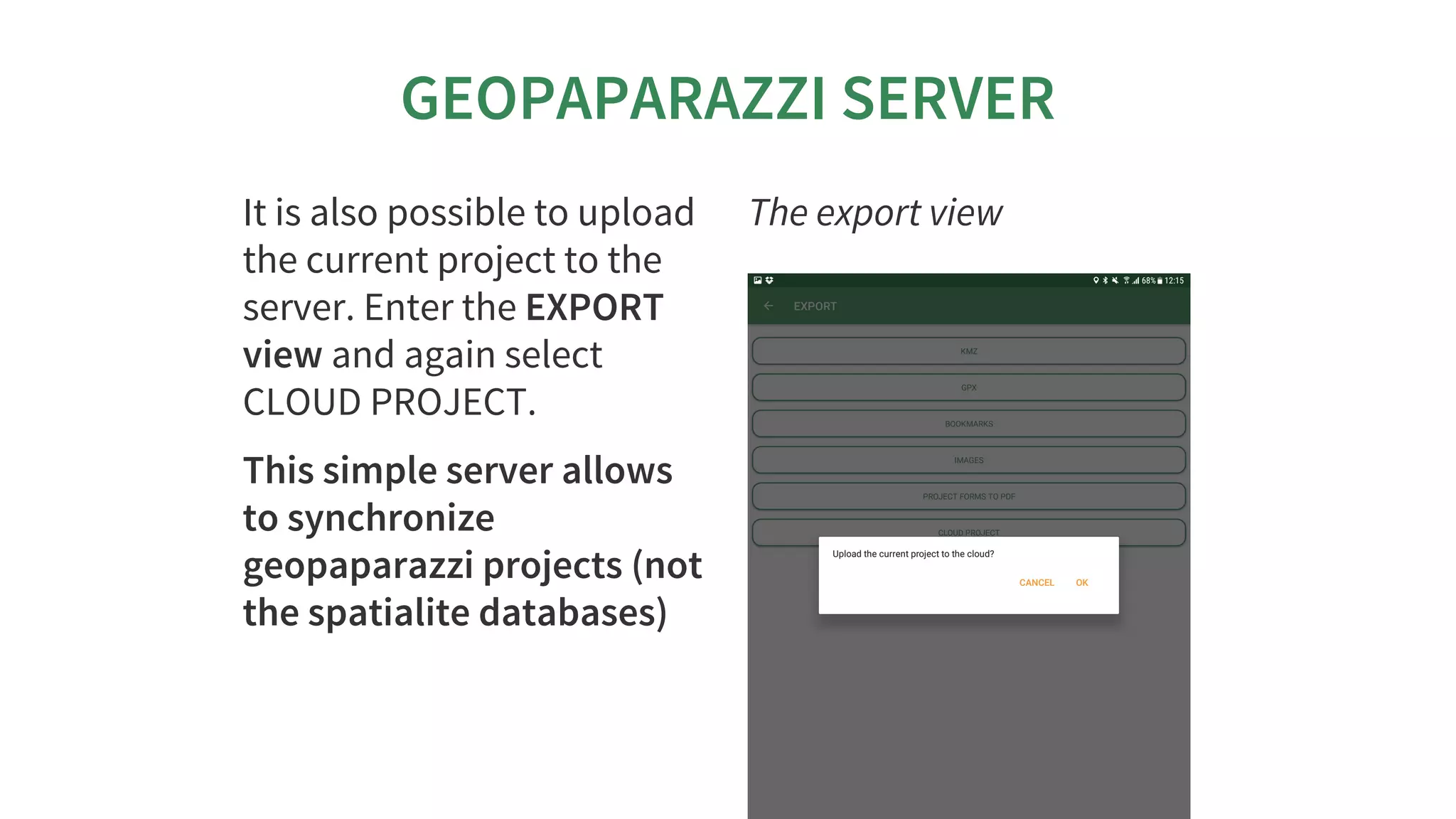
Download as PDF, PPTX


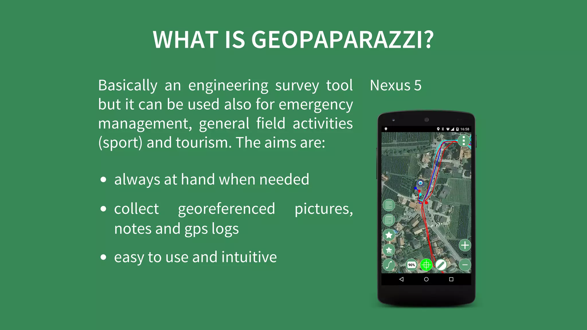

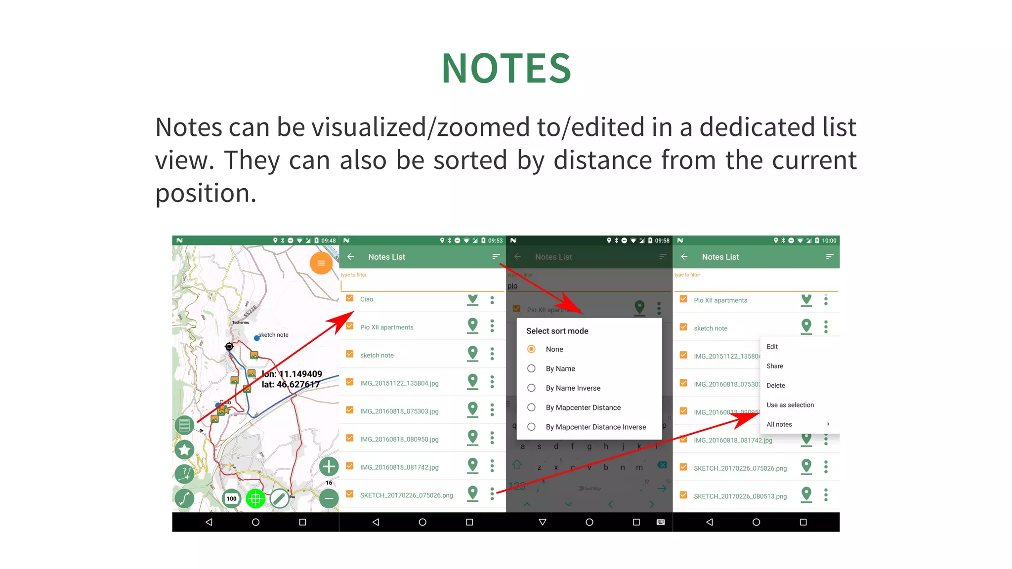
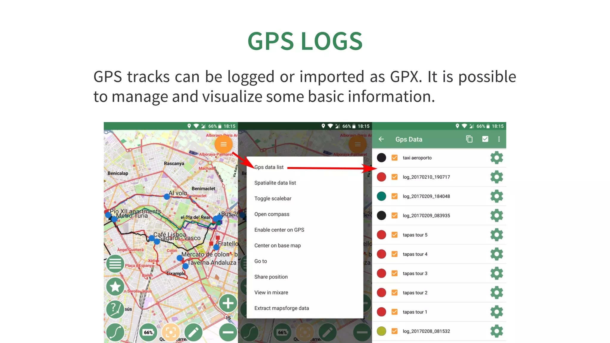
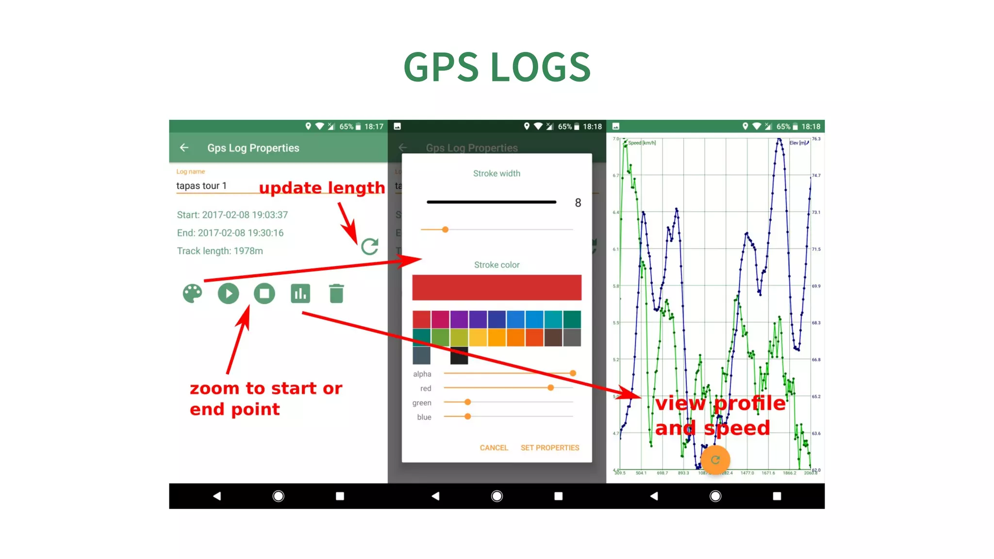


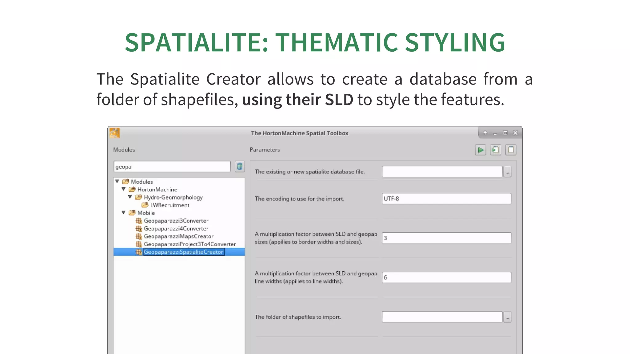
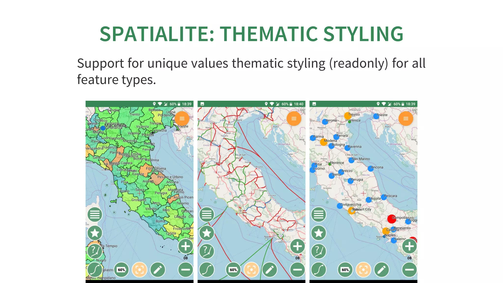
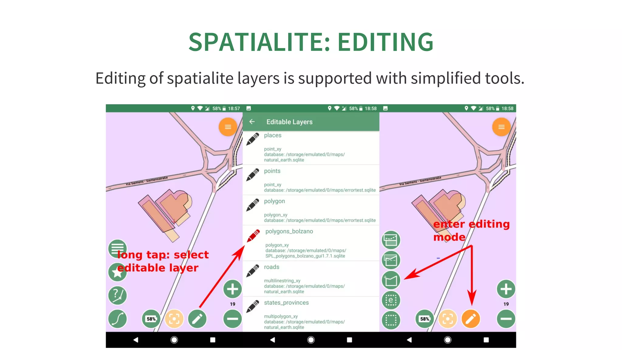
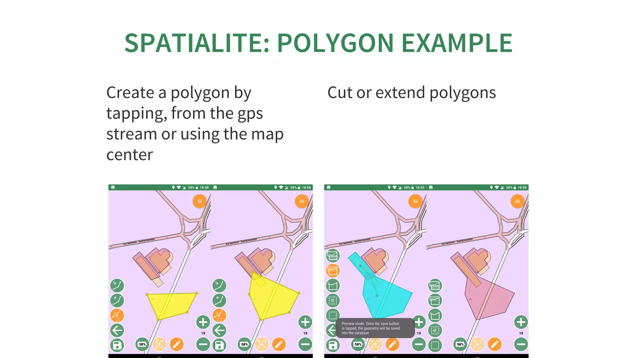


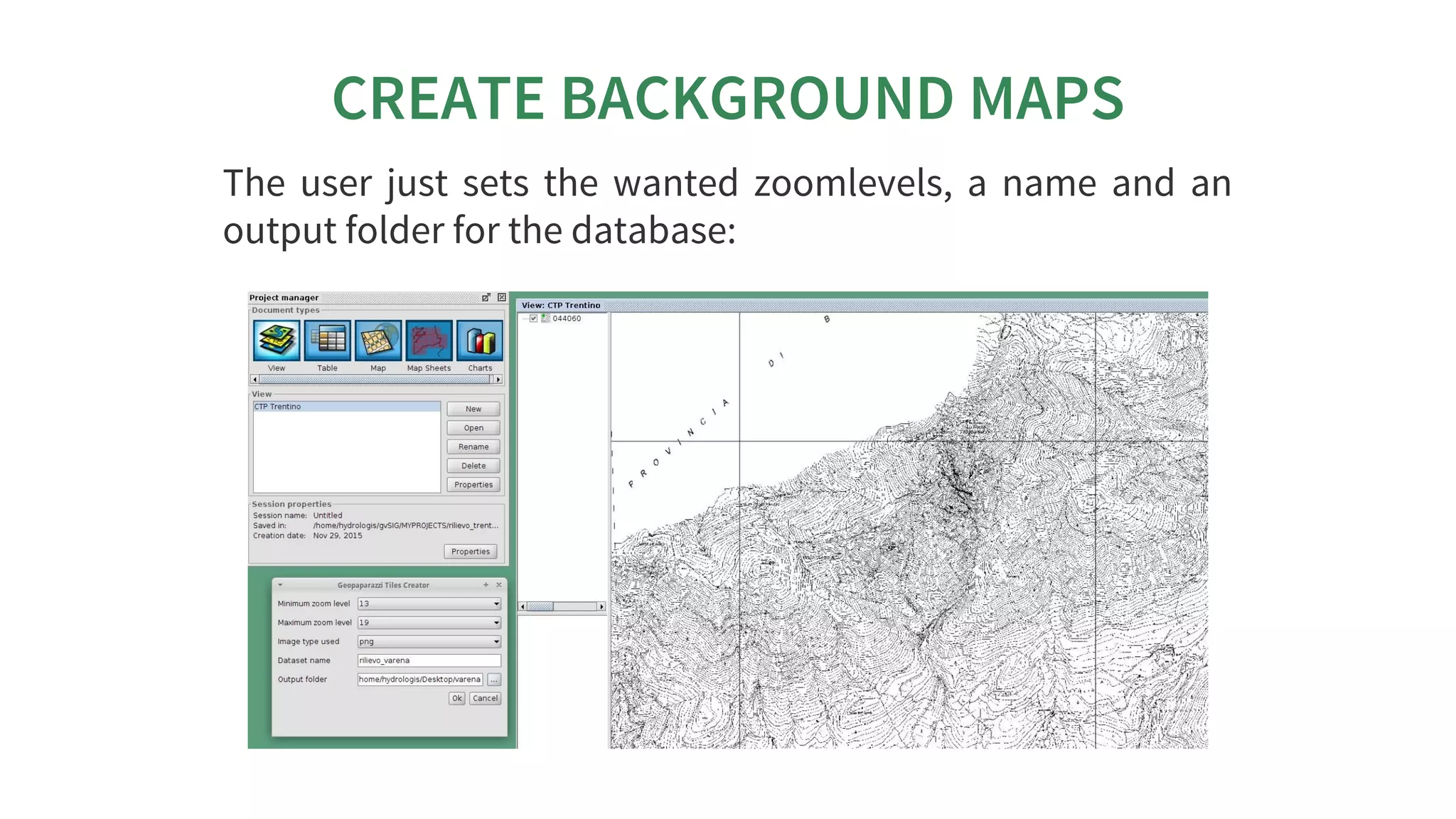


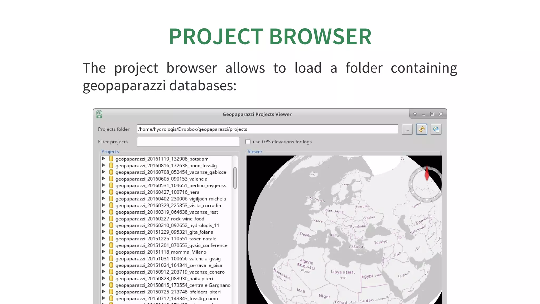
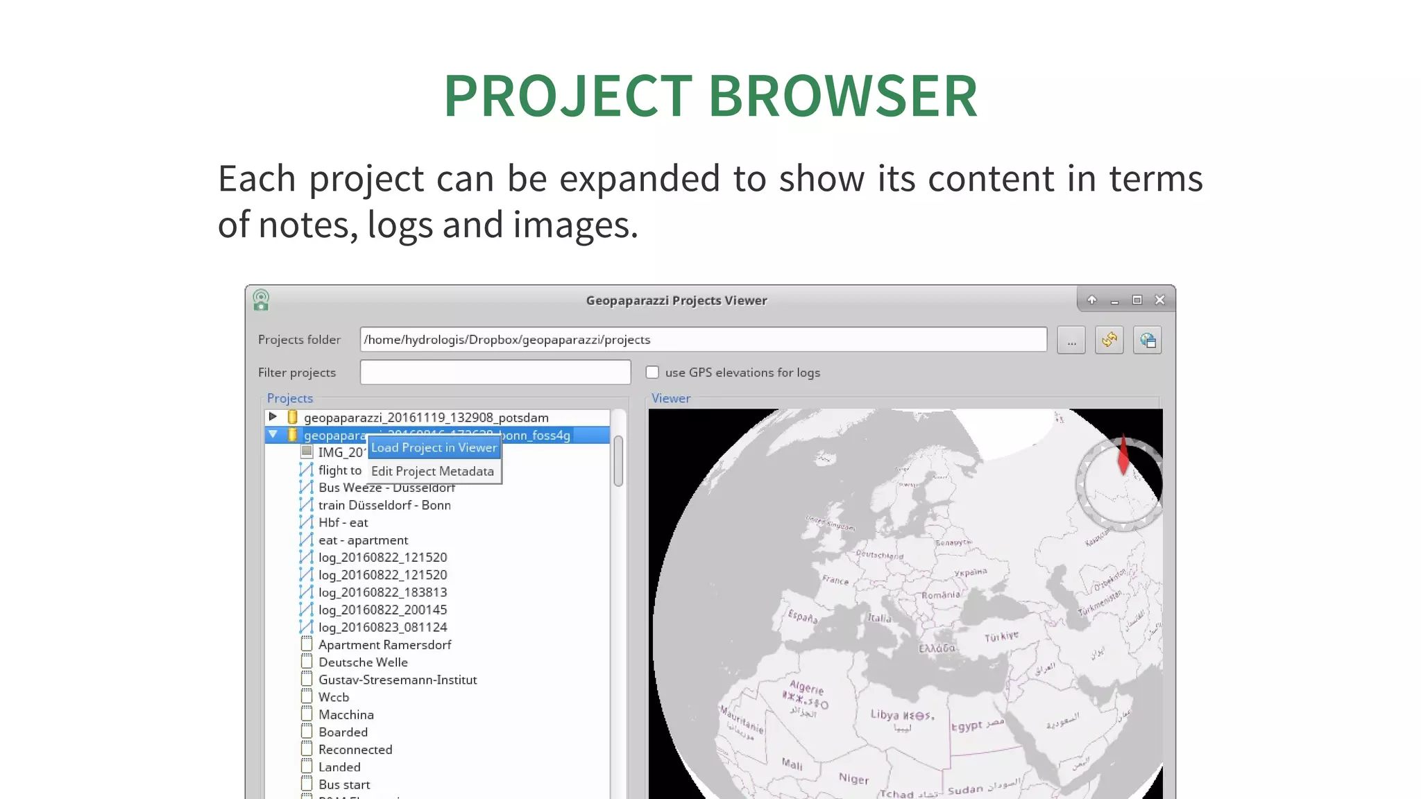
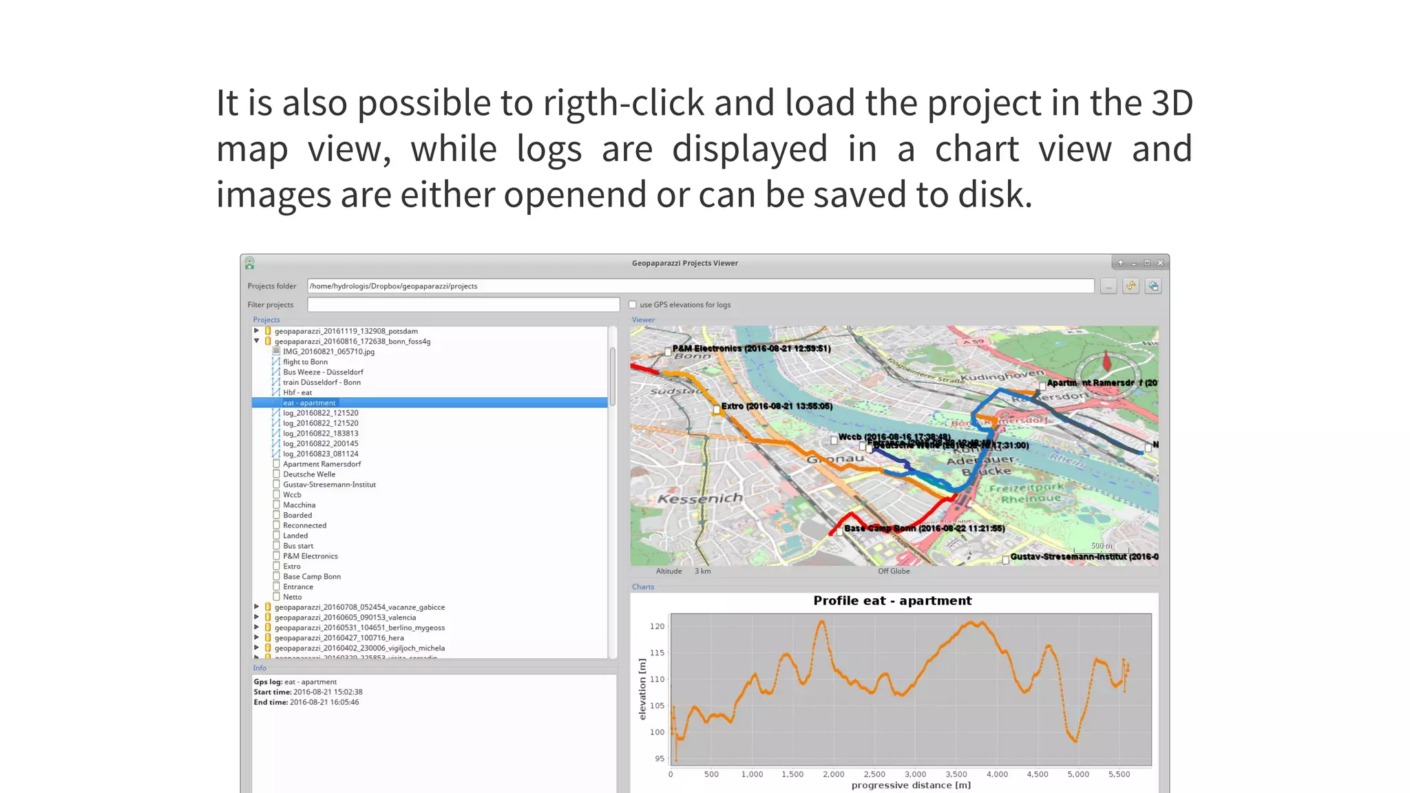
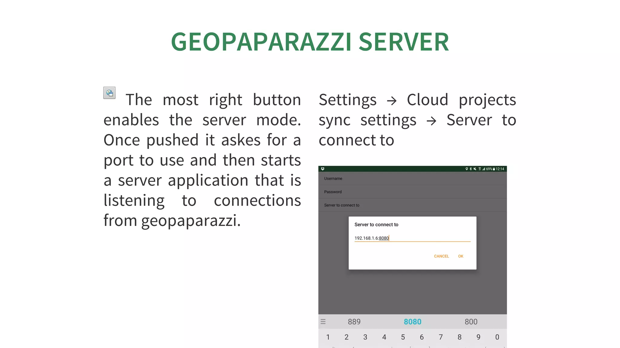


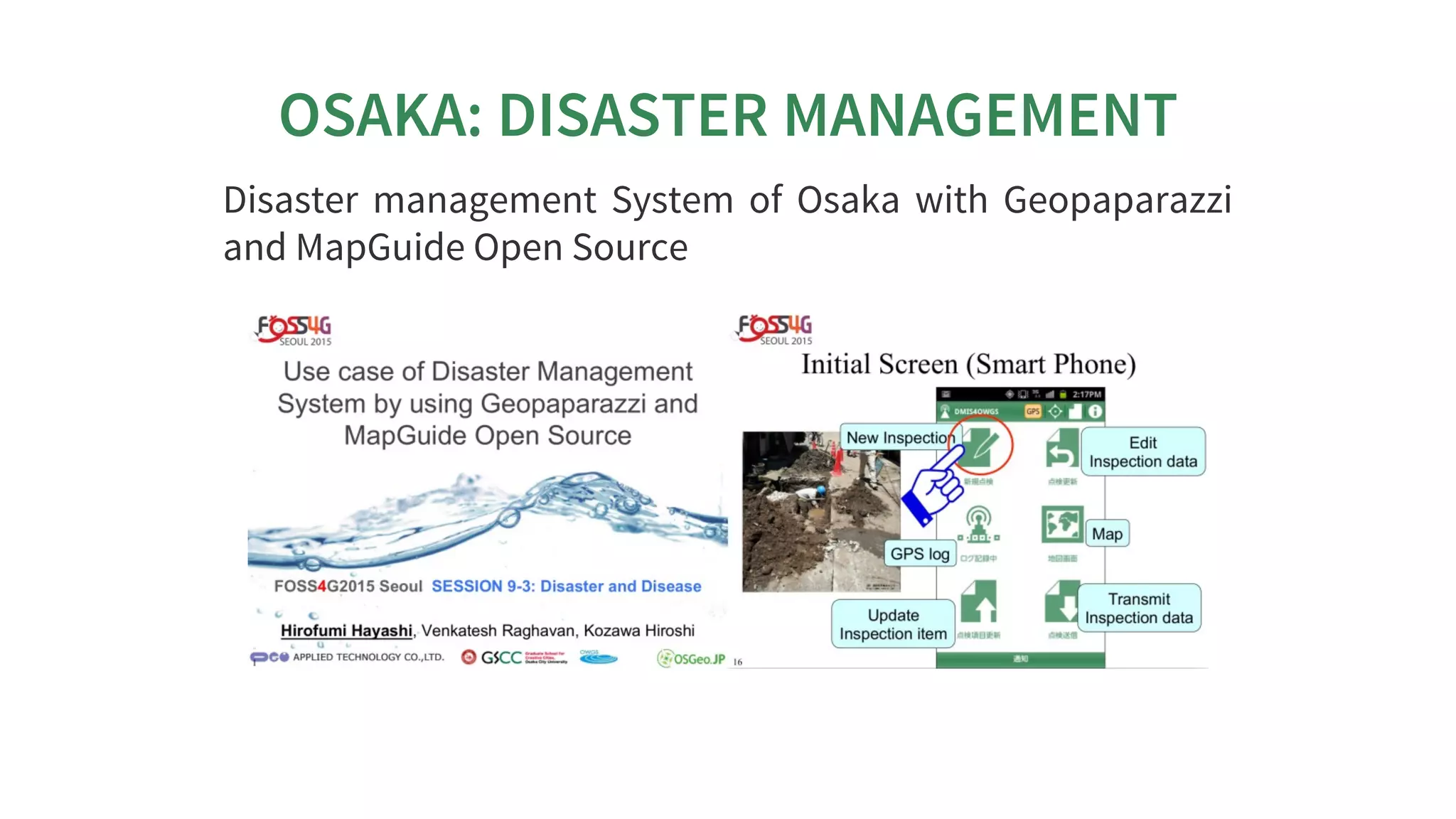
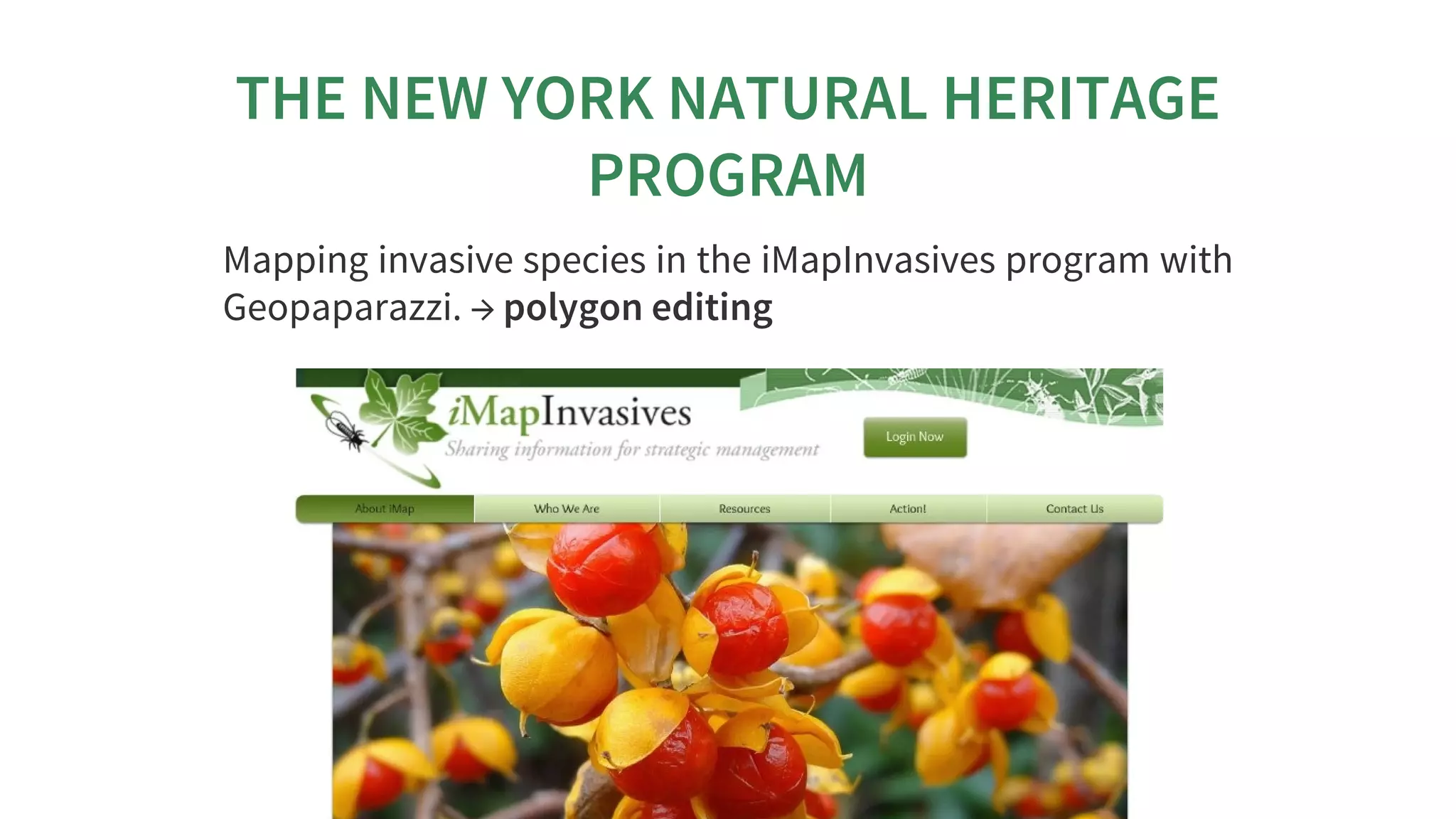


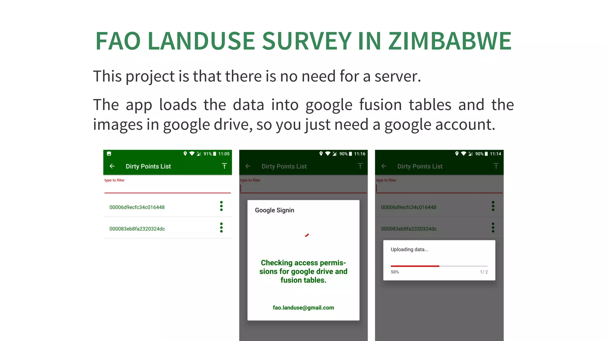


This document discusses Geopaparazzi and gvSIG Mobile applications. It begins by introducing Geopaparazzi as a tool for engineering surveys and field data collection that has been in use for 10 years. It then describes key functions of Geopaparazzi including notes, GPS logging, supported basemaps, and Spatialite database support. The document also discusses plugins that allow Geopaparazzi data to be used within gvSIG and provides examples of how both applications have been used for disaster management, natural resource mapping, and land use surveys.