Download to read offline


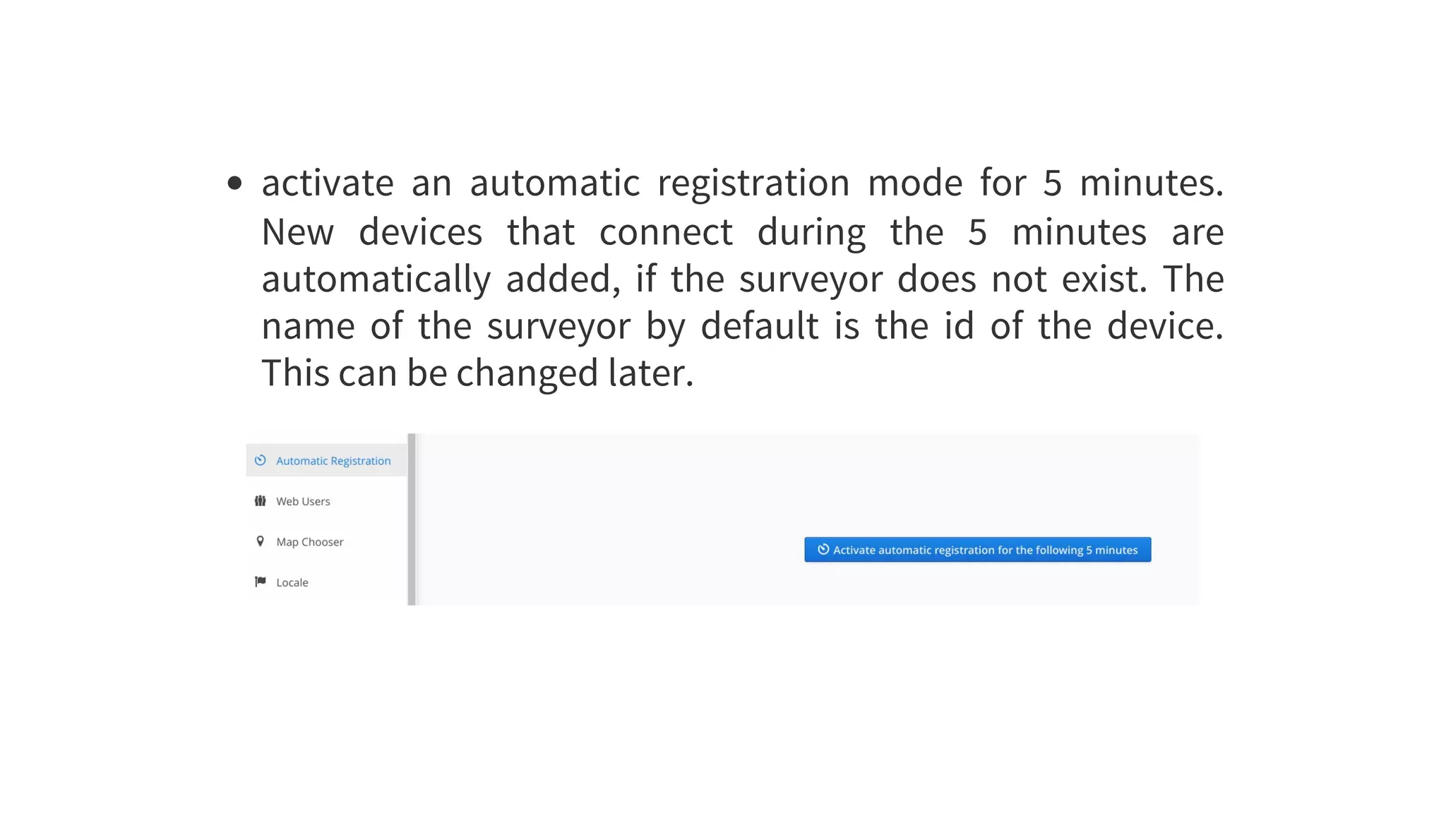
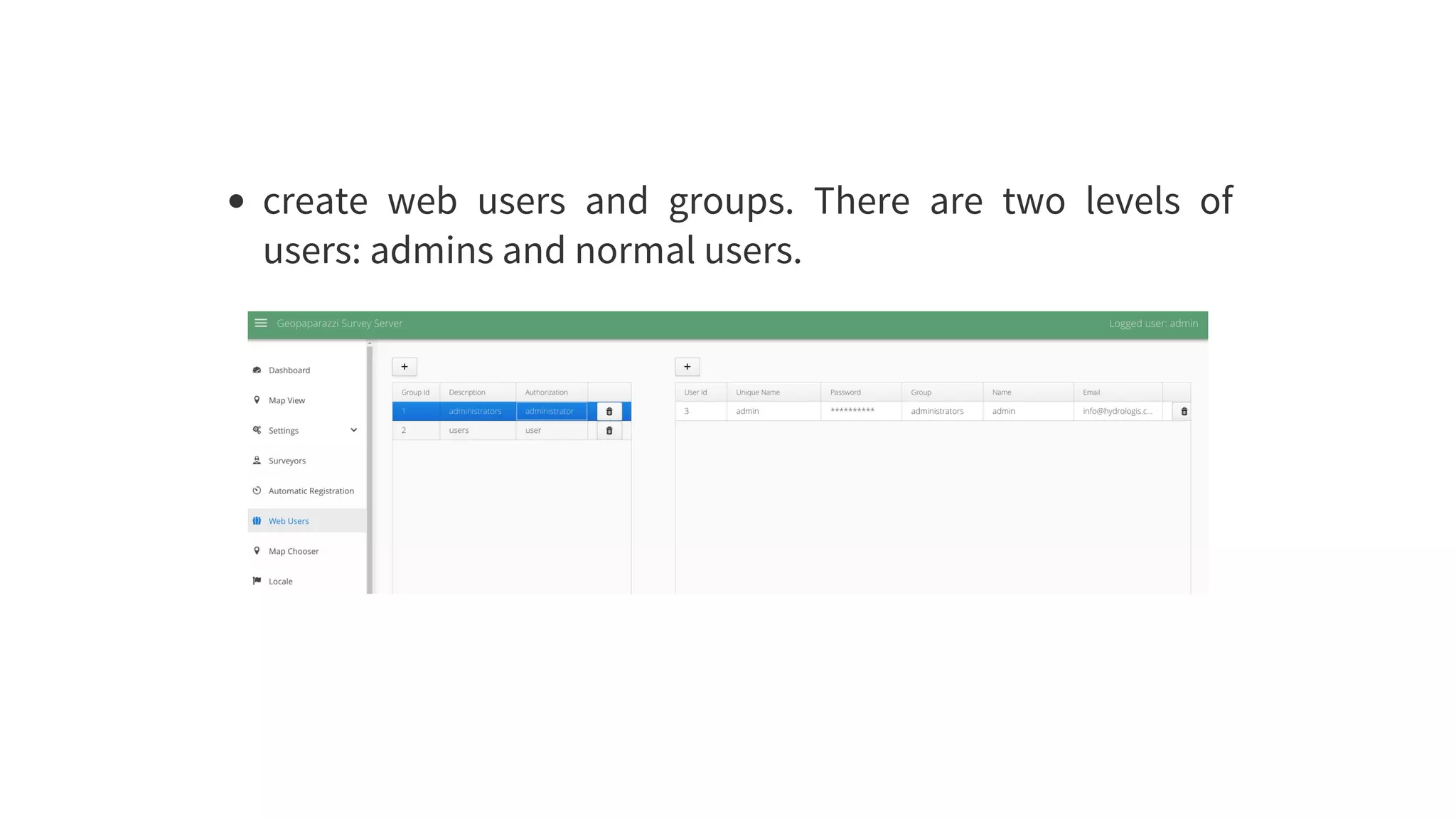
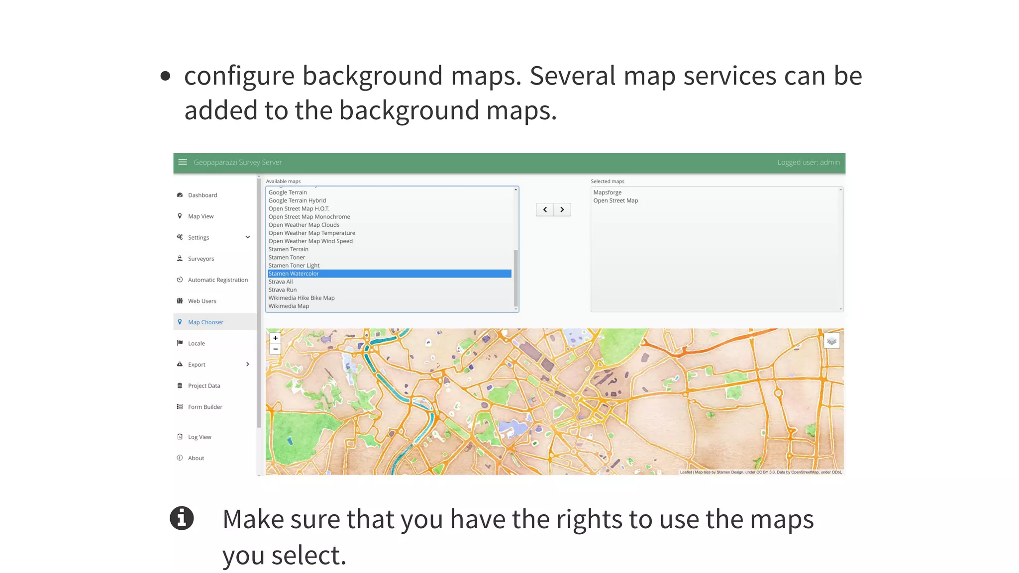
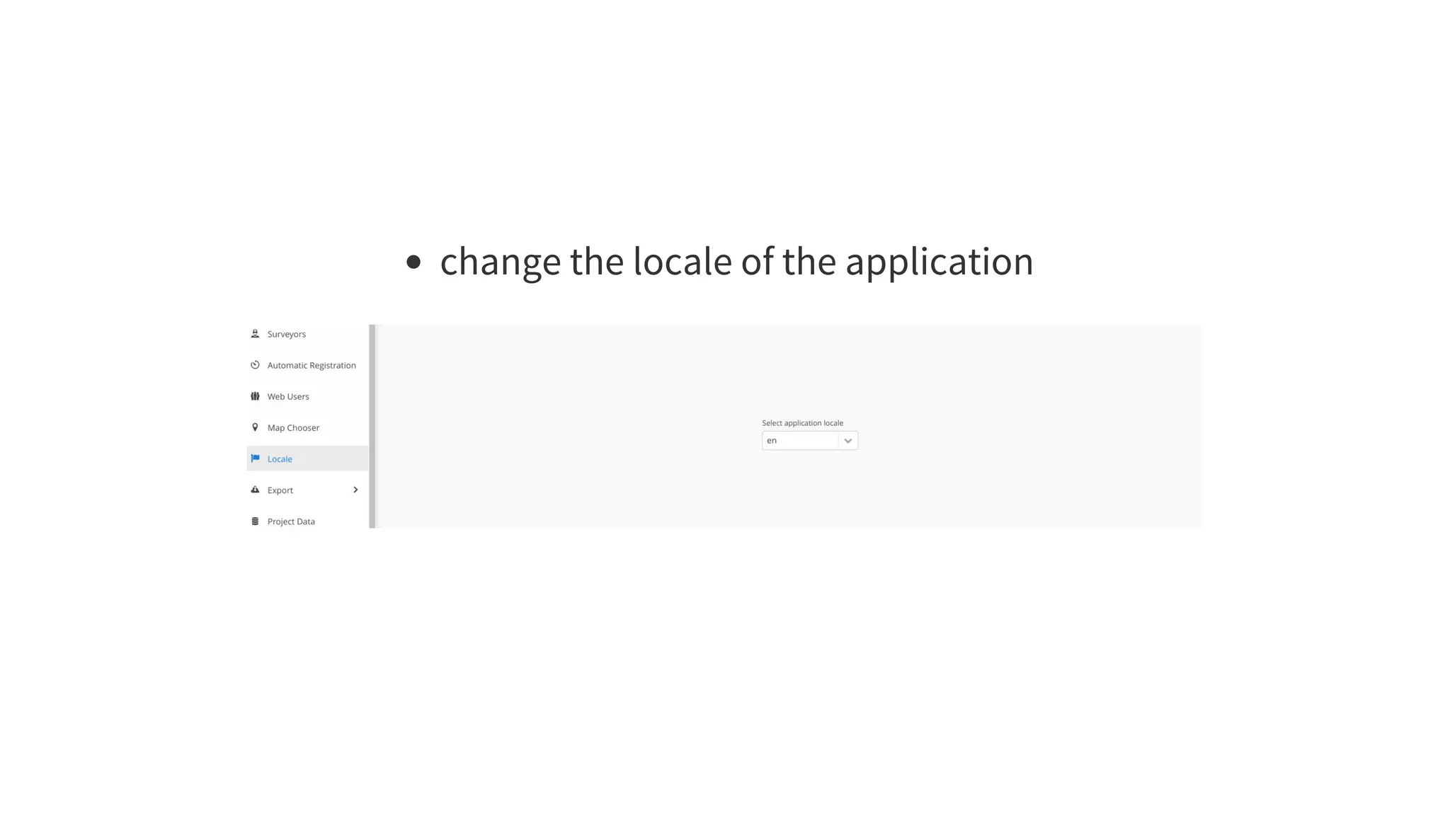
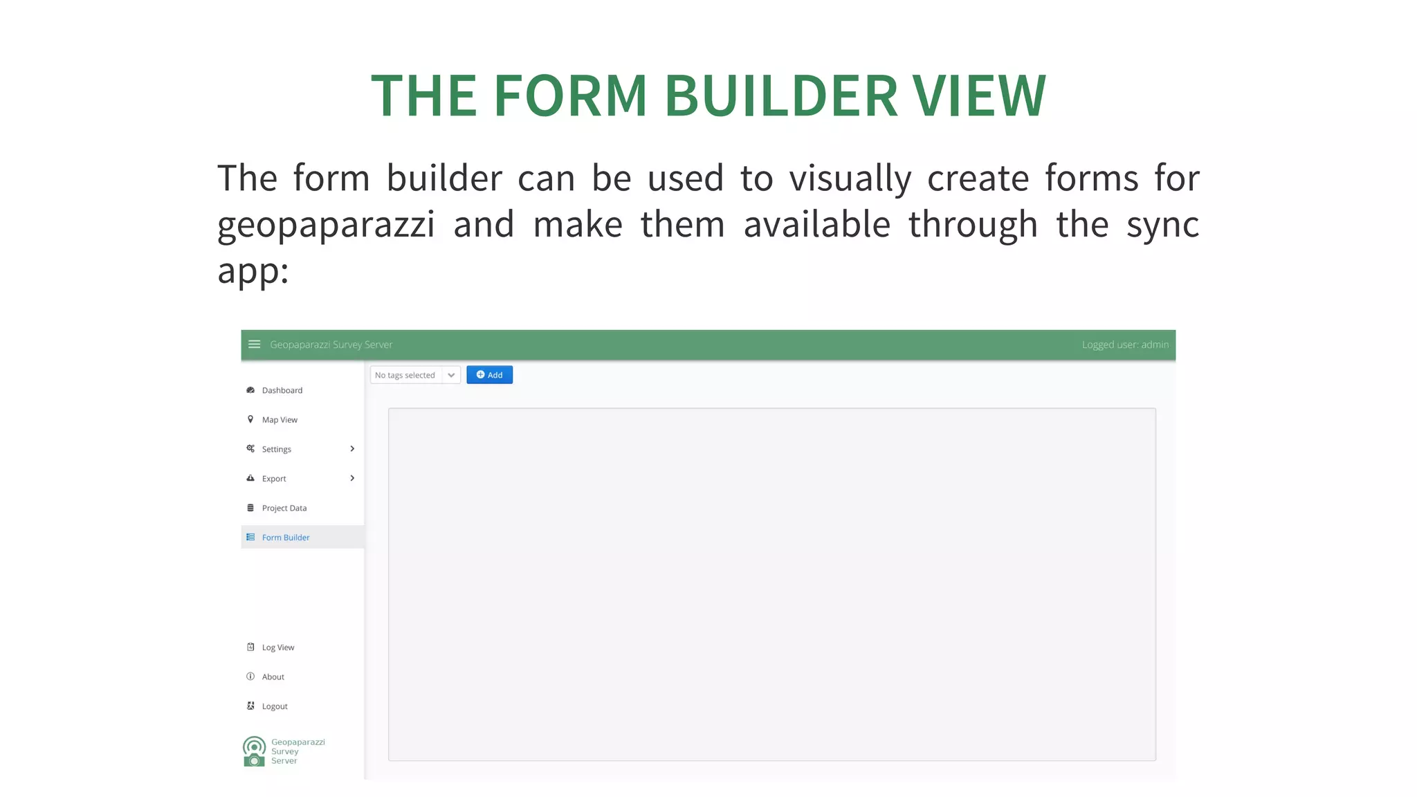
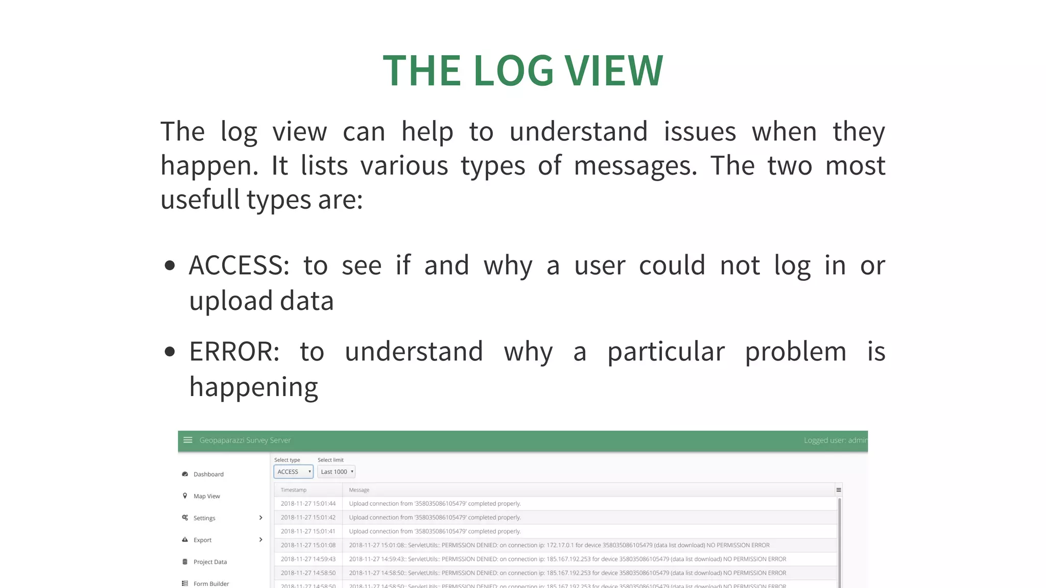
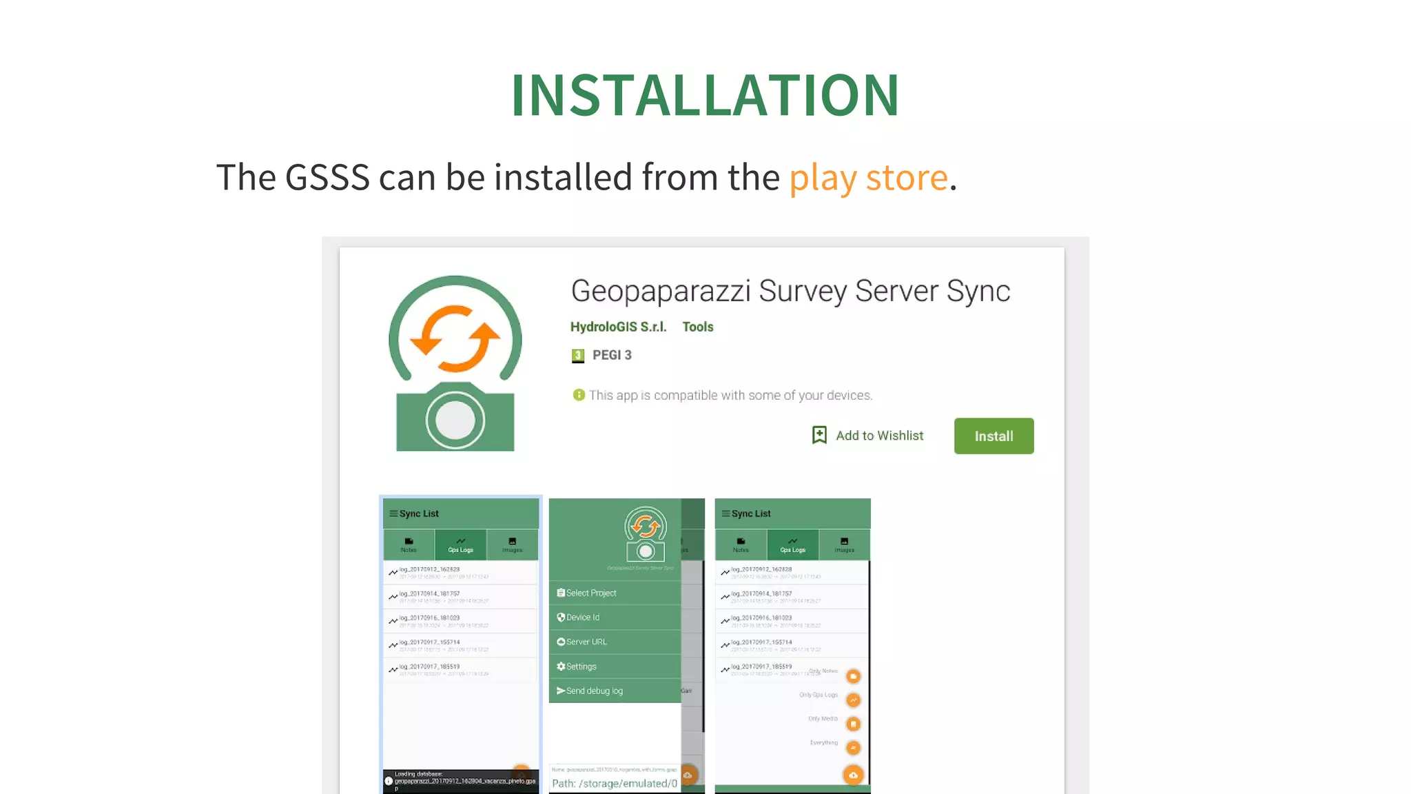
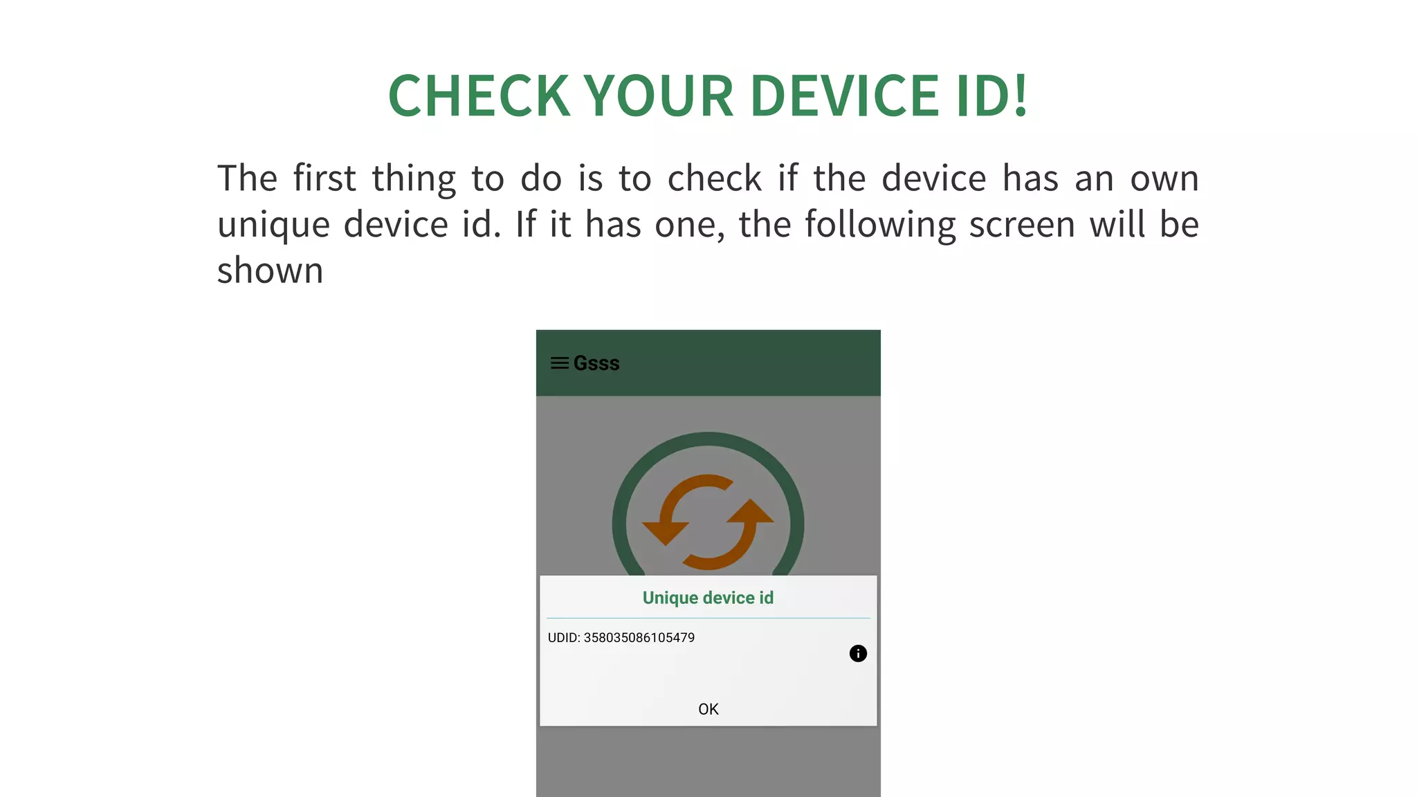
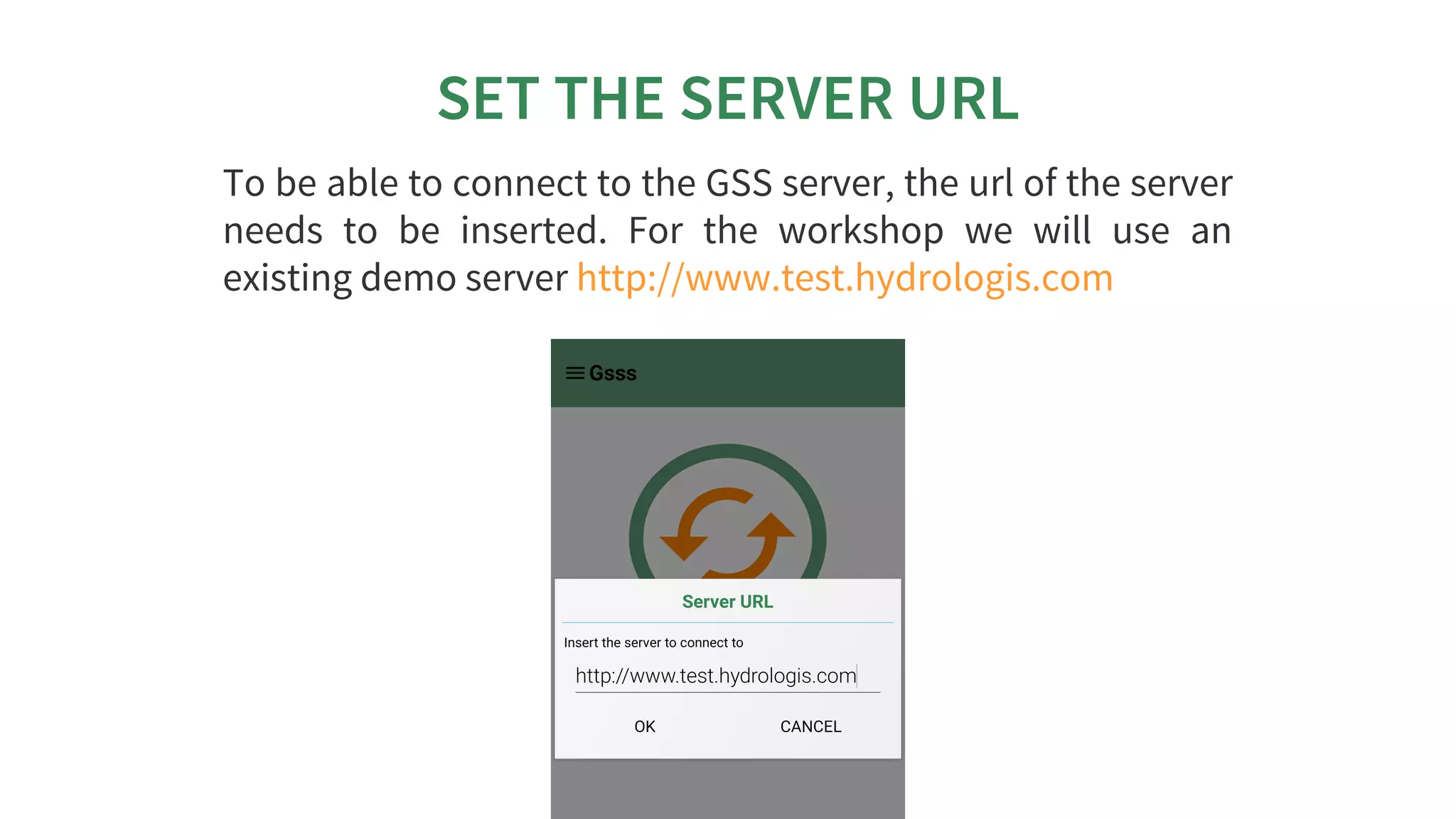

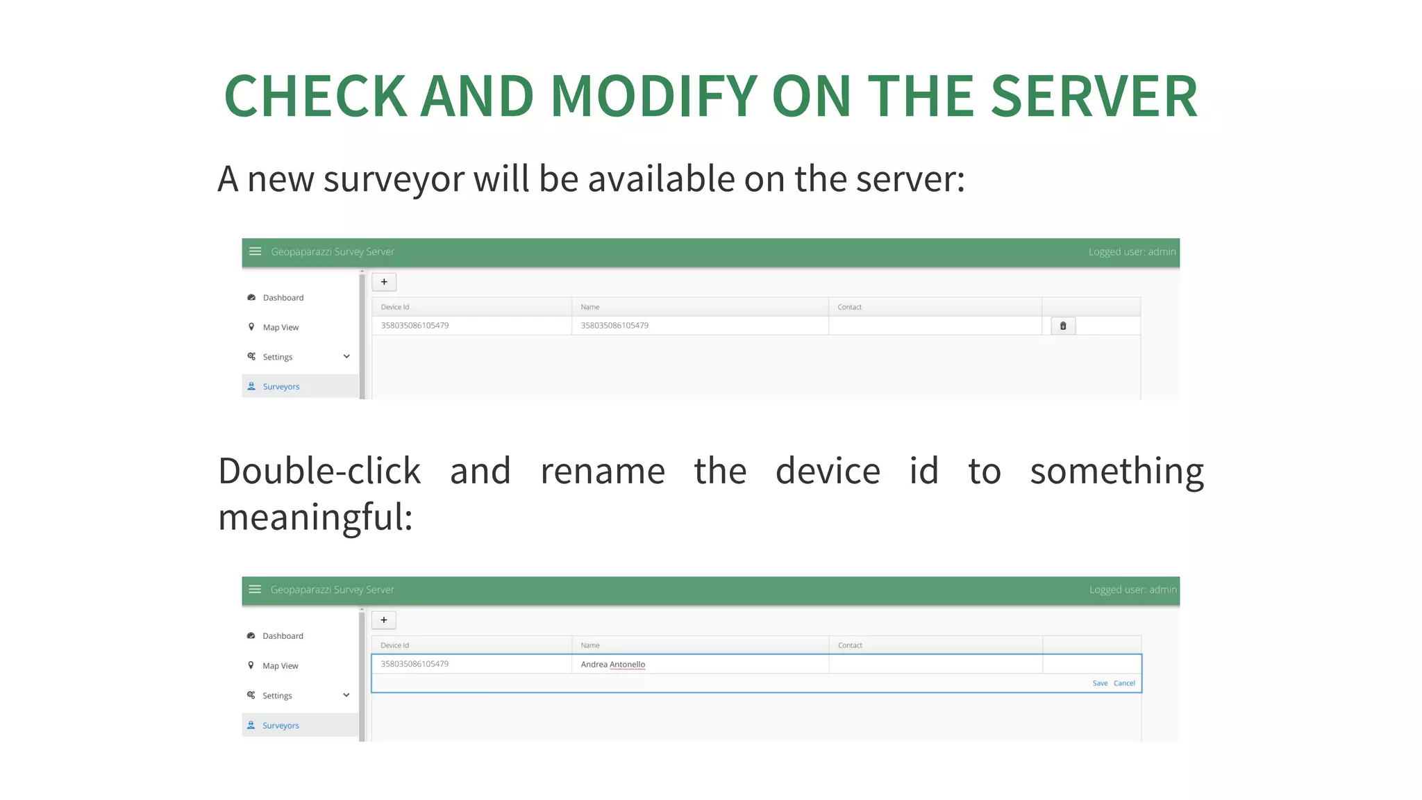
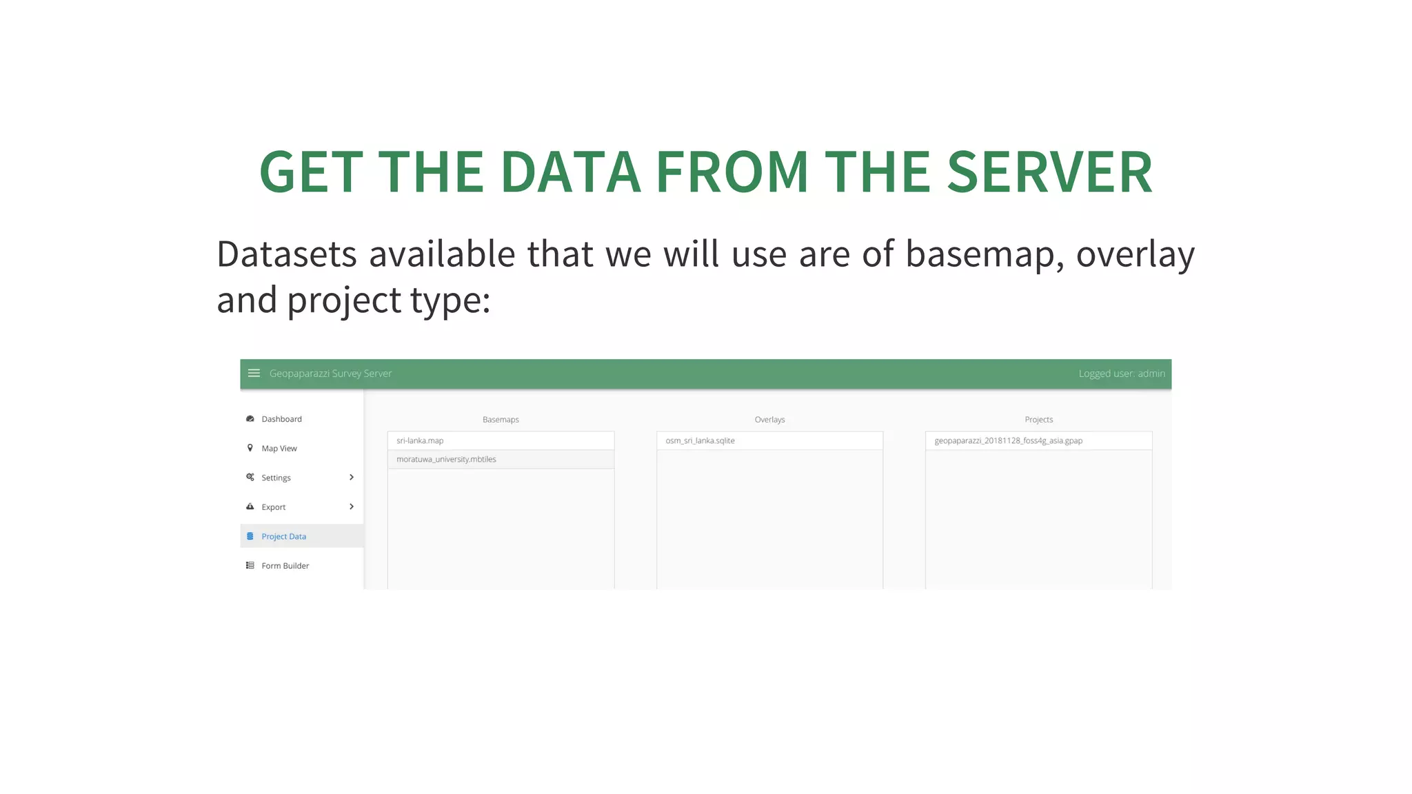

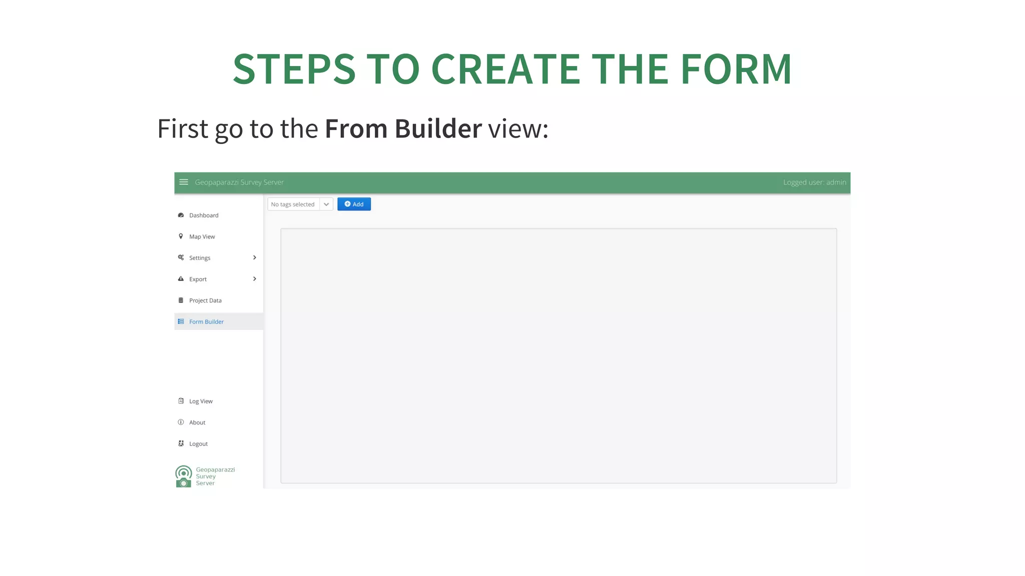
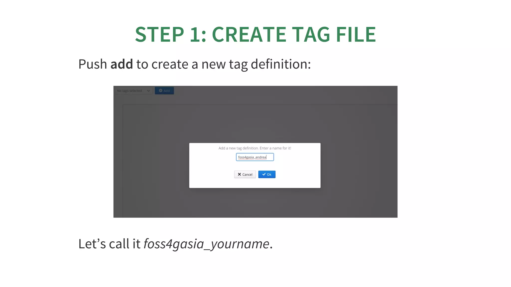
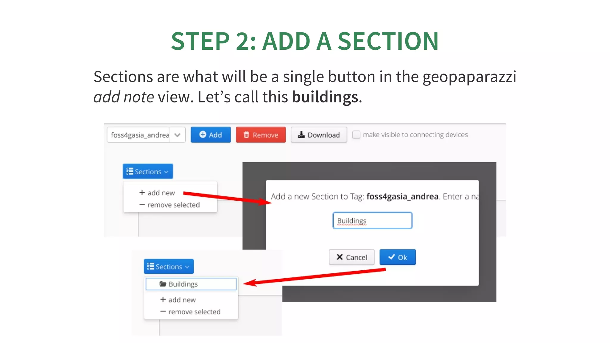
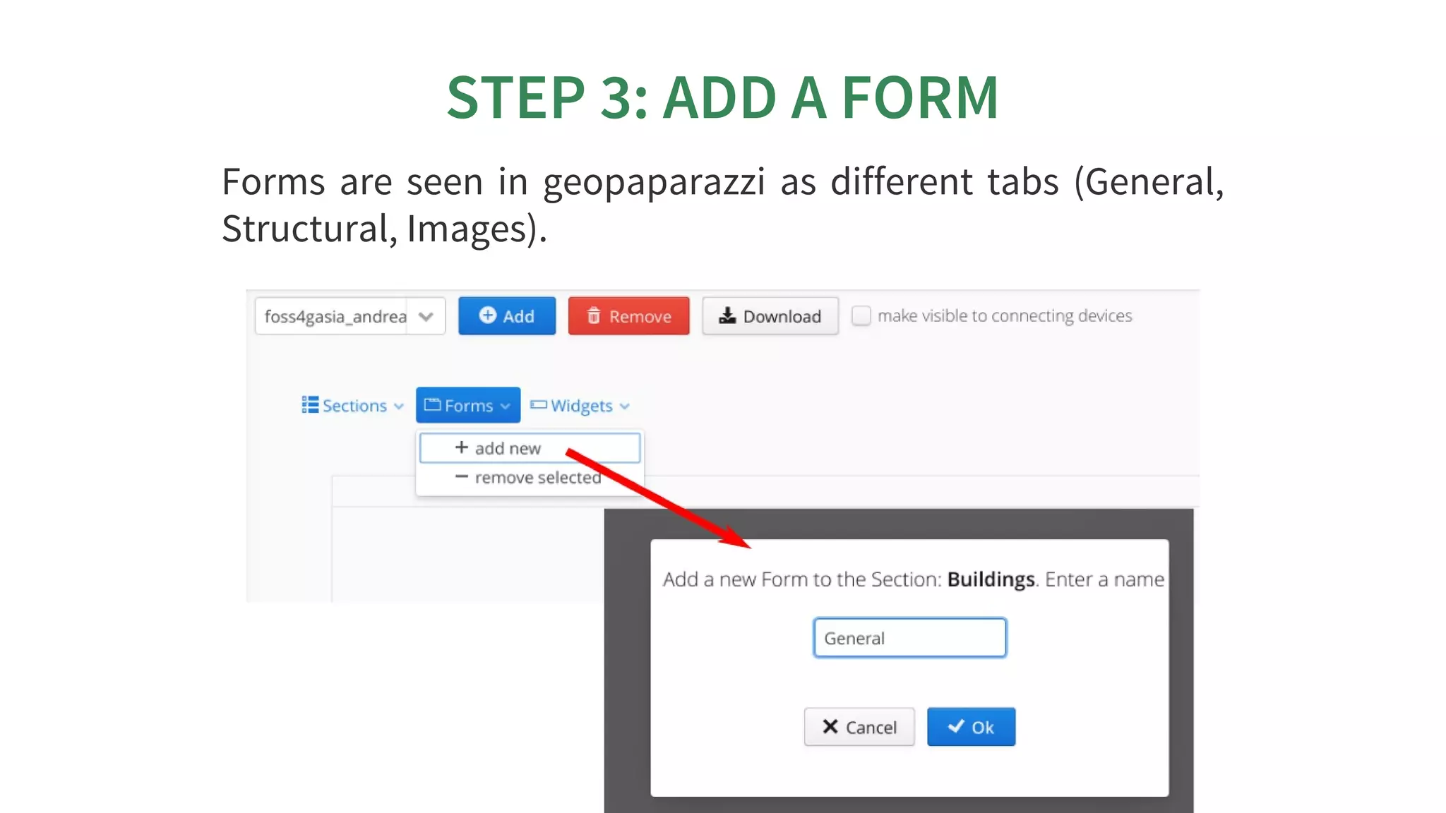
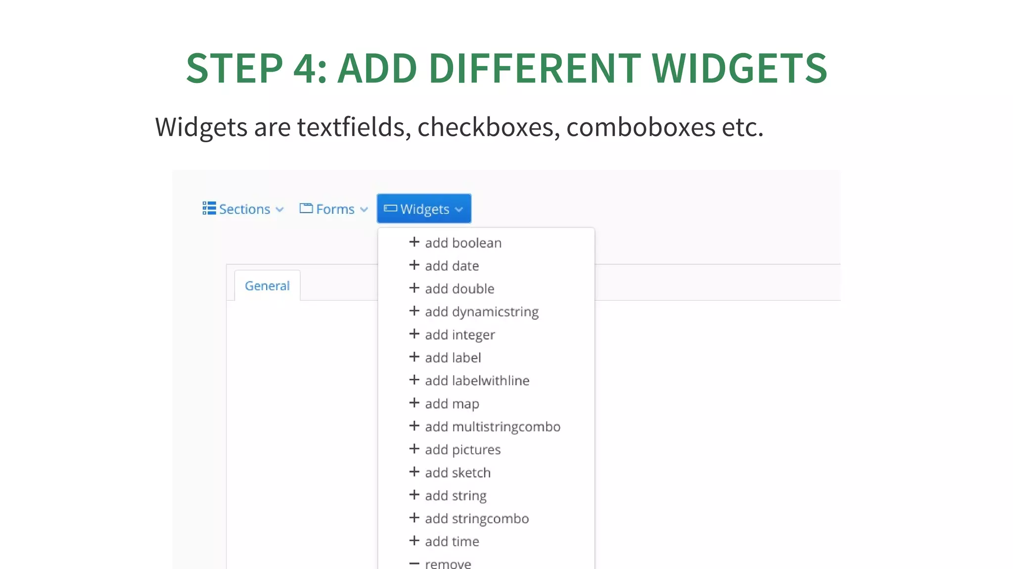

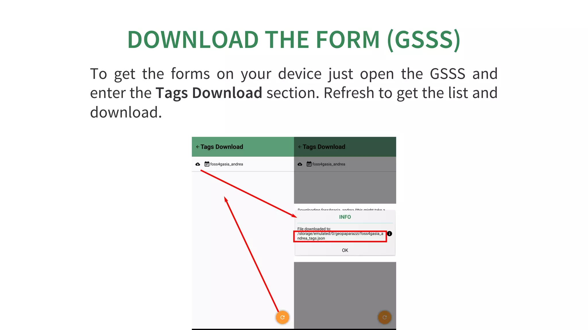


The Geopaparazzi Survey Server (GSS) allows users to synchronize Geopaparazzi projects with a central server. The GSSSync app connects Geopaparazzi projects to the GSS to upload and download data using a unique device ID. The GSS provides views for users, surveyors, maps, settings, exports, and a form builder to create customized forms for data collection. Surveys are conducted using Geopaparazzi and forms from the GSS, and survey data is synchronized to the GSS using GSSSync.


![Vibe Coding vs. Spec-Driven Development [Free Meetup]](https://cdn.slidesharecdn.com/ss_thumbnails/vibecodingvsspecdrivendevelopment-251209105622-43f455e7-thumbnail.jpg?width=640&height=640&fit=bounds)
![Coded Agents – with UiPath SDK + LangGraph [Virtual Hands-on Workshop]](https://cdn.slidesharecdn.com/ss_thumbnails/codedagentsdeck-251215155422-5497c599-thumbnail.jpg?width=640&height=640&fit=bounds)


