Download as PDF, PPTX

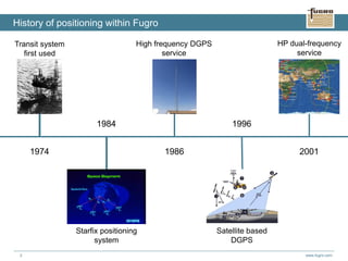
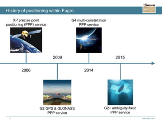
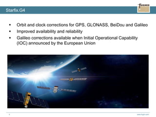
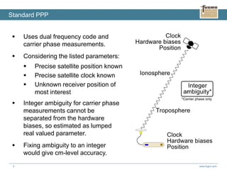
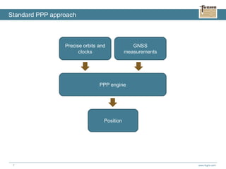
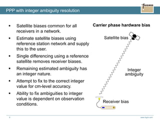
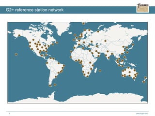
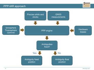
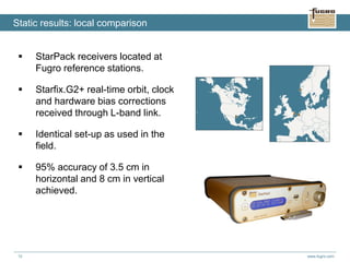
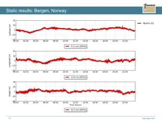
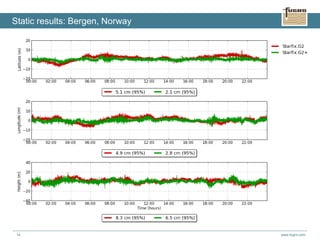
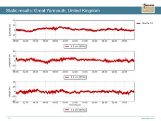
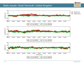
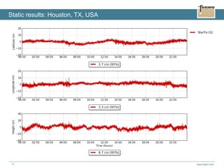
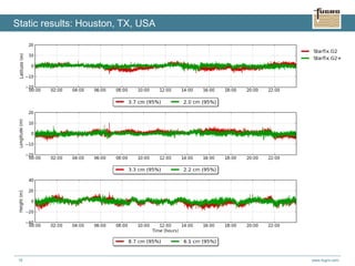
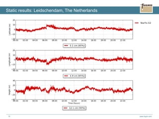
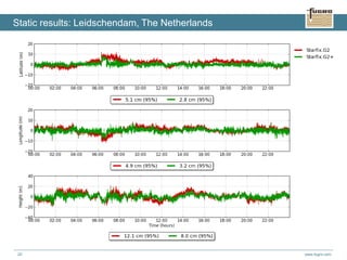
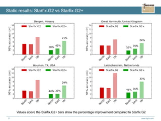
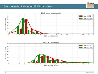
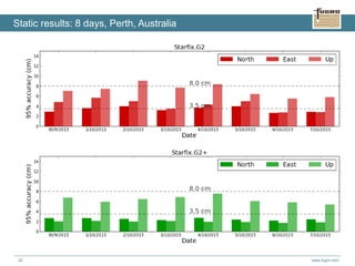
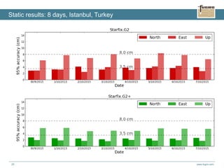
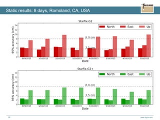
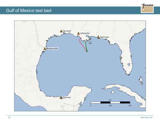
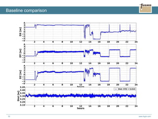

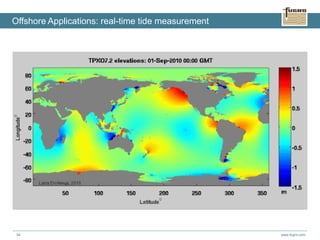
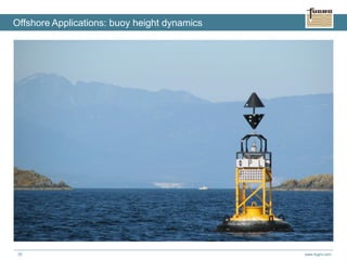
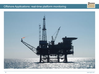


This document summarizes Fugro's G2+ worldwide centimetre-level positioning service. It discusses the history of Fugro's positioning capabilities from 1974 to present, including the introduction of G2+ in 2015. G2+ uses precise satellite orbit and clock data with integer ambiguity resolution to provide centimetre-level positioning accuracy globally in real-time. Static and dynamic testing shows G2+ achieves 95% horizontal accuracy of 3.5 cm and vertical accuracy of 8 cm. G2+ is being used for offshore applications like tide measurement, platform monitoring, and unmanned vessel navigation.