Download to read offline
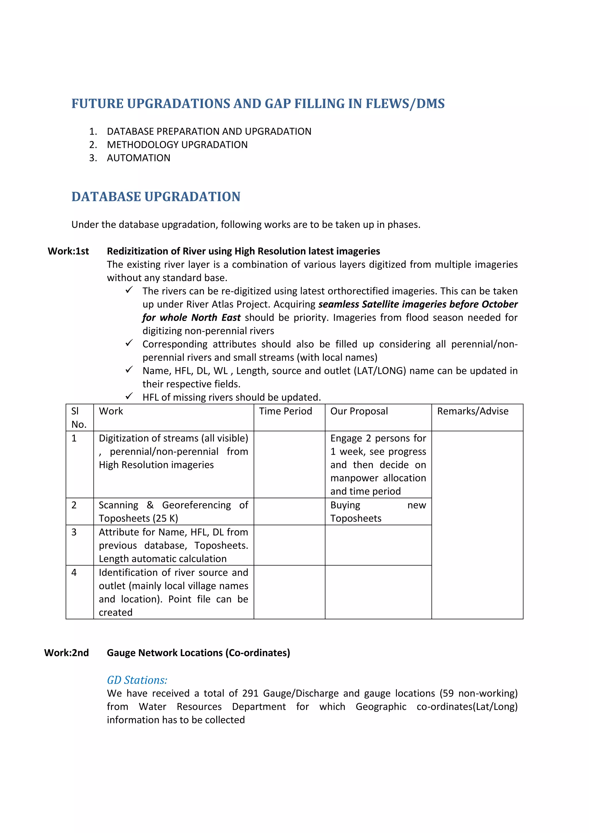
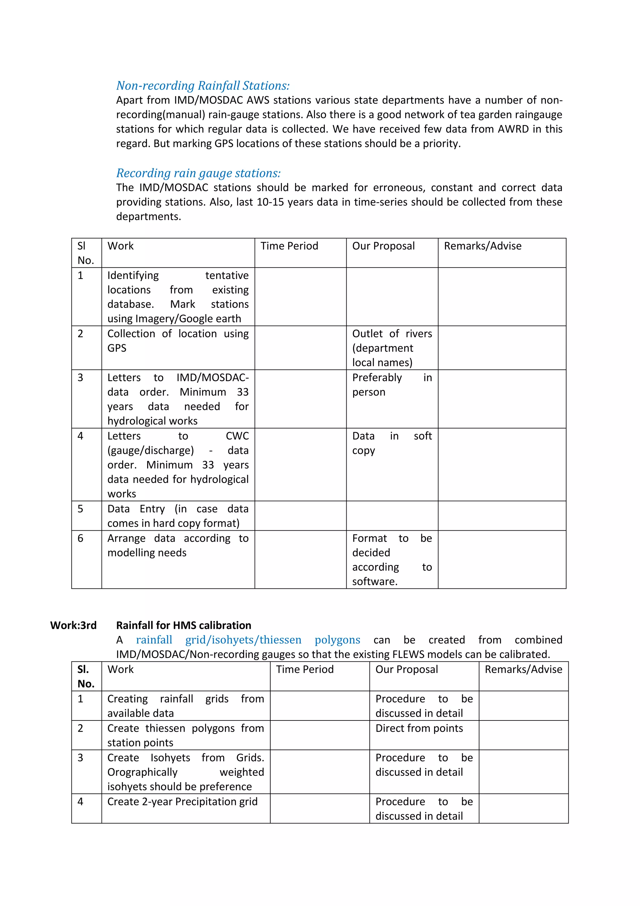

The document outlines a plan to upgrade the FLEWS/DMS system in Assam, India through database preparation and upgrading, methodology upgrading, and automation. Key activities proposed include: 1. Re-digitizing river layers from high resolution imagery and updating attribute data. 2. Collecting coordinate data for gauge stations and rainfall stations to integrate them into the database. 3. Creating rainfall grids, isohyets and Thiessen polygons from station data for hydrological model calibration. 4. Updating alert maps with latest imagery, catchment boundaries and other layers. 5. Rebuilding HEC-HMS hydrological models using updated inputs and calibration with stage-discharge data


![Hec ras 4.1-applications_guide[1]](https://cdn.slidesharecdn.com/ss_thumbnails/hec-ras4-140906052124-phpapp01-thumbnail.jpg?width=640&height=640&fit=bounds)