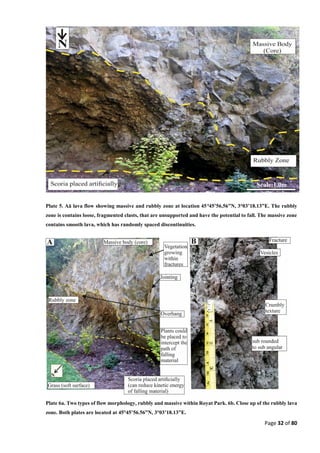
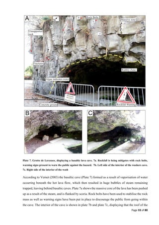
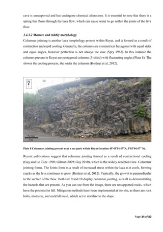
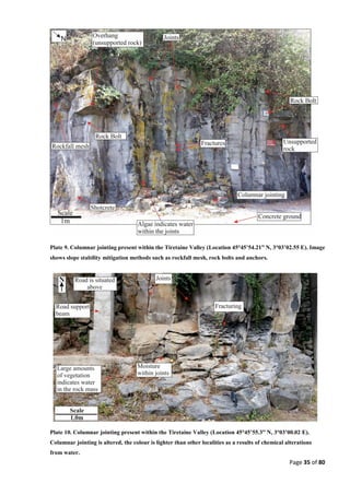
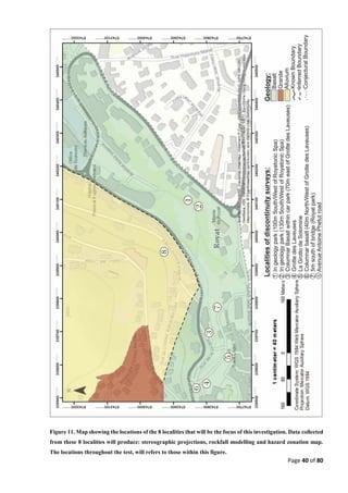
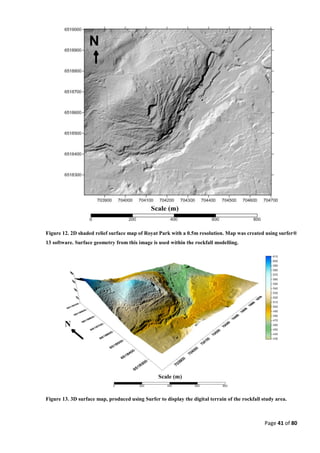
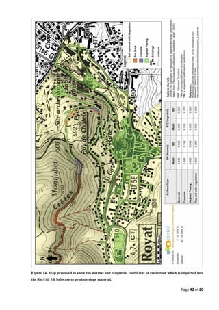
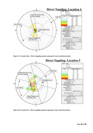
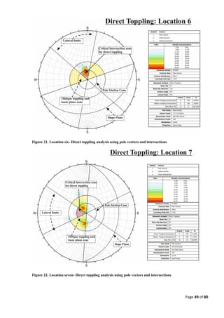
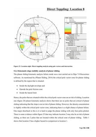
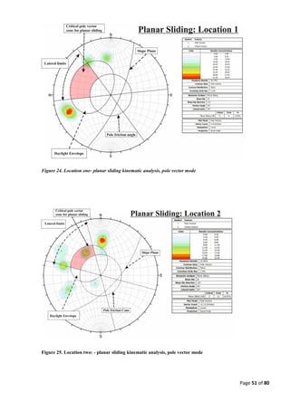
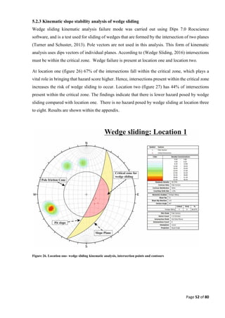
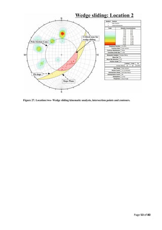
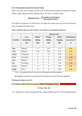
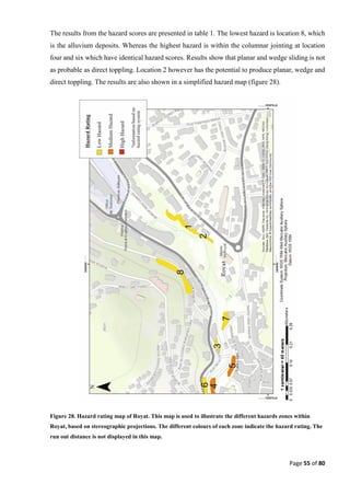
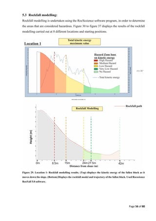
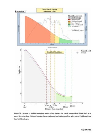
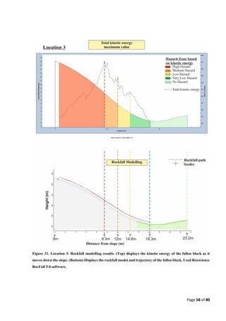
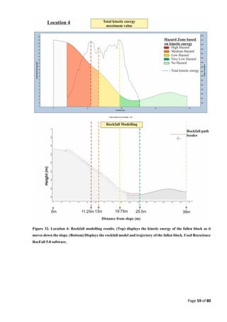
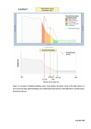
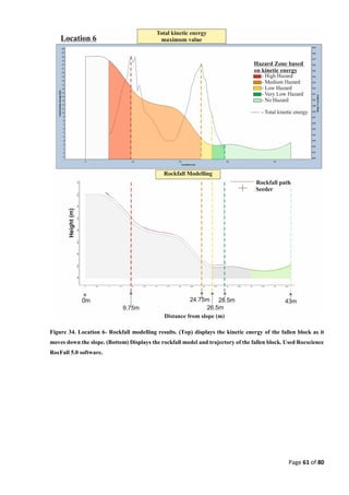
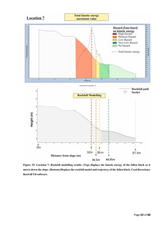
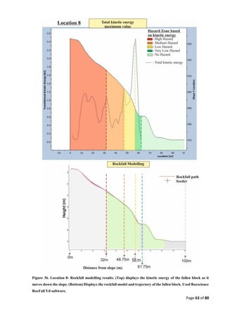
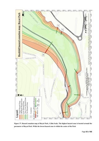
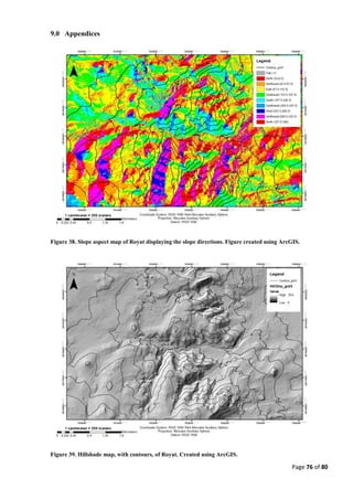
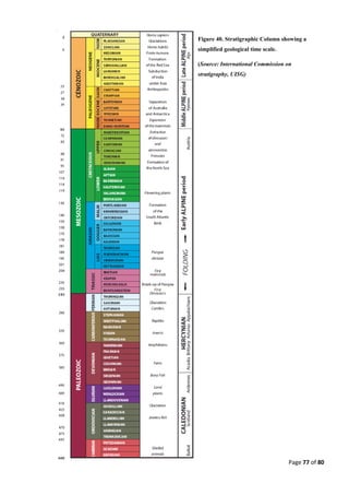
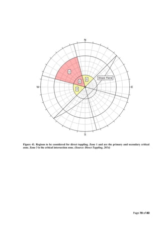
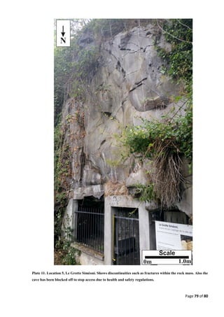
This document summarizes a student's dissertation on slope stability analysis and rockfall hazard zonation in Royat, France. The student conducted fieldwork to collect data on rock discontinuities and geological features. Stereographic projections and rockfall modeling were used to analyze slope stability hazards. This resulted in a hazard zonation map showing the areas of highest rockfall risk around Royat Park. The modeling found the perimeter of the park to have the highest hazard, while the center had the lowest.