Download as PDF, PPTX
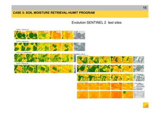
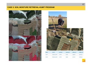
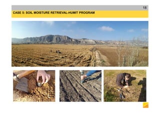
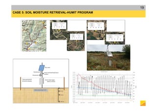
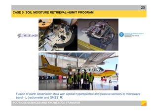
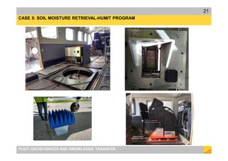
![CASE 5: SOIL MOISTURE RETRIEVAL-HUMIT PROGRAM
PCOT: GEOSCIENCES AND KNOWLEDGE TRANSFER
10
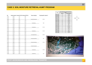
MIN MAX MIN MAX
1 1,95 1,95 0,16 1,14
5 1,95 1,95 0,43 2,29
10 2,31 4,71 0,83 2,86
15 2,68 7,81 1,18 4,95
20 3,54 10,63 1,79 6,67
25 3,54 13,28 2,08 8,19
30 4,76 16,21 2,45 10,3
60 7,13 30,28 5,03 19,83
90 9,49 45,72 7,54 28,78
120 11,87 59,97 10,05 38,51
150 14,24 75,21 12,56 48,05
ESTIMACIONS PERCENTATGES COVERTURA TERRITORI: CATALUNYA (32108 Km
2
)
[%] / RESOLUCIÓ = 300 m -SENSOR GNSS_R
INCLINACIÓ 55 INCLINACIÓ 98SSO)
DURADA DE LA
SIMULACIÓ [dies]
INCLINACIÓ 55 INCLINACIÓ 98SSO)
1 14,77 8,47
5 14,77 16,95
10 35,76 21,18
15 59,24 36,69
20 80,68 49,40
25 100,79 60,66
30 123,02 76,25
60 229,77 146,83
90 346,92 213,17
120 455,08 285,18
150 570,72 355,84
ESTIMACIONS PERCENTATGES COVERTURA TERRITORI: CATALUNYA (32108Km
2
)
[%] / RESOLUCIÓ = 30 m - SENSOR ÒPTIC
DURADA DE LA
SIMULACIÓ [dies]](https://image.slidesharecdn.com/20171211earthobservationapplicationsenvironmental-171213125513/85/Earth-Observation-and-applications-on-environmental-studies-10-320.jpg)

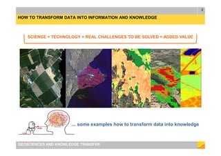
This document discusses using earth observation data and applications for environmental studies. It provides examples of how sensors like optical satellites, lidar, and aircraft collect geospatial data. The data is then processed and analyzed to extract information and knowledge about environmental issues like forest decline monitoring, agriculture and soil fertility mapping, climate change impacts, and soil moisture retrieval. Case studies are presented on using satellite data to study these topics in Catalonia.