This document provides information about Medan Pasar in Kuala Lumpur, Malaysia. It describes the author's experiences visiting and observing Medan Pasar, including taking photos of the clock tower and exploring the Central Market building. The document then delves into various aspects of Medan Pasar through sections on the 5 senses, tangible and intangible characteristics, business activity, transportation links, public facilities, and the history of landmarks like the Central Market and Jamek Mosque. In total, the document analyzes Medan Pasar from multiple perspectives to provide a comprehensive overview of the area.
Central Market, Geo Hotel, and the LRT/Bus Station were the three focus areas analyzed. Central Market is a historic area with shops selling Malaysian handicrafts. It sees many local and tourist visitors on weekends. The Geo Hotel area has many vehicles and transportation options passing by daily. The LRT/Bus Station area sees a large concentration of people transferring between different transportation modes. It connects to the KTM station via a skybridge. Both transportation hub areas experience noise and smell pollution from nearby construction, drainage, and vehicles.
Petaling Street in Kuala Lumpur maintains its traditional atmosphere, particularly at night when vendors display their goods along the street. Locals flock there primarily for bargain accessories and Chinese food from restaurants that have been in business for generations. While shopping and food are draws, the true allure is wandering through the sights, sounds and energy of the bustling night market.
Mapping the Townscape (Petaling Street & Central Market) Presentation Slidesdouglasloon
Taylor's University Lakeside Campus
School of Architecture, Building & Design
Bachelor of Science (Hons) in Architecture
Tales of Three Cities (ARC 3113)
Site Analysis - Johor Bahru City CentreCarmenChan106
This document provides an analysis of an urban site in Johor Bahru, Malaysia. It begins with a historical overview of the development of Johor Bahru's urban morphology from the 1800s to present day. Next, it examines the site's surrounding context, including its mix of land uses, urban grain, and prominent user groups throughout the day. It then analyzes the site's requirements and constraints. Finally, it evaluates the site's accessibility and vehicular patterns during morning, afternoon and evening periods. In summary, the document performs a comprehensive macro and micro analysis of the urban and transportation conditions relating to the site.
The document provides a history of the development of Johor Bahru from its origins as a fishing village called Tanjung Puteri in the 1800s. It discusses the key nodes, buildings, and people involved in Johor Bahru's growth over different time periods from 1855-1885, 1900-1920, 1920-1940, 1940-1980, 1980-1991, 2000-onwards. The site itself originated as a trading port that brought together people from different cultures. The document outlines the vehicular and pedestrian circulation patterns, edges, zones, landmarks, and nodes within the area surrounding site B in Johor Bahru.
The document provides an overview of the history and development of Johor Bahru, Malaysia from the 1830s to present. It describes how the Chinese first settled along the Segget River in the 1830s and established communities along Jalan Trus for trading. It then discusses the various phases of development in Johor Bahru from the early 1900s through the 1980s as more ethnic groups migrated there and the urban landscape transformed. This included the expansion of infrastructure like roads, markets and transportation networks to accommodate the growing population diversity and density over time.
This document provides a history of the development of Jalan Wong Ah Fook in Johor Bahru, Malaysia from 1855 to the present. It describes the early settlement of the area by Malay and Orang Laut people and how the area grew with the establishment of plantations, roads, and buildings in the early 20th century. It outlines the increasing urbanization of the area between 1920-1980 with the growth of commercial and public buildings. More recent developments from 1980-present include new business centers, facilities, and transport links. The document also discusses the changing urban morphology and architecture along Jalan Wong Ah Fook, and the ongoing plans to transform Johor Bahru into a major international business district.
This document is a development proposal for a final project submitted by students Jiji Ng and Leong Li Jing. It proposes developing the vacant site along Jalan Yap Kwan Seng in Kuala Lumpur. Jiji Ng's proposal is for a mini theme park to entertain nearby employees and promote Malaysian culture. Leong Li Jing proposes a fitness recreation center and commercial block. The document provides background on the site and surrounding context, and outlines aspects of the proposed developments such as concept, layout, and roles of professions involved.
Village study GARLI, PRAGPUR -facilitiesbhavikagoyal2
This document provides a summary of the facilities and amenities in the villages of Garli and Pragpur in Himachal Pradesh, India. It details the key infrastructure for water supply, commerce, transportation, healthcare, education, and other amenities. The main water sources are the Beas River and local ponds. Facilities include banks, markets, bus stops, roads, temples, schools, hospitals, and veterinary clinics. The villages have well-established infrastructure to support residents dating back over 100 years to their founding.
The document analyzes the urban site of Kuala Lumpur through examining its history and morphology, districts, edges, land use, landmarks, and nodes. It traces Kuala Lumpur's evolution from a 19th century mining settlement to its current form as Malaysia's capital city. Key aspects of the urban fabric are discussed such as the traditional versus modernist urban form, different types of edges, and land use patterns across various districts. Notable landmarks and nodes that help define the identity and function of the area are also identified.
This document provides a comparative analysis of two streets - Jalan Tukang in Kajang, Malaysia and Samcheong Dong Gil in Seoul, Korea. It identifies five key contact points in each street and analyzes the activities, intensities, and social patterns observed at each point. Some main findings are: the bus stop in Samcheong Dong Gil sees higher intensities due to its location near government offices and popularity with tourists, while the narrow walkways in Jalan Tukang see lower intensities; the public space in Samcheong Dong Gil is more successful as a gathering point due to its size and amenities. Both streets feature unique architectural styles - shophouses in Jalan Tukang and hanok buildings in Samche
The Origami Bento project aims to introduce new food-related programs like sustainable food printing, food origami, and food design to enhance cultural and creative activities at the KLCCD site. Currently, the site lacks diversity of activities and has lost many of its traditional economic functions. The project will provide both daily necessities like food as well as art and craft experiences. A new building is proposed with spaces for workshops, exhibitions, and performances to support the new food+art programs and attract more visitors to the site.
This document provides a comparative analysis of Shinjuku's Omoide Yokocho in Tokyo, Japan and Jalan Hang Kasturi in Kuala Lumpur, Malaysia. It examines the urban landscapes, response to tropical climate, economy and streetscapes, and urban culture and society of the two areas. The analysis finds that while the urban landscapes differ between the developed and developing cities, activities in both areas are influenced by the physical environment and climate. Omoide Yokocho features narrow alleyways lined with food stalls, while Jalan Hang Kasturi includes a covered market area and segments with varying commercial intensity. Both areas provide shade structures in response to their climates.
The document compares two streets - Jalan Besar in Klang, Malaysia and Queen's Road in Hong Kong - by analyzing their contact points, intensities of activity, and how physical characteristics influence social interactions. Both streets experience tropical weather and have food establishments as major contact points. However, Jalan Besar utilizes its walkways more for commercial activities like vendors, while Queen's Road prioritizes pedestrian flow. Additionally, Jalan Besar sees most activity from morning to evening while Queen's Road remains busy into the night. Overall, the physical environment and amenities of each street shape the types and intensities of activities between their buildings.
This document provides information about Ranganathan Street in Chennai, India. It describes the history and location of the street, which has been a major commercial area since the 1920s. The street is home to many small shops and vendors selling goods like clothing, jewelry, produce, and electronics. It is very crowded throughout the year, but especially during festivals like Deepavali. The document includes maps and diagrams showing land use, building heights, connectivity, street cross-sections, and more. It also discusses issues like lack of parking, sidewalk encroachment, and improper infrastructure that contribute to the street's congestion.
Theories of Architecture & Urbanism - Project 2: Comparative Essay Ryan Kerry Jy
This document compares two streets - Nguyen Hue Pedestrian Street in Ho Chi Minh City, Vietnam and Jalan Tuanku Abdul Rahman in Kuala Lumpur, Malaysia. It analyzes the social activities and contact points on each street based on Jahn Gehl's framework of necessary, optional, and social activities. On Nguyen Hue Street, various cultural attractions and a night market generate many social interactions. Focal contact points with high intensities of activities include a school and its adjacent market. In contrast, Jalan T.A.R. has fewer activities that mainly appeal to Malays and Indians, and its location away from major areas results in less bustling social activity compared to
The document provides an architectural design report for a project in Kuala Lumpur, Malaysia. It includes analysis of the site and surrounding area, identifying issues such as a lack of diversity of activities, loss of traditional economic functions, and negative perceptions of safety. The aim of the project is to introduce new programs centered around food, art, and craft to enhance the cultural and economic aspects of the site and attract more visitors. The document discusses relevant urban design theories and precedents to address the issues and revitalize the area as a creative and cultural district.
The document discusses the urban morphology and street typology of three historic cities in Malacca, Malaysia - St. Paul's Civic Zone, Jonker Street, and Harmony Street. It describes the different land uses, building types, and religious structures that characterized each area. Notably, St. Paul's Civic Zone contained governing buildings and the Portuguese fortress, Jonker Street was a commercial area for wealthy families, and Harmony Street had craftsman shops and religiously diverse buildings. The document uses these three streets to analyze patterns of urban development, land use, movement, and the public/private realms in a historically significant Southeast Asian city.
Tropical Cities: George Town, Penang Presentation Slidesdouglasloon
Taylor's University Lakeside Campus
School of Architecture, Building & Design
Bachelor of Science (Hons) in Architecture
Tales of Three Cities (ARC 3113)
The document describes the morphological changes to a city area over time based on historical documents:
- In 1889, buildings and transportation were built along the river as the mining industry developed in a linear pattern.
- By 1895, the population had increased, leading to more infrastructure like denser buildings along railway lines. The river separated administrative and commercial areas.
- Rapid development in 1962 increased urban density and narrowed parts of the river, risking flash floods during heavy rain.
- From 2016 onward, pockets of space started developing between old shophouses being demolished for new construction projects.
RETHINKING & REDESIGN OF KARWAN BAZAR,BANGLADESHshadiaafrin1
The document proposes rethinking and redesigning Karwan Bazar in Dhaka, Bangladesh. It identifies problems with the current area such as lack of green space, recreational areas, and traffic issues. The proposal envisions transforming Karwan Bazar into a mixed-use development with green spaces, recreational facilities, offices, residential buildings, and a relocated wholesale market. It aims to improve connectivity, create public gathering spaces, and meet the needs of the surrounding communities. Concept sketches and case studies of similar developments are presented to illustrate the vision.
The document provides a comparative analysis of two public spaces - Sisavangvong Road in Luang Prabang, Laos and Jalan Besar in Klang, Malaysia. It analyzes factors that contribute to successful public spaces, including contact points, types of activities, intensity levels, and transportation hubs. For Sisavangvong Road, there are five contact points that see a variety of necessary, optional, and social activities of high intensity. In contrast, Jalan Besar has fewer contact points and sees mostly necessary local activities of lower intensity conducted within buildings.
Comparative Essay between South Klang and Braga StreetJordanTok
This comparative essay analyzes two streets - Jalan Stesen 1 in Klang, Malaysia and Braga Street in Bandung, Indonesia. It identifies five key contact points on each street: identity of site, eatery, commercial zone, vendor stalls, and walkability. For each contact point, the essay compares the specific elements and analyzes the contact intensity and types of activities they generate based on theories of public life by Jan Gehl. Overall, it finds that while both streets are active social spaces, Braga Street emphasizes pedestrian friendliness and unique architecture more to create a pleasant walking experience, whereas Jalan Stesen 1 focuses more on necessary activities like shopping and eating.
The document provides background information and a comparative analysis of two streets - Sisavangvong Road in Luang Prabang, Laos and Jalan Sulaiman in Kajang, Malaysia. It identifies key contact points along each street where social activities occur. Eateries are analyzed as important contact points on both streets, with Medan Satay and KFC on Jalan Sulaiman enabling close seating and passive social engagement. The Luang Prabang Night Market is noted as having an even higher intensity of contact due to its narrow alley layout and mix of locals and tourists during evenings. The document examines how the spatial qualities and types of activities at different contact points influence the levels of social interaction and contact intensities.
Medan Pasar in Kuala Lumpur and Tung Chau Street in Hong Kong are analyzed and compared. Both are characterized by rows of shophouses serving commercial and residential functions. However, they differ in public spaces. Medan Pasar has a central public square while public areas in Tung Chau Street are under overpasses due to land constraints. Additionally, Medan Pasar now caters more to tourism while Tung Chau Street remains focused on industry. Contact between people also varies from passive interactions to chance encounters depending on the location within each site.
The document provides details about a proposed community library and café revitalization project in Kuala Lumpur, Malaysia. The project aims to draw more customers to the aging Coliseum Café by building an adjacent public library. The library is intended to serve as a community gathering space with facilities like a research center, meeting rooms, lounge, and mini auditorium. The project goals are to provide a comfortable space that encourages creative thinking and establishes a skilled workforce to support the library for years to come. The project's success will be measured by how many people use the library and café facilities and if it helps revive business at the Coliseum Café.
The document provides information about Medan Pasar and Central Market in Kuala Lumpur, Malaysia. It details the site area and dimensions of Medan Pasar, as well as the layout and buildings. It describes the history of Central Market, from its origins as a wet market in 1888 to its current use. It also outlines the different cultural zones within Central Market highlighting the different races in Malaysia. In addition, it discusses the art corridor and various business activities at Central Market. A SWOT analysis is also included, identifying strengths like its rich heritage, and weaknesses such as traffic congestion.
This document provides a historical timeline and context for the junction of Jalan Ampang and Jalan Tun Razak in Kuala Lumpur, Malaysia. It outlines the macro and micro history of the area from the 1850s to present day, including key events, development milestones, and changes in architectural style over time. The document also includes maps and diagrams showing land use zoning, daily activity patterns at different nodes in the area, transportation routes, and shadow casting patterns at different times of day.
Theories of Architecture and Urbanism - Comparative Essay ft. Medan Pasar, KL...Nekumi Kida
Medan Pasar in Kuala Lumpur and Pasar Baru in Jakarta are two historic markets that serve as public spaces influencing socio-economic and cultural activities. Medan Pasar has an open square that locals, migrants, and tourists use for gatherings, while Pasar Baru's dense streets are used mainly by locals. Both spaces feature contact points like intersections that facilitate chance, close, and passive social interactions. The public spaces shape the communities that identify with each location.
This document outlines the design of a Culture and Innovation Centre in Muar, Malaysia. It begins with an introduction to the project and site context, including the aims to establish a public activity center, showcase Muar's culture, and create a new landmark. Site analyses identify strengths like river breezes and walkability, as well as weaknesses like lack of accessibility. The design is influenced by precedent studies of a cultural center in Indonesia and focuses on celebrating Muar's tradition of Kuda Kepang horse puppetry. Spatial layouts are presented for the proposed programs and facilities. Environmental considerations include shading overhangs and green buffers.
The document provides details about a proposed design project for the Malaysia Food Cultural Centre located on Jalan P. Ramlee in Kuala Lumpur. The centre aims to preserve, research, promote and distribute both traditional and modern Malaysian food culture. It will include facilities such as a festival hall, incubator kitchen, wholefood market and food library. The centre seeks to educate people about Malaysian food culture and support local food businesses. It aims to be a place that brings different user groups together and celebrates the unique food culture of the area.
This document provides information about Bukit Bintang, a shopping and entertainment district in Kuala Lumpur, Malaysia. It discusses the history and location of Bukit Bintang, describes several major landmarks and shopping districts in the area like Lot 10, Starhill Gallery, and Plaza Low Yat. It also analyzes the zoning, transportation, public facilities, and traffic patterns of Bukit Bintang. In addition, the document performs a SWOT analysis and discusses how the student went beyond their comfort zone to fully explore and understand the area.
This document provides background information on Nehru Bazar Road in Jaipur, India and Jalan Besar in Klang, Malaysia to enable a comparative analysis. It describes the urban landscapes, response to tropical climate, and street activities in both areas. For Nehru Bazar Road, it notes the main road and smaller side streets that branch out, forming distinct districts. For Jalan Besar, it observes adjacent major roads and shorter back alleys. Both areas utilize five-foot walkways alongside buildings for pedestrian shelter from heat and rain. Temporary stalls in Nehru Bazar are also located under building shades or umbrellas. The document lays the groundwork for comparing social patterns and contact intensities between
This document provides a comparative analysis of Jalan TAR in Kuala Lumpur, Malaysia and Petchaburi Road in Bangkok, Thailand. It analyzes the history, activities, spatial experiences, and contact points of both roads. For both roads, necessary activities include walking for transportation and shopping. Optional activities include leisure walking and eating. Social activities are focused around public spaces near malls. While both roads provide shaded walking and social gathering, Jalan TAR has more public seating and alleys connecting to it.
This document provides details about a proposed development project for an empty plot of land in Desa Park City, Kuala Lumpur. It includes an introduction to the site, observations about the microclimate and views. It also describes two development proposals - a shopping mall by Renee Teoh and an agricultural area by Rebecca Marie Tanduba. The document lists the professionals that would be required for the shopping mall proposal, including architects, engineers, contractors and more. It provides rationales for the proposals and discusses their potential advantages and disadvantages.
THEORIES OF ARCHITECTURE AND URBANISM PART BJ-Sern Phua
Klang's Little India in Malaysia is situated along Jalan Tengku Kelana near the prominent Klang River. It began in the 19th century as a business area for Indian money lenders and textile exporters and has since grown exponentially. The area is now dominated by Indian culture as evidenced by the saris, jewelry, textiles, and cuisine found throughout. Key landmarks include the Masjid India Klang mosque, the Lax Boutique Hotel, and the old Klang KTM train station. Applying Kevin Lynch's theories of the image of the city, the document analyzes Klang's Little India and identifies its paths, edges, districts, nodes, and landmarks based on a site visit by the
Seksyen 3 in Petaling Jaya, Malaysia is analyzed using Kevin Lynch's cognitive mapping framework. The area contains distinct districts like residential, commercial, religious and educational. Major roads form strong edges around the triangular shaped area. Prominent landmarks like mosques and tall buildings aid navigation. Key paths connect districts and landmarks, with wider primary routes and narrower secondary streets. Intersections between paths serve as important nodes gathering people. Analyzing the area's paths, edges, districts, nodes and landmarks provides insights for improving urban design and navigation.
The document discusses the student's concept exploration for an architecture project on people and spaces. The student initially chose the theme of "congestion" focusing on a busy shopping area, but was advised by their tutor to change the theme to "Bazaar" to better represent their photos of Lorong Tuanku Abdul Rahman in Kuala Lumpur. Over multiple visits totalling 12 hours, the student documented the indoor and outdoor markets through photos and researched the area's history as a cultural center with different ethnic groups coexisting in a limited space. The packaging for the project was designed to highlight the Malaysian culture and heritage uncovered in the hidden bazaar.
This report analyzes and compares two cendol stalls located in different areas - Cendol & Rojak Bandar Bukit Tinggi in Klang and Teo Chew Cendol in Penang. Both businesses started in the early 2000s and have grown popular for their secret recipes and selling up to 500 bowls per day. While Cendol & Rojak Bandar Bukit Tinggi remains small with one location, Teo Chew Cendol has expanded significantly with 14 franchises across Malaysia. The businesses face competition from other cendol stalls but strive to stand out through factors like taste, price and strategic locations.
This document is the final project management report for a proposed art center and city lobby in Johor Bahru, Malaysia. It includes sections on the project introduction and background, site analysis, design considerations, organization structure, stakeholders, objectives, and work breakdown structure. The key details are:
- The project aims to create a central hub for art in Johor Bahru to preserve and teach modern and traditional Malaysian art, and help local artists gain exposure.
- The site is located in central Johor Bahru near the waterfront and surrounded by shops and buildings. A SWOT analysis and PESTLE analysis are included.
- The design considerations from the client focus on accessibility, aesthetics, security,
This report analyzes and compares two cendol stalls located in different areas - Cendol & Rojak Bandar Bukit Tinggi in Klang and Teo Chew Cendol in Penang. Both businesses have been operating for many years and specialize in homemade cendol, selling up to 500 bowls per day. While they face competition from other stalls, they each employ different strategies like unique recipes, locations, and expansion to multiple branches to stay successful in their markets.
This document describes a research project comparing two cendol stalls located in different areas - one in Klang and one in Penang, Malaysia. A group of students analyzed aspects of the businesses like their history, products offered, number of employees, competition in the area, and strategies for competing. Both stalls have been in business for many years and face competition from other cendol vendors. They strive to maintain quality and unique recipes while keeping prices low and service fast to attract customers. The students found many similarities between the businesses but also some differences in their locations, operating hours, and expansion plans.
This report analyzes and compares two cendol stalls located in different areas - Cendol & Rojak Bandar Bukit Tinggi in Klang and Teo Chew Cendol in Penang. Both businesses have been operating for many years and specialize in homemade cendol, selling hundreds of bowls per day. While they face competition from other stalls, they each employ different strategies like unique recipes, locations, and expansion to multiple branches to stay successful in their markets.
Similar to 'Exploring the Built Environment' Booklet (20)
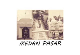
Beyond the Basics of A/B Tests: Highly Innovative Experimentation Tactics You...Aggregage
This webinar will explore cutting-edge, less familiar but powerful experimentation methodologies which address well-known limitations of standard A/B Testing. Designed for data and product leaders, this session aims to inspire the embrace of innovative approaches and provide insights into the frontiers of experimentation!
The Building Blocks of QuestDB, a Time Series Databasejavier ramirez
Talk Delivered at Valencia Codes Meetup 2024-06.
Traditionally, databases have treated timestamps just as another data type. However, when performing real-time analytics, timestamps should be first class citizens and we need rich time semantics to get the most out of our data. We also need to deal with ever growing datasets while keeping performant, which is as fun as it sounds.
It is no wonder time-series databases are now more popular than ever before. Join me in this session to learn about the internal architecture and building blocks of QuestDB, an open source time-series database designed for speed. We will also review a history of some of the changes we have gone over the past two years to deal with late and unordered data, non-blocking writes, read-replicas, or faster batch ingestion.
End-to-end pipeline agility - Berlin Buzzwords 2024Lars Albertsson
We describe how we achieve high change agility in data engineering by eliminating the fear of breaking downstream data pipelines through end-to-end pipeline testing, and by using schema metaprogramming to safely eliminate boilerplate involved in changes that affect whole pipelines.
A quick poll on agility in changing pipelines from end to end indicated a huge span in capabilities. For the question "How long time does it take for all downstream pipelines to be adapted to an upstream change," the median response was 6 months, but some respondents could do it in less than a day. When quantitative data engineering differences between the best and worst are measured, the span is often 100x-1000x, sometimes even more.
A long time ago, we suffered at Spotify from fear of changing pipelines due to not knowing what the impact might be downstream. We made plans for a technical solution to test pipelines end-to-end to mitigate that fear, but the effort failed for cultural reasons. We eventually solved this challenge, but in a different context. In this presentation we will describe how we test full pipelines effectively by manipulating workflow orchestration, which enables us to make changes in pipelines without fear of breaking downstream.
Making schema changes that affect many jobs also involves a lot of toil and boilerplate. Using schema-on-read mitigates some of it, but has drawbacks since it makes it more difficult to detect errors early. We will describe how we have rejected this tradeoff by applying schema metaprogramming, eliminating boilerplate but keeping the protection of static typing, thereby further improving agility to quickly modify data pipelines without fear.
06-04-2024 - NYC Tech Week - Discussion on Vector Databases, Unstructured Data and AI
Round table discussion of vector databases, unstructured data, ai, big data, real-time, robots and Milvus.
A lively discussion with NJ Gen AI Meetup Lead, Prasad and Procure.FYI's Co-Found
ViewShift: Hassle-free Dynamic Policy Enforcement for Every Data LakeWalaa Eldin Moustafa
Dynamic policy enforcement is becoming an increasingly important topic in today’s world where data privacy and compliance is a top priority for companies, individuals, and regulators alike. In these slides, we discuss how LinkedIn implements a powerful dynamic policy enforcement engine, called ViewShift, and integrates it within its data lake. We show the query engine architecture and how catalog implementations can automatically route table resolutions to compliance-enforcing SQL views. Such views have a set of very interesting properties: (1) They are auto-generated from declarative data annotations. (2) They respect user-level consent and preferences (3) They are context-aware, encoding a different set of transformations for different use cases (4) They are portable; while the SQL logic is only implemented in one SQL dialect, it is accessible in all engines.
#SQL #Views #Privacy #Compliance #DataLake
The Ipsos - AI - Monitor 2024 Report.pdfSocial Samosa
According to Ipsos AI Monitor's 2024 report, 65% Indians said that products and services using AI have profoundly changed their daily life in the past 3-5 years.
3. No. Topic Page
01 About Me 4
A. INTRODUCTION 5
02 Kuala Lumpur 6
03 Medan Pasar 7
B.1 MEDAN PASAR / CENTRAL MARKET /
JAMEK MOSQUE
8
04 5 Senses Experience 9
05 Tangible + Intangible 18
B.2 MORE INTO CENTRAL MARKET //
MEDAN PASAR // JAMEK MOSQUE
20
06 Business Activity 21
07 Building Types 22
08 Public Facilities 23
09 Transportation Links + Services 24
10 Characteristics of Overall Area 25
3
No. Topic Page
11 Public + Social Activities 26
12 History + Origin 27
C. BUILDING EXPLORATION: CENTRAL
MARKET
28
13 Information 29
14 Location 30
15 Plan + Spaces 31
16 Function + Activity 32
D. CONCLUSION 33
17 SWOT Analysis of Medan Pasar 34
18 Summary of Medan Pasar 35
19 References list 36
AHMAD QHALIS AHMAD MUKHLAS| 0326552 | FNBE January 2016
CONTENT
4. The aim of Project Two is for the students to plan and propose a
better town applying the basic knowledge that has been
delivered through lectures and through their investigation. For
the first part students are required to investigate and observe
an existing town as a case study and prepare a boolet about
that particular town. In the second part students are required
to proposed a new town and make the physical model and
prepare presentation boards about a new town.
Our site is Medan Pasar, Kuala Lumpur.
What I did there was taking pictures of the majestic designed
building alongside the clock tower located in the middle of the
area. We also went to the Central Market as it is the building
that we had for research purposes. Besides that, I did some
sketches on the heavy traffic road, to come up with this
amazing Medan Pasar booklet. //
4AHMAD QHALIS AHMAD MUKHLAS| 0326552 | FNBE January 2016
Hai, my name is Ahmad Qhalis bin
Ahmad Mukhlas. My favorite subject is
well, of course Elements in Natural and
Built Design. My student ID is 0326552.
My lecturers are Ms. Delliya Zain, Ms. Iffa
Nayan and Mr. Paul.
ABOUT ME
7. #medanpasar
7
We get to make the site analysis for this place and it is a
great activity to travel here and do the projects with the
teammates. We went there for about 3 times.
In the center stands an art deco clock tower that was built
back then in 1937 to commemorate the coronation of King
George VI.
AHMAD QHALIS AHMAD MUKHLAS| 0326552 | FNBE January 2016
10. 10AHMAD QHALIS AHMAD MUKHLAS| 0326552 | FNBE January 2016
See
What I noticed when I was in
Medan Pasar is that there are a lot
of foreigners who were seated
around the center and edges
while looking at passing civilians.
Sometimes there are motor bikers
passing because they use Medan
Pasar as a shortcut from the
junction of Lebuh Pasar Besar to
Jalan Tun Tan Siew Sin or vice
versa.
In addition, I can see a lot of high-
rise buildings around the Medan
Pasar.
There are also elements of
greenery (row of trees; 12 on
right side, 15 on the left side) in
Medan Pasar.
At night the lighting around the
clock tower is beautiful and can
set a person bad mood to a good
one. Red colored LED lights
mounted around the clock tower.
Most importantly what can be
seen is the work of the architect in
colonial times applied to the
buildings in the Medan Pasar.
Medan Pasar
11. 11
What can be seen when I was at Central
Market is the diversity of arts and
crafts that are sold in stalls in the
building. In additions, there are also
art, kebaya, songket, batik and souvenir
authentic Malaysia sold there.
Outside of the building, there are many
foreigners who wander around. While
inside of the building there are many
tourists or what we Malays call them
Mat Salleh.
The variety types of unique lampposts
also attract tourists there
In the Jamek Mosque, there’s a lot
of beautiful design based on
Islamic culture.
Central Market Jamek Mosque
12. 12AHMAD QHALIS AHMAD MUKHLAS| 0326552 | FNBE January 2016
HEAR
Sounds of buses engine can be
heard clearly in Leboh Pasar Besar
and Jalan Tun Tan Siew Sin. The
bus driver assistant voice can also
be heard when they shouted to
the public to board their bus.
At Lebuh Pasar Besar and Jalan
Tun Tan Siew Sin often there are
traffic jams involving buses, taxis,
cars and even motorcycles.
Therefore, sound of honking and
engine noise also make the place
noisy rumble.
If you sit on the bench provided at
the left and right of the Market
Square, you can listen to songs in
foreign languages that are played
in restaurant on the sides.
Azan and also the words of the
Quran echoed if it is time for
prayer for the Muslim. At night
there is a recital of the Quran that
can be heard by everyone in the
area. The sound source is from
the famous mosque, Masjid
Jamek.
Medan Pasar
13. 13
At night, the atmosphere at
Central Market stark
contrast when compared to
the morning. The
difference that can be seen
are fewer visitors but the
store remained open. This
results in the quietness
during night time.
As we know, the highway around Majid
Jamek very busy and this had resulted
in the area polluted with the sound of
vehicle engine rumbling.
Near Majid Jamek, there is a train
station that is called Masjid Jamek
Station. Every time the train stop, you
can hear the sound of its tires rubbing
against the track and also the bustle of
passengers who disembark at the
station.
Central Market Jamek Mosque
14. 14AHMAD QHALIS AHMAD MUKHLAS| 0326552 | FNBE January 2016
FEEL
When I walk around the Medan
Pasar, I noticed that I felt calm
and relaxed. The atmosphere in
there makes me feel as if I were in
a busy village with many vehicles.
It will feel comfortably cold if it
had just experienced a heavy rain.
Although rain had just off, the
people would come here and
enjoy the charming atmosphere.
In the sweltering heat, the
atmosphere at the Market Square
would make you feel like you are
in the middle of a market packed
with people. Vehicles that emit
carbon dioxide added to the
feeling that heat.
If you are a citizen of Malaysia,
the first thing you think is that
you will feel like you are a tourist
who was in another country. This
is because there are too many
foreigners loungers scattered
everywhere.
Medan Pasar
15. 15
You will feel cool when strolling in
Central Market at night. Besides that,
you’ll feel very relaxed.
Dim lighting set also makes us feel
comfortable. It certainly feels like you
are in the hotel lobby where the
lighting is appropriate to the client's
mood.
You will feel uncomfortable when being
in this busy place. This is because it is
busy with civilians who travels there. In
addition, there are also people who go
to work by foot uses that road as their
main pathway to their workplace.
You will also feel shortness of breath or
probability may be suffering from
asthma caused by the dirty air
exhausted by the vehicles.
Central Market Jamek Mosque
16. 16AHMAD QHALIS AHMAD MUKHLAS| 0326552 | FNBE January 2016
smell
If you stand close to the clock
tower, you can breathe in fresh air
because there are plants in the
division.
We also can smell the food
cooked in the restaurant located
in a row of shops on the right side
of the Market Square.
Other than that we also smell the
smoke of vehicles around Market
Street and Jalan Tun Tan Siew Sin.
Medan Pasar
17. 17AHMAD QHALIS AHMAD MUKHLAS| 0326552 | FNBE January 2016
TASTE
What can be eaten in this area is a
mamak shop that sells roti canai,
nasi briyani and nasi lemak. All
these foods are foods commonly
enjoyed by Malaysians.
There is also a van stall selling
mineral water, burgers, coconut
water, orange juice and water
cans that varies in flavour.
Near the Medan Pasar there’s a
motorcycle stall selling a variety of
fruit cut into small pieces and put
in a plastic package. Among the
fruits sold are watermelon, papaya
and many more.
Medan Pasar
19. 19AHMAD QHALIS AHMAD MUKHLAS| 0326552 | FNBE January 2016
Beautiful work done by colonial
time’s architect successfully
makes our jaw drop.
There were foreigner’s
everywhere and most of them
were Nepalese.
Majority of the buildings there
were commercial types while
there were several hotels and
offices too.
There’s a lot of tourists there
along with locals (which travels
there).
The temperature changes from morning to night
could drop miraculously. In the morning it’s
scorching hot while in the night it’s breezily
relaxing.
We felt insecure due to the
majority of foreigner’s and
Nepalese instead of Malaysian.
Busy roads, heavy
traffics, busy people,
noisy environment.
TANGIBLE
INTANGIBL
E
21. 21AHMAD QHALIS AHMAD MUKHLAS| 0326552 | FNBE January 2016
left side
right side
from left - money changer / pharmacy / hotel / hotel / restaurant / college / unidentified / wholesale general merchandise store /
telecommunications equipment shop / fashion clothing boutique / money changer
from left – café / money changer / bank / BM & sons group /
restaurant (top), restaurant (LG) / college / money changer / bank
BUSINESS ACTIVITY
22. 22AHMAD QHALIS AHMAD MUKHLAS| 0326552 | FNBE January 2016
BUILDING TYPES
left side
right side
from left - money changer (commercial) / pharmacy (commercial) / hotel (commercial) / hotel (commercial) / restaurant (commercial) /
college (educational) / unidentified / wholesale general merchandise store (commercial) /
telecommunications equipment shop (commercial) / fashion clothing boutique (commercial) / money changer (commercial)
from left – café (commercial) / money changer (commercial) / bank (social business) / BM & sons group (commercial) /
restaurant (commercial) / restaurant (commercial) / college (educational) /
money changer (commercial) / bank (social business)
23. 23AHMAD QHALIS AHMAD MUKHLAS| 0326552 | FNBE January 2016
PUBLIC FACILITIES
fire hydrant
bench
dustbinsewer
water service
big rubbish bin
clock tower
MEDAN PASAR
24. TRANSPORTATION LINKS &
SERVICE
24AHMAD QHALIS AHMAD MUKHLAS| 0326552 | FNBE January 2016
MASJID JAMEK STATION-
It is the nearest LRT (light rapid transit), It
is the interchange station between two of
Rapid KL's light rail transit lines, namely
the Ampang Line, Sri Petaling Line and the
Kelana Jaya Line.
The rail is located in between Klang River
and Jalan Benteng until it intersects Jalan
Tun Perak.
BUS STATION-
In front of RHB Jalan Tun H.S. Lee
Bus number - 26
Near Bangkok Bank in
Lebuh Pudu
Bus number – 41, 43
25. CHARECTERISTICS OF overall
AREA
25AHMAD QHALIS AHMAD MUKHLAS| 0326552 | FNBE January 2016
JAMEK MOSQUE-
This area had a religious type of
building which is the Jamek Mosque.
Unlike other places that had a big
mosque, this place is like a peaceful
area stranded in the middle of a
busy city.
MEDAN PASAR-
In this area therefore, it had a
characteristics of a big busy city
cramped into a small lane. With all the
foreigners and Nepalese, this place
seems to have the aura of an outside
country.
CENTRAL MARKET-
Meanwhile in this area, the big blue
historical building seems like a
normal shopping complex from the
outside but as you go inside you’ll be
amazed with all the handicraft
displayed and the face of all the
amazed tourists.
26. PUBLIC & SOCIAL ACTIVITIES
JALAN TUN PERAK, NEAR MASJID JAMEK-
This road sure is a busy road as there’s a lot
of activities going on there. Firstly, there’s a
lot of offices at that place and that results in
a lot of workers, either by walking or driving,
occupies the road and sidewalks. Secondly,
the train station boards and take people to
another places they chose. Thirdly, there are
shops, restaurants on either side of the road
which invites more people to go there.
Lastly, the mosque nearby brings in a lot of
Muslims to perform their prayers there.
AROUND THE CLOCK TOWER, MEDAN PASAR-
This area seems crowded due to the foreigners and
Nepalese that lives nearby. What makes this area have
that busy aura is because of the two roads on the north
and south side of the Medan Pasar lane. The busyness is
caused by the workers (which works in the office that
surrounds the Medan Pasar) and also the outrageous
numbers of bus that keeps boarding and taking
passengers at Medan Pasar. Furthermore, due to it’s
well-known factor which is the clock tower and the
shop houses on the side, there sure is a lot of tourists
having their vacation there.
AHMAD QHALIS AHMAD MUKHLAS| 0326552 | FNBE January 2016 26
27. 27AHMAD QHALIS AHMAD MUKHLAS| 0326552 | FNBE January 2016
HISTORY & ORIGIN
AHMAD QHALIS AHMAD MUKHLAS| 0326552 | FNBE January 2016
JAMEK MOSQUE ORIGIN-
The Sultan of Selangor, Sultan Sir Alaeddin Sulaiman
Shah officially opened the mosque in 1909, two years after
construction was completed. The mosque was built on the
first Malay burial ground in the city. Before the national
mosque, Masjid Negara, was opened in 1965, Masjid Jamek served
as Kuala Lumpur's main mosque. The architect was Arthur
Benison Hubback.
CENTRAL MARKET HISTORY + ORIGIN-
The original building was built in 1888 by the British in
colonial British Malaya. It was used as wet market for Kuala
Lumpur citizens and tin miners. The Wet Market was very
convenient to the early city dwellers because it was within the
vicinity of Klang bus stand, the hub of feeder bus service for Kuala
Lumpur and the train station. Further expansions were made in
1889, 1895, 1920 and 1921. By 1933, the expansions to the
warehouse made the market now in its present size, and cost
around $167,000. The intervention of the Malaysian Heritage
Society proved timely as they successfully petitioned against its
deconstruction and the site was declared as a 'Heritage Site'.
During construction of Dayabumi near Klang River banks in 1981,
the market was saved from demolition. In 1985, the market was
renovated into a vibrant and colourful new style, and has been
officially known as Pasar Budaya since April 1986.
MEDAN PASAR HISTORY-
Medan Pasar, or Market Square, was the capital's banking and
shopping hub in the 1920s. This area had been largely ignored
as the river confluence where the tin-miners and traders first
landed. The clock tower in the middle of Medan Pasar is
revolutionary in design for its time. It was built in 1937 in
commemoration of the coronation of King George IV, but the
original memorial plaques have been removed. The geometric
art form shows the influence of Cubism and Futurism. The
geometric sunburst motif on the doors at the bottom of the
clock tower is of especial interest, as it is more usually found
on windows and above archways than on clock towers.
29. INFO
29AHMAD QHALIS AHMAD MUKHLAS| 0326552 | FNBE January 2016
Located in the heart of Kuala Lumpur, a few
minutes away from Petaling Street, Central
Market is a famous landmark for Malaysian
culture and heritage.
The building was built in 1888 and
originally functioned as a wet market. It
has since been classified as a Heritage
Site.
Tourists flock to Central Market for its
variety of handicrafts, art, kebaya,
songket, batik and authentic Malaysian
souvenirs. A Batik Emporium houses well-
known designer labels, with the best
Malaysian-made batik items ranging from
clothes, shoes, bags to home furnishing.
The Central Market Outdoor Stage is
where visitors can catch colourful arts
and cultural events. During the country’s
main festivals, the area will be lit up in
theme, reflecting the multiracial diversity
of Malaysians.
The Annexe Gallery, located at the back of
Central Market, is a popular venue for
events such as film screenings, art
exhibitions and public discourses.
30. LOCATION
30AHMAD QHALIS AHMAD MUKHLAS| 0326552 | FNBE January 2016
Jalan Hang Kasturi, 50050 Kuala Lumpur,
Wilayah Persekutuan, Malaysia
31. PLAN & SPACES
31AHMAD QHALIS AHMAD MUKHLAS| 0326552 | FNBE January 2016
Mezzanine FloorGround Floor
At this level, most of the items for sale are small handicraft
goods such as keychains and many more. There's also
Lorong China, Lorong India and Lorong Melayu. Each lane
represents the cultural items for each culture specifically.
At this level, there are many eateries and batik boutique.
32. FUNCTION & ACTIVITIES
32AHMAD QHALIS AHMAD MUKHLAS| 0326552 | FNBE January 2016
The focus for the city’s artistic
community, inside the building is a
warren of boutiques, handicraft and
souvenir stalls with traders selling
local merchandise such as authentic
Malaysian batik prints and more.
Central Market functions is to expose
Malaysian’s culture to the tourist’s
and other cultures as well.
34. SWOT ANALYSIS
34AHMAD QHALIS AHMAD MUKHLAS| 0326552 | FNBE January 2016
Have a lot of shops. Dirty and spoiled.
Well known to people
outside of this country.
A lot of outsiders,
foreigners and Nepalese.
POSITIVE NEGATIVE
EXTERNALINTERNAL
35. SUMMARY
35AHMAD QHALIS AHMAD MUKHLAS| 0326552 | FNBE January 2016
All in all, Medan Pasar is a place that doesn’t really show the true
culture of Malaysia as there’s a lot of foreigners instead of our own
local people. But this seems to really contrast with Central Market.
Central Market really shows the true culture of Malaysia because they
include all three cultures, Malay, Chinese and Indian in their business.
Lastly, Masjid Jamek shows that Malaysia’s national religion which is
Islam can stand up in the middle of such of a busy place. //