This paper explores the use of mobile Electroencephalography (EEG) in the study of environmental
perception and the ways the perception of physical measurements of a space may affect individual
walking behaviour. The hypothesis of this study is that obtrusive and complex street environments
stretch the perception of walking time and distance. So far, the factor of an individual’s affective state
has not been taken into account in perceiving space. We propose the use of mobile EEG, a technology
that permits such insights, to augment the traditional arsenal of questionnaires and selfreported
measures of experience and mental representations of space.
The Street Tree Effect and Driver Safety
`
For more information, Please see websites below:
`
Organic Edible Schoolyards & Gardening with Children
http://scribd.com/doc/239851214
`
Double Food Production from your School Garden with Organic Tech
http://scribd.com/doc/239851079
`
Free School Gardening Art Posters
http://scribd.com/doc/239851159`
`
Increase Food Production with Companion Planting in your School Garden
http://scribd.com/doc/239851159
`
Healthy Foods Dramatically Improves Student Academic Success
http://scribd.com/doc/239851348
`
City Chickens for your Organic School Garden
http://scribd.com/doc/239850440
`
Simple Square Foot Gardening for Schools - Teacher Guide
http://scribd.com/doc/239851110
C3.04: Assessing the impact of observations on ocean forecasts and reanalyses...Blue Planet Symposium
Under GODAE OceanView the operational ocean modelling community has developed a suite of global ocean forecast, reanalysis and analysis systems. Each system has a critical dependence on ocean observations – routinely assimilating observations of in-situ temperature and salinity, and satellite sea-level anomaly and sea surface temperature. Under GODAE OceanView (GOV), the Observing System Evaluation Task Team (https://www.godae-oceanview.org/science/task-teams/observing-system-evaluation-tt-oseval-tt/) regularly coordinates analyses from the GOV community to demonstration the value and impact of ocean observations on different global and regional data-assimilating forecast and reanalysis systems. Highlights of the latest suite of demonstrations will be presented here. Results show that Argo data are critically important – the most critical for seasonal prediction, and as critical as satellite altimetry for eddy-resolving applications. Most systems show that TAO data are as important as Argo in the tropical Pacific, and that XBT data have an impact that is comparable to other data types in the vicinity of XBT transects. It is clear that no currently available data type is redundant. On the contrary, the components of the global ocean observing system complement each other remarkably well, providing sufficient information to monitor and forecast the global ocean.
National Highway Alignment from Namakkal to Erode Using GISIJERA Editor
The vision of the Highway Alignment is to increase the capacity, connectivity, efficiency and safety of the Highways System so as to enable balanced socioeconomic development of all sections of the people and all regions from NAMAKKAL to ERODE via and to reduce the traffic and travelling of the state. It is to establish shortest path for road network time in the roads which provide a better and comfortable base for updating the traffic and other related information in road administration. It is to identify the short route for the vehicles traveling from NAMAKKAL to ERODE and to reduce the time travel for the vehicles with possible paths or routes or places for laying eco-friendly highway. To optimize the route for the vehicles traveling from NAMAKKAL to ERODE using GIS with Network analysis tools. From this we can find the suitable route for peoples to carry out without any traffic disturbances and protecting the environment. It also took advantages of GIS capabilities that offer the ability to overlay maps, merge them, and perform spatial analysis on various layers of information in either two or three dimensions
IJRET : International Journal of Research in Engineering and Technology is an international peer reviewed, online journal published by eSAT Publishing House for the enhancement of research in various disciplines of Engineering and Technology. The aim and scope of the journal is to provide an academic medium and an important reference for the advancement and dissemination of research results that support high-level learning, teaching and research in the fields of Engineering and Technology. We bring together Scientists, Academician, Field Engineers, Scholars and Students of related fields of Engineering and Technology
Neural networks have gained a great deal of importance in the area of soft computing and are widely used in making predictions. The work presented in this paper is about the development of Artificial Neural Network (ANN) based models for the prediction of sugarcane yield in India. The ANN models have been experimented using different partitions of training patterns and different combinations of ANN parameters.
Experiments have also been conducted for different number of neurons in hidden layer and the algorithms for ANN training. For this work, data has been obtained from the website of Directorate of Economics and Statistics, Ministry of Agriculture, Government of India. In this work, the experiments have been conducted for 2160 different ANN models. The least Root Mean Square Error (RMSE) value that could be achieved on
test data was 4.03%. This has been achieved when the data was partitioned in such a way that there were 10% records in the test data, 10 neurons in hidden layer, learning rate was 0.001, the error goal was set to 0.01 and traincgb algorithm in MATLAB was used for ANN training.
International Journal of Engineering Research and Applications (IJERA) is an open access online peer reviewed international journal that publishes research and review articles in the fields of Computer Science, Neural Networks, Electrical Engineering, Software Engineering, Information Technology, Mechanical Engineering, Chemical Engineering, Plastic Engineering, Food Technology, Textile Engineering, Nano Technology & science, Power Electronics, Electronics & Communication Engineering, Computational mathematics, Image processing, Civil Engineering, Structural Engineering, Environmental Engineering, VLSI Testing & Low Power VLSI Design etc.
IJRET : International Journal of Research in Engineering and Technology is an international peer reviewed, online journal published by eSAT Publishing House for the enhancement of research in various disciplines of Engineering and Technology. The aim and scope of the journal is to provide an academic medium and an important reference for the advancement and dissemination of research results that support high-level learning, teaching and research in the fields of Engineering and Technology. We bring together Scientists, Academician, Field Engineers, Scholars and Students of related fields of Engineering and Technology.
A review of pedestrian group dynamics and methodologies in modelling pedestri...Premier Publishers
Observations conducted by researchers revealed that the group interaction within crowds is a common phenomenon and has great influence on pedestrian behaviour. However, most research currently undertaken by various researchers failed to consider the group dynamics when developing pedestrian flow models. This paper presented a critical review of pedestrian models that incorporates group behaviour. Models reviewed in this paper are mainly created by microscopic modelling approaches such as social force, cellular automata, and agent-based method. The purpose of this literature review is to improve the understanding of group dynamics among pedestrians and highlight the need for considering group dynamics when developing pedestrian simulation models.
Enhanced Enterprise Intelligence with your personal AI Data Copilot.pdfGetInData
Recently we have observed the rise of open-source Large Language Models (LLMs) that are community-driven or developed by the AI market leaders, such as Meta (Llama3), Databricks (DBRX) and Snowflake (Arctic). On the other hand, there is a growth in interest in specialized, carefully fine-tuned yet relatively small models that can efficiently assist programmers in day-to-day tasks. Finally, Retrieval-Augmented Generation (RAG) architectures have gained a lot of traction as the preferred approach for LLMs context and prompt augmentation for building conversational SQL data copilots, code copilots and chatbots.
In this presentation, we will show how we built upon these three concepts a robust Data Copilot that can help to democratize access to company data assets and boost performance of everyone working with data platforms.
Why do we need yet another (open-source ) Copilot?
How can we build one?
Architecture and evaluation
Adjusting primitives for graph : SHORT REPORT / NOTESSubhajit Sahu
Graph algorithms, like PageRank Compressed Sparse Row (CSR) is an adjacency-list based graph representation that is
Multiply with different modes (map)
1. Performance of sequential execution based vs OpenMP based vector multiply.
2. Comparing various launch configs for CUDA based vector multiply.
Sum with different storage types (reduce)
1. Performance of vector element sum using float vs bfloat16 as the storage type.
Sum with different modes (reduce)
1. Performance of sequential execution based vs OpenMP based vector element sum.
2. Performance of memcpy vs in-place based CUDA based vector element sum.
3. Comparing various launch configs for CUDA based vector element sum (memcpy).
4. Comparing various launch configs for CUDA based vector element sum (in-place).
Sum with in-place strategies of CUDA mode (reduce)
1. Comparing various launch configs for CUDA based vector element sum (in-place).
Chatty Kathy - UNC Bootcamp Final Project Presentation - Final Version - 5.23...John Andrews
SlideShare Description for "Chatty Kathy - UNC Bootcamp Final Project Presentation"
Title: Chatty Kathy: Enhancing Physical Activity Among Older Adults
Description:
Discover how Chatty Kathy, an innovative project developed at the UNC Bootcamp, aims to tackle the challenge of low physical activity among older adults. Our AI-driven solution uses peer interaction to boost and sustain exercise levels, significantly improving health outcomes. This presentation covers our problem statement, the rationale behind Chatty Kathy, synthetic data and persona creation, model performance metrics, a visual demonstration of the project, and potential future developments. Join us for an insightful Q&A session to explore the potential of this groundbreaking project.
Project Team: Jay Requarth, Jana Avery, John Andrews, Dr. Dick Davis II, Nee Buntoum, Nam Yeongjin & Mat Nicholas
Unleashing the Power of Data_ Choosing a Trusted Analytics Platform.pdfEnterprise Wired
In this guide, we'll explore the key considerations and features to look for when choosing a Trusted analytics platform that meets your organization's needs and delivers actionable intelligence you can trust.
Analysis insight about a Flyball dog competition team's performanceroli9797
Insight of my analysis about a Flyball dog competition team's last year performance. Find more: https://github.com/rolandnagy-ds/flyball_race_analysis/tree/main
Adjusting OpenMP PageRank : SHORT REPORT / NOTESSubhajit Sahu
For massive graphs that fit in RAM, but not in GPU memory, it is possible to take
advantage of a shared memory system with multiple CPUs, each with multiple cores, to
accelerate pagerank computation. If the NUMA architecture of the system is properly taken
into account with good vertex partitioning, the speedup can be significant. To take steps in
this direction, experiments are conducted to implement pagerank in OpenMP using two
different approaches, uniform and hybrid. The uniform approach runs all primitives required
for pagerank in OpenMP mode (with multiple threads). On the other hand, the hybrid
approach runs certain primitives in sequential mode (i.e., sumAt, multiply).
06-04-2024 - NYC Tech Week - Discussion on Vector Databases, Unstructured Data and AI
Round table discussion of vector databases, unstructured data, ai, big data, real-time, robots and Milvus.
A lively discussion with NJ Gen AI Meetup Lead, Prasad and Procure.FYI's Co-Found
The affect of service quality and online reviews on customer loyalty in the E...
Exploring distance perception in urban environments with mobile Electroencephalography
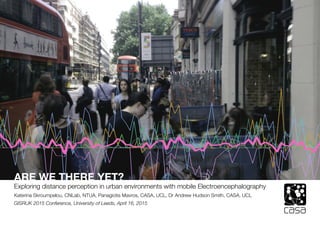
1. 0.0 Presentation Outline
ARE WE THERE YET?
Exploring distance perception in urban environments with mobile Electroencephalography
Katerina Skroumpelou, CNLab, NTUA, Panagiotis Mavros, CASA, UCL, Dr Andrew Hudson Smith, CASA, UCL
GISRUK 2015 Conference, University of Leeds, April 16, 2015
2. ARE WE THERE YET _ DISTANCE PERCEPTION AND ELECTROENCEPHALOGRAPHY | SKROUMPELOU _ MAVROS _ HUDSON-SMITH | GISRUK 2015
slide 2 of 31
0.0 Presentation Outline
1. Introduction _ Hypothesis and Intentions
2. Background _ Distance Perception and Urban Mobility
3. Methods _ The use of Electroencephalography (EEG) in a field experiment
4. Results _ What the affective state of individual walkers suggests
5. Discussion _ Possible use and application of the results
6. References and Bibliography
7. Q&A
3. ARE WE THERE YET _ DISTANCE PERCEPTION AND ELECTROENCEPHALOGRAPHY | SKROUMPELOU _ MAVROS _ HUDSON-SMITH | GISRUK 2015
slide 3 of 31
1.1 Introduction & Hypothesis
Individual perceptions of the environment vary
These perceptions affect the way we travel in the city
Architects and planners should take into account different factors that affect
perceptions of the environment to produce better spaces
therefore
4. ARE WE THERE YET _ DISTANCE PERCEPTION AND ELECTROENCEPHALOGRAPHY | SKROUMPELOU _ MAVROS _ HUDSON-SMITH | GISRUK 2015
slide 4 of 31
1.2 Questions
people perceive physical measurements differently
(Tolman, 1948, Pequet, 2002)
a number of parameters affect distance perception
(Montello, 1997).
“[distance] is used to evaluate costs of traveling from one place to another, and it helps
us utilize resources efficiently (time, money, food).” (Montello, 1997)
does the built environment affect the emotional (affective) state of individuals?
does the affective state of individuals affect distance perception?
5. ARE WE THERE YET _ DISTANCE PERCEPTION AND ELECTROENCEPHALOGRAPHY | SKROUMPELOU _ MAVROS _ HUDSON-SMITH | GISRUK 2015
slide 5 of 31
1.3 Intentions
understand how much the build environment affects emotions
explore to what extend emotions affect the perception of distance
and route length
test how the differences of these perception affect
route/trip planning
discuss the potential of this kind of research on urban planning tactics
6. ARE WE THERE YET _ DISTANCE PERCEPTION AND ELECTROENCEPHALOGRAPHY | SKROUMPELOU _ MAVROS _ HUDSON-SMITH | GISRUK 2015
slide 6 of 31
2.1 INdividual Perceptions of Environment
environmental distance and vista space
(Montello, 1997)
different individuals have different experiences of the same space
perception-driven design by
ancient Greek architects
using Entasis on the columns
(a slight curve as the diameter
is decreased from the bottom
upwards), they allow the visual
effect to make the temple ap-
pear more symmetrical than it
actually is
architectural example
7. ARE WE THERE YET _ DISTANCE PERCEPTION AND ELECTROENCEPHALOGRAPHY | SKROUMPELOU _ MAVROS _ HUDSON-SMITH | GISRUK 2015
slide 7 of 31
2.2 Urban Mobility
WHY urban mobility and distance perception?
urban mobility behaviour is vital in the context of a rapidly urbanising population
studying travel behaviour, route-choice and transport mode choice
is an essential step towards better cities
perception of distance is a main factor influencing spatial decision making tech-
niques as it affects the decision whether to walk towards a destination or seek
an alternative means of transport.
8. ARE WE THERE YET _ DISTANCE PERCEPTION AND ELECTROENCEPHALOGRAPHY | SKROUMPELOU _ MAVROS _ HUDSON-SMITH | GISRUK 2015
slide 8 of 31
2.3 Distance Perception
Montello (1997)
_environmental features of a route
_the travel time (as perceived and reported)
_travel effort
Dewulf et al. (2012)
_sense of safety
_attractiveness
_complexity of the environment
_emotional responses
people do not necessarily choose the shortest route
Yoh et al. (2011)
connections between:
_frustration and traveler’s perceived walking distance and time
_complexity and pleasantness
_ walking time, distance, fatigue
It’s time to take the emotional state into account
9. ARE WE THERE YET _ DISTANCE PERCEPTION AND ELECTROENCEPHALOGRAPHY | SKROUMPELOU _ MAVROS _ HUDSON-SMITH | GISRUK 2015
slide 9 of 31
3.1 Methods_Electroencephalography
Learning modality, individual differences in spatial abilities or cognitive strategies used
influence the detail and accuracy of resulting mental representations of space
it is less clear how the emotional state of the individual affects their
perception of travelled distance
this study uses an electroencephalography (EEG) device
measuring brain activity, and a software that interprets this brain activity
into different emotional states (see also Aspinall et al, 2013)
10. ARE WE THERE YET _ DISTANCE PERCEPTION AND ELECTROENCEPHALOGRAPHY | SKROUMPELOU _ MAVROS _ HUDSON-SMITH | GISRUK 2015
slide 10 of 31
3.2 The EEG Device
The original Emotiv EPOC EEG headset The modified version of the Emotiv EEG headset
that was used in the experiments, here worn by a
participant.
11. ARE WE THERE YET _ DISTANCE PERCEPTION AND ELECTROENCEPHALOGRAPHY | SKROUMPELOU _ MAVROS _ HUDSON-SMITH | GISRUK 2015
slide 11 of 31
3.2 The EEG Device
A screenshot of the testbench
software that comes with Emotiv
(shows raw EEG data).
A screenshot from the Emotiv
Affectiv suite software that comes
with Emotiv.
Emotiv Affective Suite soft-
ware translates the raw EEG
signal to four different mood
readings:
_“Excitement”
_“Frustration”
_“Meditation”
_“Engagement/Boredom”
12. ARE WE THERE YET _ DISTANCE PERCEPTION AND ELECTROENCEPHALOGRAPHY | SKROUMPELOU _ MAVROS _ HUDSON-SMITH | GISRUK 2015
slide 12 of 31
3.3 Field Experiment
field experiment in the
area of Fitzrovia,
central London.
eight participants were
asked to walk a
designated route that
was divided into
four segments
of different environ-
mental characteristics
main, busy road,
backstreet, shopping
street, wide pavement,
presence of trees, resi-
dential, eating facilities,
paved pathway, tube
station
start/end
13. ARE WE THERE YET _ DISTANCE PERCEPTION AND ELECTROENCEPHALOGRAPHY | SKROUMPELOU _ MAVROS _ HUDSON-SMITH | GISRUK 2015
slide 13 of 31
3.3 The Route in Fitzrovia
Noise levels on and around Fitzrovia.
Air pollution levels on and
around Fitzrovia.
14. ARE WE THERE YET _ DISTANCE PERCEPTION AND ELECTROENCEPHALOGRAPHY | SKROUMPELOU _ MAVROS _ HUDSON-SMITH | GISRUK 2015
slide 14 of 31
3.3 The Route in Fitzrovia
15. ARE WE THERE YET _ DISTANCE PERCEPTION AND ELECTROENCEPHALOGRAPHY | SKROUMPELOU _ MAVROS _ HUDSON-SMITH | GISRUK 2015
slide 15 of 31
3.4 LoggerApp _Annotation of Events
_brain activity is
influenced by incidental events
or situations that occur during the experiment
eg: confrontation of an obstacle or verbal
communication
_an Android application was developed for
this purpose, LoggerApp
_records:
location, speed, GPS recording accuracy, al-
titude, current time in unix epoch time and in
human readable format
_sampling rate of 1Hz
_event options:
“Instructions/Talk”, “Pause”, “Obstacle”,
“Looks Around”, “Start Walking”,
“Hesitates”, “Controlled Crossing”,
“Uncontrolled Crossing”
16. ARE WE THERE YET _ DISTANCE PERCEPTION AND ELECTROENCEPHALOGRAPHY | SKROUMPELOU _ MAVROS _ HUDSON-SMITH | GISRUK 2015
slide 16 of 31
3.4 LoggerApp _Annotation of Events
51.517
51.519
51.521
51.523
51.525
−0.144 −0.140 −0.136
lon
lat
Event
0
ControlledCrossing
Hesitates
Instructions/Talk
LooksAround
Obstascle
Pause
StartWalking
UncontrolledCrossing
Events as recorded by the LoggerApp
17. ARE WE THERE YET _ DISTANCE PERCEPTION AND ELECTROENCEPHALOGRAPHY | SKROUMPELOU _ MAVROS _ HUDSON-SMITH | GISRUK 2015
slide 17 of 31
4.1 Results_Variables and Data
Independent Variables
_Distance
_Segment
_Street scale
_Street type
_Land Use
_Junction (yes/ no)
_Junction Type
_Location
Dependent Variables
_Mental States
_Excitement
_Frustration
_Engagement
_Meditation
_Self-reports
_Pleasant
_Noisy
_Long
Data
_continuus EEG data
_self-reported ranking for the route four segments
(the participants were asked to rank the four route segments according to
a number of characteristics)
intention-> group the experience of the route in four segments
of distinct environmental nature
18. ARE WE THERE YET _ DISTANCE PERCEPTION AND ELECTROENCEPHALOGRAPHY | SKROUMPELOU _ MAVROS _ HUDSON-SMITH | GISRUK 2015
slide 18 of 31
4.2 Spatial Diagrams
51.520
51.522
51.524
−0.142 −0.140 −0.138 −0.136 −0.134
Longitude
Latitude
fru
0.00
0.25
0.50
0.75
1.00
0.00
0.25
0.50
0.75
1.00
fru
Frustration
Frustration levels of a participant along the route
19. ARE WE THERE YET _ DISTANCE PERCEPTION AND ELECTROENCEPHALOGRAPHY | SKROUMPELOU _ MAVROS _ HUDSON-SMITH | GISRUK 2015
slide 19 of 31
4.3 Ranking Experiences
Question: Please rank the segments from the most to least stressful.
Answer: 1st-4th-3rd-2nd
According to the ranking, the most stressful takes 4 points of “stressfulness”, the next
in line takes 3 points of stressfulness, the next to last takes 2 points of stressfulness
and the least stressful takes 1 point of stressfulness.
The points that all participants give to each characteristic are then assigned to the
segments.
20. ARE WE THERE YET _ DISTANCE PERCEPTION AND ELECTROENCEPHALOGRAPHY | SKROUMPELOU _ MAVROS _ HUDSON-SMITH | GISRUK 2015
slide 20 of 31
4.3 Ranking Experiences
21. ARE WE THERE YET _ DISTANCE PERCEPTION AND ELECTROENCEPHALOGRAPHY | SKROUMPELOU _ MAVROS _ HUDSON-SMITH | GISRUK 2015
slide 21 of 31
4.4 Length Estimation
22. ARE WE THERE YET _ DISTANCE PERCEPTION AND ELECTROENCEPHALOGRAPHY | SKROUMPELOU _ MAVROS _ HUDSON-SMITH | GISRUK 2015
slide 22 of 31
4.5 The Role of Events
51.520
51.522
51.524
−0.1425 −0.1400 −0.1375 −0.1350
Longitude
Latitude
Event
0
ControlledCrossing
Hesitates
Instructions/Talk
LooksAround
Obstascle
Pause
StartWalking
UncontrolledCrossing
fru
0.2
0.4
0.6
0.8
1.0
Frustration
Frustration levels of a participant and all the events along the route
23. ARE WE THERE YET _ DISTANCE PERCEPTION AND ELECTROENCEPHALOGRAPHY | SKROUMPELOU _ MAVROS _ HUDSON-SMITH | GISRUK 2015
slide 23 of 31
0.00
0.25
0.50
0.75
1.00
0 20 40 60 80
x
C1
"CASA001"
CASA001
CASA002
CASA003
CASA004
CASA005
CASA006
CASA007
CASA008
MEAN
Frustration
4.5 The Role of Events
Frustration levels of all participants along the route and the mean frustration. Vertical
lines divide the graph in the four route segments.
This graph is pretty messy, we needed something more.
24. ARE WE THERE YET _ DISTANCE PERCEPTION AND ELECTROENCEPHALOGRAPHY | SKROUMPELOU _ MAVROS _ HUDSON-SMITH | GISRUK 2015
slide 24 of 31
4.5 The Role of Events
Frustration levels of participants 20 seconds before and 30 seconds after a recorded
encounter with an obstacle
25. ARE WE THERE YET _ DISTANCE PERCEPTION AND ELECTROENCEPHALOGRAPHY | SKROUMPELOU _ MAVROS _ HUDSON-SMITH | GISRUK 2015
slide 25 of 31
4.5 The Role of Events
This approach imitates a Neuroscience analytical method named “Event Related Poten-
tial”, which explains brain activity in response to stimuli.
26. ARE WE THERE YET _ DISTANCE PERCEPTION AND ELECTROENCEPHALOGRAPHY | SKROUMPELOU _ MAVROS _ HUDSON-SMITH | GISRUK 2015
slide 26 of 31
4.5 The Role of Events
0
2
4
6
0.00 0.25 0.50 0.75 1.00
value
density
ident
All Frustration
Obstacles
Uncontrolled Crossings
This histogram illustrates the distributions of the means of the recorded frustration val-
ues near obstacles and uncontrolled crossings as compared to the mean of all partici-
pants’ frustration readings.
>more high frustration readings than the mean of general frustration
27. ARE WE THERE YET _ DISTANCE PERCEPTION AND ELECTROENCEPHALOGRAPHY | SKROUMPELOU _ MAVROS _ HUDSON-SMITH | GISRUK 2015
slide 27 of 31
0
10
20
30
40
0.4 0.6 0.8 1.0
value
density
ident
Controlled Crossings
Obstacles
Uncontrolled Crossings
This histogram illustrates the distributions of the maximum frustration readings around
controlled crossings, uncontrolled crossings and obstacles.
>more high frustration readings for uncontrolled crossings and obstacles
4.5 The Role of Events
28. ARE WE THERE YET _ DISTANCE PERCEPTION AND ELECTROENCEPHALOGRAPHY | SKROUMPELOU _ MAVROS _ HUDSON-SMITH | GISRUK 2015
slide 28 of 31
5.1 Conclusions
route pleasantness, route tiredness and route length do not necessarily go together
there is stronger connection between tiring and stressful routes.
length seemed to be less depended on these attributes
the shortest the route, the bigger the excitement, but a solid conclusion cannot be
drawn due to other variables, such as stressfulness and annoyance
people seemed to value more the pleasantness of the route and comfort of walking
than the length
a more complex path and having to memorise complex directions increased the
reported stress and recorded frustration.
there could be a connection between negative feelings and an overestimation of length
29. ARE WE THERE YET _ DISTANCE PERCEPTION AND ELECTROENCEPHALOGRAPHY | SKROUMPELOU _ MAVROS _ HUDSON-SMITH | GISRUK 2015
slide 29 of 31
5.2 DISCUSSION AND Future Work
urban planning “improves the welfare of people and their communities by creating more conve-
nient, equitable, healthful, efficient, and attractive places for present and future generations”
Yet, we continue to live in cities that urban planning has not met its stated purpose
Once certain characteristics and street elements are pinpointed as being a main factor
of annoyance, they can be isolated. Once isolated, they can be removed from the envi-
ronments.
The ultimate goal of this kind of studies is towards a future of better planning strategies.
further work is needed to form accurate answers
the planning of the experiment can work as an example that will set a new paradigm
on how such kind of research (combining EEG with urban studies) can be conducted in
the future
a future study should recruit more participants
American Planning Association
30. ARE WE THERE YET _ DISTANCE PERCEPTION AND ELECTROENCEPHALOGRAPHY | SKROUMPELOU _ MAVROS _ HUDSON-SMITH | GISRUK 2015
slide 30 of 31
6. References and Bibliography
Aspinall, P., Mavros, P., Coyne, R., & Roe, J. (2013). The urban brain: analysing outdoor physical activity with mobile EEG. British Journal of Sports Medicine, 1,
1–7. doi:10.1136/bjsports-2012-091877
British Government, Department for Transport, “Understanding and Valuing the Impacts of Transport Investment”, October 2013
British Social Attitudes Survey 2011: Public Attitudes Towards Transport, Department for Transport, Copyright 2012
Dewulf, B., Neutens, T., Van Dyck, D., De Bourdeaudhuij, I., & Van de Weghe, N. (2012). Correspondence between objective and perceived walking times to urban
destinations: influence of physical activity, neighbourhood walkability, and socio-demographics. International journal of health geographics, 11, 43.
Garling, T. (1989). THE ROLE OF COGNITIVE MAPS IN SPATIAL DECISIONS. Journal of Environmental Psychology, 9, 269–278.
Ishikawa, T., & Montello, D. R. (2006). Spatial knowledge acquisition from direct experience in the environment: individual differences in the development of metric
knowledge and the integration of separately learned places. Cognitive Psychology, 52(2), 93–129. doi:10.1016/j.cogpsych.2005.08.003
Kitchin, R., & Blades, M. (2002). The cognition of geographic space (Vol. 4). IB Tauris.
Meilinger, T., Frankenstein, J., & Bülthoff, H. H. (2013). Learning to navigate: Experience versus maps. Cognition, 129(1), 24–30. doi:10.1016/j.cogni-
tion.2013.05.013
Montello, D.R. (1997). The perception and cognition of environmental distance: Direct sources of information. In Spatial Information Theory A Theoretical Basis for
GIS. Lecture Notes in Computer Science. Springer Berlin Heidelberg, pp. 297-311.
Picton, T. W., Bentin, S., Berg, P., Donchin, E., Hillyard, S. A., Johnson, R., Miller, G., Ritter, W., Ruchkin, D., Rugg, M. and Taylor, M. J. (2000). Guidelines for using
human event-related potentials to study cognition: recording standards and publication criteria. Psychophysiology, 37(02), 127-152.
Richardson, A. E., Montello, D. R., & Hegarty, M. (1999). Spatial knowledge acquisition from maps and from navigation in real and virtual environments. Memory &
Cognition, 27(4), 741–50. Retrieved from http://www.ncbi.nlm.nih.gov/pubmed/10479831
Saelens, B.E., Sallis, J.F. & Frank, L.D. (2003). Environmental correlates of walking and cycling: findings from the transportation, urban design, and planning litera-
tures. Annals of behavioral medicine: a publication of the Society of Behavioral Medicine, 25(2), pp.80-91.
Waller, D., & Greenauer, N. (2007). The role of body-based sensory information in the acquisition of enduring spatial representations. Psychological Research, 71(3),
322–32. doi:10.1007/s00426-006-0087-x
31. ARE WE THERE YET _ DISTANCE PERCEPTION AND ELECTROENCEPHALOGRAPHY | SKROUMPELOU _ MAVROS _ HUDSON-SMITH | GISRUK 2015
slide 31 of 31
Thank you!
Katerina Skroumpelou, NTUA
kskroumpelou@cn.ntua.gr
@psybercity
Panos Mavros, CASA, UCL
Dr Andrew Hudson Smith, CASA UCL
questions?