European State of Climate: Summary
•
0 likes•47 views

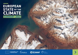
EUROPEAN STATE OF THE CLIMATE SUMMARY 2022, publication date: April 2023

Recommended
Recommended
More Related Content
Similar to European State of Climate: Summary
Similar to European State of Climate: Summary (20)
More from Energy for One World
More from Energy for One World (20)
Recently uploaded
Recently uploaded (20)
European State of Climate: Summary
- 1. IMPLEMENTED BY EUROPEAN STATE OF THE CLIMATE SUMMARY 2022
- 2. 2 EUROPEAN STATE OF THE CLIMATE - SUMMARY 2022 This is an interactive document The bottom toolbar and contents buttons allow you to navigate through the different sections of the report. Copernicus Climate Change Service European State of the Climate 2022 #ESOTC #CopernicusClimate #EUSpace Cover image: Arctic. Credit: European Union, Copernicus Sentinel-2 imagery. Report sections 2022 The Arctic in 2022 04 03 05 17 25 14 Welcome to the summary of the European State of the Climate 2022. Climate Indicators show the long-term global and regional evolution of several key variables. 24 23 Introduction About us About the report Beyond the ESOTC Parts of the Arctic saw their warmest summer on record, and Greenland’s ice sheet experienced record melt. Europe in 2022 Europe saw its warmest summer on record and a period of significant drought. Trends in Climate Indicators Globe in 2022 Globally, 2022 was the fifth warmest year on record.
- 3. EUROPEAN STATE OF THE CLIMATE - SUMMARY 2022 3 C3S provides climate monitoring for the globe, Europe and the Arctic, and annually releases the European State of the Climate (ESOTC). This report includes a short overview of the global context, a more comprehensive overview of Europe, and a focus on the Arctic. The report provides a detailed analysis of the past calendar year, with descriptions of climate conditions and events, and explores the associated variations in key climate variables from all parts of the Earth system. The ESOTC also gives updates on the long-term evolution of key Climate Indicators. Throughout the report you will find symbols that indicate the types of data and the reference period used for each section. More information on these are in About the report. Explore the complete ESOTC The complete report is available online at: climate.copernicus.eu/esotc/2022 Globally, the last eight years have been the warmest on record, and 2022 was the fifth warmest year on record. Several regions of the globe saw record-breaking tempera- tures. In Europe, summer was the warmest on record, at 1.4°C above average, and 0.3–0.4°C above the previous warmest summer, in 2021. Most of western Europe saw heatwave conditions and temperatures in the United Kingdom reached above 40°C for the first time. The average sea surface temperature across Europe’s seas was the warmest on record. The higher-than-average temperatures and a persistent lack of precipitation triggered a significant drought which, at its peak, affected most of Europe. There was also record loss of ice from glaciers in the Alps, equivalent to 5 km3 of ice, or an average depth across the glaciers of more than 3.5 m of ice. The high temperatures and drought also facilitated the spread and intensification of large fires, resulting in the year as a whole seeing the second highest burnt area on record across the EU countries. Both polar regions also experienced unusually warm conditions in 2022. Antarctic sea ice reached its lowest minimum extent on record in February. Later in the year, the Greenland ice sheet saw record melt, with at least 23% of its area impacted during one of three heatwaves in September. Satellites Reference period In situ Model-based estimates Reanalysis European State of the Climate 2022 Introduction Image: Pyrenees, February 2022. Credit: European Union, Copernicus Sentinel-3 imagery. INTRODUCTION EUROPE IN 2022 TRENDS IN CLIMATE INDICATORS BEYOND THE ESOTC ABOUT US GLOBE IN 2022 THE ARCTIC IN 2022 ABOUT THE REPORT Welcome to the summary of the European State of the Climate 2022, compiled by the Copernicus Climate Change Service (C3S), implemented by the European Centre for Medium-Range Weather Forecasts (ECMWF) with funding from the European Union.
- 4. 4 EUROPEAN STATE OF THE CLIMATE - SUMMARY 2022 The global context is provided by the evolution of key Climate Indicators. These typically build on multi-source or community estimates, in some cases leading to a delay in producing final data records, and so not all indicators are covered here. Additional information about the global climate during 2022 can be found in the World Meteorological Organization (WMO) statement on the State of the Global Climate in 2022. Surface temperature Globally, the last eight years were the warmest on record, although 2022 was one of the cooler of these. Despite this, 2022 was the warmest year on record for several regions of the globe, including much of western Europe, parts of northwestern Africa, the Horn of Africa, central Asia and China, and much of the south Pacific. The most-below-average temperatures over land were in southeastern Australia and central Canada. Sea surface temperature Global average sea surface temperature (SST) was the sixth warmest on record, and 2022 marked the third year with La Niña conditions present. This meant that it was cooler than some recent years. Since 1850, SSTs have increased by 0.9°C, but the rate of increase varies regionally. Among the fastest warming areas are parts of the Arctic Ocean, the Baltic Sea, the Black Sea, and parts of the extra-tropical Pacific. Climate stripes from ERA5, 1950–2022 For more information www.showyourstripes.info Globe in 2022 Glaciers Glaciers continued to lose mass at high rates and are estimated to currently contribute more than 1 mm per year to mean global sea level rise. A large reduction in glacier mass was observed across the globe, with only glaciers in southwestern Scandinavia showing a small gain in mass. Sea ice Sea ice extent in the Arctic remained slightly below average throughout the year. Antarctic sea ice extent reached its lowest minimum extent on record in February, with another five months seeing near-record low extent. Sea level Data available for the first six months of the year show a continuing rise in global mean sea level, reaching a new record high. Arctic Europe Globe Greenhouse gases Atmospheric concentrations of the green- house gases carbon dioxide and methane continued to increase, reaching record levels, and were their highest in at least hundreds of thousands of years. The year-on-year increase in methane was significantly higher than the average of the last ten years, but not as high as the record levels seen in 2020 and 2021. INTRODUCTION EUROPE IN 2022 TRENDS IN CLIMATE INDICATORS BEYOND THE ESOTC ABOUT US GLOBE IN 2022 THE ARCTIC IN 2022 ABOUT THE REPORT
- 5. This section provides the 2022 view for Europe, compared to long-term trends of variables across the climate system. Key events that occurred during the year are also described within a climatic context. 5 Europe has been warming faster than any other continent in recent decades, with temperatures increasing at twice the global average rate. During summer, much of the continent was affected by exceptional heatwaves, and the highest temperatures in western Europe reached around 10°C warmer than typical summer maximum temperatures. Southern Europe saw a record number of days with ‘very strong heat stress’. Image: Western Europe, August 2022. Credit: European Union, Copernicus Sentinel-3 imagery. EUROPEAN STATE OF THE CLIMATE - SUMMARY 2022 Europe in 2022 find out more INTRODUCTION EUROPE IN 2022 TRENDS IN CLIMATE INDICATORS BEYOND THE ESOTC ABOUT US GLOBE IN 2022 THE ARCTIC IN 2022 ABOUT THE REPORT
- 6. 6 EUROPEAN STATE OF THE CLIMATE - SUMMARY 2022 Warmest summer on record Record loss of glacier ice from European Alps Record sunshine duration 2nd lowest river flow on record 2nd largest wildfire burnt area on record Records 6 EUROPEAN STATE OF THE CLIMATE - SUMMARY 2022 Events in 2022 Credit: European Union, Copernicus Sentinel-3 imagery. INTRODUCTION EUROPE IN 2022 TRENDS IN CLIMATE INDICATORS BEYOND THE ESOTC ABOUT US GLOBE IN 2022 THE ARCTIC IN 2022 ABOUT THE REPORT Key Events Marine heatwave MAY ONWARDS: The western Mediterranean Sea Coldwave DECEMBER: Northern Europe Wildfires JULY, AUGUST: Czechia, France, Portugal, Slovenia, Spain, UK Heatwaves MAY: Southwestern Europe SUMMER: Affecting much of Europe SEPTEMBER: Greenland Drought Spring through summer across much of Europe Storms FEBRUARY: Three storms in one week Heavy rainfall and flooding SEPTEMBER: Bulgaria, Croatia, Italy, Portugal, Slovenia, Spain
- 7. 7 EUROPEAN STATE OF THE CLIMATE - SUMMARY 2022 Temperature The summer temperature for Europe was the highest on record. 2022 was the second warmest year on record for Europe, at 0.9°C warmer than average. For many countries in southwestern Europe, the yearwasthewarmestonrecord.Themost-above-averagetemperatures occurred in northeastern Scandinavia and those countries bordering the northwestern Mediterranean Sea. Winter, summer and autumn were all warmer than average, and spring was slightly cooler than average, by 0.1–0.2°C. Summer was the warm- est on record, at 1.4°C above average, and 0.3–0.4°C above the previous warmest summer, in 2021. The year was characterised by many more warm than cool events. A long-term trend towards higher surface air temperatures over Europe’s land regions continues. 1991—2020 Average surface air temperature anomaly for 2022, relative to the 1991–2020 reference period. Data source: ERA5. Credit: C3S/ECMWF. Lake and sea temperatures Europe’s lakes and seas are seeing increasing surface temperatures. The average sea surface temperature (SST) across Europe’s seas was the warmest on record in 2022. In the Mediterranean Sea, temperatures were much warmer than average for a prolonged period from May onwards, with record-breaking marine heatwaves during summer. Record-warm sea surface temperatures were also observed in the Bay of Biscay, English Channel and Irish Sea, and in the Norwegian Sea. Across the region, 73% of lakes recorded warmer-than-average temperatures, with the warmest temperatures in Spain and the coolest in Ukraine. Throughout the warm season, which runs from July to September, lake temperatures (LSWT) were consistently above average in southern Europe, while lakes in northern and eastern Europe were cooler than average. Reference period: 1991-2020, Data source: ERA5, Credit: C3S/ECMWF °C 2022 mean temperature anomaly -3 -2.5 -2 -1.5 -1 -0.75 -0.5 -0.25 0 0.25 0.5 0.75 1 1.5 2 2.5 3 Reference period: 1991-2020, Data source: ERA5, Credit: C3S/ECMWF °C 2022 mean temperature anomaly -3 -2.5 -2 -1.5 -1 -0.75 -0.5 -0.25 0 0.25 0.5 0.75 1 1.5 2 2.5 3 SST: 1991–2020 LSWT: 1995–2020 JAN MAR FEB APR MAY JUL JUN AUG SEP NOV OCT DEC Average sea surface temperature anomalies for each month of 2022, relative to the respective monthly average for the 1991–2020 reference period. Data source: C3S SST dataset. Credit: C3S/ECMWF/ UK Met Office. INTRODUCTION EUROPE IN 2022 TRENDS IN CLIMATE INDICATORS BEYOND THE ESOTC ABOUT US GLOBE IN 2022 THE ARCTIC IN 2022 ABOUT THE REPORT European land surface air temperature anomalies for summer (JJA) 1950–2022, relative to the average for the 1991–2020 reference period. Data source: ERA5, E-OBS. Credit: C3S/ECMWF/KNMI.
- 8. Extreme heat Many more warm spells than cool periods were seen during 2022. In southwestern and western areas, up to 30% more warm days occurred than average, highlighting the frequency of high temperature extremes. In March and May, daily maximum temperatures reached as much as 8°C above average. During summer, much of Europe was affected by exceptional heatwaves, and, in western Europe, the highest temperatures were around 10°C warmer than typical summer maximum tempera- tures. In July, temperatures in the UK reached 40°C for the first time on record. Globally, increasingly high latitudes are seeing more extreme tempera- tures, including those exceeding 40°C. The heat- waves impacted human health, with a record number of days with ‘very strong heat stress’ in southern Europe, and the second lowest number of days with ‘no heat stress’. The heatwaves contrib- uted to the production of surface ozone pollution, potentially exacerbating the health impact. October was the warmest on record and while December saw a cold start to the month, it became exceptionally warm at the end of the year. 1991—2020 Summer 2022 In summer, heatwaves led to a record number of days with ‛very strong heat stress*’ in southern Europe. The number of summer days with ‛strong’ or ‛very strong heat stress’ on humans is increasing, and the number of days with 'no heat stress' is decreasing. For Europe as a whole, summer was the warmest on record. Unseasonably warm temperatures occurred throughout the year. In March, May to August, October and December, temperatures reached up to 7–10°C warmer than average. In July, temperatures reached 40°C for the first time on record in the UK. For a large part of Europe, 2022 was the warmest year on record. Data source: E-OBS Credit: C3S/KNMI Reference Period: 1991-2020 Warmest day-time temperature anomaly in Summer 202 High temperatures and dry conditions contributed to the spread and intensification of wildfires, with the second largest burnt area on record. In July, favoured by high temperatures and long sunshine hours, surface ozone concentrations reached potentially harmful levels across much of Europe. The exceptionally warm summer, following a winter with large snow deficits, led to a record loss of ice from glaciers in the Alps. Figures: (1) Warmest daytime temperature anomaly in summer. Data source: E-OBS. Credit: KNMI/C3S/ECMWF. (2) Number of summer days with ‘very strong heat stress’. Data source: ERA5-HEAT. Credit: C3S/ECMWF. (3) Anomaly in the number of days with Fire Weather Index > 50. Data source: ERA5. Credit: Copernicus EMS/ECMWF. *High temperatures represent a hazard to human health. Heat stress indices represent how the human body responds to the impact of different thermal environments. Image: Wildfire in western Spain, July 2022. Credit: European Union, Copernicus Sentinel-2 imagery. INTRODUCTION EUROPE IN 2022 TRENDS IN CLIMATE INDICATORS BEYOND THE ESOTC ABOUT US GLOBE IN 2022 THE ARCTIC IN 2022 ABOUT THE REPORT 8 EUROPEAN STATE OF THE CLIMATE - SUMMARY 2022
- 9. Soil moisture Soil moisture conditions were the second lowest in the last 50 years. Most months saw lower-than-average soil moisture conditions, with the lowest in July at -8%, and the highest in September at +2%. Central European countries experienced a prolonged drought that not only affected surface soil moisture, but deeper soil layers too. The near-average conditions in winter gave way to predominantly below-average conditions in spring, with the largest dry anomalies occurring in northern Germany and Poland, and in countries to the west of the Black Sea. The most widespread dry conditions occurred during summer, affecting much of Europe, before returning to near or above average soil moisture conditions in autumn. In deeper soil layers, the dry conditions also persisted through autumn in some areas, and briefly intensified again in November. 1991—2020 Precipitation A lack of precipitation contributed to widespread drought conditions. The year as a whole was as much as 10% drier than average. May was the driest month, with 21–28% less precipitation than average, while September was the wettest month, with 13–21% more precipitation. There were also fewer wet days than average, particularly in France, Italy and Poland. The dry conditions may have also contributed to the extreme high temperatures throughout the year. During winter, precipitation varied between regions, with wetter-than-average conditions in northern and eastern Europe, and drier-than-average conditions in southwestern Europe. Spring and summer were drier than average across most areas, reflecting the drought conditions, although isolated areas saw wet anomalies during summer. The driest anomalies were found in Germany, Spain and the United Kingdom. 1991—2020 River discharge For 10 months of the year, river discharge was below average. River discharge was the second lowest on record across Europe,markingthesixthconsecutiveyearofbelow-average flows. In terms of the area affected, it was the driest year on record, with 63% of rivers seeing below-average flows. In March, flows were the lowest since records began, although April saw the most widespread high river flows, with 54% of the river network having above-average river discharge. In August, two thirds of the river network had below-average river discharge, with one third experiencing exceptionally low flows, reflecting drought conditions. Around half the river network had below-average flows for the remainder of the year. 1991—2020 Precipitation anomalies (%) for summer (JJA) 2022, expressed as a percentage of the seasonal average for the 1991–2020 reference period. Data source: ERA5. Credit: C3S/ECMWF. Soil moisture anomalies (%) in the top soil layer for summer (JJA) 2022, expressed as a percentage of the seasonal average for the 1991–2020 reference period. Data source: ERA5-Land. Credit: C3S/ECMWF. Monthly average river discharge anomalies for August 2022, relative to the 1991–2020 reference period. Rivers with drainage areas greater than 1000 km2 are shown. Data source: EFAS. Credit: Copernicus EMS/ECMWF. 9 EUROPEAN STATE OF THE CLIMATE - SUMMARY 2022 Winter (DJF) Spring (MAM) Data source: ERA5 Credit: C3S/ECMWF Reference Period: 1991-2020 Summer (JJA) % Autumn (SON) 100 80 60 40 20 0 20 40 60 80 100 Winter (DJF) Spring (MAM) Data source: ERA5 Credit: C3S/ECMWF Reference Period: 1991-2020 Summer (JJA) % Autumn (SON) 100 80 60 40 20 0 20 40 60 80 100 Winter (DJF) Spring (MAM) Data source: ERA5-Land Credit: C3S/ECMWF Reference Period: 1991-2020 Summer (JJA) % Autumn (SON) 50 40 30 20 10 0 10 20 30 40 50 Winter (DJF) Spring (MAM) Data source: ERA5-Land Credit: C3S/ECMWF Reference Period: 1991-2020 Summer (JJA) % Autumn (SON) 50 40 30 20 10 0 10 20 30 40 50 Data source: EFAS Credit: CEMS/ECMWF Reference Period: 1991-2020 INTRODUCTION EUROPE IN 2022 TRENDS IN CLIMATE INDICATORS BEYOND THE ESOTC ABOUT US GLOBE IN 2022 THE ARCTIC IN 2022 ABOUT THE REPORT
- 10. From January to August, much of the continent saw less precipitation than average. The Italian Alps were among the worst- affected areas, with spring snowfall as much as 60% below average. Soil moisture conditions for the year as a whole were the second driest in the last 50 years. Heatwaves exacerbated the drought, with impacts on vegetation reaching their peak in mid-August. The high temperatures and drought led to numerous wildfires and higher-than- average wildfire emissions. Europe’s rivers saw their driest year on record in terms of the area affected, with 63% experiencing below-average flows. The drought impacted natural systems and society, affecting agriculture, energy and river transport. A significant and prolonged drought affected most of Europe. Lower-than-average precipitation and higher-than-average temperatures, with exceptional heatwaves, led to widespread and prolonged drought. 2022 Drought High temperatures and a lack of precipitation resulted in a widespread and prolonged drought that affected much of Europe and impacted sectors such as agriculture, energy and river transport. A precipitation deficit at the start of the year continued through spring, with most of Europe affected. One of the worst-affected areas was the Italian Alps, which experienced a lack of snowfall that widely reached 60% below aver- age, and up to 75% locally. This severe deficit had further repercussions due to reduced water from snowmelt, contributing to the drought and to the record glacier ice loss during the year. The lack of precipitation persisted into summer, leading to critically dry soil. This, combined with the heatwaves, further exacerbated the drought and its impacts on vegetation. The dry condi- tions may have, in return, contributed to the extreme high temperatures. A further conse- quence of the dry conditions was the spread and intensification of wildfires. 1991—2020 Figures: (1) Combined Drought Indicator for the first 10 days of August. Data source: Copernicus EMS EDO. Credit: European Commission, JRC. (2) March anomaly in the number of wet days. Data source: E-OBS. Credit: KNMI/C3S/ECMWF. (3) annual soil moisture anomalies. Data source: ERA5-Land. Credit: C3S/ECMWF. (4) August average river discharge anomalies. Data source: EFAS. Credit: Copernicus EMS/ECMWF. Image: Po River, Italy, February 2022. Credit: European Union Copernicus Sentinel-2 imagery. INTRODUCTION EUROPE IN 2022 TRENDS IN CLIMATE INDICATORS BEYOND THE ESOTC ABOUT US GLOBE IN 2022 THE ARCTIC IN 2022 ABOUT THE REPORT 10 EUROPEAN STATE OF THE CLIMATE - SUMMARY 2022
- 11. Distribution and extent of burnt areas across Europe and the Mediterranean in 2022. Data source: European Forest Fire Information System (EFFIS). Credit: EFFIS/Copernicus EMS. Annual glacier ice mass changes in the European Alps from 1962 to 2022. Data source: WGMS (2022, updated) based on observations from NVE and GLAMOS. Credit: C3S/ECMWF/WGMS. Wildfires Second largest burnt area on record across the EU countries. Above-average fire danger conditions were seen for most of the year, driven by persistent drought and heat conditions, in particular in southwestern areas. Here, fire danger was extremely high at the beginning of the year and from March into summer, and high again in October. In southeastern Europe, fire danger was high throughout spring. These extreme fire danger conditions facilitated the ignition and spread of large fires in central Europe and the Mediterranean region, with critical fires, those covering an area greater than 10 000 ha, in Czechia, France, Portugal, Slovenia and Spain. It is estimated that in total, over 900 000 ha were burnt across the EU countries. 1991—2020 11 EUROPEAN STATE OF THE CLIMATE - SUMMARY 2022 Land cryosphere Lack of snow at the start of the year contributed to drought conditions and exacerbated glacier melt. Across much of central and southern Europe, there were up to 20 fewer winter snow days, those with at least 1 cm snow depth, than average, and up to 50 fewer in some locations. Snowmelt is an important source of water for many of Europe’s rivers, so the reduced number of snow days contributed to the drought. Snow also influences glacier melt; snow accumulated during winter and spring can delay melting in spring and summer. In 2022, glaciers in southwestern Scandinavia benefitted from the slightly above average number of winter snow days, seeing a slight gain in ice. Meanwhile, the Alpine glaciers saw record ice loss, due to lack of winter snow and the unusually warm summer. While glacier mass loss has been significant globally, the European Alps is one of the regions where glaciers are shrinking the most. 1991—2020 INTRODUCTION EUROPE IN 2022 TRENDS IN CLIMATE INDICATORS BEYOND THE ESOTC ABOUT US GLOBE IN 2022 THE ARCTIC IN 2022 ABOUT THE REPORT
- 12. 12 EUROPEAN STATE OF THE CLIMATE - SUMMARY 2022 Glaciers Both globally and across Europe, glaciers, distinct from the two ice sheets in Greenland and Antarctica, have seen a substantial and prolonged loss of ice since the mid-19th Century. This loss has intensified since around the 1990s. Melting of ice from glaciers has contributed to more than 3 cm of global sea level rise. Glacier ice loss Global >8600 km3 since 1997 Europe >960 km3 (excluding Greenland) since 1997 INTRODUCTION EUROPE IN 2022 TRENDS IN CLIMATE INDICATORS BEYOND THE ESOTC ABOUT US GLOBE IN 2022 THE ARCTIC IN 2022 ABOUT THE REPORT
- 13. Annual anomalies in (left) onshore wind capacity factor (CF), (centre) solar photovoltaic (PV) CF, and (right) electricity demand for 2022. Data: C3S Climate and Energy Indicators for Europe. Credit: C3S/ECMWF. Annual European sunshine duration anomalies (hours) for 1983–2022. Data source: SARAH-2.1 CDR/ICDR. Credit: EUMETSAT CM SAF. Wind and solar energy resources Surface solar radiation was the highest on record. Wind and solar renewable energy resources complement each other throughout the year: winds are usually stronger in winter while solar radiation reaches a maximum in summer. In 2022, the annual average wind speed for Europe as a whole was virtually equal to the 30-year average, while the region experienced its highest amount of surface solar radiation in the 40-year record, consistent with a marked positive trend observed over the same period. Potential power generation from onshore wind was below-average across most of Europe, especially in southern central regions. Conversely, potential solar photovoltaic power generation was above average in most of Europe. Climate-driven electricity demand was below average in most areas, linked to above-average temperatures in non-summer months, but above-average in parts of southern Europe as a result of extreme heat during summer. 1991—2020 13 EUROPEAN STATE OF THE CLIMATE - SUMMARY 2022 Clouds and sunshine duration Highest sunshine duration and second-lowest cloud cover on record. In 2022, Europe experienced its highest sunshine duration on record, with 130 more sunshine hours than average, fitting with a marked trend towards more sunshine hours. This positive anomaly came mainly from above-average sunshine hours between January and July. From August onwards, sunshine duration was closer to or below average. Consistent with the high sunshine duration, annual cloud cover was the second lowest on record, at 4% less than average. It was most below average in parts of western and south- eastern Europe, and slightly above average over the Iberian Peninsula and far-eastern Europe. 1991—2020 1985 1990 1995 2000 2005 2010 2015 2020 250 200 150 100 50 0 50 100 150 hours Annual sunshine duration anomalies for European land Atmospheric circulation High pressure over western Europe led to warm, sunny and dry conditions. Patterns of atmospheric circulation vary throughout the year. During winter 2021/22, the pattern favoured dry and warmer-than-average conditions over western Europe, and colder-than-average conditions in Scandinavia and eastern Europe. In February, northwestern Europe saw three storms in a week, influenced by a strongly positive North Atlantic Oscillation (NAO), a type of large-scale circulation pattern that has one of the largest influences on weather and climate variability in Europe, alongside others such as the Arctic Oscillation (AO). In spring and summer, high pressure con- ditions prevailed across western Europe, resulting in low precipitation, heatwaves and drought. In autumn, the circulation varied from month to month, and in December, negative phases of the NAO and AO were favourable to the coldwave over northern Europe. 1991—2020 Onshore wind CF -10% 0 10% Solar PV CF -8% 0 8% Electricity demand -3% 0 3% Energy indicator anomalies for 2022 Data: C3S Climate & Energy Indicators for Europe Reference period: 1991-2020 Credit: C3S/ECMWF Electricity demand for 2022 Solar PV CF Onshore wind CF INTRODUCTION EUROPE IN 2022 TRENDS IN CLIMATE INDICATORS BEYOND THE ESOTC ABOUT US GLOBE IN 2022 THE ARCTIC IN 2022 ABOUT THE REPORT
- 14. The Arctic section provides an overview of key climate events in high northern latitudes during 2022. 14 Greenland experienced record-breaking temperatures and ice sheet melt during a period of heatwaves in September. The Svalbard region experienced its warmest summer on record, with some areas seeing temperatures 2.5°C above average. Image: Svalbard, August 2022. Credit: European Union, Copernicus Sentinel-2 imagery. EUROPEAN STATE OF THE CLIMATE - SUMMARY 2022 Arctic in 2022 INTRODUCTION EUROPE IN 2022 TRENDS IN CLIMATE INDICATORS BEYOND THE ESOTC ABOUT US GLOBE IN 2022 THE ARCTIC IN 2022 ABOUT THE REPORT find out more
- 15. Arctic wildfires Arctic wildfire activity and carbon emissions were near average. In contrast to the previous three years, high latitude wildfire activity and emissions were mostly from North America. These were concentrated in Alaska and Canada’s Northwest and Yukon territories rather than Siberia, as has been seen in recent years, reflecting a change in soil moisture anom- alies. The location of wildfires, particularly the most intense ones, coincided with drier-than-average soils, which make vegetation more vulnerable to burning. Wildfire emissions from the Arctic reached an estimated total of nine million tonnes of carbon in 2022. This is considerably less than the record 58 million tonnes emitted in 2020 and the 15 million in 2021, and closer to the average annual emis- sions prior to 2020. Arctic temperature Record-breaking temperatures in Svalbard and Greenland. The annual average temperature for the Arctic as a whole was 0.9°C above average, and for Arctic land was 1.2°C above average. Much of the northern high latitudes experienced above-average temperatures, except for parts of Canada and Alaska, which saw temperatures as much as 1°C below average. Temperatures were most above average in northern Eurasia, particularly in northwestern Siberia, where anomalies exceeded 3°C around the Kara Sea. In the Svalbard region, summer was the most remarkable season of 2022 and the warmest on record, with an average temperature 1.4°C above average across the region, and up to 2.5°C locally. Greenland also experienced record-breaking temperatures during a period of heatwaves in September. 1991—2020 Arctic ocean Arctic sea ice extent remained consistently below, yet close to, average. At its annual minimum in September, it was 11% below average, the second-smallest anomaly since 2015. In the Barents Sea, the ice extent dropped rapidly in late May and early June, to near-record low levels, before reaching near-zero at the end of July. This was linked to warm southerly winds over the area, and followed a period of close to, and sometimes above, average extent from January to mid-May. The Barents and Kara Seas also saw well-above-average sea surface temperatures during the summer, which likely delayed the development of sea ice cover in the autumn. The summer warmth in this part of the Arctic was also seen in the air temperature records. 1991—2020 Summer temperature anomalies for 2022. Data source: ERA5. Credit: C3S/ECMWF. Summer soil moisture anomalies and locations of wildfires. Data sources: ERA5-Land soil moisture and CAMS GFAS v1.2 wildfire data. Credit: CAMS/C3S/ECMWF. Monthly average sea surface temperature anomalies for July 2022. Data source: ESA CCI/C3S SST. Credit: C3S/ECMWF/UK Met Office. 15 EUROPEAN STATE OF THE CLIMATE - SUMMARY 2022 Soil moisture: 1991–2020 Wildfire emissions: 2003–2022 Surface temperature anomaly for JJA 2022 -7 -5 -3 -2 -1 0 1 2 3 5 7 °C Surface temperature anomaly for JJA 2022 -7 -5 -3 -2 -1 0 1 2 3 5 7 °C Soil moisture anomalies and wildfires in JJA 2022 -30 -24 -18 -12 -6 0 6 12 18 24 30 % Soil moisture anomalies and wildfires in JJA 2022 -30 -24 -18 -12 -6 0 6 12 18 24 30 % Sea surface temperature anomaly for July 2022 -3.0 -2.0 -1.5 -1.0 -0.5 0.0 0.5 1.0 1.5 2.0 3.0 °C Sea surface temperature anomaly for July 2022 -3.0 -2.0 -1.5 -1.0 -0.5 0.0 0.5 1.0 1.5 2.0 3.0 °C INTRODUCTION EUROPE IN 2022 TRENDS IN CLIMATE INDICATORS BEYOND THE ESOTC ABOUT US GLOBE IN 2022 THE ARCTIC IN 2022 ABOUT THE REPORT
- 16. September 2022 The last of the heatwaves resulted from an atmospheric river connected with Hurricane Fiona, which dissipated west of Greenland after impacting Canada. The frequency of atmospheric rivers reaching Greenland has increased since the late 1990s, contributing to increased melt of the ice sheet. A series of atmospheric rivers delivered exceptional heat and rainfall to Greenland. These atmospheric rivers resulted in three heatwaves, with record temperatures for September as a whole, up to 8°C above average. The extreme heat, combined with rainfall during a time of year when precipitation would normally fall as snow, led to record ice sheet melt, with around a quarter of the ice sheet (442 000 km2 ) under surface melt on 3 September. Hurricane Fiona-related heatwave 24 September first heatwave peaking 3 September September Ice sheet melt Record ice sheet melt Greenland heatwaves In September 2022, Greenland experienced exceptional heat and rainfall as a result of a series of atmospheric rivers, which are long bands of moisture transport in the atmosphere. Temperatures were the highest on record for the month, reaching up to 8°C higher than average. Three heatwaves, and precipitation that fell as rain more often than as snow, led to the most extensive September surface melting of the ice sheet on record, with at least 23% of its area impacted at the peak of the first heatwave. Rainfall was much higher than average across southern and western areas of the ice sheet. An area in the far southwest saw almost double the average amount of rainfall for September, a time of year when snowfall is more typical. 1991—2020 Atmospheric rivers are long, narrow bands of concentrated moisture (water vapour) transport across the midlati- tudes, and can bring precipitation and flooding (and in Greenland’s case, melt- ing of the ice) when they reach land. Figures: (1) September temperature anomalies. Data source: ERA5. Credit: C3S/ECMWF. (2) Melt area of the Greenland ice sheet. Data source: CARRA. Credit: GEUS/C3S/ ECMWF. (3) Total column water vapour on 25 September. Data source: ERA5. Credit: Copernicus EMS/ECMWF. Image: Greenland, September 2022. Credit: European Union, Copernicus Sentinel-2 imagery. INTRODUCTION EUROPE IN 2022 TRENDS IN CLIMATE INDICATORS BEYOND THE ESOTC ABOUT US GLOBE IN 2022 THE ARCTIC IN 2022 ABOUT THE REPORT 16 EUROPEAN STATE OF THE CLIMATE - SUMMARY 2022
- 17. Climate Indicators show the long-term evolution of several key variables that are used to assess the global and regional trends of a changing climate. These also provide the wider context in which to read the report. 17 Image: Spain, February 2022. Credit: European Union, Copernicus Sentinel-2 imagery. EUROPEAN STATE OF THE CLIMATE - SUMMARY 2022 Trends in Climate Indicators INTRODUCTION EUROPE IN 2022 TRENDS IN CLIMATE INDICATORS BEYOND THE ESOTC ABOUT US GLOBE IN 2022 THE ARCTIC IN 2022 ABOUT THE REPORT find out more
- 18. 18 EUROPEAN STATE OF THE CLIMATE - SUMMARY 2022 The Paris Agreement aims to hold the increase in global average temperature to well below 2°C above pre-industrial levels, with countries pursuing efforts to limit the increase to 1.5°C. The Global Stocktake, currently underway and to be repeated every five years, facilitates the assessment of collective progress in the implementation of the Paris Agreement. Monitoring surface air and sea surface temperatures globally and regionally contributes to this stocktake. Global average values for these variables have increased significantly since the pre-industrial era, by 1.2°C and 0.9°C, respectively, but the rate of increase has varied in both space and time. Increasing temperatures over land and ocean Since 1850—1900, an increase in surface air temperature of around Globe +1.2°C Europe +2.2°C Arctic +3°C (For latest five-year averages) Temperature The latest five-year average global temper- ature is almost the highest on record. In recent decades, temperatures over land have risen around twice as fast as those over oceans. Temperatures over the Arctic have risen much more rapidly than those over most of the rest of the globe, with an estimated warming of around 3°C since the 1970s. Changes prior to this are more uncertain, particularly for the Arctic. Sea surface temperature Global mean sea surface temperature (SST) has increased by close to 0.9°C since records began in 1850. A key modulator of global SSTs on interannual timescales is the El Niño Southern Oscillation, which sees periods of warmer (El Niño) or cooler (La Niña) than average SSTs in the central and eastern equatorial Pacific. These changes in SST influence circulation pat- terns and surface air temperatures around the globe. 2022 marked the third consecutive year of La Niña conditions. 18 EUROPEAN STATE OF THE CLIMATE - SUMMARY 2022 Global sixty-month average surface air temperature (°C). Data source: Six temperature datasets covering all or parts of 1850–2021. Credit: C3S/ECMWF. Relative to 1991–2020 0.5 0 -0.5 -0.5 0 0.5 1 1.5 -1 1860 1940 1900 1980 1880 1960 1920 2000 2020 Increase above 1850–1900 reference level INTRODUCTION EUROPE IN 2022 TRENDS IN CLIMATE INDICATORS BEYOND THE ESOTC ABOUT US GLOBE IN 2022 THE ARCTIC IN 2022 ABOUT THE REPORT Six temperature datasets covering all or parts of 1850–2022. Values for Europe and the Arctic are over land only. Two SST datasets covering 1980-2022 HadCRUT5 Berkely Earth NOAAGlobalTempv5 GISTEMPv4 JRA-55 ERA5 Since 1980, an increase in SST of around Globe +0.5°C Europe +1.1°C (For latest five-year averages)
- 19. 19 EUROPEAN STATE OF THE CLIMATE - SUMMARY 2022 Greenhouse gases driving climate change Greenhouse gases (GHGs) in the atmosphere trap heat close to Earth’s surface. If concentrations increase, then Earth’s near-surface temperature also rises, with significant global impacts. Human activities lead to the emission of GHGs in various ways, including the combustion of fossil fuels for energy, deforestation, the use of fertilisers in agriculture, livestock farming, and the decomposition of organic material in landfills. Of all the long-lived GHGs that are emit- ted by human activities, carbon dioxide (CO2 ), methane (CH4 ) and nitrous oxide (N2 O) have the largest impact on Earth’s climate. ppm: parts per million ppb: parts per billion 1 teragram (Tg) = 1 000 000 000 000 (1012 ) grams In 2022, the annual average concentrations of greenhouse gases were CO2 +417 ppm CH4 +1894 ppb 19 EUROPEAN STATE OF THE CLIMATE - SUMMARY 2022 Greenhouse gas concentrations The amount of a gas contained in a certain volume of air. The atmospheric concentrations of CO2 and CH4 are at record levels. Over the last decade of measurements, an increase in net fluxes of greenhouse gases at Earth’s surface of around CO2 +5000 TgC CH4 +420 TgC N2O +18 TgN (Per year) Greenhouse gas fluxes The net difference between the amount of a gas added to the atmosphere by emissions from various ‘sources’ and the amount taken up by various ‘sinks’. Estimated net surface fluxes of CO2 , CH4 and N2 O have been increasing during recent dec- ades. Anthropogenic emissions of CO2 have been partly compensated by a natural uptake from the ocean and vegetation. CO2 : 1979–2021 CH4: 1979–2021 N2O: 1996–2020 Concentrations (column-averaged mixing ratios) for CO2 and CH4 covering 2003–2022. Monthly averaged atmospheric concentrations of carbon dioxide (CO2 ) and methane (CH4 ). Data are derived from satellite measurements and averaged over the whole atmospheric column and for 60°S–60°N. Data source: C3S/Obs4MIPs (v4.4) consolidated (2003–2021) and CAMS preliminary near real-time data (2022) records. Credit: C3S/CAMS/ECMWF/University of Bremen/SRON. INTRODUCTION EUROPE IN 2022 TRENDS IN CLIMATE INDICATORS BEYOND THE ESOTC ABOUT US GLOBE IN 2022 THE ARCTIC IN 2022 ABOUT THE REPORT
- 20. 20 EUROPEAN STATE OF THE CLIMATE - SUMMARY 2022 The cryosphere encompasses all parts of the Earth system where water is in solid form, including ice sheets, glaciers, snow cover, perma- frost and sea ice. The cryosphere exerts an important influence on Earth’s climate, and vice versa. Due to its high reflectivity, changes in the cryosphere impact the amount of solar energy taken up by the planet’s surface, and consequently temperatures. As temperatures rise, vast amounts of water stored on land, in glaciers and ice sheets, melt, which contributes to global sea level rise. The changing cryosphere there- forehasmanyfurtherenvironmental and societal implications. The cryosphere in a changing climate Since the 1980s, a loss of sea ice of around Arctic (September) 2.6 million km2 Antarctic No long-term trend Since 1997, a loss of glacier ice of Global 8600 km3 Europe 960 km3 Reference glacier network of more than 30 years of ongoing observations. 20 Sea ice Arctic sea ice extent has declined markedly since records began. The decline is largest around the annual minimum in September, with widespread retreat across the region. In addition to the decline in Arctic sea ice extent, the proportion of multiyear ice has decreased while the proportion of first-year ice has in- creased. In the Antarctic, sea ice extent shows no clear long-term trend, despite reaching successive all-time minima in February 2022 and 2023. Glaciers Both globally and in Europe, glaciers, distinct from the two ice sheets in Greenland and Antarctica, have seen a substantial and prolonged loss of ice mass since the mid 19th century. The loss has intensified since around the 1990s, with, for example, glaciers in Europe having lost between 9 m and 34 m of ice thickness, depending on the region, since 1997. 1979–2022 Time series of Antarctic daily sea ice extent for 2022 (black), 2021 (red) and 2017 (blue), the year with the previous lowest February minimum. Data source: OSI SAF Global Sea Ice Concentration Climate Data Record v3. Credit: C3S/ECMWF/EUMETSAT. Record minimum INTRODUCTION EUROPE IN 2022 TRENDS IN CLIMATE INDICATORS BEYOND THE ESOTC ABOUT US GLOBE IN 2022 THE ARCTIC IN 2022 ABOUT THE REPORT
- 21. Credit: European Union Copernicus Sentinel-3 imagery. INTRODUCTION EUROPE IN 2022 TRENDS IN CLIMATE INDICATORS BEYOND THE ESOTC ABOUT US GLOBE IN 2022 THE ARCTIC IN 2022 ABOUT THE REPORT LOSS OF ICE SHEET GREENLAND AND ANTARCTICA SINCE THE 1970S km3* 11000 more than Ice sheet loss Greenland 5850 km3 ±575 between 1972 and 2021 Antarctica 5372 km3 ±1046 between 1979 and 2021 Ice sheets Since the 1970s, loss of ice from the Greenland and Antarctic ice sheets has caused sea level to rise by almost 3 cm. The combined rate of ice loss has more than tripled since the 1980s, from 120 km3 per year in the 1980s, to around 460 km3 per year in the 2010s. Satellite data *Equivalent to a volume of ice as large as the white circle and with a depth of 1 metre. EUROPEAN STATE OF THE CLIMATE - SUMMARY 2022 21
- 22. EUROPEAN STATE OF THE CLIMATE - SUMMARY 2022 22 EUROPEAN STATE OF THE CLIMATE - SUMMARY 2022 Sea level trends (mm/year) from January 1993 to June 2022. Data source: CMEMS Ocean Monitoring Indicator based on the C3S sea level product. Credit: C3S/ECMWF/CMEMS. Image: The Netherlands, March 2022. Credit: European Union, Copernicus Sentinel-2 imagery. Between 1993 and 2022, an average sea level increase of around Global +3.3 mm ±0.3 Europe +2–4 mm January 1993 to July 2022. Sea level Between 1993 and 2022, there has been a rise in global mean sea level of around 9.7 cm. There is also an increasing rate of sea level rise, with the past 10 years seeing 4.2 mm per year. Regional trends can deviate considerably from the global mean. For example, across Europe, sea level changes differ between the open ocean and coastal areas due to various oceanic and geophysical processes. INTRODUCTION EUROPE IN 2022 TRENDS IN CLIMATE INDICATORS BEYOND THE ESOTC ABOUT US GLOBE IN 2022 THE ARCTIC IN 2022 ABOUT THE REPORT (Per year)
- 23. 23 EUROPEAN STATE OF THE CLIMATE - SUMMARY 2022 Extreme heat impacts on agriculture The climate and related extreme events, such as those discussed in the ESOTC, can impact agriculture, affecting crop management, devel- opment and distribution of diseases and pests, and ultimately the harvest. Heat stress, for example, at stages such as flowering, can lead to yield losses and decreased quality. C3S’ ‘Agroclimatic indicators explorer’, with European location-specific data and climate scenarios, is designed to help facilitate decision-making ‘at farm level’, and adaptation planning at a larger scale. It provides a visual means of exploring agroclimatic i ndicators in the current climate, and assessing their evolution based on past trends and future projections. The ESOTC provides a snapshot of the past year, based on data from the Copernicus Services and other agencies. Alongside this valuable historical information, C3S also offers data underpinning future climate projections and emission scenarios. Based on these, C3S provides sector-focused services with data, tools and example workflows. These help users in areas such as infrastructure, agriculture, food security, water, energy, tourism, health and financial services, in their climate- sensitive decisions and solutions. Extreme values, the frequency of certain events, or cumulative climate conditions over long periods, are among the elements available. By providing crucial data for the past, the present, and for potential future climates, C3S supports adaptation to current and future impacts from climate change. C3S offers a range of products and tools to explore the impacts of climate change and variability. Beyond the ESOTC Data for assessing climate impacts Are we on track to keep global temperatures below 1.5 degrees of warming by 2050? Climate projections and the data that underpin them are vital for decision - making, allowing various sectors to plan and act based on future climate scenarios. In the context of the Paris Agreement, the C3S ‘global temp erature trend monitor’ provides a near real-time snapshot of when the 1.5°C limit would be reached, if warming continued unabated at today’s rate. As an operational monitoring tool fed by C3S’ free and open data, it can also be adapted or built upon by those in different sectors wanting to under- stand their climate risk. INTRODUCTION EUROPE IN 2022 TRENDS IN CLIMATE INDICATORS BEYOND THE ESOTC ABOUT US GLOBE IN 2022 THE ARCTIC IN 2022 ABOUT THE REPORT Heat stress (days) 0 20 5 40 100 1 30 10 50 150 A representative concentration pathway (RCP) is a greenhouse gas concentration trajectory adopted by the IPCC for climate modelling and research. Projected Heat stress from RCP4.5 Heat stress experienced during 2022 exceeded the ‘middle of the road’ (RCP 4.5) climate projection
- 24. 24 EUROPEAN STATE OF THE CLIMATE - SUMMARY 2022 Contributors The ESOTC’s findings are based on expertise from across the C3S community, as well as other Copernicus services and external partners. The sections are authored by C3S and data providers from institutions across Europe and edited by the C3S team. This report is reviewed by colleagues across the Copernicus network. The EU Copernicus Services: C3S, CAMS, Copernicus EMS, CMEMS, CLMS. International organisations and initiatives: ECMWF, EC JRC, EEA, ESA, EUMETSAT SAF Network, GCOS and WMO RA VI RCC Network. European national and regional meteorological and hydrological services: DMI (Denmark), DWD (Germany), KNMI (the Netherlands), MET Norway, Météo-France, Met Office (United Kingdom) and indirect contributions from many others. Universities and research organisations: TU Wien (Austria), CzechGlobe/GCRI (Czechia), GEUS (Denmark), CEA/LSCE, CLS, CNES, LEGOS and RTE (France), AWI and University of Bremen (Germany), SRON, TNO VanderSat and VU Amsterdam (the Netherlands), NILU (Norway), University of Zurich and WGMS (Switzerland), PML, University of Leeds, University of Leicester, University of Reading and WEMC (United Kingdom). The ESOTC 2022 sections rely extensively on datasets provided operationally and in near real-time by the Copernicus Services, to give an overview of 2022 in the long-term context. The operational data are freely accessible via data catalogues such as the C3S Climate Data Store (CDS). These operational data services build on extensive research and development undertaken by institutions across Europe and the rest of the world. Climate Indicators provide the long-term context for the globe, Europe and the Arctic, and build on datasets and estimates which are brought together to provide a comprehen- sive multi-source reference, based on data from Copernicus and from other monitoring activities. Where data do not yet fully cover the reporting period, the most up to date information is included. The data behind the ESOTC 2022 and the Climate Indicators About the report Satellites Providing information about Earth’s surface and its atmosphere from spaceborne orbit. Reference periods By comparing 2022 against the average for a reference period, we can see how the year fits within a longer-term context. Generally, the reference period used is 1991–2020, but where less extensive data records are available, more recent and shorter periods are used as indicated by this symbol. Model-based estimates Using the laws of physics and statistics to build large-scale models of environmental indicators. In situ Measurements from an instrument located at the point of interest, such as a land station, at sea or in an aeroplane. Reanalysis Using a combination of observations and computer models to recreate historical climate conditions. INTRODUCTION EUROPE IN 2022 TRENDS IN CLIMATE INDICATORS BEYOND THE ESOTC ABOUT US GLOBE IN 2022 THE ARCTIC IN 2022 ABOUT THE REPORT
- 25. About us Vital environmental information for a changing world The European Centre for Medium-Range Weather Forecasts (ECMWF) has been entrusted by the European Commission to implement two of the six services of the Copernicus programme: the Copernicus Climate Change Service (C3S) and the Copernicus Atmosphere Monitoring Service (CAMS). In addition, ECMWF provides support to the Copernicus Emergency Management Service (Copernicus EMS). To meet the challenge of global climate change, accurate, reliable and timely data are key. The Copernicus Services at ECMWF routinely monitor data on a global scale, including surface air temperature, precipitation, sea ice area and atmospheric greenhouse gases. The Copernicus Climate Change Service (C3S) The Copernicus Climate Change Service adds value to environmental measurements by providing free access to quality-assured, traceable data and applications, all day, every day. We offer consistent information on the climate anywhere in the world, and support policymakers, businesses and citizens in preparing for future climate change impacts. The Copernicus Atmosphere Monitoring Service (CAMS) The Copernicus Atmosphere Monitoring Service adds value to air quality and atmospheric compo- sition measurements, and provides free access to quality-assured, traceable data and applications. Copernicus Services implemented by ECMWF European Centre for Medium-Range Weather Forecasts Image: Europe. Credit: Modified European Union Copernicus Sentinel data. doi.org/10.24381/gvaf-h066 climate.copernicus.eu atmosphere.copernicus.eu copernicus.eu ecmwf.int #ESOTC #CopernicusClimate #EUSpace copernicus-press@ecmwf.int INTRODUCTION EUROPE IN 2022 TRENDS IN CLIMATE INDICATORS BEYOND THE ESOTC ABOUT US GLOBE IN 2022 THE ARCTIC IN 2022 ABOUT THE REPORT Reading, UK Bologna, Italy Bonn, Germany