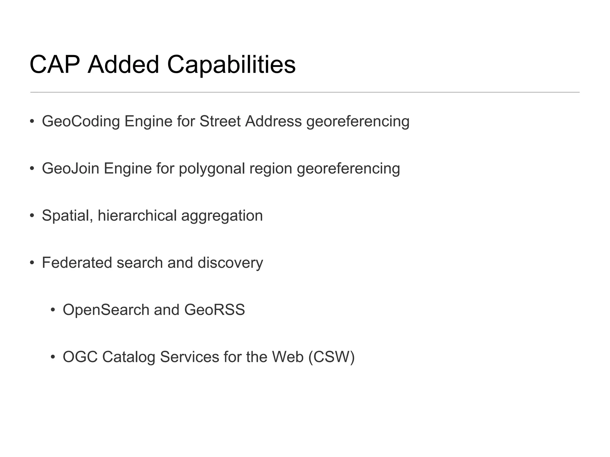
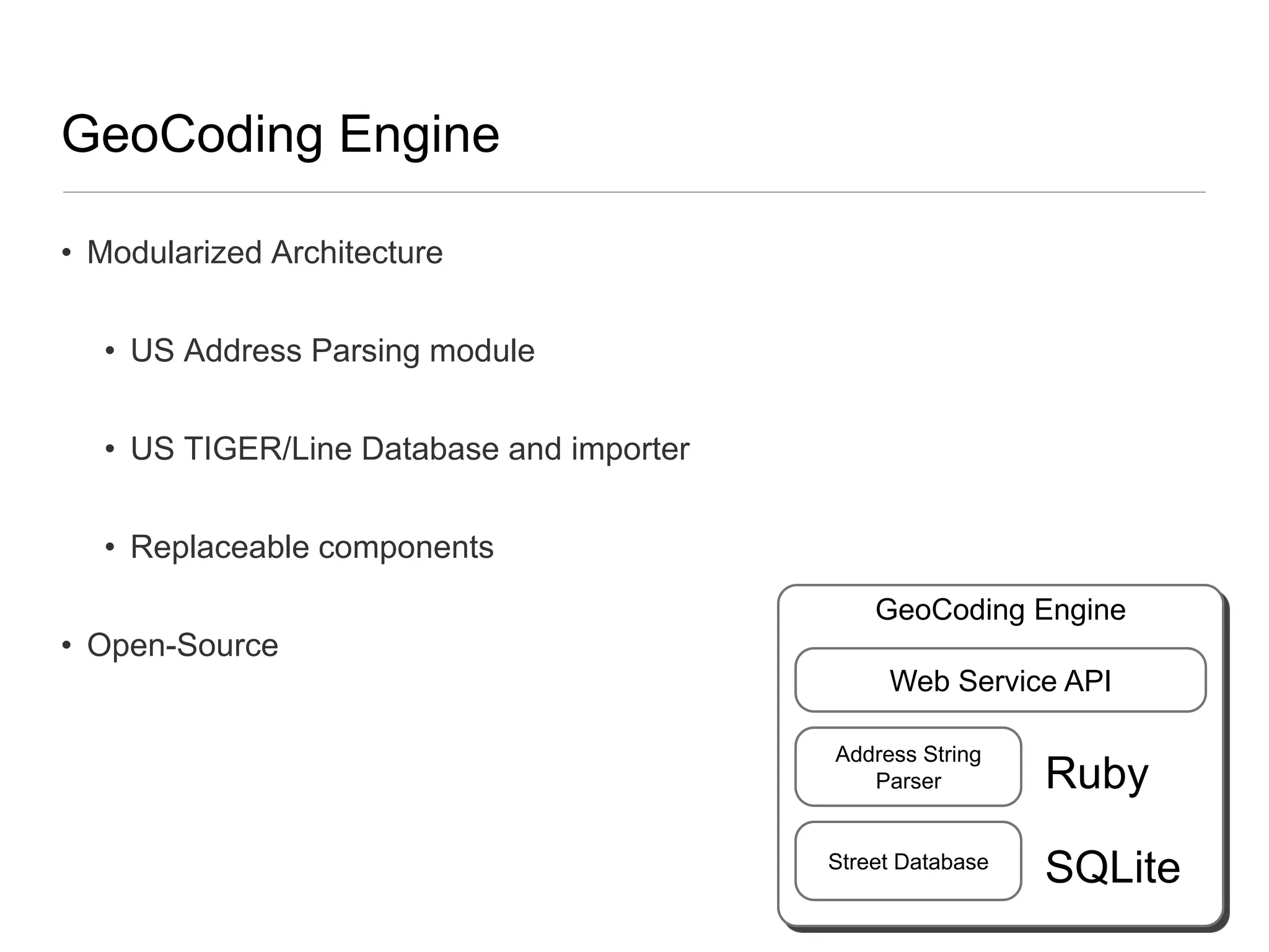
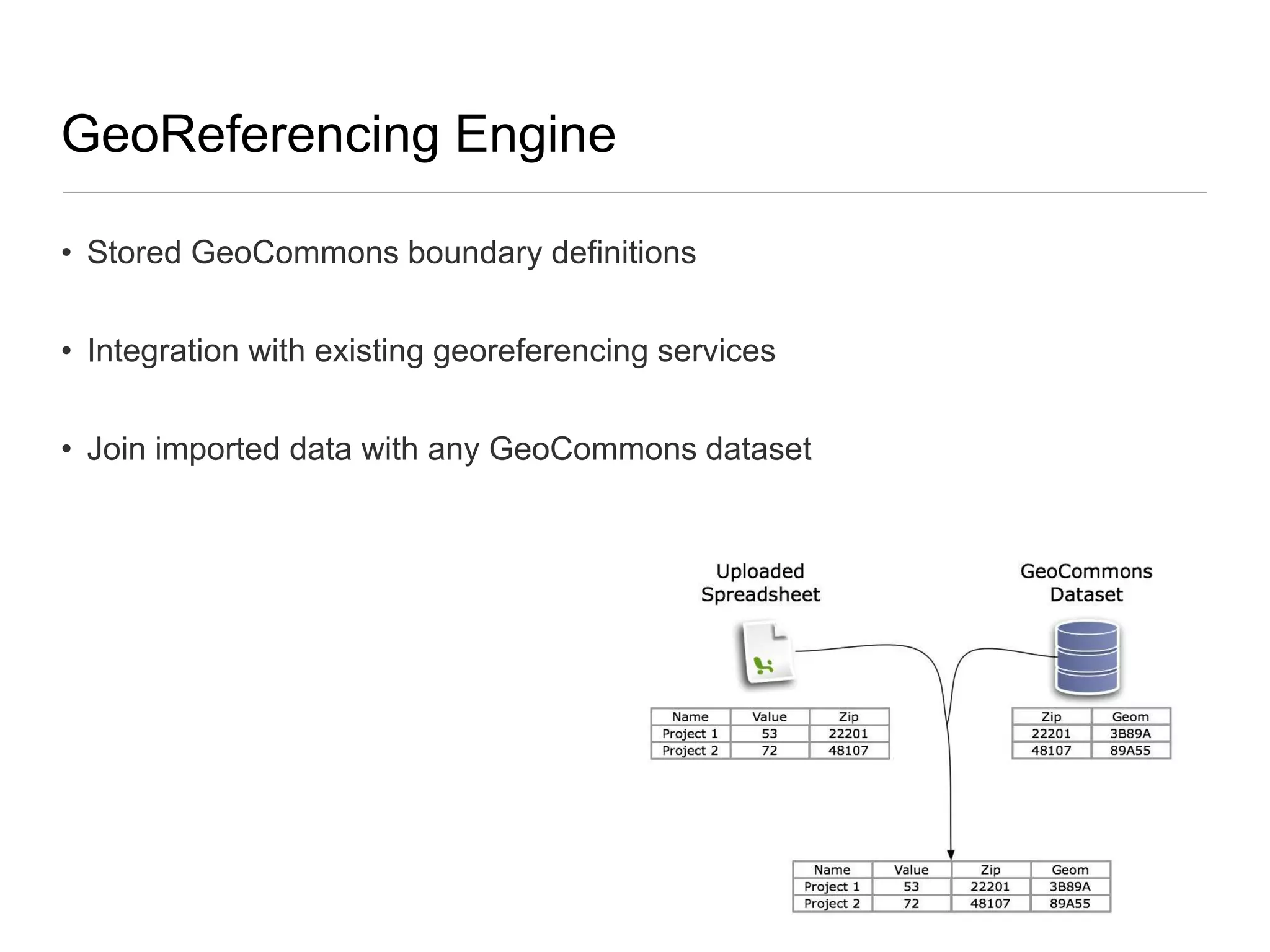
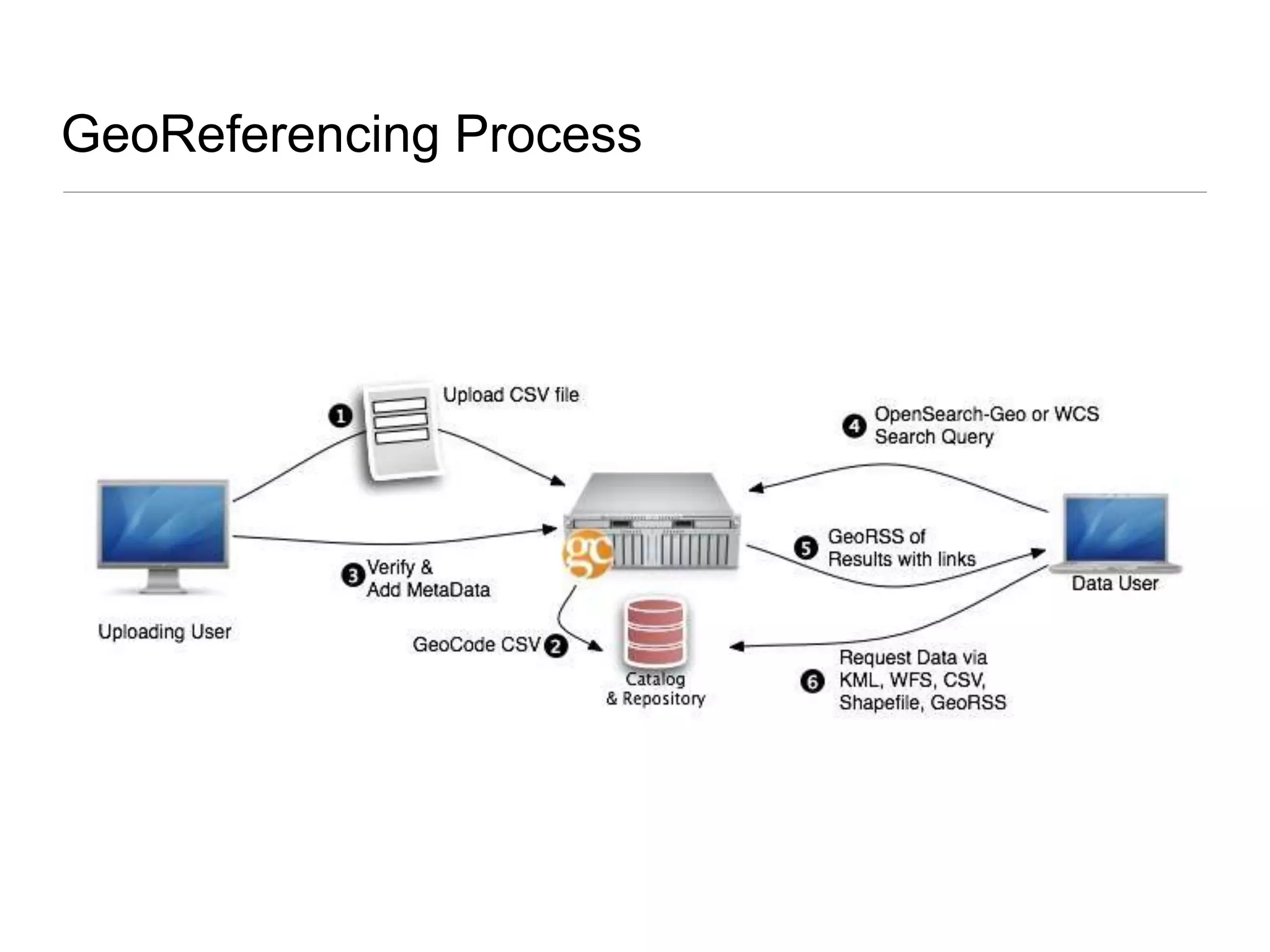
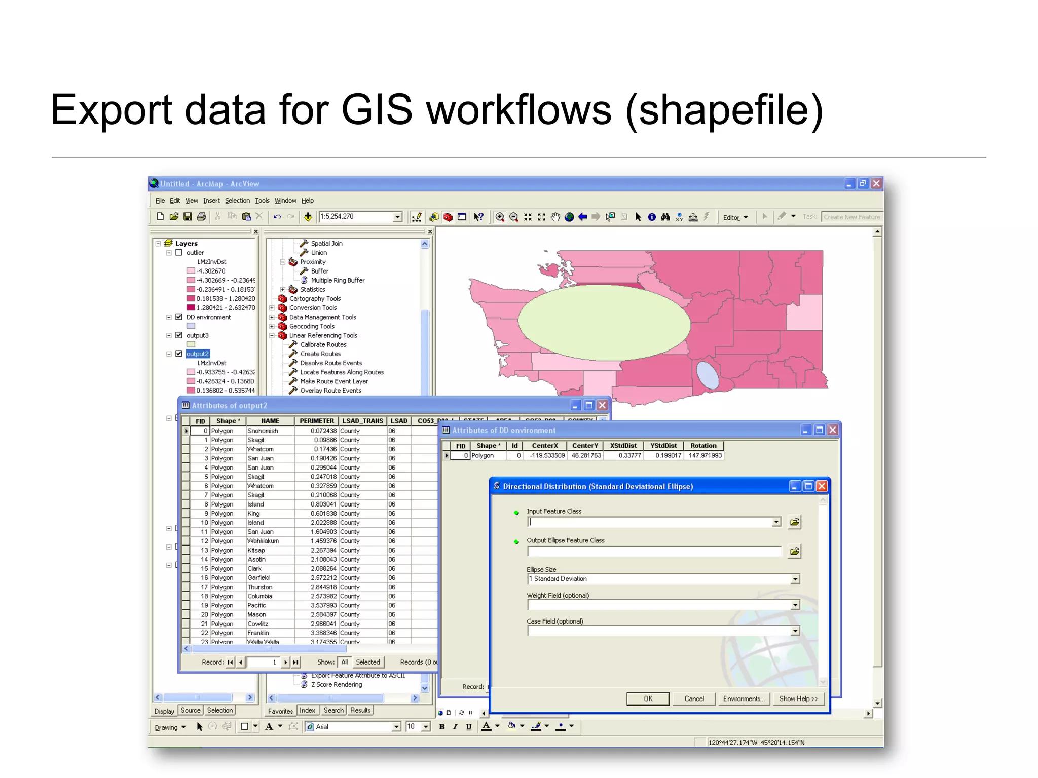
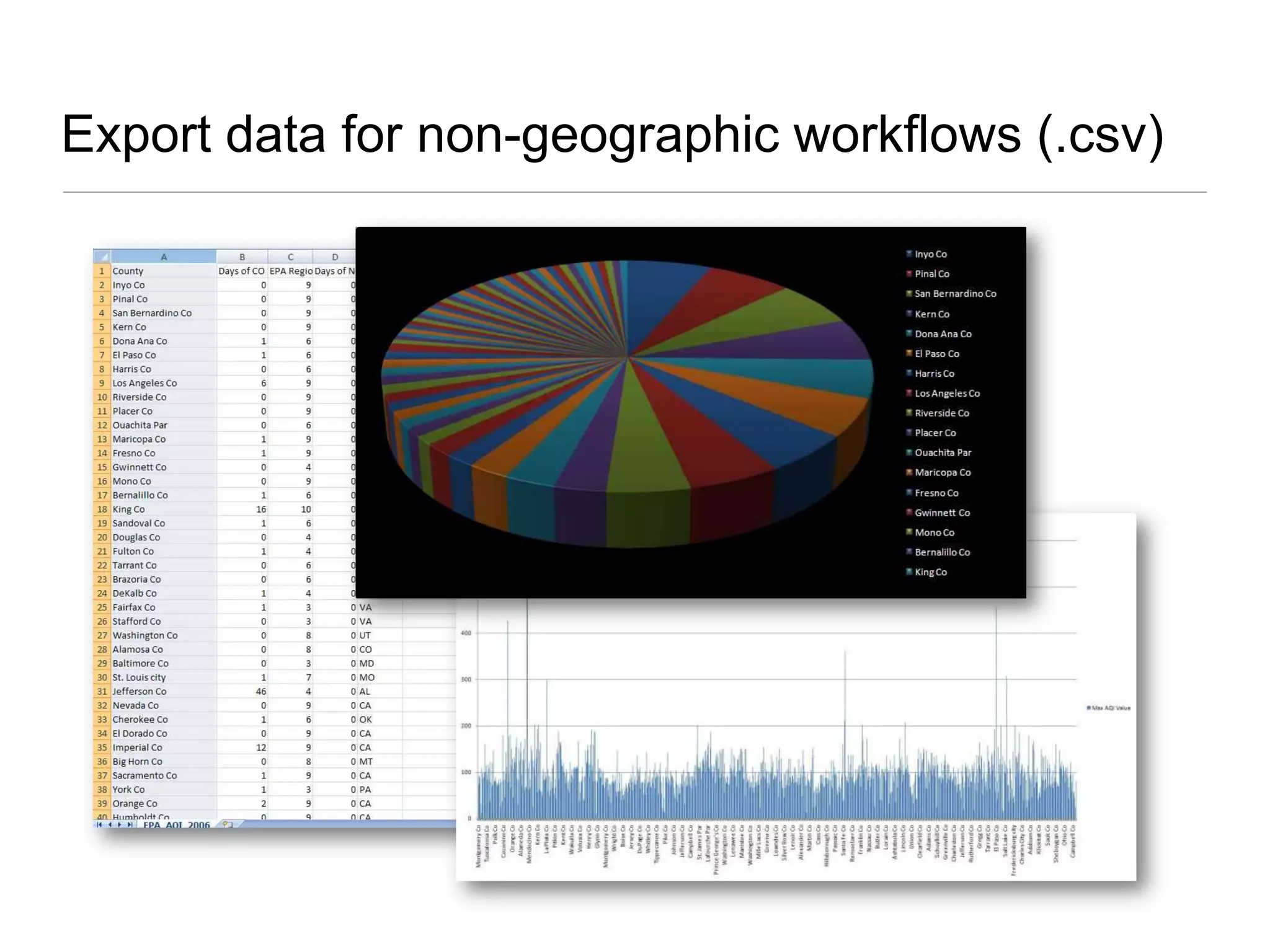
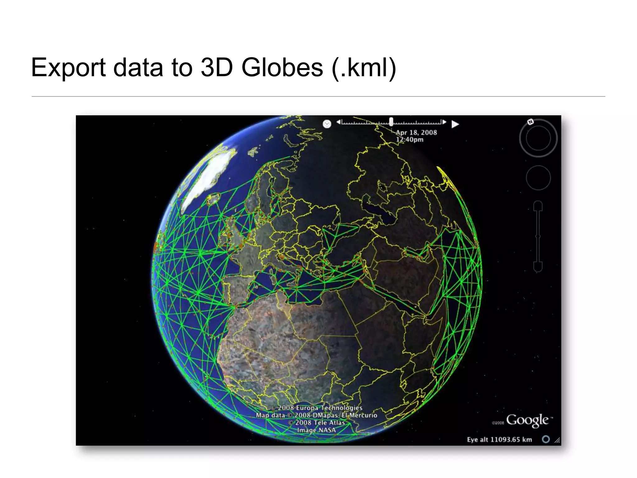
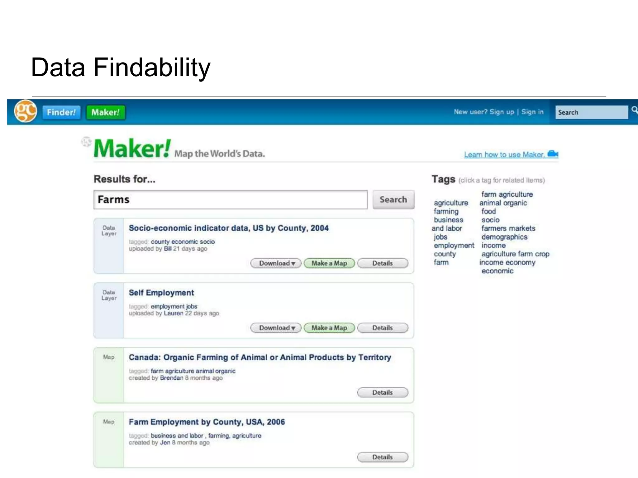
This document discusses a project to enable more government tabular data to be used in a geographic context. The goals are to 1) make more data consumable for geographic applications and education, 2) increase demand for geographic technologies, and 3) create a positive impact on agencies and companies using geospatial technologies. The proposed solution is a platform to easily georeference non-spatial data through address geocoding, polygon matching, and catalog/search capabilities. This will allow data to be mapped and used in a variety of workflows including spreadsheets, GIS, and the web.
Field Data Collecting, Processing and Sharing: Using web Service TechnologiesNiroshan Sanjaya
Collecting, Distributing and Analyzing field data is a crucial part in any geospatial study. Field data collection tools and methods have been developed significantly due to the advancement of technologies such as Global Navigational Satellite Systems (GNSS) and development of smartphones. Accurate field data collection is also a necessary task for broad spatial data analysis and proper decision making. Development of Web technologies led to share the data and information effectively. This study tries to develop a framework based on the Geospatial Semantic Web technologies for disseminating and processing field data. Experimental results from an implemented prototype show that the proposed framework allows to visualize and process the field data in any context. The system of this study is capable of distributing and processing field data using web application. Moreover, the study demonstrates the importance and the capabilities of web services for spatial data gathering and processing. The system has been developed based on Free and Open Source Software (FOSS) packages such as ZOO-Project, Open Data Kit, etc. It enables user to further improve or deploy the system for variety of studies.
This tool solves a real problem in the environmental inventory industry and makes a valuable open data set more accessible.
The NJDEP maintains a statewide wildlife habitat data set that details conservation requirements related to environmental regulations. This is an open data set, but accessibility is limited since working with the one million habitat areas often requires knowledge of GIS software. Using desktop GIS software, a site-specific search is a time-intensive process, taking minutes or hours to run geoprocessing operations for specific properties.
Now, a user can draw a custom area in a browser window and return results in seconds.
Learn about how the project was built in this presentation.
Presented by Abenet Yabowork and Marie-Angelique Laporte at the Agricultural Research Data Network for Modeling and Analytics (ARDN-MA), Virtual Hackathon, 17–20 November 2020
Overview of the world of geospatial metadata, and the role of the EDINA service GoGeo in creating, saving, and discovering it. Presented on 19 June 2014 by Tony Mathys in Aberdeen, Scotland.
With the rapid development in Geographic Information Systems (GISs) and their applications, more and
more geo-graphical databases have been developed by different vendors. However, data integration and
accessing is still a big problem for the development of GIS applications as no interoperability exists among
different spatial databases. In this paper we propose a unified approach for spatial data query. The paper
describes a framework for integrating information from repositories containing different vector data sets
formats and repositories containing raster datasets. The presented approach converts different vector data
formats into a single unified format (File Geo-Database “GDB”). In addition, we employ “metadata” to
support a wide range of users’ queries to retrieve relevant geographic information from heterogeneous and
distributed repositories. Such an employment enhances both query processing and performance.
The development of a Geographic Information System for traffic route planni...Matthew Pulis
This was my MSc. Informatics thesis. The project started with a Literature Review studying the historic advancements of Location Based Services and Geographic Information Systems, in particular Open Source GIS. Case Studies were reviewed so as to gain knowledge from past experiences. The methodology used for this project followed the DSDM methodology and requirements were drawn following the MoSCoW priorities. A full working version of the project which is presented in
a Web Interface can be accessed online.
This presentation outlines an GPS data collection method for rapid GIS map production - for multiple users under emergency/disaster conditions.
Database available upon request
SDSC Technology Forum: Increasing the Impact of High Resolution Topography Da...OpenTopography Facility
High-resolution topography is a powerful tool for studying the Earth's surface, vegetation, and urban landscapes, with broad scientific, engineering, and educational-based applications. Over the past decade, there has been dramatic growth in the acquisition of these data for scientific, environmental, engineering and planning purposes. In the US, the U.S. Geological Society is undertaking the 3D Elevation Program (3DEP) to map the entire lower 48 with lidar by 2023.
The richness of these topography datasets make them extremely valuable beyond the application that drove their acquisition and thus are of interest to a large and varied user community. A cyberinfrastructure platform that enables users to efficiently discover, access and process these massive volumes of data increases the impact of investments in collection of the data and catalyzes scientific discovery as well as informs critical decisions that are made across our Nation every day that depend on elevation data, ranging from immediate safety of life, property, and environment to long term planning for infrastructure projects.
Join us to hear about the motivations, technology, and data assets behind the National Science Foundation funded OpenTopography platform, which aims to democratize access to high resolution topographic data. OpenTopography’s innovation is in co-locating massive volumes of topographic data with processing tools that enable users with varied expertise and application domains to quickly and easily access and process data, to enable innovation and decision making.
Presentation at Where 2.0 2008 where we discuss our rational for building a NoSQL data store after reaching limitations with the spatial SQL solution that were available at the time.
2009 AAG presentation for the "Is Google Good for Geography?" session.
Can the GeoWeb Get the Public to Care about Geography? The Positive Externalities of a Web Enabled Ecosystem
2024.06.01 Introducing a competency framework for languag learning materials ...Sandy Millin
http://sandymillin.wordpress.com/iateflwebinar2024
Published classroom materials form the basis of syllabuses, drive teacher professional development, and have a potentially huge influence on learners, teachers and education systems. All teachers also create their own materials, whether a few sentences on a blackboard, a highly-structured fully-realised online course, or anything in between. Despite this, the knowledge and skills needed to create effective language learning materials are rarely part of teacher training, and are mostly learnt by trial and error.
Knowledge and skills frameworks, generally called competency frameworks, for ELT teachers, trainers and managers have existed for a few years now. However, until I created one for my MA dissertation, there wasn’t one drawing together what we need to know and do to be able to effectively produce language learning materials.
This webinar will introduce you to my framework, highlighting the key competencies I identified from my research. It will also show how anybody involved in language teaching (any language, not just English!), teacher training, managing schools or developing language learning materials can benefit from using the framework.
The Indian economy is classified into different sectors to simplify the analysis and understanding of economic activities. For Class 10, it's essential to grasp the sectors of the Indian economy, understand their characteristics, and recognize their importance. This guide will provide detailed notes on the Sectors of the Indian Economy Class 10, using specific long-tail keywords to enhance comprehension.
For more information, visit-www.vavaclasses.com
This is a presentation by Dada Robert in a Your Skill Boost masterclass organised by the Excellence Foundation for South Sudan (EFSS) on Saturday, the 25th and Sunday, the 26th of May 2024.
He discussed the concept of quality improvement, emphasizing its applicability to various aspects of life, including personal, project, and program improvements. He defined quality as doing the right thing at the right time in the right way to achieve the best possible results and discussed the concept of the "gap" between what we know and what we do, and how this gap represents the areas we need to improve. He explained the scientific approach to quality improvement, which involves systematic performance analysis, testing and learning, and implementing change ideas. He also highlighted the importance of client focus and a team approach to quality improvement.
Ethnobotany and Ethnopharmacology:
Ethnobotany in herbal drug evaluation,
Impact of Ethnobotany in traditional medicine,
New development in herbals,
Bio-prospecting tools for drug discovery,
Role of Ethnopharmacology in drug evaluation,
Reverse Pharmacology.
The Art Pastor's Guide to Sabbath | Steve ThomasonSteve Thomason
What is the purpose of the Sabbath Law in the Torah. It is interesting to compare how the context of the law shifts from Exodus to Deuteronomy. Who gets to rest, and why?
The French Revolution, which began in 1789, was a period of radical social and political upheaval in France. It marked the decline of absolute monarchies, the rise of secular and democratic republics, and the eventual rise of Napoleon Bonaparte. This revolutionary period is crucial in understanding the transition from feudalism to modernity in Europe.
For more information, visit-www.vavaclasses.com
Students, digital devices and success - Andreas Schleicher - 27 May 2024..pptxEduSkills OECD
Andreas Schleicher presents at the OECD webinar ‘Digital devices in schools: detrimental distraction or secret to success?’ on 27 May 2024. The presentation was based on findings from PISA 2022 results and the webinar helped launch the PISA in Focus ‘Managing screen time: How to protect and equip students against distraction’ https://www.oecd-ilibrary.org/education/managing-screen-time_7c225af4-en and the OECD Education Policy Perspective ‘Students, digital devices and success’ can be found here - https://oe.cd/il/5yV
How to Create Map Views in the Odoo 17 ERPCeline George
The map views are useful for providing a geographical representation of data. They allow users to visualize and analyze the data in a more intuitive manner.
1. Enabling Use of Government Tabular Data in a Geographic Context U.S. Federal Geographic Data Committee 2009 CAP Grant, Category 4
2. FGDC Cap Grant, Category 4 Easy and productive access to geographic, tabular government data Reference location by Address, Code, or Coordinates Shared Public Web Service Discoverable, Accessible, and Applicable to geographic contexts
3. Project Goals Enable more data to be consumable in a geographic context Increases in geo-enabled data will cause an increase in demand for geographic applications and education Geo-enabled data creates a positive externality for the entire ecosystem of agencies and companies that leverage or provide geospatial technologies Mapping should be an option for every data work flow when there is a geographic component available (80-90% of the time) Make data available to a variety of workflows (spreadsheet data to GIS and GeoWeb) and provide dynamic loops (GIS data back to spreadsheets and GeoWeb) allow for collaboration and data sharing
4. Proposed Solution Deliver a platform to provide easy georeferencing of non-spatial data Quality Assurance and Error identification and remediation of contributed datasets Catalog and store taxonomy of existing boundary data sources Add OGC Catalog Services for the Web (CSW) support
5.
6. CAP Added Capabilities GeoCoding Engine for Street Address georeferencing GeoJoin Engine for polygonal region georeferencing Spatial, hierarchical aggregation Federated search and discovery OpenSearch and GeoRSS OGC Catalog Services for the Web (CSW)
7. GeoCommons Architecture Web Services API Finder! Maker! Search Core Analysis Engine GeoJoin Engine File Parsers GeoCoding Engine Data Store
8. GeoCoding Engine Modularized Architecture US Address Parsing module US TIGER/Line Database and importer Replaceable components Open-Source GeoCoding Engine Web Service API Address String Parser Ruby Street Database SQLite
9. GeoReferencing Engine Stored GeoCommons boundary definitions Integration with existing georeferencing services Join imported data with any GeoCommons dataset