The document provides an introduction to geospatial intelligence and Earth observation applications from the Satellite Applications Catapult. It discusses the growing market opportunity in Earth observation, examples of application areas like agriculture, urban planning, and infrastructure monitoring, and technologies like satellite sensors, change detection over time, and interferometric synthetic aperture radar. It emphasizes the potential of applying AI/ML to extract information from Earth observation data and highlights reasons to invest in developing related applications.
UK space agency - The Space Economy and Role of the UK Space AgencyChris Atherton
Talk on the UK space economy and the role of the UK Space Agency by Elizabeth Seaman, Head of Major projects at the UK Space Agency. The talk was delivered on the 18th of March at the Cunard building in Liverpool as part of the inaugural Northern Space consortium 'A case for space as an economic driver' event.
With the adoption in April and the launch of S1A, the European Programme for Earth Observation, Copernicus, will deliver European information services based on satellite Earth Observation and in-situ data analyses. It is the first time that vast amounts of global data from satellites and from ground-based, airborne and seaborne measurement systems are being used to provide information to help service providers, public authorities and other international organisations improve the quality of life for the citizens of Europe. The information services provided will be freely and openly accessible to users.
The services address six thematic areas: land, marine, atmosphere, climate change, emergency management and security.
Copernicus Services support a broad range of environmental and security applications, including sustainable development, transport and mobility, climate change monitoring, civil protection, urban area management, regional and local planning, agriculture and health.
The wealth of space based data is an important opportunity to develop innovative space applications. Copernicus Services will have to evolve to remain in tune with the state-of-art, adjusting to user's requirement and new developments need. Thanks to H2020, the Europe's research Programme, this will be guaranteed.
Upcoming Datasets: Global wind map, Jake Badger ( Risoe DTU)IRENA Global Atlas
Upcoming Datasets: Global wind map. A presentation by Jake Badger ( Risoe DTU) during the Global Atlas side event which held at the World Future Energy Summit in 2014
Progresses on the Global Solar and Wind Atlas, Data Quality Information Frame...IRENA Global Atlas
Progresses on the Global Solar and Wind Atlas, Data Quality Information Framework and concept for the Global Renewable Energy Atlas.
A presentation by Nicolas Fichaux (IRENA) during the Global Atlas side event which held at the World Future Energy Summit in 2014
Global Atlas for Renewable Energy - application to MauritaniaIRENA Global Atlas
One of the key activities in IRENA is the development of renewable readiness assessments (RRAs). An RRA is a holistic assessment of conditions for renewable energy deployment in a country, and the actions necessary to further improve these conditions. An RRA is a rapid assessment of how a country can increase readiness and overcome the main barriers to the deployment of renewable energy technologies. It covers all services (transport, heat, electricity and motive power), and sources of renewable energy, with countries selecting those of relevance. The RRA comprises a process and a methodology that includes completing a set of templates and a final report. On the occasion of the RRA Mauritania, the Global Atlas was presented, as a potential supplier of data, data infrstructure and education for zoning renewable energy hotspots.
Presentation of a case study of an air quality hot spot mapper - an overview of the satellite enabled solution and the prototype, as well as the costs and benefits. Presented by Paul Monks, Professor of Atmospheric Chemistry and Earth Observation at University of Leicester, at the Making Efficiencies using Satellites – ‘it’s not rocket science’ Discovery Day on 13 March 2015 in Oxfordshire.
EGNOS growing market in Agriculture and fostering new opportunities in MappingCAPIGI
EGNOS is Europe's operational contribution to satellite based navigation. Awaiting completion of the GALILEO programme, EGNOS is a service of growing interest in agriculture.
Space research : space research projects under the 7th framework programme for research (5th call)
Civilisations have always wondered what is beyond the sky. But it is only recently that the limitless possibilities provided by space science and technology came into stronger spotlight and started to be used to the full. The EU has been playing a significant role in this process, in particular through the FP7 space research programme. The 5th FP7 space call brochure – through presentation of 50 projects divided into four categories (Copernicus applications and data; space technologies; space science and data exploitation; cross-cutting issues) – aims at giving a comprehensive overview of Europe's endeavours to fully, yet sustainably, use space for purposes ranging from excellent reception of TV signal to helping victims of earthquakes and other natural disasters
UK Spectrum Policy Forum – Richard Peckham, UK Space - The Case for SpacetechUK
UK Spectrum Policy Forum
Cluster 3 Meeting – 17 September 2014
Richard Peckham, UK Space
The Case for Space: The commercial, societal and macro-economic case for satellite spectrum
More information at: http://www.techuk.org/about/uk-spectrum-policy-forum
All rights reserved
We show how deep learning can be effectively applied to remote sensing. Many problems we faced, solutions we have had discovered were highlighted too. Remotely sensed data, unlike other vision tasks are very challenging and posses extra difficulties. Objects are very small compared to the image size, and even small pixel sizes of 8*10 pixel can contain huge amount of informations.
To the best of our knowledge there is no automated or simi-automated tool that uses deep learning to detect features from satellite imagery.
Disaster Risk Management ‘enlarged actions’ by Ivan Petiteville, co-chair, CE...Global Risk Forum GRFDavos
Presentation at the Consultion Day event about: Scientific and Technical Platforms / Networks: Achievements and Future Goals during the Global Platform for Disaster Risk Reduction GPDRR 2013 in Geneva
Space Mission UK is an exciting series of entrepreneur missions specifically designed to support UK startups with their ambition to build world-leading space and satellite application companies. It’s supported by Innovate UK, UK Trade & Investment and produced by Chinwag.
The first mission took place 8-14 August 2015 visiting the Small Sat Conference in Utah, followed by a packed programme in San Francisco, Silicon Valley and Los Angeles.
Presentation on the satellite landscape, the Space for Smarter Government Programme and funding opportunities. Presented by Beth Greenaway at the Making Efficiencies using Satellites – ‘it’s not rocket science’ Discovery Day on 13 March 2015 in Oxfordshire.
The Value Added Element (VAE) and Data User Element (DUE) are two programmatic components of the Earth Observation Envelope Programme (EOEP), an optional programme of the European Space Agency, currently subscribed by 20 ESA Member States. While the DUE mission focuses on the establishment of a long-term relationship between the User communities and Earth Observation in support of major environmental conventions, the VAE focuses on developing the European and Canadian EO Services Industry in growing the prospects of sustainable use of EO-based information the operations of non-EO businesses and organisations.
Space for Smarter Government Programme (SSGP)techUK
Presented by Sara Huntingdon, Space for Smarter Government Programme Manager, UK Space Agency in the techUK Satellite Applications & Services Conference, 2nd Oct. 2015
Space Mission UK - Mission 3 Lookbook - 5-11 Nov 2016Chinwag
Space Mission UK is a series of entrepreneur-led missions specifically designed for the UK's top space and satellite application startups. This lookbook covers the ten companies taking part in the third mission to San Francisco, Silicon Valley and Los Angeles.
For more information:
http://spacemissionuk.org
Space Mission UK is supported by Innovate UK and produced by trade mission specialists, Chinwag - http://chinwag.com
Dr Neil Walton from Manchester University shares his project on traffic analytics.
‘Deep Reinforcement Learning has seen a surge of interest in recent years. We investigate the applicability of Reinforcement Learning (RL) to Urban Traffic Control (UTC). We compare our results with commercially available UTC systems namely MOVA from the Transport Research Laboratory, BALANCE from PTV Group, and our own implementation of the SurTrac system.’
Slides demonstrating the DWP Digital's ML applications for social policy. Presented by Pablo Suau at the Machine Intelligence Garage meetup with the University of Newcastle.
Builder.ai Founder Sachin Dev Duggal's Strategic Approach to Create an Innova...Ramesh Iyer
In today's fast-changing business world, Companies that adapt and embrace new ideas often need help to keep up with the competition. However, fostering a culture of innovation takes much work. It takes vision, leadership and willingness to take risks in the right proportion. Sachin Dev Duggal, co-founder of Builder.ai, has perfected the art of this balance, creating a company culture where creativity and growth are nurtured at each stage.
Encryption in Microsoft 365 - ExpertsLive Netherlands 2024Albert Hoitingh
In this session I delve into the encryption technology used in Microsoft 365 and Microsoft Purview. Including the concepts of Customer Key and Double Key Encryption.
Epistemic Interaction - tuning interfaces to provide information for AI supportAlan Dix
Paper presented at SYNERGY workshop at AVI 2024, Genoa, Italy. 3rd June 2024
https://alandix.com/academic/papers/synergy2024-epistemic/
As machine learning integrates deeper into human-computer interactions, the concept of epistemic interaction emerges, aiming to refine these interactions to enhance system adaptability. This approach encourages minor, intentional adjustments in user behaviour to enrich the data available for system learning. This paper introduces epistemic interaction within the context of human-system communication, illustrating how deliberate interaction design can improve system understanding and adaptation. Through concrete examples, we demonstrate the potential of epistemic interaction to significantly advance human-computer interaction by leveraging intuitive human communication strategies to inform system design and functionality, offering a novel pathway for enriching user-system engagements.
Elevating Tactical DDD Patterns Through Object CalisthenicsDorra BARTAGUIZ
After immersing yourself in the blue book and its red counterpart, attending DDD-focused conferences, and applying tactical patterns, you're left with a crucial question: How do I ensure my design is effective? Tactical patterns within Domain-Driven Design (DDD) serve as guiding principles for creating clear and manageable domain models. However, achieving success with these patterns requires additional guidance. Interestingly, we've observed that a set of constraints initially designed for training purposes remarkably aligns with effective pattern implementation, offering a more ‘mechanical’ approach. Let's explore together how Object Calisthenics can elevate the design of your tactical DDD patterns, offering concrete help for those venturing into DDD for the first time!
Software Delivery At the Speed of AI: Inflectra Invests In AI-Powered QualityInflectra
In this insightful webinar, Inflectra explores how artificial intelligence (AI) is transforming software development and testing. Discover how AI-powered tools are revolutionizing every stage of the software development lifecycle (SDLC), from design and prototyping to testing, deployment, and monitoring.
Learn about:
• The Future of Testing: How AI is shifting testing towards verification, analysis, and higher-level skills, while reducing repetitive tasks.
• Test Automation: How AI-powered test case generation, optimization, and self-healing tests are making testing more efficient and effective.
• Visual Testing: Explore the emerging capabilities of AI in visual testing and how it's set to revolutionize UI verification.
• Inflectra's AI Solutions: See demonstrations of Inflectra's cutting-edge AI tools like the ChatGPT plugin and Azure Open AI platform, designed to streamline your testing process.
Whether you're a developer, tester, or QA professional, this webinar will give you valuable insights into how AI is shaping the future of software delivery.
The Art of the Pitch: WordPress Relationships and SalesLaura Byrne
Clients don’t know what they don’t know. What web solutions are right for them? How does WordPress come into the picture? How do you make sure you understand scope and timeline? What do you do if sometime changes?
All these questions and more will be explored as we talk about matching clients’ needs with what your agency offers without pulling teeth or pulling your hair out. Practical tips, and strategies for successful relationship building that leads to closing the deal.
Essentials of Automations: Optimizing FME Workflows with ParametersSafe Software
Are you looking to streamline your workflows and boost your projects’ efficiency? Do you find yourself searching for ways to add flexibility and control over your FME workflows? If so, you’re in the right place.
Join us for an insightful dive into the world of FME parameters, a critical element in optimizing workflow efficiency. This webinar marks the beginning of our three-part “Essentials of Automation” series. This first webinar is designed to equip you with the knowledge and skills to utilize parameters effectively: enhancing the flexibility, maintainability, and user control of your FME projects.
Here’s what you’ll gain:
- Essentials of FME Parameters: Understand the pivotal role of parameters, including Reader/Writer, Transformer, User, and FME Flow categories. Discover how they are the key to unlocking automation and optimization within your workflows.
- Practical Applications in FME Form: Delve into key user parameter types including choice, connections, and file URLs. Allow users to control how a workflow runs, making your workflows more reusable. Learn to import values and deliver the best user experience for your workflows while enhancing accuracy.
- Optimization Strategies in FME Flow: Explore the creation and strategic deployment of parameters in FME Flow, including the use of deployment and geometry parameters, to maximize workflow efficiency.
- Pro Tips for Success: Gain insights on parameterizing connections and leveraging new features like Conditional Visibility for clarity and simplicity.
We’ll wrap up with a glimpse into future webinars, followed by a Q&A session to address your specific questions surrounding this topic.
Don’t miss this opportunity to elevate your FME expertise and drive your projects to new heights of efficiency.
Accelerate your Kubernetes clusters with Varnish CachingThijs Feryn
A presentation about the usage and availability of Varnish on Kubernetes. This talk explores the capabilities of Varnish caching and shows how to use the Varnish Helm chart to deploy it to Kubernetes.
This presentation was delivered at K8SUG Singapore. See https://feryn.eu/presentations/accelerate-your-kubernetes-clusters-with-varnish-caching-k8sug-singapore-28-2024 for more details.
Generating a custom Ruby SDK for your web service or Rails API using Smithyg2nightmarescribd
Have you ever wanted a Ruby client API to communicate with your web service? Smithy is a protocol-agnostic language for defining services and SDKs. Smithy Ruby is an implementation of Smithy that generates a Ruby SDK using a Smithy model. In this talk, we will explore Smithy and Smithy Ruby to learn how to generate custom feature-rich SDKs that can communicate with any web service, such as a Rails JSON API.
JMeter webinar - integration with InfluxDB and GrafanaRTTS
Watch this recorded webinar about real-time monitoring of application performance. See how to integrate Apache JMeter, the open-source leader in performance testing, with InfluxDB, the open-source time-series database, and Grafana, the open-source analytics and visualization application.
In this webinar, we will review the benefits of leveraging InfluxDB and Grafana when executing load tests and demonstrate how these tools are used to visualize performance metrics.
Length: 30 minutes
Session Overview
-------------------------------------------
During this webinar, we will cover the following topics while demonstrating the integrations of JMeter, InfluxDB and Grafana:
- What out-of-the-box solutions are available for real-time monitoring JMeter tests?
- What are the benefits of integrating InfluxDB and Grafana into the load testing stack?
- Which features are provided by Grafana?
- Demonstration of InfluxDB and Grafana using a practice web application
To view the webinar recording, go to:
https://www.rttsweb.com/jmeter-integration-webinar
GraphRAG is All You need? LLM & Knowledge GraphGuy Korland
Guy Korland, CEO and Co-founder of FalkorDB, will review two articles on the integration of language models with knowledge graphs.
1. Unifying Large Language Models and Knowledge Graphs: A Roadmap.
https://arxiv.org/abs/2306.08302
2. Microsoft Research's GraphRAG paper and a review paper on various uses of knowledge graphs:
https://www.microsoft.com/en-us/research/blog/graphrag-unlocking-llm-discovery-on-narrative-private-data/
Geospatial intelligence satellite applications catapult pdf - july 23 2019
1. Catapult Open
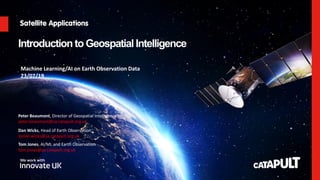
IntroductiontoGeospatial Intelligence
Dan Wicks, Head of Earth Observation
daniel.wicks@sa.catapult.org.uk
Peter Beaumont, Director of Geospatial Intelligence
peter.beaumont@sa.catapult.org.uk
Machine Learning/AI on Earth Observation Data
23/07/19
Tom Jones, AI/ML and Earth Observation
tom.jones@sa.catapult.org.uk
2. Catapult Open
Agenda
• Introduction to the Satellite Applications Catapult
• The Market Opportunity
• Introduction to Earth Observation
• Example Application Areas
4. Catapult Open
Who
are
we?
SATELLITE APPLICATIONS CATAPULT
An innovation and
technology company
transforming the way
the world uses
satellite technology
and data.
WE HELP ORGANISATIONS
GROW THEIR BUSINESS
WE ARE
INDEPENDENT
We help organisations to use satellite
applications to grow their business in
the UK and internationally.
We bring together industry,
researchers, end-users and
government to explore and
develop new ideas.
WE ARE
GOVERNMENT BACKED
We are partly-funded by the Government
and work closely with Innovate UK, UK
Space Agency, UK Science & Innovation
Network, and other public bodies.
5. Catapult Open
Our
focus
SATELLITE APPLICATIONS CATAPULT
INTEGRATION FOR A CONNECTED AND INFORMATION CENTRIC WORLD
APPLICATIONS
UBIQUITOUS
CONNECTIVITY
Super-fast, always on connectivity for the digital age
GEOSPATIAL
INTELLIGENCE
An ever growing demand for information that is
accurate, personalised, localised and available
globally in real-time
6. Catapult Open
OUR STRATEGIC VISION
ENERGISING
THE MARKET
Through our market programmes we
unlock latent customer demand,
open new markets, and drive exports
by raising awareness, changing
preconceptions and showcasing the
power of space derived services.
EMPOWERING
TECHNOLOGY
Through our technology programme we
help companies advance their products
to be closer to market programme
opportunities by identifying the barriers
to entry such as regulation,
incumbents, or simple accessibility.
ENABLING
BUSINESS
We connect business of all sizes with
the resources and facilities they need
to launch and grow, opening new
routes to market and attracting
inward investment. We provide
targeted business support, user-
centred design expertise and
signposting to finance.
8. Catapult Open
Earth Observation – Growing Opportunity
• Satellite-derived EO still relatively immature
• Data improving, infrastructure advancing, and applications
evolving continuously.
• Global satellite-based EO market is buoyant and growing.
• Market studies suggest the global industry was worth $43.7
billion in 2017, expected to reach $66.1 billion in 2020 (CAGR
of 14.8%)
• London Economics’ analysis of the UK space industry suggests
that UK EO industry was worth £325 million in 2014/15, double
to £625 million by 2020. (CAGR of 11.5%)
• Total spend on EO by government is estimated at £1.2bn
between 2014 and 2020, equivalent to annual average spend of
£175m
• Geospatial Commission
• Analysis of private sector use cases suggests government
could unlock up to £6-11 billion per year of economic value
Value of satellite-derived Earth Observation capabilities to the UK
Government today and by 2020, London Economics
An Initial Analysis of the Potential Geospatial Economic Opportunity, Cabinet Office, 2018
9. Catapult Open
CEMS Concept
Confidentiality Status: Catapult Open
Established 2013
Current usage:
48 live environments
Projects & SMEs
450+ VMs
1100 Ghz CPU
6.2TB RAM
80% Utilised
12. Catapult Open
Science of obtaining
information about the Earth's
physical, chemical and
biological systems.
13. Catapult Open
SPATIAL RESOLUTION
Jensen, 2015
Spatial resolution:
• smallest separation between two objects that can be
resolved;
• the size of the cells on the ground
15. Catapult Open
SPECTRAL RESOLUTION
Jensen, 2015
Spectral resolution:
• number and dimension of wavelength intervals (‘bands’) in
the electromagnetic spectrum
Example from Worldview 3
18. 18
Catapult Open
Al Zaatari, Jordanien
08.03.2011
Al Zaatari, Jordanien
11.09.2012
Al Zaatari, Jordanien
12.12.2012
Al Zaatari, Jordanien
03.01.2013
Al Zaatari, Jordanien
26.02.2013
Al Zaatari, Jordanien
13.01.2014
Evolution of Al Zaatari
refugee camp, Mafraq
Governorate, Jordan
• WorldView-2 imagery
(50cm) @European Space
Imaging / DigitalGlobe
• Rapid increase of
satellite detected shelters
and other buildings
• Visible areas of
expansion through the
temporal span, e.g.
preparations to
accommodate the
increasing number of
refugees
Change Detection
21. Catapult Open
EARTH OBSERVATION APPLICATIONS
Meteorology Sustainable
development
Safety and security
Global change
research
Earth system and
environmental sciences
Mobility Resource
management
Civil engineering
and urban planning
23. Catapult Open
WHO WE ARE
Depends on the socio-
economic group, the resilient
to cope with weather impact
varies. On top of that,
depends on the built
environment, e.g. urban area
has mini heat islands, the
impact of a weather event is
distributed unevenly.
Understanding the impact of
extreme weather events can
support the redesigning built
environment and capacity
planning to handle ill health.
Case Study
To understand
where the heatwave
(2013) hits the
hardest
Satellite Application
• Climate
(Weather)
• Socio-economic
indicators of a
population (Heat
Vulnerability
Index)
HEAT VULNERABILITY IN CITIES
26. Catapult Open
UK FloodScore™ AddressRisk: combined risk – Average Annual Loss (defended)
Very High Risk
High Risk
Moderate Risk
Low Risk
Negligible Risk
UK FloodScore™
28. Catapult Open
Interferometric Synthetic Aperture Radar
(InSAR) Tunnelling operation in London
uplift
subsidence
• Ground deformation May 2011 – April 2017
• TerraSAR-X satellite (X-band)
• Crossrail construction works and their progress clearly visible
31. Catapult Open
31
• Bolivia 7Lithium Prospectivity, Cornwall, UK
Carmenellis
St. Austell
188km² site with an
expansive history of
mining activity and more
recently reclaimed natural
landscapes
111km² site, a landscape that
is still subject to intensive
mining, providing a current
context for environmental
monitoring
32. Catapult Open
Lithium Prospectivity map
faults
mineral
alterations
terrain
displacement
(active faults)
vegetation
anomalies
Legend
1km_prospectivity - 10 class
1km_prospectivity.Prospect
0 - 7
8 - 14
15 - 20
21 - 27
28 - 34
35 - 41
42 - 48
49 - 54
55 - 61
62 - 68
not probable
higher probability
1 sqkm probability of Li occurrence
lower probability
34. Catapult Open
Why consider investing in developing Earth Observation
applications?
• Massively growing opportunity
• Contribute to solving todays important
challenges
• Unprecedented access to data
• Essential to optimise information
extraction through application of
AI/ML
• Strong support to develop
applications form Catapult
network
• Look out for funding opportunities
Why consider investing in developing Earth
Observation applications?
35. Catapult Open
Thank
you
Dan Wicks, Head of Earth Observation
daniel.wicks@sa.catapult.org.uk
Peter Beaumont, Director of Geospatial Intelligence
peter.beaumont@sa.catapult.org.uk
Tom Jones, AI/ML and Earth Observation
tom.jones@sa.catapult.org.uk