Download to read offline

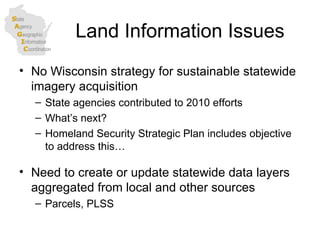
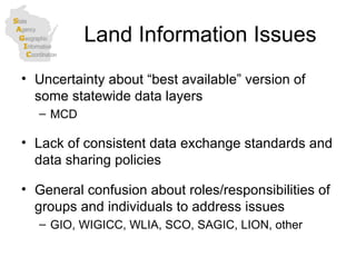
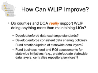

This document discusses several key land information issues facing state government in Wisconsin, including the lack of a statewide imagery acquisition strategy, uncertainty around authoritative statewide data layers, and the need for business case assessments for centralized data infrastructure and services. It also describes relevant technological advances like web services and political advances in government transparency. The document questions how the Wisconsin Land Information Program (WLIP) could be enhanced to better support state government needs, such as developing standards, policies and funding for statewide data layers and a central repository. It discusses whether WLIP should focus more on local government roles or take on broader statewide initiatives.


![Getting Started with Apache Spark: Big Data Made Simple [Free Meetup]](https://cdn.slidesharecdn.com/ss_thumbnails/apachesparkgettingstarted-260203175547-8361bcc3-thumbnail.jpg?width=640&height=640&fit=bounds)

