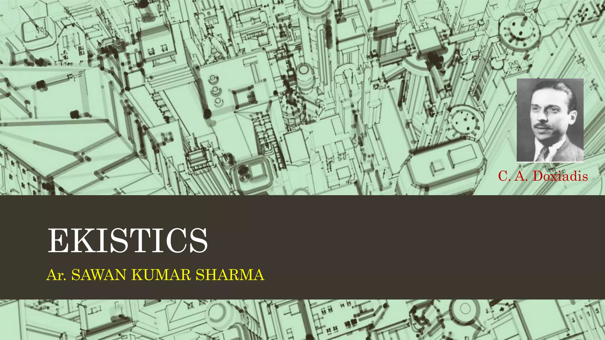
Ar Sawan Kumar Sharma
B.Arch, M. Ekistics,
Associate Professor
(Head Faculty Development & social media)
DC School of Architecture and Design, DCSMAT, Vagamon, Idukki,
Kerala
9811992123
Le Corbusier designed the unrealized Radiant City project in 1930 which sought to improve urban living standards. The design had strict zoning with segregated areas for housing, business, and industry connected by underground transit. Housing would be in tall, standardized residential towers set amongst green spaces. Though never built, the Radiant City influenced many later projects seeking efficient urban planning and design through order and separation of functions.
Patrick Geddes was a Scottish biologist, sociologist, geographer, philanthropist and pioneering town planner known as the "Father of Modern Town Planning". He introduced concepts like the "region" in architecture and planning. Geddes believed that a region influences and is influenced by the cities within it, represented by his "Geddian Trio" of activity, work, and place. He coined the term "conurbation" to describe merged cities and regions influenced by new transportation technologies. Some of Geddes' plans included the master plan for Tel Aviv which emphasized pedestrians, greenery, and civic spaces. He also developed the "constellation theory" of regional planning around groupings of interconnected cities.
This document provides information about Sir Patrick Geddes, a Scottish biologist, sociologist, geographer, philanthropist, and pioneering town planner. It discusses his influential thinking in fields like urban planning and sociology. Some of Geddes' key contributions mentioned include introducing the concept of "region" to architecture and planning, coining the term "conurbation" to describe merged urban areas, and founding the Scots College international teaching establishment. The document also outlines some of Geddes' principles for urban planning projects in places like Bombay and his concepts around the relationships between a place, its folk/people, and their work.
Le Corbusier was a pioneering modern architect and urban planner who helped establish the principles of the modernist movement. He advocated for high-density urban planning with towers set within open green spaces. Some of his influential urban plans included the Ville Contemporaine from 1922, which proposed a concentric city with central skyscrapers surrounded by parks, and Plan Voisin from 1925, which reimagined part of Paris with cruciform towers. Le Corbusier believed high density could reduce travel distances if incorporated with efficient transportation systems and abundant public green spaces.
DOXIADIS
HUMAN SETTLEMENT AND PLANING
CONSTANTINOS APOSTOLOU DOXIADIS
THEORY OF EKISTICS
Minor shells- Micro-settlements- Meso-settlements- Macro-settlements-Ekistics Logarithm Scale:-
BY EVOLUNITARY PHASE
BY FACTOR AND DISCIPLINE
CASE STUDY: ISLAMABAD
Master Plan
Comparison of Land cover
CONCEPT OF CITY PLANNING
ROAD NETWORK & HIERARCHY
ROAD NETWORK & TRANSPORT
HOUSES AND STREET PATTERN
GRID SYSTEM
CURRENT CHALLENGES FACED BY THE CITY
The document discusses the principles and concepts of neighborhood planning. It explains that neighborhood planning aims to create small residential units of 2,000-5,000 people to foster a sense of community. Key aspects of neighborhood planning include limiting the size to a walkable area, using boundary roads, incorporating green spaces, designing internal streets for safety, providing a mix of housing, locating shops and community centers in central areas, and including facilities like schools and parks within 1 km to encourage social life. The principles of neighborhood planning aim to balance residential development with community spaces and recreation to recreate the lost neighborhood relationships of modern cities.
- The document discusses two historical neighborhood concepts - Radburn neighborhood model by Stein and Wright, and Clarence Perry's neighborhood unit concept. Both aimed to design self-contained neighborhoods with boundaries, green spaces, and pedestrian-focused streets, though they differed in maximum walking distances and treatment as overlapping vs separate units.
- Neighborhoods are considered the basic building block of cities in planning, with the goal of improving social and physical environments. However, increased mobility has challenged the social benefits of neighborhoods.
- Contemporary developments often prioritize financial goals over unified social and physical environments, though neighborhoods remain important for decentralized, community-focused planning.
- Le Corbusier was an influential 20th century architect and pioneer of modern architecture. He developed principles like pilotis and roof gardens.
- His 1925 plan for the Radiant City proposed vertical housing blocks surrounded by green space, with strict zoning and an emphasis on transportation. It aimed to provide a better urban lifestyle.
- Though never fully realized, the Radiant City influenced modern planning with its high-density approach. Le Corbusier later applied these principles to his master plan for Chandigarh, India in the 1950s.
Perception of Urban Space Shape of an Urban FormSomesh Siddharth
This document provides an overview of key concepts for understanding urban morphology, including:
- Perception of urban space is determined by factors like urban form, massing, and scale. Massing influences how space is perceived, and scale relates to human vision and modes of movement.
- Shape of an urban form is defined by characteristics like size, density, pattern, grain, texture, voids, and routes. Districts, activity structures, orientation, vistas, skylines, and details further shape the urban environment.
- Learning objectives are to understand how to perceive urban environments through determinants of urban form like space, mass, and scale. Key aspects that influence the perception of urban space are discussed.
Sir Patrick Geddes was a Scottish biologist, sociologist, geographer, philanthropist and pioneering town planner in the late 19th and early 20th centuries. He is known for introducing concepts like "region" and "conurbation" to urban planning. A conurbation refers to merged cities and urban areas that have grown together due to transportation and infrastructure development. Geddes coined the term and gave examples like the New York metropolitan area. He developed theories on the relationships between people, their work and their environment. Geddes also produced master plans for cities like Tel Aviv and emphasized pedestrian-focused design with green spaces.
GARDEN CITY(garden city concept), the perfect blend of city and nature.
the preservation of agricultural and rural life, nature and heritage conservation, recreation, pollution minimization, and growth management as well as the city endowed the tradition of urban planning with a social and community dimensions.
The document discusses the concept of the neighborhood unit plan proposed by Clarence Perry in the 1920s. The key aspects of Perry's plan included:
1) Neighborhoods of a fixed size to support one elementary school
2) Boundaries defined by arterial streets to discourage through traffic
3) Open spaces like parks and playgrounds making up 10% of the area
4) Community facilities like schools and shops located near the center
5) An internal street network to facilitate circulation within the neighborhood
The document summarizes several urban planning concepts from the 20th century, including the Garden City Concept, Neighborhood Unit Concept, and Sector Theory. The Garden City Concept proposed limiting city populations and incorporating green spaces. The Neighborhood Unit Concept centered schools and included parks, shops, and distinct internal/perimeter streets. Sector Theory described how distinct land use sectors near the city center would perpetuate as the city expanded in wedge-like fashion along major routes.
The Radiant City plan proposed by Le Corbusier involved rebuilding cities using modern construction methods. It centered around large, pre-fabricated apartment buildings called les unites that would house thousands of residents. Les unites would be placed on stilts above the ground and connected by interior streets and elevators. Transportation and industry would be separated onto different roadway levels. However, critics argue that while Corbusier advocated for certain individual freedoms and leisure activities, his vision actually involved a paternalistic and bureaucratic form of authority that did not allow for individual voice or non-rational human behavior. His conception of a rationally-planned city did not account for the complexity and unpredictability of human nature.
Clarence Perry was an early 20th century American planner who developed the concept of the neighborhood unit. The neighborhood unit aimed to design self-contained residential areas that promoted community and protected residents from industrial areas and traffic. Key elements included centering the neighborhood around an elementary school, placing arterial streets on the perimeter, and dedicating 10% of land to parks and open space. The ideal neighborhood unit size was 5,000-6,000 people and 160 acres to allow children to walk half a mile to school and residents to access local services. Neighborhood planning principles focused on size, boundaries, internal streets, land use mix, and locating community facilities to encourage social interaction.
Sir Patrick Geddes was a Scottish biologist, sociologist, geographer, philanthropist and pioneering town planner in the late 19th/early 20th century. He is known for his innovative thinking in fields like urban planning and sociology. Some of his key contributions include introducing the concepts of "region" and "conurbation" to architecture and planning. A conurbation refers to a region comprising cities and towns that have merged due to population growth and expansion. Geddes coined the term and provided examples like the Greater London area. He also developed theories around the relationships between a population ("folk") and their environment ("place") and means of work, which influenced his approach to regional and urban planning.
Radburn was developed in 1929 in New Jersey as one of America's first planned garden communities. It was designed by Clarence Stein and Henry Wright based on principles separating pedestrian and vehicular traffic through the use of cul-de-sacs and footpaths. The development included single family homes, row houses, apartments, and a central shopping center organized around extensive common green spaces within superblocks. While innovative at the time, some aspects of Radburn's design did not work as intended in practice and it faced financial difficulties, though its approach to integrating land uses and prioritizing pedestrian access influenced later suburban development.
Life and Career with works of Constantinos Apostolou Doxiadis. Theory of Urban Design presentation - CA Doxiadis : Ekistics theory, Islamabad master plan, Aspra Spitia introduction, Name of books and journals with bibliography
Ebenezer Howard proposed the garden city concept as a solution to problems in late 19th century cities. He envisioned self-sufficient towns of around 30,000 people, surrounded by greenbelts, that combined the benefits of town and country living without their drawbacks. Letchworth Garden City, built in 1903, was the first to implement Howard's ideas of concentric design and separation of housing, industry and agriculture. The garden city movement aimed to reform urban planning and integrate people more with nature.
Every one in the world wants to live in a compact environment. like in olden days the peoples they were used telephone, telegram, etc. for communication. but in the current scenario every one have smart phones for better communication. Because smartphones are compact and convenient to them.This presentation about Compact City planning and also it dealt how various compact cities in the developed and developing countries manage themselves. This presentation just gives an outline of the compact city planning.
This document discusses density in urban planning and defines three common ways it is measured:
1) Population density - the number of people living in a given area.
2) Floor space index (FSI) or floor area ratio (FAR) - the size of buildings on a site relative to the site area.
3) Dwelling unit density - the number of homes in a given area.
Higher density development can help conserve land but must still provide a high quality of life. Careful planning is needed to balance density with infrastructure, services, and environmental protection. Different stakeholders often focus on different density metrics - planners on FSI, agencies on population numbers, and realtors on
Urban morphology, elements of urban designAbdul Rab
This document provides an overview of urban design topics including urban morphology, elements of urban design, and the nature of urban design projects in public and private developments. It defines urban morphology as the study of the form and development of human settlements. It then discusses some key elements of urban design like buildings, public spaces, streets, transportation, and landscaping. Finally, it describes how urban design projects are carried out through public-private partnerships, with the private sector taking on financial and operational risks and the public sector providing funding or subsidies.
The document discusses several theories and models of urban and town planning from ancient to modern times. It describes the earliest river valley civilizations and oldest continuously inhabited cities. It then covers concepts in modern town planning like segregating industries, high-rise buildings, and master plans. Various approaches to town planning like rational, incremental, and communicative are mentioned. Models of urban structure and land use are summarized, including central place theory, Ebenezer Howard's three magnets diagram, the garden city movement, concentric zone model, linear city, Radburn superblock, neighborhood unit design, core frame model, sector model, and multiple nuclei model.
This document discusses the history and evolution of urban planning and settlement design. It describes early river valley civilizations and features of cities from ancient times, including the Indus Valley and cities in Greece, China, and India. It then covers the development of modern planning principles and new planned cities in the 20th century, highlighting concepts from Ebenezer Howard's Garden Cities, Tony Garnier's industrial cities, and Clarence Stein's Radburn design. The document also outlines key aspects of urban planning like transportation networks, land use planning, and social infrastructure standards.
Patrick Geddes was a Scottish biologist, sociologist, and pioneering town planner in the late 19th/early 20th century. He developed several influential theories including the valley section, constellation theory, and the concept of "conurbation." The valley section model illustrated the relationship between a region's physical geography, occupations, and human settlements. The constellation theory addressed how multiple unequal cities could plan cooperatively as a region. Geddes coined the term "conurbation" to describe the merging of cities, towns, and urban areas into continuous built-up areas through population growth. He sought to integrate social and environmental factors into urban planning approaches.
Frank Lloyd Wright was an American architect known for his organic architecture and philosophy of designing structures in harmony with humanity and nature. He was interested in urban planning throughout his career. His most ambitious plan was Broadacre City, proposed in the 1930s, which envisioned decentralized, automobile-oriented communities where each American family would be given one acre of land. Broadacre City was meant to be the antithesis of dense cities and exemplify Wright's vision of suburban living, but it remained primarily a theoretical concept that highlighted some realities of future urban sprawl and independent living. While never fully realized, Broadacre City reflected Wright's belief that technological changes would make large cities obsolete.
Jane Jacobs was an influential writer and activist in urban planning in the mid-20th century. She opposed the widespread replacement of urban communities with high-rise buildings and advocated for mixed-use neighborhoods with a focus on walkability. Along with Lewis Mumford, she is considered a founder of the New Urbanist movement. New Urbanism aims to reduce car dependence and create livable, walkable neighborhoods with a mix of housing, jobs, and commercial areas. Some examples of New Urbanist developments include Seaside, Florida, the first fully New Urbanist town, and Stapleton in Denver, Colorado. However, New Urbanism has also faced some criticisms around issues like lack of privacy and questions about how well it achieves
The document discusses the City Beautiful movement which emerged in the late 19th century. It aimed to beautify American cities through neoclassical civic design including grand boulevards, public buildings, and parks. Key examples discussed are the 1893 World's Columbian Exposition in Chicago which popularized the City Beautiful ideal, and Kansas City's implementation of this approach through a comprehensive park and boulevard system designed by George Kessler. The 1909 Plan of Chicago by Daniel Burnham and Edward Bennett also sought to beautify the city through similar civic improvements and create a more functional transportation network. However, critics argued that City Beautiful planning focused too much on aesthetics and wealthy areas, neglecting social and housing issues.
Konstantinos Doxiadis coined the term "ekistics" in 1942 to describe the interdisciplinary study of human settlements at all scales, from individual dwellings to cities to global urbanization. Ekistics examines how settlements are shaped by nature, humans, society, infrastructure, and built structures over time. Doxiadis applied ekistic principles to projects like designing the University of Punjab campus to promote walkability and community interaction, and in developing Baghdad's 1958 master plan with standardized housing types arranged in a rectilinear grid connected by new roads and mixed-use sectors. Ekistics aims to balance influences on settlements and view cities as dynamic entities that allow for continuous growth and change.
Doxiadis : Ekistics the science of human settlementHemant Mishra
The document discusses Constantinos Doxiadis and his theory of Ekistics, which is the science of human settlements. Doxiadis believed that populations and energy use in cities would greatly increase in the future. He proposed that all of humanity would eventually live in a single massive "Ecumenopolis," or worldwide city. Doxiadis developed a framework for classifying and understanding the relationships between different elements and scales of human settlements, from individual homes to global urbanization. A key aspect of his theory was that future cities must be planned to accommodate continued population growth and expansion.
C.A. Doxiadis was a Greek architect and town planner who is best known for designing the city of Islamabad, Pakistan's capital city. He graduated with architectural engineering and doctoral degrees from universities in Athens and Berlin. Doxiadis planned Islamabad according to hierarchical and sustainable principles - the city has extensive green spaces integrated throughout and a transportation network that separates vehicles, public transit, bicycles and pedestrians to reduce congestion. The master plan for Islamabad and the surrounding region was based on Doxiadis' concept of a "Dynametropolis", allowing the areas to dynamically expand over time.
C.A Doxiadis was a Greek architect and town planner known for developing the theory of Ekistics and designing the new capital city of Islamabad in Pakistan. Some key points of his work:
- He founded the science of Ekistics to study human settlements of all scales, from villages to cities to regions, and how they evolve over time. This aimed to build optimized cities for humans.
- His theory analyzed factors like geography, growth, organization, and internal/external structures that influence human settlements. It also established a hierarchy of rural villages up to larger urban areas.
- Doxiadis designed Islamabad as the new capital of Pakistan in the 1950s based on Ekistic principles
This document does not contain any text to summarize. It only contains the letters "EK", which provides no context or meaning on its own in only two characters. A proper summary requires substantive content to extract and convey the most important ideas, events, or topics in a concise yet informative way.
Ekistics - Defining What is a Polis? What does it consist ofYaryalitsa
1. The document discusses ekistics, which is defined as the science of human settlements. It examines how humans inhabit settlements and provides a conceptual framework for understanding them.
2. Ekistics studies the basic elements that make up human settlements: nature, humans, society, physical structures (shells), and connecting networks.
3. It then presents a classification system of different types of settlements based on population size, ranging from an individual person to a global city. The largest settlements discussed are megacities with populations over 50 million people.
Constantinos Apostolou Doxiadis was a Greek architect and town planner known as the "Father of Ekistics". He worked as the chief town planning officer for the Greek ministry of public works and planned many new cities and settlements around the world. Doxiadis developed the science of ekistics to systematically study human settlements and create optimal cities. He believed cities should limit heights, separate vehicle and pedestrian traffic, and be planned as small "cells". Notable projects he worked on included the master plans for Islamabad, Pakistan and Rio de Janeiro, Brazil.
Author Dr. Mirela Newman Wings Of Green Urbanism Ecological Cities, Sustainab...NewmanMirela
The document summarizes the origins and key concepts of the ecological city approach. It traces the origins of the idea back to 1975 in Berkeley, California, with the founding of the Urban Ecology organization. Major developments included Richard Register's 1987 book Eco-City Berkeley which introduced the concept, and the First International Eco-City Conference in 1990. The ecological city aims to achieve a balanced, sustainable city in harmony with nature by integrating social, economic, and environmental objectives. It acknowledges ecological limits and promotes diversity, community, and fulfilling human needs within those limits.
The phenomenon of urbanisation, especially suburbanisation, is observed monolithically worldwide, but in a rippling wave like vogue. It trickles down vertically and diffuses out horizontally from the developed to the developing areasand from central to the peripheral regions, respectively. No economically progressing country has ever been able to avert its occurrence, which is inevitable and challenging. The daunting task of intelligently designing and confirming sanity and sustainability for an urban canvas is a multidimensional and multi / cross disciplinary endeavour. This demands retrospective understanding of the place and its people; anticipatory sense to forecast and strategize; and awareness about the practices worldwide and indigenous. Civilizations have always been civilized because of their informed and active citizens, who have come forth to the rescue of theirlands of origin and fellow natives. Representation of this kind can be cited in the Garden City and City Beautiful movements of the late nineteenth and twentieth centuries, followed by many similar smaller and bigger experiments to the formal school of thought of urbanism, called “New Urbanism”.Many experiments happened under the wide umbrella of New Urbanism and garden city movement across the globe. From Great Britain, to the USA, Abu Dhabi and India, all have witnessed and / or are undergoing the sweeping dynamism in thought and action, for the pursuit of urban revamp and sustainability. This piece of research is an attempt towards compiling and evaluating such utopian models, taking cases from different countries, from different time periods, that have aimed at urban amelioration. The paper considers four cases of Masdar City (Abu Dhabi), Letchworth City (U.K), Disney Celebration Community (U.S.A.) and Magarpatta City (India) to showcase people’s experiments with truth for urban sustainability.
A B S T R A C T
This article aims at following the traces of the transformation of public sphere in Turkey through its manifestations on urban public spaces with the case study of Taksim Square. In this attempt, the article illustrates how Taksim square, as a public space, has been shaped by struggles between different ideologies, discourses, political decisions and daily activities taking place at personal, interpersonal, local, national, supranational and global scales. Through this way this article also aims at understanding how these contestations at different scales are affecting people, individually and collectively, from daily life practices to political integration. The article also discusses that our daily life practices and preferences are political decisions and our participation in public sphere occurs through those daily actions of the personal spheres. Therefore, the article suggests that a paradigm shift is needed in the design and production of the built environments that will facilitate the coexistence of multiple counter publics.
The document discusses factors that contribute to intelligent, sustainable, and livable cities. It covers the following key points in 3 sentences:
Letchworth Garden City in the UK and the work of planners Ebenezer Howard and Patrick Geddes are discussed as early examples of planned communities that integrated urban and rural amenities. Modern examples like Masdar City aim to be carbon and waste neutral through traditional design and advanced technologies. As urban populations grow rapidly, challenges include traffic, pollution, inequality and ensuring prosperity for future generations through sustainable planning of large cities and regions.
Urban, Historical development of urbanism, New urbanismBiya Girma Hirpo
Urbanism is the study of how inhabitants of urban areas interact with the built environment. It involves the planning and development of cities and towns. New urbanism emerged as a planning movement in response to the low-density, car-centric development patterns that resulted from industrialization. The principles of new urbanism promote walkable, mixed-use neighborhoods with a range of housing and transportation options. New urbanism aims to create sustainable communities that improve public health and quality of life.
ICOMOS is a non-governmental international organization dedicated to the conservation of cultural heritage sites around the world. It has over 10,000 members in 151 countries who are experts in fields like architecture, history, and archaeology. ICOMOS works to establish standards and best practices for conserving different types of cultural heritage properties. It also acts as an advisory body to UNESCO's World Heritage Committee and reviews nominations of cultural world heritage sites. ICOMOS promotes integrating cultural heritage conservation with sustainable development and addressing challenges like climate change, urbanization, and disasters.
Towards the Egyptian Charter for Conservation of Cultural Heritages
1 Associate Professor Dr. Corinna Rossi , 2 * Sara Rabie
1 Department of Architecture and Urban Design, Faculty of Architecture, Politecnico di Milano Cairo, Milan, Italy
2 Department of Architecture and Urban Design, Faculty of Architecture, German University in Cairo, Cairo, Egypt
1 E-mail: corinna.rossi@polimi.it , 2 E-mail: sarah.rabie@guc.edu.eg
ARTICLE INFO:
Article History:
Received 5 April 2021
Accepted 15 June 2021
Available online 25 June 2021
Keywords:
Cultural Heritages;
Conservation;
History;
Value;
Authenticity;
Europe;
Egypt.
ABSTRACT
The notion of “Cultural heritage” is quite modern compared to other humanistic fields developed in the last century. Conservation as a science has emerged and took shape during international conventions and treaties in many places in Europe and developed various frameworks to recognize the heritage and its value but based on “Eurocentric bias” criteria. The fact of sharing universal values and common practices during the age of globalization had a significant impact on conservation actions in contexts utterly different from western societies and don’t share the same historical or cultural dimensions. Therefore, this study traces the history of the evolution of conservation in the west from two perspectives; the historical one and the developing methodologies, and the philosophies behind the main theories in conservation. Cultural heritage is a reflection of the identity of the society and its past; thus, this study outlines the development of conservation practices in Egypt within the international approaches in a chronological order to investigate the social response and the impact of the political and cultural influence of the cultural consciousness of the society and the conservation actions in the Egyptian context. Furthermore, to investigate the contribution of international charters in developing national policies in Egypt.
JOURNAL OF CONTEMPORARY URBAN AFFAIRS (2021), 5(1), 101-111.
Sir Patrick Geddes was a pioneering Scottish town planner in the late 19th/early 20th century. Some of his key contributions included:
- Introducing the concepts of "region" and "conurbation" to urban planning.
- Arguing that rural development, urban planning, and city design require different approaches and shouldn't follow a single process.
- Developing the concept of the "valley section" to illustrate how a region influences and is influenced by its cities.
- Coining the term "conurbation" to describe the merging of cities, towns, and urban areas through population growth and expansion.
- Advocating a sequential approach to planning of regional survey, rural development
Art is Open Source at Visualize: materials and links
Some links and resources explored at the Visualize talk and workshop in Lecce, Italy, June 2014
more info here:
http://www.artisopensource.net/network/artisopensource/2014/04/17/micro-histories-of-cities-and-ubiquitous-commons-at-visualize-in-lecce/
Human settlements can be classified in several ways, including by population size, geographical distribution, physical form, functions, and time dimension. Key classifications include rural vs urban settlements, with urban defined as having a population over 50,000 and density over 1,000 per square mile. Settlements are also classified by their population sizes from small villages to large cities. Their physical forms can take geometric shapes like linear, rectangular, circular or star-like patterns. Classification is difficult to standardize due to wide diversity globally.
हिंदी वर्णमाला पीपीटी, hindi alphabet PPT presentation, hindi varnamala PPT, Hindi Varnamala pdf, हिंदी स्वर, हिंदी व्यंजन, sikhiye hindi varnmala, dr. mulla adam ali, hindi language and literature, hindi alphabet with drawing, hindi alphabet pdf, hindi varnamala for childrens, hindi language, hindi varnamala practice for kids, https://www.drmullaadamali.com
LAND USE LAND COVER AND NDVI OF MIRZAPUR DISTRICT, UPRAHUL
This Dissertation explores the particular circumstances of Mirzapur, a region located in the
core of India. Mirzapur, with its varied terrains and abundant biodiversity, offers an optimal
environment for investigating the changes in vegetation cover dynamics. Our study utilizes
advanced technologies such as GIS (Geographic Information Systems) and Remote sensing to
analyze the transformations that have taken place over the course of a decade.
The complex relationship between human activities and the environment has been the focus
of extensive research and worry. As the global community grapples with swift urbanization,
population expansion, and economic progress, the effects on natural ecosystems are becoming
more evident. A crucial element of this impact is the alteration of vegetation cover, which plays a
significant role in maintaining the ecological equilibrium of our planet.Land serves as the foundation for all human activities and provides the necessary materials for
these activities. As the most crucial natural resource, its utilization by humans results in different
'Land uses,' which are determined by both human activities and the physical characteristics of the
land.
The utilization of land is impacted by human needs and environmental factors. In countries
like India, rapid population growth and the emphasis on extensive resource exploitation can lead
to significant land degradation, adversely affecting the region's land cover.
Therefore, human intervention has significantly influenced land use patterns over many
centuries, evolving its structure over time and space. In the present era, these changes have
accelerated due to factors such as agriculture and urbanization. Information regarding land use and
cover is essential for various planning and management tasks related to the Earth's surface,
providing crucial environmental data for scientific, resource management, policy purposes, and
diverse human activities.
Accurate understanding of land use and cover is imperative for the development planning
of any area. Consequently, a wide range of professionals, including earth system scientists, land
and water managers, and urban planners, are interested in obtaining data on land use and cover
changes, conversion trends, and other related patterns. The spatial dimensions of land use and
cover support policymakers and scientists in making well-informed decisions, as alterations in
these patterns indicate shifts in economic and social conditions. Monitoring such changes with the
help of Advanced technologies like Remote Sensing and Geographic Information Systems is
crucial for coordinated efforts across different administrative levels. Advanced technologies like
Remote Sensing and Geographic Information Systems
9
Changes in vegetation cover refer to variations in the distribution, composition, and overall
structure of plant communities across different temporal and spatial scales. These changes can
occur natural.
Strategies for Effective Upskilling is a presentation by Chinwendu Peace in a Your Skill Boost Masterclass organisation by the Excellence Foundation for South Sudan on 08th and 09th June 2024 from 1 PM to 3 PM on each day.
Exploiting Artificial Intelligence for Empowering Researchers and Faculty, In...Dr. Vinod Kumar Kanvaria
Exploiting Artificial Intelligence for Empowering Researchers and Faculty,
International FDP on Fundamentals of Research in Social Sciences
at Integral University, Lucknow, 06.06.2024
By Dr. Vinod Kumar Kanvaria
Executive Directors Chat Leveraging AI for Diversity, Equity, and InclusionTechSoup
Let’s explore the intersection of technology and equity in the final session of our DEI series. Discover how AI tools, like ChatGPT, can be used to support and enhance your nonprofit's DEI initiatives. Participants will gain insights into practical AI applications and get tips for leveraging technology to advance their DEI goals.
How to Add Chatter in the odoo 17 ERP ModuleCeline George
In Odoo, the chatter is like a chat tool that helps you work together on records. You can leave notes and track things, making it easier to talk with your team and partners. Inside chatter, all communication history, activity, and changes will be displayed.
A review of the growth of the Israel Genealogy Research Association Database Collection for the last 12 months. Our collection is now passed the 3 million mark and still growing. See which archives have contributed the most. See the different types of records we have, and which years have had records added. You can also see what we have for the future.
it describes the bony anatomy including the femoral head , acetabulum, labrum . also discusses the capsule , ligaments . muscle that act on the hip joint and the range of motion are outlined. factors affecting hip joint stability and weight transmission through the joint are summarized.
2. INTRODUCTION
In order to create the cities of the future, we need to systematically develop a science of
human settlements. This science termed as Ekistics. Coined by Constantinos A. Doxiadis
"Ekistics starts with the premise that human settlements are susceptible of systematic
investigation".
3. Constantinos A. Doxiadis
(1913 – 1975)
comes from a family that played an important role in the settlement of Greek war refugees in between the two
World Wars
•Chief Town Planning Officer, Greater Athens Area (1937 - 1938).
•Head, Department of Regional and Town Planning, Ministry of Public Works, Greece (1939 - 1945).
4. FOCUS
• Ekistics, will take into consideration the principles, man takes into account when
building his settlements, as well as the evolution of human settlements through
history in terms of size and quality.
• The target is to build the city of optimum size, that is, a city which respects human
dimensions. Since there is no point in resisting development, we should try to
accommodate technological evolution and the needs of man within the same
settlement.
• Ekistics examines not only built forms, but also the interface of time , movements and
systems in the built environment.
5. PRINCIPALS
• maximization of man's potential
• minimization of the effort required for the achievement
• optimization of man's protective space
• optimization of the quality of man's relationship with his environment
• man organizes his settlements in an attempt to achieve an optimum
synthesis of the other four principles
9. EKISTICS LOGARITHMIC SCALE (ELS)
CLASSIFICATION OF HUMAN SETTLEMENTS
FOUR BASIC GROUPS
Minor shells or elementary units- man (anthropos),
room, house;
Micro-settlements- units smaller than, or as small as,
the traditional town where people used , do & still do
achieve interconnection by walking (housegroup, small
neighbourhood);
Meso-settlements- between traditional town &
conurbation within which one can commute daily (small
polis, polis, small metropolis, small megalopolis, small
eperopolis, eperopolis); and
Macro-settlements- whose largest possible expression is
the Ecumenopolis.
12. WSE- WORLD SOCEITY OF EKISTICS (defunct)
Founded
1963 Athens Greece
History
Founded Feb 1965, Athens (Greece), preliminary conferences having been held: 1963, Delos
(Greece); 1964, the Aegean (Greece). Constitution adopted 29 Jul 1967, Athens, and
incorporated under Greek law; incorporated 26 Mar 1970, in the State of Delaware (USA). Current
statutes adopted 15 May 1975, Arc-et-Senans (France).
Aims
Promote development of knowledge and ideas concerning human settlements; encourage
development and expansion of education in ekistics; educate public opinion concerning the
subject; recognize and promote the benefits and necessity of an inter-disciplinary approach to
the needs of human settlements.
13. IE- INSTITUTE OF EKISTICS
Founded
2017 New Delhi
History
Founded Nov 2017, New Delhi (INDIA)
preliminary conferences having been held: 2017, 2018, 2019, 2021 New Delhi
Constitution adopted Mar 2018, New Delhi, and incorporated under SOCEITEIS REGITRATION ACT
1860; incorporated 17 NOV 2017, in New Delhi (INDIA)
Aims
To promote and foster education and research in the subjects related with the system of human
settlements with special emphasis on the development of Ekistics and to assist its teachings in various
aspects.
http://www.instituteofekistics.com/
14. MASTERS PROGRAMME IN EKISTICS
M. Arch. (Ekistics)
While the country is developing at a very fast pace, the condition of
human settlements especially the Urban agglomerate is deteriorating.
The environmental hazards, depletion of natural resources, the ever
growing population and its various needs, stressful working conditions,
congested cities, migration, deteriorating social fabric, cracking socio-
economic dynamism are issues of concern.
Jamia Millia Islamia being the pioneer in taking the lead on the issues of
Social Concern and as Centre of Innovation has realized the need of the
time. It has taken initiative via multidisciplinary Masters Degree program
in Ekistics with a holistic approach, so that growth and management of
Human Settlements, rural and Urban both, can be shaped up to the
needs, aspiration and expectations of the people.
FACULTY OF ARCHITECTURE & EKISTICS, JAMIA
MILLIA ISLAMIA, NEW DELHI