
More Related Content
Similar to Earthquake Review
Similar to Earthquake Review (20)
More from nissangoldberg
More from nissangoldberg (20)
Recently uploaded
Recently uploaded (20)
Earthquake Review
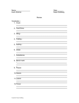
- 1. Name:________________ Date:_______ Earth Science Rabbi Goldberg Review Vocabulary – 1. Crust - ___________________________________________________________ ___________________________________________________________ 2. Fault Zone- ___________________________________________________________ ___________________________________________________________ 3. tilting - ___________________________________________________________ ___________________________________________________________ 4. Folding - ___________________________________________________________ ___________________________________________________________ 5. faulting - ___________________________________________________________ ___________________________________________________________ 6. strata- ___________________________________________________________ ___________________________________________________________ 7. Subsidence- ___________________________________________________________ ___________________________________________________________ 8. Bench mark -__________________________________________________________ ___________________________________________________________ _ 9. Pwave- ___________________________________________________________ ___________________________________________________________ 10. Swave- ___________________________________________________________ ___________________________________________________________ 11. Lwave- ___________________________________________________________ ___________________________________________________________ 12. Focus- ___________________________________________________________ ___________________________________________________________ Created by Nissan Goldberg
- 2. 13. epicenter- ___________________________________________________________ ___________________________________________________________ 14. Earthquake- ___________________________________________________________ ___________________________________________________________ 15. tsunamis - ___________________________________________________________ ___________________________________________________________ Notes review I. The Crust a. Is the outer zone of the earth made out of rock b. Always changing II. Proofs that the earth is always changing a. Deformed rock strata- _____________________________________________________ _____________________________________________________ _____________________________________________________ _____________________________________________________ _____________________________________________________ b. Displaced Fossils – _____________________________________________________ _____________________________________________________ _____________________________________________________ _____________________________________________________ _____________________________________________________ c. Subsidence- _____________________________________________________ _____________________________________________________ _____________________________________________________ _____________________________________________________ d. Bench mark -_____________________________________________________ _____________________________________________________ _____________________________________________________ _____________________________________________________ III. What is the difference between horizontal and vertical displacement/ a. _____________________________________________________ _____________________________________________________ _____________________________________________________ IV. Areas of crustal activies a. Earthquakes and volcanic eruption usually occur ____________________________________________________. b. Usually the _____________ ocean Created by Nissan Goldberg
- 3. c. These zones mark _____________________________________. V. Earthquake a. Is a sudden trembling or shaking of the ground caused by movement along a break or fault in the rock realeasing the stress build up in the ground b. When an earthquake occurs ___________________ waves move in all different direction from the focus i. Focus-__________________________________________ ii. Epicenter -_______________________________________________ ________________________________________________ iii. Seismographs -_______________________________________________ ________________________________________________ _ VI. Waves OF Earthquakes a. There are several different types of waves i. P Waves – also called Compress waves 1. ____________________________teh same direction the wave is moving 2. Pass through anything 3. Highest velocity - __________________________ ii. S Waves – also called secondary waves 1. cause earth to vibrate in _____________________ 2. _________________________________________ iii. Lwaves – Long Period waves VII. How do we measure Earthquake strength a. Mercalli scale - _____________________________________________________ _____________________________________________________ _____________________________________________________ b. Richter scale i. Measures the amount of energy released by the earth moving ii. Goes from ___________________________ VIII. Facts a. Both volcanoes and Earthquakes are hazaerdous (dangerous) to living things b. Fires are common after an Earthquake do to broken gas lines etc….. IX. Tsunamis a. Large underwater earthquakes i. Can occur after a reg earthquake ii. DON’T GO NEAR COAST VERY DANGEROUS Created by Nissan Goldberg
- 4. X. How do we use a graph ? Example Question # 1 If the P wave hits a location at 7 min 30 seconds where is this location? Step #1 Locate 7 Minutes 30 Seconds Step # 2 Take a straight piece of paper and draw a line until you hit the P wave Step # 3 Using a ruler or your piece of paper draw a straight line down Step 4 The line hits the distance at 5.2 multiply that by 1000 = 5,200 Answer = 5, 200 Created by Nissan Goldberg
- 5. Example Question #2 An earthquake occurred at 5:00:00 a.m. According to the Earth Science Reference Tables, at what time would the P-wave reach a seismic station 3,000 kilometers from the epicenter? STEP #1 - LOCATE 3,OOO Kilometers on the graph Step #2 Move up until you hit the p wave Step #3 the move to the left and mark down how many minutes it took the earthquake to hit the location In our case it is around 5 minutes and 40 seconds Step # 4 Add 5:40 minutes to 5 am = 5:05 and 40 Seconds Example question #3 Created by Nissan Goldberg
- 6. If the difference between the p wave and S wave is 6 minutes 20 seconds, how far away is the location from the epicenter? Step # 1 Put a piece of paper and measure 6minutes 45 seconds Step #2 Drag the marked index card up the P wave line until your marking hits the s wave and the bottom of your card or paper is on the P wave Step #3 Draw a straight line down and mark the distance in our example it goes to 5 x1000 = 5,000 km Example # 4 Created by Nissan Goldberg
- 7. If it takes the S wave 17 minutes to reach Position x How long would it take the p-wave to get to position x ? Step # 1 Locate 17 minutes Step #2 Using a piece of paper or an index card draw a straight line from the 17 until you hit the S wave Step # 3 draw a straight line down from the point of the S wave until the distance number Step #4 Mark off the number ( remember each box is 200 km) Our answer is 6,000 Example 6 **** Created by Nissan Goldberg
- 8. Where is the Epicenter? NYS Lab Step 1 Look at the graph above it shops three different seismograms at three different locations The first set of zigzags with the P is the P wave the second set and larger is the S wave. Subtract the p wave time from the S wave time. San Jose New York San Francisco P wave = 21 S wave began 30:30 30:30 - 21:00 8:30 Minutes Step #2 Take each time difference and do the same thing you did in example #3 and determine the distance for each location. San Jose New York San Francisco Created by Nissan Goldberg
- 9. Step #3 On the bottom of your map below there are measurements using your protractor measure out the distance . Created by Nissan Goldberg
- 10. Step #4 Without moving your measurement put the point on the correct location and make a circle Step # 5 Do this for each location Step 6 the place where the circles meet mark with an X (or if there is a large over gap color it in and them mark it. You are done the X is your epicenter GOOD JOB!!!!!!!!!!! Created by Nissan Goldberg
- 11. Example #5 Question: If it takes the S wave 18 minute to get to location Y, How long does it take the p wave to get to the same location? Step # 1 Locate 18 minutes Step #2 Using a piece of paper or an index card draw a straight line from the 18 until you hit the S wave Step # 3 Then draw using a piece of paper or a card a straight line down from the point of the S wave until the you HIT THE P WAVE Step #4 From the point on the P wave draw a straight line to the left until you hit the time line Step #4 Mark off the time to the nearest 00:10 Our answer is !0 minutes Created by Nissan Goldberg