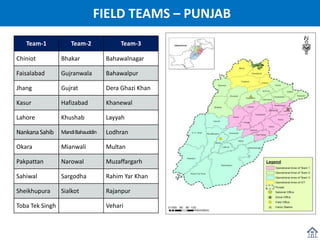
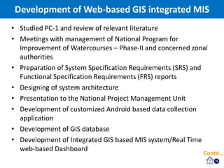
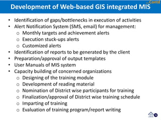
The document discusses the development of an Android-based application for monitoring projects under the National Program for Improvement of Watercourses Phase II (NPIWC-II) in Pakistan. Key points:
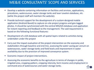
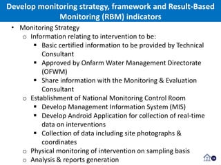
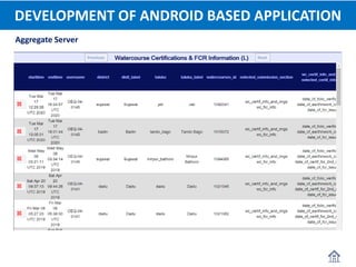
- The consultants will develop a customized Android application to capture project progress data and geo-tagged photos on-site for real-time reporting.
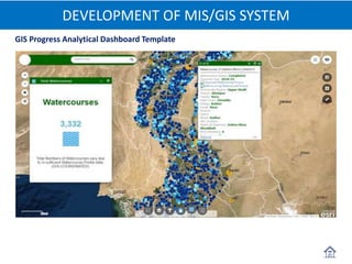
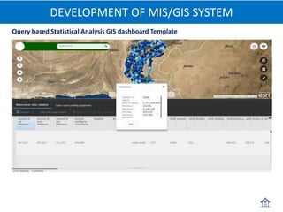
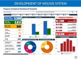
- A GIS database will be created containing spatial layers of all project activities.
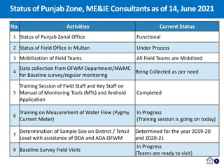
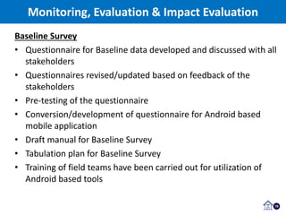
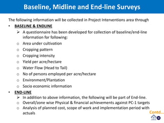
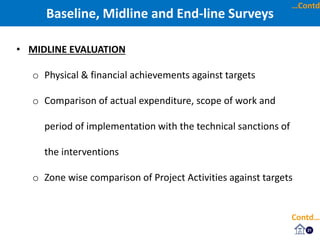
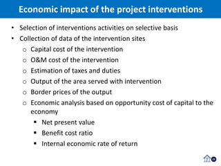
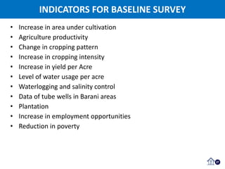
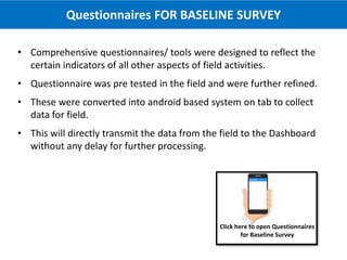
- Baseline, midline, and endline surveys will assess the economic and social impact of interventions on water availability, agriculture yields, incomes, and employment. Standardized questionnaires have been designed for data collection.
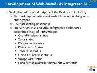
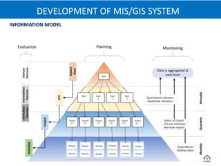
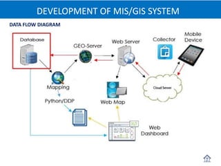
- A web-based GIS integrated management information system and real-