Decision-Point Panorama-Based Indoor Navigation
•
1 like•658 views

We present a novel user interface concept for indoor navigation which uses directional arrows and panorama images at decision points. The interface supports the mental model of landmark-based navigation, can be used on- and offline and is highly tolerant to localization inaccuracy.

Recommended
More Related Content
Similar to Decision-Point Panorama-Based Indoor Navigation
Similar to Decision-Point Panorama-Based Indoor Navigation (20)
More from Distributed Multimodal Information Processing Group
More from Distributed Multimodal Information Processing Group (8)
Recently uploaded
Recently uploaded (20)
Decision-Point Panorama-Based Indoor Navigation
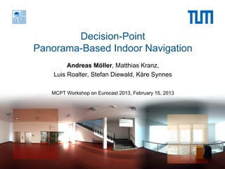
- 1. Decision-Point Panorama-Based Indoor Navigation Andreas Möller, Matthias Kranz, Luis Roalter, Stefan Diewald, Kåre Synnes MCPT Workshop on Eurocast 2013, February 15, 2013
- 2. Institute for Media Technology Distributed Multimodal Information Processing Group Technische Universität München Overview Motivation: Vision-Based Localization UI Concept and First Evaluation Decision-Point Based Navigation User Study Discussion and Future Work 15.2.2013 A. Möller, M. Kranz, L. Roalter, S. Diewald, K. Synnes
- 3. Institute for Media Technology Distributed Multimodal Information Processing Group Technische Universität München Background and Motivation § Location information still the most important contextual information § Indoor localization is a hot topic and useful for a lot of locations: □ Airports □ Hospitals □ Conference venues □ Large environments § Various indoor localization methods possible: □ WLAN/cell-based localization □ Sensor-based localization □ Beacon-based localization □ Vision-based localization 15.2.2013 A. Möller, M. Kranz, L. Roalter, S. Diewald, K. Synnes
- 4. Institute for Media Technology Distributed Multimodal Information Processing Group Technische Universität München Vision-Based Localization Live features § Principle □ Comparing of query images, taken with camera, to reference images based on visual features § Advantages □ No infrastructure and augmentation of the environment needed □ Immune to disturbances (reflection/refraction…) □ Works with existing (modern) hardware 15.2.2013 A. Möller, M. Kranz, L. Roalter, S. Diewald, K. Synnes
- 5. Institute for Media Technology Distributed Multimodal Information Processing Group Technische Universität München Overview Motivation: Vision-Based Localization UI Concept and First Evaluation Decision-Point Based Navigation User Study Discussion and Future Work 15.2.2013 A. Möller, M. Kranz, L. Roalter, S. Diewald, K. Synnes
- 6. Institute for Media Technology Distributed Multimodal Information Processing Group Technische Universität München HCI Perspective: Interaction Concept § Augmented Reality View for intuitiveness □ But: Consequence when location estimate is inaccurate: wrong overlays! ? § Permanent re-localization during path required □ High computational effort □ Uncomfortable camera pose □ Not all scenes adequate for visual localization (sometimes insufficient features for algorithm) 15.2.2013 A. Möller, M. Kranz, L. Roalter, S. Diewald, K. Synnes
- 7. Institute for Media Technology Distributed Multimodal Information Processing Group Technische Universität München Interaction Concept (cont.) Instead: § Re-localization from time to time (when possible) □ Estimation of intermediate position with odometry (device sensors) □ More comfortable usage § “Virtual Reality” View □ Regularly show 360° panorama images of the environment with embedded navigation instructions (those panoramas are already available from reference images) □ More robust: user matches virtual and real world 15.2.2013 A. Möller, M. Kranz, L. Roalter, S. Diewald, K. Synnes
- 8. Institute for Media Technology Distributed Multimodal Information Processing Group Technische Universität München Initial User Study § Comparison of Augmented Reality and Virtual Reality § Simulation of different levels of accuracy § Survey of user preferences See Full Paper: A. Möller, M. Kranz, R. Huitl, S. Diewald, L. Roalter A Mobile Indoor Navigation System Interface Adapted to Vision-Based Localization In: 11th Intl. Conf. on Mobile and Ubiquitous Multimedia (MUM 2012) 15.2.2013 A. Möller, M. Kranz, L. Roalter, S. Diewald, K. Synnes
- 9. Institute for Media Technology Distributed Multimodal Information Processing Group Technische Universität München Initial User Study: Summary § Panoramas provide better guidance when location estimate is inaccurate than Augmented Reality § But: Subjects experienced frequent changes (~2m) as irritating, as □ Shown locations are not always correct □ Locations sometimes do not look like in reality □ Frequent changes in the UI are visually straining § Subjects manage finding their goal, also when not looking at the screen all the time § How to improve? □ Reduce frequent visual changes □ Simplify match between panoramas and real world (problem of misplaced panoramas?) 15.2.2013 A. Möller, M. Kranz, L. Roalter, S. Diewald, K. Synnes
- 10. Institute for Media Technology Distributed Multimodal Information Processing Group Technische Universität München Overview Motivation: Vision-Based Localization UI Concept and First Evaluation Decision-Point Based Navigation User Study Discussion and Future Work 15.2.2013 A. Möller, M. Kranz, L. Roalter, S. Diewald, K. Synnes
- 11. Institute for Media Technology Distributed Multimodal Information Processing Group Technische Universität München Decision-Point Based Navigation (DPBN) § Show only panoramas of decision points § Compliance with familiar mental model of self-orientation § Users can always re-localize and retrieve the panorama of their current location § High error tolerance § Offline usage possible (by swiping through list of route instructions) 15.2.2013 A. Möller, M. Kranz, L. Roalter, S. Diewald, K. Synnes
- 12. Institute for Media Technology Distributed Multimodal Information Processing Group Technische Universität München Decision-Point Based Navigation (DPBN) § Show only panoramas of decision points § Compliance with familiar mental model of self-orientation § Users can always re-localize and retrieve the panorama of their current location § High error tolerance § Offline usage possible 15.2.2013 A. Möller, M. Kranz, L. Roalter, S. Diewald, K. Synnes
- 13. Institute for Media Technology Distributed Multimodal Information Processing Group Technische Universität München Decision-Point Based Navigation (DPBN) § Show only panoramas of decision points § Compliance with familiar mental model of self-orientation § Users can always re-localize and retrieve the panorama of their current location § High error tolerance § Offline usage possible 15.2.2013 A. Möller, M. Kranz, L. Roalter, S. Diewald, K. Synnes
- 14. Institute for Media Technology Distributed Multimodal Information Processing Group Technische Universität München Decision-Point Based Navigation (DPBN) § Show only panoramas of decision points § Compliance with familiar mental model of self-orientation § Users can always re-localize and retrieve the panorama of their current location § High error tolerance § Offline usage possible 15.2.2013 A. Möller, M. Kranz, L. Roalter, S. Diewald, K. Synnes
- 15. Institute for Media Technology Distributed Multimodal Information Processing Group Technische Universität München Decision-Point Based Navigation (DPBN) § Show only panoramas of decision points § Compliance with familiar mental model of self-orientation § Users can always re-localize and retrieve the panorama of their current location § High error tolerance § Offline usage possible 15.2.2013 A. Möller, M. Kranz, L. Roalter, S. Diewald, K. Synnes
- 16. Institute for Media Technology Distributed Multimodal Information Processing Group Technische Universität München Decision-Point Based Navigation (DPBN) § Show only panoramas of decision points § Compliance with familiar mental model of self-orientation § Users can always re-localize and retrieve the panorama of their current location § High error tolerance § Offline usage possible 15.2.2013 A. Möller, M. Kranz, L. Roalter, S. Diewald, K. Synnes
- 17. Institute for Media Technology Distributed Multimodal Information Processing Group Technische Universität München Decision-Point Based Navigation (DPBN) § Show only panoramas of decision points § Compliance with familiar mental model of self-orientation § Users can always re-localize and retrieve the panorama of their current location § High error tolerance § Offline usage possible 15.2.2013 A. Möller, M. Kranz, L. Roalter, S. Diewald, K. Synnes
- 18. Institute for Media Technology Distributed Multimodal Information Processing Group Technische Universität München Overview Motivation: Vision-Based Localization UI Concept and First Evaluation Decision-Point Based Navigation User Study Discussion and Future Work 15.2.2013 A. Möller, M. Kranz, L. Roalter, S. Diewald, K. Synnes
- 19. Institute for Media Technology Distributed Multimodal Information Processing Group Technische Universität München User Study: Research Questions § RQ1: Does DPBN have an effect on efficiency? Are users as fast as with continuous panoramas? § RQ2: Is DPBN more convenient than continuous panoramas? What mode do users prefer? How well do they feel guided? § RQ3: What usage patterns can be identified? What do we learn for designing an “ideal” route description? 15.2.2013 A. Möller, M. Kranz, L. Roalter, S. Diewald, K. Synnes
- 20. Institute for Media Technology Distributed Multimodal Information Processing Group Technische Universität München User Study – Quick Facts 3 conditions - Continuous panoramas (automatic *) * Wizard of Oz - Decision points (automatic *) - Decision points (manual navigation) 3 routes (avoidance of learning effects) Measured data: time, user behavior, questionnaires 12 Participants, 75% male, 25% female, average 25 years Within-subjects design 75% own a smartphone, only one has experience with indoor navigation Source: iconsdb.com 15.2.2013 A. Möller, M. Kranz, L. Roalter, S. Diewald, K. Synnes
- 21. Institute for Media Technology Distributed Multimodal Information Processing Group Technische Universität München Results: RQ1 Average Time per Mode 350 300 Time in seconds 250 200 Difference 150 not significant 263 100 196 208 50 0 Continuous Decision-Point Decision-Point (automatic) (automatic) (manual) 15.2.2013 A. Möller, M. Kranz, L. Roalter, S. Diewald, K. Synnes
- 22. Institute for Media Technology Distributed Multimodal Information Processing Group Technische Universität München Results: RQ2 I found the method pleasing to use. 5: fully agree 1: fully disagree - Median + Mean Continuous Decision-Point Decision-Point (automatic) (automatic) (manual) 15.2.2013 A. Möller, M. Kranz, L. Roalter, S. Diewald, K. Synnes
- 23. Institute for Media Technology Distributed Multimodal Information Processing Group Technische Universität München Results: RQ2 I felt guided well to the goal. 5: fully agree 1: fully disagree - Median + Mean Continuous Decision-Point Decision-Point (automatic) (automatic) (manual) 15.2.2013 A. Möller, M. Kranz, L. Roalter, S. Diewald, K. Synnes
- 24. Institute for Media Technology Distributed Multimodal Information Processing Group Technische Universität München Results: RQ2 Panoramas of decision points are sufficient for Which system would you choose? orientating 8% Continuous 17% (automatic) Decision-Point (automatic) Decision-Point 75% (manual) 5: fully agree 1: fully disagree 15.2.2013 A. Möller, M. Kranz, L. Roalter, S. Diewald, K. Synnes
- 25. Institute for Media Technology Distributed Multimodal Information Processing Group Technische Universität München Results: RQ3 Participant 12 - Path 1 40 30 Distance (m) 20 10 0 20 40 60 80 100 120 140 160 180 200 220 240 260 280 300 320 340 Time (s) swipe relocalize Δd position 15.2.2013 A. Möller, M. Kranz, L. Roalter, S. Diewald, K. Synnes
- 26. Institute for Media Technology Distributed Multimodal Information Processing Group Technische Universität München Results: RQ3 Participant 2 - Path 2 60 50 40 30 20 10 Distance (m) 0 20 40 60 80 100 120 140 160 180 200 220 240 260 280 300 320 340 -10 -20 -30 -40 -50 -60 Time (s) swipe relocalize Δd position 15.2.2013 A. Möller, M. Kranz, L. Roalter, S. Diewald, K. Synnes
- 27. Institute for Media Technology Distributed Multimodal Information Processing Group Technische Universität München Results: RQ3 Participant 5 - Path 3 30 20 Distance (m) 10 0 20 40 60 80 100 120 140 160 180 200 220 -10 -20 Time (s) swipe relocalize Δd position 15.2.2013 A. Möller, M. Kranz, L. Roalter, S. Diewald, K. Synnes
- 28. Institute for Media Technology Distributed Multimodal Information Processing Group Technische Universität München Results: RQ3 – Manual Mode § Average numbers □ 52.5 continuous locations (automatic, continuous mode) □ 10.3 decision points (automatic, decision-point mode) □ 15.3 manual swipes □ 9.3 times relocalized § Different usage patterns/strategies □ Showing “ahead” panoramas, no use of automatic re-localization □ Frequent use of re-localization, (sometimes only in parts of the route) – equivalent to continuous panorama mode □ “Memorizing” of the entire route not observed, subjects only looked at the “next” panorama location 15.2.2013 A. Möller, M. Kranz, L. Roalter, S. Diewald, K. Synnes
- 29. Institute for Media Technology Distributed Multimodal Information Processing Group Technische Universität München Overview Motivation: Vision-Based Localization UI Concept and First Evaluation Decision-Point Based Navigation User Study Discussion and Future Work 15.2.2013 A. Möller, M. Kranz, L. Roalter, S. Diewald, K. Synnes
- 30. Institute for Media Technology Distributed Multimodal Information Processing Group Technische Universität München Discussion § Subjects were equally fast with DPBN as with continuous panoramas (RQ1) § Subjects felt guided better with continuous panoramas (RQ2) □ Due to more certainty whether they are on the right way □ Confirmed by frequent swipes and re-localizations in manual mode § DPBN is desirable from a technical point of view (reliability…), but acceptance must be increased § Requires stronger confirmation whether subjects are (still) on the right way 15.2.2013 A. Möller, M. Kranz, L. Roalter, S. Diewald, K. Synnes
- 31. Institute for Media Technology Distributed Multimodal Information Processing Group Technische Universität München How could this be achieved? (Lessons learned) § Compromise between continuous mode and DPBN as it is now § Distance information § Verification when decision point was passed § Add intermediate landmarks in decision point mode □ Especially if decision point lies too far away (distance threshold) § Simplify the mapping of picture content to real environment □ Highlight significant objects in panorama 15.2.2013 A. Möller, M. Kranz, L. Roalter, S. Diewald, K. Synnes
- 32. Institute for Media Technology Distributed Multimodal Information Processing Group Technische Universität München Summary and Outlook § With Decision-Point Based Navigation, we have presented a novel interface for visual indoor navigation □ Very robust in case of localization inaccuracy □ Works even if localization fails (manual mode) □ Supports users’ mental model of navigation (landmarks) § Real-world study results □ DPBN as efficient as full panorama navigation □ DPBN needs more information to reduce users’ uncertainty (landmarks, confirmations) to increase satisfaction § Future work □ See previous slide ;-) □ Identification of good candidates for (additional) key points 15.2.2013 A. Möller, M. Kranz, L. Roalter, S. Diewald, K. Synnes
- 33. Institute for Media Technology Distributed Multimodal Information Processing Group Technische Universität München Thank you for your attention! Questions? ? ? andreas.moeller@tum.de www.vmi.ei.tum.de/team/andreas-moeller.html This research project has been supported by the space agency of the German Aerospace Center with funds from the Federal Ministry of Economics and Technology on the basis of a resolution of the German Bundestag under the reference 50NA1107. 15.2.2013 A. Möller, M. Kranz, L. Roalter, S. Diewald, K. Synnes
- 34. Institute for Media Technology Distributed Multimodal Information Processing Group Technische Universität München Paper Reference § Please find the associated paper at: https://vmi.lmt.ei.tum.de/publications/2013/MCPT2013- IndoorNav_preprint.pdf § Please cite this work as follows: § A. Möller, M. Kranz, L. Roalter, S. Diewald, Kåre Synnes Decision-Point Panorama-Based Indoor Navigation In: 14th International Conference on Computer Aided Systems Theory (EUROCAST 2013), pp. 325-326, Las Palmas de Gran Canaria, Spain, February 2013 15.2.2013 A. Möller, M. Kranz, L. Roalter, S. Diewald, K. Synnes
- 35. Institute for Media Technology Distributed Multimodal Information Processing Group Technische Universität München If you use BibTex, please use the following entry to cite this work: @INPROCEEDINGS{MCPT13IndoorNav, author = {Andreas M{"o}ller and Matthias Kranz and Luis Roalter and Stefan Diewald}, title = {{Decision-Point Panorama-Based Indoor Navigation}}, booktitle = {14th International Conference on Computer Aided Systems Theory (EUROCAST 2013)}, editor = {Alexis Quesada-Arencibia and Jos'{e} Carlos Rodriguez and Roberto Moreno-Diaz jr. and Roberto Moreno-Diaz}, year = {2013}, month = feb, pages = {325--326}, ISBN = {978-84-695-6971-9}, location = {Las Palmas de Gran Canaria, Spain}, } 15.2.2013 A. Möller, M. Kranz, L. Roalter, S. Diewald, K. Synnes