Download as PDF, PPTX

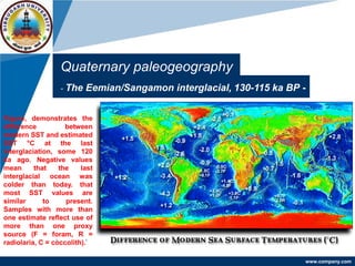
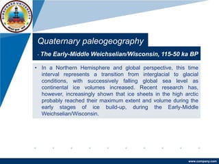
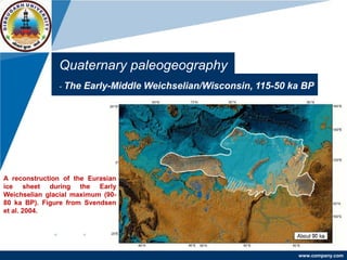
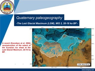

The document outlines cycles of climatic change during the Quaternary period, including glacial and interglacial periods. It discusses the Eemian/Sangamon interglacial 130,000-115,000 years ago, the Early-Middle Weichselian/Wisconsin glacial period 115,000-50,000 years ago, and the Last Glacial Maximum 20,000-18,000 years ago. During glacial periods, continental ice sheets grew and sea levels dropped globally. Interglacials were warmer with higher sea levels. Reconstructions show the extent of ice sheets and changes in ocean temperatures over this timeframe.


![PLEISTOCENE GLACIATION[2].pptx](https://cdn.slidesharecdn.com/ss_thumbnails/pleistoceneglaciation2-230427185954-e5deb48d-thumbnail.jpg?width=640&height=640&fit=bounds)


