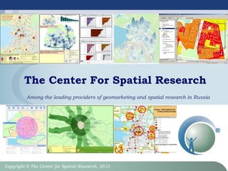
The Center for Spatial Research (CSR) is a Russian company that has specialized in geomarketing techniques and solutions since 2003. CSR provides professional geomarketing services and solutions to over 100 B2B and B2G clients in retail, construction, banking, and other industries. CSR's projects utilize techniques such as niche occupying, data accumulation, and simple geomarketing models and tools to provide strategic and operational recommendations. CSR also engages in research and development to improve geomarketing methods and models, and provides geomarketing training programs.
This document discusses geomarketing techniques for analyzing the attractiveness of locations for commercial real estate developments like shopping centers. It summarizes a case study that analyzed factors like population density, income levels, transportation access, pedestrian flows, and competitive environment within different accessibility zones around a potential development site in St. Petersburg, Russia. Based on this analysis, it provides forecasts for pedestrian flows to the potential shopping center over the next three years under optimistic, realistic, and pessimistic scenarios. It concludes that the location shows potential for a shopping mall based on favorable densities of residents, economically active population, and higher-income residents within walking distance.
A sample of possibilities to use geomarketing tools for empowering business solutions.
Geomarketing solves problems in companies and makes always right decisions.
MarketLine Country Analysis Profiles provide concise summaries of over 150 countries using the PESTLE framework. The profiles are written by in-house analysts based on primary and secondary research. MarketLine analysts conduct extensive preparatory and secondary research, using modeling and forecasting techniques as well as quality controls, to validate accurate insights for each country profile. Customers can rely on MarketLine's up-to-date country profiles to efficiently understand individual country landscapes and operating industries.
This document discusses graphical presentation of data. It covers organizing and graphing qualitative and grouped data using different chart types such as bar charts, histograms, pie charts, frequency polygons and cumulative frequency polygons. The chapter also discusses quantitative and qualitative variables in research methodology. It explains different data levels including nominal and ordinal categorical data. Finally, the document discusses business research statistical measurement based on population sampling. In summary, the chapter provides an overview of graphical data presentation and statistical concepts.
This document discusses location intelligence and its benefits for businesses. Location intelligence involves analyzing business data in relation to location to gain insights. It can help answer questions like where assets, sales and target markets are located. The document provides case studies of how companies have used location intelligence to improve distribution, marketing and recruitment. It also outlines the steps to implement location intelligence, including enhancing data with location and demographics, visualizing on maps, and integrating it into business intelligence systems. Attendees are encouraged to download an evaluation copy to get started with location intelligence.
The Center for Spatial Research (CSR) is a leading provider of geomarketing and spatial products and services in Russia. It was established in 2003 in Saint Petersburg. CSR conducts geomarketing research to help clients with site selection, network optimization, and revenue forecasting. It has over 50 clients and has completed more than 50 geomarketing projects. CSR provides geomarketing software, geodata, and analytical web services. It also offers training programs in geomarketing through a high school program in Russia.
The Global Digital Map Market Size Was Valued at USD 21.95 Billion in 2022 and is Projected to Reach USD 63.93 Billion By 2030, Growing at A CAGR of 14.3% From 2022 To 2030.
Targomo provides a cloud-based location intelligence platform that enables organizations worldwide to optimize business decisions and actions. Targomo’s innovative technology brings together spatial analysis and artificial intelligence, allowing for the strategic integration of location performance indicators into all business operations.
Lepton provides a location Intelligence platform , MarketPulse, that organize enterprise business information geographically and make it universally accessible and useful in a unified manner to entire Sales & Marketing ecosystem. It facilitate Connect with right people at the right time at the right place, Optimise people and assets, Make better decisions.
1) Na-Pokaz.ru is a social networking service that provides an interactive map showing real-time occupancy of public places.
2) It uses video analytics technology to accurately count visitors to locations and integrate this data into the geo-social platform.
3) This information is then used to provide targeted offers and promotions to users from brands based on the places they visit.
The problem of the effective placement of the sale outlets, advertisements is crucial for the retail enterprises, companies of foodservice industry, healthcare, insurance companies, banks. When assisting with choice of the optimal place for opening of a sale outlet or a bank terminal (in 47 cities), we are saving the client's time and mitigating risks as the effective placement increases sales rates.
Cross-Tab is a market research outsourcing company that provides services including research operations management, global online data collection, survey programming, and data analytics. It aims to enhance client agility and value by offering an integrated suite of research services at competitive prices. Cross-Tab's services are delivered from an offshore location by an experienced team using various market research tools and technologies.
The document summarizes a strategic economic development action plan project kickoff meeting for the Town of Reading. It discusses the project goal of producing an action plan focused on four priority development areas to support local housing and economic goals. An agenda, scope, process, and overview of upcoming market analyses were presented. The market analyses will estimate development potential for each site to inform zoning and strategies.
This document discusses how geographic information systems (GIS) can benefit banks. GIS allows banks to analyze customer and competitor locations, monitor branch performance, manage bank assets like ATMs, and aid in strategic planning. It provides examples of how GIS can be used for market analysis, banking services, and strategic decision making. Specifically, GIS helps with competitor analysis, customer segmentation, focused marketing, cash distribution management, and business expansion planning.
Stas Sushkov is a market planning and store chain development expert with Pizza Hut International. He led analysis and strategic development for over 10,000 Pizza Hut restaurants globally. Some of his responsibilities included developing market planning standards and methodologies, implementing a store lifecycle management software, and developing penetration strategies for new Pizza Hut concepts. He has extensive experience conducting market planning for Pizza Hut in various countries around the world.
This document discusses geomarketing solutions offered by the Center for Spatial Research to help a fitness center chain with expansion and new location selection. The solutions include:
1) Geomarketing analysis of potential city areas and demographics to evaluate where target customers live and work and where competitors are located.
2) A geomarketing information system that performs site selection analysis, evaluates potential network locations, and provides custom reports and forecasting.
3) Services like market research, creation of suitability zones for different club types, micro-level analysis of zones, and site selection recommendations to aid decision making.
Positioning for Retail Recovery: The Role of Predictive Analytics Fueled by M...Precisely
As parts of the world show signs of emergence from the initial Covid-19 onslaught, retailers are opening their doors and looking to reduce risk and increase opportunities through strategies which are backed by highly accurate data and analytics. Retailers who understand context and can make location intelligent marketing plays will win, with mobile trace data playing a key role in taking contextual consumer understanding to the next level.
In this webinar, discover how using mobile trace data helps the most effective retailers and restaurants to understand previous pedestrian footfall and predict the most likely areas where retail activity will return. This understanding is helping to drive highly targeted multi-channel marketing programs for leaders in the industry.
This on-demand webinar will also cover:
- The principles of mobile trace data and what makes it a game-changing data set for the retail community
- How to use mobile trace data analytics to drive retail strategies around site selection and marketing in a transformative environment
- Showcasing of retailer use cases where predictive analytics fueled by mobile trace data is being used to compete and win in the market
This document discusses using geographical information systems (GIS) in retail marketing. It outlines how GIS helps with spatially-based business planning problems and customer/competitor analysis. While GIS adoption is growing, challenges remain around complex technology for end-users, lack of integrated spatial decision models, and societal impacts of geographic data use. The proposed research aims to systematically study GIS implementation across organizations and design models to identify effective marketing strategies and how GIS can improve decision making.
People Counting System Market Size, Share, Trends, Regional Outlook & Future ...KiranDeshmukh42
The global people counting system market is projected to reach USD 1.4 billion by 2026 from an estimated USD 0.9 billion in 2021, at a CAGR of 9.4% from 2021 to 2026.
Инструмент пересечения зон позволяет в считанные секунды накладывать до 5 зон одновременно, находить сложные зоны и считать в них информацию. Геоинтеллект - облачный геоинформационная система аналитика. Значительно сокращает время анализа территории.
Региональная геоинформационная система Ленинградской областиCSR
В Ленинградской области создана новая геоинформационная система, позволяющая оценить картину состояния сельскохозяйственных земель региона с помощью интерактивной карты.
Part 2 Deep Dive: Navigating the 2024 Slowdownjeffkluth1
Introduction
The global retail industry has weathered numerous storms, with the financial crisis of 2008 serving as a poignant reminder of the sector's resilience and adaptability. However, as we navigate the complex landscape of 2024, retailers face a unique set of challenges that demand innovative strategies and a fundamental shift in mindset. This white paper contrasts the impact of the 2008 recession on the retail sector with the current headwinds retailers are grappling with, while offering a comprehensive roadmap for success in this new paradigm.
How to Implement a Strategy: Transform Your Strategy with BSC Designer's Comp...Aleksey Savkin
The Strategy Implementation System offers a structured approach to translating stakeholder needs into actionable strategies using high-level and low-level scorecards. It involves stakeholder analysis, strategy decomposition, adoption of strategic frameworks like Balanced Scorecard or OKR, and alignment of goals, initiatives, and KPIs.
Key Components:
- Stakeholder Analysis
- Strategy Decomposition
- Adoption of Business Frameworks
- Goal Setting
- Initiatives and Action Plans
- KPIs and Performance Metrics
- Learning and Adaptation
- Alignment and Cascading of Scorecards
Benefits:
- Systematic strategy formulation and execution.
- Framework flexibility and automation.
- Enhanced alignment and strategic focus across the organization.
The 10 Most Influential Leaders Guiding Corporate Evolution, 2024.pdfthesiliconleaders
In the recent edition, The 10 Most Influential Leaders Guiding Corporate Evolution, 2024, The Silicon Leaders magazine gladly features Dejan Štancer, President of the Global Chamber of Business Leaders (GCBL), along with other leaders.
3 Simple Steps To Buy Verified Payoneer Account In 2024SEOSMMEARTH
Buy Verified Payoneer Account: Quick and Secure Way to Receive Payments
Buy Verified Payoneer Account With 100% secure documents, [ USA, UK, CA ]. Are you looking for a reliable and safe way to receive payments online? Then you need buy verified Payoneer account ! Payoneer is a global payment platform that allows businesses and individuals to send and receive money in over 200 countries.
If You Want To More Information just Contact Now:
Skype: SEOSMMEARTH
Telegram: @seosmmearth
Gmail: seosmmearth@gmail.com
Structural Design Process: Step-by-Step Guide for BuildingsChandresh Chudasama
The structural design process is explained: Follow our step-by-step guide to understand building design intricacies and ensure structural integrity. Learn how to build wonderful buildings with the help of our detailed information. Learn how to create structures with durability and reliability and also gain insights on ways of managing structures.
HOW TO START UP A COMPANY A STEP-BY-STEP GUIDE.pdf46adnanshahzad
How to Start Up a Company: A Step-by-Step Guide Starting a company is an exciting adventure that combines creativity, strategy, and hard work. It can seem overwhelming at first, but with the right guidance, anyone can transform a great idea into a successful business. Let's dive into how to start up a company, from the initial spark of an idea to securing funding and launching your startup.
Introduction
Have you ever dreamed of turning your innovative idea into a thriving business? Starting a company involves numerous steps and decisions, but don't worry—we're here to help. Whether you're exploring how to start a startup company or wondering how to start up a small business, this guide will walk you through the process, step by step.
At Techbox Square, in Singapore, we're not just creative web designers and developers, we're the driving force behind your brand identity. Contact us today.
Top mailing list providers in the USA.pptxJeremyPeirce1
Discover the top mailing list providers in the USA, offering targeted lists, segmentation, and analytics to optimize your marketing campaigns and drive engagement.
Digital Marketing with a Focus on Sustainabilitysssourabhsharma
Digital Marketing best practices including influencer marketing, content creators, and omnichannel marketing for Sustainable Brands at the Sustainable Cosmetics Summit 2024 in New York
Industrial Tech SW: Category Renewal and CreationChristian Dahlen
Every industrial revolution has created a new set of categories and a new set of players.
Multiple new technologies have emerged, but Samsara and C3.ai are only two companies which have gone public so far.
Manufacturing startups constitute the largest pipeline share of unicorns and IPO candidates in the SF Bay Area, and software startups dominate in Germany.
How are Lilac French Bulldogs Beauty Charming the World and Capturing Hearts....Lacey Max
“After being the most listed dog breed in the United States for 31
years in a row, the Labrador Retriever has dropped to second place
in the American Kennel Club's annual survey of the country's most
popular canines. The French Bulldog is the new top dog in the
United States as of 2022. The stylish puppy has ascended the
rankings in rapid time despite having health concerns and limited
color choices.”
[To download this presentation, visit:
https://www.oeconsulting.com.sg/training-presentations]
This PowerPoint compilation offers a comprehensive overview of 20 leading innovation management frameworks and methodologies, selected for their broad applicability across various industries and organizational contexts. These frameworks are valuable resources for a wide range of users, including business professionals, educators, and consultants.
Each framework is presented with visually engaging diagrams and templates, ensuring the content is both informative and appealing. While this compilation is thorough, please note that the slides are intended as supplementary resources and may not be sufficient for standalone instructional purposes.
This compilation is ideal for anyone looking to enhance their understanding of innovation management and drive meaningful change within their organization. Whether you aim to improve product development processes, enhance customer experiences, or drive digital transformation, these frameworks offer valuable insights and tools to help you achieve your goals.
INCLUDED FRAMEWORKS/MODELS:
1. Stanford’s Design Thinking
2. IDEO’s Human-Centered Design
3. Strategyzer’s Business Model Innovation
4. Lean Startup Methodology
5. Agile Innovation Framework
6. Doblin’s Ten Types of Innovation
7. McKinsey’s Three Horizons of Growth
8. Customer Journey Map
9. Christensen’s Disruptive Innovation Theory
10. Blue Ocean Strategy
11. Strategyn’s Jobs-To-Be-Done (JTBD) Framework with Job Map
12. Design Sprint Framework
13. The Double Diamond
14. Lean Six Sigma DMAIC
15. TRIZ Problem-Solving Framework
16. Edward de Bono’s Six Thinking Hats
17. Stage-Gate Model
18. Toyota’s Six Steps of Kaizen
19. Microsoft’s Digital Transformation Framework
20. Design for Six Sigma (DFSS)
To download this presentation, visit:
https://www.oeconsulting.com.sg/training-presentations
5. Geomarketing niche…
Working since 2003 The Center for Spatial Research (CSR) firmly occupy
a niche of providing with professional B2B and B2G geomarketing
services and solutions.
CSR is one of the first Russian companies specializing in developing of
geomarketing techniques and solutions that are aimed to effective
business for clients of retail trade and construction industries, bank,
food, farm retail and other markets.
CSR projects for more than 100 companies shown that strategies of
niche occupying, data and geodata accumulation, creation of techniques,
models and simple geomarketing instruments are right and demanded in
the Russian market and among international clients.
Projects and approaches meet the highest requirements of western
analytical companies including math models since we constantly practice
in perspective R&D-development.
CSR actively participate in making standards and business processes,
connected with location assessment in the large companies.
Clients recommendations - www.geointellect.ru
6. Some customers
Working in B2B sector CSR has made
more than 80 researches for more than 70
companies. Every third company contacts
us repeatedly
International projects with companies from Germany, Finland, Czech Republic, USA, France
State projects in GIS-sphere (health service, real property): Saint Petersburg administration,
Gamaleya SRI of Moscow and others
7. Geomarketing
Software (GIS) and
Geodata in
GIS - format
Geomarketing
Research and
Reports
Analytical
geoinformational
B2B web-service
«Geointellect.com»
Use geoanalysis
and rare geodata
functions directly
from your office!
Digital maps and
detailed geodata for
your geoinformation
systems!
Geomarketing
reports for your
strategic
and/or day-to-
day aims!
Geomarketing products
9. Geomarketing research aims
Strategic aims
• Economic indicators determination: turnover, market share,
profit, market potential, profitability, payback
• Solutions on developing the chain or planning a new one:
sales points opening and closing, operational optimization
Day-to-day aims
• Chain monitoring
• Rapid evaluation of the supply of commercial property
objects
• Express estimation of consumer or competitive situation in
the radius
• Obtaining the operational information about objects
• Forming the advertising campaigns
• Comparative analysis of the chain outlets work, etc.
10. Retail aims solvable by means of
geomarketing (day-by-day)
• Selection of priority cities for the expansion
• Selection of location for the outlet opening
• Selection of a size of particular place, or a place for
particular size
• Chain expansion
• Chain optimization
• Existing outlet sales increase (local market leadership or
market share increase)
• Client base increase
• Adjustment or selection of assortment policy
• Spatial benchmarking
• Planning of advertising campaigns (taking geography into
account)
• Logistics (delivery planning)
11. Suitability zones
Площадь зон пригодности для ФЦ
класса Премиум и Люкс, кв. км.
0,31
0,45
0,55
0,63
1,60
1,64
1,97
2,37
2,43
4,03
6,84
8,35
11,75
11,79
11,95
12,87
0,00 2,00 4,00 6,00 8,00 10,00 12,00 14,00
Зона Среднеохтинского пр.
Зона Адмиралтейского района
Зона ст.м. Новочеркасская
Зона Искровского пр. и ул. Тельмана
Зона ул. Савушкина
Зона ст.м. Ветеранов
Зона ст.м. Большевиков
Зона ст.м. Василеостровская
Зона пр. Наставников
Зона Гражданского пр.
Зона западной части В.О.
Зона Центрального района
Зона пр. Энгельса
Зона Петроградского района
Зона ст.м. Комендантский пр. и ст.м. Пионерская
Зона Московского района
13. Suitability zones model for Sberbank formats, calculation
model of ATM and IPT transactions forecast, etc.
14. Zoning examples
MoreMore::
-- Expert zonesExpert zones
- Huff model- Huff model
- “Russian Huff” model- “Russian Huff” model ((CSR projectCSR project))
and othersand others
Zones obtained by geocoding of clientsZones obtained by geocoding of clients (delivery,
consumer maps, etc.)
Transport
availability of an
object
Walking
availability of the
outlets
Zones of
equidistance from
the outlets
Zones obtained by
population survey
15. Geomarketing report
PDF report
Cartographical applications
(.jpg)
Table applications (.xls)
Presentation of the results (PPS)
Geodata viewer delivery is
possible (Arc Reader) with basic
functionality (map navigation,
address search, point
information, work with layers,
report arrangement in any place
of a map) on CD
16. 2. Geodata and data,
GEOSERVICES
GIS format for your GIS!!!
17. Geodata. Levels of geography
Municipality districts
15,000-70,000 residents
(Moscow and Saint
Petersburg)
CSR is the only supplier of
geomarketing data at block
level in Russia.
City –Administrative
Regions
150, 000 – 300, 000
residents
(65 cities)
The methodology of creating
boundary files of postal
codes in Russia for 30
regions of Russia
19. Space models
Points density models;
Population and working population density;
Suitability zones model;
Solvency model by indirect signs;
Service zones;
Availability by municipalities;
Proximity and remoteness models (own chain,
competitors, highways, etc.)
Pedestrian flows model
Subway service zones model,
Trading density model
Car flow migration model in Moscow region
Models built on indirect data in lack of information
conditions
20. Product (GIS format, geoservices)
vector SHP files(Arc GIS, ESRI)
or MapInfo (MID/MIF)
Files in the other vector GIS
formats
Table files (xls, dbf)
GRID files (raster), example of
img
Projections
Geoinformation geodata viewer
“Heavy client” – professional
GIS software (for example, Arc
GIS)
Printed version of business
atlas
NEW!!! Geoservices for
desktop software (Arc GIS
and others) and API to the
web application
25. We embed geomarketing tool
into the client’s business processes
Turnover estimation (assume that technique is approved):
1. External data collection, making of geodata (population,
clients, competition, infrastructure)
2. Collection and (if necessary) geocoding of internal data on
existing chain (sales, etc.)
3. Zone estimation
4. Population estimation
5. Competition estimation
6. …..
7. ….
8. Download data to MS Excel
9. Turnover estimation
10. Analysis of the results
11. Making of georeports with trading zone visualization with all
the factors affecting the turnover
12. Comprehension of true causes and nonlinear effects, that can
affect the change in turnover figures in particular outlet
13. Commodity turnover adjustment
14. Printing the report in figures and zones with factors on the
map (or embedding into РРТ, PDF)
26. Development strategy.
Geodata of human
•Collecting and
modeling of data and
geodata of human
«over» the
geographical map
Where people live? How many
of them live there?
Where people work? How many
of them work there?
Where people move? How many
of them move there?
WHO?
WHO?
WHO?
The map of microdistrict, city,
region and country
27. R&D-development
1. Geomarketing methods of finding
the “suitability zones” – marketing
service standard
2. Estimation models of probability of
solvent population being in the
cities
3. Estimation math models of
business efficiency indexes on the
map (revenue, number of ATM
transactions, payback, etc.)
4. Geostatistics of causal relations
5. Modeling of people flows on the
map and their behavior scenarios
6. Cannibalization models
ТОТО = f(x= f(x,,y,z,…n)y,z,…n)ТОТО = f(x= f(x,,y,z,…n)y,z,…n)
28. 1. Professional training program
“Geomarketing. Using GIS in
Retail and Development of Real
Estate” (102 hours). Theory,
methods, rapid computer
learning lessons
2. “Geomarketing in Health
services” (10 hours)
3. Seminar and webinar
“Geomarketing in Bank retail.
Branches and self-service devices
network planning” ( 24 hours)
4. Seminars including MBA-
programs in HSE
5. Geomarketing seminars and
workshops for retail
Teaching geomarketing programs in the High School
of Economics since 2005
In cooperation with High Economic School
of The Saint-Petersburg’s State University
of Economics and Finance
29. Geomarketing Community (RUS) is
1.1.Community of companies specialistsCommunity of companies specialists::
2.2.Ability to communicateAbility to communicate
31. MANAGING
DIRECTOR
DENIS STRUKOV
The Center for Spatial Research
197341, Saint Petersburg, Fermskoe shosse ,22, of. 200.1 и 200.2,
Contacts in Moscow: +7(495) 374-09-54, +7-916-812-46-00
Contact in St.Petersburg: +7-921-983-70-73, +7(812) 647-90-77
CSR@geointellect.com