Download to read offline
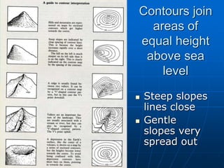
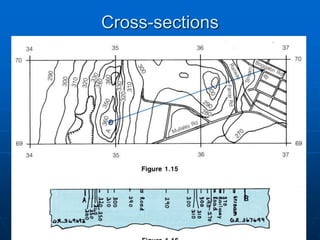
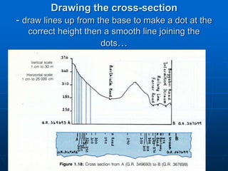
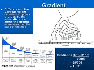
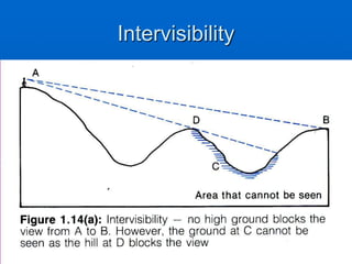

A cross section shows contours joining areas of equal height above sea level, with steep slope lines drawn close together and gentle slopes more spread out. To draw a cross section, dots are placed at the correct heights and smooth lines join the dots. Gradient is calculated by taking the difference in vertical height between two points and dividing it by the actual distance between them on the map scale. Intervisibility refers to whether two points can see each other based on the landscape features between them.