Nepal has diverse climates depending on altitude, ranging from subtropical in the south to an alpine climate in the Himalayas. The climate varies from hot summers and mild winters in the south to cool summers and severe winters in the north. Most of Nepal experiences a hot, rainy monsoon season from June to September, brought by southwest winds, with heavy rainfall throughout the country. Temperatures decrease with increasing altitude, dropping 6°C for every 1,000 meter increase.
It is a presentation about the
Koppen's climate classification system. It provides an overview of Koppen system.It is an informative and engaging overview of the Koppen climate classification system, providing a useful resource for anyone interested in understanding how climate is classified and how it impacts different regions around the world.
This presentation encompasses what cyclones (tropical and midlatitude) are and how they form even where they occur. Even though almost all types of cyclones are highlighted in the slide the main focus is on Tropical and Mid-latitude cyclones. This is very helpful when one is searching for specifically the two types of cyclones.
Climate Extreme (extreme weather or climate event) refers to the occurrence of a value of a weather or climate variable above (or below) a threshold value near the upper (or lower) ends of the range of observed values of the variable. Extreme weather and climate events, interacting with exposed and vulnerable human and natural systems, can lead to disasters.
The climate of a region is ultimately determined by the radiation energy of the sun, and its distribution and temporal fluctuations. The long-term state of the atmosphere is a function of a variety of interacting elements. They are: Solar radiation, Air masses, Pressure systems (and cyclone belts),Ocean Currents, and topography.
this is a presentation of cyclone.in this ppt, various types of cyclones are given.its effects, formation, different names, types, emergency response on cyclone is given
This presentation have all what you need to present about Monsoon winds, even it's types.
If you want to learn geophysics/geology
visit my blog
http://geophysicsdiary.blogspot.com/
India belongs to the tropical monsoon climate zone. Since the Indian subcontinent is separated from the rest of Asia by the lofty Himalayan ranges, they block the cold air masses moving southwards from Central Asia. The climatic conditions of India are highlighted in this module.
The Seasons Of United Kingdom And India by Bhanu YadavBhanu Yadav
In this Presentation , you can learn about the climate, weather, and the seasons of India And UK. Its a complete pack with all the custom animation , background animation and sound effects.So download it and enjoy and gain more marks in your School Projects.
About
Indigenized remote control interface card suitable for MAFI system CCR equipment. Compatible for IDM8000 CCR. Backplane mounted serial and TCP/Ethernet communication module for CCR remote access. IDM 8000 CCR remote control on serial and TCP protocol.
• Remote control: Parallel or serial interface.
• Compatible with MAFI CCR system.
• Compatible with IDM8000 CCR.
• Compatible with Backplane mount serial communication.
• Compatible with commercial and Defence aviation CCR system.
• Remote control system for accessing CCR and allied system over serial or TCP.
• Indigenized local Support/presence in India.
• Easy in configuration using DIP switches.
Technical Specifications
Indigenized remote control interface card suitable for MAFI system CCR equipment. Compatible for IDM8000 CCR. Backplane mounted serial and TCP/Ethernet communication module for CCR remote access. IDM 8000 CCR remote control on serial and TCP protocol.
Key Features
Indigenized remote control interface card suitable for MAFI system CCR equipment. Compatible for IDM8000 CCR. Backplane mounted serial and TCP/Ethernet communication module for CCR remote access. IDM 8000 CCR remote control on serial and TCP protocol.
• Remote control: Parallel or serial interface
• Compatible with MAFI CCR system
• Copatiable with IDM8000 CCR
• Compatible with Backplane mount serial communication.
• Compatible with commercial and Defence aviation CCR system.
• Remote control system for accessing CCR and allied system over serial or TCP.
• Indigenized local Support/presence in India.
Application
• Remote control: Parallel or serial interface.
• Compatible with MAFI CCR system.
• Compatible with IDM8000 CCR.
• Compatible with Backplane mount serial communication.
• Compatible with commercial and Defence aviation CCR system.
• Remote control system for accessing CCR and allied system over serial or TCP.
• Indigenized local Support/presence in India.
• Easy in configuration using DIP switches.
Saudi Arabia stands as a titan in the global energy landscape, renowned for its abundant oil and gas resources. It's the largest exporter of petroleum and holds some of the world's most significant reserves. Let's delve into the top 10 oil and gas projects shaping Saudi Arabia's energy future in 2024.
Hierarchical Digital Twin of a Naval Power SystemKerry Sado
A hierarchical digital twin of a Naval DC power system has been developed and experimentally verified. Similar to other state-of-the-art digital twins, this technology creates a digital replica of the physical system executed in real-time or faster, which can modify hardware controls. However, its advantage stems from distributing computational efforts by utilizing a hierarchical structure composed of lower-level digital twin blocks and a higher-level system digital twin. Each digital twin block is associated with a physical subsystem of the hardware and communicates with a singular system digital twin, which creates a system-level response. By extracting information from each level of the hierarchy, power system controls of the hardware were reconfigured autonomously. This hierarchical digital twin development offers several advantages over other digital twins, particularly in the field of naval power systems. The hierarchical structure allows for greater computational efficiency and scalability while the ability to autonomously reconfigure hardware controls offers increased flexibility and responsiveness. The hierarchical decomposition and models utilized were well aligned with the physical twin, as indicated by the maximum deviations between the developed digital twin hierarchy and the hardware.
Hybrid optimization of pumped hydro system and solar- Engr. Abdul-Azeez.pdffxintegritypublishin
Advancements in technology unveil a myriad of electrical and electronic breakthroughs geared towards efficiently harnessing limited resources to meet human energy demands. The optimization of hybrid solar PV panels and pumped hydro energy supply systems plays a pivotal role in utilizing natural resources effectively. This initiative not only benefits humanity but also fosters environmental sustainability. The study investigated the design optimization of these hybrid systems, focusing on understanding solar radiation patterns, identifying geographical influences on solar radiation, formulating a mathematical model for system optimization, and determining the optimal configuration of PV panels and pumped hydro storage. Through a comparative analysis approach and eight weeks of data collection, the study addressed key research questions related to solar radiation patterns and optimal system design. The findings highlighted regions with heightened solar radiation levels, showcasing substantial potential for power generation and emphasizing the system's efficiency. Optimizing system design significantly boosted power generation, promoted renewable energy utilization, and enhanced energy storage capacity. The study underscored the benefits of optimizing hybrid solar PV panels and pumped hydro energy supply systems for sustainable energy usage. Optimizing the design of solar PV panels and pumped hydro energy supply systems as examined across diverse climatic conditions in a developing country, not only enhances power generation but also improves the integration of renewable energy sources and boosts energy storage capacities, particularly beneficial for less economically prosperous regions. Additionally, the study provides valuable insights for advancing energy research in economically viable areas. Recommendations included conducting site-specific assessments, utilizing advanced modeling tools, implementing regular maintenance protocols, and enhancing communication among system components.
Cosmetic shop management system project report.pdfKamal Acharya
Buying new cosmetic products is difficult. It can even be scary for those who have sensitive skin and are prone to skin trouble. The information needed to alleviate this problem is on the back of each product, but it's thought to interpret those ingredient lists unless you have a background in chemistry.
Instead of buying and hoping for the best, we can use data science to help us predict which products may be good fits for us. It includes various function programs to do the above mentioned tasks.
Data file handling has been effectively used in the program.
The automated cosmetic shop management system should deal with the automation of general workflow and administration process of the shop. The main processes of the system focus on customer's request where the system is able to search the most appropriate products and deliver it to the customers. It should help the employees to quickly identify the list of cosmetic product that have reached the minimum quantity and also keep a track of expired date for each cosmetic product. It should help the employees to find the rack number in which the product is placed.It is also Faster and more efficient way.
Overview of the fundamental roles in Hydropower generation and the components involved in wider Electrical Engineering.
This paper presents the design and construction of hydroelectric dams from the hydrologist’s survey of the valley before construction, all aspects and involved disciplines, fluid dynamics, structural engineering, generation and mains frequency regulation to the very transmission of power through the network in the United Kingdom.
Author: Robbie Edward Sayers
Collaborators and co editors: Charlie Sims and Connor Healey.
(C) 2024 Robbie E. Sayers
Sachpazis:Terzaghi Bearing Capacity Estimation in simple terms with Calculati...Dr.Costas Sachpazis
Terzaghi's soil bearing capacity theory, developed by Karl Terzaghi, is a fundamental principle in geotechnical engineering used to determine the bearing capacity of shallow foundations. This theory provides a method to calculate the ultimate bearing capacity of soil, which is the maximum load per unit area that the soil can support without undergoing shear failure. The Calculation HTML Code included.
Industrial Training at Shahjalal Fertilizer Company Limited (SFCL)MdTanvirMahtab2
This presentation is about the working procedure of Shahjalal Fertilizer Company Limited (SFCL). A Govt. owned Company of Bangladesh Chemical Industries Corporation under Ministry of Industries.
CFD Simulation of By-pass Flow in a HRSG module by R&R Consult.pptxR&R Consult
CFD analysis is incredibly effective at solving mysteries and improving the performance of complex systems!
Here's a great example: At a large natural gas-fired power plant, where they use waste heat to generate steam and energy, they were puzzled that their boiler wasn't producing as much steam as expected.
R&R and Tetra Engineering Group Inc. were asked to solve the issue with reduced steam production.
An inspection had shown that a significant amount of hot flue gas was bypassing the boiler tubes, where the heat was supposed to be transferred.
R&R Consult conducted a CFD analysis, which revealed that 6.3% of the flue gas was bypassing the boiler tubes without transferring heat. The analysis also showed that the flue gas was instead being directed along the sides of the boiler and between the modules that were supposed to capture the heat. This was the cause of the reduced performance.
Based on our results, Tetra Engineering installed covering plates to reduce the bypass flow. This improved the boiler's performance and increased electricity production.
It is always satisfying when we can help solve complex challenges like this. Do your systems also need a check-up or optimization? Give us a call!
Work done in cooperation with James Malloy and David Moelling from Tetra Engineering.
More examples of our work https://www.r-r-consult.dk/en/cases-en/
Immunizing Image Classifiers Against Localized Adversary Attacksgerogepatton
This paper addresses the vulnerability of deep learning models, particularly convolutional neural networks
(CNN)s, to adversarial attacks and presents a proactive training technique designed to counter them. We
introduce a novel volumization algorithm, which transforms 2D images into 3D volumetric representations.
When combined with 3D convolution and deep curriculum learning optimization (CLO), itsignificantly improves
the immunity of models against localized universal attacks by up to 40%. We evaluate our proposed approach
using contemporary CNN architectures and the modified Canadian Institute for Advanced Research (CIFAR-10
and CIFAR-100) and ImageNet Large Scale Visual Recognition Challenge (ILSVRC12) datasets, showcasing
accuracy improvements over previous techniques. The results indicate that the combination of the volumetric
input and curriculum learning holds significant promise for mitigating adversarial attacks without necessitating
adversary training.
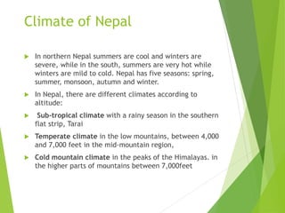
1. Climate of Nepal
In northern Nepal summers are cool and winters are
severe, while in the south, summers are very hot while
winters are mild to cold. Nepal has five seasons: spring,
summer, monsoon, autumn and winter.
In Nepal, there are different climates according to
altitude:
Sub-tropical climate with a rainy season in the southern
flat strip, Tarai
Temperate climate in the low mountains, between 4,000
and 7,000 feet in the mid-mountain region,
Cold mountain climate in the peaks of the Himalayas. in
the higher parts of mountains between 7,000feet
2. Sub tropical climate
In the thin southern plain,a region known as Tarai,
In winter, it's sunny and mild, pleasantly warm during
the day but cool at night, sometimes even cold.
The average temperatures in January is around 15 °C
(59 °F). By March, the temperature rises considerably
and it begins to be hot, while from April to June it's
scorching hot, and highs can reach or exceed 40 °C (104
°F).
The highest temperature ever recorded in Nepalgunj
was 45.0 °C (113.0 °F) on 16 June 1995, while the
lowest temperature ever recorded was −0.3 °C (31.5
°F) on 9 January 2013.
3. Nepalganj - Average temperatures
Month
Min
(°C)
Max (°C)
Mean
(°C)
Min (°F) Max (°F)
Mean
(°F)
January 9 21 15 48 70 58.9
February 12 25 18.4 53 77 65.1
March 16 31 23.4 60 88 74
April 21 36 28.6 69 98 83.6
May 25 37 31 76 99 87.8
June 26 36 31.4 80 98 88.6
July 26 33 29.8 80 92 85.7
August 26 33 29.7 80 91 85.5
September 25 32 28.8 77 90 83.8
October 21 31 26 69 88 78.8
November 15 28 21.6 59 82 70.8
December 10 23 17 51 74 62.5
Year 19.4 30.7 25 66.9 87.3 77
Nepalganj
the average temperatures of Nepalganj
4. In June, the summer monsoon arrives, characterized by
heavy rains, in the form of downpours and
thunderstorms.
The monsoon arrives first in the east, in early June,
while in the west it comes in the middle of the month
or so. The temperature decreases, with the maximum
dropping to around 32 °C (90 °F) in July and August, but
the humidity increases, making the heat muggy.
The rains are intense especially in July and August,
when they exceed 300 millimeters (12 inches) per
month, but in certain areas at the foot of the
mountains, especially in the east of the country, they
can exceed 600 mm (23.5 in) per month.
5. Nepalganj - Average precipitation
Month Millimeters Inches Days
January 20 0.8 1
February 25 1 1
March 9 0.4 1
April 8 0.3 1
May 30 1.2 4
June 155 6.1 10
July 310 12.2 17
August 325 12.8 17
September 215 8.5 10
October 40 1.6 4
November 7 0.3 1
December 8 0.3 1
Year 1150 45.4 68
6. Temperate climate (Mountain
Region, Hills-valleys )
Above 800/1,000 meters (2,600/3,300 feet), the
climate is temperate.
Average temperatures in Nepal drop 6°C in every 1,000
m high altitude.
In hills and valleys, summers are temperate while
winter temperatures can plummet to sub zero.
The Kathmandu Valley has a pleasant climate with
average summer temperatures of 20°C – 35°C and 2°C –
12°C in winter
In Pokhara, at 800 meters (2,600 feet), the average
temperature ranges from 13.5 °C (56 °F) in January to
26 °C (79 °F) in July and August.
7. Pokhara - Average temper
Month Min (°C)
Max
(°C)
Mean
(°C)
Min
(°F)
Max (°F) Mean (°F)
January 7 20 13.4 45 67 56.1
February 9 22 15.7 49 72 60.3
March 13 27 19.8 55 80 67.6
April 16 30 22.8 60 86 73
May 18 30 24.2 65 86 75.6
June 21 31 25.8 70 87 78.4
July 22 30 26 72 86 78.8
August 22 30 26.1 72 86 79
September 21 29 25 69 85 77.1
October 17 28 22.1 62 82 71.8
November 12 24 18 53 75 64.4
December 8 21 14.4 46 69 57.8
Year 15.5 26.8 21.1 59.9 80.2 70
8. Pokhara is the rainiest city of Nepal because it is
located at the foot of the Annapurna Range
Rainfall amounts to 3,900 mm (153 in) per year,
including up to 940 mm (37 in) in July and 865 mm (34
in) in August.
In winter the rains are rare, but there can be some
atmospheric instability already in spring, with
significant thunderstorms in April and May.
9. Pokhara-Average Precipitation.
Month Millimeters Inches Days
January 25 1
February 35 1.4
March 60 2.4
April 130 5.1
May 360 14.2
June 670 26.4
July 940 37
August 865 34.1
September 640 25.2
October 140 5.5
November 20 0.8
December 20 0.8
Year 3900 153.5
10. Annual rainfall amounts of Kathmandu is 1,400 mm (55
in), of which 115 mm (4.5 in) fall already in May (due to
thunderstorms that precede the monsoon),
up to 360 mm (14.2 in) in July, which is the rainiest
month.
In September, still 185 mm (7.3 in) of rain fall, and 60
mm (2.4) in October, concentrated in the first part of
the month, before the monsoon withdraws.
11. Kathmandu - Average
precipitation
Kathmandu - Average precipitation
Month Millimeters Inches Days
January 15 0.6 2
February 15 0.6 3
March 30 1.2 4
April 55 2.2 6
May 115 4.5 12
June 255 10 17
July 360 14.2 23
August 315 12.4 22
September 185 7.3 15
October 60 2.4 4
November 10 0.4 1
December 15 0.6 1
Year 1425 56.1 110
12. In Kathmandu, and in Nepal in general, the sun shines
quite often in winter and very often in spring, before
the monsoon.
In contrast, in the rainy season, especially from July to
September, the sky is often cloudy, so it's difficult to
spot the highest mountains of the Himalayas.
13. Average sunshine hours per day in
Kathmandu.
Month Average Total
January 6.5 200
February 6 175
March 8 250
April 9.5 290
May 6.5 205
June 5.5 170
July 3 100
August 3 95
September 4 125
October 6 185
November 6 175
December 5.5 175
Year 5.9 2145
14. Cold Mountain Climate
The temperature and rainfall vary with altitude and
with slope exposure. Most of the mountains of Nepal are
situated on the southern side, the temperature is
relatively mild even at high altitudes.
The annual mean temperatures(AMT) of Jumla, located
at 2,300 meters (7,500 ft) is 12.8ºC
15. Month
Min
(°C)
Max (°C)
Mean
(°C)
Min (°F) Max (°F) Mean (°F)
January -5 14 4.4 23 57 40
February -3 15 6 26 59 42.7
March 0 18 9.4 33 65 48.9
April 4 22 12.6 38 71 54.8
May 8 24 15.9 46 75 60.6
June 13 26 19.4 55 79 67
July 16 25 20.3 60 77 68.5
August 15 25 20 60 76 67.9
September 12 24 18.3 54 76 64.9
October 4 22 13 40 71 55.5
November -2 19 8.6 29 65 47.4
December -4 16 5.8 24 61 42.4
Year 4.9 20.8 12.8 40.8 69.5 55
Jumla - Average temperatures
16. In inland areas, the summer monsoon penetrates with
more difficulty, precipitation doesn't go above 100/150
mm (4/6 in) per month in the rainiest months(July and
August) .
Some particularly sheltered inland valleys which are in
the rain shadow behind the mountains receive lower
amount of rainfall, and have a desert or semi-desert
landscape, such as the kingdom of Mustang.
17. The average temperature in January drops below
freezing (0 °C or 32 °F) above 3,000 meters (9,800 ft).
Above 3,600 meters (11,800 ft), where the average
temperature of the warmest month does not exceed 10
°C (50 °F).
Perennial snows in Nepal are found at very high
altitudes, around 6,000 meters (20,000 feet).
18. At the base camp of Mount Everest, in the Khumbu
glacier, 5,300 meters (17,400 ft) above sea level, only
450 mm (17.5 in) of rain or snow fall per year.
The average temperature is around -18 °C (0 °F) in
January and -2 °C (28 °F) in July, while at the Everest's
summit it's around -36 °C (-33 °F) in January and -18 °C
(0 °F) in July. On the highest peaks of Nepal, terrible
wind storms occur, especially in winter.