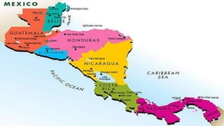
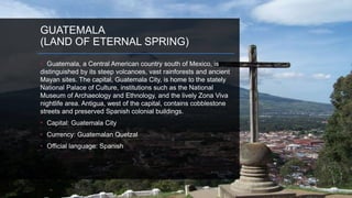
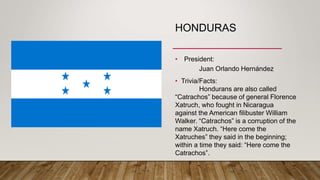
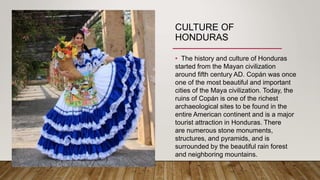
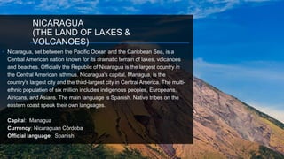
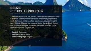
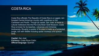
SlideShare a Scribd company logo
CENTRAL AMERICA
WORLD TOURISM
DESCRIPTION OF CENTRAL AMERICA
• Central America, a part of North America, is a tropical isthmus that connects North
America to South America. It includes (7) countries and many small offshore
islands.
• Overall, the land is fertile and rugged, and dominated through its heart by a string
of volcanic mountain ranges that are punctuated by a few active and dangerous
volcanos.
• Positioned in the planet's northern and western hemispheres the Central America
isthmus is bordered in the northwest by the country of Mexico, and in the
southeast by the country of Colombia. In addition, it's bordered by the Caribbean
Sea, Pacific Ocean, and numerous bays, gulfs and inlets.
Area: 523,780 square kilometers
Population: 42,682,190
Languages: Spanish, English, Mayan
languages, Garifuna, Kriol, and other languages
of Mesoamerica
Religion: Christianity (95.6%)
FACT:
• Temperature and location greatly affect the physical geography of a
region. All of Central America lies in a region commonly known as
Tropical Zone. The Tropical Zone is the region that lies between the
Tropic of Cancer and the Tropic of Capricorn. The region is
generally quite hot, and can be both rainy and dry. Unlike most
places on Earth, in the Tropical Zone, the higher the elevation, the
higher the temperature.
GUATEMALA
(LAND OF ETERNAL SPRING)
• Guatemala, a Central American country south of Mexico, is
distinguished by its steep volcanoes, vast rainforests and ancient
Mayan sites. The capital, Guatemala City, is home to the stately
National Palace of Culture, institutions such as the National
Museum of Archaeology and Ethnology, and the lively Zona Viva
nightlife area. Antigua, west of the capital, contains cobblestone
streets and preserved Spanish colonial buildings.
• Capital: Guatemala City
• Currency: Guatemalan Quetzal
• Official language: Spanish
GUATEMALA
(LAND OF ETERNAL SPRING)
• President:
Jimmy Morales
• Trivia/Fact:
Violent crime is a serious
concern due to endemic poverty, an
abundance of weapons, a legacy of
societal violence, and weak law
enforcement and judicial systems.
Guatemala has one of the highest violent
crime rates in Central America. The
violent crime rate is considered “Critical”
by the U.S. Department of State.
CULTURE OF
GUATEMALA
• The culture of Guatemala reflects strong Mayan and
Spanish influences and continues to be defined as a
contrast between poor Mayan villagers in the rural
highlands, and the urbanized and relatively wealthy
mestizos population (known in Guatemala as ladinos) who
occupy the cities and surrounding agricultural plains.
• Religion
Roman Catholicism combined with the
indigenous Maya religion to form the unique syncretic
religion which prevailed throughout Guatemala and still
does in the rural regions. Beginning from negligible roots
prior to the 1960s, Protestant Pentecostalism has grown to
become the predominant religion of Guatemala City and
other urban centers and down to mid-sized towns.
MAIN GATEWAY - GUATEMALA
• Guatemala's main airport, La Aurora International
Airport (GUA), is in Guatemala City.
• Airport Code: GUA
ANTIGUA
Antigua is a small city surrounded by volcanoes in
southern Guatemala. It’s renowned for its Spanish
colonial buildings, many of them restored following
a 1773 earthquake that ended Antigua’s 200-year
reign as Guatemala’s colonial capital.
TIKAL NATIONAL
PARKTikal National Park encompasses 575 square kilometres
of jungle and thousands of ruined structures. The central
part of the ancient city alone contains 3,000 buildings and
covers about 16 square kilometres.
LAKE ATITLAN
Lake Atitlán is a lake in the Guatemalan Highlands of the
Sierra Madre mountain range. It is in the Sololá
Department of southwestern Guatemala. Atitlan means "at
the water" in Nahuatl.
PACAYA
VOLCANOPacaya is an active complex volcano in Guatemala, which
first erupted approximately 23,000 years ago and has
erupted at least 23 times since the Spanish invasion of
Guatemala. Pacaya rises to an elevation of 2,552 metres.
CAHABON
The Río Cahabón (Cahabón River) is a 196-kilometre (122 mi) long
river in eastern Guatemala. From its sources in the Sierra de las
Minas range in Baja Verapaz it turns north and then east into Alta
Verapaz, running through Santa Cruz Verapaz Tactic Cobán, San
Pedro Carchá, Semuc Champey and Santa María Cahabón below
which it joins the smaller Polochic River.
HONDURAS
• Honduras is officially the Republic of Honduras is a republic
in Central America. It has at times been referred to as Spanish
Honduras to differentiate it from British Honduras, which became
modern-day Belize. Honduras is bordered to the west
by Guatemala, to the southwest by El Salvador, to the southeast
by Nicaragua, to the south by the Pacific Ocean at the Gulf of
Fonseca, and to the north by the Gulf of Honduras, a large inlet
of the Caribbean Sea.
• Capital: Tegucigalpa
• Currency: Honduran lempira
• Official language: Spanish
HONDURAS
• President:
Juan Orlando Hernández
• Trivia/Facts:
Hondurans are also called
“Catrachos” because of general Florence
Xatruch, who fought in Nicaragua
against the American filibuster William
Walker. “Catrachos” is a corruption of the
name Xatruch. “Here come the
Xatruches” they said in the beginning;
within a time they said: “Here come the
Catrachos”.
CULTURE OF
HONDURAS
• The history and culture of Honduras
started from the Mayan civilization
around fifth century AD. Copán was once
one of the most beautiful and important
cities of the Maya civilization. Today, the
ruins of Copán is one of the richest
archaeological sites to be found in the
entire American continent and is a major
tourist attraction in Honduras. There
are numerous stone monuments,
structures, and pyramids, and is
surrounded by the beautiful rain forest
and neighboring mountains.
HOLIDAYS AND CELEBRATIONS
• The people of Honduras celebrate their Independence Day on September 15th each
year. The festivities start early in the morning with marching bands, dancers, and
cheerleaders. Typical Honduran foods such as beans, tamales, baleadas, cassava
with chicharron, and tortillas are offered. It is a day of great joy, and pride for their
country
• Children's Day or Dia del Niño is celebrated on September 10th. On this day, children
receive presents and have parties similar to Christmas or birthday celebrations.
• Since Catholicism is the dominant religion in Honduras, Holy week is an important
occasion. From Palm Sunday to the crucifixion, Honduras honor and celebrate the
sacrifice Jesus Christ made for them by re-enacting the events. People decorate the
trail that Jesus will walk through with colorful sawdust designs to make the walk less
painful for Him.
MAIN GATEWAY - HONDURAS
• Toncontín International Airport or Teniente Coronel
Hernán Acosta Mejía Airport is the airport located 6 km
(4 mi) from the centre of Tegucigalpa, Honduras.
• Airport Code: TGU
ROATAN
ISLANDRoatán is an island in the Caribbean, about 65 kilometres
off the northern coast of Honduras. It is located between
the islands of Útila and Guanaja, and is the largest of the
Bay Islands of Honduras.
RIO
The Cangrejal River or Río Cangrejal is a river that drains
several mountain tributaries and borders the rainforest of
Pico Bonito National Park near La Ceiba, Honduras.
GUANAJA
Guanaja is one of the Bay Islands of Honduras and is in
the Caribbean. The densely populated cay has been
described as the Venice of Honduras because of the
waterways that run through it.
COPAN
Copán is an archaeological site of the Maya civilization
located in the Copán Department of western Honduras, not
far from the border with Guatemala. It was the capital city of
a major Classic period kingdom from the 5th to 9th centuries
AD.
LAGO DE
YOJOALake Yojoa is the largest lake in Honduras with a surface
area of 79 square kilometers and an average depth of 15
meters. At an altitude of 700 meters, it lies in a depression
formed by volcanoes.
NICARAGUA
(THE LAND OF LAKES &
VOLCANOES)
• Nicaragua, set between the Pacific Ocean and the Caribbean Sea, is a
Central American nation known for its dramatic terrain of lakes, volcanoes
and beaches. Officially the Republic of Nicaragua is the largest country in
the Central American isthmus. Nicaragua's capital, Managua, is the
country's largest city and the third-largest city in Central America. The multi-
ethnic population of six million includes indigenous peoples, Europeans,
Africans, and Asians. The main language is Spanish. Native tribes on the
eastern coast speak their own languages.
Capital: Managua
Currency: Nicaraguan Córdoba
Official language: Spanish
NICARAGUA
• President:
Daniel Ortega
• Trivia/Facts:
The name of the country is derived
from two words “Nicarao” and “Agua.” Nicarao is
the name of the indigenous people that lived on
the shores of Lake Nicaragua in the 15th century,
prior to the Spanish conquest of the
Americas. Agua is the Spanish word for water,
used due to the abundance of water in the
country, such as the large lakes, Lago de
Nicaragua (also known as Lake Cocibolca) and
Lago de Managua (Lake Xolotlán).
CULTURE OF
NICARAGUA
• The people of Nicaragua are mostly mestizos, and
Spanish is invariably their first language.
Nicaraguans mostly refer to themselves
as Nicas, Nicoyas & Pinoleros.
• The rest of Nicaragua was colonized by Spain and
has a similar culture to other Spanish-speaking
American countries. The eastern half of the
country, on the other hand, was once a
British protectorate, and English spoken
domestically along with Spanish and indigenous
languages. Its culture is similar to that of former
and present British colonies in the Caribbean, such
as Jamaica, Belize, the Cayman Islands, etc.
MAIN GATEWAY – NICARAGUA
• Augusto C. Sandino International Airport or ACS is
the main airport in Managua, Nicaragua. Named as Las
Mercedes Airport in 1968 it was later renamed Augusto
C. Sandino International Airport.P
• Airport Code: MGA
GRANADA
Granada is a Nicaraguan city on the shores of Lake Nicaragua. It’s
home to multiple Spanish colonial landmarks that have survived
repeated pirate invasions. The city’s main plaza, Central Park, is
dominated by the colorful, neoclassical facade of the Cathedral of
Granada, originally dating to 1583. The Centro Cultural Convento
San Francisco nearby is famed for its displays of pre-Columbian
statues.
SAN JUAN DEL
SUR
San Juan del Sur is a municipality and coastal town
on the Pacific Ocean, in the Rivas department in
southwest Nicaragua. It is located 140 kilometres
south of Managua.
MATAGALPA
Matagalpa is the second most important city in Nicaragua
and is known as the "Pearl of the North" and "Land of
Eternal Spring."
OMETEPE
Ometepe is an island formed by two volcanoes rising from
Lake Nicaragua in the Republic of Nicaragua. Its name
derives from the Nahuatl words ome and tepetl, meaning
two mountains. It is the largest island in Lake Nicaragua.
CERO NEGRO
Cerro Negro is an active volcano in the Cordillera de los
Maribios mountain range in Nicaragua, about 10 km from
the village of Malpaisillo. It is a very new volcano, the
youngest in Central America, having first appeared in April
1850.
PANAMA
(BRIDGE OF THE WORLD)
Panama is a country on the isthmus linking Central and South
America. The man-made Panama Canal cuts through its center,
linking the Atlantic and Pacific oceans to create an essential
shipping route. In the capital, Panama City, modern skyscrapers,
casinos and nightclubs contrast with colonial buildings in the
Casco Viejo district and the rainforest of Natural Metropolitan
Park.
• Capital: Panama City
• Currencies: United States Dollar, Panamanian balboa
• Official language: Spanish
PANAMA
• President:
Juan Carlos Varela
• Trivia/Facts:
Panama is the only place
in the world where you can see
the sun rise on the Pacific and
set on the Atlantic.
CULTURE OF PANAMA
• Panamanian culture is a hybrid
of African, Native Panamanian, and
European culture - specifically Spanish.
For example, the tamborito is a Spanish
dance that was blended with Native
American rhythms and dance moves.
Dance is a symbol of the diverse cultures
that have coupled in Panama. The local
folklore can be experienced through a
multitude of festivals, dances and traditions
that have been handed down from
generation to generation.
MAIN GATEWAY - PANAMA
• Tocumen International Airport. Tocumen International
Airport is the international airport of Panama City, the
capital of Panama.
• Airport Code: PTY
PANAMA CANAL
The Panama Canal is an artificial 48-mile waterway in
Panama that connects the Atlantic Ocean with the Pacific
Ocean. The canal cuts across the Isthmus of Panama and
is a key conduit for international maritime trade.
COIBA
Coiba is the largest island in Central America, with an
area of 503 km², off the Pacific coast of the Panamanian
province of Veraguas. It is part of the Montijo District of
that province.
• Panama City, Panama's capital, is a
modern city framed by the Pacific Ocean
and man-made Panama Canal. Casco
Viejo, its cobblestoned center, contains
colonial-era landmarks like the
neoclassical Palacio Presidencial (aka
Palacio de las Garzas) as well as
bougainvillea-filled plazas lined with
cafes and bars. From Miraflores Locks
one can watch ships pass through the
city's famed canal, linking the Atlantic
and Pacific.
PEARL ISLAND
The Pearl Islands are a group of 200 or more islands and
islets lying about 30 miles off the Pacific coast of Panama
in the Gulf of Panama.
• Bastimentos Island is an island with
eponymous town, and corregimiento
located in the Bocas del Toro District
and archipelage of Bocas del Toro
Province, Panama. The island is about
62 square kilometres, one of the
largest in Panama.
ISLA TABOGA
Taboga Island, also known as the "Island of Flowers", is a
volcanic island in the Gulf of Panama. It is a tourist
destination, about 20 km from Panama City, Panama.
• The Chagres National Park is located
between the Province of Panama and
Colon, in the Eastern sector of the
Panama Canal with a total surface area
of 129,000 hectares.
AMADOR CAUSEWAY
Amador Causeway, a narrow land bridge that connects
four islands by the Pacific entrance to the Panama Canal.
The Causeway was created using rock extracted during the
excavations of the canal.
BELIZE
(BRITISH HONDURAS)
• Belize is a nation on the eastern coast of Central America, with
Caribbean Sea shorelines to the east and dense jungle to the
west. It's known for its beaches, eco-lodges, scuba diving and
sport fishing. Offshore, the massive Belize Barrier Reef, dotted
with hundreds of cayes, hosts rich marine life. Belize’s jungle
areas are rich with Mayan ruins.
• Capital: Belmopan
• Currency: Belize dollar
• Official language: English
BELIZE
• President:
Dean Oliver Barrow
• Trivia/Facts:
Belize has the only
Jaguar reserve in the world,
otherwise known as
Cockscomb Basin Wildlife
sanctuary.
CULTURE OF BELIZE
• The Belizean culture is a mix of
influences and people from Kriol,
Maya, Garinagu (also known as
Garifuna), Mestizo (a mixture of
Spanish and Native Americans),
Mennonites who are of German
descent, with a blend of many other
cultures from Chinese to Lebanese. It
is a unique blend that emerged
through the country's long and
occasionally violent history.
MAIN GATEWAY - BELIZE
• BELIZE main airport is derived from the name of
Belize politician Philip Stanley Wilberforce Goldson.
• Airport Code: BZE
San Pedro is a town on the southern part of the island
of Ambergris Caye in the Belize District of the nation
of Belize, in Central America. According to 2015 mid-
year estimates, the town has a population of about
16,444. It is the second largest town in the Belize
District and largest in the Belize Rural South
constituency. The once sleepy fishing village was
granted the status of a town in 1984 and was
sometimes said to be the inspiration for the song "La
Isla Bonita", written by Madonna, Patrick Leonard and
Bruce Gaitsch. San Pedro's inhabitants are known as
San Pedranos. Most speak both Spanish and English
fluently. Due to the influence of Kriol, most San
Pedranos can speak it, as well as an intermediate form
that is known as "Kitchen Spanish".
CAYE CAULKER
Caye Caulker is a small Caribbean island off the coast of Belize. It’s
divided by a narrow channel called the Split, where there’s a bar
and a sandy beach. To the south is the island’s only settlement,
known as Caye Caulker Village. The north of the island is home to
dense mangrove forest and diverse birdlife, protected by a forest
reserve. The Caye Caulker Marine Reserve has dive sites on the
Belize Barrier Reef.
San Ignacio and Santa Elena are towns in western
Belize. San Ignacio serves as the cultural-economic
hub of Cayo District. It got its start from Mahogany
and chicle production during British colonialism. Over
time it attracted people from the surrounding areas,
which led to the diverse population of the town today.
San Ignacio is the largest settlement in Cayo District
and the second largest in the country, after Belize City.
The area around San Ignacio is one of the most
popular parts of the country for tourism. Nearby
attractions include the ancient Maya ruins of Caracol,
Xunantunich, Cahal Pech, and El Pilar, the Actun
Tunichil Muknal cave, Chaa Creek Nature Reserve, and
the Mountain Pine Ridge Forest Reserve. Barton Creek
Cave is another attraction that is popular among
tourists interested in cave tubing.
CARACOL
Caracol is the name given to a large ancient Maya
archaeological site, located in what is now the Cayo
District of Belize.
Ambergris Caye, Belize's largest island, is
known for its Caribbean beaches, water
sports and scuba diving. Off the eastern
shore, the Belize Barrier Reef features
famed snorkeling and dive sites like the
Hol Chan Marine Reserve, with an
abundance of sea life, and the 124m-
deep Great Blue Hole. The town of San
Pedro is the island's gateway and a
center for sailing and reef exploration.
COCKSCOMB BASIN
WILDLIFE SANCTUARY
The Cockscomb Basin Wildlife Sanctuary is a nature reserve in the Stann Creek District of
south-central Belize. It was established to protect the forests, fauna and watersheds of an
approximately 400 square kilometres (150 sq mi) area of the eastern slopes of the Maya
Mountains. The reserve was founded in 1990 as the first wilderness sanctuary for the Jaguar
(Panthera onca) and is regarded as a premier site for Jaguar preservation in the world.
• The Belize Barrier Reef is a series of
coral reefs straddling the coast of
Belize, roughly 300 meters offshore in
the north and 40 kilometers in the
south within the country limits.
AMBERGRIS CAYE
Ambergris Caye, Belize's largest island, is known for its Caribbean beaches, water
sports and scuba diving. Off the eastern shore, the Belize Barrier Reef features
famed snorkeling and dive sites like the Hol Chan Marine Reserve, with an
abundance of sea life, and the 124m-deep Great Blue Hole. The town of San Pedro
is the island's gateway and a center for sailing and reef exploration.
• San Pedro is a town on the southern
part of the island of Ambergris Caye in
the Belize District of the nation of
Belize, in Central America. According to
2015 mid-year estimates, the town has
a population of about 16,444.
BELIZE BARRIER REEF
The Belize Barrier Reef is a series of coral reefs straddling
the coast of Belize, roughly 300 meters offshore in the
north and 40 kilometers in the south within the country
limits.
COSTA RICA
Costa Rica officially The Republic of Costa Rica is a rugged, rain
forested Central American country with coastlines on the
Caribbean and Pacific. Though its capital, San Jose, is home to
cultural institutions like the Pre-Columbian Gold Museum, Costa
Rica is known for its beaches, volcanoes and immense
biodiversity. Roughly a quarter of its area is made up of protected
jungle, rich with wildlife including spider monkeys and quetzal
birds.
Capital: San José
Currency: Costa Rican Colón
Official language: Spanish
COSTA RICA
• President:
Luis Guillermo Solís
• Trivia/Facts:
For most of Costa Rica, the dry
season runs from December through April.
During these months, the Pacific coast and
most of the Central Valley receive little rain, or
the odd afternoon shower. May through mid-
November is considered the rainy season,
when days are marked by sunny mornings
and late afternoon thunderstorms. The
Caribbean coast, Monteverde and Arenal
areas are exceptions to this rule, and have no
distinct dry season. -
CULTURE OF COSTA
RICA
• Costa Rican culture has been heavily
influenced by Spanish culture ever since
the Spanish colonization of the
Americas including the territory which today
forms Costa Rica. Parts of the country have
other strong cultural influences, including
the Caribbean province of Limón and the
Cordillera de Talamanca which are
influenced by Jamaican immigrants and
indigenous native people, respectively.
MAIN GATEWAY – COSTA RICA
• There are currently two international airports in Costa
Rica. The largest, Juan Santamaria Airport (SJO) in
Alajuela, is located within the Central Valley region north of
San Jose. The other airport, Daniel Oduber Airport (LIR) in
Liberia, facilitates access to destinations in the
northwestern Guanacaste region.
• Airport Code: SJO, LIR
MONTEVERDE
CLOUD FOREST
RESERVE
The Monteverde Cloud Forest Reserve is a Costa Rican
reserve located along the Cordillera de Tilarán within the
Puntarenas and Alajuela provinces.
Tortuguero National Park is a National Park
in the Limón Province of Costa Rica. It is
situated within the Tortuguero Conservation
Area of the northeastern part of the
country.[1] Despite its remote location, it is
the third-most visited park in Costa Rica,
reached only by airplane or boat.[2] The park
has a large variety of biological diversity due
to the existence within the reserve of eleven
different habitats, including rainforest,
mangrove forests, swamps, beaches, and
lagoons. Located in a tropical climate, it is
very humid, and receives up to 250 inches
(6,400 mm) of rain a year.
MANUEL ANTONIO
NATIONAL PARK
Manuel Antonio National Park, on Costa Rica’s central Pacific coast,
encompasses rugged rainforest, white-sand beaches and coral reefs. It’s
renowned for its vast diversity of tropical plants and wildlife, from three-toed
sloths and endangered white-faced capuchin monkeys to hundreds of bird
species. The park’s roughly 680 hectares are crossed with hiking trails, which
meander from the coast up into the mountains.
SAN JOSE
San Jose, Costa Rica’s capital, sits in the Central Valley region
with the Talamanca Mountains to the south and volcanoes to the
north. The city is distinguished by its Spanish colonial buildings,
like the ornate, neoclassical National Theatre of Costa Rica
overlooking downtown’s Plaza de la Cultura, a popular gathering
spot. Below the plaza, the Pre-Columbian Gold Museum displays
hundreds of gleaming artifacts.
Manuel Antonio National Park, on Costa
Rica’s central Pacific coast, encompasses
rugged rainforest, white-sand beaches
and coral reefs. It’s renowned for its vast
diversity of tropical plants and wildlife,
from three-toed sloths and endangered
white-faced capuchin monkeys to
hundreds of bird species. The park’s
roughly 680 hectares are crossed with
hiking trails, which meander from the
coast up into the mountains.
TAMARINDO
Tamarindo is a town and distrito located on the Nicoya
Peninsula on the Northern Pacific coast of Costa Rica in
the Province of Guanacaste. The district has a population
of 6,869, although the town itself is about 500.
La Fortuna is the name of a district and
a small city located in San Carlos, in the
province of Alajuela, Costa Rica. "La
Fortuna" is Spanish for "The Fortune",
and aptly named due its ample supply
of tourist attractions and extremely
fertile lands.
ARENAL VOLCANO
Arenal Volcano, in Spanish Volcán Arenal, is an active
andesitic stratovolcano in north-western Costa Rica
around 90 km northwest of San José, in the province of
Alajuela, canton of San Carlos, and district of La Fortuna.
EL SALVADOR
• El Salvador is a tiny Central American nation
known for its Pacific Ocean beaches, surfing and
mountainous landscape. Its Ruta de Las Flores
is a winding journey past flowering coffee farms,
rainforest zip-line sites and towns like Juayúa,
with its weekend food festival, and Ataco, home
to vivid murals. The capital, San Salvador, with a
dramatic backdrop of volcanoes, has vibrant
nightlife and arts scenes.
• Capital: San Salvador
• Official language: Spanish
EL SALVADOR
• President:
Salvador Sánchez Cerén
• Trivia/Facts:
Various indigenous groups
such as the Mayas and the Lencas
inhabited El Salvador’s territory during
pre-Columbian times. However, the
country was “conquered” when the
Spaniards took control of the Kingdom of
Cuzcatlan inhabited by the Pipiles (a
group descending from the Aztecs).
CULTURE OF EL
SALVADOR
• The culture of El Salvador is similar to
other countries in Latin America, and more
specifically to other countries in Central
America. The European influences are
emphasized in the architecture of the
colonial churches, museums and theaters
throughout most of El Salvador. In addition,
contemporary life in its cities has become
similar to that of the rest of Latin America.
MAIN GATEWAY – EL SALVADOR
• Panoramic view of terminal and jet bridges of the
International Airport of El Salvador (SAL), also known
as Comalapa Airport, El Salvador.
• Airport Code: SAL
• San Salvador is the capital city of El Salvador
and of San Salvador Department. It is the
country's political, cultural, educational and
financial center. San Salvador has been the host
city for various regional and international sporting,
political, and social events. It hosted the Central
American and Caribbean Games in 1935 and 2002,
and the Central American Games in 1977 and
1994, as well as the Miss Universe 1975 pageant.
San Salvador was also the host city of the 18th
Ibero-American Summit, held October 29–31,
2008, the most important sociopolitical event in
the Spanish and Portuguese sphere.
SAN SALVADOR
San Salvador is the capital city of El Salvador and of San
Salvador Department. It is the country's political, cultural,
educational and financial center.
• Coatepeque De Coatepeque (Nahuatl cōātepēc,
"at the snake hill") is a volcanic caldera in El
Salvador in Central America. The caldera was
formed during a series of major rhyolitic explosive
eruptions between about 72,000 and 57,000 years
ago. Since then, basaltic cinder cones and lava
flows formed near the west edge of the caldera,
and six rhyodacitic lava domes have formed. The
youngest dome, Cerro Pacho, formed after 8000
BC.
RUTA DE LAS FLORES
It's a searingly beautiful series of villages, each with a mix
of colonial architecture in indigenous tones.
TOP DESTINATION IN EL SALVADOR–
ILOBASCO
• Ilobasco is a municipality in the Cabañas
department of El Salvador. It is located 30 miles (48
kilometers) northeast of the capital, San Salvador.
• This town is known country wide (and
internationally) for its clay (other materials also
used) craftsmanship or pottery. The clay is extracted
and prepared locally. The clay work includes the
"miniatures", which are small representations of
daily scenes as lived by Salvadorans, no bigger
than 2 inches tall. The Town is also home for
second division soccer team El Roble. One version
of the miniatures are the "surprises", which are
basically a scene covered with another piece of clay
shaped and painted in the form of a fruit, an egg, a
house or other things. The cover can be removed
and then the scene can be seen.
El Imposible National Park is a tropical forest and a
national park in El Salvador. It was established on 1
January 1989 and covers an area of 38.20 square
kilometres. It literally means, "national park The
Impossible" in English.
• El Imposible National Park is a
tropical forest and a national park in El
Salvador. It was established on 1
January 1989 and covers an area of
38.20 square kilometers. It literally
means, "Impossible national park" in
English.
PUNTA ROCA
Punta Roca is a classic when visiting the Salvadoran coast. It is located in Playa
El Cocal, Department of La Libertad. This site offers a variety of dining options
including seafood and steaks in a tropical and family oriented environment,
right on the beach. Recently, Punta Roca opened several luxurious bungalows,
built with a combination of traditional and modern architecture that blends
perfectly with the well-kept gardens.
• Lake Ilopango is a crater lake which
fills a scenic 8 by 11 km volcanic
caldera in central El Salvador, on the
borders of the San Salvador, La Paz,
and Cuscatlán departments.
MONUMENTO AL DIVINO
SALVADOR DEL MUNDO
Monumento al Divino Salvador del Mundo (English: Monument to the Divine Savior
of the World) is a monument located on Plaza El Salvador del Mundo (The Savior of
the World Plaza) in San Salvador City, El Salvador. It consists of a statue of Jesus
Christ standing on top of a global sphere of planet earth, placed on top of the tall
four-sided concrete base pedestal. It is a landmark located in the country's capital San
Salvador. It is a symbol that identifies and represents both El Salvador and
Salvadorans throughout the world.
THANK YOU 

More Related Content

What's hot

South america physical
South america physicalSouth america physical
South america physicallschmidt1170
 
South American Geography
South American GeographySouth American Geography
South American GeographyDonald Johnson
 
South america
South americaSouth america
South america
Jason Hauck
 
South america project
South america projectSouth america project
South america project
misswardsclass
 
1.australia oceania
1.australia oceania1.australia oceania
1.australia oceania
Pinecrest Academy Nevada
 
North Africa
North AfricaNorth Africa
North Africa
mildredjohnson
 
South America - Intro PPT
South America - Intro PPTSouth America - Intro PPT
South America - Intro PPT
Matthew Lawhead
 
Colombia: Basic Facts
Colombia: Basic FactsColombia: Basic Facts
Colombia: Basic Facts
Allana Delgado
 
South America
South AmericaSouth America
South America
Nahid Hossen
 
Central America
Central AmericaCentral America
Central Americastanwood
 
South america
South americaSouth america
South americaMrO97
 
Geography of Mexico
Geography of MexicoGeography of Mexico
Geography of MexicoSeth Dixon
 
Geography North America
Geography North AmericaGeography North America
Geography North America
Pinecrest Academy Nevada
 
Australia and New Zealand
Australia and New ZealandAustralia and New Zealand
Australia and New ZealandAaron Carn
 
North america
North americaNorth america
North america
Pradeep Singh
 
North america
North americaNorth america
North america
iqbal muhammed
 
geography of Canada.
geography of Canada.geography of Canada.
geography of Canada.
Camila Brito
 
Canada tourism.pptx
Canada tourism.pptxCanada tourism.pptx
Canada tourism.pptx
Shobha Verma
 

What's hot (20)

South america physical
South america physicalSouth america physical
South america physical
 
Venezuela[1]
Venezuela[1]Venezuela[1]
Venezuela[1]
 
South American Geography
South American GeographySouth American Geography
South American Geography
 
South america
South americaSouth america
South america
 
South america project
South america projectSouth america project
South america project
 
Central America
Central AmericaCentral America
Central America
 
1.australia oceania
1.australia oceania1.australia oceania
1.australia oceania
 
North Africa
North AfricaNorth Africa
North Africa
 
South America - Intro PPT
South America - Intro PPTSouth America - Intro PPT
South America - Intro PPT
 
Colombia: Basic Facts
Colombia: Basic FactsColombia: Basic Facts
Colombia: Basic Facts
 
South America
South AmericaSouth America
South America
 
Central America
Central AmericaCentral America
Central America
 
South america
South americaSouth america
South america
 
Geography of Mexico
Geography of MexicoGeography of Mexico
Geography of Mexico
 
Geography North America
Geography North AmericaGeography North America
Geography North America
 
Australia and New Zealand
Australia and New ZealandAustralia and New Zealand
Australia and New Zealand
 
North america
North americaNorth america
North america
 
North america
North americaNorth america
North america
 
geography of Canada.
geography of Canada.geography of Canada.
geography of Canada.
 
Canada tourism.pptx
Canada tourism.pptxCanada tourism.pptx
Canada tourism.pptx
 

Viewers also liked

Geography: Geography of Central America and the Caribbean
Geography: Geography of Central America and the CaribbeanGeography: Geography of Central America and the Caribbean
Geography: Geography of Central America and the CaribbeanRebecca Subert
 
Central america geography
Central america geographyCentral america geography
Central america geographyStephanie Weltz
 
Central America Powerpoint
Central America PowerpointCentral America Powerpoint
Central America Powerpoint
winklerk
 
The 8 physical regions of north america
The 8 physical regions of north americaThe 8 physical regions of north america
The 8 physical regions of north americaJake Rablou
 
Eight Regions Of North America
Eight Regions Of North AmericaEight Regions Of North America
Eight Regions Of North America
guest8d1309c7
 
3.1 North American Geography
3.1 North American Geography3.1 North American Geography
3.1 North American Geography
Sandy Anthony
 
Geography of North America
Geography of North AmericaGeography of North America
Geography of North America
Nirmal Roshan
 
South America PowerPoint
South America PowerPointSouth America PowerPoint
South America PowerPointCaroline Baum
 
South America Geography: Regions of Realm
South America Geography: Regions of RealmSouth America Geography: Regions of Realm
South America Geography: Regions of RealmDes Hague
 
Chapter 6 central america and the caribbean ppt lesson 2
Chapter 6 central america and the caribbean ppt lesson 2Chapter 6 central america and the caribbean ppt lesson 2
Chapter 6 central america and the caribbean ppt lesson 2
Warren wOZfromOZ
 
Chapter 6 central america and the caribbean ppt lesson 3
Chapter 6 central america and the caribbean ppt lesson 3Chapter 6 central america and the caribbean ppt lesson 3
Chapter 6 central america and the caribbean ppt lesson 3
Warren wOZfromOZ
 
Physical region of north america
Physical region of north americaPhysical region of north america
Physical region of north america
badtrainerno1
 
The Physical Geography of the Americas
The Physical Geography of the AmericasThe Physical Geography of the Americas
The Physical Geography of the AmericasMichael Klingensmith
 
Chapter 6 central america and the caribbean ppt lesson 1
Chapter 6 central america and the caribbean ppt lesson 1Chapter 6 central america and the caribbean ppt lesson 1
Chapter 6 central america and the caribbean ppt lesson 1
Warren wOZfromOZ
 
Geographic Regions of North America
Geographic Regions of North AmericaGeographic Regions of North America
Geographic Regions of North America
abarnett06
 
South American Geography Powerpoint
South American Geography PowerpointSouth American Geography Powerpoint
South American Geography Powerpoint
emilyst3
 
Definitions of the caribbean
Definitions of the caribbeanDefinitions of the caribbean
Definitions of the caribbean
Deighton Gooden
 
All about North America
All about North AmericaAll about North America
All about North America
shaikamardayen
 
Tourism geography
Tourism geographyTourism geography
Tourism geographyUUM
 
North america the continent
North america the continentNorth america the continent
North america the continent
rajesh0ks
 

Viewers also liked (20)

Geography: Geography of Central America and the Caribbean
Geography: Geography of Central America and the CaribbeanGeography: Geography of Central America and the Caribbean
Geography: Geography of Central America and the Caribbean
 
Central america geography
Central america geographyCentral america geography
Central america geography
 
Central America Powerpoint
Central America PowerpointCentral America Powerpoint
Central America Powerpoint
 
The 8 physical regions of north america
The 8 physical regions of north americaThe 8 physical regions of north america
The 8 physical regions of north america
 
Eight Regions Of North America
Eight Regions Of North AmericaEight Regions Of North America
Eight Regions Of North America
 
3.1 North American Geography
3.1 North American Geography3.1 North American Geography
3.1 North American Geography
 
Geography of North America
Geography of North AmericaGeography of North America
Geography of North America
 
South America PowerPoint
South America PowerPointSouth America PowerPoint
South America PowerPoint
 
South America Geography: Regions of Realm
South America Geography: Regions of RealmSouth America Geography: Regions of Realm
South America Geography: Regions of Realm
 
Chapter 6 central america and the caribbean ppt lesson 2
Chapter 6 central america and the caribbean ppt lesson 2Chapter 6 central america and the caribbean ppt lesson 2
Chapter 6 central america and the caribbean ppt lesson 2
 
Chapter 6 central america and the caribbean ppt lesson 3
Chapter 6 central america and the caribbean ppt lesson 3Chapter 6 central america and the caribbean ppt lesson 3
Chapter 6 central america and the caribbean ppt lesson 3
 
Physical region of north america
Physical region of north americaPhysical region of north america
Physical region of north america
 
The Physical Geography of the Americas
The Physical Geography of the AmericasThe Physical Geography of the Americas
The Physical Geography of the Americas
 
Chapter 6 central america and the caribbean ppt lesson 1
Chapter 6 central america and the caribbean ppt lesson 1Chapter 6 central america and the caribbean ppt lesson 1
Chapter 6 central america and the caribbean ppt lesson 1
 
Geographic Regions of North America
Geographic Regions of North AmericaGeographic Regions of North America
Geographic Regions of North America
 
South American Geography Powerpoint
South American Geography PowerpointSouth American Geography Powerpoint
South American Geography Powerpoint
 
Definitions of the caribbean
Definitions of the caribbeanDefinitions of the caribbean
Definitions of the caribbean
 
All about North America
All about North AmericaAll about North America
All about North America
 
Tourism geography
Tourism geographyTourism geography
Tourism geography
 
North america the continent
North america the continentNorth america the continent
North america the continent
 

Similar to CENTRAL AMERICA

South America2
South America2South America2
South America2
Donald Johnson
 
Find out about the T’zutujil people of Guatemala | Jürg Widmer Probst
Find out about the T’zutujil people of Guatemala | Jürg Widmer Probst  Find out about the T’zutujil people of Guatemala | Jürg Widmer Probst
Find out about the T’zutujil people of Guatemala | Jürg Widmer Probst
Jürg Widmer Probst
 
South America
South AmericaSouth America
South America
Adrianne Askali
 
South america people and places
South america people and placesSouth america people and places
South america people and places
Pyramid Connections
 
Central america geography
Central america geographyCentral america geography
Central america geographyStephanie Weltz
 
Buenos aires, argentina, nation
Buenos aires, argentina, nationBuenos aires, argentina, nation
Buenos aires, argentina, nationtazw6
 
South america by tatyana
South america by tatyanaSouth america by tatyana
South america by tatyana
Nyusha Yurovskaya
 
Real world
Real worldReal world
Real world
marugim17
 
Nicaragua Vs Jamaica (Comparatives and Superlatives)
Nicaragua Vs Jamaica (Comparatives and Superlatives)Nicaragua Vs Jamaica (Comparatives and Superlatives)
Nicaragua Vs Jamaica (Comparatives and Superlatives)FabianMoralesMoro
 
Nicaragua Vs Jamaica (Comparatives and Superlatives)
 Nicaragua Vs Jamaica (Comparatives and Superlatives) Nicaragua Vs Jamaica (Comparatives and Superlatives)
Nicaragua Vs Jamaica (Comparatives and Superlatives)Miiss Yohannita
 
The Many Lands of South America
The Many Lands of South AmericaThe Many Lands of South America
The Many Lands of South America
New Lucena National High School
 
America 6B
America 6BAmerica 6B
America 6BC FM
 
Human geography of latin america
Human geography of latin americaHuman geography of latin america
Human geography of latin americaAaron Carn
 
Peru ss bethanyjohn
Peru ss bethanyjohnPeru ss bethanyjohn
Peru ss bethanyjohn
neodymiddle
 
Chilean way
Chilean wayChilean way
Chilean way
David Medina Novoa
 
Peru nation report
Peru nation reportPeru nation report
Peru nation reportkathliz
 
History 141 them4 5
History 141 them4 5History 141 them4 5
History 141 them4 5kwag929
 
LOS LUGARES TURISTICOS DE AMERICA
LOS LUGARES TURISTICOS DE AMERICALOS LUGARES TURISTICOS DE AMERICA
LOS LUGARES TURISTICOS DE AMERICA
Jersson LR
 

Similar to CENTRAL AMERICA (20)

South America2
South America2South America2
South America2
 
Find out about the T’zutujil people of Guatemala | Jürg Widmer Probst
Find out about the T’zutujil people of Guatemala | Jürg Widmer Probst  Find out about the T’zutujil people of Guatemala | Jürg Widmer Probst
Find out about the T’zutujil people of Guatemala | Jürg Widmer Probst
 
South America
South AmericaSouth America
South America
 
South america people and places
South america people and placesSouth america people and places
South america people and places
 
Colombia
ColombiaColombia
Colombia
 
Central america geography
Central america geographyCentral america geography
Central america geography
 
Buenos aires, argentina, nation
Buenos aires, argentina, nationBuenos aires, argentina, nation
Buenos aires, argentina, nation
 
South america by tatyana
South america by tatyanaSouth america by tatyana
South america by tatyana
 
Real world
Real worldReal world
Real world
 
Nicaragua Vs Jamaica (Comparatives and Superlatives)
Nicaragua Vs Jamaica (Comparatives and Superlatives)Nicaragua Vs Jamaica (Comparatives and Superlatives)
Nicaragua Vs Jamaica (Comparatives and Superlatives)
 
Nicaragua Vs Jamaica (Comparatives and Superlatives)
 Nicaragua Vs Jamaica (Comparatives and Superlatives) Nicaragua Vs Jamaica (Comparatives and Superlatives)
Nicaragua Vs Jamaica (Comparatives and Superlatives)
 
The Many Lands of South America
The Many Lands of South AmericaThe Many Lands of South America
The Many Lands of South America
 
America 6B
America 6BAmerica 6B
America 6B
 
Human geography of latin america
Human geography of latin americaHuman geography of latin america
Human geography of latin america
 
Peru ss bethanyjohn
Peru ss bethanyjohnPeru ss bethanyjohn
Peru ss bethanyjohn
 
Guatemala
GuatemalaGuatemala
Guatemala
 
Chilean way
Chilean wayChilean way
Chilean way
 
Peru nation report
Peru nation reportPeru nation report
Peru nation report
 
History 141 them4 5
History 141 them4 5History 141 them4 5
History 141 them4 5
 
LOS LUGARES TURISTICOS DE AMERICA
LOS LUGARES TURISTICOS DE AMERICALOS LUGARES TURISTICOS DE AMERICA
LOS LUGARES TURISTICOS DE AMERICA
 

Recently uploaded

Mule 4.6 & Java 17 Upgrade | MuleSoft Mysore Meetup #46
Mule 4.6 & Java 17 Upgrade | MuleSoft Mysore Meetup #46Mule 4.6 & Java 17 Upgrade | MuleSoft Mysore Meetup #46
Mule 4.6 & Java 17 Upgrade | MuleSoft Mysore Meetup #46
MysoreMuleSoftMeetup
 
The Challenger.pdf DNHS Official Publication
The Challenger.pdf DNHS Official PublicationThe Challenger.pdf DNHS Official Publication
The Challenger.pdf DNHS Official Publication
Delapenabediema
 
special B.ed 2nd year old paper_20240531.pdf
special B.ed 2nd year old paper_20240531.pdfspecial B.ed 2nd year old paper_20240531.pdf
special B.ed 2nd year old paper_20240531.pdf
Special education needs
 
PART A. Introduction to Costumer Service
PART A. Introduction to Costumer ServicePART A. Introduction to Costumer Service
PART A. Introduction to Costumer Service
PedroFerreira53928
 
Digital Tools and AI for Teaching Learning and Research
Digital Tools and AI for Teaching Learning and ResearchDigital Tools and AI for Teaching Learning and Research
Digital Tools and AI for Teaching Learning and Research
Vikramjit Singh
 
Additional Benefits for Employee Website.pdf
Additional Benefits for Employee Website.pdfAdditional Benefits for Employee Website.pdf
Additional Benefits for Employee Website.pdf
joachimlavalley1
 
Instructions for Submissions thorugh G- Classroom.pptx
Instructions for Submissions thorugh G- Classroom.pptxInstructions for Submissions thorugh G- Classroom.pptx
Instructions for Submissions thorugh G- Classroom.pptx
Jheel Barad
 
Ethnobotany and Ethnopharmacology ......
Ethnobotany and Ethnopharmacology ......Ethnobotany and Ethnopharmacology ......
Ethnobotany and Ethnopharmacology ......
Ashokrao Mane college of Pharmacy Peth-Vadgaon
 
Thesis Statement for students diagnonsed withADHD.ppt
Thesis Statement for students diagnonsed withADHD.pptThesis Statement for students diagnonsed withADHD.ppt
Thesis Statement for students diagnonsed withADHD.ppt
EverAndrsGuerraGuerr
 
Introduction to Quality Improvement Essentials
Introduction to Quality Improvement EssentialsIntroduction to Quality Improvement Essentials
Introduction to Quality Improvement Essentials
Excellence Foundation for South Sudan
 
Synthetic Fiber Construction in lab .pptx
Synthetic Fiber Construction in lab .pptxSynthetic Fiber Construction in lab .pptx
Synthetic Fiber Construction in lab .pptx
Pavel ( NSTU)
 
How to Create Map Views in the Odoo 17 ERP
How to Create Map Views in the Odoo 17 ERPHow to Create Map Views in the Odoo 17 ERP
How to Create Map Views in the Odoo 17 ERP
Celine George
 
The approach at University of Liverpool.pptx
The approach at University of Liverpool.pptxThe approach at University of Liverpool.pptx
The approach at University of Liverpool.pptx
Jisc
 
Language Across the Curriculm LAC B.Ed.
Language Across the  Curriculm LAC B.Ed.Language Across the  Curriculm LAC B.Ed.
Language Across the Curriculm LAC B.Ed.
Atul Kumar Singh
 
Basic phrases for greeting and assisting costumers
Basic phrases for greeting and assisting costumersBasic phrases for greeting and assisting costumers
Basic phrases for greeting and assisting costumers
PedroFerreira53928
 
Sectors of the Indian Economy - Class 10 Study Notes pdf
Sectors of the Indian Economy - Class 10 Study Notes pdfSectors of the Indian Economy - Class 10 Study Notes pdf
Sectors of the Indian Economy - Class 10 Study Notes pdf
Vivekanand Anglo Vedic Academy
 
1.4 modern child centered education - mahatma gandhi-2.pptx
1.4 modern child centered education - mahatma gandhi-2.pptx1.4 modern child centered education - mahatma gandhi-2.pptx
1.4 modern child centered education - mahatma gandhi-2.pptx
JosvitaDsouza2
 
2024.06.01 Introducing a competency framework for languag learning materials ...
2024.06.01 Introducing a competency framework for languag learning materials ...2024.06.01 Introducing a competency framework for languag learning materials ...
2024.06.01 Introducing a competency framework for languag learning materials ...
Sandy Millin
 
The Art Pastor's Guide to Sabbath | Steve Thomason
The Art Pastor's Guide to Sabbath | Steve ThomasonThe Art Pastor's Guide to Sabbath | Steve Thomason
The Art Pastor's Guide to Sabbath | Steve Thomason
Steve Thomason
 
MARUTI SUZUKI- A Successful Joint Venture in India.pptx
MARUTI SUZUKI- A Successful Joint Venture in India.pptxMARUTI SUZUKI- A Successful Joint Venture in India.pptx
MARUTI SUZUKI- A Successful Joint Venture in India.pptx
bennyroshan06
 

Recently uploaded (20)

Mule 4.6 & Java 17 Upgrade | MuleSoft Mysore Meetup #46
Mule 4.6 & Java 17 Upgrade | MuleSoft Mysore Meetup #46Mule 4.6 & Java 17 Upgrade | MuleSoft Mysore Meetup #46
Mule 4.6 & Java 17 Upgrade | MuleSoft Mysore Meetup #46
 
The Challenger.pdf DNHS Official Publication
The Challenger.pdf DNHS Official PublicationThe Challenger.pdf DNHS Official Publication
The Challenger.pdf DNHS Official Publication
 
special B.ed 2nd year old paper_20240531.pdf
special B.ed 2nd year old paper_20240531.pdfspecial B.ed 2nd year old paper_20240531.pdf
special B.ed 2nd year old paper_20240531.pdf
 
PART A. Introduction to Costumer Service
PART A. Introduction to Costumer ServicePART A. Introduction to Costumer Service
PART A. Introduction to Costumer Service
 
Digital Tools and AI for Teaching Learning and Research
Digital Tools and AI for Teaching Learning and ResearchDigital Tools and AI for Teaching Learning and Research
Digital Tools and AI for Teaching Learning and Research
 
Additional Benefits for Employee Website.pdf
Additional Benefits for Employee Website.pdfAdditional Benefits for Employee Website.pdf
Additional Benefits for Employee Website.pdf
 
Instructions for Submissions thorugh G- Classroom.pptx
Instructions for Submissions thorugh G- Classroom.pptxInstructions for Submissions thorugh G- Classroom.pptx
Instructions for Submissions thorugh G- Classroom.pptx
 
Ethnobotany and Ethnopharmacology ......
Ethnobotany and Ethnopharmacology ......Ethnobotany and Ethnopharmacology ......
Ethnobotany and Ethnopharmacology ......
 
Thesis Statement for students diagnonsed withADHD.ppt
Thesis Statement for students diagnonsed withADHD.pptThesis Statement for students diagnonsed withADHD.ppt
Thesis Statement for students diagnonsed withADHD.ppt
 
Introduction to Quality Improvement Essentials
Introduction to Quality Improvement EssentialsIntroduction to Quality Improvement Essentials
Introduction to Quality Improvement Essentials
 
Synthetic Fiber Construction in lab .pptx
Synthetic Fiber Construction in lab .pptxSynthetic Fiber Construction in lab .pptx
Synthetic Fiber Construction in lab .pptx
 
How to Create Map Views in the Odoo 17 ERP
How to Create Map Views in the Odoo 17 ERPHow to Create Map Views in the Odoo 17 ERP
How to Create Map Views in the Odoo 17 ERP
 
The approach at University of Liverpool.pptx
The approach at University of Liverpool.pptxThe approach at University of Liverpool.pptx
The approach at University of Liverpool.pptx
 
Language Across the Curriculm LAC B.Ed.
Language Across the  Curriculm LAC B.Ed.Language Across the  Curriculm LAC B.Ed.
Language Across the Curriculm LAC B.Ed.
 
Basic phrases for greeting and assisting costumers
Basic phrases for greeting and assisting costumersBasic phrases for greeting and assisting costumers
Basic phrases for greeting and assisting costumers
 
Sectors of the Indian Economy - Class 10 Study Notes pdf
Sectors of the Indian Economy - Class 10 Study Notes pdfSectors of the Indian Economy - Class 10 Study Notes pdf
Sectors of the Indian Economy - Class 10 Study Notes pdf
 
1.4 modern child centered education - mahatma gandhi-2.pptx
1.4 modern child centered education - mahatma gandhi-2.pptx1.4 modern child centered education - mahatma gandhi-2.pptx
1.4 modern child centered education - mahatma gandhi-2.pptx
 
2024.06.01 Introducing a competency framework for languag learning materials ...
2024.06.01 Introducing a competency framework for languag learning materials ...2024.06.01 Introducing a competency framework for languag learning materials ...
2024.06.01 Introducing a competency framework for languag learning materials ...
 
The Art Pastor's Guide to Sabbath | Steve Thomason
The Art Pastor's Guide to Sabbath | Steve ThomasonThe Art Pastor's Guide to Sabbath | Steve Thomason
The Art Pastor's Guide to Sabbath | Steve Thomason
 
MARUTI SUZUKI- A Successful Joint Venture in India.pptx
MARUTI SUZUKI- A Successful Joint Venture in India.pptxMARUTI SUZUKI- A Successful Joint Venture in India.pptx
MARUTI SUZUKI- A Successful Joint Venture in India.pptx
 

CENTRAL AMERICA

  • 2.
  • 3. DESCRIPTION OF CENTRAL AMERICA • Central America, a part of North America, is a tropical isthmus that connects North America to South America. It includes (7) countries and many small offshore islands. • Overall, the land is fertile and rugged, and dominated through its heart by a string of volcanic mountain ranges that are punctuated by a few active and dangerous volcanos. • Positioned in the planet's northern and western hemispheres the Central America isthmus is bordered in the northwest by the country of Mexico, and in the southeast by the country of Colombia. In addition, it's bordered by the Caribbean Sea, Pacific Ocean, and numerous bays, gulfs and inlets.
  • 4. Area: 523,780 square kilometers Population: 42,682,190 Languages: Spanish, English, Mayan languages, Garifuna, Kriol, and other languages of Mesoamerica Religion: Christianity (95.6%)
  • 5. FACT: • Temperature and location greatly affect the physical geography of a region. All of Central America lies in a region commonly known as Tropical Zone. The Tropical Zone is the region that lies between the Tropic of Cancer and the Tropic of Capricorn. The region is generally quite hot, and can be both rainy and dry. Unlike most places on Earth, in the Tropical Zone, the higher the elevation, the higher the temperature.
  • 6. GUATEMALA (LAND OF ETERNAL SPRING) • Guatemala, a Central American country south of Mexico, is distinguished by its steep volcanoes, vast rainforests and ancient Mayan sites. The capital, Guatemala City, is home to the stately National Palace of Culture, institutions such as the National Museum of Archaeology and Ethnology, and the lively Zona Viva nightlife area. Antigua, west of the capital, contains cobblestone streets and preserved Spanish colonial buildings. • Capital: Guatemala City • Currency: Guatemalan Quetzal • Official language: Spanish
  • 7. GUATEMALA (LAND OF ETERNAL SPRING) • President: Jimmy Morales • Trivia/Fact: Violent crime is a serious concern due to endemic poverty, an abundance of weapons, a legacy of societal violence, and weak law enforcement and judicial systems. Guatemala has one of the highest violent crime rates in Central America. The violent crime rate is considered “Critical” by the U.S. Department of State.
  • 8. CULTURE OF GUATEMALA • The culture of Guatemala reflects strong Mayan and Spanish influences and continues to be defined as a contrast between poor Mayan villagers in the rural highlands, and the urbanized and relatively wealthy mestizos population (known in Guatemala as ladinos) who occupy the cities and surrounding agricultural plains. • Religion Roman Catholicism combined with the indigenous Maya religion to form the unique syncretic religion which prevailed throughout Guatemala and still does in the rural regions. Beginning from negligible roots prior to the 1960s, Protestant Pentecostalism has grown to become the predominant religion of Guatemala City and other urban centers and down to mid-sized towns.
  • 9. MAIN GATEWAY - GUATEMALA • Guatemala's main airport, La Aurora International Airport (GUA), is in Guatemala City. • Airport Code: GUA
  • 10. ANTIGUA Antigua is a small city surrounded by volcanoes in southern Guatemala. It’s renowned for its Spanish colonial buildings, many of them restored following a 1773 earthquake that ended Antigua’s 200-year reign as Guatemala’s colonial capital.
  • 11. TIKAL NATIONAL PARKTikal National Park encompasses 575 square kilometres of jungle and thousands of ruined structures. The central part of the ancient city alone contains 3,000 buildings and covers about 16 square kilometres.
  • 12. LAKE ATITLAN Lake Atitlán is a lake in the Guatemalan Highlands of the Sierra Madre mountain range. It is in the Sololá Department of southwestern Guatemala. Atitlan means "at the water" in Nahuatl.
  • 13. PACAYA VOLCANOPacaya is an active complex volcano in Guatemala, which first erupted approximately 23,000 years ago and has erupted at least 23 times since the Spanish invasion of Guatemala. Pacaya rises to an elevation of 2,552 metres.
  • 14. CAHABON The Río Cahabón (Cahabón River) is a 196-kilometre (122 mi) long river in eastern Guatemala. From its sources in the Sierra de las Minas range in Baja Verapaz it turns north and then east into Alta Verapaz, running through Santa Cruz Verapaz Tactic Cobán, San Pedro Carchá, Semuc Champey and Santa María Cahabón below which it joins the smaller Polochic River.
  • 15. HONDURAS • Honduras is officially the Republic of Honduras is a republic in Central America. It has at times been referred to as Spanish Honduras to differentiate it from British Honduras, which became modern-day Belize. Honduras is bordered to the west by Guatemala, to the southwest by El Salvador, to the southeast by Nicaragua, to the south by the Pacific Ocean at the Gulf of Fonseca, and to the north by the Gulf of Honduras, a large inlet of the Caribbean Sea. • Capital: Tegucigalpa • Currency: Honduran lempira • Official language: Spanish
  • 16. HONDURAS • President: Juan Orlando Hernández • Trivia/Facts: Hondurans are also called “Catrachos” because of general Florence Xatruch, who fought in Nicaragua against the American filibuster William Walker. “Catrachos” is a corruption of the name Xatruch. “Here come the Xatruches” they said in the beginning; within a time they said: “Here come the Catrachos”.
  • 17. CULTURE OF HONDURAS • The history and culture of Honduras started from the Mayan civilization around fifth century AD. Copán was once one of the most beautiful and important cities of the Maya civilization. Today, the ruins of Copán is one of the richest archaeological sites to be found in the entire American continent and is a major tourist attraction in Honduras. There are numerous stone monuments, structures, and pyramids, and is surrounded by the beautiful rain forest and neighboring mountains.
  • 18. HOLIDAYS AND CELEBRATIONS • The people of Honduras celebrate their Independence Day on September 15th each year. The festivities start early in the morning with marching bands, dancers, and cheerleaders. Typical Honduran foods such as beans, tamales, baleadas, cassava with chicharron, and tortillas are offered. It is a day of great joy, and pride for their country • Children's Day or Dia del Niño is celebrated on September 10th. On this day, children receive presents and have parties similar to Christmas or birthday celebrations. • Since Catholicism is the dominant religion in Honduras, Holy week is an important occasion. From Palm Sunday to the crucifixion, Honduras honor and celebrate the sacrifice Jesus Christ made for them by re-enacting the events. People decorate the trail that Jesus will walk through with colorful sawdust designs to make the walk less painful for Him.
  • 19. MAIN GATEWAY - HONDURAS • Toncontín International Airport or Teniente Coronel Hernán Acosta Mejía Airport is the airport located 6 km (4 mi) from the centre of Tegucigalpa, Honduras. • Airport Code: TGU
  • 20. ROATAN ISLANDRoatán is an island in the Caribbean, about 65 kilometres off the northern coast of Honduras. It is located between the islands of Útila and Guanaja, and is the largest of the Bay Islands of Honduras.
  • 21. RIO The Cangrejal River or Río Cangrejal is a river that drains several mountain tributaries and borders the rainforest of Pico Bonito National Park near La Ceiba, Honduras.
  • 22. GUANAJA Guanaja is one of the Bay Islands of Honduras and is in the Caribbean. The densely populated cay has been described as the Venice of Honduras because of the waterways that run through it.
  • 23. COPAN Copán is an archaeological site of the Maya civilization located in the Copán Department of western Honduras, not far from the border with Guatemala. It was the capital city of a major Classic period kingdom from the 5th to 9th centuries AD.
  • 24. LAGO DE YOJOALake Yojoa is the largest lake in Honduras with a surface area of 79 square kilometers and an average depth of 15 meters. At an altitude of 700 meters, it lies in a depression formed by volcanoes.
  • 25. NICARAGUA (THE LAND OF LAKES & VOLCANOES) • Nicaragua, set between the Pacific Ocean and the Caribbean Sea, is a Central American nation known for its dramatic terrain of lakes, volcanoes and beaches. Officially the Republic of Nicaragua is the largest country in the Central American isthmus. Nicaragua's capital, Managua, is the country's largest city and the third-largest city in Central America. The multi- ethnic population of six million includes indigenous peoples, Europeans, Africans, and Asians. The main language is Spanish. Native tribes on the eastern coast speak their own languages. Capital: Managua Currency: Nicaraguan Córdoba Official language: Spanish
  • 26. NICARAGUA • President: Daniel Ortega • Trivia/Facts: The name of the country is derived from two words “Nicarao” and “Agua.” Nicarao is the name of the indigenous people that lived on the shores of Lake Nicaragua in the 15th century, prior to the Spanish conquest of the Americas. Agua is the Spanish word for water, used due to the abundance of water in the country, such as the large lakes, Lago de Nicaragua (also known as Lake Cocibolca) and Lago de Managua (Lake Xolotlán).
  • 27. CULTURE OF NICARAGUA • The people of Nicaragua are mostly mestizos, and Spanish is invariably their first language. Nicaraguans mostly refer to themselves as Nicas, Nicoyas & Pinoleros. • The rest of Nicaragua was colonized by Spain and has a similar culture to other Spanish-speaking American countries. The eastern half of the country, on the other hand, was once a British protectorate, and English spoken domestically along with Spanish and indigenous languages. Its culture is similar to that of former and present British colonies in the Caribbean, such as Jamaica, Belize, the Cayman Islands, etc.
  • 28. MAIN GATEWAY – NICARAGUA • Augusto C. Sandino International Airport or ACS is the main airport in Managua, Nicaragua. Named as Las Mercedes Airport in 1968 it was later renamed Augusto C. Sandino International Airport.P • Airport Code: MGA
  • 29. GRANADA Granada is a Nicaraguan city on the shores of Lake Nicaragua. It’s home to multiple Spanish colonial landmarks that have survived repeated pirate invasions. The city’s main plaza, Central Park, is dominated by the colorful, neoclassical facade of the Cathedral of Granada, originally dating to 1583. The Centro Cultural Convento San Francisco nearby is famed for its displays of pre-Columbian statues.
  • 30. SAN JUAN DEL SUR San Juan del Sur is a municipality and coastal town on the Pacific Ocean, in the Rivas department in southwest Nicaragua. It is located 140 kilometres south of Managua.
  • 31. MATAGALPA Matagalpa is the second most important city in Nicaragua and is known as the "Pearl of the North" and "Land of Eternal Spring."
  • 32. OMETEPE Ometepe is an island formed by two volcanoes rising from Lake Nicaragua in the Republic of Nicaragua. Its name derives from the Nahuatl words ome and tepetl, meaning two mountains. It is the largest island in Lake Nicaragua.
  • 33. CERO NEGRO Cerro Negro is an active volcano in the Cordillera de los Maribios mountain range in Nicaragua, about 10 km from the village of Malpaisillo. It is a very new volcano, the youngest in Central America, having first appeared in April 1850.
  • 34. PANAMA (BRIDGE OF THE WORLD) Panama is a country on the isthmus linking Central and South America. The man-made Panama Canal cuts through its center, linking the Atlantic and Pacific oceans to create an essential shipping route. In the capital, Panama City, modern skyscrapers, casinos and nightclubs contrast with colonial buildings in the Casco Viejo district and the rainforest of Natural Metropolitan Park. • Capital: Panama City • Currencies: United States Dollar, Panamanian balboa • Official language: Spanish
  • 35. PANAMA • President: Juan Carlos Varela • Trivia/Facts: Panama is the only place in the world where you can see the sun rise on the Pacific and set on the Atlantic.
  • 36. CULTURE OF PANAMA • Panamanian culture is a hybrid of African, Native Panamanian, and European culture - specifically Spanish. For example, the tamborito is a Spanish dance that was blended with Native American rhythms and dance moves. Dance is a symbol of the diverse cultures that have coupled in Panama. The local folklore can be experienced through a multitude of festivals, dances and traditions that have been handed down from generation to generation.
  • 37. MAIN GATEWAY - PANAMA • Tocumen International Airport. Tocumen International Airport is the international airport of Panama City, the capital of Panama. • Airport Code: PTY
  • 38. PANAMA CANAL The Panama Canal is an artificial 48-mile waterway in Panama that connects the Atlantic Ocean with the Pacific Ocean. The canal cuts across the Isthmus of Panama and is a key conduit for international maritime trade.
  • 39. COIBA Coiba is the largest island in Central America, with an area of 503 km², off the Pacific coast of the Panamanian province of Veraguas. It is part of the Montijo District of that province.
  • 40. • Panama City, Panama's capital, is a modern city framed by the Pacific Ocean and man-made Panama Canal. Casco Viejo, its cobblestoned center, contains colonial-era landmarks like the neoclassical Palacio Presidencial (aka Palacio de las Garzas) as well as bougainvillea-filled plazas lined with cafes and bars. From Miraflores Locks one can watch ships pass through the city's famed canal, linking the Atlantic and Pacific. PEARL ISLAND The Pearl Islands are a group of 200 or more islands and islets lying about 30 miles off the Pacific coast of Panama in the Gulf of Panama.
  • 41. • Bastimentos Island is an island with eponymous town, and corregimiento located in the Bocas del Toro District and archipelage of Bocas del Toro Province, Panama. The island is about 62 square kilometres, one of the largest in Panama. ISLA TABOGA Taboga Island, also known as the "Island of Flowers", is a volcanic island in the Gulf of Panama. It is a tourist destination, about 20 km from Panama City, Panama.
  • 42. • The Chagres National Park is located between the Province of Panama and Colon, in the Eastern sector of the Panama Canal with a total surface area of 129,000 hectares. AMADOR CAUSEWAY Amador Causeway, a narrow land bridge that connects four islands by the Pacific entrance to the Panama Canal. The Causeway was created using rock extracted during the excavations of the canal.
  • 43. BELIZE (BRITISH HONDURAS) • Belize is a nation on the eastern coast of Central America, with Caribbean Sea shorelines to the east and dense jungle to the west. It's known for its beaches, eco-lodges, scuba diving and sport fishing. Offshore, the massive Belize Barrier Reef, dotted with hundreds of cayes, hosts rich marine life. Belize’s jungle areas are rich with Mayan ruins. • Capital: Belmopan • Currency: Belize dollar • Official language: English
  • 44. BELIZE • President: Dean Oliver Barrow • Trivia/Facts: Belize has the only Jaguar reserve in the world, otherwise known as Cockscomb Basin Wildlife sanctuary.
  • 45. CULTURE OF BELIZE • The Belizean culture is a mix of influences and people from Kriol, Maya, Garinagu (also known as Garifuna), Mestizo (a mixture of Spanish and Native Americans), Mennonites who are of German descent, with a blend of many other cultures from Chinese to Lebanese. It is a unique blend that emerged through the country's long and occasionally violent history.
  • 46. MAIN GATEWAY - BELIZE • BELIZE main airport is derived from the name of Belize politician Philip Stanley Wilberforce Goldson. • Airport Code: BZE
  • 47. San Pedro is a town on the southern part of the island of Ambergris Caye in the Belize District of the nation of Belize, in Central America. According to 2015 mid- year estimates, the town has a population of about 16,444. It is the second largest town in the Belize District and largest in the Belize Rural South constituency. The once sleepy fishing village was granted the status of a town in 1984 and was sometimes said to be the inspiration for the song "La Isla Bonita", written by Madonna, Patrick Leonard and Bruce Gaitsch. San Pedro's inhabitants are known as San Pedranos. Most speak both Spanish and English fluently. Due to the influence of Kriol, most San Pedranos can speak it, as well as an intermediate form that is known as "Kitchen Spanish". CAYE CAULKER Caye Caulker is a small Caribbean island off the coast of Belize. It’s divided by a narrow channel called the Split, where there’s a bar and a sandy beach. To the south is the island’s only settlement, known as Caye Caulker Village. The north of the island is home to dense mangrove forest and diverse birdlife, protected by a forest reserve. The Caye Caulker Marine Reserve has dive sites on the Belize Barrier Reef.
  • 48. San Ignacio and Santa Elena are towns in western Belize. San Ignacio serves as the cultural-economic hub of Cayo District. It got its start from Mahogany and chicle production during British colonialism. Over time it attracted people from the surrounding areas, which led to the diverse population of the town today. San Ignacio is the largest settlement in Cayo District and the second largest in the country, after Belize City. The area around San Ignacio is one of the most popular parts of the country for tourism. Nearby attractions include the ancient Maya ruins of Caracol, Xunantunich, Cahal Pech, and El Pilar, the Actun Tunichil Muknal cave, Chaa Creek Nature Reserve, and the Mountain Pine Ridge Forest Reserve. Barton Creek Cave is another attraction that is popular among tourists interested in cave tubing. CARACOL Caracol is the name given to a large ancient Maya archaeological site, located in what is now the Cayo District of Belize.
  • 49. Ambergris Caye, Belize's largest island, is known for its Caribbean beaches, water sports and scuba diving. Off the eastern shore, the Belize Barrier Reef features famed snorkeling and dive sites like the Hol Chan Marine Reserve, with an abundance of sea life, and the 124m- deep Great Blue Hole. The town of San Pedro is the island's gateway and a center for sailing and reef exploration. COCKSCOMB BASIN WILDLIFE SANCTUARY The Cockscomb Basin Wildlife Sanctuary is a nature reserve in the Stann Creek District of south-central Belize. It was established to protect the forests, fauna and watersheds of an approximately 400 square kilometres (150 sq mi) area of the eastern slopes of the Maya Mountains. The reserve was founded in 1990 as the first wilderness sanctuary for the Jaguar (Panthera onca) and is regarded as a premier site for Jaguar preservation in the world.
  • 50. • The Belize Barrier Reef is a series of coral reefs straddling the coast of Belize, roughly 300 meters offshore in the north and 40 kilometers in the south within the country limits. AMBERGRIS CAYE Ambergris Caye, Belize's largest island, is known for its Caribbean beaches, water sports and scuba diving. Off the eastern shore, the Belize Barrier Reef features famed snorkeling and dive sites like the Hol Chan Marine Reserve, with an abundance of sea life, and the 124m-deep Great Blue Hole. The town of San Pedro is the island's gateway and a center for sailing and reef exploration.
  • 51. • San Pedro is a town on the southern part of the island of Ambergris Caye in the Belize District of the nation of Belize, in Central America. According to 2015 mid-year estimates, the town has a population of about 16,444. BELIZE BARRIER REEF The Belize Barrier Reef is a series of coral reefs straddling the coast of Belize, roughly 300 meters offshore in the north and 40 kilometers in the south within the country limits.
  • 52. COSTA RICA Costa Rica officially The Republic of Costa Rica is a rugged, rain forested Central American country with coastlines on the Caribbean and Pacific. Though its capital, San Jose, is home to cultural institutions like the Pre-Columbian Gold Museum, Costa Rica is known for its beaches, volcanoes and immense biodiversity. Roughly a quarter of its area is made up of protected jungle, rich with wildlife including spider monkeys and quetzal birds. Capital: San José Currency: Costa Rican Colón Official language: Spanish
  • 53. COSTA RICA • President: Luis Guillermo Solís • Trivia/Facts: For most of Costa Rica, the dry season runs from December through April. During these months, the Pacific coast and most of the Central Valley receive little rain, or the odd afternoon shower. May through mid- November is considered the rainy season, when days are marked by sunny mornings and late afternoon thunderstorms. The Caribbean coast, Monteverde and Arenal areas are exceptions to this rule, and have no distinct dry season. -
  • 54. CULTURE OF COSTA RICA • Costa Rican culture has been heavily influenced by Spanish culture ever since the Spanish colonization of the Americas including the territory which today forms Costa Rica. Parts of the country have other strong cultural influences, including the Caribbean province of Limón and the Cordillera de Talamanca which are influenced by Jamaican immigrants and indigenous native people, respectively.
  • 55. MAIN GATEWAY – COSTA RICA • There are currently two international airports in Costa Rica. The largest, Juan Santamaria Airport (SJO) in Alajuela, is located within the Central Valley region north of San Jose. The other airport, Daniel Oduber Airport (LIR) in Liberia, facilitates access to destinations in the northwestern Guanacaste region. • Airport Code: SJO, LIR
  • 56. MONTEVERDE CLOUD FOREST RESERVE The Monteverde Cloud Forest Reserve is a Costa Rican reserve located along the Cordillera de Tilarán within the Puntarenas and Alajuela provinces.
  • 57. Tortuguero National Park is a National Park in the Limón Province of Costa Rica. It is situated within the Tortuguero Conservation Area of the northeastern part of the country.[1] Despite its remote location, it is the third-most visited park in Costa Rica, reached only by airplane or boat.[2] The park has a large variety of biological diversity due to the existence within the reserve of eleven different habitats, including rainforest, mangrove forests, swamps, beaches, and lagoons. Located in a tropical climate, it is very humid, and receives up to 250 inches (6,400 mm) of rain a year. MANUEL ANTONIO NATIONAL PARK Manuel Antonio National Park, on Costa Rica’s central Pacific coast, encompasses rugged rainforest, white-sand beaches and coral reefs. It’s renowned for its vast diversity of tropical plants and wildlife, from three-toed sloths and endangered white-faced capuchin monkeys to hundreds of bird species. The park’s roughly 680 hectares are crossed with hiking trails, which meander from the coast up into the mountains.
  • 58. SAN JOSE San Jose, Costa Rica’s capital, sits in the Central Valley region with the Talamanca Mountains to the south and volcanoes to the north. The city is distinguished by its Spanish colonial buildings, like the ornate, neoclassical National Theatre of Costa Rica overlooking downtown’s Plaza de la Cultura, a popular gathering spot. Below the plaza, the Pre-Columbian Gold Museum displays hundreds of gleaming artifacts.
  • 59. Manuel Antonio National Park, on Costa Rica’s central Pacific coast, encompasses rugged rainforest, white-sand beaches and coral reefs. It’s renowned for its vast diversity of tropical plants and wildlife, from three-toed sloths and endangered white-faced capuchin monkeys to hundreds of bird species. The park’s roughly 680 hectares are crossed with hiking trails, which meander from the coast up into the mountains. TAMARINDO Tamarindo is a town and distrito located on the Nicoya Peninsula on the Northern Pacific coast of Costa Rica in the Province of Guanacaste. The district has a population of 6,869, although the town itself is about 500.
  • 60. La Fortuna is the name of a district and a small city located in San Carlos, in the province of Alajuela, Costa Rica. "La Fortuna" is Spanish for "The Fortune", and aptly named due its ample supply of tourist attractions and extremely fertile lands. ARENAL VOLCANO Arenal Volcano, in Spanish Volcán Arenal, is an active andesitic stratovolcano in north-western Costa Rica around 90 km northwest of San José, in the province of Alajuela, canton of San Carlos, and district of La Fortuna.
  • 61. EL SALVADOR • El Salvador is a tiny Central American nation known for its Pacific Ocean beaches, surfing and mountainous landscape. Its Ruta de Las Flores is a winding journey past flowering coffee farms, rainforest zip-line sites and towns like Juayúa, with its weekend food festival, and Ataco, home to vivid murals. The capital, San Salvador, with a dramatic backdrop of volcanoes, has vibrant nightlife and arts scenes. • Capital: San Salvador • Official language: Spanish
  • 62. EL SALVADOR • President: Salvador Sánchez Cerén • Trivia/Facts: Various indigenous groups such as the Mayas and the Lencas inhabited El Salvador’s territory during pre-Columbian times. However, the country was “conquered” when the Spaniards took control of the Kingdom of Cuzcatlan inhabited by the Pipiles (a group descending from the Aztecs).
  • 63. CULTURE OF EL SALVADOR • The culture of El Salvador is similar to other countries in Latin America, and more specifically to other countries in Central America. The European influences are emphasized in the architecture of the colonial churches, museums and theaters throughout most of El Salvador. In addition, contemporary life in its cities has become similar to that of the rest of Latin America.
  • 64. MAIN GATEWAY – EL SALVADOR • Panoramic view of terminal and jet bridges of the International Airport of El Salvador (SAL), also known as Comalapa Airport, El Salvador. • Airport Code: SAL
  • 65. • San Salvador is the capital city of El Salvador and of San Salvador Department. It is the country's political, cultural, educational and financial center. San Salvador has been the host city for various regional and international sporting, political, and social events. It hosted the Central American and Caribbean Games in 1935 and 2002, and the Central American Games in 1977 and 1994, as well as the Miss Universe 1975 pageant. San Salvador was also the host city of the 18th Ibero-American Summit, held October 29–31, 2008, the most important sociopolitical event in the Spanish and Portuguese sphere. SAN SALVADOR San Salvador is the capital city of El Salvador and of San Salvador Department. It is the country's political, cultural, educational and financial center.
  • 66. • Coatepeque De Coatepeque (Nahuatl cōātepēc, "at the snake hill") is a volcanic caldera in El Salvador in Central America. The caldera was formed during a series of major rhyolitic explosive eruptions between about 72,000 and 57,000 years ago. Since then, basaltic cinder cones and lava flows formed near the west edge of the caldera, and six rhyodacitic lava domes have formed. The youngest dome, Cerro Pacho, formed after 8000 BC. RUTA DE LAS FLORES It's a searingly beautiful series of villages, each with a mix of colonial architecture in indigenous tones.
  • 67. TOP DESTINATION IN EL SALVADOR– ILOBASCO • Ilobasco is a municipality in the Cabañas department of El Salvador. It is located 30 miles (48 kilometers) northeast of the capital, San Salvador. • This town is known country wide (and internationally) for its clay (other materials also used) craftsmanship or pottery. The clay is extracted and prepared locally. The clay work includes the "miniatures", which are small representations of daily scenes as lived by Salvadorans, no bigger than 2 inches tall. The Town is also home for second division soccer team El Roble. One version of the miniatures are the "surprises", which are basically a scene covered with another piece of clay shaped and painted in the form of a fruit, an egg, a house or other things. The cover can be removed and then the scene can be seen. El Imposible National Park is a tropical forest and a national park in El Salvador. It was established on 1 January 1989 and covers an area of 38.20 square kilometres. It literally means, "national park The Impossible" in English.
  • 68. • El Imposible National Park is a tropical forest and a national park in El Salvador. It was established on 1 January 1989 and covers an area of 38.20 square kilometers. It literally means, "Impossible national park" in English. PUNTA ROCA Punta Roca is a classic when visiting the Salvadoran coast. It is located in Playa El Cocal, Department of La Libertad. This site offers a variety of dining options including seafood and steaks in a tropical and family oriented environment, right on the beach. Recently, Punta Roca opened several luxurious bungalows, built with a combination of traditional and modern architecture that blends perfectly with the well-kept gardens.
  • 69. • Lake Ilopango is a crater lake which fills a scenic 8 by 11 km volcanic caldera in central El Salvador, on the borders of the San Salvador, La Paz, and Cuscatlán departments. MONUMENTO AL DIVINO SALVADOR DEL MUNDO Monumento al Divino Salvador del Mundo (English: Monument to the Divine Savior of the World) is a monument located on Plaza El Salvador del Mundo (The Savior of the World Plaza) in San Salvador City, El Salvador. It consists of a statue of Jesus Christ standing on top of a global sphere of planet earth, placed on top of the tall four-sided concrete base pedestal. It is a landmark located in the country's capital San Salvador. It is a symbol that identifies and represents both El Salvador and Salvadorans throughout the world.