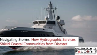
Navigating Storms: How Hydrographic Services Shield Coastal Communities from Disaster
•Download as PPTX, PDF•
0 likes•3 views

We will look at the critical role hydrographic services play in protecting coastal populations from disasters. Know More: https://www.falconsurveyme.com/our-services/bathymetric-survey/hydrographic-survey-2/

Recommended
More Related Content
Similar to Navigating Storms: How Hydrographic Services Shield Coastal Communities from Disaster
Similar to Navigating Storms: How Hydrographic Services Shield Coastal Communities from Disaster (20)
More from falconsurveyme
More from falconsurveyme (20)
Recently uploaded
Recently uploaded (20)
Navigating Storms: How Hydrographic Services Shield Coastal Communities from Disaster
- 1. Navigating Storms: How Hydrographic Services Shield Coastal Communities from Disaster
- 2. Introduction Consider a world in which coastal settlements confront risks from the elements without a dependable guide. The repercussions might be disastrous. Fortunately, there is a silent hero operating beneath the waves: hydrographic services. We will look at the critical role hydrographic services play in protecting coastal populations from disasters.
- 3. Understanding the lay of the land (or sea, rather) Coastal communities are especially vulnerable to natural calamities such as hurricanes, tsunamis, and increasing sea levels. Understanding the underwater terrain is critical for anticipating these events and planning for their consequences. Hydrographic services step in to chart the ocean floor in great detail. This mapping aids in the identification of underwater dangers such as reefs, shoals, and submerged debris, all of which can worsen disaster consequences.
- 4. Early Warning Systems: The Power of Data Every second counts when a tragedy is imminent. Hydrographic surveys give critical information that feeds into early warning systems. Hydrographers can forecast how waves would behave during a storm or tsunami by properly mapping the seabed's depths and shapes, providing communities valuable time to escape and prepare.
- 5. Coastal regions are lively commercial and transportation hubs. Hydrographic services generate accurate charts that ships and vessels use to safely navigate dangerous waterways. Hydrographic surveys guarantee that maritime transportation runs smoothly even in adverse conditions by locating and designating shipping routes, dangers, and depth restrictions. Navigating Safe Passage for Marine Transportation
- 6. Building Resilience: Infrastructure Planning In the aftermath of a disaster, rebuilding activities are critical to restore normalcy in coastal towns. Hydrographic data helps with the planning and development of resilient infrastructure. Understanding the undersea topography allows engineers to create coastal fortifications such as seawalls and breakwaters to resist future storms and lessen the effects of rising sea levels.
- 7. Knowledge is power, especially in disaster preparedness. Hydrographic services play an important role in teaching coastal populations about the threats they face and how to protect themselves. Hydrographers educate residents on how to stay safe and resilient in the midst of disaster through outreach initiatives and public awareness campaigns. Empowering communities via education and outreach
- 8. Conclusion: Charting a Safer Future In the ever-changing environment of coastal risks, hydrographic services provide a ray of hope for vulnerable communities. Hydrographers assist coastal communities in navigating storms with confidence and fortitude by charting depths, providing early warnings, and supporting resilience measures. As we look ahead, let us appreciate the critical role of hydrographic services in safeguarding lives, livelihoods, and the fragile coastal habitats we call home.
- 9. Contact Us ADDRESS: 209, 2ND FLOOR - APRICOT TOWER, P.O. BOX : 238544, DUBAI SILICON OASIS, DUBAI - UNITED ARAB EMIRATES. : info@falconsurveyme.com : +97143271414 : http://www.falconsurveyme.com/
- 10. Thank You