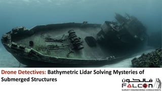
Drone Detectives: Bathymetric Lidar Solving Mysteries of Submerged Structures
•Download as PPTX, PDF•
0 likes•4 views

Bathymetric Lidar drones are plunging into the depths, changing the way we check and maintain underwater infrastructure. Know More: https://www.falconsurveyme.com/our-services/bathymetric-survey/

Recommended
Recommended
More Related Content
Similar to Drone Detectives: Bathymetric Lidar Solving Mysteries of Submerged Structures
Similar to Drone Detectives: Bathymetric Lidar Solving Mysteries of Submerged Structures (20)
More from falconsurveyme
More from falconsurveyme (16)
Recently uploaded
Recently uploaded (20)
Drone Detectives: Bathymetric Lidar Solving Mysteries of Submerged Structures
- 1. Drone Detectives: Bathymetric Lidar Solving Mysteries of Submerged Structures
- 2. Introduction When we think about drones, we frequently envision elegant devices soaring across the skies. However, there is an intriguing frontier where these unmanned vehicles are truly making waves. Bathymetric Lidar drones are plunging into the depths, changing the way we check and maintain underwater infrastructure.
- 3. Understanding the Basics Let's dissect it. Bathymetric Lidar is a device that employs laser light to scan the underwater topography and determine water depths. When this is combined with the adaptability of drones, you have a formidable team capable of assessing underwater infrastructure with remarkable precision.
- 4. What is the significance of undersea infrastructure inspection? Well, beneath the surface of the river is a network of important facilities - bridges, dams, pipelines - that are critical to our everyday existence. Regular inspections are required to ensure that these structures are sound and safe, protecting both the environment and our people. The Need for Underwater Infrastructure Inspection
- 5. Inspection of underwater infrastructure was difficult until the advent of Bathymetric Lidar drones. Divers experienced accessibility and visibility challenges, making inspections time-consuming and occasionally dangerous. Traditional approaches frequently necessitated the use of expensive equipment and the draining of bodies of water for a closer examination. Traditional Challenges
- 6. Consider a drone outfitted with powerful Lidar sensors flying over a body of water, scanning and mapping the underwater environment in high resolution. In many cases, bathymetric Lidar drones eliminate the need for human divers, lowering dangers and expenses while increasing efficiency. Enter Bathymetric Lidar Drones
- 7. High Precision Mapping: Bathymetric Lidar drones provide precise, accurate images of underwater structures, revealing possible problems with unparalleled clarity. Time and Cost Efficiency: When compared to traditional techniques, deploying drones for infrastructure inspection is faster and less expensive, resulting in less downtime and lower total project costs. Safety First: Bathymetric Lidar drone improves safety during inspections by decreasing the need for human divers in some scenarios, particularly in tough or dangerous areas. Key Advantages
- 8. Applications in Action Bathymetric Lidar drones have already established a name for themselves in a variety of applications: Bridge Examinations: Drones are capable of quickly inspecting underwater bridge supports for symptoms of erosion or structural flaws. Dam Evaluations: Lidar-equipped drones can survey the underwater landscape around dams, assuring the structural integrity of these critical facilities. Pipeline Monitoring: Drones serve an important role in examining undersea pipelines and identifying any leaks or damage.
- 9. Looking to the Future Bathymetric Lidar drone capabilities will improve as technology progresses. Future advancements may include improved data processing, real-time monitoring, And even more powerful sensors, which will broaden their uses in underwater infrastructure assessment.
- 10. Conclusion A technological transformation is taking place in the depths of our bodies of water. Bathymetric Lidar drone is not only changing the way we assess underwater infrastructure, but they are also assuring the durability and safety of the structures that underpin our contemporary society. As we enter this new era of underwater research, the combination of Lidar and drones is proving to be a game changer, opening up possibilities that were previously out of reach. So, the next time you see a drone beautifully flying over the lake, remember that it's not just shooting magnificent overhead images - it's also delving into the invisible world below, protecting the foundations on which our infrastructure is built.
- 11. Contact Us Address: 209, 2nd Floor - Apricot Tower, P.O. Box : 238544, Dubai Silicon Oasis, Dubai - United Arab Emirates. : +97143271414 : info@falconsurveyme.com : http://www.falconsurveyme.com/
- 12. THANK YOU