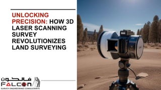
Unlocking Precision: How 3d laser scanning survey Revolutionizes Land Surveying
•Download as PPTX, PDF•
0 likes•2 views

Let's look at how this breakthrough technology is transforming the area of land surveying. Know More: https://www.falconsurveyme.com/our-services/laser-scanning/

Recommended
Recommended
More Related Content
Similar to Unlocking Precision: How 3d laser scanning survey Revolutionizes Land Surveying
Similar to Unlocking Precision: How 3d laser scanning survey Revolutionizes Land Surveying (20)
More from falconsurveyme
More from falconsurveyme (16)
Recently uploaded
Recently uploaded (20)
Unlocking Precision: How 3d laser scanning survey Revolutionizes Land Surveying
- 1. UNLOCKING PRECISION: HOW 3D LASER SCANNING SURVEY REVOLUTIONIZES LAND SURVEYING
- 2. INTRODUCTION In the ever-changing technology landscape, one instrument has emerged as a game changer in the field of land surveying: 3D laser scanning. The days of painstaking data collection and hand measurements are over. 3d laser scanning surveys combine precision and efficiency, revolutionizing how we map and comprehend our environment. Let's look at how this breakthrough technology is transforming the area of land surveying.
- 3. PRECISION REDEFINED Traditional land surveying methods frequently use manual measurements and theodolites, which are time-consuming and prone to human error. Enter 3D laser scanning, a non-invasive method that records millions of data points in seconds with unrivalled precision. By firing laser beams and measuring the time it takes for them to return, 3D laser scanners generate detailed point clouds that provide a full depiction of the examined region.
- 4. EFFICIENCY AMPLIFIED Imagine examining enormous landscapes or complicated buildings with speed and precision. That is exactly what 3d laser scanning surveys give. Surveyors may accomplish tasks in a quarter of the time that traditional methods need due to their ability to record precise information quickly. From building sites to archeological excavations, 3d laser scanning surveys improve processes and drastically decrease project durations.
- 5. ENHANCED VISUALIZATION One of the most impressive aspects of 3d laser scanning surveys is its ability to create extremely detailed, three-dimensional models. These models provide a full picture of the surveyed region, allowing surveyors to analyze and interpret data in unprecedented detail. 3D laser scanning, whether used to examine land topography, discover structural defects, or monitor environmental changes, gives previously inconceivable insights.
- 6. SAFETY FIRST In addition to accuracy and efficiency, 3d laser scanning surveys stresses safety in land surveying. By removing the need for manual measures in dangerous or difficult-to- reach areas, such as steep slopes or unstable terrain, it decreases the risk of accidents and assures surveyors' safety. Surveyors may collect data from a safe distance using remote scanning capabilities, which improves on-site safety standards.
- 7. FUTURE PERSPECTIVES As technology advances, the future of land surveying appears more promising than ever, with 3d laser scanning surveys at the forefront. From automated data processing techniques to integration with drones and artificial intelligence, the possibilities are limitless. Each breakthrough improves the efficiency, precision, and breadth of 3D laser scanning, creating new opportunities for exploration and discovery.
- 8. CONCLUSION To summarize, 3d laser scanning surveys are more than simply a technology; it represents a revolution in land surveying. Its accuracy, efficiency, improved vision, and safety features have altered the way we view and interact with our surroundings. As we look to the future, the influence of 3d laser scanning surveys will only increase, altering the landscape of land surveying for years.
- 9. CONTACT US Address: 209, 2nd Floor - Apricot Tower, P.O. Box : 238544, Dubai Silicon Oasis, Dubai - United Arab Emirates. : +97143271414 : info@falconsurveyme.com : http://www.falconsurveyme.com/
- 10. Thank You