Download as PDF, PPTX


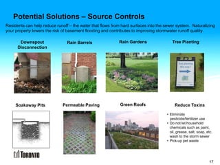


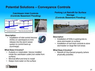


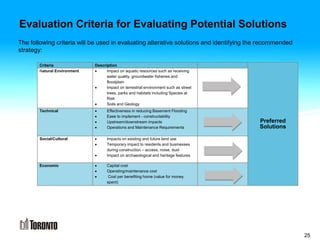


This document provides information about a public information center regarding an investigation into basement flooding and stormwater runoff quality control in Study Area 38. The meeting introduces the project background, study area, potential causes of flooding, possible solutions that will be evaluated, and next steps. Attendees can view displays, ask questions, and provide comment sheets. Potential solutions that will be evaluated include source controls on private property, conveyance controls like road retrofits and local bioretention, and end-of-pipe controls such as wetlands, dry ponds, and underground storage tanks. Criteria for evaluating solutions include environmental, technical, social, and economic factors. The project team will consider public comments received by June 1st and


