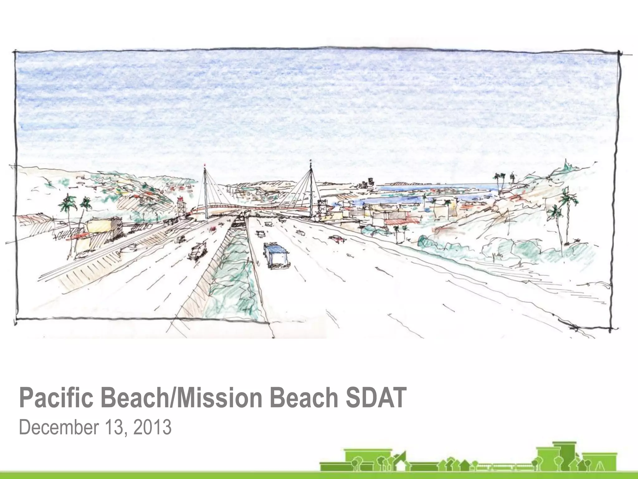
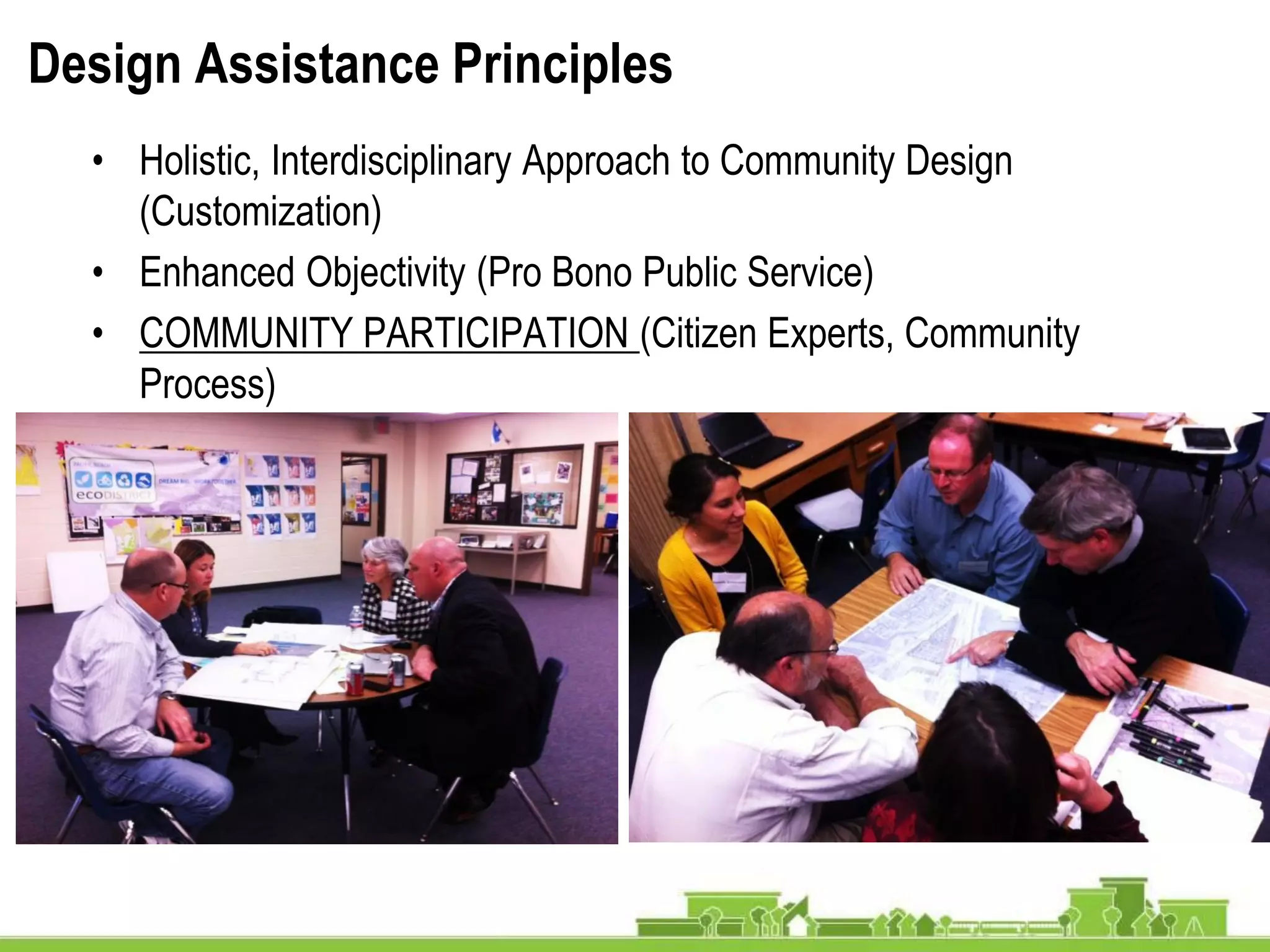
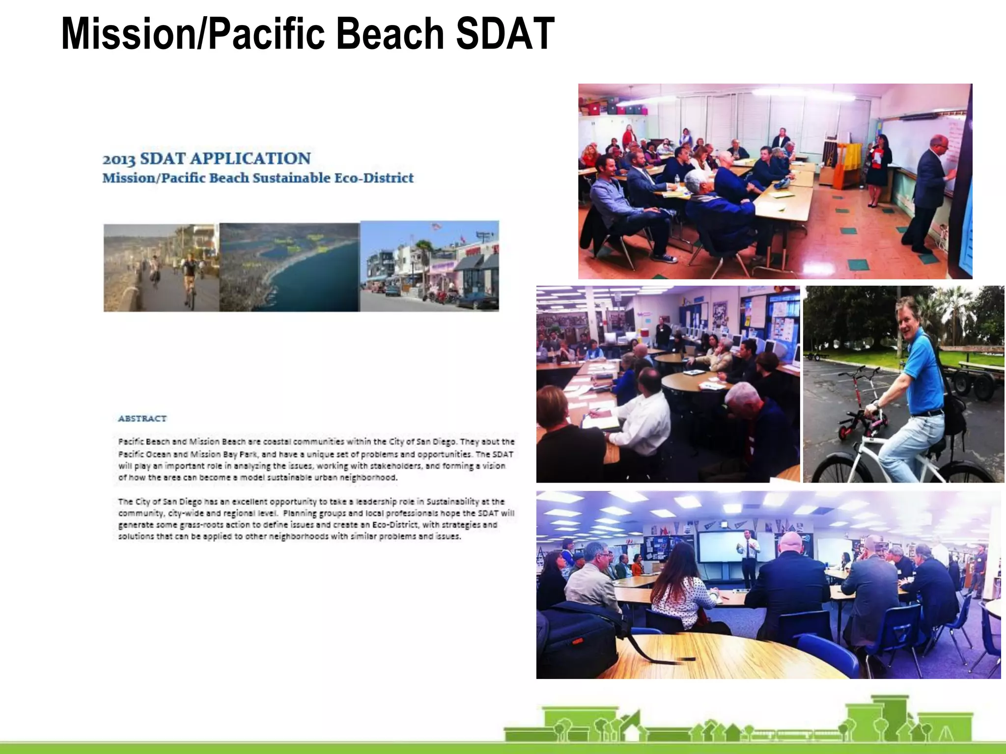
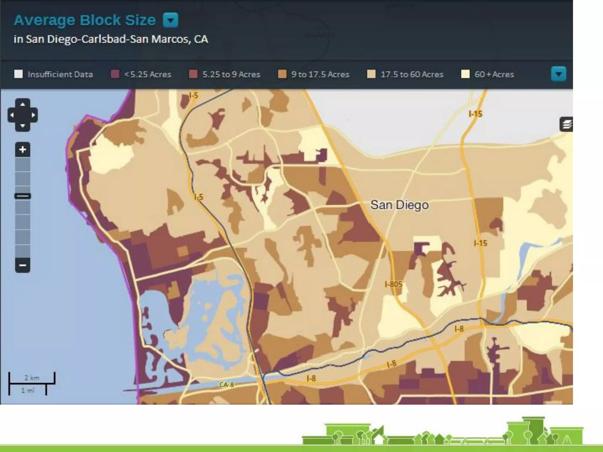
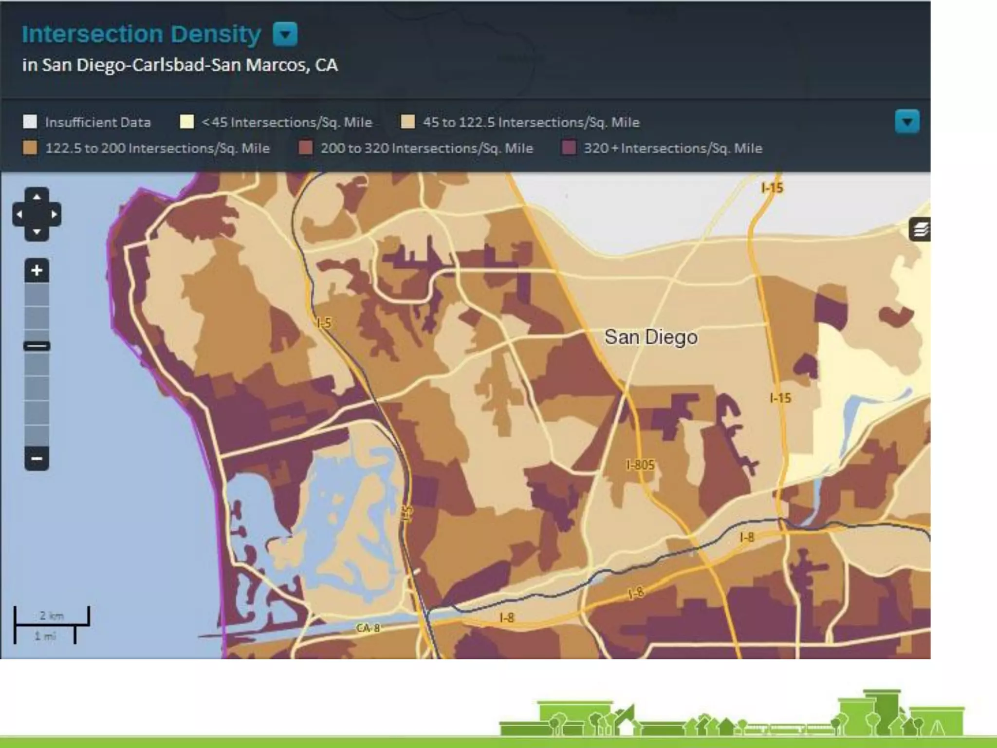
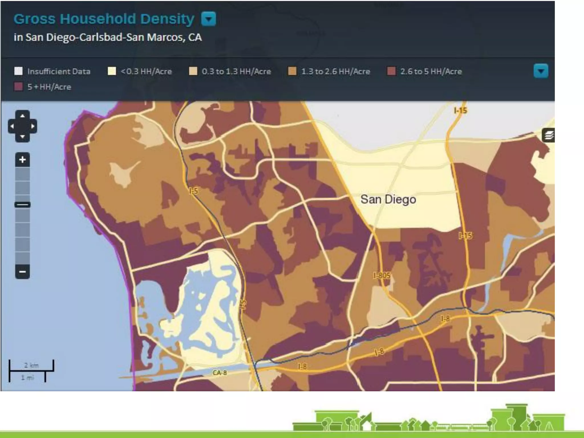
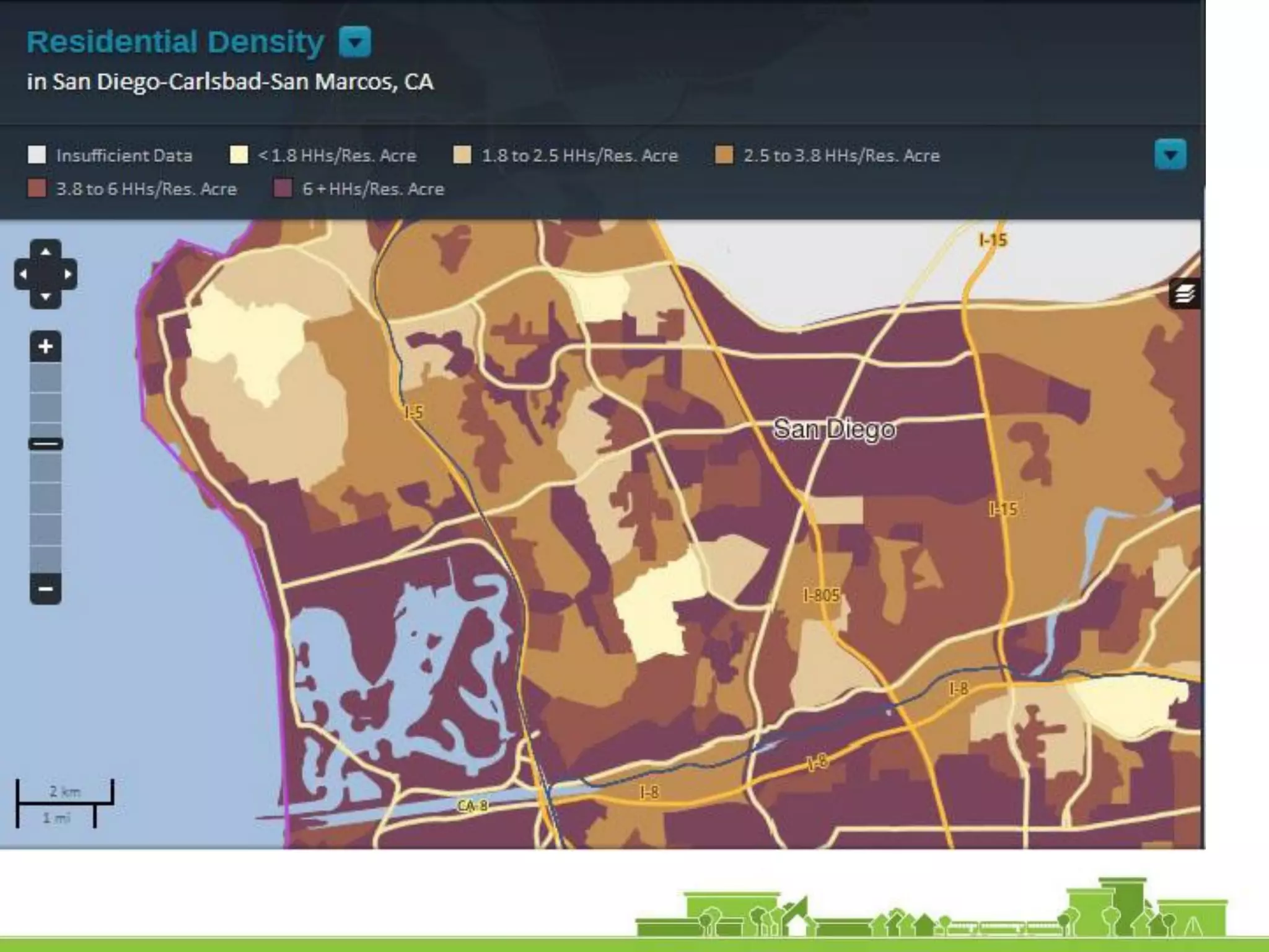
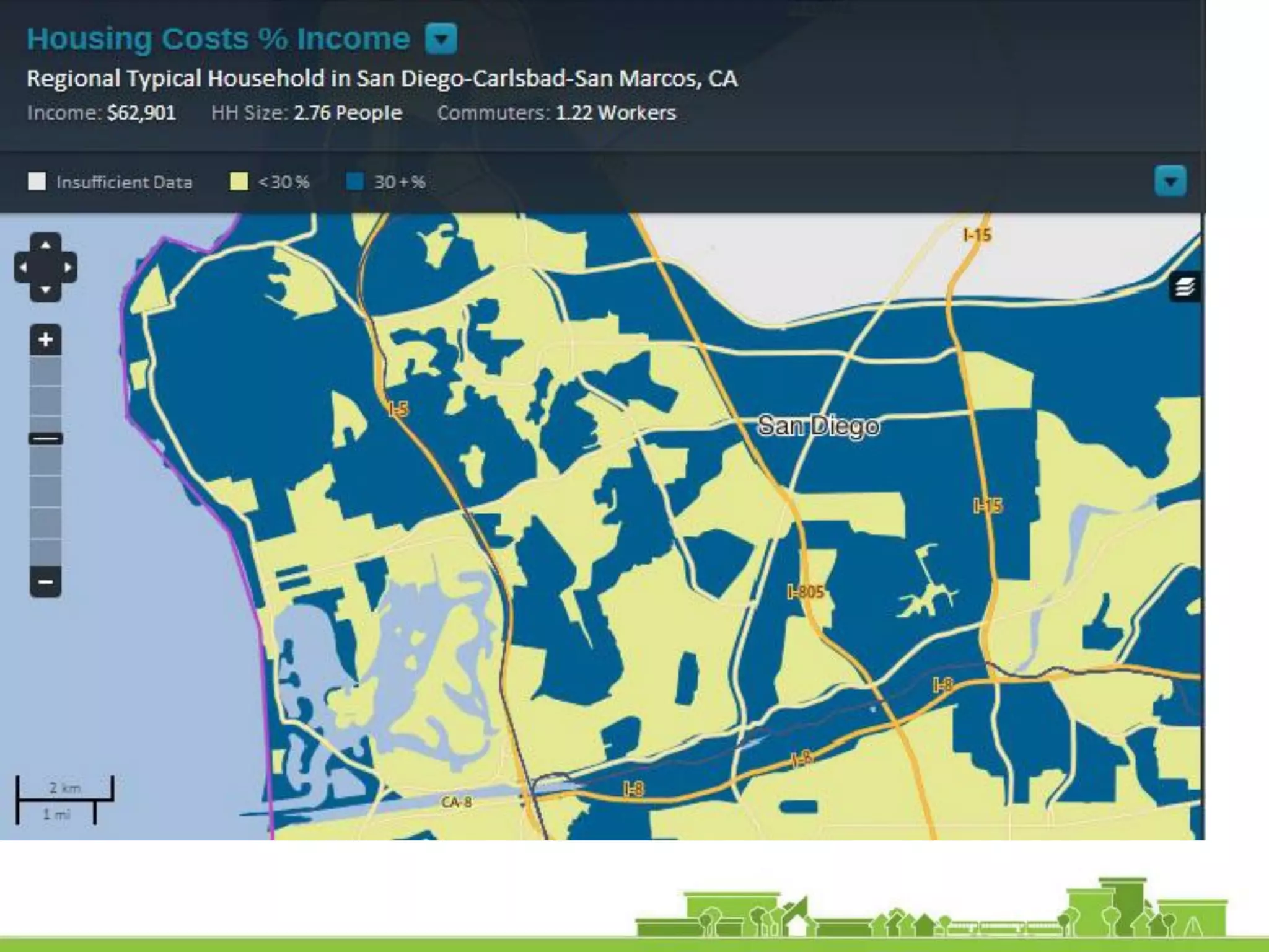
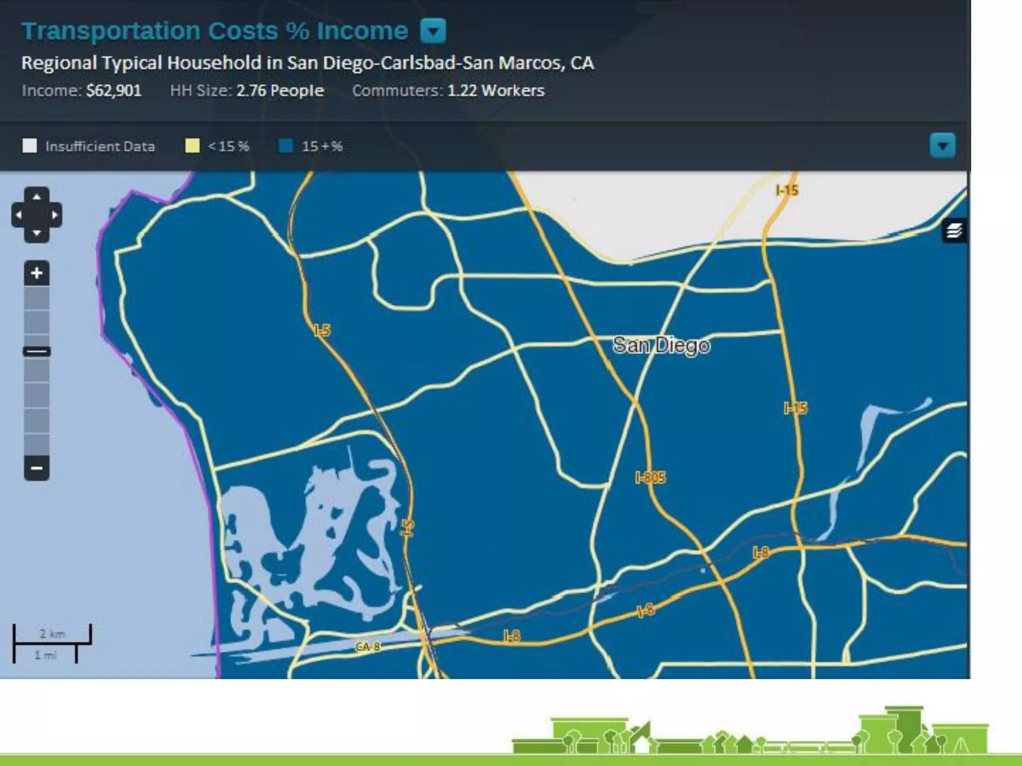
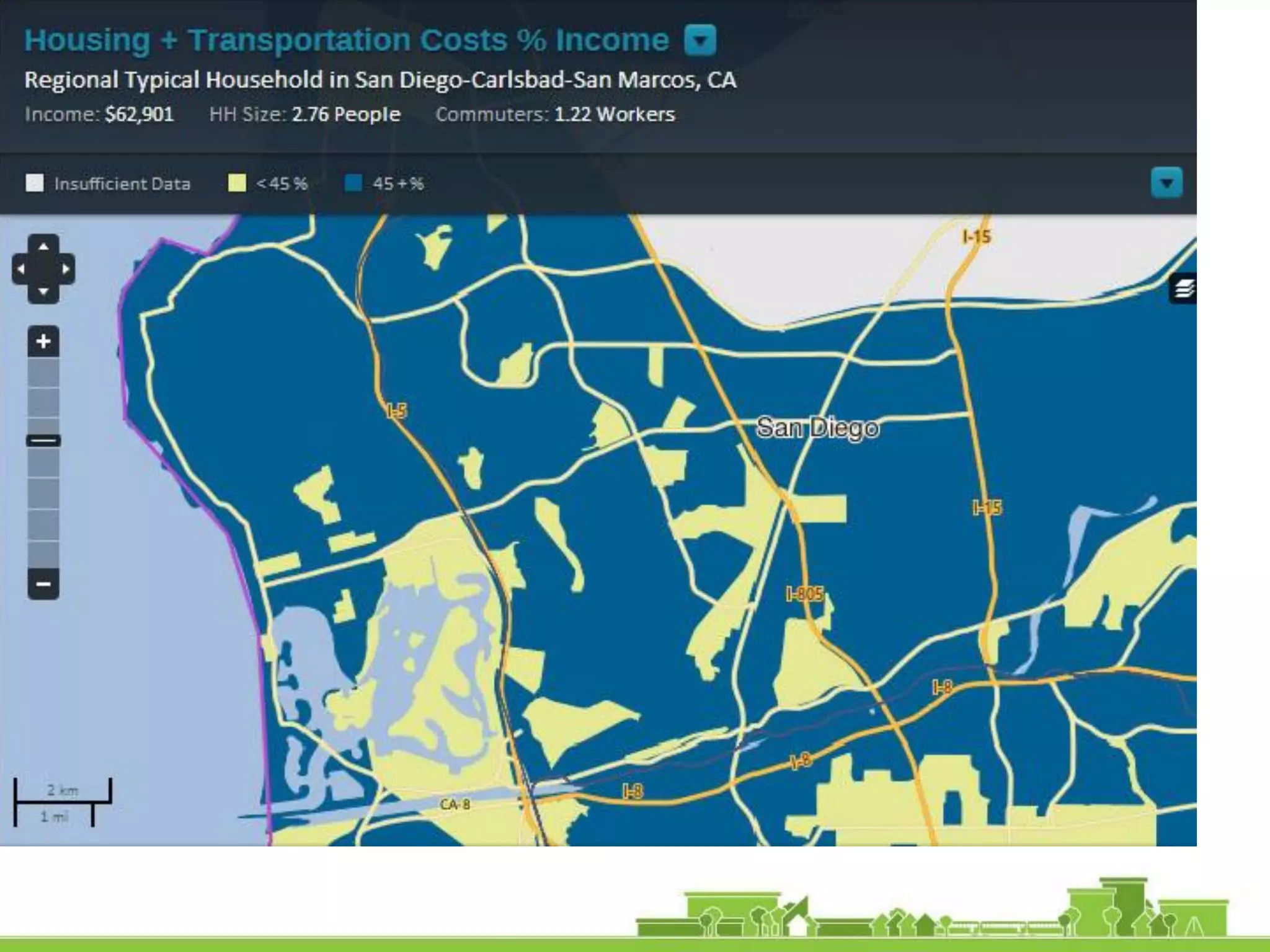
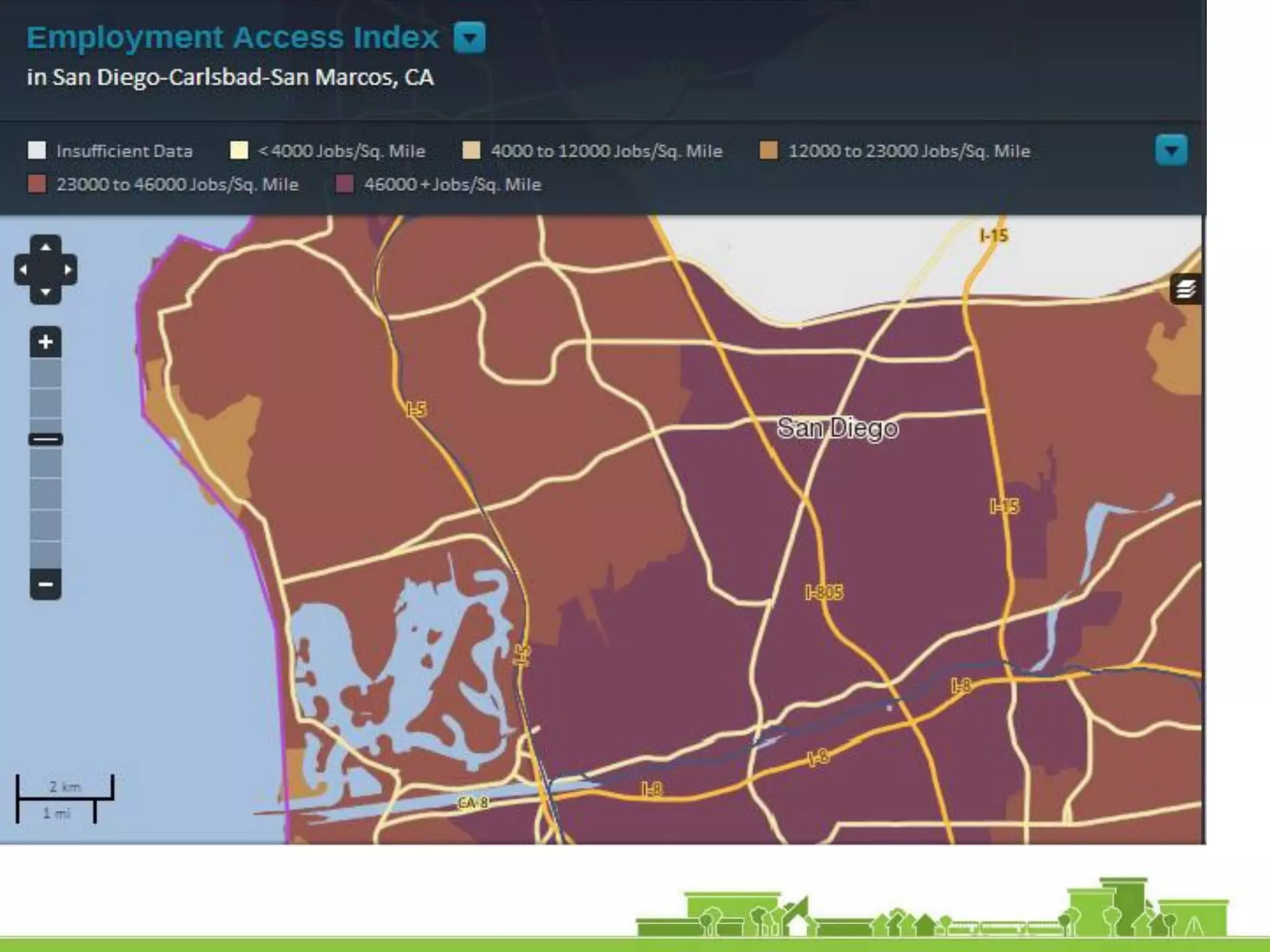
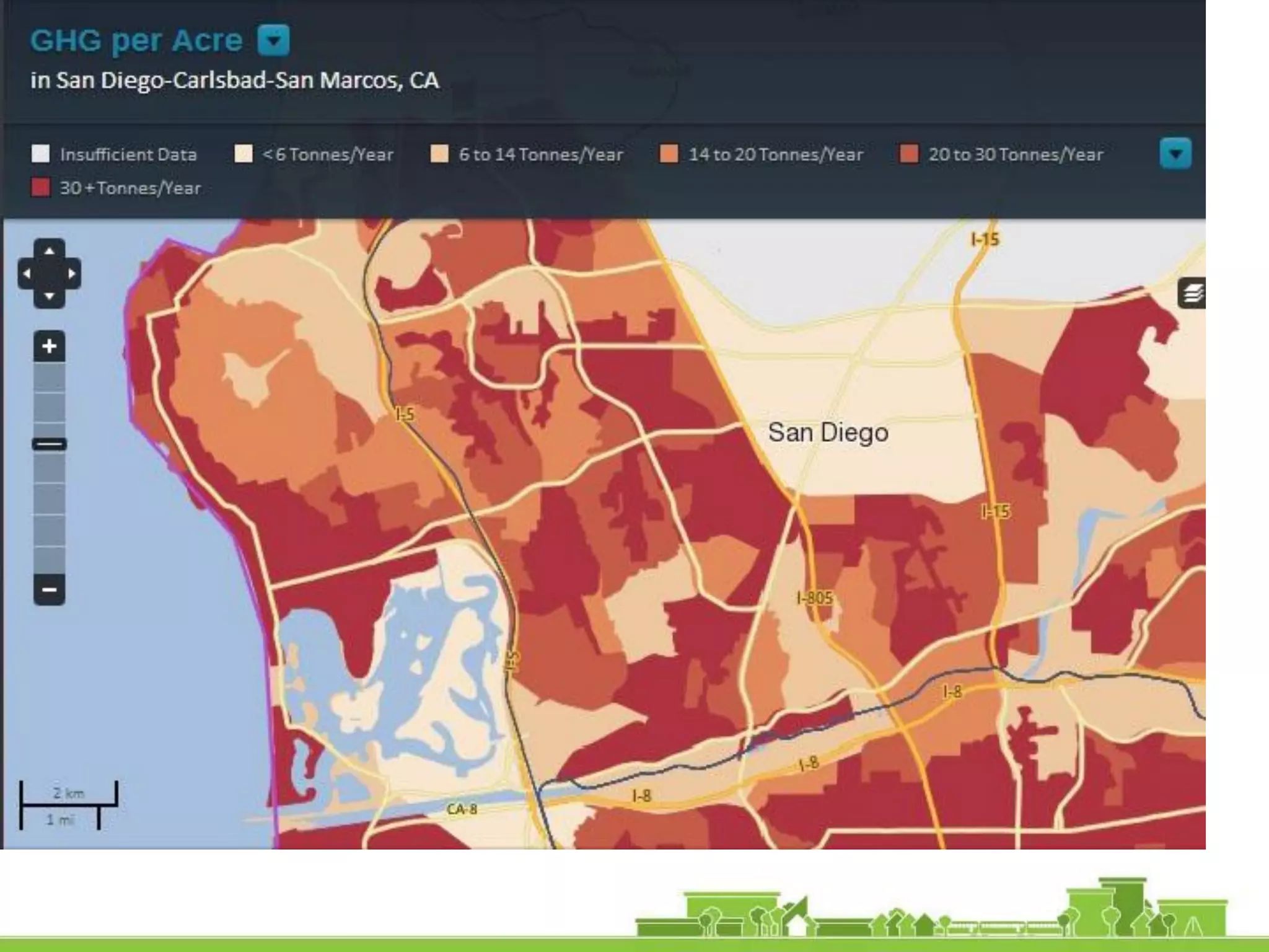
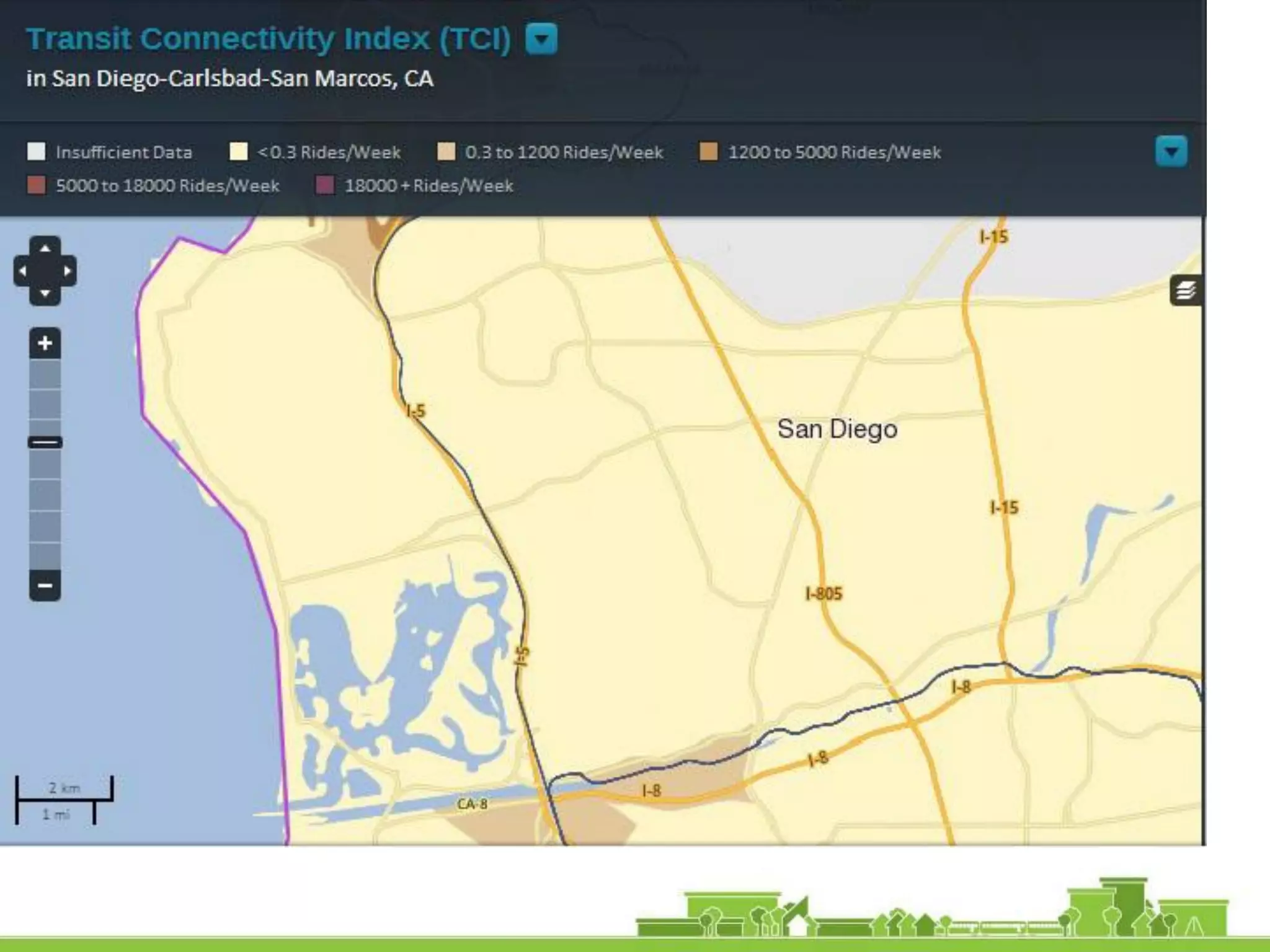
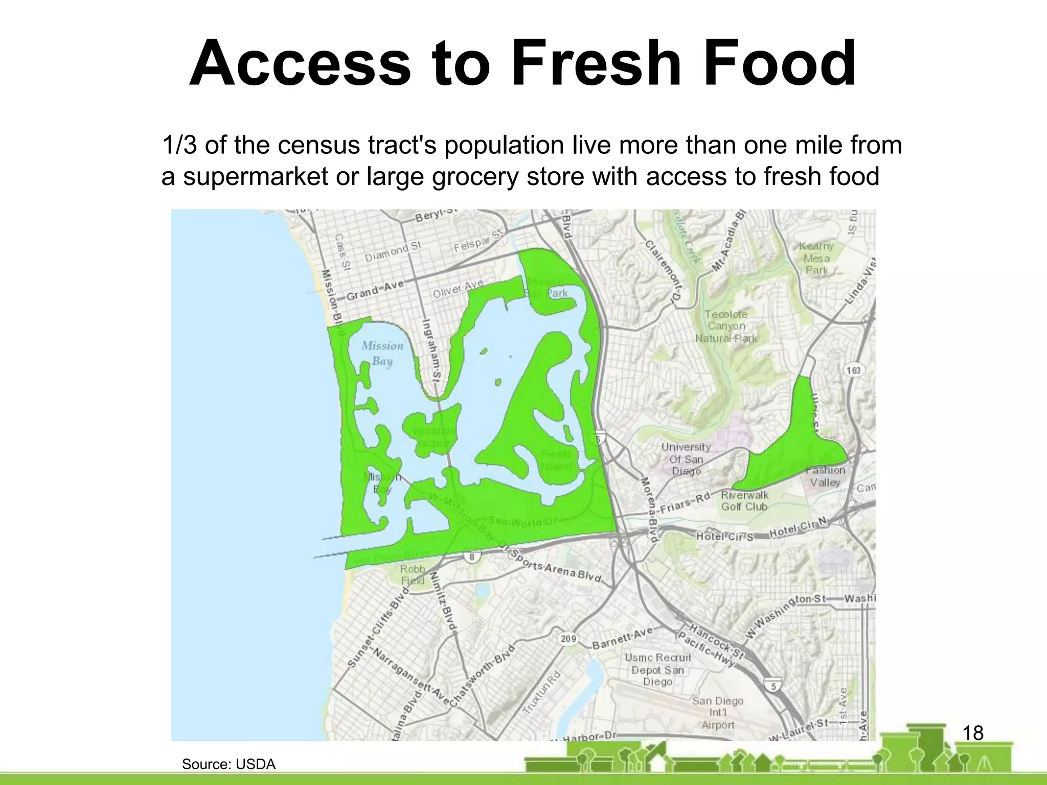
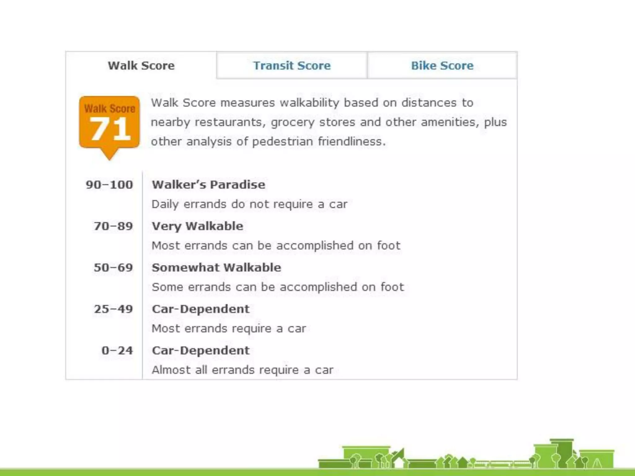
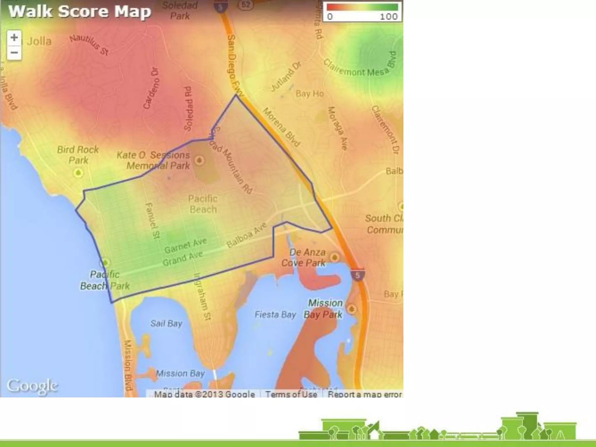
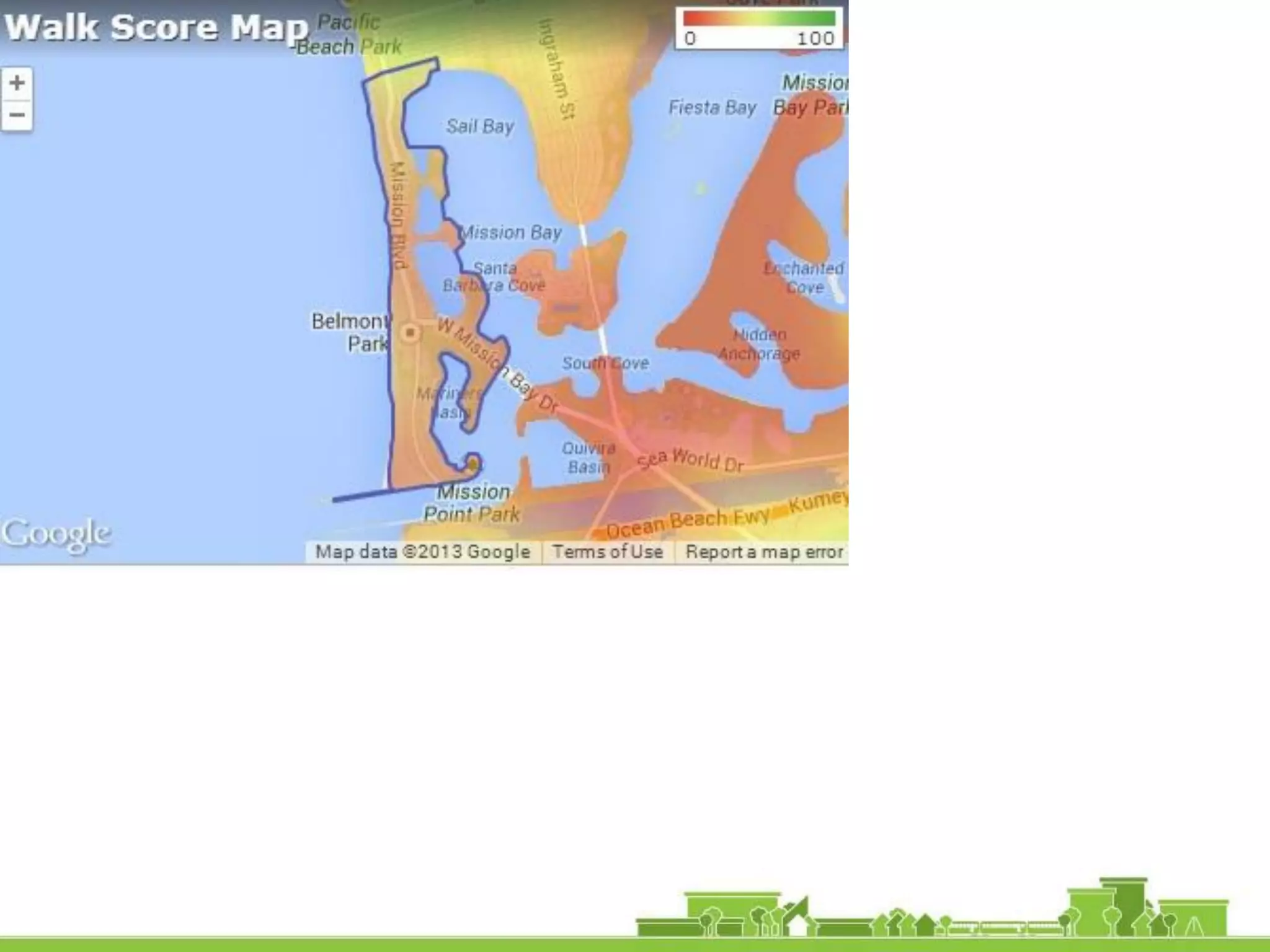
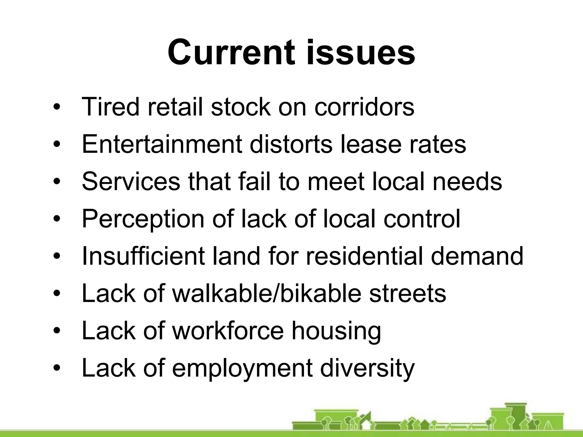
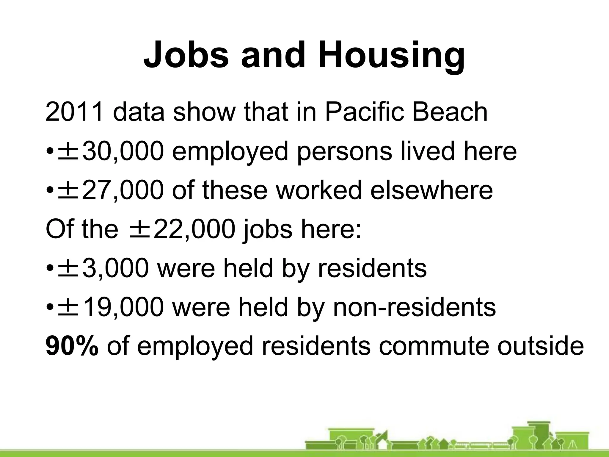
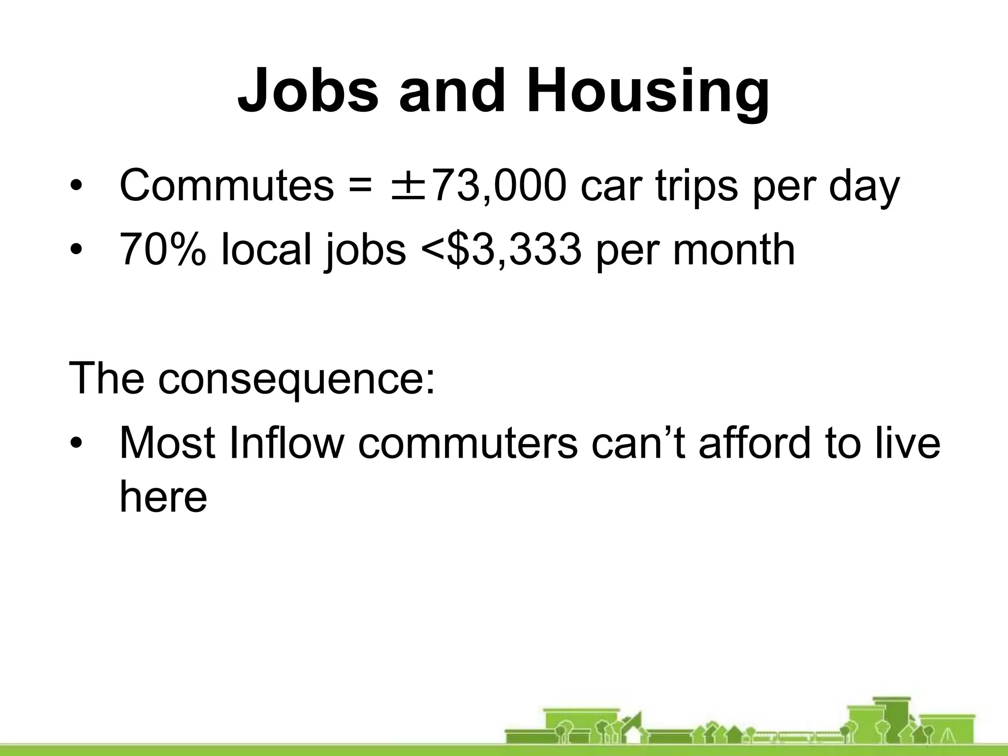
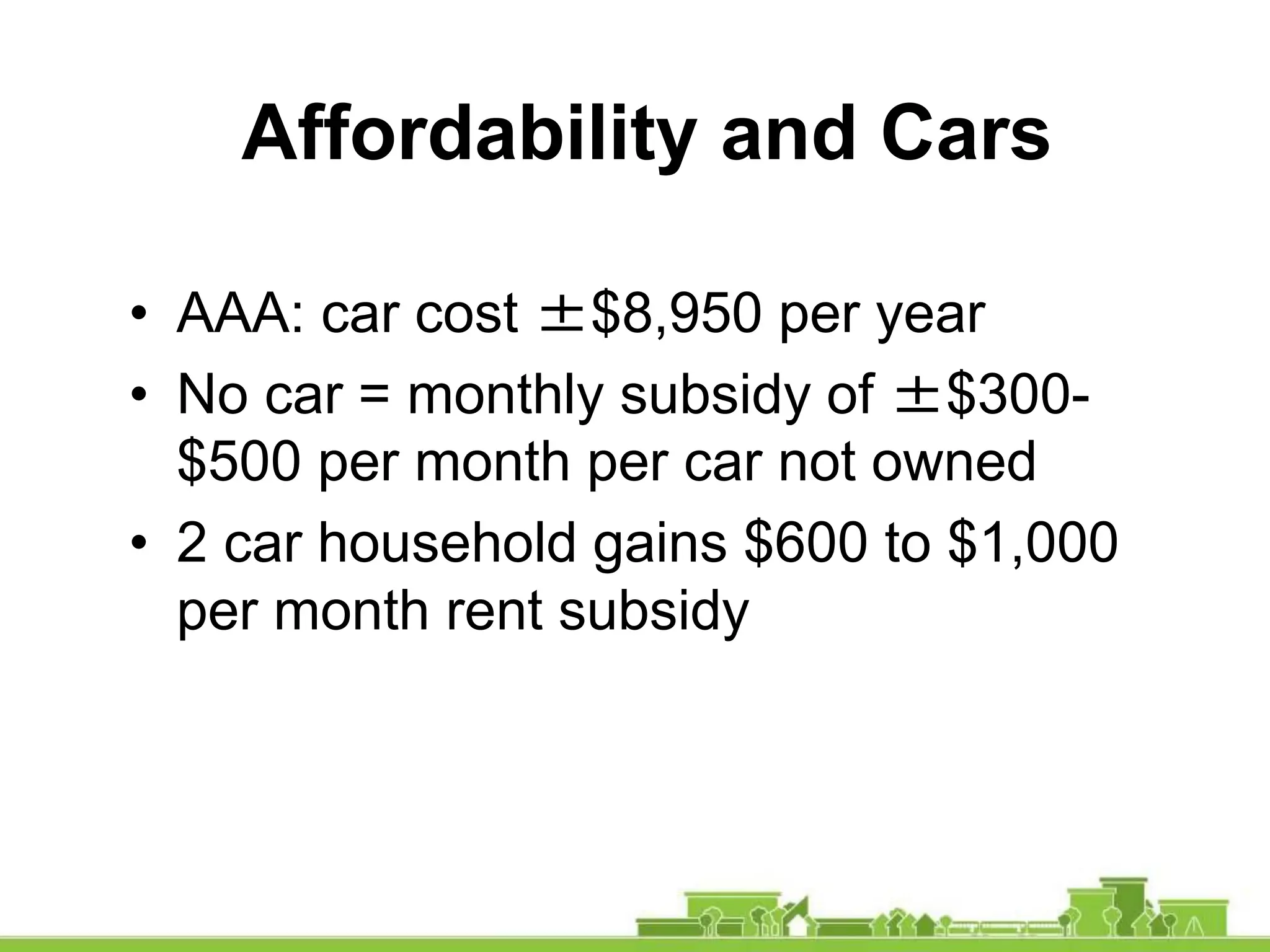
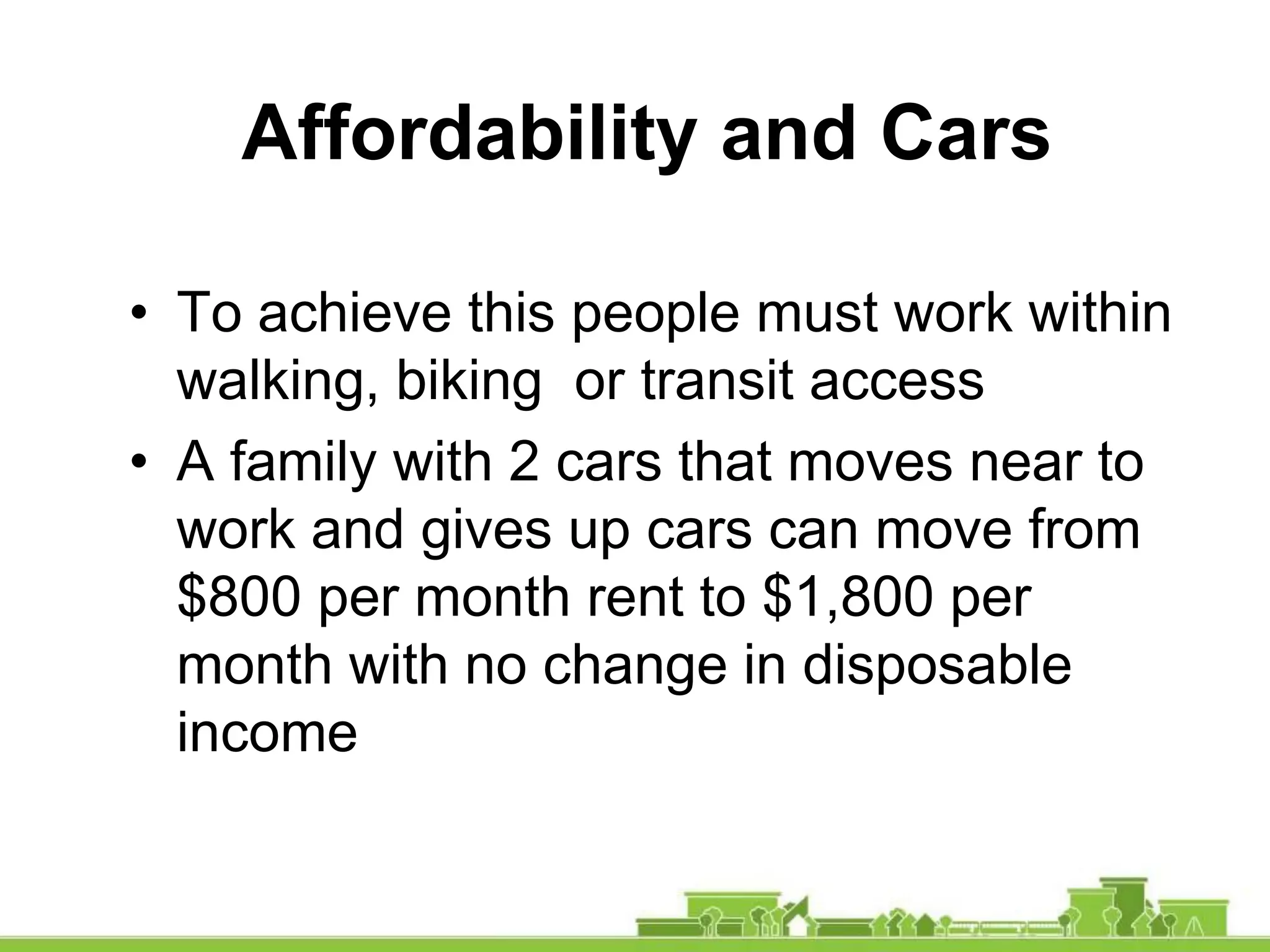
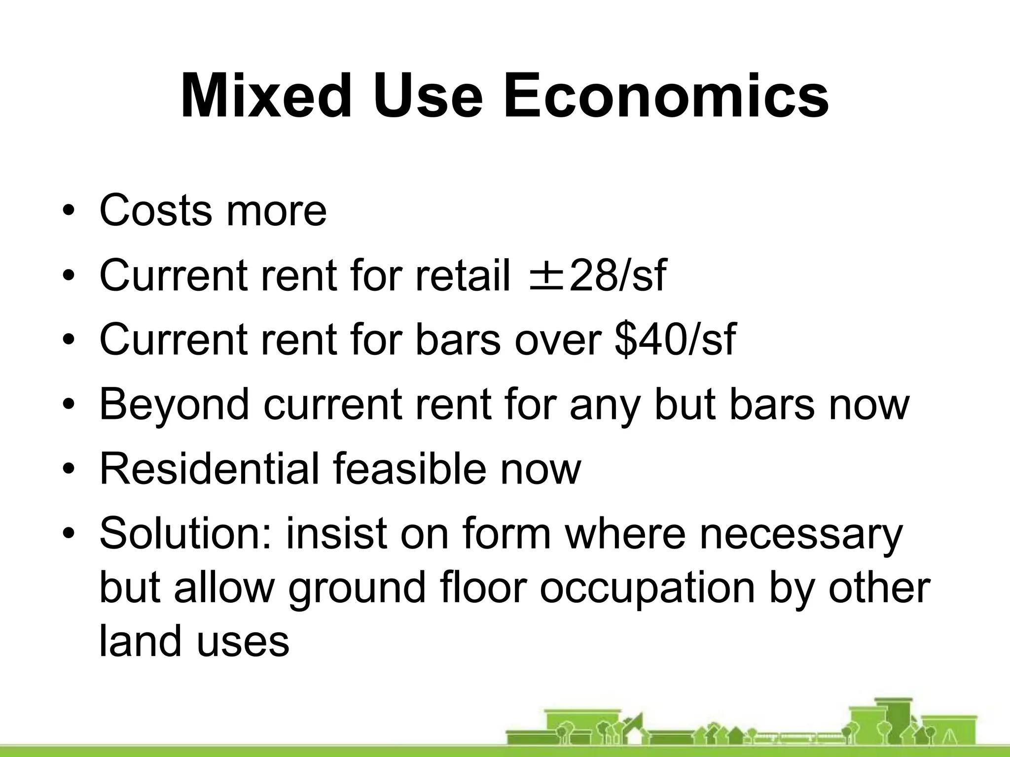
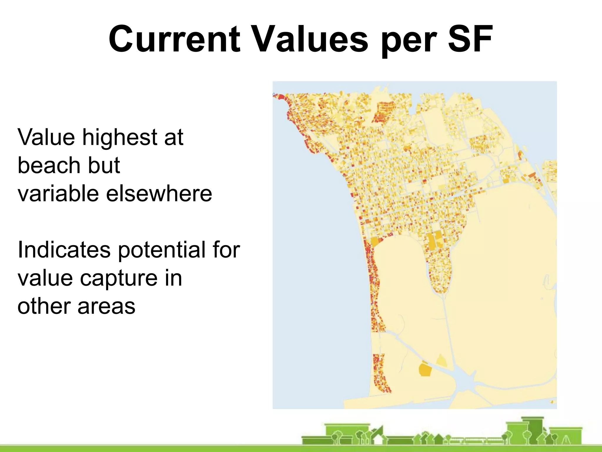
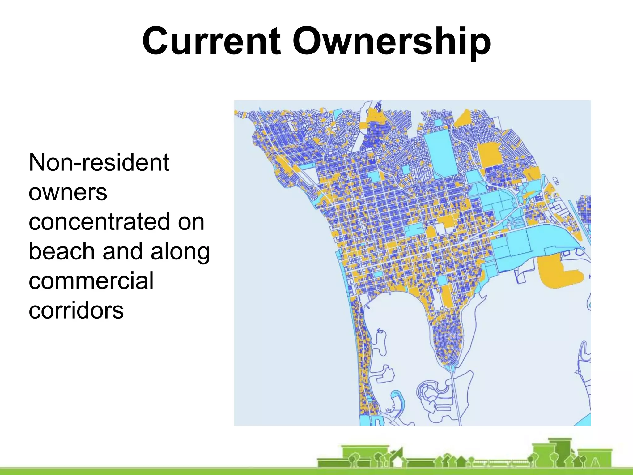
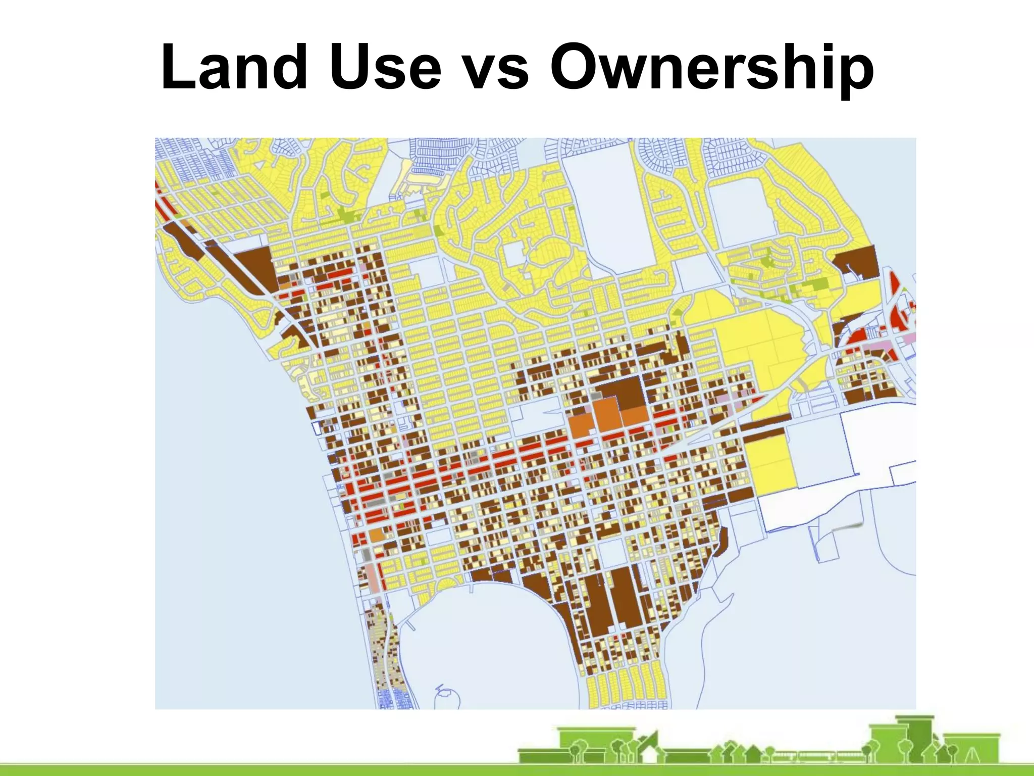
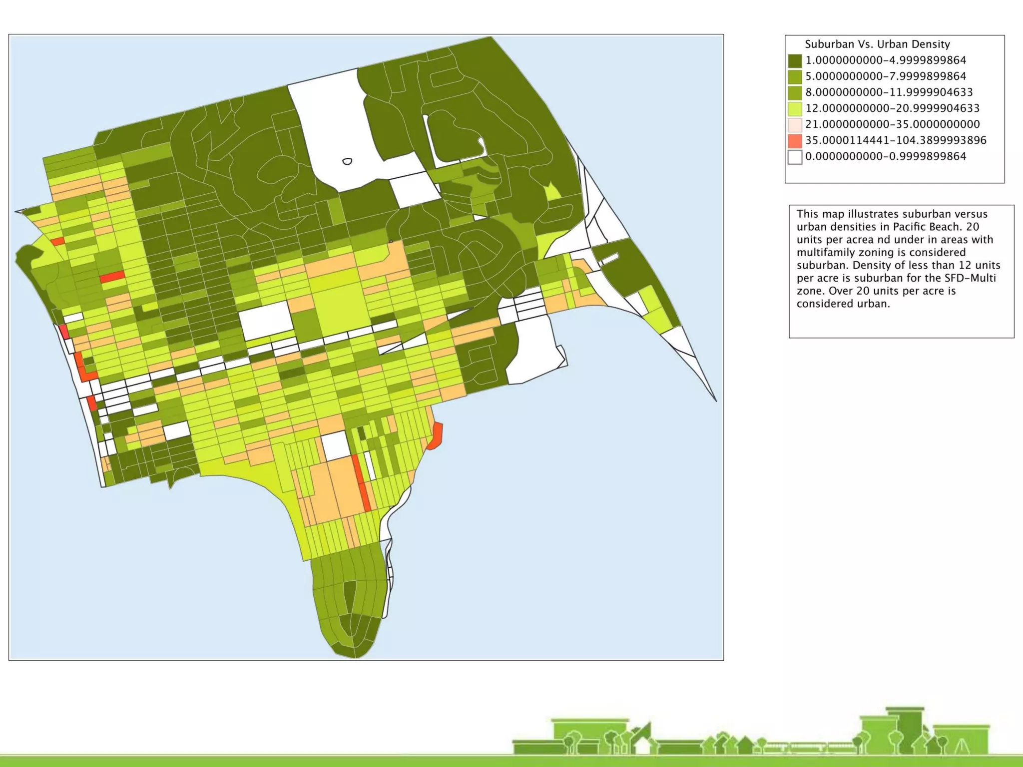
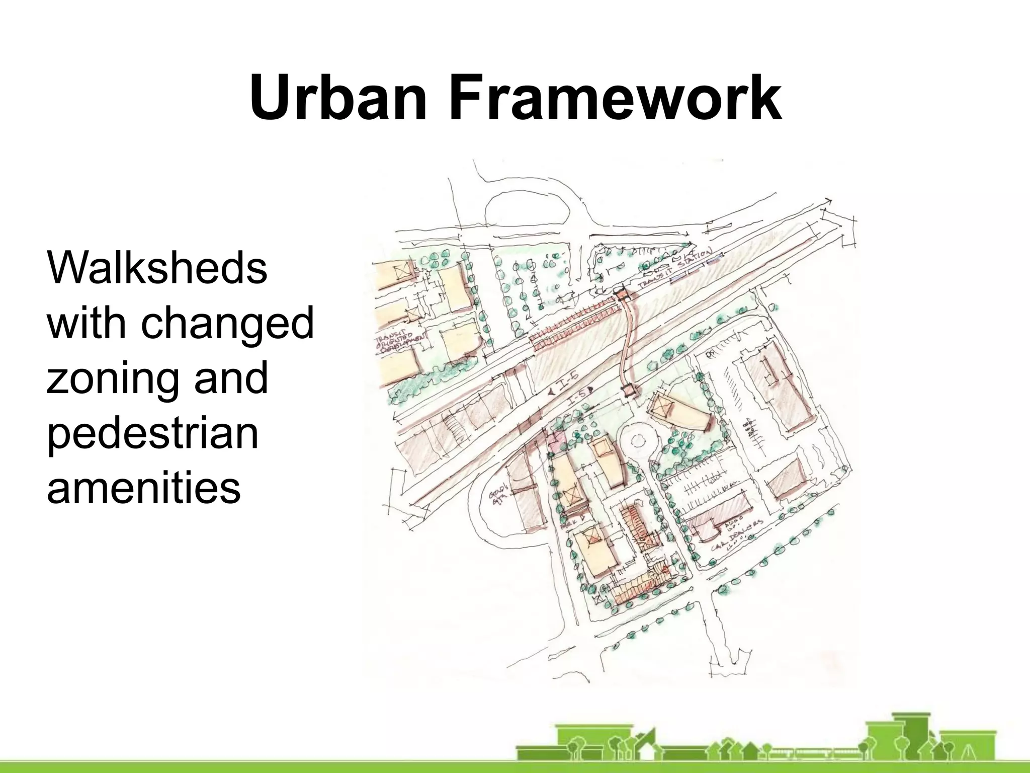
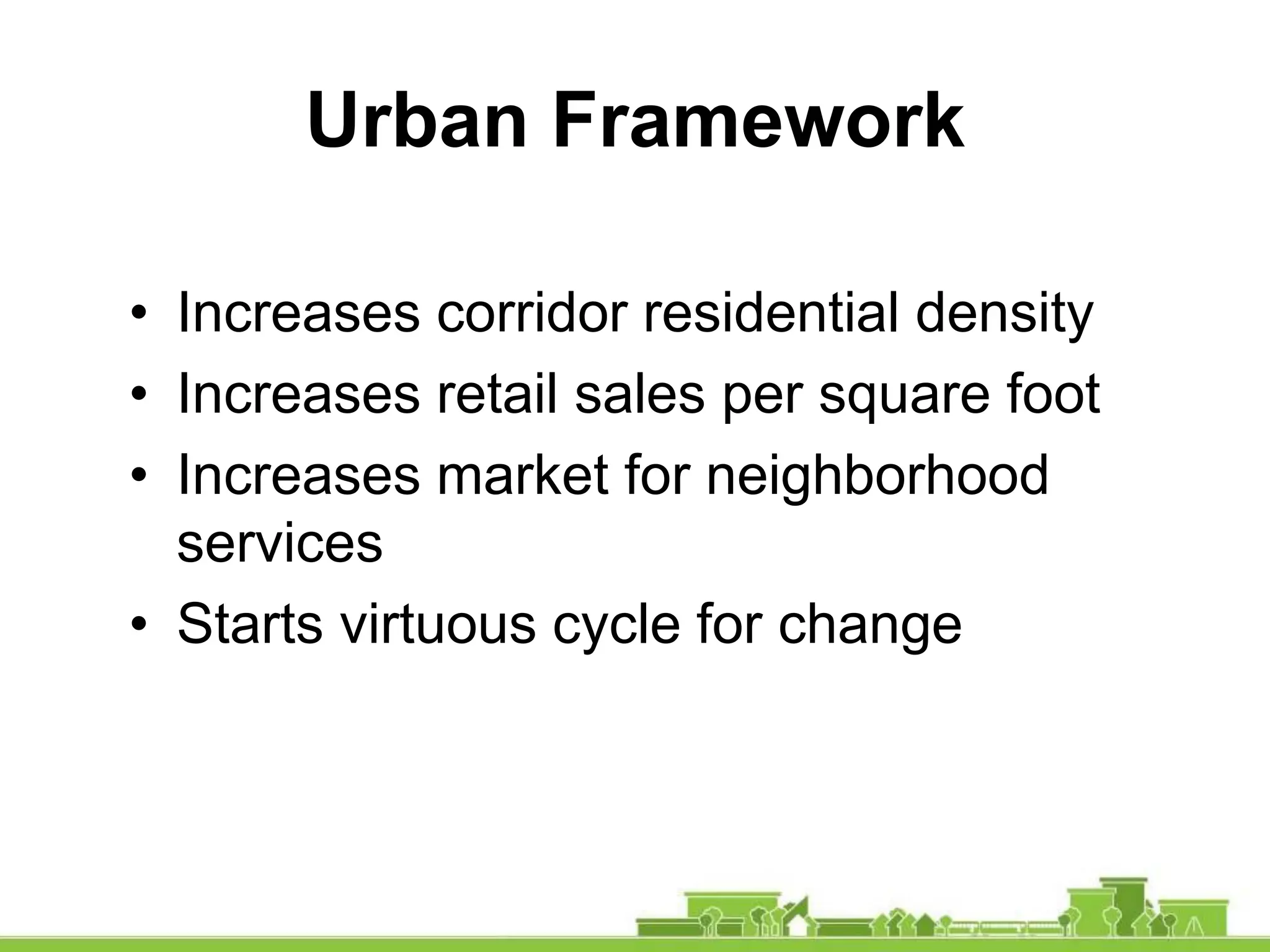
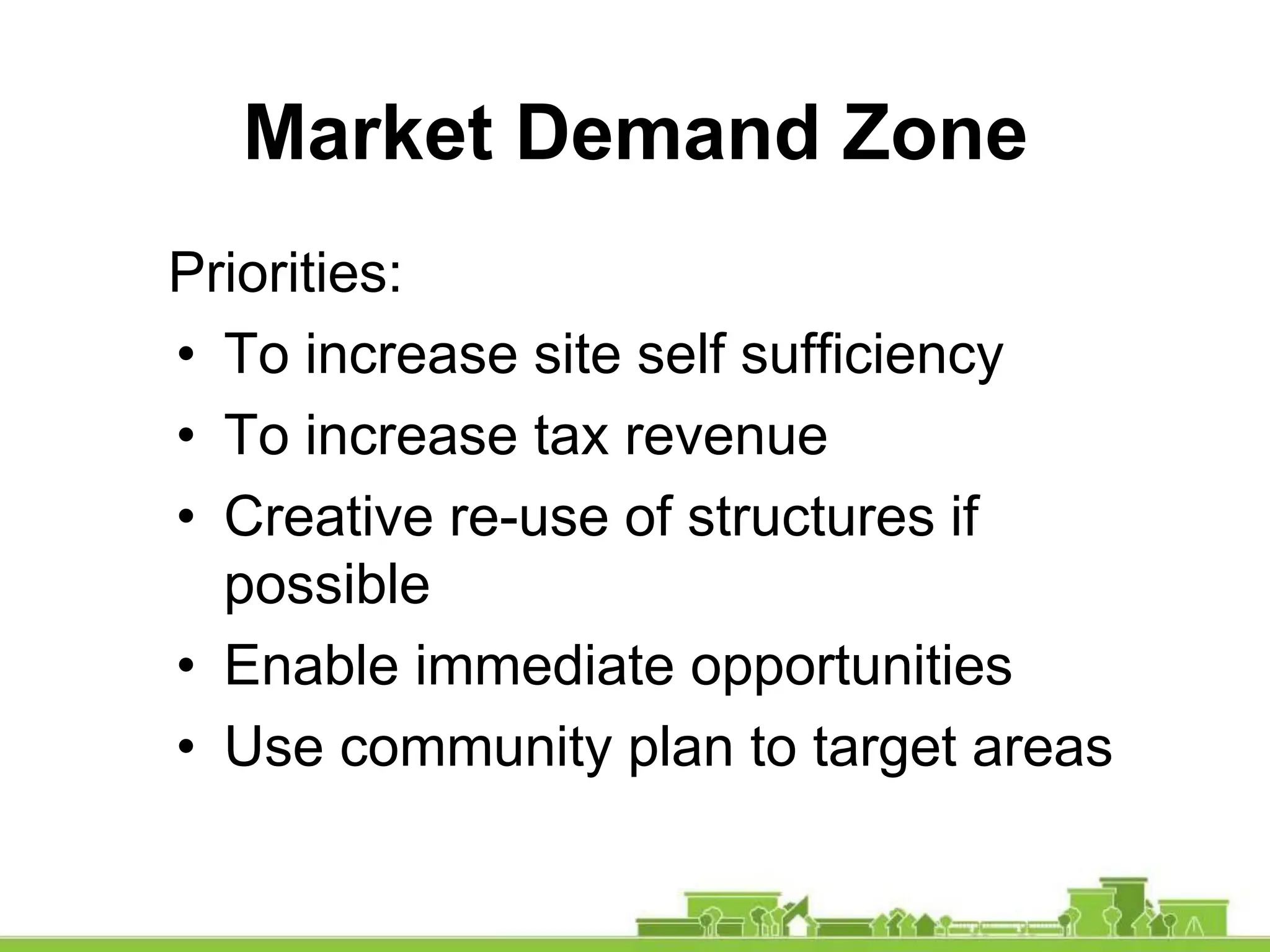
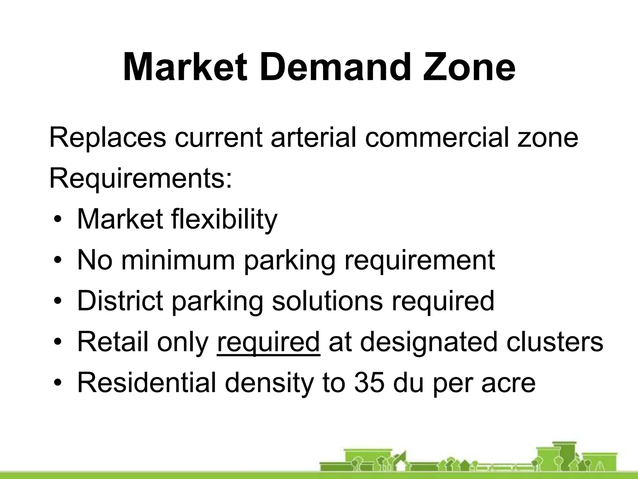
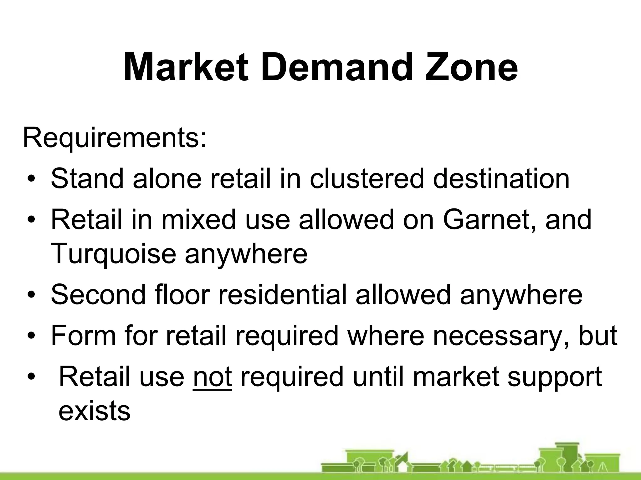
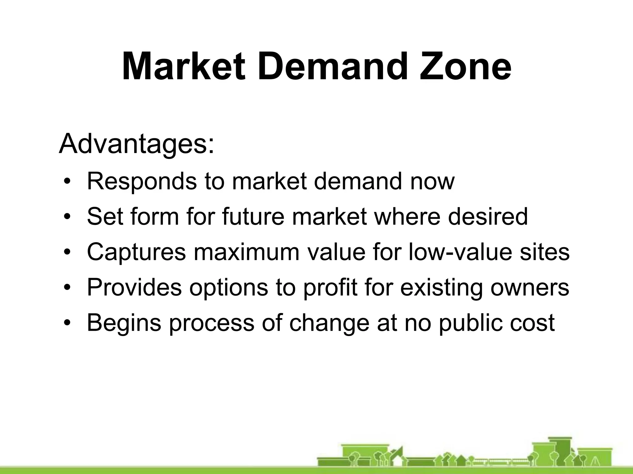
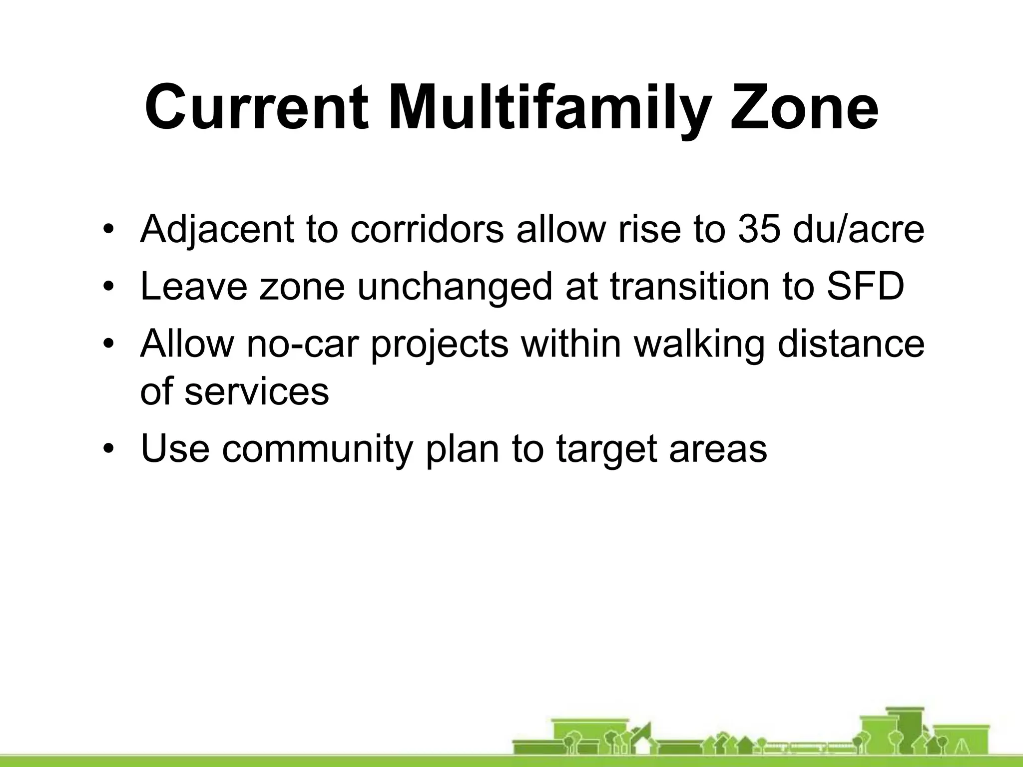
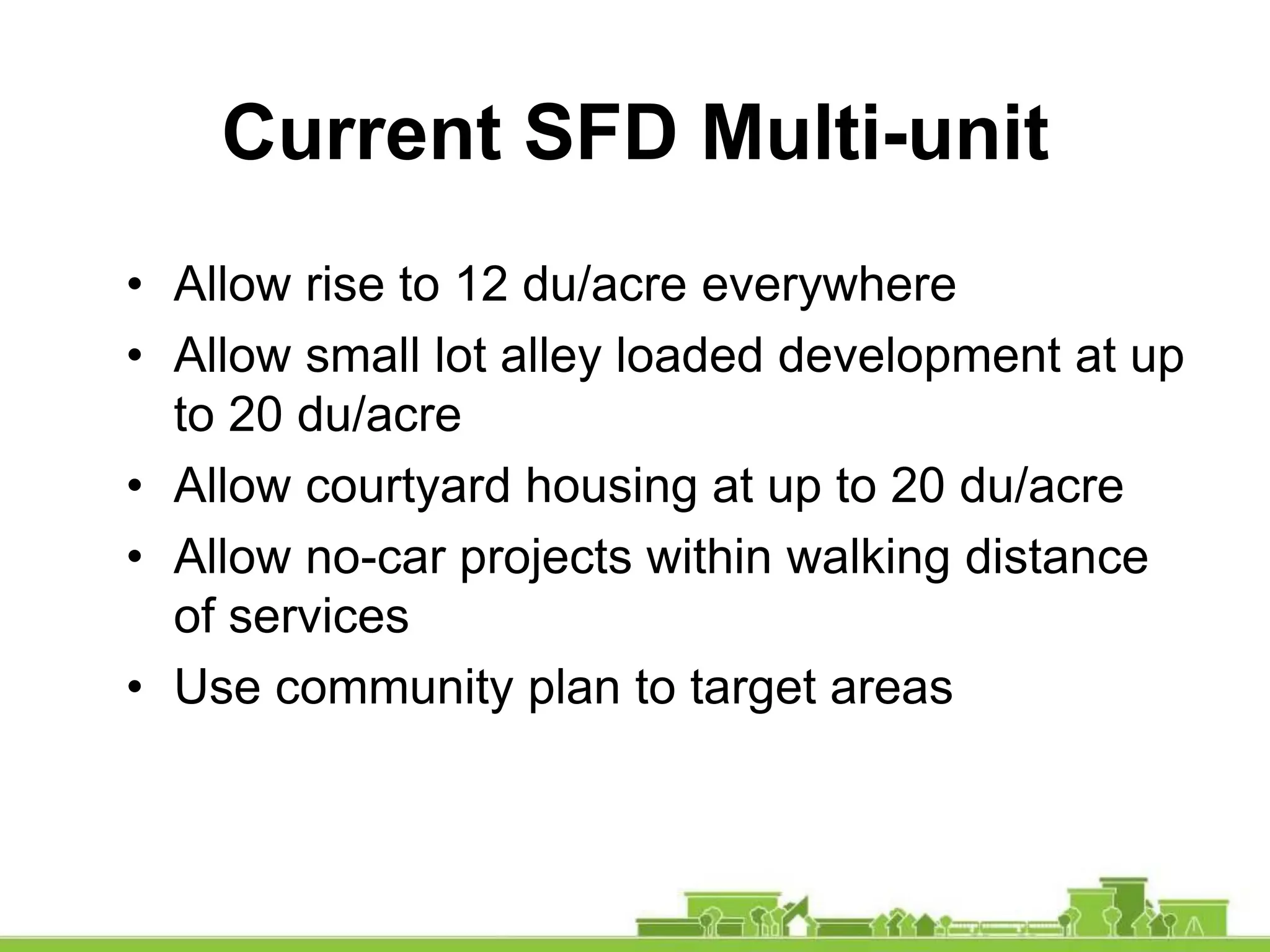
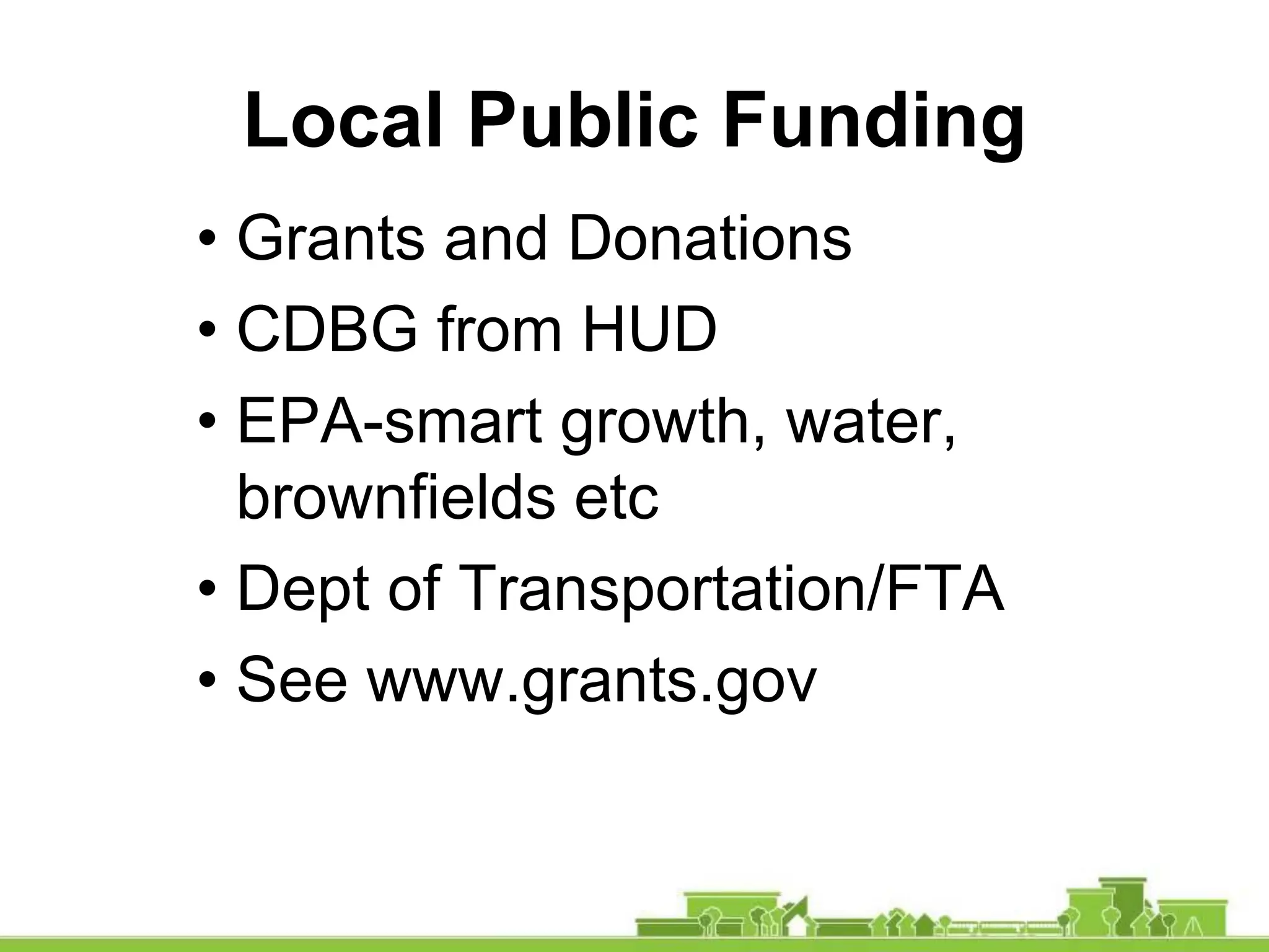
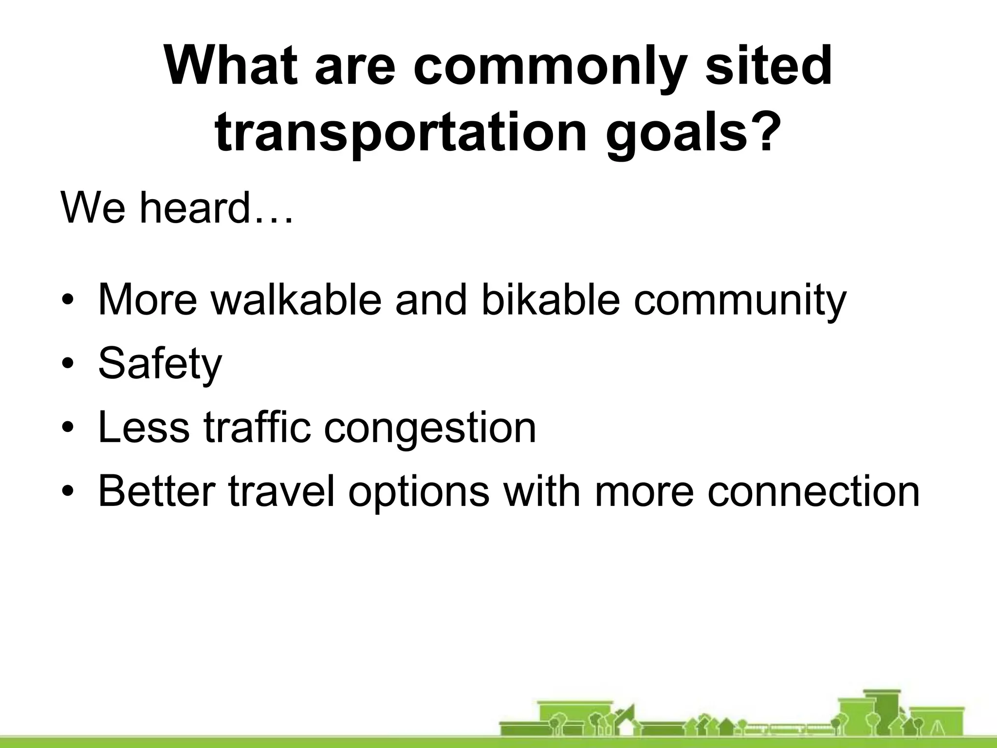
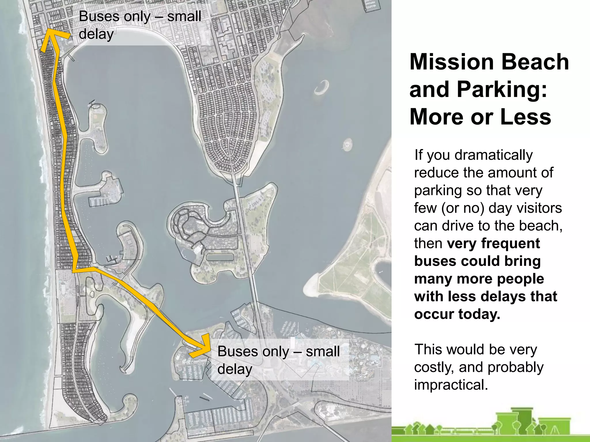
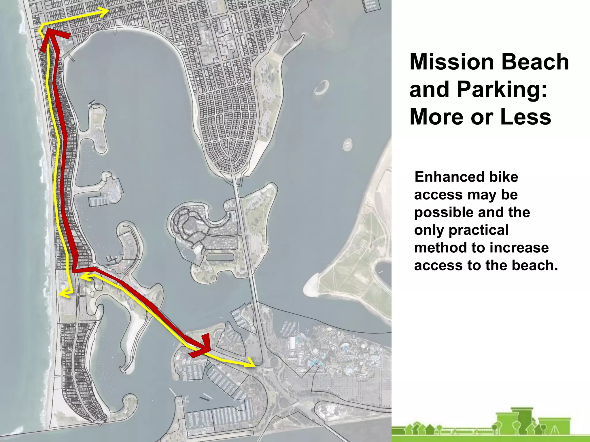
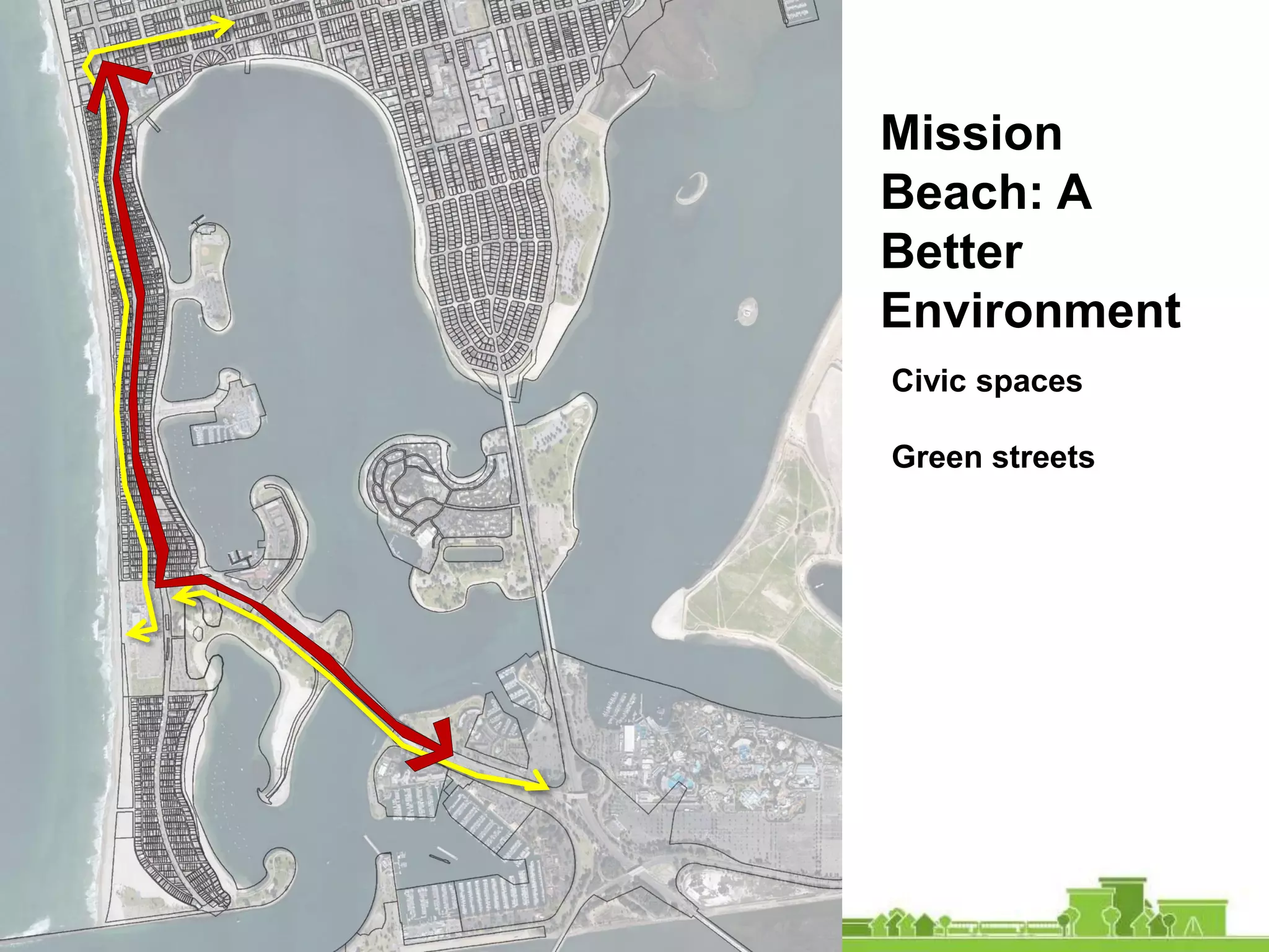
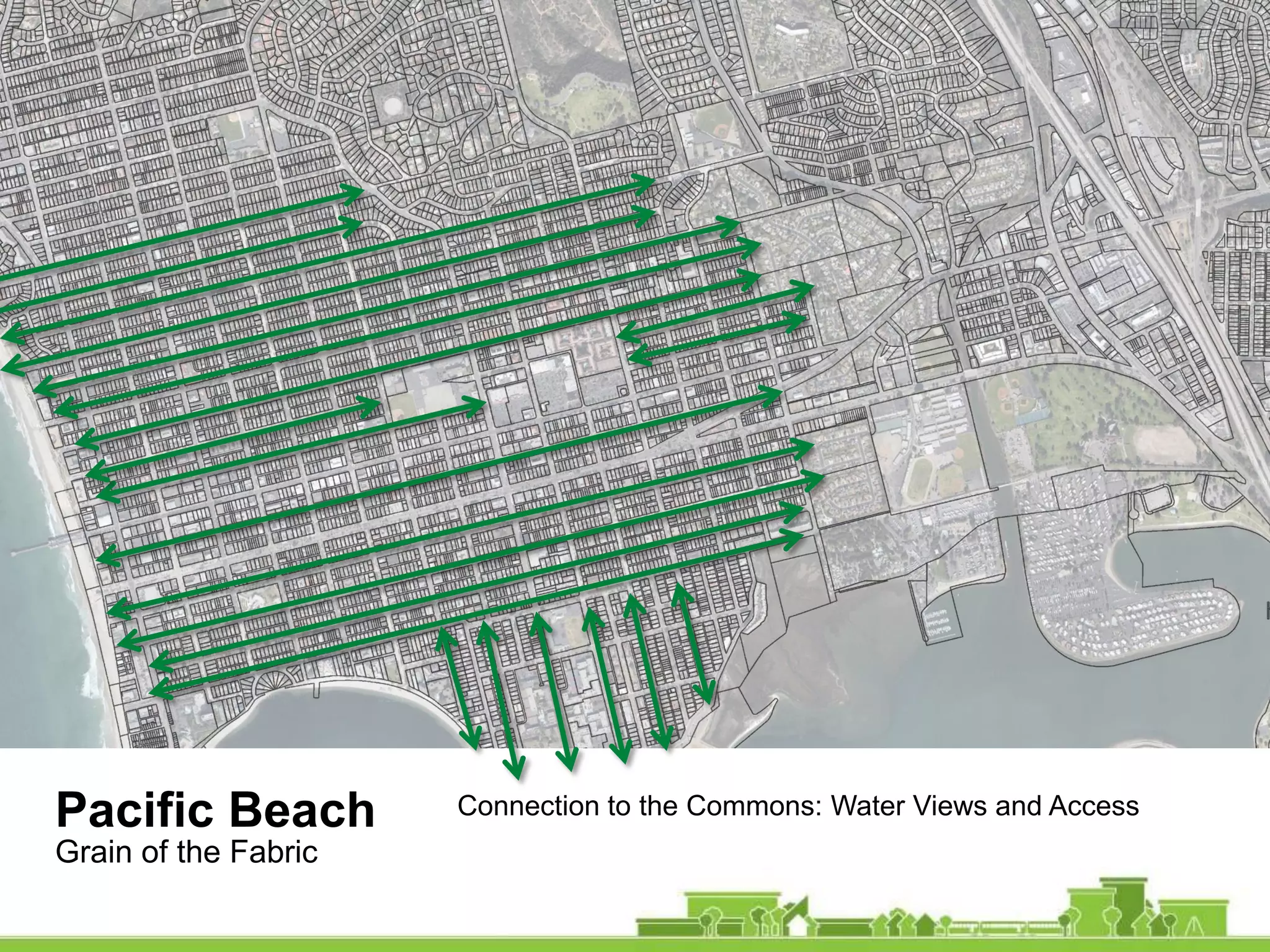
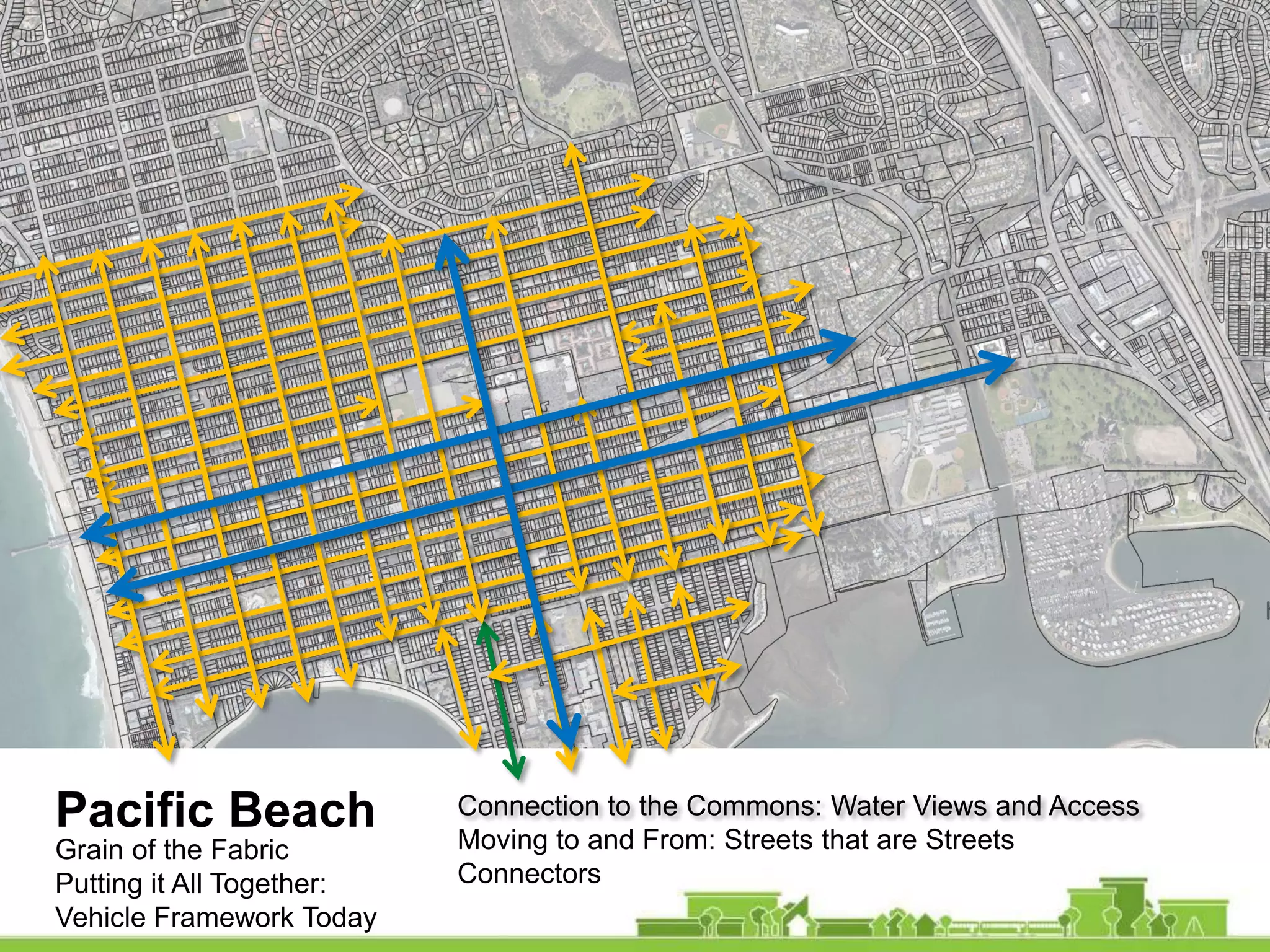
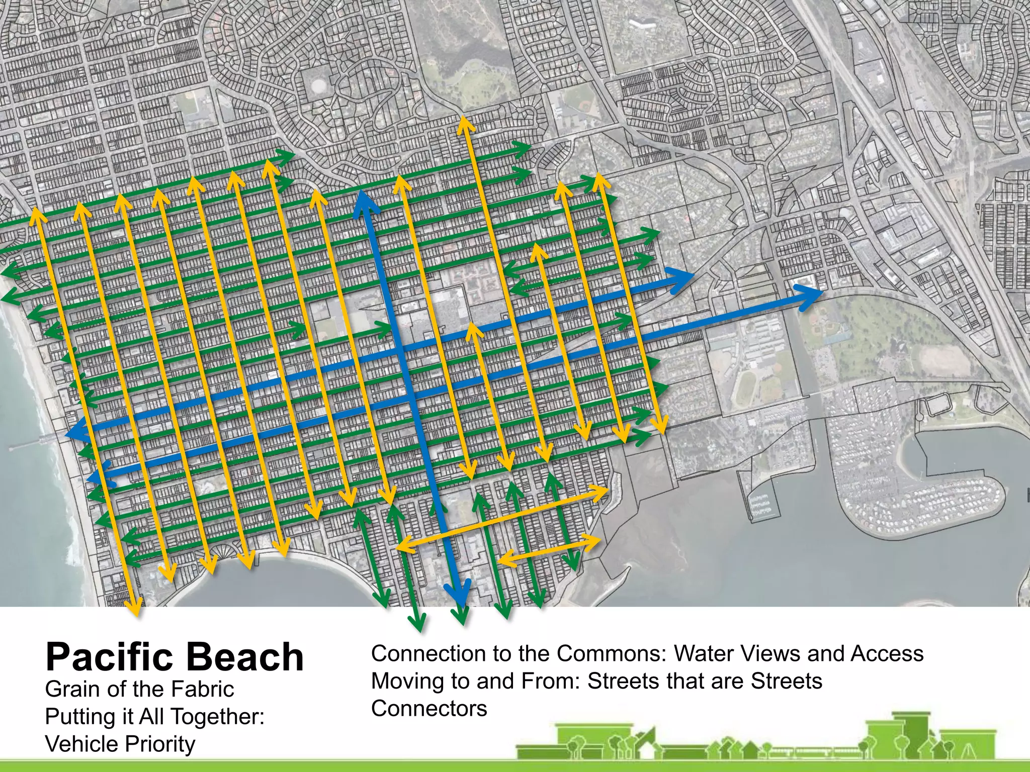
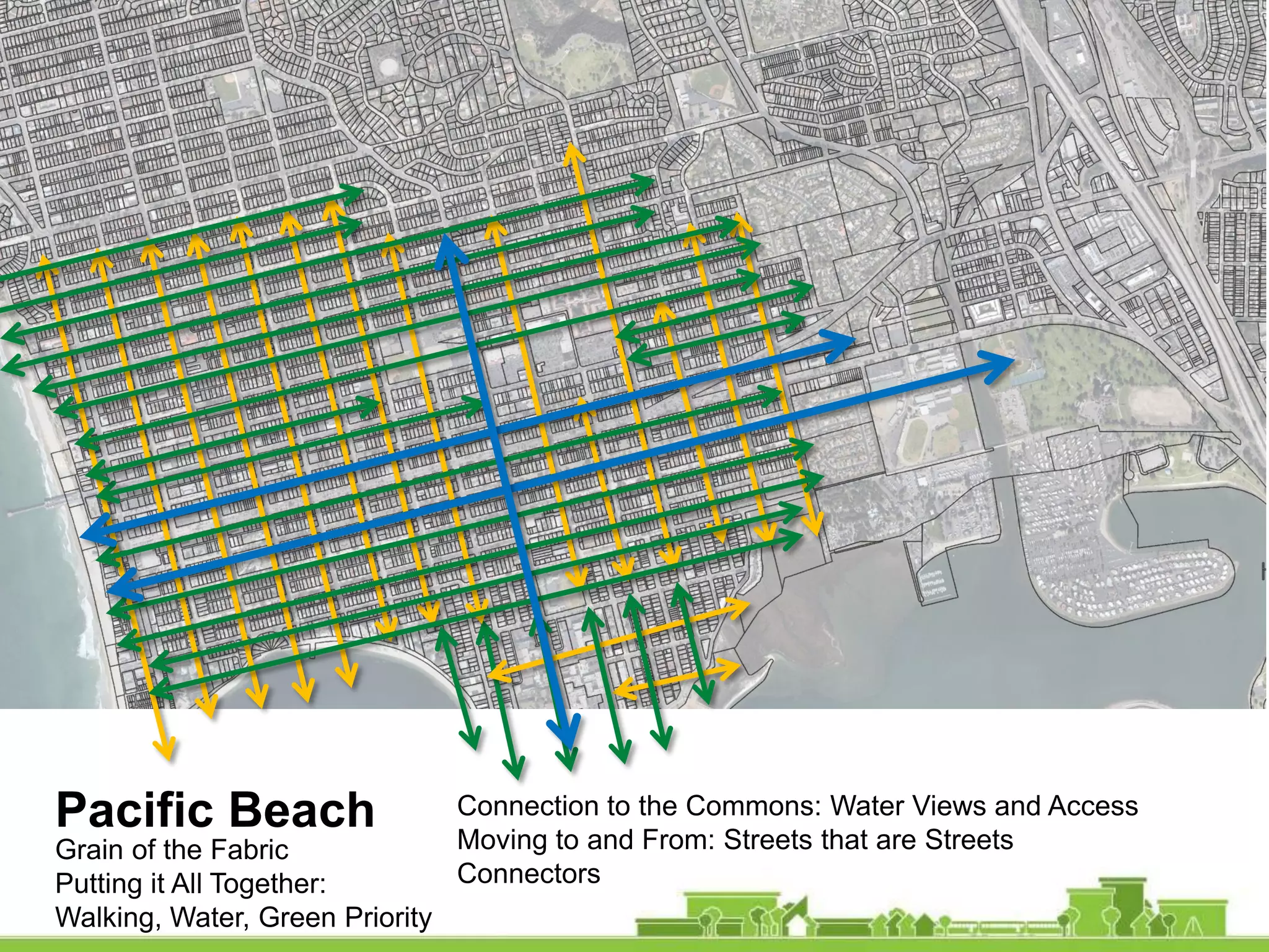
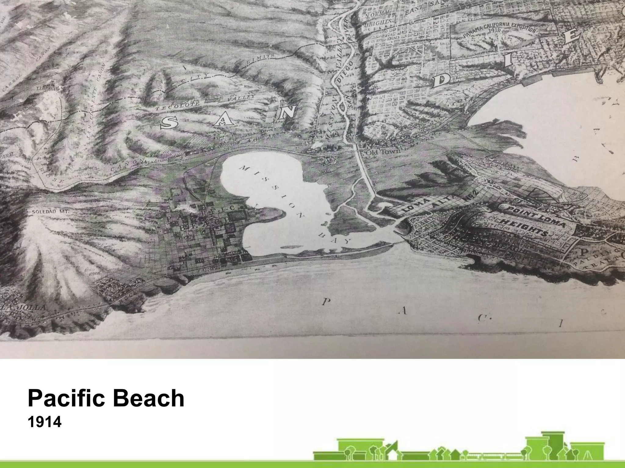
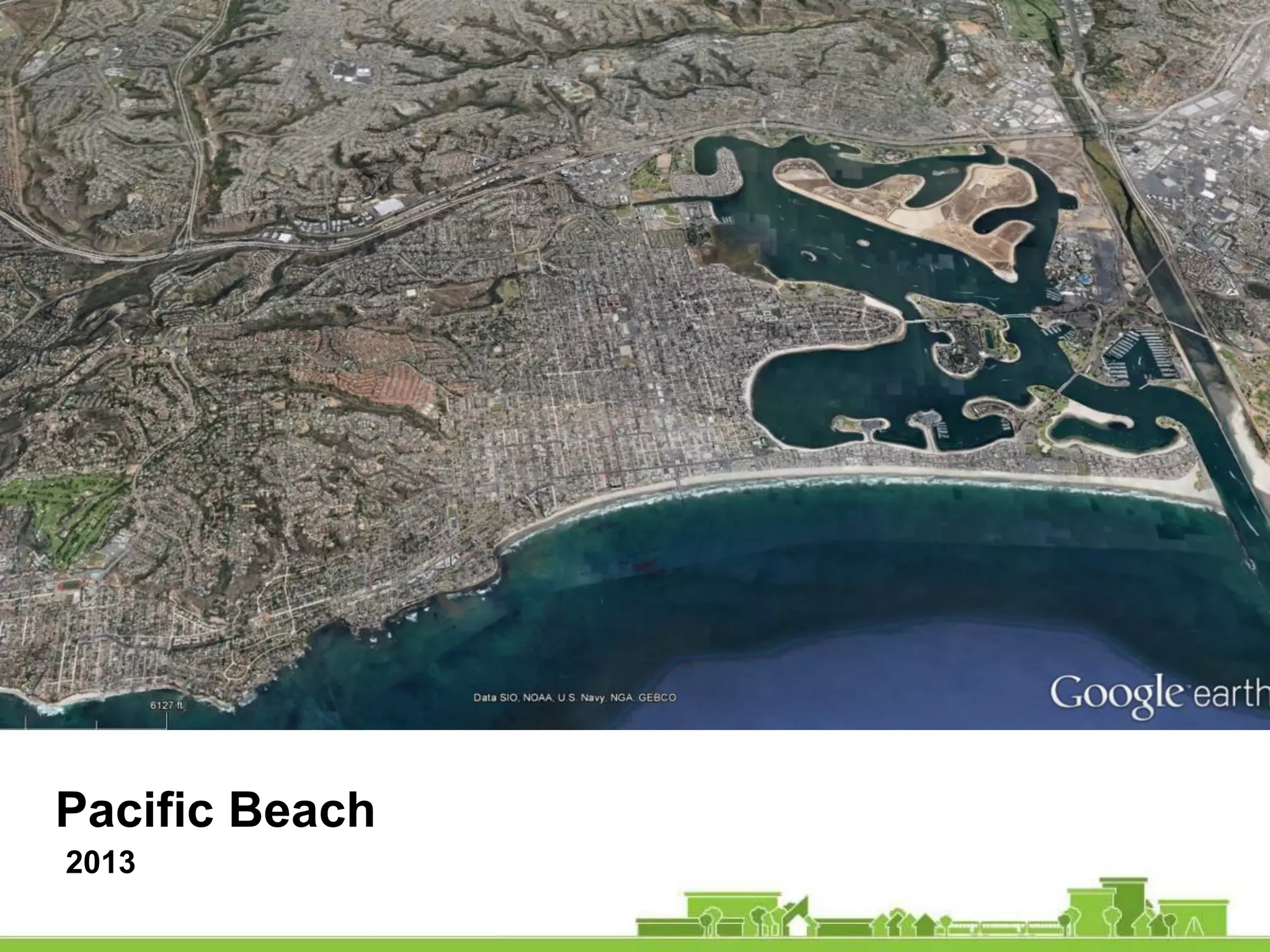
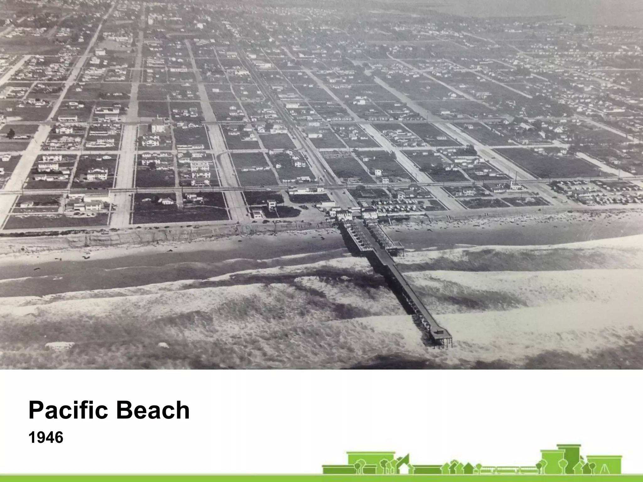
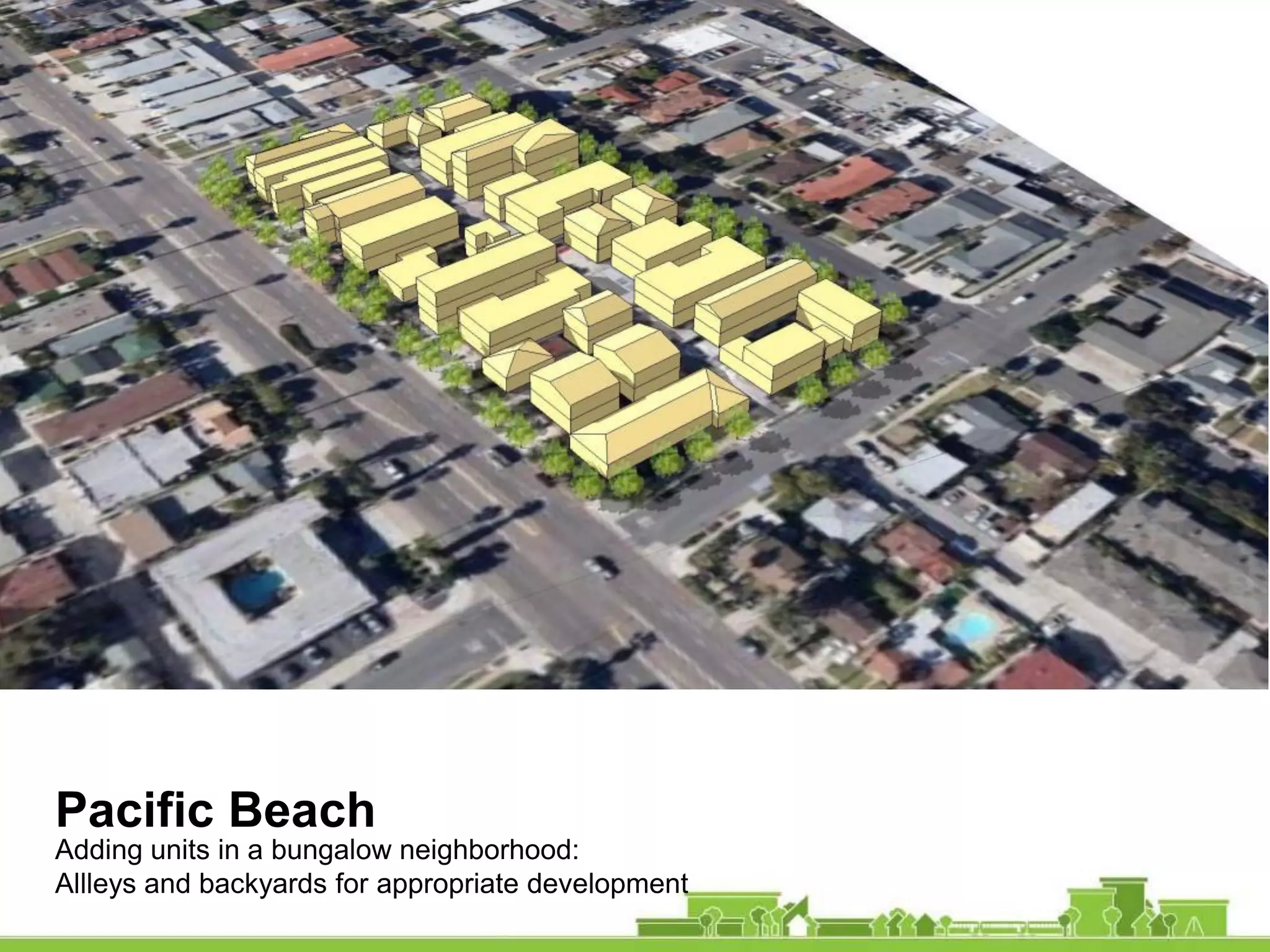
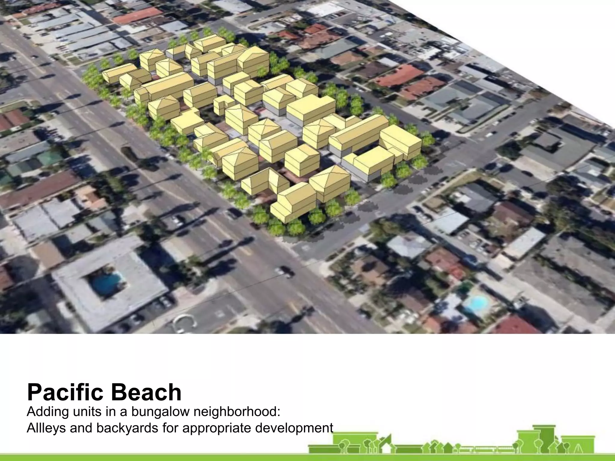
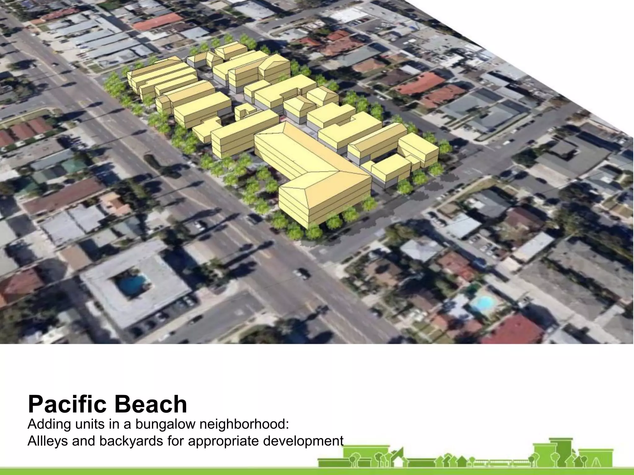
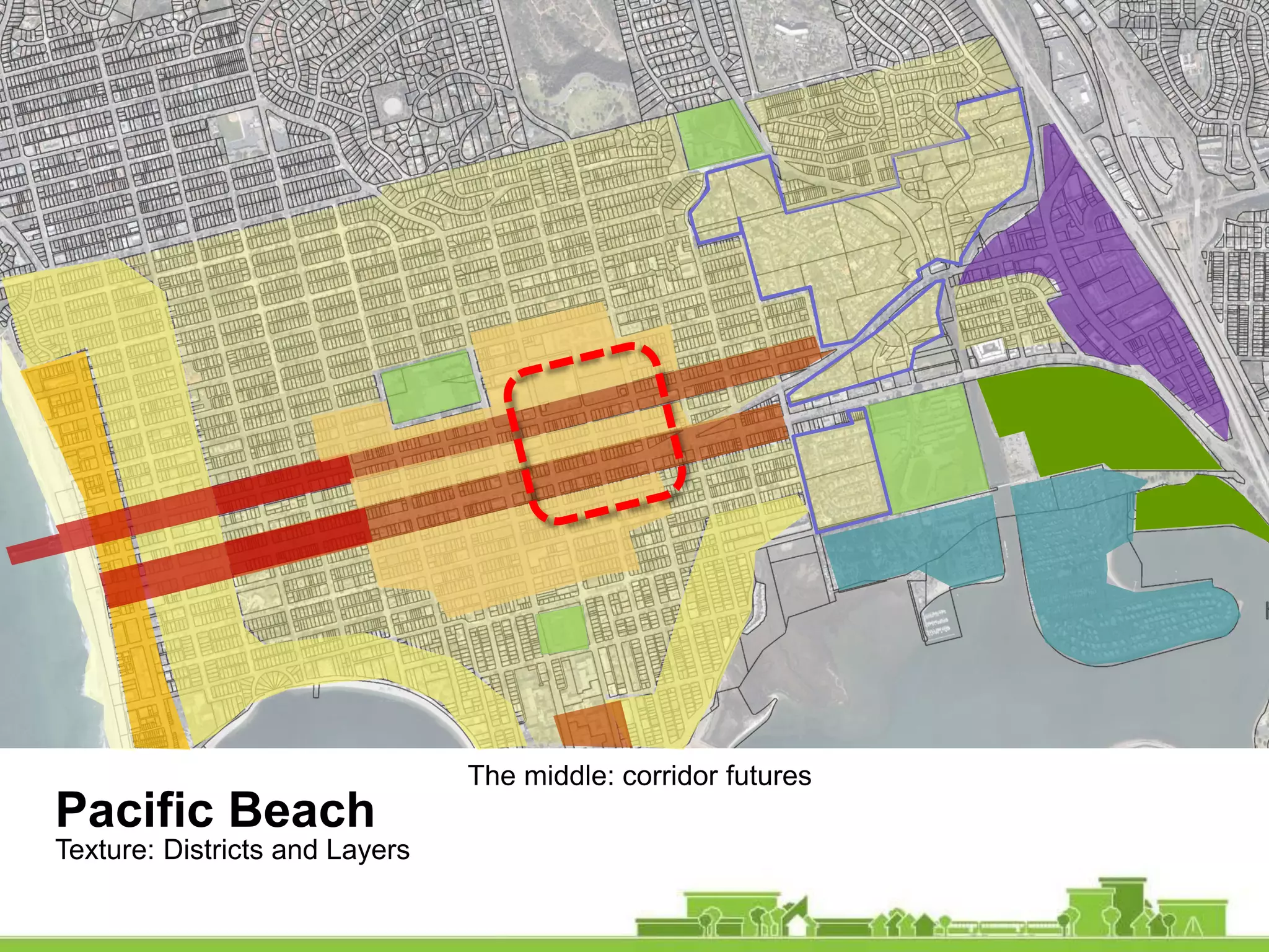
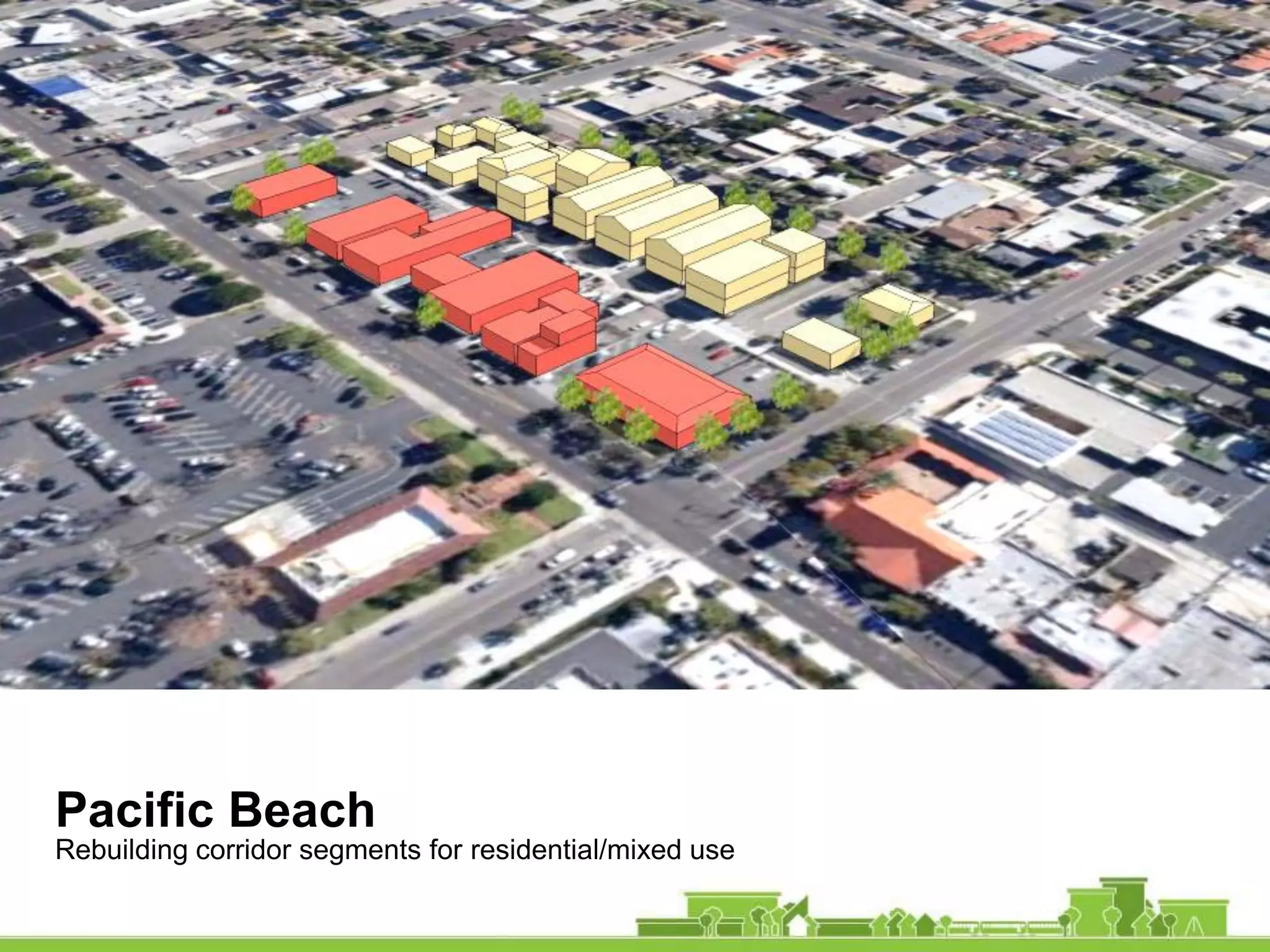
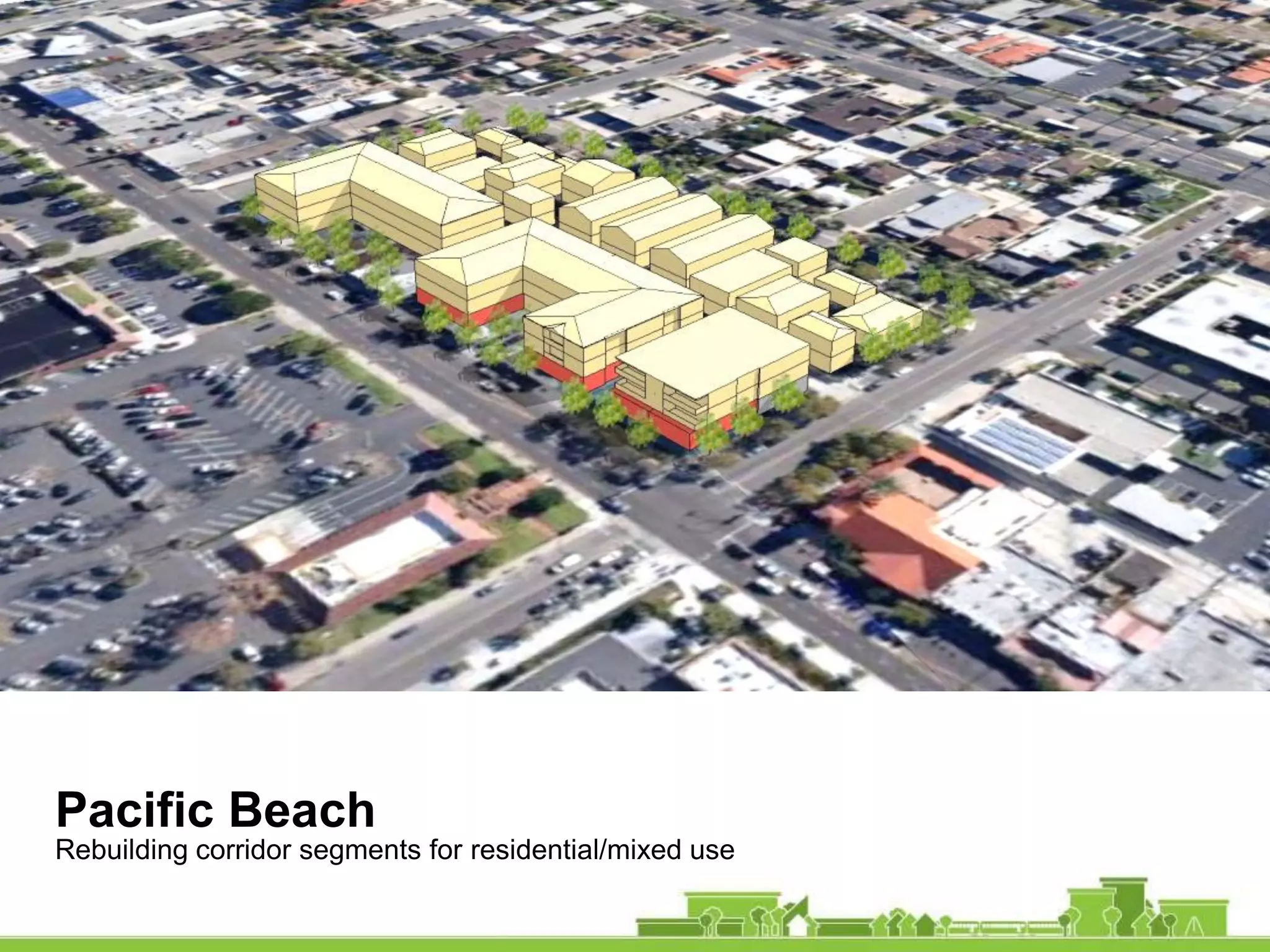
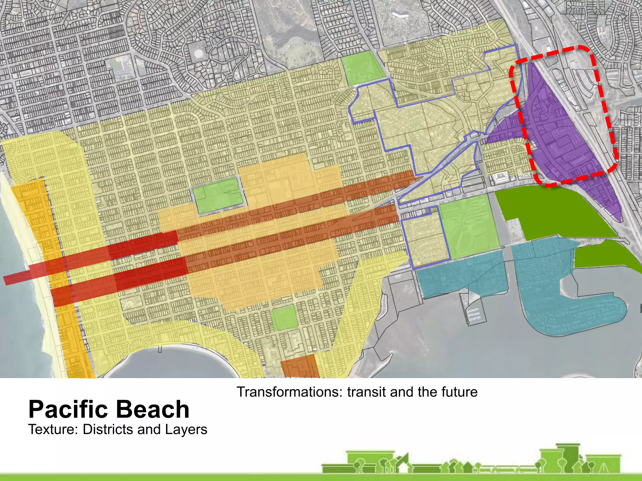
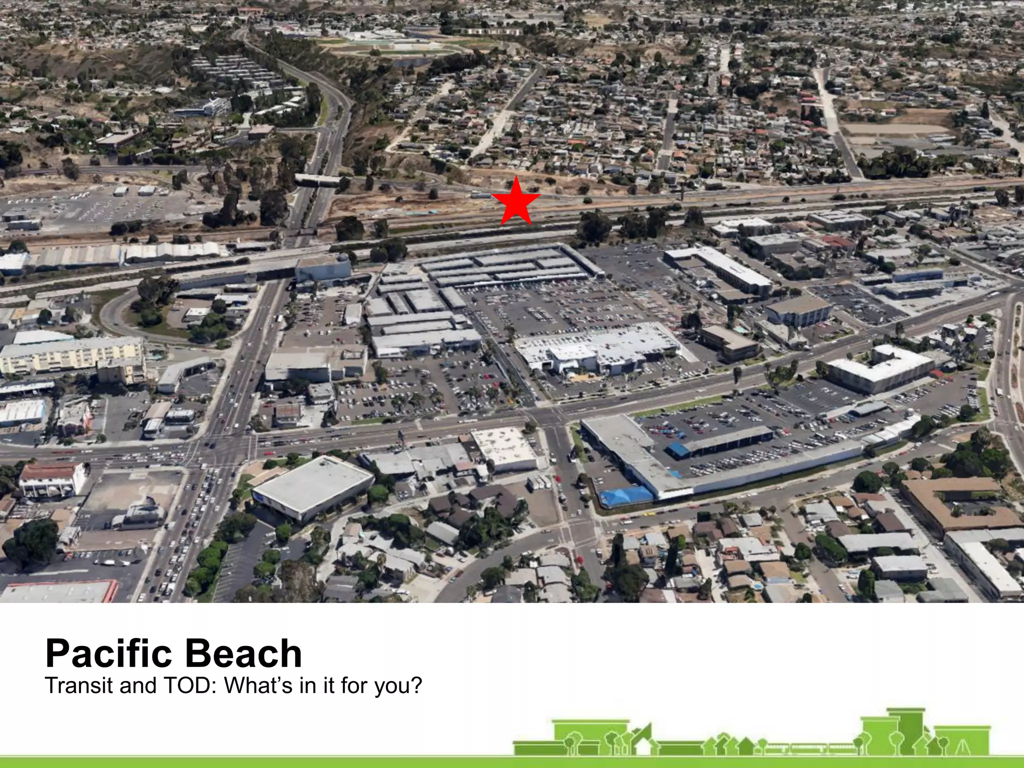
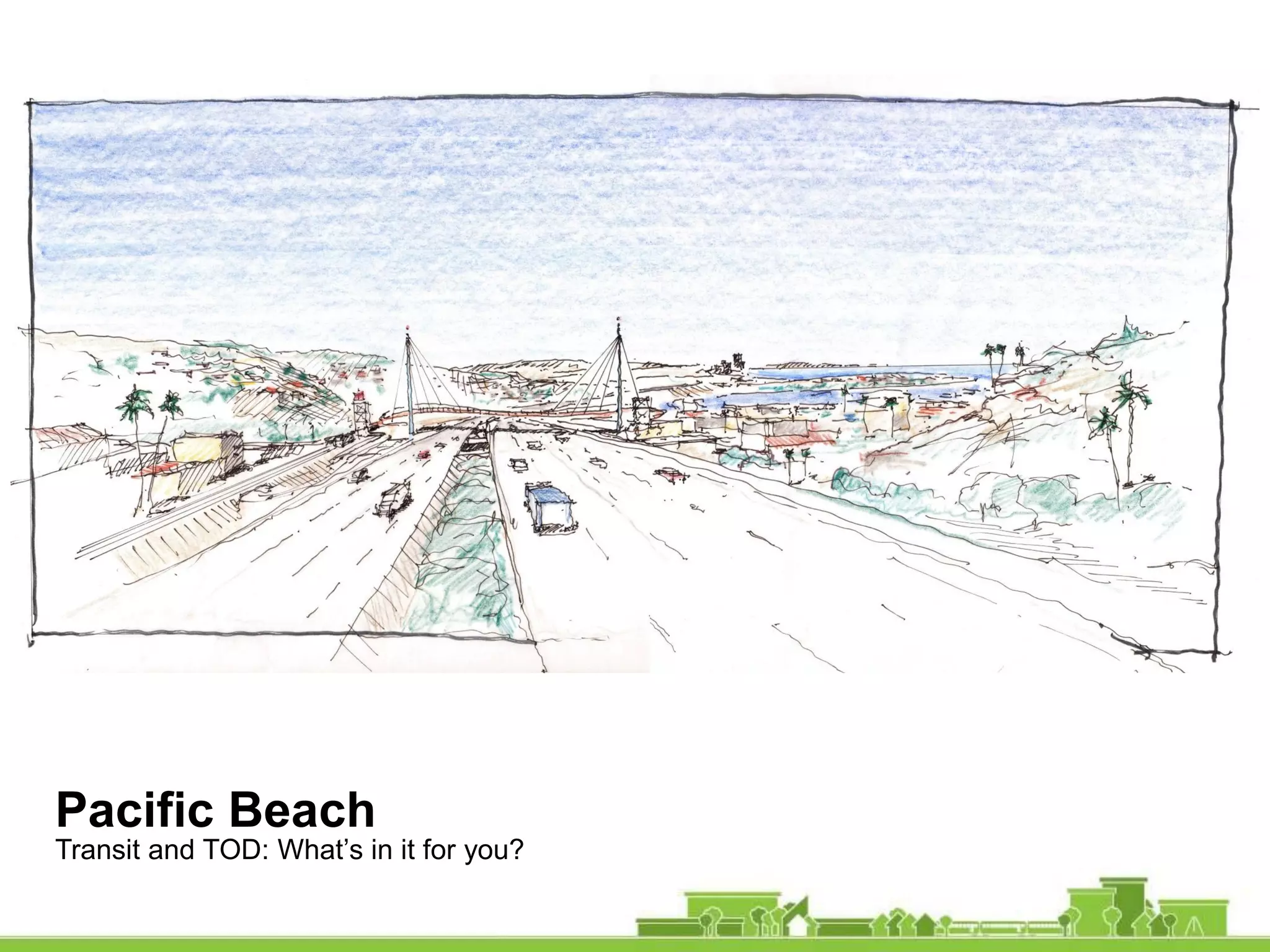
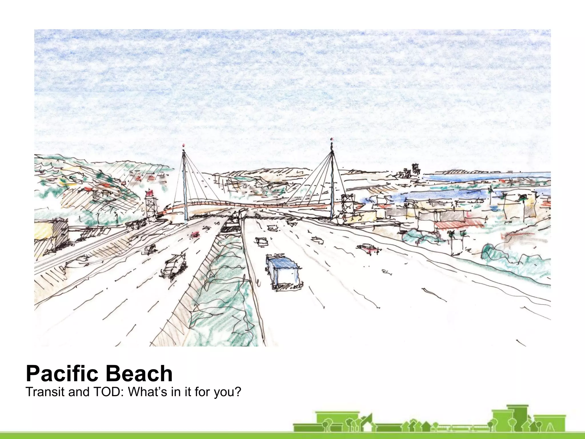
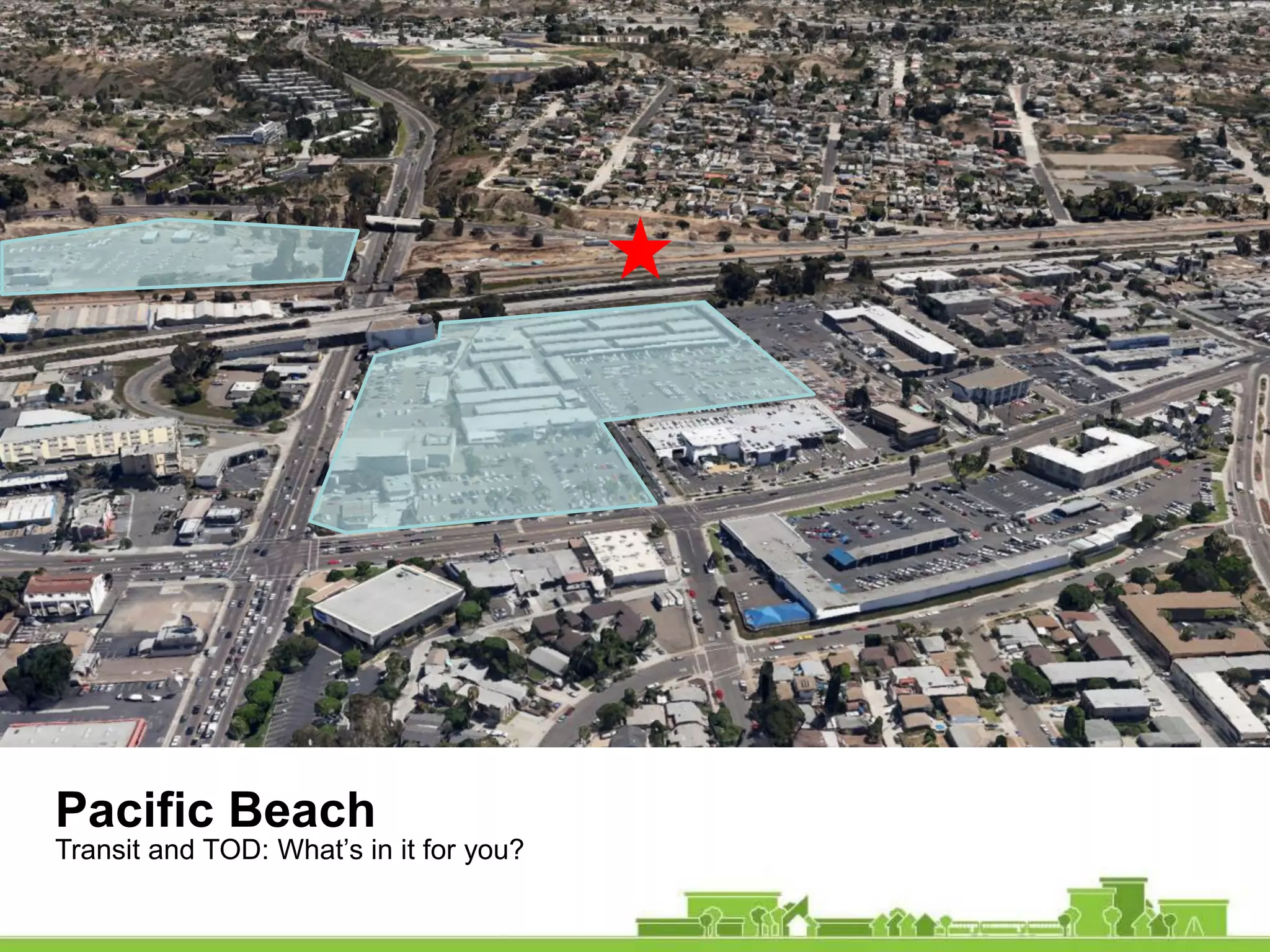
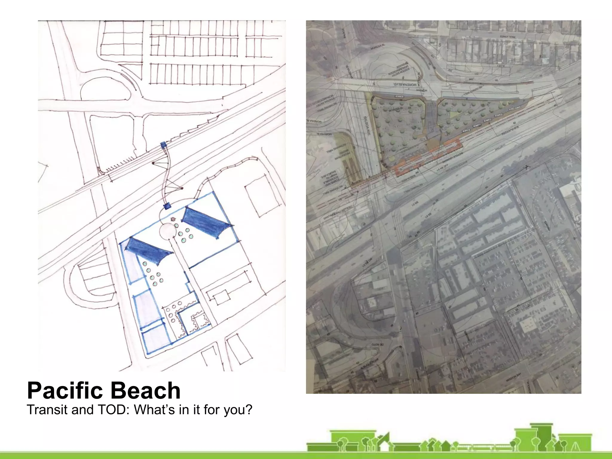
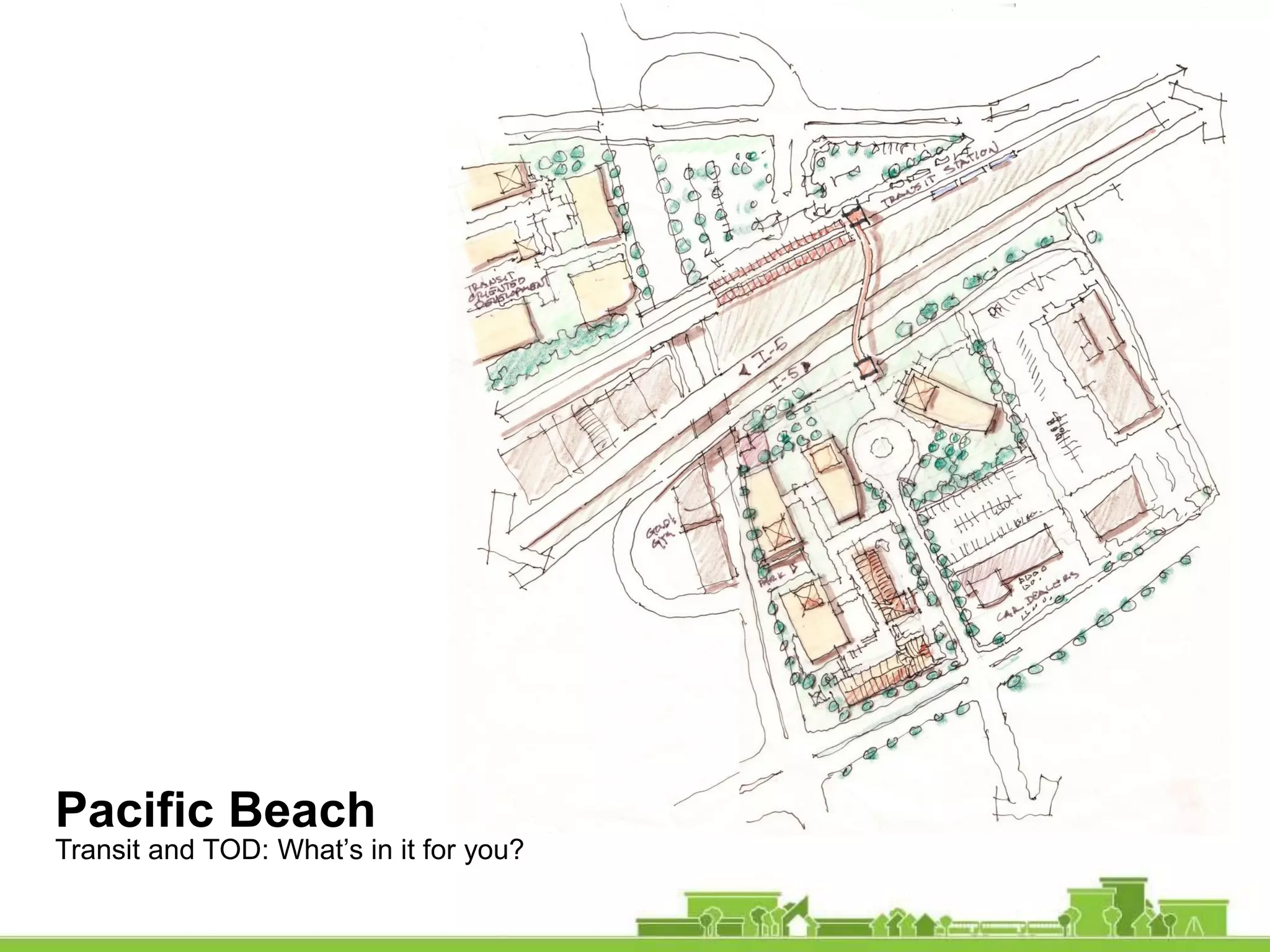
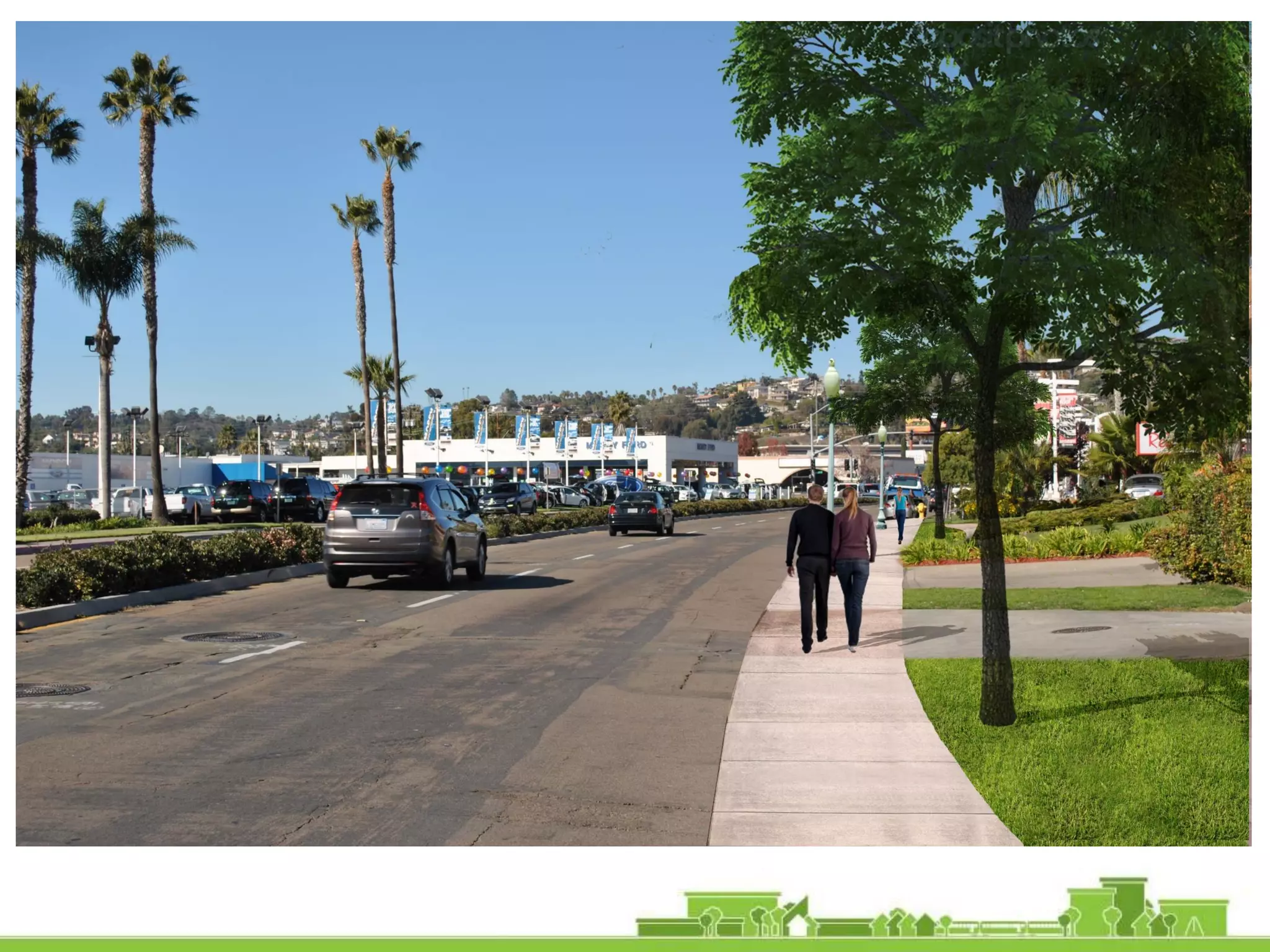
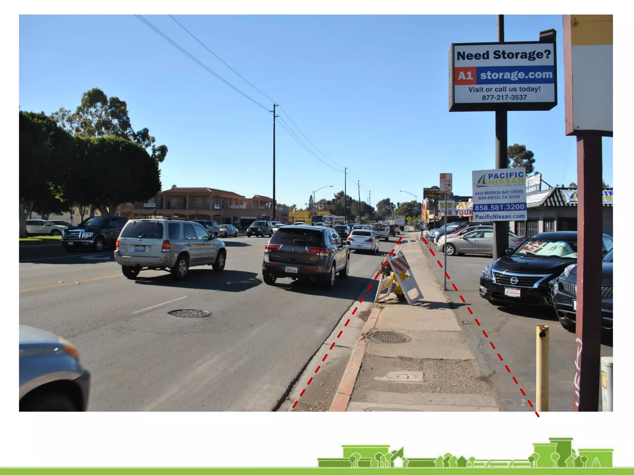
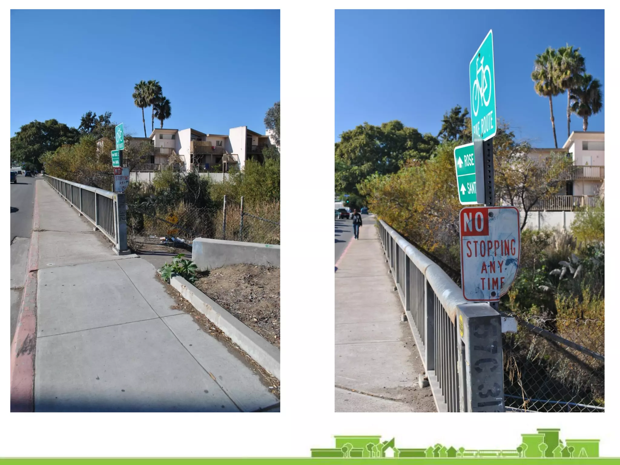
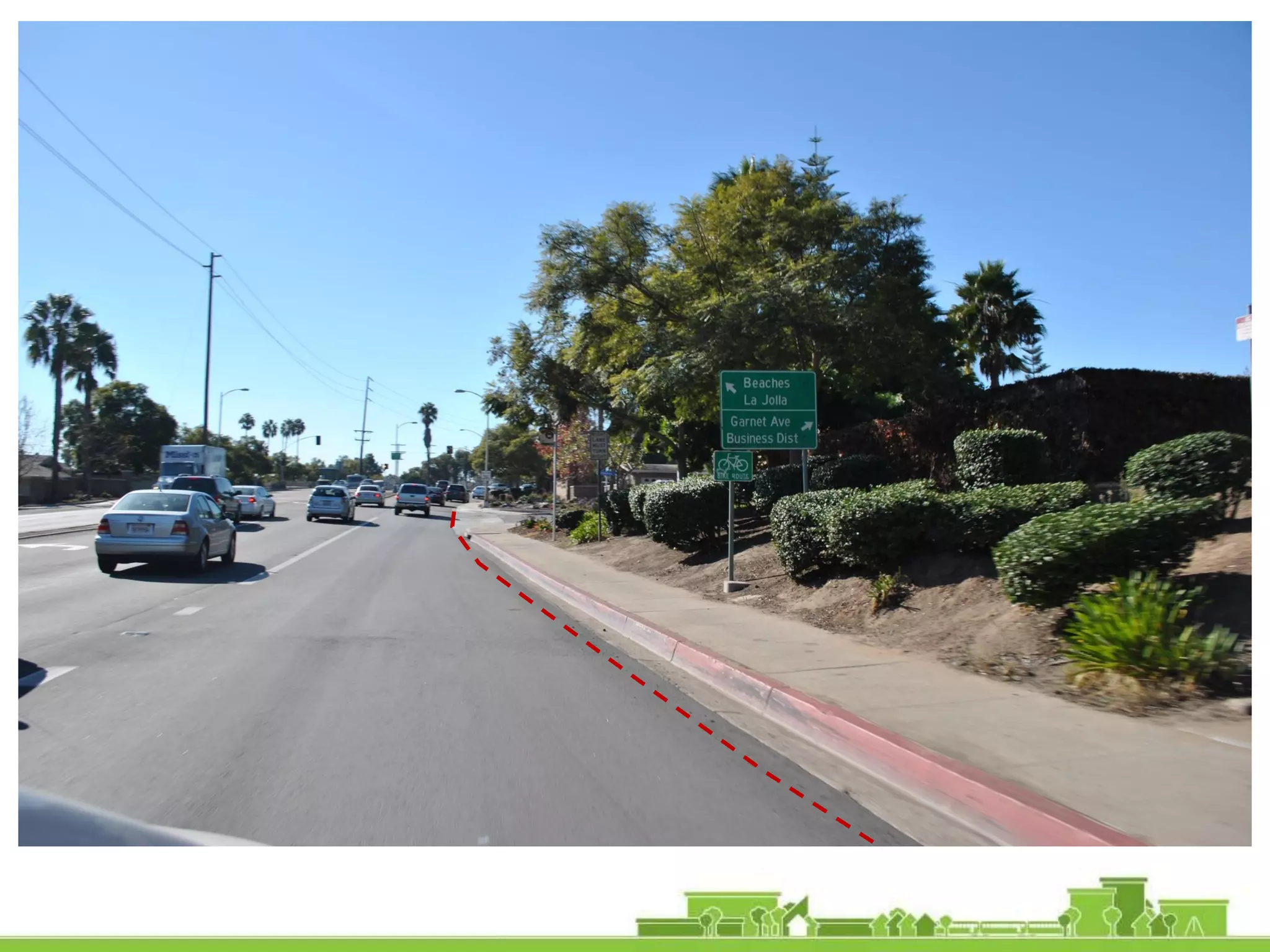
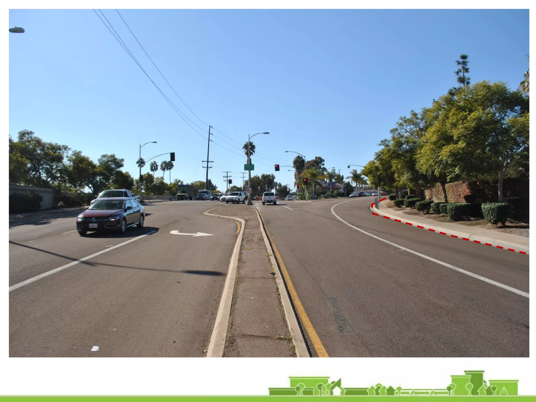
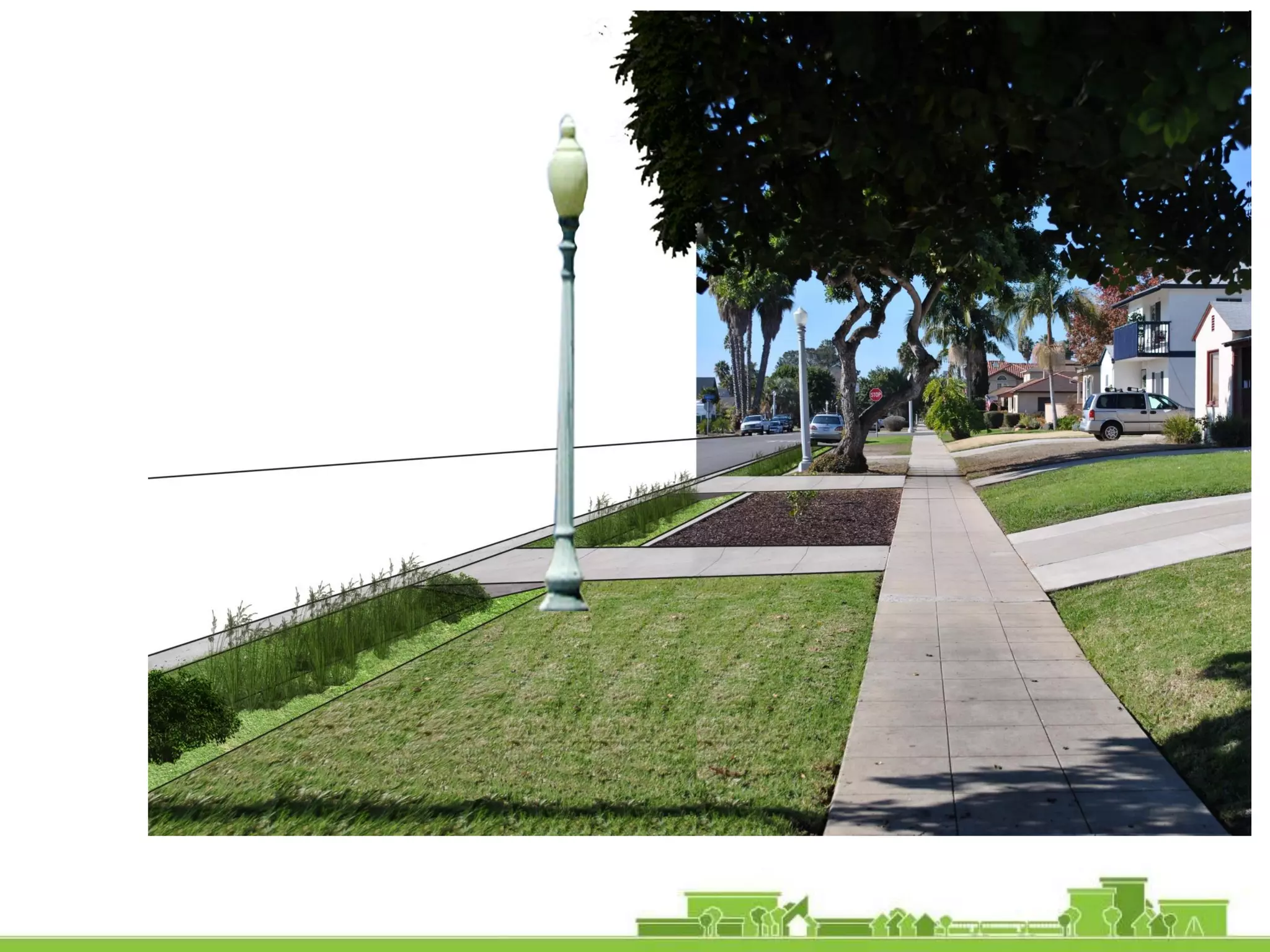
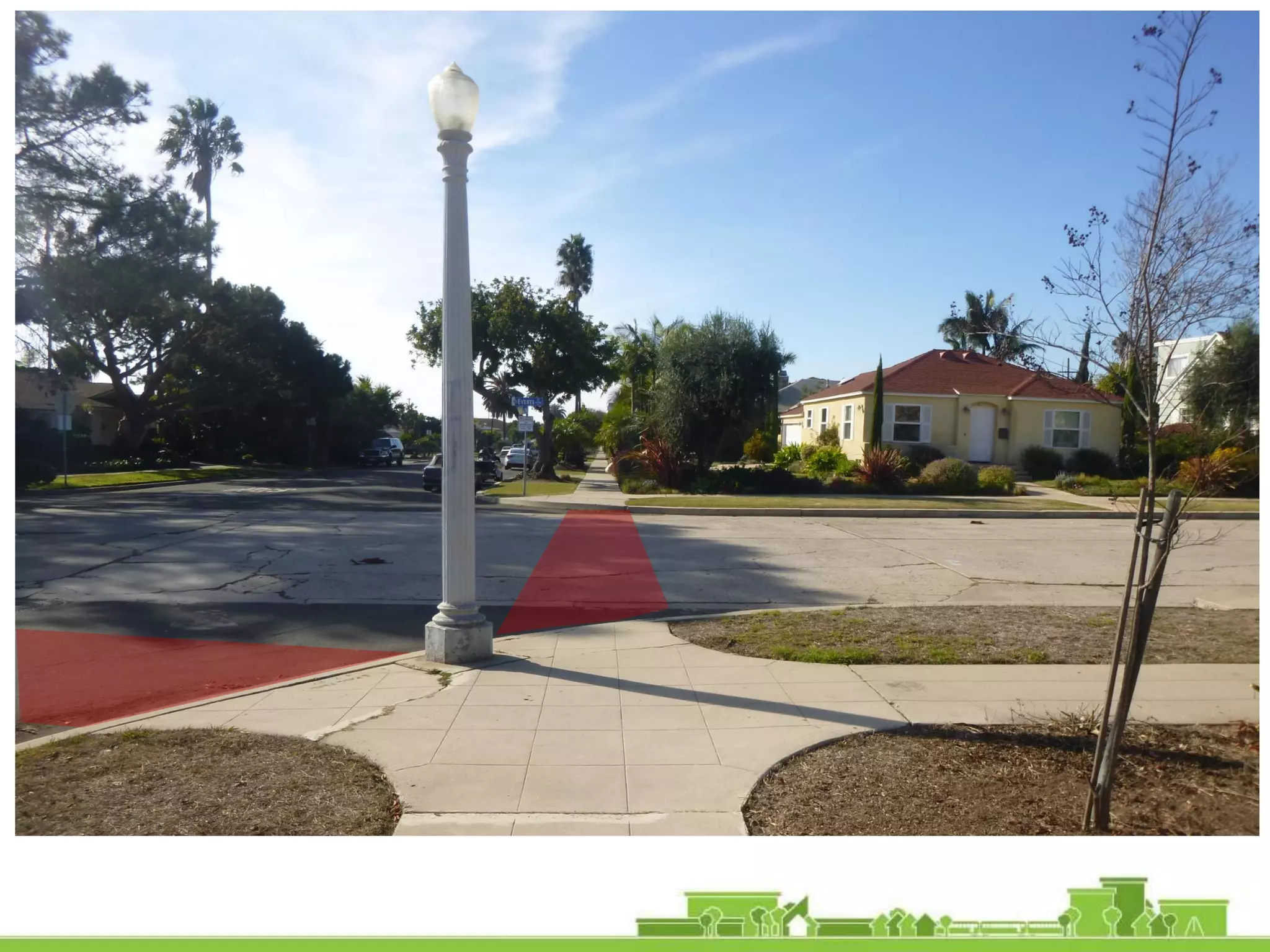
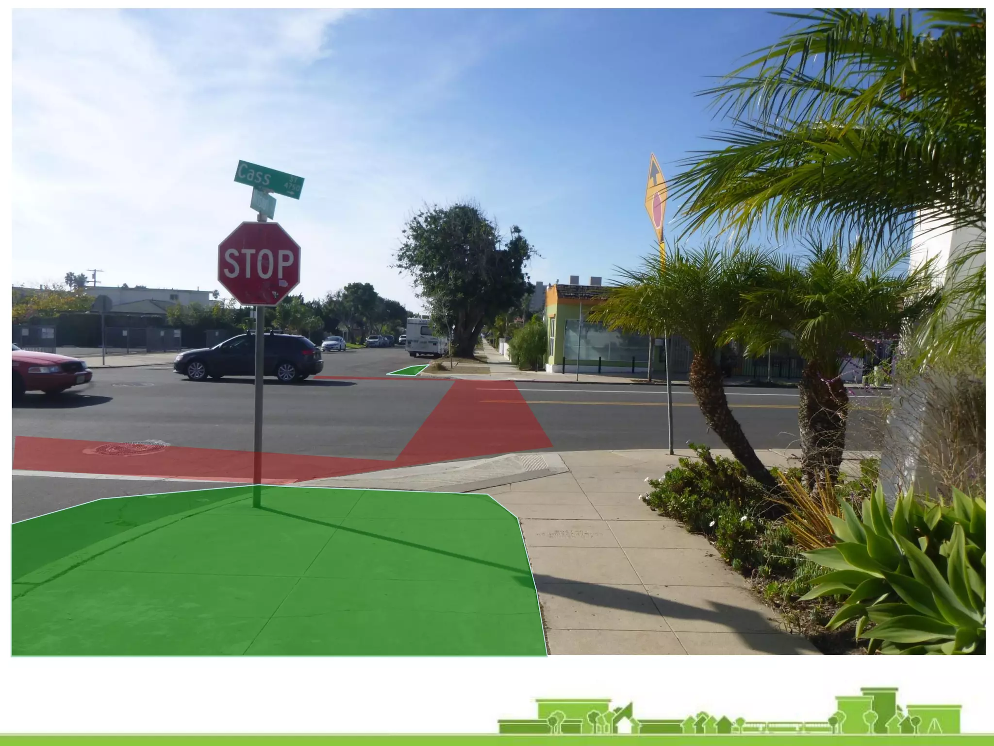
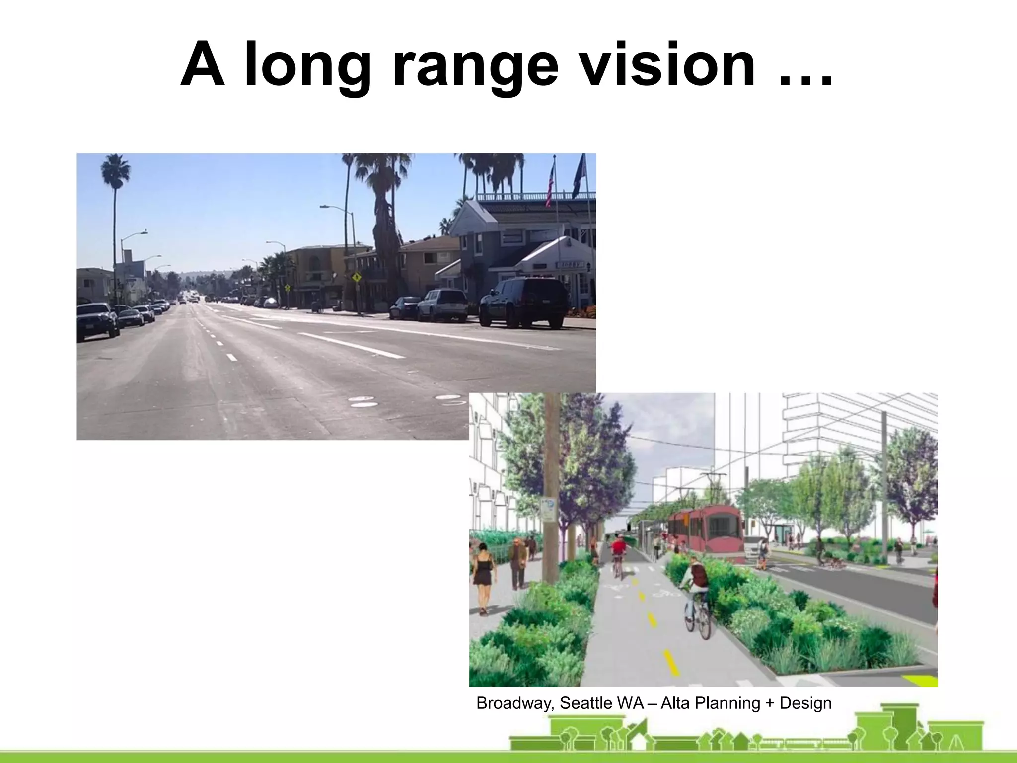
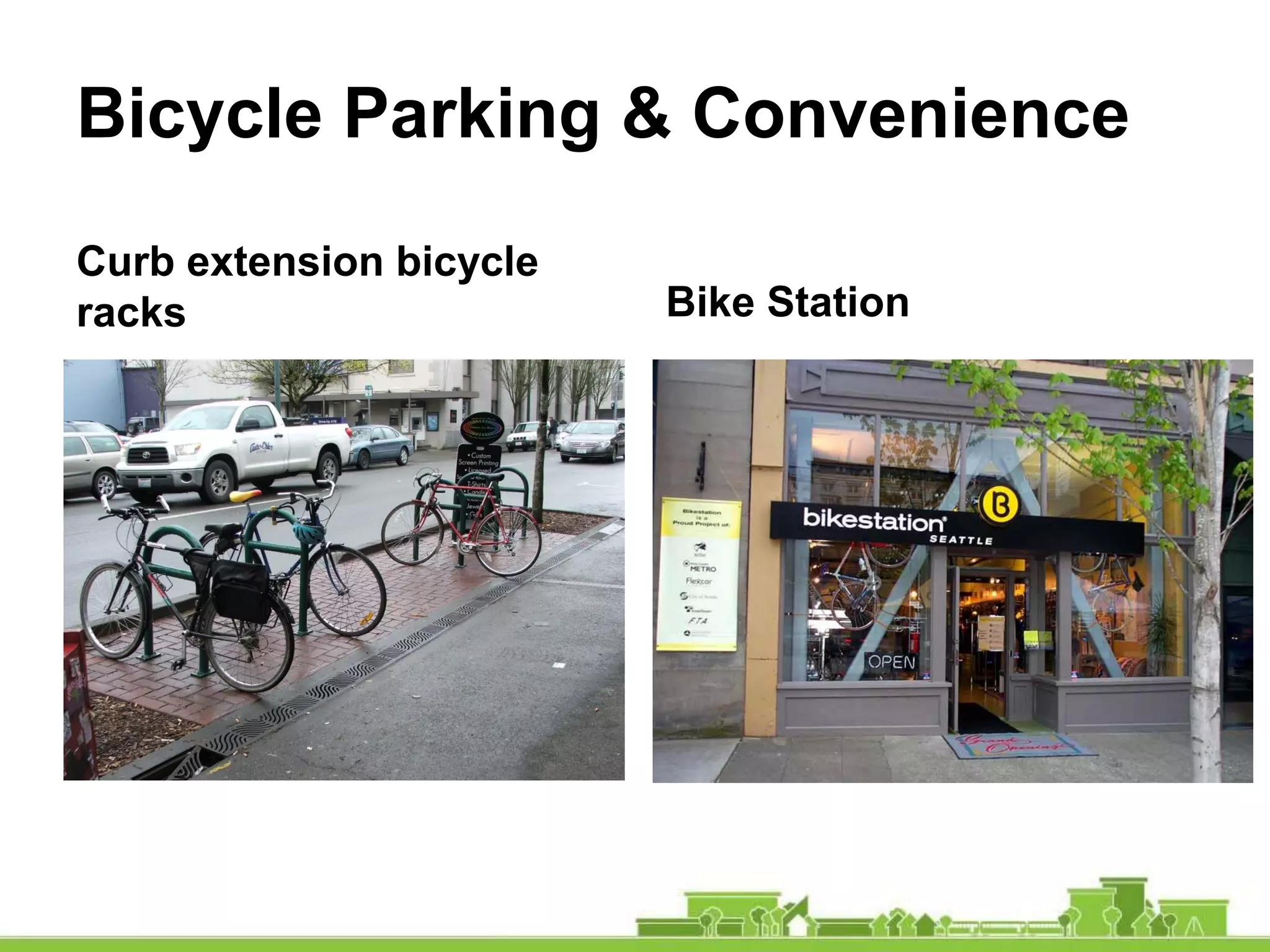
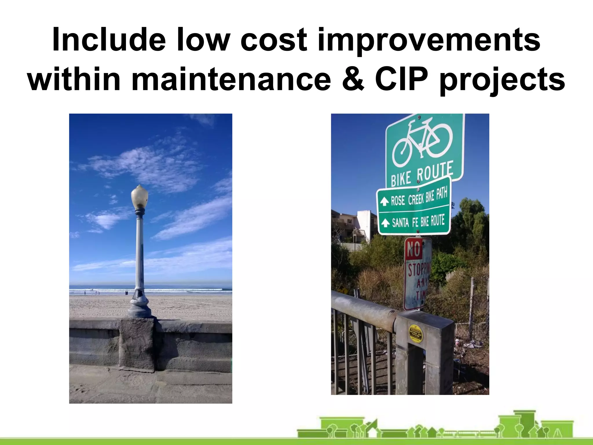
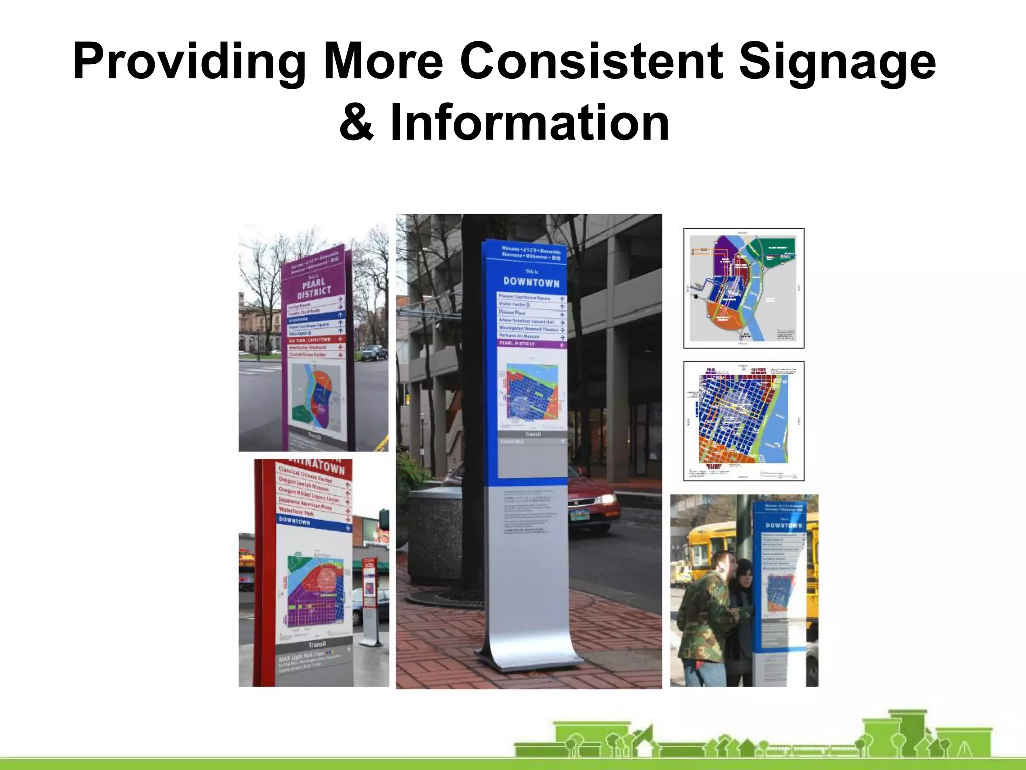
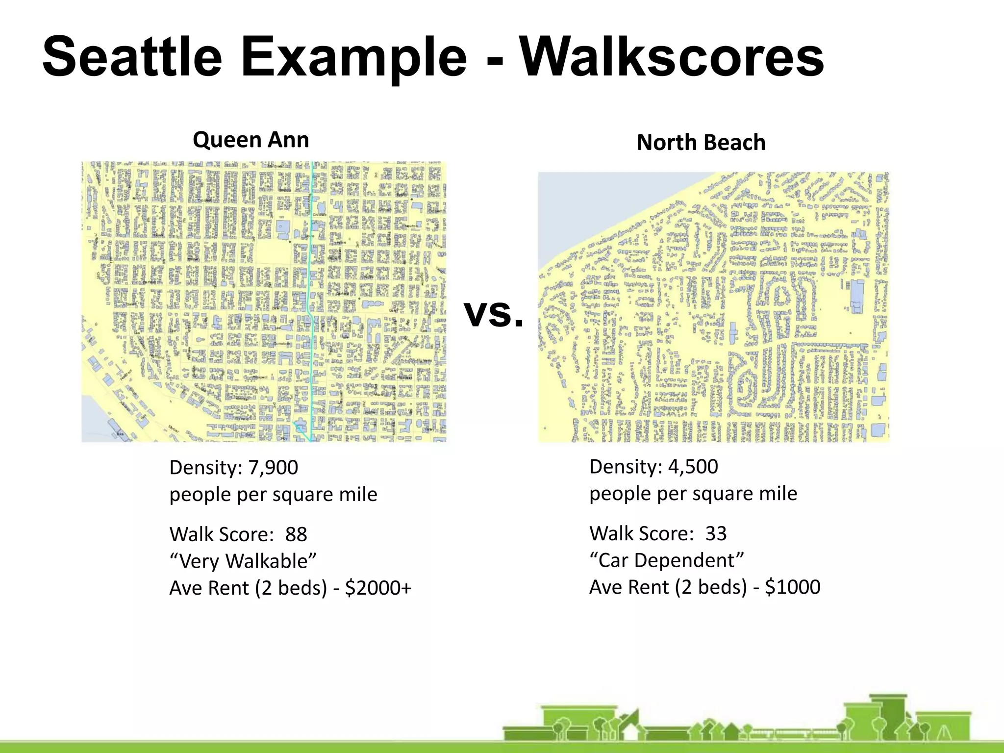
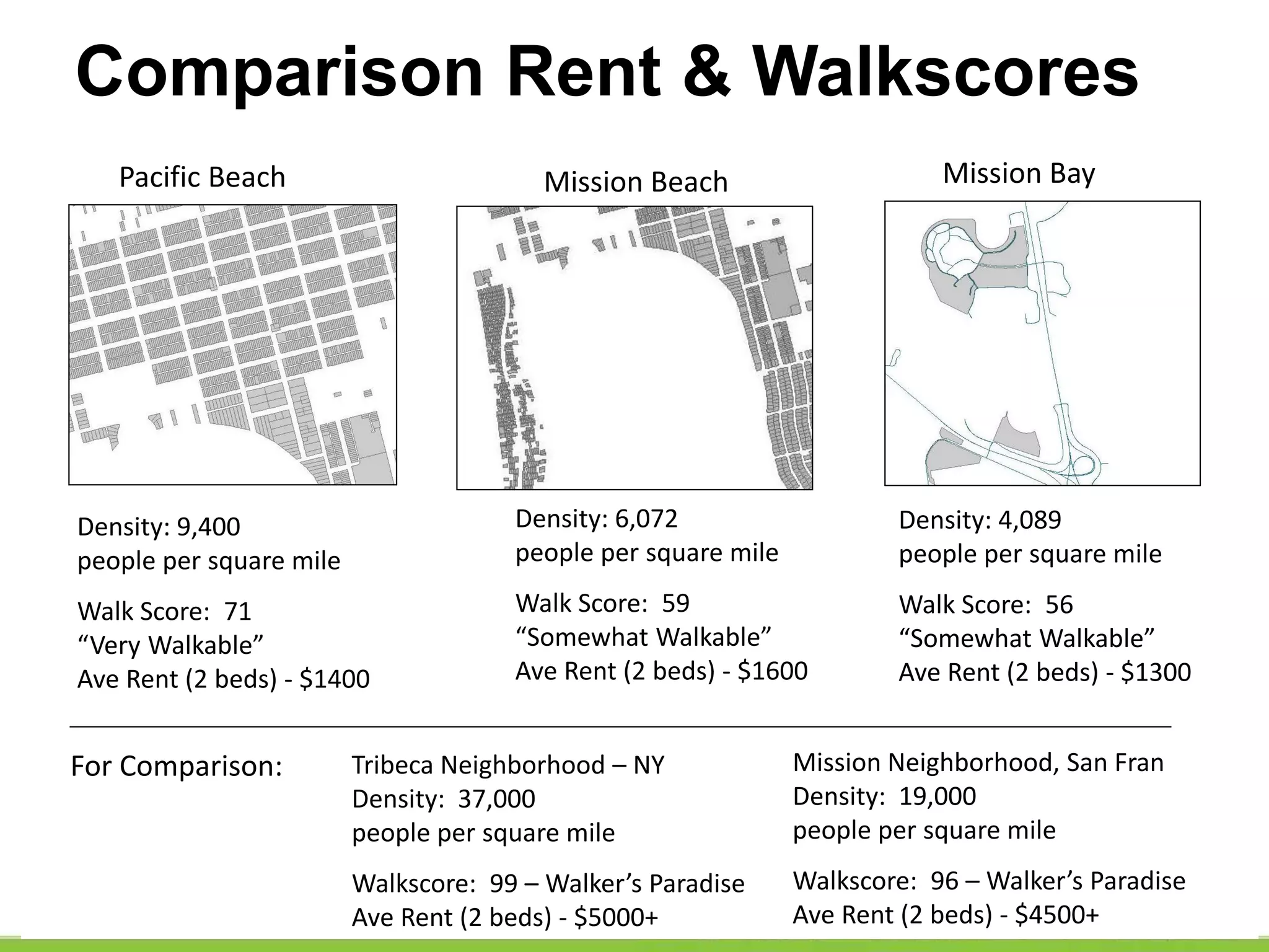
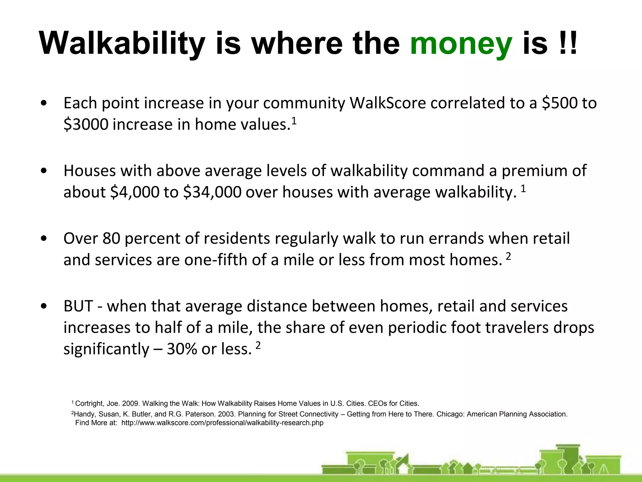
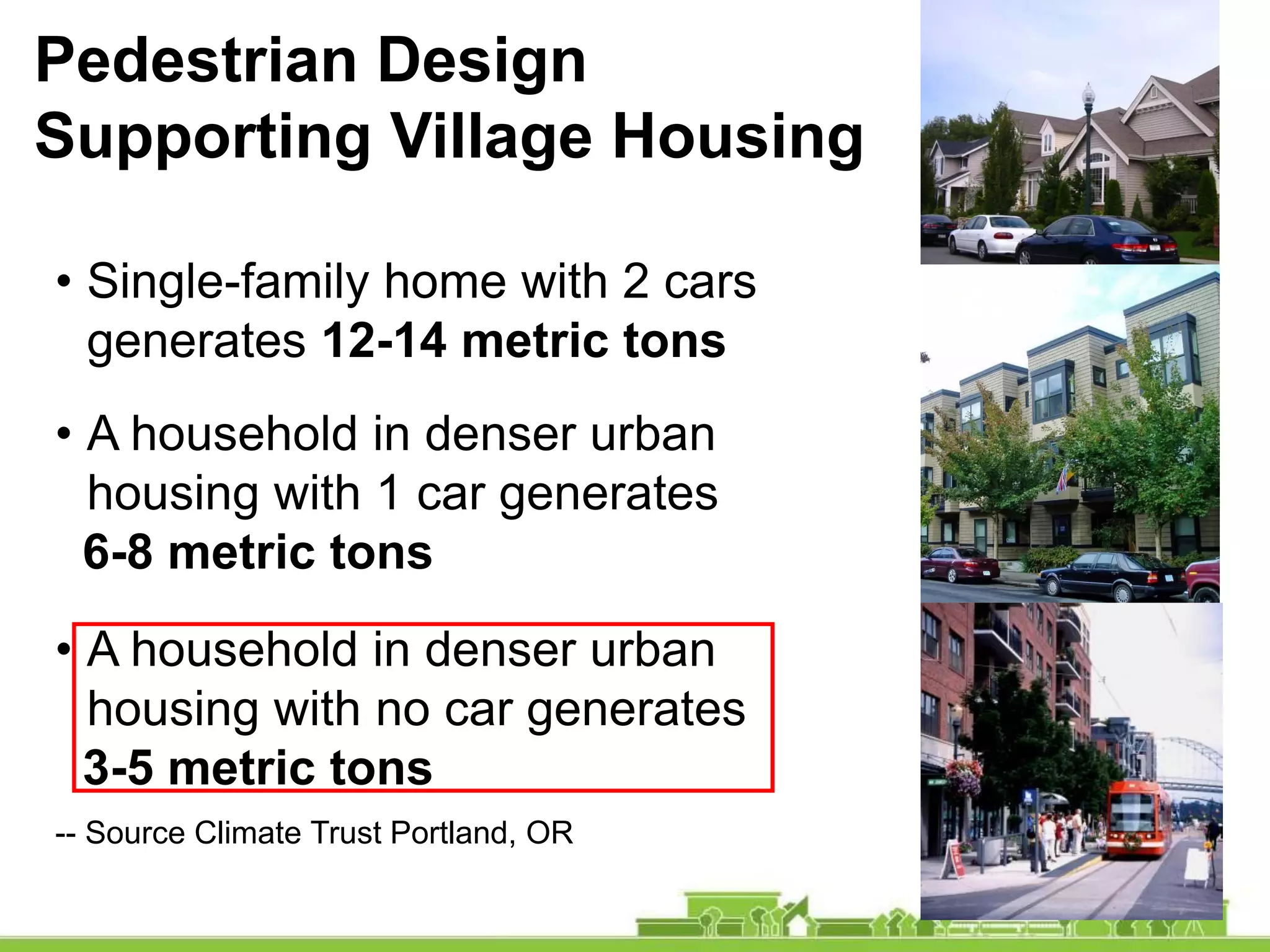
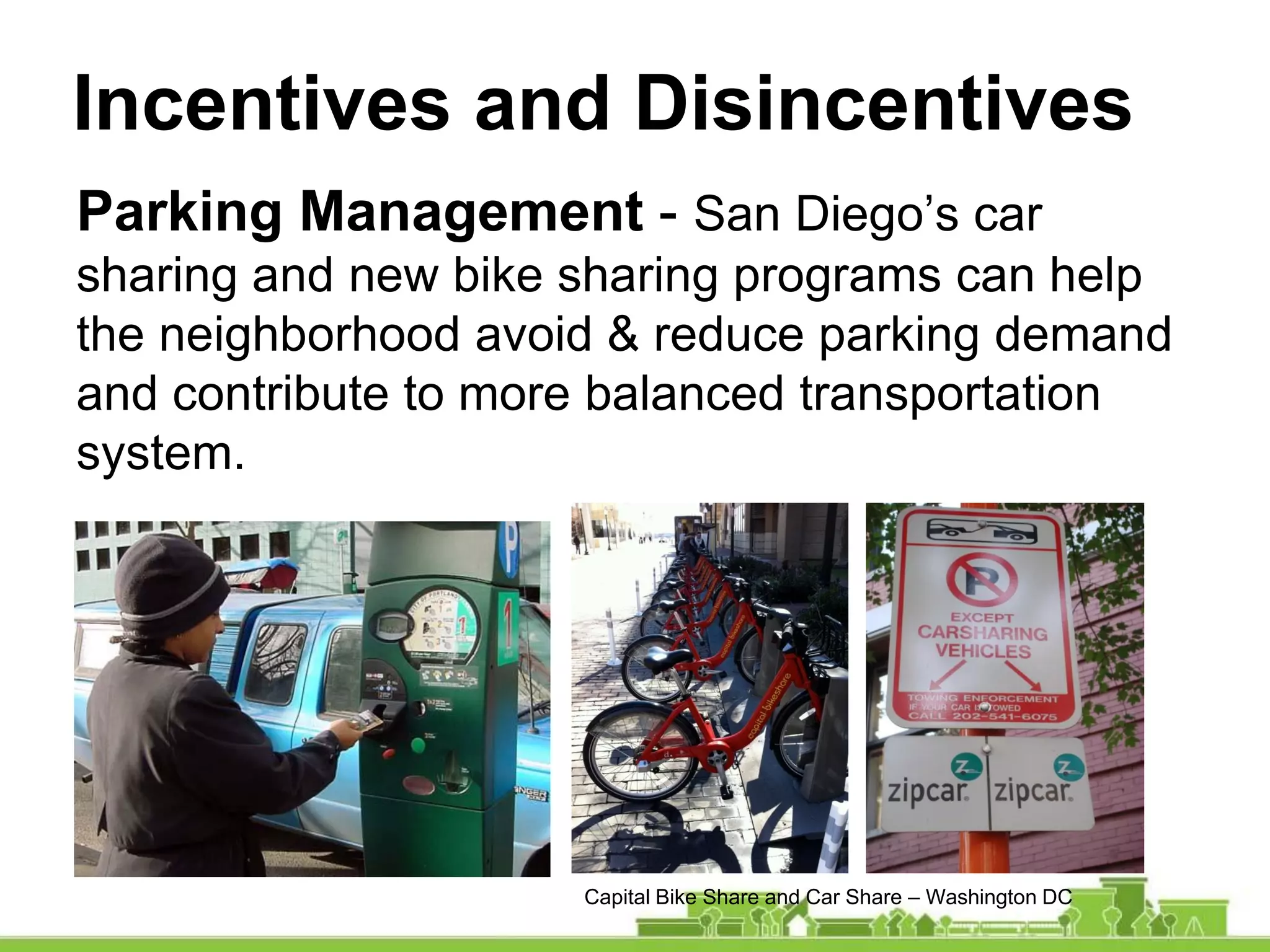
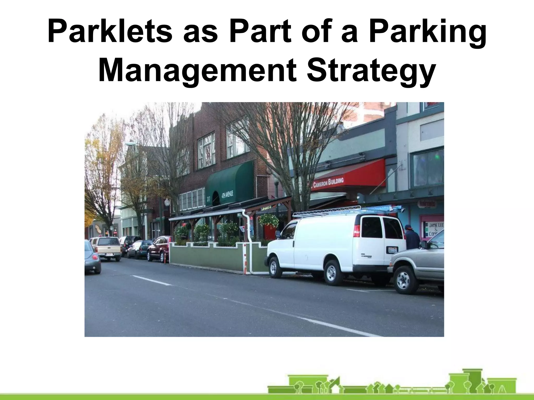
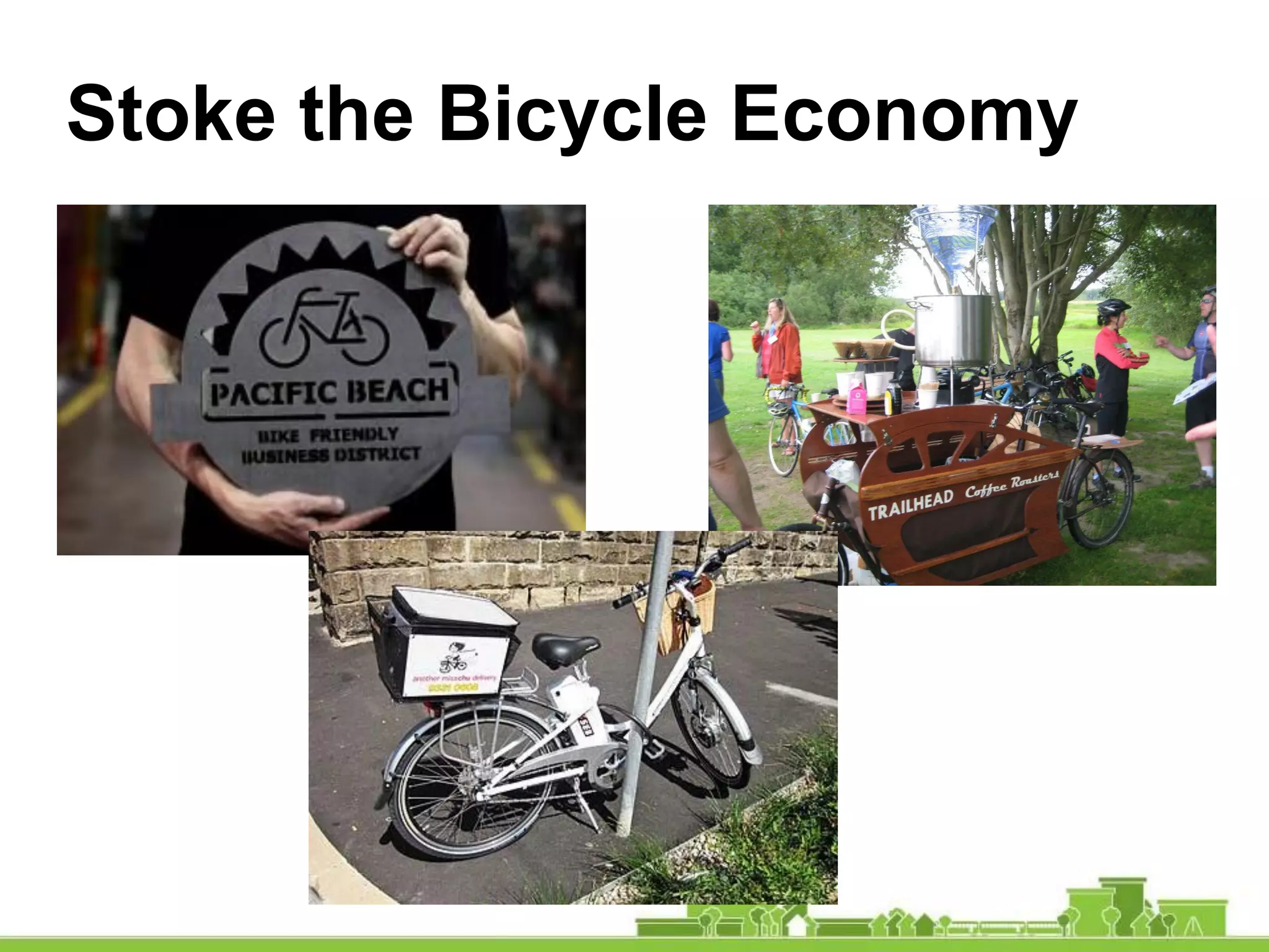
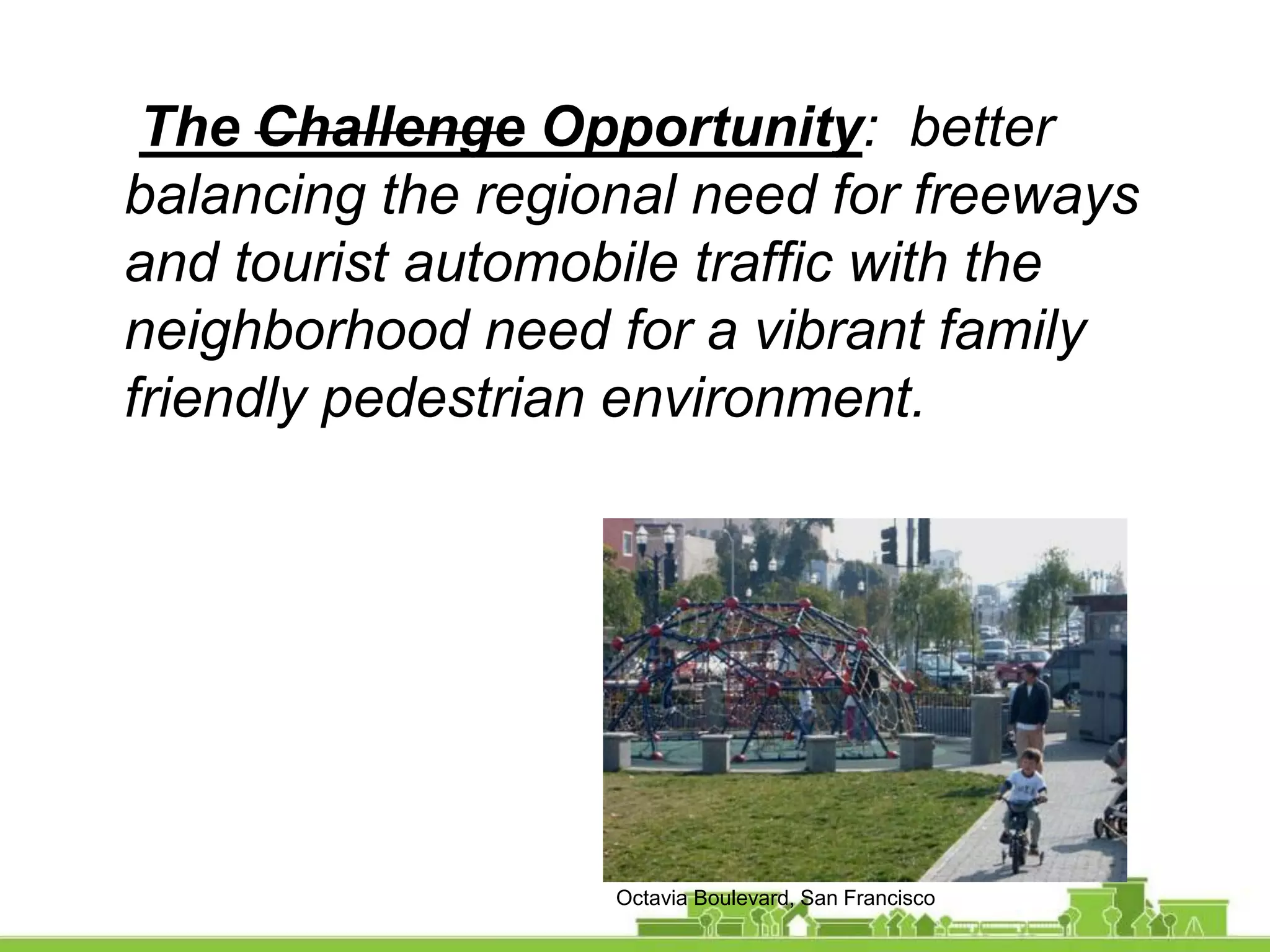
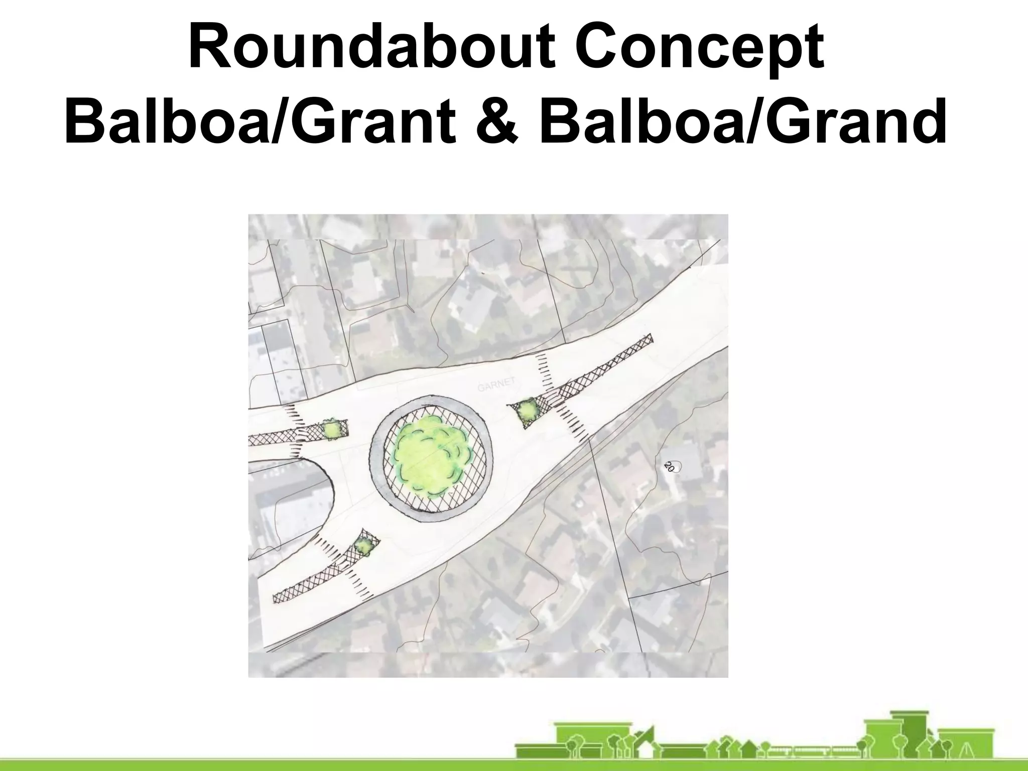
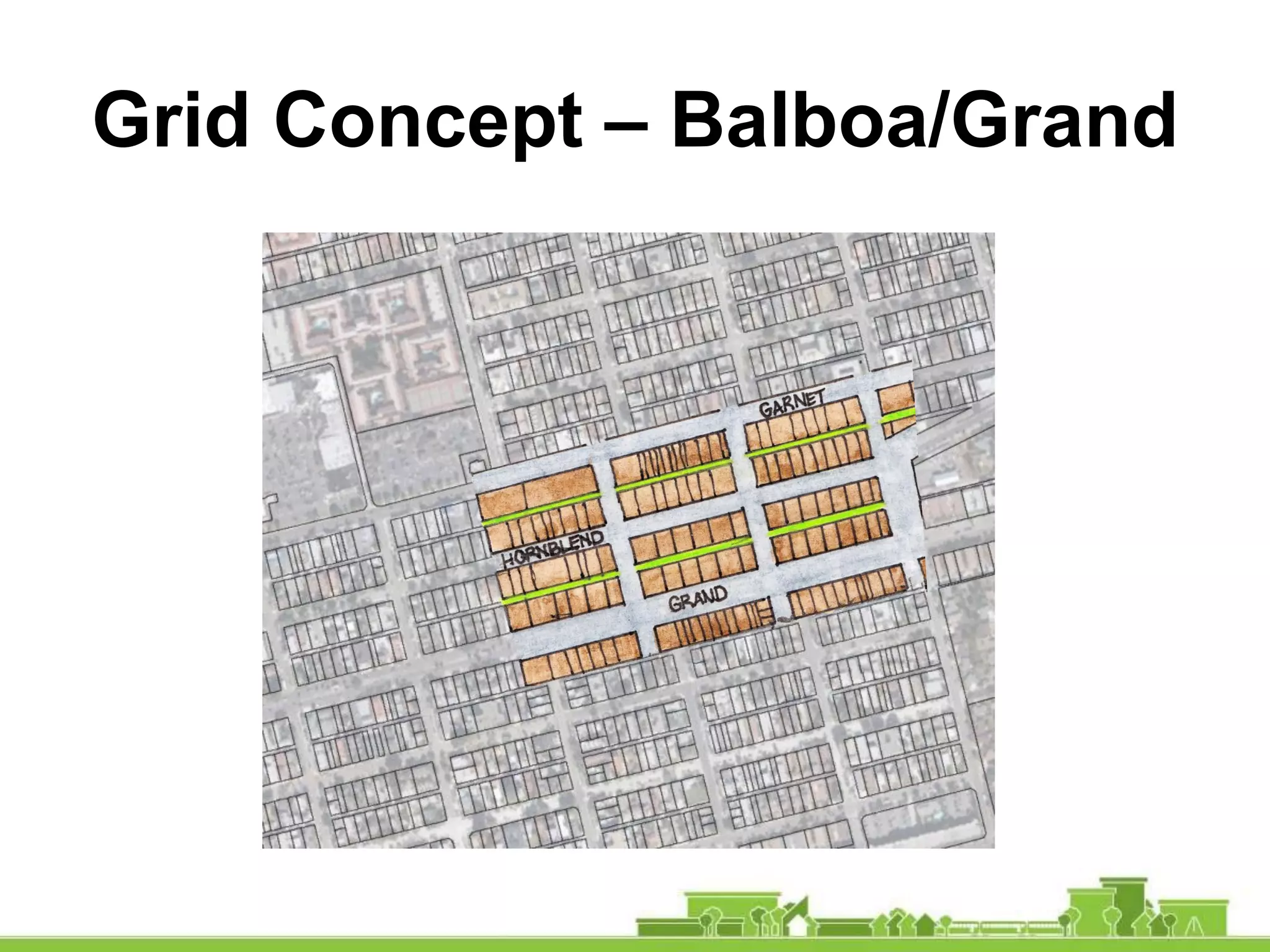
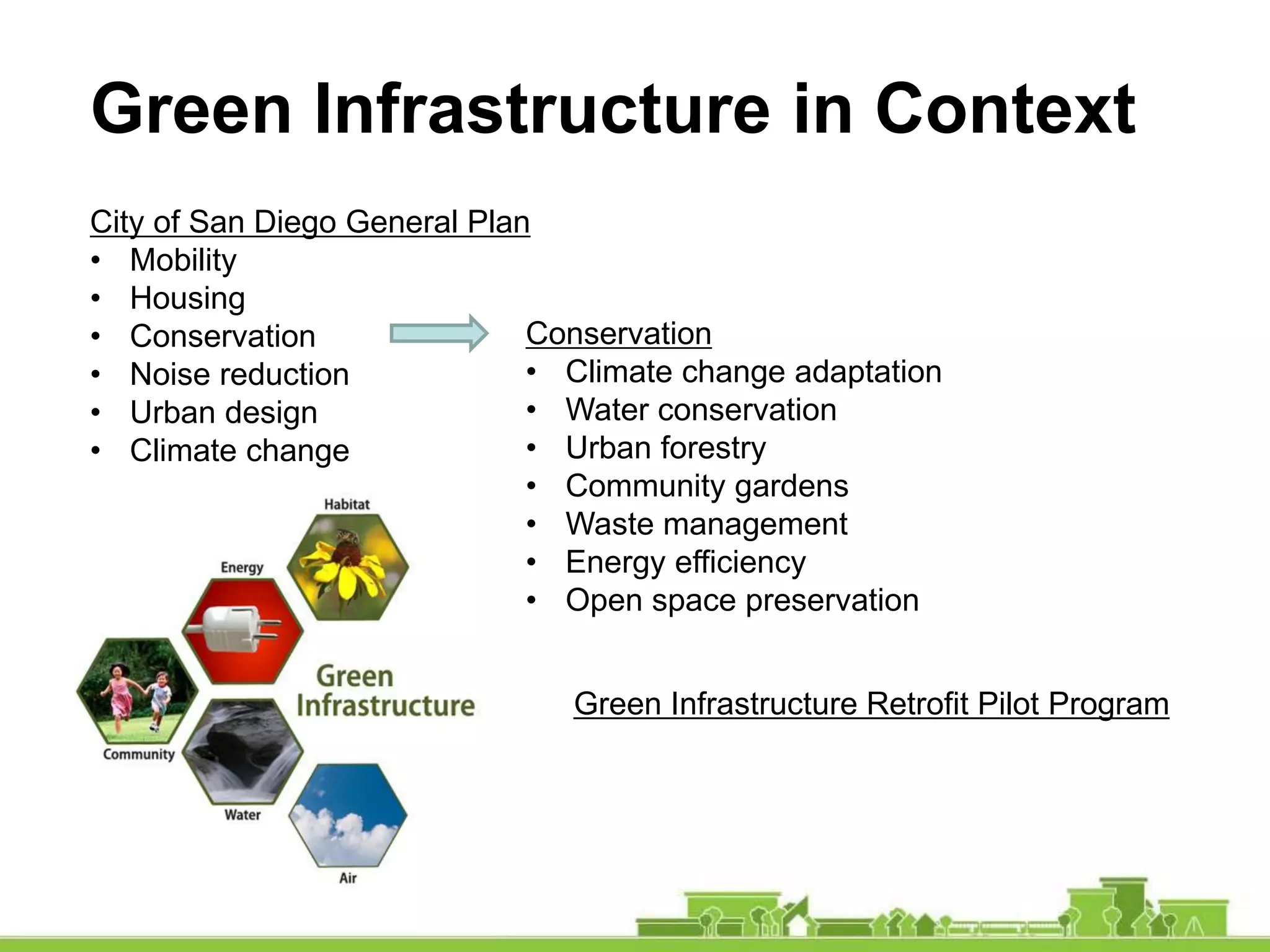
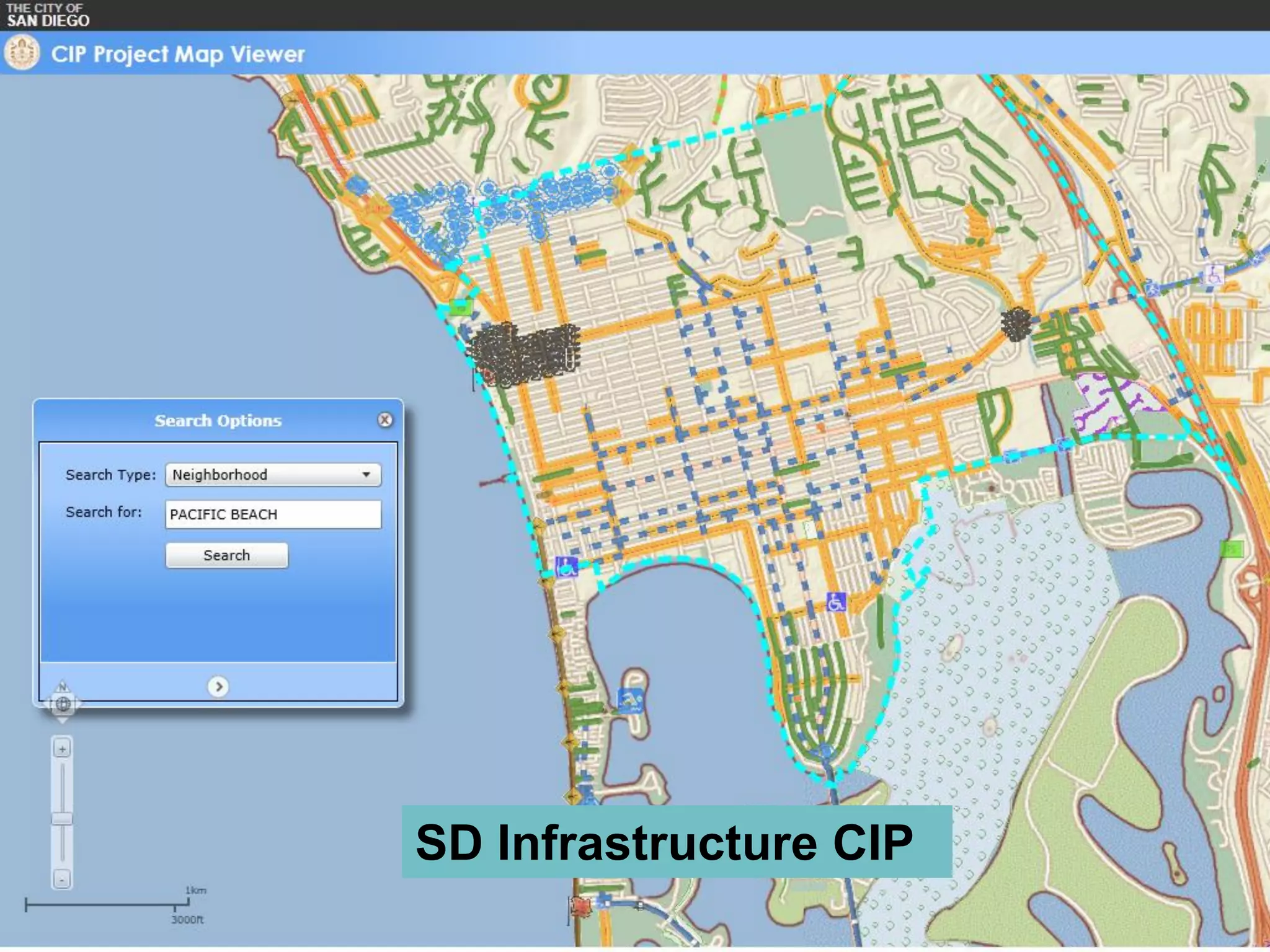
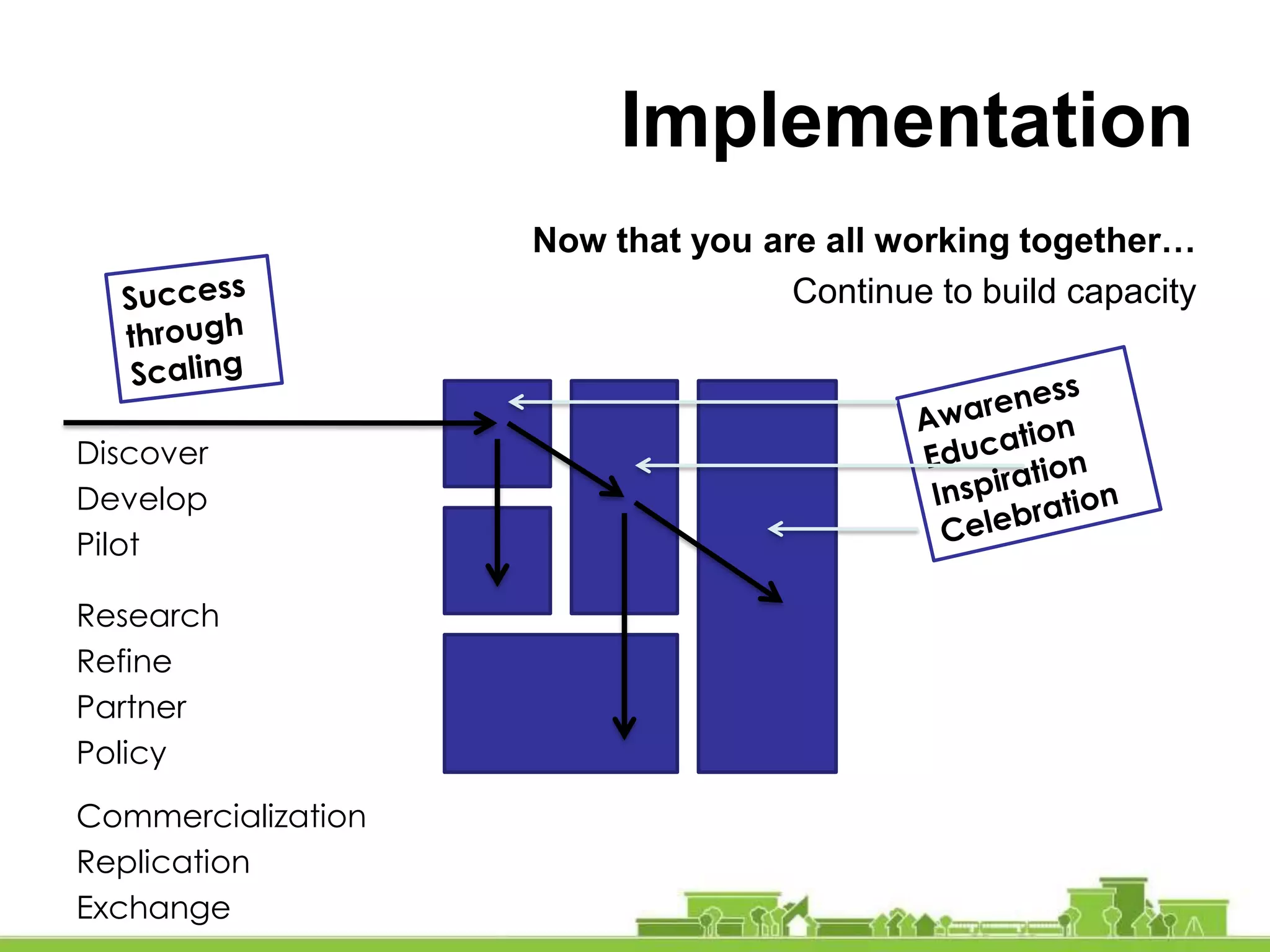
Pacific Beach and Mission Beach are coastal communities within the City of San Diego. This American Institute of Architects SDAT report summarizes recommendations to become a model sustainable community. The goal is to generate grass-roots local action to define issues and create an Eco-District, with strategies and solutions that can be applied to other neighborhoods.
The document contains a presentation on transportation planning for a city. It discusses goals of mobility, health, safety, accessibility and affordability. It notes challenges like limited road space, overcrowded transit, and climate change. The presentation outlines directions for various modes of transportation including promoting walking, cycling, and transit use over private vehicle trips. It proposes targets for increasing sustainable trips and reducing car dependence. Specific strategies are provided for land use planning, goods movement, and managing motor vehicles. The document concludes with a discussion of monitoring progress towards the transportation goals.
This document summarizes Virginia's new street connectivity policy. It provides background on transportation funding challenges in Virginia and outlines Governor Kaine's initiatives to improve coordination between transportation and land use planning. It describes the new subdivision street acceptance standards developed, which require street networks to connect to existing transportation infrastructure and minimize impervious surfaces. The document addresses concerns about the policy, such as impacts on traffic speeds, emergency response times, development costs, and local government approval of connections. It argues the policy improves safety, dispersal of traffic, and emergency access compared to conventional cul-de-sac designs.
This document summarizes the benefits of smart growth development compared to urban sprawl. It discusses how smart growth leads to lower household transportation costs, safer communities, healthier lifestyles, and preservation of farmland and green space. Smart growth also provides more mobility options, reduces infrastructure costs, and achieves equity goals. While requiring some additional upfront subsidies, smart growth provides significant long-term economic, social, and environmental returns on investment. Professional organizations support smart growth policies for their multiple advantages over sprawl.
This document discusses how implementing Complete Streets policies can save money compared to traditional road projects that only focus on vehicles. It provides many examples from cities that were able to build features like sidewalks, bike lanes, and pedestrian islands through low-cost changes and incremental improvements. Reallocating existing budgets and right-sizing roads based on actual transportation needs rather than predicted growth has allowed cities to reduce project costs by millions while increasing safety and accessibility for all users.
Complete Streets are designed and operated to enable safe access for all users, including pedestrians, bicyclists, motorists and transit riders of all ages and abilities. Complete Streets policies ensure that transportation planners and engineers consistently design and construct the entire right-of-way to accommodate all anticipated users. Adopting a Complete Streets policy changes transportation decision-making processes to incrementally create a fully connected street network that meets the needs of all road users. Case studies show that Complete Streets projects have resulted in economic development, public health gains, and reduced crashes and congestion in various communities across the United States.
Mid pen car light housing - march 26, 2018Adina Levin
MidPen Housing presented on developing affordable housing near transit. They have a proven track record developing over 7,500 homes. They discussed best practices like zoning that allows higher density, parking ratios below 1 space per unit near transit, and providing unlimited transit passes to residents. They provided examples of projects they developed with densities from 46-68 units/acre and parking ratios from 1.5 to 1.8 spaces per unit located near Caltrain and bus lines that include affordable housing components.
Complete Streets means creating streets that are designed and operated to enable safe access for all users. People of all ages and abilities are able to safely move along and across streets in a community, regardless of how they are traveling. Nationally 625 communities and 27 states have adopted complete streets policies including the following cities in Oklahoma: Tulsa, Edmond, Guthrie, Lawton, Sand Springs, and Collinsville.
These policies vary among jurisdictions from a global application to all street projects (public and private) to policies that focus on specific areas or applications. Transpiration staff is currently working with a citizen committee to develop a Complete Streets policy recommendation for Stillwater.
Complete streets activists call presentation - part 1rachel_butler
Complete Streets activists call for policies that ensure safe access for all users of roads, including pedestrians, bicyclists, and public transportation riders. A Complete Streets policy requires that new and retrofitted roads accommodate all users through features like sidewalks, bike lanes, and safe crossings. Over 700 jurisdictions have adopted such policies in the U.S. Advocates argue that Complete Streets improve safety, health, mobility, and economic opportunities in communities.
This document discusses repurposing parking spaces to create public spaces like parklets and bike corrals. It provides an example of the first parklet and bike corral created in Lexington, MA. The goals were to promote placemaking and economic benefits. Placemaking is about creating good public spaces to promote community health and well-being. Studies show bicyclists and pedestrians spend more overall at local businesses than drivers. The document outlines a 6-step approach used in Lexington, including piloting projects, documenting success, and building on success. Key questions for communities to consider are outlined.
This document summarizes the many benefits of Complete Streets, which are streets designed to enable safe and convenient travel for all users, including pedestrians, bicyclists, transit riders and motorists of all ages and abilities. Complete Streets can benefit older adults and people with disabilities by improving accessibility, benefit children by encouraging physical activity and independence, improve safety for all users by reducing speeds and adding infrastructure like sidewalks and crosswalks, promote better health by facilitating active transportation, boost local economies through increased business and property values, and create more livable communities.
This document discusses strategies for addressing concerns that Complete Streets policies are too costly. It provides four key answers: 1) Complete Streets are necessary to accommodate existing users like pedestrians, cyclists, and those with disabilities; 2) Complete Streets can be achieved within existing transportation budgets; 3) Complete Streets can lead to new funding opportunities; and 4) Complete Streets add lasting value to communities. It emphasizes using real examples, photos, statistics, and quotes to show the needs of vulnerable users and that the up-front costs of Complete Streets are outweighed by their long-term benefits.
Upper Green Side conducted a survey with over 200 residents of the Upper East Side about their transportation patterns a views on how to reduce congestion and promote more sustainable modes.
This presentation provides an overview of Complete Streets. Please visit www.completestreets.org for more information.
This presentation is free for for non-commercial use. For-profit entities wishing to use our presentations and materials in working with clients should contact us at sseskin [at] completestreets [dot] org.
The document discusses the DECOBIKE bike sharing program in Miami Beach and the opportunity it provides for an exclusive annual corporate sponsorship. Key points include:
- DECOBIKE is a new zero-emission public transit system in Miami Beach consisting of electric bikes and stations located throughout the city.
- The sponsorship would provide extensive outdoor advertising, branding on the bikes and stations, and guaranteed media exposure to tens of millions of impressions per month.
- In exchange for financial support, the sponsor would gain goodwill by supporting a green, healthy transportation initiative that improves the environment and community well-being.
This document discusses funding opportunities for Complete Streets projects from various sources. It provides examples of cities that have passed voter-supported transportation funding measures for multi-modal projects. Surveys show public support for spending on walking, biking and transit over road expansion alone. Examples are given of cities that obtained federal grants or private contributions to fund Complete Streets projects. Adopting a Complete Streets policy can make a city more competitive for certain sources of local, state and federal transportation funding.
This document discusses strategies for implementing temporary demonstrations, called Better Block projects, to test urban design improvements. It provides examples of past Better Block projects focused on testing bike infrastructure, pedestrian areas, and traffic calming. The document advocates using temporary and low-cost materials like chalk and cones rather than permanent infrastructure, to test designs without large upfront costs. It argues this approach removes barriers of permanence and assumptions, allows real-time adjustment, and fosters community involvement. The goal is to create safer, more shared and inviting public spaces that encourage people to stay.
Pune Pedestrians Day - December 11 2021Ranjit Gadgil
The document provides details about the Lakshmi Road Open Street Mall initiative in Pune on Pedestrian Day (December 11th, 2021). Key points:
- The initiative aimed to pedestrianize a 500m stretch of Lakshmi Road to improve the shopping experience and business for local shops.
- Planning involved stakeholder consultations, awareness campaigns, and design of the street layout with designated spaces.
- On the event day, the street was transformed using temporary materials like paint and pots. Various activities were organized.
- Feedback found high support for repeating the initiative from pedestrians, shopkeepers and vendors. Improved footfall and environment were observed.
- Some concerns around parking and
In this project, we sought to connect people to nature, promote equitable transportation (including access to multi-use trails, light rail, heavy rail, and blueways), preserve housing affordability, and establish a Lindbergh neighborhood identity through place-making.
I-75 / University Drive: An Interchange Under Pressure Becomes a DiamondOHM Advisors
John Katers, PE and Pat Wingate, PE present I-75 / University Drive: An Interchange Under Pressure Becomes a Diamond at the 2016 Ohio Transportation Engineering Conference.
The document discusses proposals for an "Outer Beltway" road in Northern Virginia and alternatives to address traffic issues in the region. It summarizes that the Outer Beltway has been proposed and rejected multiple times due to high costs and not effectively addressing transportation needs. Concerns about the current proposal include environmental impacts, induced development, and not aligning with where most people live and work in the region. The document advocates focusing transportation funding on improving existing east-west corridors and expanding public transit options instead of the Outer Beltway.
The Minneapolis Bicycle Story David PetersonTrailnet
The Minneapolis Bicycle Story provides a history of bicycle planning and infrastructure development in Minneapolis over several decades. It details how an extensive system of off-street parkways and trails were established beginning in the early 1900s. In the 1970s, the first on-street bike lanes were installed and a system of on-street bike routes was developed downtown in the 1990s. Major opportunities like bridge reconstructions have been leveraged to improve bicycle facilities. Today, Minneapolis has over 85 miles of off-street trails and a growing network of on-street low-stress bikeways through strategies like bike boulevards and protected bike lanes. Coordination between numerous city departments and external organizations has been key to funding and implementing the bicycle network.
This presentation was part of my senior capstone course, Environmental Impact Assessment. I and four other seniors produced a report and final presentation of our LEED ND analysis of the squalicum lofts development in Bellingham, WA.
South Park Blocks Parking - Portland Downtown Neighborhood Associationmazik
Explains the Portland (Oregon) Downtown Neighborhood Association's reasons for urging restoration of the 25-year ban on parking in the South Park Blocks.
This document provides information on the costs and benefits of complete streets. It discusses how complete streets can improve public health by promoting physical activity, safety, and access to destinations. Economic benefits include job creation, increased property values and business revenue. Traffic is better managed through complete streets, as evidenced in Portland and Boulder which saw increased biking and walking and decreased driving. User fees do not cover full road costs, and complete streets may reduce costs by offering transportation alternatives.
Forward Thinking: A Study In Transportation, Land Use And Urban Design In Nag...Willy Prilles
Presentation of the University of British Columbia (UBC) Transportation and Land Use Group on June 7, 2007 at the Bicol Science and Technology Centrum, Naga City, in conjunction with their Naga Planning Studio Course.
The document introduces the Design Manual for Urban Roads and Streets (DMURS), which provides new national street design guidance for Ireland. DMURS aims to change the conventional approach that prioritized vehicle movement over other street users. It advocates for a balanced approach that considers streets as places as well as routes for movement. DMURS seeks to create "self-explaining streets" where street design influences driver behavior to naturally reduce speeds and prioritize vulnerable street users through techniques like narrower lanes, on-street parking, and shared spaces. The challenges ahead include overcoming cultural and professional norms focused on vehicle movement and changing misconceptions about liability and legislation.
Smart Growth (A21): The wolf at your front door (part 2)Patti Gettinger
Threats to private property rights from smart growth policies (aka sustainable development, livable communities, Agenda 21), including eminent domain and restrictions to mobility are based on failed socialist models.
The New Urbanism: Design Principles for Vibrant CommunitiesVierbicher
Much of the development that has occurred in Wisconsin and around the nation over the past 60 years has created a feeling of sameness from community to community. Our development pattern has separated uses from one another and catered to cars at the expense of pedestrians, bicyclists, and transit. The New Urbanism promotes the creation and restoration of diverse, walkable, compact, vibrant mixed-use communities built with integrated housing, employment, shops, and schools. It is a revival of the lost art of "placemaking" to raise our quality of life and standard of living by creating neighborhoods, not just subdivisions, and building main streets, not just shopping malls.
This document discusses parking policy in Australian capital city centers and its impacts on transportation and development. It analyzes three case studies - Adelaide, Brisbane, and Perth - and finds that Perth's consistent parking policy approach, which strictly limits new parking supply and uses parking levies to fund public transit, has led to strong city growth while improving pedestrian access and reducing car traffic compared to the other cities. The authors conclude that integrated land use, parking, and transit policies are needed for sustainable growth of city centers to accommodate more people with less reliance on private vehicles.
Todd Litman, Victoria Transport Policy Institute - Use of Public Space for S...INVERS Mobility Solutions
The document summarizes strategies for more efficient use of public space for shared mobility. It advocates designing communities around people rather than cars by promoting compact, mixed-use development served by walking, cycling, and public transit over personal automobiles. This can provide economic, social, and environmental benefits while reducing transportation costs. Strategies discussed include carsharing, complete streets that accommodate all road users, and parking management.
Land Use & Transport Planning_Istanbul IETT Workshop 4_15 June 2015VTPI
The document summarizes a presentation on integrating public transport and land use planning in Istanbul, Turkey. It discusses how Istanbul aims to protect its historic center through sustainable transport, including improving mass transit. It recommends making Istanbul's historic center more walkable, bikeable, and accessible through public transit. The presentation also promotes transit-oriented development, complete streets, and other smart growth policies to create a more people-oriented city and reduce automobile dependence.
Istanbul IETT Professional Development Workshop, #4 of 6_Transit & Land UseVTPI
Istanbul IETT Professional Development Workshop, #4 of 6, Transit & Land Use
Presenter: Todd Litman, Victoria Transport Policy Institute
Assistant: Aysha Cohen, UCLA Institute of Transportation Studies Scholar
Presentation Date: June 15, 2015
This document summarizes a study and design process for upgrades to King William Road in Adelaide. Key points:
- A 2014 masterplan introduced a "Curated Street" concept to renew the aging pavement, address high vacancy rates, and allow flexibility in space use.
- A 2017 perception study surveyed businesses, visitors and residents to understand issues and priorities for improvement. It found a desire for more outdoor spaces and pedestrian access.
- An extensive design process developed three options for street upgrades, with strong community preference for the "Beautiful Street" option with more greening, outdoor areas, and pedestrian access over retaining parking.
- Challenges included balancing parking needs with creating an attractive public realm, while ensuring
Join The Sarasota Chamber, in partnership with Gulf Coast Community Foundation and SRQ Media, as we explore the facts, plans, and future of mobility and transportation in the Sarasota region. This six-week series will cover everything from traffic basics and land use impacts, to traffic studies and roadway improvement plans, and will wrap-up with a look at creative solutions.
What We Will Cover:
Healing The Grid
Multi-Modal Connectivity
New Bridges
Complete Streets
Featured Speaker:
Andrew Georgiadis
President, Georgiadis Urban Design
See Herald-Tribune's Article: http://sarasotaheraldtribune.fl.app.newsmemory.com/publink.php?shareid=0a1ec5b3f
Financing Regional Rail by Michael Burrill of Grow Smart Planet (April 2018)Michael Burrill
This document discusses how to finance regional rail transit without raising taxes through transit-oriented development. It suggests planning high-density development around new transit lines, which can generate billions in tax revenue over 30 years from property and income taxes. This tax revenue could pay off bonds used to build the transit lines without raising taxes. The document reviews different transit modes and cites examples where modern streetcars and light rail have attracted more development and riders than buses or commuter rail.
In 2017-8, Michael Burrill forwarded his ideas on how cities can encourage Smart Growth and fund regional rail transit lines - without raising taxes - to public officials and interested citizens in several cities. Attached are his latest slides that use tax revenues from Transit-Oriented-Development (TOD) in Cincinnati as an example. Most other regions can anticipate similar results - with revenues from TOD at least five to 20 times the cost of new light rail lines.
Beacon Street Construction Proposal 10/15/12Samantha Coren
The community meeting summarized the Beacon Street Roadway and Streetscapes Improvements project in Somerville, MA. It introduced key members from MassDOT, the City of Somerville, and the design consultants. It provided the project history and purpose, which is to improve functionality, flow, and quality of life for all users through roadway, signal, and amenity upgrades. The meeting outlined proposed improvements to utilities, land use, existing conditions, and proposed conditions. It discussed accommodating bicycles through a proposed cycle track and parking study findings and options.
Neighborhood Greenways are a network of existing low-traffic streets that are repurposed to encourage through bicycle and pedestrian trips. The goals are to keep auto traffic below 1,000 vehicles per day to create a comfortable environment for biking, add traffic calming measures to limit speeds to 20 mph, help people safely cross busy streets, and efficiently connect people to key destinations using residential streets. Common tools used for neighborhood greenways include signs, crosswalk improvements, traffic barriers, and speed bumps. The implementation process involves identifying routes, notifying residents, and holding community meetings to discuss plans and get feedback.
Presentation given by Stephanie Pollack, Associate Director of Research, Kitty & Michael Dukakis Center for Urban and Regional Policy, at the Metropolitan Area Planning Council's parking conference, sPARKing New Ideas, Boston, MA, 4/8/14.
Planning & Urban Design Principles for Non-PlannersVierbicher
Much of the development that has occurred in Wisconsin and around the nation over the past 60 years has created a feeling of sameness from community to community. Our development pattern has separated uses from one another and catered to cars at the expense of pedestrians, bicyclists, and transit. The New Urbanism promotes the creation and restoration of diverse, walkable, compact, vibrant mixed-use communities built with integrated housing, employment, shops, and schools. It is a revival of the lost art of "placemaking" to raise our quality of life and standard of living by creating neighborhoods, not just subdivisions, and building main streets, not just shopping malls.
Slide deck used in the Eastside Transportation Association's Legislator briefing held 7/18/2018 at the Master Builder's Association in Bellevue, WA. To watch the recording of the meeting, visit http://stop405tolls.org/2018/07/20/etameeting
The document discusses 20-minute neighborhoods, which aim to allow residents to meet most daily needs within a 20-minute walk, bike ride, or transit trip from home. Key aspects of 20-minute neighborhoods include providing transportation options like walking, biking and convenient transit; having a mix of destinations like schools, grocery stores and parks within close distance; and sufficient population and employment density. The benefits of 20-minute neighborhoods include reduced vehicle miles traveled, improved health, stronger communities and local economies. Cities like Portland and Eugene have implemented aspects of 20-minute neighborhoods.
TOD and Parking: Matching the Requirements to the Neighborhood by Jason Witte...Rail~Volution
This document summarizes a presentation given in Dallas, TX about reducing parking minimums in Minneapolis to promote transit-oriented development and housing affordability. Key points include:
- An advisory group with city staff, council, and stakeholders helped develop new parking regulations near transit.
- The new ordinance allows up to 100% reduction in minimum parking requirements for housing within 1/4 mile of high-frequency bus or 1/2 mile of rail.
- In the first few months of implementation, three housing projects utilized the parking reductions, constructing fewer spaces than the previous minimum.
- The ordinance aims to reduce costs of housing while supporting the city's long-term plans to encourage transit, walking and biking
This document discusses issues with current parking policies and proposes reforms. It notes that minimum parking requirements increase housing costs, affect urban design negatively, and do not consider the true costs of parking. It advocates for performance-based pricing for curb parking where prices adjust to maintain availability, establishing parking benefit districts to fund neighborhood improvements with meter revenue, and reducing or removing off-street parking mandates to allow for more flexible development. The document argues these reforms can address traffic, pollution, and make parking and development more efficient and affordable.
This document discusses transit-oriented development opportunities around existing and planned transit stations in southern New England. It provides information on different transit types and examples of active transit projects. Case studies on successful transit-oriented developments around the Rosslyn Ballston Metro, Portland Streetcar, and Cleveland HealthLine are presented. Challenges to transit-oriented development include local real estate market conditions and achieving higher densities. The document then discusses potential transit-oriented development strategies and scenarios for specific areas in Wallingford, CT and Branchville, CT based on transportation access, land use, market conditions, and infrastructure constraints.
Parisar - Vision for a people-friendly cityParisarPune
The document discusses the need for sustainable transport solutions in cities. It notes that cities today face a mobility crisis due to congestion, a health crisis due to air pollution, and a safety crisis with high rates of accidents. It argues that continuing to build more roads and infrastructure focused on vehicles will not solve these issues and will only increase traffic. The document advocates for designing cities for people rather than vehicles through policies like restricting personal motor vehicles, improving public transit and non-motorized transport, implementing parking and congestion pricing, and creating more pedestrian and cyclist-friendly streets. It provides examples of cities that have successfully implemented such policies and transformed their transport systems.
The document reviews the car parking policy of a district council in the Derbyshire Dales area. It provides information from a citizens panel survey about parking usage and satisfaction. It outlines the council's objectives to review the policy regarding the structure of charges, concessions, parking provision, and information/promotion. The review aims to consider the financial and economic impacts of policies and gather public input to develop a new policy to be introduced in the fall of 2013.
Similar to AIA Communities by Design Pacific Beach/Mission Beach SDAT Presentation (20)
This document provides information on development alternatives for downtown Las Vegas. It summarizes public outreach efforts, including stakeholder meetings, online surveys, and community events. Two development alternatives are presented. Alternative 1 focuses on leveraging existing assets and establishing downtown as a cultural capital. Alternative 2 focuses on creating mixed-use lifestyle hubs centered around transit. Both alternatives include proposed land uses, estimated build out sizes, driving market forces, and transportation and open space improvements.
CPR Yards Crossing Study - open house panelsCrowdbrite
CPR Yards Crossing Study
Welcome to our open house
Today we’re talking about ideas to replace the
Arlington Street Bridge and improve crossings over the
CPR Yards. We look forward to hearing your views.
Regan Beach Plan City of South Lake TahoeCrowdbrite
This document presents three preliminary design options for improving Regan Beach in South Lake Tahoe, California. All options include universal accessibility upgrades and enhanced amenities. Option 1, called "The Hub", centers around a multi-use hub area and improves circulation. Option 2, called "Play", expands the beach and play areas. Option 3, called "Restoration", features an adventure play area, dog beach, and overlook area. Each option is depicted in a programmatic map and compared based on space allocation and amenities.
This document outlines 30 strategies for attracting infill development in distressed communities. It defines infill development as new construction or redevelopment in existing urban areas using vacant or underutilized land. The strategies are aimed at overcoming challenges like high vacancy rates, limited public funding, and developer risk that discourage private investment in distressed communities. They involve prioritizing infill areas, adopting supportive policies, forming partnerships, improving community perceptions, and finding funding sources for development and infrastructure. The case study of Fresno, California shows how such strategies were used to revitalize its historic downtown and neighborhoods.
The document summarizes community feedback and a proposed restoration plan for Ala Moana Regional Park in Honolulu. Over 30,000 people provided input on 585 park ideas through an online platform and polls. Common requests were to maintain existing features, not commercialize the park, and make enhancements for local residents. A draft plan proposes guiding principles and initial phases to hire more staff, renovate facilities, repair paths and irrigation, improve beach areas, add a playground, and enhance security and concessions.
SF Rec & Parks 2016-2020 strategic plan Crowdbrite
This Plan is the result of asking, thinking, and listening about how to better serve the people of San Francisco. It is the collaboration of staff, stakeholders, and park visitors, who gave time, talent, and energy, knowing that healthy parks and robust recreation programs make our City thrive.
The document summarizes public input from a workshop and online survey regarding improvements to Ala Moana Beach Park in Honolulu, Hawaii. Over 346 people participated in the workshop where they identified priorities and ideas in small groups. Top workshop priorities included beach and sand restoration, bathrooms, park greening, safety, and pathways. The online survey saw over 27,000 interactions from over 2,800 respondents. Top online priorities were similar and included maintaining open spaces, improving bathrooms, and preserving the park's character. Next steps discussed were improving facilities, access, and park management.
The document discusses the benefits of exercise for mental health. Regular physical activity can help reduce anxiety and depression and improve mood and cognitive function. Exercise causes chemical changes in the brain that may help protect against mental illness and improve symptoms.
The document discusses transportation and land use (T&LU) as it relates to greenhouse gas (GHG) emissions at a port. It notes that recreational boating, on-road vehicles, off-road equipment, lodging, restaurants, and other transportation account for 35% of the port's 2006 baseline GHG emissions. The port aims to reduce GHG emissions from transportation and land use by 57% by 2020 through various initiatives and strategies around improving traffic flow, increasing alternative fuel vehicles, updating parking policies, improving transit, reducing vehicle trips, and encouraging land use that supports efficient transportation.
This document summarizes a workshop on design alternatives for improving the SR 75 tollbooth plaza gateway to the city of Coronado. It provides an overview of the project and community outreach process. It then outlines six proposed design frameworks - preserving or removing existing structures and narrowing the right-of-way, adding a roundabout, creating a boulevard, using a curved alignment, or a cut-and-cover tunnel option. Examples of similar gateway projects are shown. Community members are invited to provide input on the alternatives through an online poll by July 4th to help identify a preferred design.
Honolulu Downtown Tod Plan_draft_final_5-15Crowdbrite
This document provides an introduction and overview of the Downtown Honolulu Neighborhood Transit-Oriented Development Plan. The plan aims to guide development around the three planned Downtown rail stations (Downtown, Chinatown, and Iwilei) to maximize the benefits of the new rail system. The rail project will improve transit access and speeds, with the Downtown station projected to be the second busiest. The TOD plan seeks to promote higher density, mixed-use development within walking distance of the stations to further boost transit ridership and walkability. The objectives are more efficient land use, reduced traffic congestion, and revitalization of Downtown and Chinatown.
Honolulu TOD downtown community meeting 05/12/15Crowdbrite
The community meeting presented the Downtown Neighborhood Transit Oriented Development (TOD) Plan to the public. It discussed the planning process and timeline, purpose of creating a community vision with land use strategies and transportation improvements. It highlighted the major strategies of the plan, including creating a vibrant mixed-use downtown, enhancing the waterfront, expanding housing, and improving transportation networks. The meeting also covered implementation through zoning changes and next steps to bring the plan to adoption.
Ala Moana Park combined online and workshop reportCrowdbrite
This document summarizes public input from a workshop and online discussion about improvements to Ala Moana Park in Honolulu. Beach and sand replenishment, bathrooms and maintenance, restoration and greening of the park, safety and security, and pathways and trails were the top five suggested park improvements. Next steps identified included addressing vehicular access and circulation, improving existing facilities, developing new facilities, and improving event coordination and park management. The workshop results provided more details on specific suggestions within each category.
In march 2015 more than 225 people filled out post cards indicating what they love about Ala Moana Beach Park. This was step one of a planning process for the park launched by the City & County of Honolulu.
This document provides a history of Ala Moana Park in Honolulu, Hawaii from its origins in the 1920s to 1987. The park was conceived in the 1920s by socially prominent women's groups who wanted to beautify Honolulu. It was developed in the 1930s through New Deal public works programs which constructed its sports facilities, bridges, and landscaping. Throughout its history, the park has balanced increasing demands for development with preserving its original design and purpose as a public space.
Trichogramma spp. is an efficient egg parasitoids that potentially assist to manage the insect-pests from the field condition by parasiting the host eggs. To mass culture this egg parasitoids effectively, we need to culture another stored grain pest- Rice Meal Moth (Corcyra Cephalonica). After rearing this pest, the eggs of Corcyra will carry the potential Trichogramma spp., which is an Hymenopteran Wasp. The detailed Methodologies of rearing both Corcyra Cephalonica and Trichogramma spp. have described on this ppt.
A Comprehensive Guide on Cable Location Services Detections Method, Tools, an...Aussie Hydro-Vac Services
Explore Aussie Hydrovac's comprehensive cable location services, employing advanced tools like ground-penetrating radar and robotic CCTV crawlers for precise detection. Also offering aerial surveying solutions. Contact for reliable service in Australia.
GFW Office Hours: How to Use Planet Imagery on Global Forest Watch_June 11, 2024Global Forest Watch
Earlier this year, we hosted a webinar on Deforestation Exposed: Using High Resolution Satellite Imagery to Investigate Forest Clearing.
If you missed this webinar or have any questions about Norway’s International Climate & Forests Initiative (NICFI) Satellite Data Program and Planet’s high-resolution mosaics, please join our expert-led office hours for an overview of how to use Planet’s satellite imagery on GFW, including how to access and analyze the data.
18. 18
Access to Fresh Food
1/3 of the census tract's population live more than one mile from
a supermarket or large grocery store with access to fresh food
Source: USDA
48. Incentives
Free Shuttle Loop
Light Rail Station to Beach
Paid for by Parking Revenues
Better Pedestrian Experience
Make Walking/Biking/Etc. less
scary and more enjoyable
49. • Tired retail stock on corridors
• Entertainment distorts lease rates
• Services that fail to meet local needs
• Perception of lack of local control
• Insufficient land for residential demand
• Lack of walkable/bikable streets
• Lack of workforce housing
• Lack of employment diversity
Current issues
50. 2011 data show that in Pacific Beach
•±30,000 employed persons lived here
•±27,000 of these worked elsewhere
Of the ±22,000 jobs here:
•±3,000 were held by residents
•±19,000 were held by non-residents
90% of employed residents commute outside
Jobs and Housing
51. • Commutes = ±73,000 car trips per day
• 70% local jobs <$3,333 per month
The consequence:
• Most Inflow commuters can’t afford to live
here
Jobs and Housing
52. • AAA: car cost ±$8,950 per year
• No car = monthly subsidy of ±$300-
$500 per month per car not owned
• 2 car household gains $600 to $1,000
per month rent subsidy
Affordability and Cars
53. • To achieve this people must work within
walking, biking or transit access
• A family with 2 cars that moves near to
work and gives up cars can move from
$800 per month rent to $1,800 per
month with no change in disposable
income
Affordability and Cars
54. Mixed Use Economics
• Costs more
• Current rent for retail ±28/sf
• Current rent for bars over $40/sf
• Beyond current rent for any but bars now
• Residential feasible now
• Solution: insist on form where necessary
but allow ground floor occupation by other
land uses
55. Current Values per SF
Value highest at
beach but
variable elsewhere
Indicates potential for
value capture in
other areas
60. • Create walkable, bikable networks
• Concentrate retail/commercial
• Consider putting liquor licensing and
location under local land use controls
• Consider adding land use oversight to
location of controversial land uses
• Make your corridors transit ready
Recommendations
61. • Modify area zoning to:
• Increase multifamily residential
density
• Implement mixed use incrementally
• Enable no-car projects
• Create an urban framework for residents
Recommendations
63. • Creates pedestrian network for
neighborhoods
• Connects Garnet and Turquoise by
greenway at Cass
• Concentrates retail/commercial
destinations
• Enables value capture by changed zoning
Urban Framework
64. • Increases corridor residential density
• Increases retail sales per square foot
• Increases market for neighborhood
services
• Starts virtuous cycle for change
Urban Framework
65. Priorities:
• To increase site self sufficiency
• To increase tax revenue
• Creative re-use of structures if
possible
• Enable immediate opportunities
• Use community plan to target areas
Market Demand Zone
66. Replaces current arterial commercial zone
Requirements:
• Market flexibility
• No minimum parking requirement
• District parking solutions required
• Retail only required at designated clusters
• Residential density to 35 du per acre
Market Demand Zone
67. Requirements:
• Stand alone retail in clustered destination
• Retail in mixed use allowed on Garnet, and
Turquoise anywhere
• Second floor residential allowed anywhere
• Form for retail required where necessary, but
• Retail use not required until market support
exists
Market Demand Zone
68. Advantages:
• Responds to market demand now
• Set form for future market where desired
• Captures maximum value for low-value sites
• Provides options to profit for existing owners
• Begins process of change at no public cost
Market Demand Zone
69. • Adjacent to corridors allow rise to 35 du/acre
• Leave zone unchanged at transition to SFD
• Allow no-car projects within walking distance
of services
• Use community plan to target areas
Current Multifamily Zone
70. • Allow rise to 12 du/acre everywhere
• Allow small lot alley loaded development at up
to 20 du/acre
• Allow courtyard housing at up to 20 du/acre
• Allow no-car projects within walking distance
of services
• Use community plan to target areas
Current SFD Multi-unit
71. Local Public Funding
• Grants and Donations
• CDBG from HUD
• EPA-smart growth, water,
brownfields etc
• Dept of Transportation/FTA
• See www.grants.gov
72. Local Public Funding
• Tax Credits
• Workforce and Senior housing
• New Market in eligible tract
• Job Creation grants (CDBG)
• Down payment assistance
• Façade improvement grant
and loans
73. Vehicles for Projects
• Public Development Corporations
• CDFI’s and CDC’s
• Public Private Partnerships
• Private Development
74. Vehicles for Projects
• CDFI’s and CDC’s
• Can use both public and private
funds and grants
• Can form as consortia with banks
and others or as simple non-profit
• Can enable New Market credits
75. Vehicles for Projects
Public Private Partnerships
• May need to create at city level
• Require separate accounting of
sources and funds
• Private portion bonds are taxable
• Especially effective with CDC’s
• Locally Barnhardt School, YMCA,
Petco Park, Liberty Station, others
77. Trends “Driving” Change…
• Rising/fluctuating fuel prices
• Health & environmental concerns
• Technology
• Aging population
• Rising maintenance needs and
costs + declining transportation
revenue (gas tax).
• Increased urbanization & resulting
traffic
San Diego VMT Per Capita
78. Other Important Trends
Millennials are driving less –
from 2001 to 2009 down 23
percent (National Household Transportation
Survey)
K-8 children walking to
school increasing – from
2007 to 2012 up 27 percent
increase (National Center Safe Routes to
School)
78
79. Commuting Trends
Commute trips make up
less than 20% of all vehicle
trips during peak hour -
from 1969 to 2009, down
from 45% (National Household
Transportation Survey)
Half of all trips are less
than 3 miles, yet 80% of
these are made by car
(National Household Transportation Survey)
82. 82
Land Use Evolution
Transportation Evolution
Mode of
Travel
Route
Choice
AccessibilityAffordability
Attractions
Destination
Choice
Transportation & Land Use Integration
83. What are commonly sited
transportation goals?
We heard…
• More walkable and bikable community
• Safety
• Less traffic congestion
• Better travel options with more connection
84. What are the commonly
cited barriers?
We heard…
• Wide, fast streets without crossings or bike
facilities
• City is a through way for traffic
• Crime as a deterrent to walking
• Not enough parking
• Bus services are infrequent
• Car culture
85. Mission Beach
and Parking:
More or Less
What is the capacity
problem?
Is the beach too full?
No.
Almost. There is
usually a little
turnover.
Sort of…
Are the streets at
capacity?
Is the parking full?
86. 30 min.
Mission Beach
and Parking:
More or Less
What is the capacity
problem?
The maximum
tolerable delay on the
access streets is about
30 minutes , or
people choose to go
elsewhere
30 min.
87. 30 min.
Mission Beach
and Parking:
More or Less
What is the capacity
problem?
Transit is not likely to
reduce the delay –
there are only two
routes in and out, and
there is no opportunity
to give transit priority –
buses are in line, too;
if taking a bus makes
the wait the same or
longer, people won’t
take the bus.
30 min.
88. 30 min.
Mission Beach
and Parking:
More or Less
What is the capacity
problem?
It is not practical to
increase the supply
of parking
If you could, then you
could pack some more
people in (equal to the
number of new parking
spaces), but the
delays would re-occur,
and transit still won’t
work
30 min.
P+
89. Mission Beach
and Parking:
More or Less
If you dramatically
reduce the amount of
parking so that very
few (or no) day visitors
can drive to the beach,
then very frequent
buses could bring
many more people
with less delays that
occur today.
This would be very
costly, and probably
impractical.
Buses only – small
delay
Buses only – small
delay
90. Mission Beach
and Parking:
More or Less
Enhanced bike
access may be
possible and the
only practical
method to increase
access to the beach.
95. Pacific Beach Connection to the Commons: Water Views and Access
Grain of the Fabric
Putting it All Together:
Vehicle Framework Today
Moving to and From: Streets that are Streets
Connectors
96. Pacific Beach Connection to the Commons: Water Views and Access
Grain of the Fabric
Putting it All Together:
Vehicle Priority
Connectors
Moving to and From: Streets that are Streets
97. Pacific Beach
Grain of the Fabric
Putting it All Together:
Walking, Water, Green Priority
Moving to and From: Streets that are Streets
Connection to the Commons: Water Views and Access
Connectors
148. A long range vision …
Broadway, Seattle WA – Alta Planning + Design
149. First Steps to Start Tomorrow
Low Cost & High Benefit Projects
• Improve Conditions for Biking
• Engage the Community
• Put the Pedestrians First
• Apply Both Transportation Incentives &
Disincentives
• Stoke the Bicycle Economy
151. What is a Neighborhood
Greenway?
Residential streets
with low traffic
speeds and volumes
of auto traffic where
bicycle and
pedestrians have
priority.
162. Prioritizing Pedestrians –
Design Principles
• Confine high speed roads to edges of urban
area
• Limit speed in urban areas
• Limit size of roads or streets in urban areas
• Maintain a connected or grid network
• Consider boulevard and avenue designs to
retrofit arterials to better accommodate
pedestrians and cyclists
Creating safety, convenience, and supporting neighborhood identity
163. Queen Ann
Density: 7,900
people per square mile
Walk Score: 88
“Very Walkable”
Ave Rent (2 beds) - $2000+
Seattle Example - Walkscores
North Beach
Density: 4,500
people per square mile
Walk Score: 33
“Car Dependent”
Ave Rent (2 beds) - $1000
vs.
164. Pacific Beach Mission BayMission Beach
Density: 9,400
people per square mile
Walk Score: 71
“Very Walkable”
Ave Rent (2 beds) - $1400
Density: 4,089
people per square mile
Walk Score: 56
“Somewhat Walkable”
Ave Rent (2 beds) - $1300
Density: 6,072
people per square mile
Walk Score: 59
“Somewhat Walkable”
Ave Rent (2 beds) - $1600
Tribeca Neighborhood – NY
Density: 37,000
people per square mile
Walkscore: 99 – Walker’s Paradise
Ave Rent (2 beds) - $5000+
Mission Neighborhood, San Fran
Density: 19,000
people per square mile
Walkscore: 96 – Walker’s Paradise
Ave Rent (2 beds) - $4500+
For Comparison:
Comparison Rent & Walkscores
165. • Each point increase in your community WalkScore correlated to a $500 to
$3000 increase in home values.1
• Houses with above average levels of walkability command a premium of
about $4,000 to $34,000 over houses with average walkability. 1
• Over 80 percent of residents regularly walk to run errands when retail
and services are one-fifth of a mile or less from most homes.2
• BUT - when that average distance between homes, retail and services
increases to half of a mile, the share of even periodic foot travelers drops
significantly – 30% or less. 2
Walkability is where the money is !!
1 Cortright, Joe. 2009. Walking the Walk: How Walkability Raises Home Values in U.S. Cities. CEOs for Cities.
2Handy, Susan, K. Butler, and R.G. Paterson. 2003. Planning for Street Connectivity – Getting from Here to There. Chicago: American Planning Association.
Find More at: http://www.walkscore.com/professional/walkability-research.php
166. Pedestrian Design
Supporting Village Housing
• Single-family home with 2 cars
generates 12-14 metric tons
• A household in denser urban
housing with 1 car generates
6-8 metric tons
• A household in denser urban
housing with no car generates
3-5 metric tons
-- Source Climate Trust Portland, OR
168. Incentives and Disincentives
Parking Management - San Diego’s car
sharing and new bike sharing programs can help
the neighborhood avoid & reduce parking demand
and contribute to more balanced transportation
system.
Capital Bike Share and Car Share – Washington DC
172. The Challenge Opportunity: better
balancing the regional need for freeways
and tourist automobile traffic with the
neighborhood need for a vibrant family
friendly pedestrian environment.
Octavia Boulevard, San Francisco
178. Green Infrastructure in Context
City of San Diego General Plan
• Mobility
• Housing
• Conservation
• Noise reduction
• Urban design
• Climate change
Green Infrastructure Retrofit Pilot Program
Conservation
• Climate change adaptation
• Water conservation
• Urban forestry
• Community gardens
• Waste management
• Energy efficiency
• Open space preservation
179. Green Infrastructure and the Community
“Green infrastructure is an approach that communities can
choose to maintain healthy waters, provide multiple environmental
benefits and support sustainable communities”
(http://water.epa.gov/infrastructure/greeninfrastructure/index.cfm)
Mission Bay Stormwater Warning PB Flood Warning
180. Green Infrastructure Objectives
• Protect Water Resources of Mission Bay
– Restore watershed function and eco-capacity
• Reduce Heat Island Effect
– Increase street tree canopy cover
• Improve Urban Habitat
– Promote native species use and biodiversity
• Decrease Energy Consumption
– Provide alternatives to single occupant trips
– Use energy-efficient infrastructure
191. Building Community Capacity
• Tiers of Governance
• Inclusive decision making - VISION
• Maximizing resources for common goals
192. CitySanctioned
Planning Department
Pacific Beach Planning
Committee
Mission Beach Precise
Planning Board
Parks and Rec.
Department
Mission Bay Parks
Committee
Business Improvement
District
Discover PB
Neighborhood
Pacific Beach
Town Council
Mission Beach
Town Council
Organizations
Pacific Beach
Women’s Club
Mission Beach
Women’s Club
Beautiful PB
PB Community
Foundation
Tiers of Governance
193. Inclusive Decision Making
PB Community
Collaborators
PB + MB
Collaborators
Needs to expand What is your shared
community VISION?
A shared vision will provide
all councils, boards,
organizations, and citizens
with a guide for achieving
community goals, desired
improvements, and
sustainability.
194. Maximizing Resources for Common Goals
Multiple groups working together will
yield more results, accomplish more
projects, increase sweat equity, and
shorten timelines.
Integrating budgets from multiple group
partnerships will allow you to
implement projects and/or increase the
scale of community improvements.
Fundraising ideas…
Crowd Source
Crowd Fund
Kickstarter
Tampa Heights Neighborhood
Tampa, FL
195. Ways to Engage
• Meaningful participation
• Engage people where they go
• Inspire citizens to roll up their sleeves
196. Ways to Engage
Meaningful participation
Value every community
member and the time they
spend making contributions to
improve the community.
Make events and projects fun
for community members.
Always ask for input and be
willing to share the load.
205. Programming Public Space
Vacant storefronts to Community Contributors
Filling empty storefront with community
Organizations and projects until there is a
demand for more retail/commercial space.
Example:
DIY tools for filling the gap. Guidelines
for approaching property owners, legal
Issues, insurance, budgets, and more
Turquoise Street
208. Programming Public Space
PARK(ing) Day and Parklets
PB and particularly north PB do not
have the required 2.8 acres of park
space per 1000 people. In fact, the
Congressional District of Pacific
Beach and Mission Beach has the
least amount of park space among all
of the districts.
So how will the community increase
park space for existing residents and
provide 56 acres of new park space
for future growth?
209. Programming Public Space
PARK(ing) Day, Parklets, and
Tactical Urbanism
5-6 parklets will create one
acre of park space.
San Francisco has
guidelines for parklets.
Make them unique to reflect
community spirit.
Major road work is not
needed!
211. Implementation
Now that you are all working together…
Continue to build capacity
Discover
Develop
Pilot
Research
Refine
Partner
Policy
Commercialization
Replication
Exchange