SlideShare a Scribd company logo
1 of 81
Download to read offline
6
A REPORT
ON
SEDIMENTARY TERRAIN MAPPING IN & AROUND SONBHADRA
AND MIRZAPUR DISTRICT (UTTAR PRADESH)
Submitted by:
PRANAV MUKTIBODH
M.Sc.Tech (AGL) IInd SEMESTER
ADMISSION NO. 2010MC0006
Submitted to:
DR. R.K.DUBEY
DR.A.K.BHAUMIK
INDIAN SCHOOL OF MINES, DHANBAD
DEC. 27, 2010- JAN. 06, 2011
7
Contents
ACKNOWLEDGEMENT
CERTIFICATE
Aims and objectives of the field training and abstracts
Abstracts
Page
Chapter 1 Introduction 1-5
Chapter 2. General geology of Lower Vindhyan supergroup 6-18
Chapter 3. Day 1 19-22
Chapter 4. Day 2 23-28
Chapter 5. Day 3 29-36
Chapter 6. Day 4 37-41
Chapter 7. Day 5 42-50
Chapter 8 Day 6 51-58
Chapter 9 Day 7 59-61
Chapter 10 Day 8 62-65
Chapter 11 Day 9 66-68
Chapter 12 Day 10 69-72
Chapter 13 Day 11 73-75
References 76
8
ACKNOWLEDGEMENTS
I take this opportunity to pay my sincere reverence to Dr.R.K. Dubey and Dr.A.K.Bhaumik for their
thorough guidance, constant care, affection and inspiration in the field that made it a memorable event.
I feel grateful to Prof B.C. Sarkar, Head of the Department of Applied Geology for providing necessary
facilities. I express my deep sense of gratitude to Prof T. Kumar, Director I.S.M University, for granting his
kind approval for this field trip.
I am thankful to the Manager of Tirupati Basera lodge, who provided us all an accommodation and
cooperated with us during the entire field work. I am also thankful to the Singh travels for providing the
bus facility to carry us from lodge to field, without which the field work, would not have been possible.
Eventually, I express my thankfulness to all those who were directly or indirectly related in this
training. I would like to ever remember cheerful company of my classmates throughout the training
session.
(Pranav Muktibodh)
Admission No. 2010MC0006
9
CERTIFICATE
This is to certify that Pranav Muktibodh (Admn.No-2010MC0006) a student of M.Sc.Tech IInd
semester, Applied Geology Department, Indian School of Mines, Dhanbad has undergone an Sedimentary
Terrain Mapping Training in and around Sonbhadra region, Uttar Pradesh during December 27, 2010- Jan
07, 2011 under our guidance. He has successfully completed this field-training programme.
(Dr. R.K. Dubey) (Dr. A. K. Bhaumik)
Associate Professor Assistant Professor
Applied Geology Dept Applied Geology Dept
ISM, Dhanbad ISM,Dhanbd
Aims and objectives
10
The main aim of the Sedimentary terrain field training was to study the lithology , its formation,
sedimentary structures and their analysis in field to study the paleocurrent direction and
paleoenvironment of deposition. The details of which are briefed below:
 To identify and mark the contact between different stratigraphic formations.
 To study and identify litho logical pattern of different litho units and their spatial distribution.
 To understand the contact between different lithounits and their depositional pattern in the field.
 To identify the different planar and linear structures, their measurement to ocumentation of any
regional variability.
 To examine the characteristics of different sedimentary processes.
 Establishment of product relationship and documentation of spatial and temporal packaging.
 To detect the palaeoflow direction of each formation and document the change in palaeocurrent
direction.
 To describe the comprehensive geological picture or the sedimentation history of the area.
 Concept of facies and theory behind facies construction
 Methods of environmental identification; lithological composition, sedimentary structures, fossil
content and ichnofacies
 Vertical sequence facies analysis and application to construction of depositional models
 Sedimentary Structures and Palaeocurrent Analysis
 Sedimentary Rock Formation
 Rock composition and classification (clastic and carbonate);
 Textural and mineralogical indicators of maturity, provenance determination
 Behaviour of minerals in the subsurface and their importance in assessing reservoir potential
 Identification of Sedimentary Structures
 Definition of bedform types
 Development of bedforms, fundamental properties of sediment particles in fluid, hydrodynamic
significance; concept of energetics, lower and upper flow regimes, flow variables
 Bedforms and their relationships to sedimentary structures; types and preservation of ripples and
dunes, plane beds, antidunes
 Utility of sedimentary structures, sand body orientation, depositional environment, flow conditions,
palaeoslope and source area
 Measurement and interpretation of Palaeocurrent indicators in core using our proprietary Computer
Aided Goniometry (CAG)
 Identification of different cycle of sedimentation by preparing lithologs .
11
Abstracts
DATE DAY DETAILS LOCATION(S)
27-12-2010 Day 1,
Monday
Made the litholog of a section of rocks
along the Ghaghar river.
Ghurma Village (L1)
28-12-2010 Day 2,
Tuesday
Prepared the Sedimentary litholog for the
rock exposures near the Ghaghar river.
Ghurma Village (L2 & L3)
29-12-2010 Day 3,
Wednesday
Mapping in Ghurma, Limestone Mines site Ghurma Village (L4, L5 & L6)
30-12-2010 Day 4,
Thursday
Prepared the lithologs near of 3 sections of
rocks near the railway track.
Markundi (L7, L8 & L9)
31-12-2010 Day 5,
Friday
Mapped the rock sections and observed
various sedimentary structures including a
herringbone cross bedding.
Markundi (L10, L11, L12, L13,
L14 & L15)
1-1-2011 Day 6,
Saturday
Prepared the lithologs of various well
exposed rock sections
Near Kawai Ghat (L16, L17,
L18, L19)
2-1-2011 Day 7,
Sunday
Noted the Palaeo-current direction
readings by observing various rib and
furrow structures and later plotted them
on a Rose Diagram.
Near Kawai Ghat (L20)
3-1-2011 Day 8,
Monday
Noted the Palaeo-current direction
readings by observing various rib and
furrow structures and later plotted them
on a Rose Diagram.
Near Kawai Ghat (L21 & L22)
4-1-2011 Day 9,
Tuesday
Noted the Palaeo-current direction
readings by observing various rib and
furrow structures and later plotted them
on a Rose Diagram.
Near Kawai Ghat (L23)
5-1-2011 Day 10,
Wednesday
Noted the Palaeo-current direction
readings by observing various rib and
furrow structures and later plotted them
on a Rose Diagram.
Baba Siddhnath Mandir (L24
& L25)
6-1-2011 Day 11,
Thursday
Noted the Palaeo-current direction
readings by observing various rib and
furrow structures and later plotted them
on a Rose Diagram.
Lakhaniya Dari
12
Chapter 1
Introduction
1.1 Introduction
We, the students of II Semester MSc. Tech and VIth semester (MSc. Tech integrated) Applied Geology
were undergone for Sedimentary Terrain mapping (Dec 27 2010-Jan 6, 2011) in and around Sonbhadra
district of Uttar Pradesh .This training was confined to some selected sites of Lower Vindhyan formation
with a view to study (a) The lithology (b) Sedimentary Structures (c) Sedimentary terrain mapping (d)
Paleocurrent analysis. Besides we were also taken to Siddhnathdari and Lakhania dari waterfalls located
in the adjoining Mirzapur District. Geologically district of Sonbhadra and Mirzapur comprises of Rocks of
lower Vindhyan formation
Location and Accessibility
It lies in the extreme southeast of the state, and is bounded by Mirzapur District to the northwest,
Chandoli District to the north, Bihar state to the northeast, Jharkhand state to the east, Koriya and Surguja
districts of Chhattisgarh state to the south, and Madhya Pradesh state to the west. The district
headquarters is in the town of Robertsganj. It is the only district in India which borders four states namely
Madhya Pradesh, Chhattisgarh, Jharkhand, and Bihar. It is located 82.72 & 83.33 East (longtude) & 23.52
& 25.32 North (Latitude) on the survey of India map.
It is easily accessible from all parts of the country and well connected by
Rail, Road & Air. The nearest airport for Sonbhadra is Babatpur which is in District Varanasi & 110 Kms
from Robertsganj (District HQ.). There are direct flights from Varanasi to different major cities i.e. Delhi,
Agra, Khajuraho, Kolkata, Mumbai, Lucknow & Bhubhneshwar etc. and vice-versa.
It is also well connected by rail. The ea est ail ay statio fo Dist ict Head ua te is "ROBERTSGANJ”
which is on the loop line from Chunar (Delhi-Howrah line). There are so many other stations in Sonbhadra
District i.e. Chopan, Renukoot, Shaktinagar etc. The major trains passes through the Sonbhadra are (a)
Moorie Express (8101/8102) (From Tatanagar to Pathankot) (b) Jharkhand Swarnjayanti
Express(8603/8604)(from Hatia to Delhi) (c) Triveni Express(4269/4270)(From Lucknow to
Shaktinagar/Singrauli) (d) Shaktipunj Express (Howrah to Bhopal)
The Sonbhadra is well connected to Lucknow, Allahabad, Varanasi, Mirzapur etc by road. Buses are 24
hours available from Varanasi to Sonbhadra & it will take hardly 2 ½ hours to Robertsganj (Distrcit
Headquarter). The easiest way to come Sonbhadra is by train/air upto Varanasi/ Mirzapur then take a
bus/private taxi to Sonbhadra, which are available 24 hours from varanasi & Mirzapur.
13
Fig. 1.1 Map of India, showing the location of Sonbhadra district (Uttar Pradesh)
14
Fig.1.2 Map showing location of Sonbhadra district in Uttar Pradesh
1.2 Topography and drainage
The district presents a undulating topography,several highlands and lowlands, the district headquarters
at Robertsgunj is located at a topographic high, with its elevation higher than other blocks of he district.
The Sone River flows through the district from east to west and its tributary the Rihand River,
which rises to the south in the highlands of Surguja district of Chhattisgarh, flows north to join the Son in
the center of the district. The Govind Ballabh Pant Sagar, a reservoir on the Rihand, lies partly in the district
and partly in Madhya Pradesh. The district has historic, cultural, and ecological affinities with the
Bagelkhand region. Obra a power project is located in this city. Robertsganj is the main town
15
The topographical map of Sonbhadra District, Uttar Pradesh
16
1.3 Climate
Robertsganj has a relatively subtropical climate with high variation between summer and winter
temperatures. The average temperature is 32°C–42°C in the summer and 2°C–15°C in the winter.
Fig.1.4. Geological map of Central India (Vindhyan Basin)
17
Chapter 2
Lower Vindhyan
2.1 Introduction
The Vindhyan basin is an intracratonic basin covers an aerial extent of 1,66,400 sq.km. Tectonically,
the Vindhyan basin is bounded on the south by the Satpura orogenic belt and close to the boundary passes
the Narmada-Son lineament which is a narrow zone of an echelonally arranged normal faults. Towards
NW the Vindhyan rocks are separated from the Delhi-Aravalli orogenic belt by the Great Boundary
Fault(steep diping reverse fault) trending roughly NE-SW. The western boundary is hidden under the
Deccan traps but possibly the southern extension of Great Boundary Fault beneath the cover of Deccan
basalt forms the boundary.The geophysical data, especially seismic and gravity, and sub-surface drilling
data by ONGC suggest that the Vindhyan Basin extended from the present outcrop limit far to the north
under the Gangetic Alluvium cover. The E-W trending Moradabad fault defines the probable northern
limit of Vindhyan basin in the NW cover. The deepest part of the Vindhyan basin towards North, near the
Himalayan foothill. Towards east, the exposed folded Satpura massive forms the limit of the basin
.However, towards NE, the equivalent of the Vindhyan under the Gangetic Alluvium cover are limited by
the sub-surface extension of Satpura massif, designated as Patna uplift. The Bundelkhand Massif together
with its sub-surface extension towards NE, known as Faizabad ridge lies in the centre of the basin trending
roughly NE-SW and divides the basin in two parts - the western Rajasthan part and the eastern Son valley
part. The Rajasthan and the Son valley areas of Vindhyan outcrops were the sites of two separate basin
atleast during the lower Vindhyan (Semri) time. Two sub-surface transverse ridges of Bundalkhand
Massif, viz. Dholpur saddle on the NW side and Meja saddle in the SE side, also appear to have acted as
barriers during the deposition of lower Vindhyan sediments. During the Vindhyan period, horst and
graben tectonics was prevalent and several basement faults were formed which created many sub-basins
within the master basin.
The Vindhyan Supergroup of India is one of the largest and thickest sedimentary successions ofthe
world. Deposited in an intra-cratonic basin, it is composed mostly of shallow marine deposits. It is believed
to have recorded a substantial portion of Proterozoic time and therefore, likely to contain valuable
information on the evolution of the atmosphere, climate, and life on our planet. It also contains some of
the most disputed fossils of earliest animal life. Despite their importance, the absolute age of these rocks
had remained unknown until recently.
The Vindhyan Supergroup is the thickest Precambrian sedimentary succession of India and the
duration of its deposition is one of the longest in the world. Since the earliest descriptions by Oldham
(1856), Mallet (1869) and Auden (1933) the Supergroup has received a great deal of attention, and
volumes of geological and geophysical data have been gathered. Many of these data have been reviewed
at various times during the last 150 years (e.g., Valdiya et al 1982; Sastry and Moitra 1984; Bhattacharya
1996; Bose et al 2001). The importance of the Vindhyan sequences lies in the notion that because of its
18
ast ess i ti e a d space they co tai i po ta t i fo atio o the e olutio of the Ea th’s
atmosphere, climate, sedimentary cover and life. However, even after decades of scrutiny we have not
fully understood all the records that were uncovered from these rocks. The biggest challenge has been
the difficulty in establishing links between the records found with global phenomena, because we have
not yet determined with certainty the timings of the local events.
Fig.2.1 A map showing the relative stratigraphic boundaries of the Vindhyan supergroup with other
formations.
2.2 Stratigraphy
On the basis of Lithostratigraphic and the chronostratigraphic studies, the entire Vindhyan
Supergroup is divided into four groups as:
1. Semri Group,
2. Kaimur Group,
3. Rewa Group and
4. Bhander Group,
The lithology, general trend and stragraphical relation to each other is described in details
2.2.1 Bhander Group
Shikhaoda Formation (Sharda Formation)
19
The lower part of the formation is of mixed lithology containing sandstone beds encased within shale.
The upper part is dominated by medium-grained sandstones.The lower part represents deposits of storm-
influenced tidal flat system, whereas the upper sandstone-dominated part contains braidplain and eolian
strata (Singh 1980;Chakraborty 2001; Bose et al 1999; Chakraborty and Chakraborty 2001).
Sirbu Shale
This formation begins with oolitic and stromatolitic limestones followed by shales with stringers of
sandstone and siltstone. A lagoonal environment has been inferred(Singh 1980; Chakraborty 2001; Sarkar
et al 2002).
Bundihill Formation (Maihar Formation)
The formation consists of sandstones with interlayers of reddish mudstone. The depositional system
is considered as a tide-storm influenced coastal flat (Bose andChaudhuri 1990; Chakraborty 2001).
Lakheri Formation (Dolni Limestone)
This formation is characterized by limestones, at places stromatolitic, with an intervening unit of
siliciclastics (sandstone-shale heterolithic unit). The depositionalenvironment has been inferred as a
storm-influenced, homoclinal carbonate ramp (Sarkar et al 1996; Chakraborty 2004).
Ganurgarh Formation
The formation is represented by shales with intervening layers of siltstone and sandstone. A tide-
affected, coastal flat system has been inferred for its deposition(Chakraborty et al 1998).
2.2.2 Rewa Group
Govindgarh Sandstone
Pebbly to coarse-grained sandstone representing deposits of a braidplain with patches of eolianites
(Chakraborty and Chaudhuri 1990; Bose and Chakraborty 1994).
Drammondgunj Sandstone
Medium-grained sandstone deposited in shoreface environment (Chakraborty and Chaudhuri 1990;
Bose and Chakraborty 1994).
Rewa Shale (Panna Shale, Asan Sandstone, Jhiri Shale)
Purple to green shale with sandstone interbeds up to several meters thick and meter thick and
volcaniclastic beds (Chakraborty P et al 1996). The inferred depositionalenvironment is inner shelf with
the sand interbeds emplaced by storm flows (Chakraborty and Chaudhuri 1990).
2.2.3 Kaimur Group
Dhandraul Sandstone
This formation is represented by medium to coarse-grained sandstones. The depositional
environments include braidplain, aeolian sandsheet (upper part), braidplain delta(lower part)
(Bhattacharyya and Morad 1993; Chakraborty 1993, 1996).
Mangeswar Formation
This formation is represented by fine to medium-grained, decimeter to meter-thick, tabular sandstone
bodies with shale partings. The inferred depositional environment is storm-influenced inner shelf
(Chakraborty and Bose 1992).
Bijaygarh Shale
20
The lower part of this formation is characterized by a sandstone-shale intercalated unit with the
sandstone/shale ratio decreasing upwards; whereas, the upper part is represented by claystones with
significant pyrite concentration at Amjhor, Rohtas District, Bihar. The succession records gradual
transition from inner shelf to outer shelf (Chakraborty 1995). At the top volcaniclastics occur locally
(Chakraborty et al , 1996).
Ghaghar Sandstone
This is a medium-grained sandstone unit deposited in shoreface environment under the influence of
wave and tide (Chakraborty 1999).
Sasaram Formation
This formation begins with medium-grained sandstone and is followed by a sandstone-shale
intercalated unit. The lower part represents deposits of tide-affected shoreface environment and the
upper part a storm influenced inner shelf setting (Chakraborty and Bose 1990).
2.2.4 Semri Group
Rohtas Formation
This formation begins with massive, plane-laminated and/or stromatolitic limestones followed by an
intercalated unit of limestone and shale. In the western part at Jukehi, Satna District, M.P., the limestones
of the formation are overlain by thick (30 m) volcaniclastic deposits. This volcaniclastic horizon thins
towards east. The overall depositional environment is inferred to be a carbonate platform with a distally
steepened ramp (Chakraborty, T et al 1996).
Rampur Formation
This formation consists of greenish shales with interbeds of sandstone representing deposits of storm-
influenced inner and outer shelf (Sarkar et al 2002).
Salkhan Formation
This formation is well developed in the eastern part of the Son valley in Mirzapur district and is
represented by stromatolitic as well as non-stromatolitic limestones. Thisformation is a lateral equivalent
of Chorhat Formation. A peritidal envornment is inferred for its deposition (Banerjee and Jeevankumar
2003).
Chorhat Formation
This formation is represented by sandstones with and without mud partings and layers. The formation
is well developed in the western part of Son valley in the Chorhatarea of Sidhi District, M.P. The inferred
depositional environment varies from shoreface to tide-storm influenced coastal flat. The formation
yielded some markings claimedto be of trails of triploblastic metazoans (Sarkar et al 1998; Seilacher et al
1998).
Koldaha Formation
The Koldaha Formation begins with a sandstone-shale intercalated unit and gradually becomes clayey.
There are three distinct coarser units within the formation, thebottom-most of which is conglomeratic
containing clasts of the underlying horizons; the other two units are coarse to medium-grained
sandstones. There is also a thinlimestone band occurring below the top-most sandstone unit. The shales
of this formation yielded some markings claimed to be of trails of metazoans (Sarkar et al 1998;Seilacher
et al 1998). The shaly parts are products inner and outer shelf, whereas the encased coarser clastics have
been interpreted as deposits of fan deltas (Banerjee 2000;
Paikaray et al 2005; Banerjee and Jeevankumar 2005).
Deonar Formation
The Deonar Formation is entirely represented by volcaniclastic deposits. There are fine-grained tuffs
along with infrequent thicker and coarser volcaniclastics depositedin outer shelf environment (Roy and
Banerjee 2002).
21
Kajrahat Formation
This formation is overwhelmingly represented by limestones, which are at places stromatolitic.
However, a few interbeds of volcaniclastics and siliciclastics have also beenrecognized. The formation is
best developed in the eastern part at Dala, Mirzapur District, U.P. In the western part, it again crops out
at Kuteswar, Satna District, M.P.They dominantly represent peritidal to subtidal carbonate deposits of a
carbonate platform (Bose et al 2001).
Arangi Formation
This formation is characterized by sandstone-shale intercalation followed by pure claystones. The
formation also contains a few intercalated horizons of fine-grained volcaniclastics (tuffs). The overall
environment of deposition is inner to outer shelf (Chakraborty and Bhattacharyya 1996; Bose et al 2001).
Deoland Formation
This is the bottom-most formation of the Vindhyan Supergroup. It starts with conglomerates followed
by pebbly sandstone and sandstone representing deposits of alluvialfans and fan deltas (Chakraborty and
Bhattacharya 1996; Bose et al 2001).
Fig.2.2 Strike-wise stratigraphic column of the Vindhyan Supergroup in the Son valley prepared by
combining several discrete logs constructed at different locations along the structural strike. The upper
boundary of the column represents the present-day topography. Maihar town has been shown as a
reference location on the topographic profile.
22
Fig. 2.3 A table showing generalized stratigraphic sequence of vindhyan supergroup
23
24
2.3 Geology and Correlations
The Vindhyan basin is bounded to the west by the Aravalli Mountains along the Great Boundary Fault
but is believed to continue uninterrupted beneath the Gangetic alluvial plain beyond the present northern
outcrop limit (e.g., Verma 1991),and below the Deccan Traps in the southwest. The Bijawar Group borders
the southeast margin of the basin. Figure 2.4 gives a geological map and a simple lithological framework
of the Vindhyan Supergroup. The rocks of the Supergroup are exposed in two sectors: Rajasthan in the
west and Son valley in the east. The general belief that many of the Vindhyan formations of Rajasthan are
laterally correlatable with those in the Son valley is difficult to establish in the absence of physical
continuity. Biostratigraphic correlation in the Vindhyans, like the Proterozoic sequences elsewhere in the
world, is not robust. Existing data from carbon and strontium isotope stratigraphy in carbonate formations
do not support this hypothesis (Ray et al 2003). A similar correlation problem exists between the
Vindhyans of Chitrakut–Majhgawan sector and that of the Son valley (e.g., Ray et al 2003).
The Vindhyan strata are unmetamorphosed and mostly undeformed. However, there exist largescale
folds in the Son valley and several post depositional faults in Rajasthan (e.g., Verma1996; Srivastava and
Sahay 2003; Chakraborty, this issue). The Upper Vindhyans in the Bundi– Sapotra–Karauli sector in
Rajasthan are significantly affected by reactivations of the Great Boundary Fault (e.g., Verma 1996) and
hence stratigraphic correlation is tricky. Evidence for any global or local event found in these formations
must therefore be linked carefully with those reported elsewhere in the basin.
The Vindhyan Supergroup is composed mostly of low dipping formations of sandstone, shale and
carbonate, with a few conglomerate and volcaniclastic beds, separated by a major regional and several
local unconformities (e.g., Bhattacharyya 1996). The regional unconformity occurs at the base of the
Kaimur Group and divides the sequence into two units: the Lower Vindhyans (Semri Group) and the Upper
Vindhyans (Kaimur, Rewa and Bhander Groups). The outcrop pattern of the Supergroup resembles a
simple saucershaped syncline (figure 1). It is generally believed that the Vindhyan basin was a vast intra-
cratonic basin formed in response to intraplate stresses (e.g., Bose et al 2001). Detailed stratigraphy of
the Supergroup has been discussed in numerous contributions (see reviews in Bhattacharyya 1996).
25
T able 1. Summary of recent non-contentious geochronological information on the Vindhyan Supergroup.
26
Fig 2.4. A generalized geological map of the Vindhyan Supergroup showing the major lithological units and the sample locations for the age data
that appear in table 1. The right hand side figure is a simplified stratigraphic log of the succession in the Son valley. GBF: Great Boundary Fault.
27
2.4 Structure and tectonics
The Vindhyan rocks show a regional ENE-WSW trend between Sasaram in the east and Hosangabad in the west
in the Son valley.In the eastern Rajasthan the regional trend is NE-SW and near the Great Boundary Fault(GBF) the
trend is parallel to the trend of GBF.The Vindhyan rocks are folded to regional synclinorium with its general E-W axil
trend in the eastern part and changes to ENE-WSW in the western part resulting in a broad northward curvature in
the Son valley.Beyond Bhopal it is not traceable due toDeccan trap cover.In the eastern Rajasthan,the axial trend is
NE-SW.In the Son valley area,the regional fault plunges 10° to 20° westward.The northern limb has gentle dip of 2°
to 10° towards east.In eastern Rajasthan area,the amount of dip ranging from 5° to 15° in Kaimur and becomes almost
horizontal in upper members except in the vicinity of the GBF where the Vindhyans are folded and faulted.
The Vindhyan rocks are more deformed in the southern margin of the basin adjoining the Narmada and Son
rivers and along the GBF in thE Rajasthan area.Along the GBF several large antiforms and synforms are
mapped.Folding in the Southern margin of the basin is confined to a very narrow belt adjoining to Narmada and Son
river.In the eastern and southern Son valley a number of ENE-WSW trending regional faults have been mapped.The
Vindhyan rocks have suffered single phase of deformation.A number of domal structures have been mapped in the
Vindhyan rocks.Conspicuous domal structures are the Jabera dome in the Son valley, Ramgarh dome in kota district,
similar structures are also reported from west of Katni and north Hosangabad . ramgarh dome shows an average dip
of beds ranging from 20° to 45°. It is dissected by number of faults causes this locations of circular outcrop of different
litho unit. The actual region behind the formation is not clear.
Faulting is pronounced in the vindhyan and generally restricted to zones along the Son-Narmoda lineament and
the GBF. In the Son valley area a large number of ENE-WSW and NW-SE striking faults have been mapped.
Sarkar(1981) has described 3 major faults named as Rohinian fault,Ghagra fault and Lami fault. The Rohinian fault
marks the boundary between vindhyan and pre-vindhyan formation. Apart from the faults in the southern margin a
number of faults have been recorded from within the basin. Extensive faulting is recorded near the GBF. This faults
strike ENE-WSW. Two major faults have been recoded in the area------- one located right along the boundary towards
the east and the other (Machilpur fault of Heron) situated well within the basin.
From tectonic point of view it is suggested that the main vindhyan basin is bounded by two crustal fractures one
along the course of Narmada-Son river and the other along theGBF which have got rejuvenated periodically.
2.5 Basin evolution
The Aravalli craton stabilized a billion years before vindhyan sedimentation commenced on it. Vindhyan
sediments dominantly marine deposited in an E-W elongated depository segmented in to smaller NW –SE elongated
sub-basin formed under the combined influence of N S rifting and a dextral shear. After a transitory compression that
was propagated from the southwestern plate margin, rifting ceased. The basin floor then sagged and flattened in
unified fashion under orthogonal extension, although paleo-shoreline alignment sensed little. Throughout the
vindhyan history, terrigenous sediments were derived from a low relief southern source. The source area occasionally
uplifted , but almost never delivered any sediment coarser than granules. During upper vindhyan time, the E-W
elongated basin tilted northward and this coincided with kimberlite intrusion and basin-wide volcanism albeit of
limited scale.
28
The basin-wide unconformity bounded vindhyan supergroup is divided into two sequences by an unconformity
that owes its origin to the transitory compression. Each of the sequences is punctuated by three MFSs (major flooding
surfaces). Almost all this major flooding events coincided with magmatic activity, which was much larger in scale in
the rift stage than in the sag stage. Flooding therefore took place due to tectonic subsidence of the basin.
Short, decameter and meter scale depositional cycles were also terminated by paleo-seismic events. During the
tectonic pulses the depositional sub-stratum tilted. This tilt is recognizable in the rift succession in systematic sense
in northwesterly bed dips resulting in meter scale depositional cycles and complimentary senses in that thickness. In
contrast in the sag stage, the tilt is generally recorded in cm scale slump folds or temporary sharp deflection of paleo-
current direction consistently towards the NE. during the sag stage the landward party of the basin subsided
differentially and resulted in development of parasequences and parasequence sets. The sediment epicenter
however shifted through time. Despite landward differential subsidence, connection of the basin with the open sea
was maintain. The frequency of the NE-SW extension decreased progressively but the orthogonal NW-SE extension,
possibly propagated from the plate margin, maintained a uniform tempo. A relatively higher rate of the former
extension possibly elongated the basin in a NW-SE direction. However with its gradual decline the basin tended to
be relatively more circular or even elongated in NE-SW direction. As a consequence of overall decline in subsidence
rate, the basin eventually filled up completely.
Fig. 2.6 Downdip structural profiles of the Vindhyan succession in the Son valley
2.6 Depositional environments
The environments of deposition for different lithounits vary from beach to barrier bar or shoal through tidal flat
and lagoon, although all such variations remain within an overall shallow marine domain which is supported by :
1) Sheet like geometry of the sedimentary bodies.
2) High textural and mineralogical maturity of the sandstones
3) Glauconitic and Phosphatic accessory mineralogy
4) Presence of stromatolites (in Semri and Bhander groups)
5) Profuse development of shallow water structures such as current and wave ripples, desiccation marks, rain prints,
halite casts, ooids, intraclasts, etc.
29
Although none of the criteria, taken alone is diagnostic of shallow marine origin, their profusion and association
weigh heavily in favour of the above contention. The facies are found to be repeated vertically which signifies
repeated shifting of shoreline through the whole span of Vindhyan sedimentation.
2.7 Sequence stratigraphy
The sequences of the Vindhyan succession are composed of several systems tracts. The different
paleogeographic settings characterizing the systems tracts within individual sequences are as
follows:
Sequence 1:
• TST – alluvial fan–fan delta–shelf (Deoland and Arangi Formations)
• HST – carbonate ramp (Kajrahat Formation)
Sequence 2:
• TST – shelf (Deonar Formation)
• FSST to TST – braid/fan delta–shelf (Koldaha Formation)
• HST – tidal flat–shoreface–shelf (Chorhat and Koldaha Formations)
• TST – shelf (Rampur Formation)
30
• TST – carbonate ramp (Rohtas Formation)
Sequence 3:
• TST – shoreface–shelf (Sasaram Formation)
• FSST – shoreface (Ghaghar Formation)
• TST – shelf (Bijaygarh Formation)
• HST – braidplain–braid delta–shelf (Mageswar and Dhandraul Formations)
Sequence 4:
• TST – shelf (Panna Formation)
• FSST to TST – shoreface (Assan and Jhri Formations)
• HST – braidplain–braid delta–shelf (Jhiri, Drammondgunj and Govindgarh Formations)
Sequence 5:
• TST – tidal flat (Ganurgarh Formation)
• HST – carbonate platform (Bhander Formartion)
• TST – tidal flat to coastal lagoon (Bundihill and Sirbu Formations)
• FSST – tidal flat–braidplain–eolian (Shikhaoda Formation)
31
Chapter 3
DAY 1
Location 1
The study area was located about 12 kms north of District headquarters of Sonbhadra, Robertsganj at
Meenabazar locality along Ghaghar River. N24o
’ . ” a dE o
’ . ”.
Aims and Objectives
(i) Identification of the different lithounits .
(ii) Identification of the lithological features.
(iii) Identification and study of different sedimentary structures present if any.
(iv) Measurement of thickness of various lithounits and preparation of lithology of the section.
Weather
The weather was calm and moist during morning time when we reached the study area by bus, it became hotter
as the day passed by.
Lithology and Structure
The lithology of the area is comprised mainly of Limestone and shale. The Limestones were very thick and blocky.
The broken part of limestone exhibits a sharp edge. Shale is relatively very thin and is pinched out at places. Two
intersecting sedimentary dykes (Sandstone dyke) were also noticed in the field, bearing a cross-cutting relationship
with each other. The trend of the shale was measured as N320o
/9o
→N55o
and the trend of limestone was
N12o
/11o
→N100o
.
The overall thickness of the sedimentary succession was around 7.62 m as calculated by adding up the different
layers. A minor stylolitic structure was found in the limestone bed, also the conversion of Calcite to limestone was
noticed t places, where there were calcite veins.
The lithology of the section was drawn as according to the thicknesses of different sedimentary units. The
measurements are given in the Table 1.
Table 1. Measured Thickness of different lithounits
Lithounit Original Thickness Thickness converted to the Scale (1:25)
Shale 22 0.8
Limestone 10 0.4
Shale 6 0.24
Limestone 38 1.5
Shale 2 0.1
Limestone 8 0.3
Shale 7 0.3
Limestone 15 0.6
Shale 4 0.16
Limestone 18 0.7
32
Shale 5 0.2
Limestone 120 4.8
Shale 5 0.2
Limestone 56 2.24
Shale 6 0.24
Limestone 10 0.4
Shale 2 0.1
Limestone 2 0.1
Shale 6 0.24
Limestone 23 0.9
Shale 4 0.16
Limestone 25 1
Shale 15 0.6
Limestone 50 2
Shale 2 0.1
Limestone 28 1.1
Shale 3 0.1
Limestone 20 0.8
Shale 5 0.2
Limestone 27 1
Shale 5 0.2
Limestone 30 1.2
Shale 5 0.2
Limestone Bottom not exposed
Environment of deposition
The Rohtas Limestone around Ghurma area represents a prograding shelf succession on a ramp. The
colour variation in the limestone indicates the gradation. In this location, the limestone shows spindle shaped
cross laminae within the wavy laminated limestone facies. The deposition occurs in shallow marine
condition.
33
Ghaghar River
Stratigraphy of the area
The lithounits identified as Limestone and shales belonged to Stratigraphy of the area is as mentioned :-
SUPERGROUP GROUP FORMATION STAGE
Lower Vindhyan Semri Group
Rohtas Formation Rohtas Limestone
34
Chapter 4
DAY 2
2.1 Location
On 28.12.2010 we visited the same locality along the Ghaghar river section but the study area was located along
the left bank of Ghaghar River. The area was located N24o
’ . ” a d E o
’ . ” o the map. The trends of the
two piers of the bridge were measured as N 315 o
and N 330o
. The altitude of the area was around 133.5 ±19 m.
2.2 Aims and Objectives
(i) Identification of the different lithounits.
(ii) Identification of the lithological features.
(iii) Identification and study of different sedimentary structures present if any.
(iv) Measurement of thickness of various lithounits and preparation of lithology of the section.
2.3 Weather
The weather was hot and sunny during the entire field day. Cold breezes were felt as we moved back from field
to our lodge in evening.
Location 2
Location of the Study Area
The field of study area was Meenabazar, located at about 200m in the south of Ghurma Hospital. The
site is about 250m in SE direction of the bridge on the Ghagar river. The position parameters of the very
place are:
Latitude : 240
35 51.85N
Longitude : 830
4 7.16E
Altitude : 147m above MSL
Lithology and Structure
The lithology of the area is comprised mainly of Limestone and shale. The Limestones were very thick and blocky.
The broken part of limestone exhibits a sharp edge. Shale is relatively very thin and is pinched out at places. The
general trend of the region was measured to be N300o
/5o
→N30o
The overall thickness of the sedimentary succession was around 5 m as calculated by adding up the different
layers. The conversion of Calcite to limestone was noticed at places, where there were calcite veins. Limestone and
Shale constitute the typical lithology of the area. Mainly two types of lithounits are found , viz. limestone
and shale. At the bottom part we found limestone beds intercalated with shale. As we move to the top the
thickness of shale bed increase and eventually it is converted into clay at the top part. The beds are found to
be disposed near-horizontally and generally not affceted by tectonic disturbances
The lithology of the section was drawn as according to the thicknesses of different sedimentary units. The
measurements are given in the Table 1.
35
Table 1. Measured Thickness of different lithounits
Lithounit Original Thickness Thickness converted to the Scale (1:25)
Shale 22 0.8
Limestone 10 0.4
Shale 6 0.24
Limestone 38 1.5
Shale 2 0.1
Limestone 8 0.3
Shale 7 0.3
Limestone 15 0.6
Shale 4 0.16
Limestone 18 0.7
Shale 5 0.2
Limestone 120 4.8
Shale 5 0.2
Limestone 56 2.24
Shale 6 0.24
Limestone 10 0.4
Shale 2 0.1
Limestone 2 0.1
Shale 6 0.24
Limestone 23 0.9
Shale 4 0.16
Limestone 25 1
Shale 15 0.6
Limestone 50 2
Shale 2 0.1
Limestone 28 1.1
Shale 3 0.1
Limestone 20 0.8
Shale 5 0.2
Limestone 27 1
Shale 5 0.2
Limestone 30 1.2
Shale 5 0.2
Limestone Bottom not exposed
36
Fig. 4.1 A lithology of the location 2 on left bank of Ghagar river.
Stratigraphy
Stratigraphically we were studying the rocks of lower vindhyan supergroup
37
VINDHYAN SUPERGROUP
SEMRI GROUP
ROHTAS FORMATION
ROHTAS LIMESTONE INTERCALATED WITH SHALE
Depositional Environment
The thickness of the shale layer was showing an increasing trend from top to bottom indicating that the deposition
of clay particles took place in shallow marine environment.
Location No.3
Location of the study area
The area was located nearly 400m away from the Ghurma Hospital and approximately 150 m SE of the location 2 .
The position parameters are :
Latitude : 240
37 51.8 N
Longitude : 830
04 7.1E
Altitude : 147m above MSL
Lithology and Structure
Mainly two types of lithounits are found viz., Limestone and shale. At the bottom part we found thin shale beds
(around 1 cm) intercalated within massive limestone beds. As we moved progressively upward to the top, the
thickness of shale bed showed an increasing trend and it is eventually converted to clay overburden on the top, while
the limestone beds thinned out when traced upto the top. The attitude of the bed was measured to be
N310/30
→N 0
Shale beds show pinched out structure.
Stratigraphy
The stratigraphy of the location 3 was same as location2.
Cycle of deposition-
One depositional cycle consists of a set of succession of the lithounits present in the area. By approximate
measurement, we found that there were eleven distinct cycles of deposition
Depositional Environment
The progressively upward increasing thickness of the shale layers indicates shallow marine environment
characterizing marine regression.
38
Fig.4.2 Litholog of the location3
39
Right Bank of Ghaghar River
40
Chapter 5
DAY 3
Location No.4
Date- 29-12-2010
Location
The site was located around 1.5 km north-east of the Meenabazar bridge over Ghagar river, in Ghurma village.
Latitude : ˚  54.2  N
Lo gitude : ˚  10.25  E
Altitude : 144.5 ± 25m above MSL
Lithology and Structure
The area mainly comprised alternate bedding of limestone and shale. At the bottom part lithology was dominated
by limestone with thin shale beds. The genral trend of the area was measured to be N 3200
/110
→N 510
Fig. 5.1 Limestone and shale beds
41
Fig.5.2 Litholog of location 4
Location No.5
42
Location
The site was located about 1.3 km NNE of the Meenabazar bridge on Ghghar river, Markundi town, Sonbhadra and
about 500 m from Location 4.
Lithology and structure
The beds in the location-5 were mainly limestone and shale which were interbedded, but here the thickness of
shale beds was comparatively more than that which was observed in Location 4. The average trend of the area was
N 2950
/170
→N 250
Fig. 5.3 Alternate bedding of Limestone and shale in location 5.
43
Fig.5.4 Litholog of the location 5
Location No.6
44
Location
The site was located about 200m from location 5 in the nort-east direction. Basically we moved on the lower
vindhyans i.e, on the Rohtas Formation of Semri group and to a ds you ge ocks. Latitude : ˚ 
54.2  N
Lo gitude: ˚  10.25  E
Position accuracy: 16m
Altitude : 144.5 ± 25m above MSL.
Lithology and structure
The area mainly consisted of parallel laminated beds of limestone. 5 major cycles of deposition were observed
in the beds. A thick limestone bed was found to be massive. Mostly, the limestone beds were laminated and
parallel to each other.
Fig. 5.5 Limestone and shale beds
45
Fig.5.6.
Litholog of
location 6
Location No.7
Location
46
Location 7 was located adjacent to Location 6, around 500m away from it.
Latitude : ˚ 25.53N
Lo gitude : ˚ 24.57E
Position accuracy : 10.21m
Altitude: 227 ± 20.5m
Lithology and structure
The typical lithology of the area consisted of the sandstones. The sandstones observed had the following
characteristics:-
a) Coarse grained to fine grained
b) Moderately cemented
c) Properly sorted
d) Ferruginous reddish spots.
On the way to reach location no 7 a change of facies was clearly evident where Rohtas limestone terrain was overlain
by shale beds (approx. 5m thick.) depicting a change in facies from limestone to shale. The shale was found to be
weathered condition and hence most of it was weathered to soil. And at the top ie, at our location the area basically
comprised of spotted sandstones which were pinkish in colour.
Strike : ˚
Dip : ˚ to a ds N ˚
The common sedimentary features observed were :-
 Ripple marks (only in one location)
 Parallel bedding.
Location No.8
Location
The location 8 was reached after traversing down the rocks of sandstone and shale, which was about 2.5 km from
Ghagar Bridge in the NE direction where again limestone beds were prominent in the area, which belonged to the
upper part of the lower vindhyans.
Latitude : ˚ ’
Lo gitude : ˚ ’
Altitude : 170m above MSL
Lithology and structure
Comprised basically of limestone beds with thick layers of shale on upper portion, which showed pinched out
structure.
ATTITUDE:-
St ike : ˚
Dip : ˚ to a ds ˚N
The shales in the site show pinched out structure.
47
Fig. 5.7
Litholog
of
location
8
48
Chapter 6
DAY 4
Location No.9
Date- 30-12-2010
Location
The site was located about 1.5 km away from Agori Khas railway goomty towards North.
Latitude- 240
37 N
Longitude -830
3 E
Lithology
The site consisted of a 2.2m thick succession of interbedded Siltstone, massive sandstone and shale. The siltstone
thickness showed a decreasing trendwhile the sandstone thickness increased as traced upwards . Here we got 6
major cycle of deposition.
Local Structure
Attitude-N2800
/220
→N 0
49
Fig.6.1 Litholog of location 9
50
Location No.10
Location
The field of study was located at about 100m away from the railway track in the NE direction. It was about 1.5km
away from Agari Khas Gumti.
Latitude-240
37N
Longitude -830
3E
Lithology and structure
The site consisted of a 1.64m thick succession of interbedded limestone and shale. The limestone thickness is very
less in the upper part and the shale thickness is increasing towards the upper part. We find 10 major cycle of
deposition.
Attitude-N700
/150
→N 0
The limestone is bedded and the shale is laminated. And the thickness is variable.
Location No.11
Location
The field of study was located on the right hand side of the railway line on Location 10, about 1.8km away from Agori
Khas Gumti.
Latitude-240
37N
Longitude -830
3E
Lithology
A 5.46m thick succession of interbeded limestone and shale along coarse grained sandstone in the upper part was
observed. We found 9 major cycle of sedimentation.
Local Structure
Attitude-N2500
/120
→N 0
The shale is laminated and the limestone is bedded. In sandstone the grain size varies from coarse to medium.
51
Fig.6.2 Interbedded Limestone and Shale at location 11
Location No.12
Location
The field of study was located adjacent to Location 11, about 2 km away from Agori Khas Goomty.
Latitude-240
3658.7N
Longitude -830
0341.18E
Attitude-169.5 ± 28.5m
Position Accuracy- 10.64m
A 5mt thick succession of shale was observed, known as the Suket shale which is underlain by Rohtas limestone
and overlain by sandstone.
Stratigraphy
The lower side consisted of the rocks of Lower Vindhyans ( Rohtas Limestone ). The upper side consisted of the
Bijaigarh shales, belonging to the Kaimur Group.
Lithology and structures
The area typically consisted of Sandstones. The basic characteristics of the sandstone as observed are hereby
mentioned:-
1. Spotted with ferruginous materials.
2. Coarse to fine grained.
3. Fining upward sequence was observed.
4. Well sorted grains.
5. Moderately cemented grains.
Attitude-N2550
/110
→N 0
Graded Bedding was observed at some places.
52
Location No.13
Location
The field of study was located on the embankment of Ghaghra Dam.
Latitude-240
365N
Longitude-830
0341.1E
Altitude-162.10±25mt
Lithology and structures
The area consisted basically of dumped rocks. Shales and sandstones were observed. Reddish to brownish
coloured shale was also observed. Basically, at the site, the underlying shale is dugged out and is made the
embankment.
Attitude-2100
/150
→ 0
In this location structures such as Graded bedding, Ripple marks, Planer tabular cross bedding and Herring bone
cross bedding were observed. A fining upward sequence is found.
Herringbone Structure Observed
On day 4 we worked in lower as well as upper Vindhyan, we found traced the contact boundary between the
lower and upper vindhyan boundary i.e. the boundary between Semri Group and Kaimur Group at an altitude of
160.18±28mt.
53
Chapter 7
DAY 5
Location No.14
Date- 31-12-2010
Location
The field of study was located about the road cuts in the Markundi area.
Latitude – 240
377.3
Longitude -830
0242.54
Altitude-160.5 ± 22.5mt
Stratigraphy
The regional stratigraphy consisted of the rocks of Upper Vindhyan. There are intercalations between Scarp
sandstones and Bijaigarh shales.
Lithology and structures
There are thick successions of fine grained sandstone units overlained by siltstone. The sandstones are very hard and
compact.
Attitude-1100
/280
→ 0
The Markundi Fault seperates the Lower and Upper Vindhyans. Along this fault, the Lower Vindhyan rocks
(Hanging wall) have shifted down and the Upper Vindhyan rocks have stayed stationary (footwall). The fault is a
Normal Fault.
The units get thickened, show thinning from time to time. Sandstones are bedded not massive. Common
structures are drift ripple, cross bedding and herringbone cross bedding. The sandstone have fining upward
sequence.
There are 8 major cycle of deposition.
Depositional Environment
The beds have formed under marine environment. Herringbone Structures show continuous change in current
or wave directions.
54
Fig. 6.1 A litholog of location 14
Location No.15
55
Location
The field of study was located in the Markundi area.
Latitude – 240
377.3
Longitude -830
0242.54
Altitude-160.5 ± 22.5mt
Stratigraphy
The regional stratigraphy consisted of the rocks of Upper Vindhyan. There are intercalations between Scarp
sandstones and Bijaigarh shales.
Lithology and structures
There are thick successions of alternate fine grained sandstone and siltstone. The sandstones bed thickness is large
than that of siltstone. The sandstones are fine grained, compact and very hard.
Attitude- N800
/200
→N 0
The common sedimentary structures are ripple marks, planer cross bedding, pinch and swell structure.
We get 6 major cycle of deposition.
Fig. 6.2 Sandstones with intercalation of siltstone
56
Fig. 6.3. Litholog of location 15
57
Location No.16
Location
The field of study was located in the Markundi area.
Latitude – 240
377.3
Longitude -830
0242.54
Altitude-160.5 ± 22.5mt
Lithology and structures
The area shows thick units of sandstones with intercalation of siltstone. Sandstones are fine grained, compact and
very hard. Three major cycles of sedimentations were visible.
Attitude-2800
/280
→
Sedimentary structure includes parallel bedding, cross bedding, drift ripples and pinch and swells structure.
Fig.6.4. Sandstones with intercalation of siltstone
Location No.17
Location
The field of study was located in the Markundi area.
Latitude – 240
377.31
Longitude -830
0242.54
Altitude-160.5 ± 22.5mt
Lithology and structures
The lithology comprises of alternating layer of very fine grained sandstone and siltstone.We get 4 major cycle of
sedimentation.
Local Structure
Attitude-2600
/280
→ 0
The structures observed are drift ripples and herringbone cross bedding.
58
Fig.6.5. Litholog of Location 17
59
Fig.6.6 Sandstones with intercalation of siltstone
Location No.18
Location
The field of study was located in the Markundi area.
Latitude – 240
377.31
Longitude -830
0242.54
Altitude-160.5 ± 22.5mt
Lithology and structures
Thick units of fine grained sandstone are found. Siltstones are also present but the thickness. Attitude -
2600
/250
→ 0
.
Among the common structures, Pinch and swell structures and asymptotic cross bedding are present. Typical
Herringbone structure was also observed. This is due to continuous change in current or wave directions.
Depositional Environment
The beds have formed under marine environment. Herringbone Structures show continuous change in current
or wave directions.
60
Fig.6.6.Cross Bedding
Location No.19
Location
The field of study was located in the Markundi area.
Latitude – 240
377.31
Longitude -830
0242.54
Altitude-160.5 ± 22.5mt
Lithology and structure
The area consist of thick succession of fine grained sandstone, siltstone is almost indistinct. Fining upward
sequence is seen.
Attitude - N50
/180
→N 0
The common structures observed are herringbone cross bedding, asymptotic cross bedding and drift ripples.
Depositional Environment
The beds have formed under marine environment. Herringbone Structures show continuous change in current
or wave directions.
61
Fig.6.8. A litholog of location 19.
62
Chapter 8
DAY 6
Location No.20
Date- 01-01-2011
Location
It is situated in the Markundi area, 500m away from the Veer lorik patthar memorial gate on Markundi national
highway.
Latitude-240
3713.31N
Longitude-830
0222.09E
Positon accuracy-11.29 mt
Altitude- 214 ± 15.5 mt
Lithology and structure
The area typically consists of sandstone and siltstone. A 7m thick succession of sandstone and shale was
observed. The common characteristics of the sandstones are:-
(i) fine grained,
(ii) well sorted,
(iii) well cemented, and
(iv) Very hard.
(v) cross beddings
Lamina of very fine grained sandstone are also found.
Attitude - Upper bed-1650
/160
→ 0
Lower bed-3100
/260
→ 0
In this location, common structures observed were Mega ripples, Drift ripples and Herringbone cross bedding.
Depositional Environment
The beds have formed under marine environment. Herringbone Structures show continuous change in current
or wave directions.
63
Fig.8.1 Litholog of location 20
64
Location No.21
Location
It is situated in the Markundi area, 300m away from the highway direction.
Latitude-240
3713.31N
Longitude-830
0222.09E
Attitude- 214 ± 15.5 mt
Lithology and structure
The area typically consists of sandstone. A 8m thick succession of sandstone was observed. The common
characteristics of the sandstones are:
(i) fine grained,
(ii) well sorted,
(iii) well cemented, and
(iv) very hard, comparable to quartzites.
(v) Whitish, spotted with ferruginous materials.
Lamina of very fine grained sandstone are also found.
Attitude - N2700
/50
→N3500
In this location we observed Ripples, Drift ripples and Herringbone cross bedding.
Fig.8.2 Interference Ripples
65
Fig.8.3 Litholog of location 22
66
Location No.22
Location
It is situated in the Markundi area, 1mt away from the highway direction.
Latitude-240
3713.31N
Longitude-830
0222.09E
Attitude- 214 ± 15.5 mt
Lithology
The area typically consists of sandstone. A 8mt thick succession of sandstone was observed. These common
characteristics of the sandstones are:-
(i) fine grained,
(ii) well sorted,
(iii) well cemented, and
(iv) very hard.
(v) Spotted with ferruginous materials
Lamina of very fine grained sandstone are also found.
Local Structure
Attitude - N550
/50
→N 0
In this location we got Ripples, Cross beddings, Drift ripples and Herringbone cross bedding. Very good exposures
of cross beddings are observed.
Fig. 8.4 Ripples
67
Fig.8.5 Litholog of location 22
68
Location No.23
Location
It is situated in the Markundi area, 1mt away from the highway direction.
Latitude-240
3713.31N
Longitude-830
0222.09E
Attitude- 214 ± 15.5 mt
Lithology and structures
The area typically consists of sandstone. A 5mt thick succession of sandstone was observed. These common
characteristics of the sandstones are:-
(i) fine grained,
(ii) well sorted,
(iii) moderately cemented,
(iv) Very hard, and
(v) Spotted with ferruginous materials
Attitude - N550
/50
→N 0
In this location we got Ripples, especially , Drift ripples Cross beddings and Herringbone cross bedding.
Fig. 8.6 Herringbone cross bedding.
69
Fig. 8.7. Litholog of location 23
70
Chapter 9
DAY 7
Location No.24
Date- 02-01-2011
Location
The field of study was the hilly areas lying on the right side of the main road between Robertsganj and Markundi,
near Veer Lorik Stone Monuments
Latitude- 243717.78 N
Longitude- 83257.59 E
Position Accuracy- 29m
Altitude- 267m ± 28m
Lithology
The area typically consists of QUARTZITIC SANDSTONES, which were medium to fine grained and were well
cemented. These sandstones resemble high energy conditions prevailing at the time of their deposition. This is also
shown by the changes in the Paleocurrent directions over the entire area.
Quartzite- It is the metamorphic equivalent of sandstone. It is rich in quartz, and characterized by thorough
induration, either through cementation with silica or through recrystallisation, that is essentially homogeneous and
breaks with vitreous surfaces.
Structural Features
The typical structural features of the area consisted of the ripple marks. Lingoid ripples, Cross bedding and Rib and
furrow structure were seen. From rib & furrow structure, we can determine the palaeocurrent direction.
RIPPLE MARKS- These are small ridges formed on sediment surfaces, exposed to moving wind or water. The ridges
form perpendicularly to the direction of motion of current.
RIPPLE MORPHOLOGY
1. Ripple Length / Wavelength- It is the distance between two successive hinge points. (L)
2. Ripple Height- It is the distance between the hinge at trough and the hinge at the crest part of Ripple. (H)
3. Ripple Index- It is also known as vertical form index. It is defined as the ratio of length to the height of the
ripple.
i.e R.I.= L / H,
where L= Ripple Length & H= Ripple Height
Ripple Indexes measured on the site
1. L = 1.2cm
H = 0.2cm
R.I. = L / H =0.6
Paleocurrent data taken on the site:
71
260 295 360 305 350 322
220 345 265 300 355 338
240 345 290 290 280 308
250 350 310 315 253 359
250 340 310 310 255 318
265 350 260 310 280 322
280 335 290 360 340 342
285 310 305 340 310 327
290 335 320 340 270 350
285 290 310 320 240 321
265 350 310 345 230 353
310 355 30 350 235 262
315 345 350 350 295 305
335 315 350 300 330 291
305 315 10 290 345 256
310 360 360 260 240 295
315 330 360 270 355 268
335 330 5 250 358 225
315 355 330 325 326 324
335 350 340 295 328 276
315 355 345 250 332 330
305 265 265 250 315 358
305 270 345 245 210 332
305 320 290 240 220 325
330 260 270 240 224 255
290 330 330 250 357 278
305 360 290 330 305 332
310 275 310 270 336 348
315 260 290 230 329 350
340 295 305 270 314 325
345 340 315 270 230 320
330 330 310 320 230 320
335 240 350 230 320 320
72
73
Chapter 10
DAY 8
Location No.25
Date- 03-01-2011
Location
The field of study was the hilly areas lying on the right side of the main road between Robertsganj and Markundi.
Latitude- 243717.78 N
Longitude- 83257.59 E
Position Accuracy- 29m
Altitude- 267m ± 28m
Lithology
The area typically consists of QUARTZITIC SANDSTONES, which were medium to fine grained and were well
cemented. These sandstones resemble high energy conditions prevailing at the time of their deposition. This is also
shown by the changes in the Paleocurrent directions over the entire area.
Quartzite- It is the metamorphic equivalent of sandstone. It is rich in quartz, and characterized by thorough
induration, either throug cementation with silica or through recrystallisation, that is essentially homogeneous and
breaks with vitreous surfaces.
Structural Features
The typical structural features of the area consisted of the ripple marks. Assymetric Ripple marks and Cross bedding
are seen.
RIPPLE MARKS- These are small ridges formed on sediment surfaces, exposed to moving wind or water. The ridges
form perpendicularly to the direction of motion of current.
RIPPLE MORPHOLOGY
a) Ripple Length / Wavelength- It is the distance between two successive hinge points. (L)
b) Ripple Height- It is the distance between the hinge at trough and the hinge at the crest part of Ripple. (H)
c) Ripple Index- It is also known as vertical form index. It is defined as the ratio of length to the height of the
ripple.
i.e R.I.= L / H,
where L= Ripple Length & H= Ripple Height
d) Lee Side- It is the side of the ripple away from the direction of flow of wind. It is generally steeper. (Ls)
e) Stoss Side- It is the side towards the direction of motion of wind. It is gentler in slope. (Ss)
Ripple Indexes measured on the site
1 L = 3.8cm
H = 0.5cm
R.I. = L / H =7.6
Ls = 0.5cm
74
Ss = 3.5cm
Ripple Assymetric Index (R.A.I.) = Ss / Ls = 7cm
Thus, we can can conclude that the ripple is a Current Ripple since the R.A.I. is 7. It is characterised by
assymetrical feature.
2 L = 3cm
H = 0.3cm
R.I. = L / H =10
Ls = 2.2cm
Ss = 0.2cm
Ripple Assymetric Index (R.A.I.) = Ss / Ls = 11cm
Hence, these are also Assymetrical Current Ripples.
3 Ls =0.5 cm
Ss =3.5 cm
Ripple Assymetric Index (R.A.I.) = Ss / Ls =3.5/0.5=7
Palaeocurrent analysis data
10 260 240 280 282
20 265 240 280 250
215 265 240 280 250
215 265 240 280 250
220 265 240 280 250
220 265 240 281 250
220 265 240 282 250
220 265 240 283 250
223 265 240 285 250
223 265 240 285 253
225 265 242 285 254
225 268 242 285 255
225 270 242 285 255
225 270 242 285 255
225 270 242 285 255
228 270 242 285 255
230 270 243 286 255
230 270 245 286 255
230 270 245 290 255
230 270 245 290 255
230 270 245 290 256
230 270 245 290 258
230 270 245 290 258
230 270 245 292 258
230 271 245 292 259
234 272 245 293 259
75
235 273 245 294 260
235 274 245 295 260
235 275 245 295 260
235 275 245 295 260
235 275 245 298 260
235 275 245 300 260
235 275 245 300 260
235 275 248 305 260
235 275 248 306 260
235 275 248 308 260
235 276 248 310 260
237 276 248 310 260
240 278 250 310 260
240 279 250 310 250
240 280 250 310 250
240 280 250 315 250
240 280 250 315 250
350 250 250 315 250
360 250 250 315 335
360 250 250 319 340
250 319 250 320 345
250 319 250 250 319
76
77
Chapter 11
DAY 9
Location No.26
Date- 04-01-2011
Location
The position parameters of the site are:
Latitude : 240
37 28.55N
Longitude : 830
03 94.92E
Altitude : 214+37m above MSL.
Lithology and structures
Ferruginous Sandstone is the dominant rock type of the concerned area.
 The sandstones are coarse-grained, well-sorted and well-cemented.
 The sandstones become white in colour towards the top of the succession.
 At places sandstones are found to be altered into laterite.
Attitude – N2340
/50
→N 0
The beds pervasively show planar cross stratification. Herringbone cross stratifications are present at places.
Rib and furrow structures are present abruptly and from their presence on tilted beds , sense of paleocurrent is
analysed.
Depositional Environment
Planar and herringbone cross-stratification envisages shallow marine and tidal environment of deposition.
Paleocurrent data taken on the site
360 258 289 297 336
20 254 285 298 318
10 252 245 355 341
310 260 280 340 339
315 262 300 315 343
10 256 282 280 352
250 270 275 250 347
295 295 300 275 336
285 310 295 282 338
250 292 289 265 327
265 270 285 240 310
260 295 245 255 330
250 310 250 240 345
248 292 235 258 297
255 270 210 255 314
270 262 305 245 324
235 265 325 305 355
245 255 295 330 338
78
254 245 210 325 317
266 280 235 320 338
255 300 230 325 317
278 282 236 322 322
267 275 235 310 336
255 300 282 338 355
275 295 330 324 348
360 360 350 352 350
328 350 270 352 270
356 356 295 355 295
352 360 350 357 350
79
Chapter 12
DAY 10
Location No.27
Date- 05-01-2011
Location
The site of visit was about 35-40 km from Robertsganj main town, in Mirjapur District, on the right and left side of
the State Highway.
Lithology and structures
The area basically consisted of quartzitic sandstones, which were basically pink in colour. Sedimentary structures
observed were :- Rib and furrow structures were abundantly present, which were used to determine the
paleocurrent direction, some ripples were also observed.
Paleocurrent data taken on the site
10 250 265 282 300 325 347
10 250 265 285 282 325 348
20 250 266 285 305 325 350
210 250 267 289 310 305 350
210 252 270 289 285 328 327
230 254 270 292 310 330 352
235 254 270 292 310 330 352
235 255 270 295 310 330 352
235 255 270 295 310 336 352
235 255 275 295 314 336 355
236 255 275 295 315 336 355
240 255 275 295 315 338 355
240 255 275 295 317 338 355
245 256 278 295 317 338 356
245 258 280 297 318 338 356
245 258 280 297 320 339 357
245 260 280 298 322 340 360
245 260 282 300 322 341 360
248 262 282 300 324 343 360
250 265 262 300 324 345 360
80
Location No.28
Location
81
The site of visit was Siddhnath ki darri (waterfall), located at around 6 km from location 27 on the road side.
Lithology
The area basically consisted of sandstones, which were subjected to weathering and erosion by the action of river.
Paleocurrent data taken on the site
308 340 300 295 323
330 300 298 298 323
318 292 293 315 327
289 295 294 312 323
325 285 300 340 327
295 310 300 338 319
320 295 293 323 316
328 292 330 325 305
335 305 332 328 315
340 285 334 325 295
328 331 293 323 298
82
83
Chapter 13
DAY 11
Location No.29
Date- 06-01-2011
Location
The site of visit was LAKHANIA DARI CAVE. On the final day of our sedimentary field while returning from
Robertsganj to Banaras , enroute we took a halt at Lakhaniya Dari waterfalls located in Mirzapur district.
The position parameters of the site are:
Latitude - 240
35 51.86N
Longitude - 830
04 07.16E
Altitude -158 m above MSL
Lithology
The area typically consists of sandstones. The characteristics are hereby mentioned :-
 The lower beds show ferruginous bands, which are a result of weathering and iron leaching . The iron
enrichment was high so that bands were formed.
 The upper beds were however not so enriched in iron. This is because they show slight leaching of
iron, marked by slight reddish colour of sandstone.
 Well cemented and Well sorted
 The sandstones were medium to fine grained.
 Quartz content was high. Mica particles were also present
Structural Features
Attitude- N3200
/40
→N 0
Herringbone cross-stratifications are common indicating the shallow marine depositional environment. Pot-holes
are also abundant.
Depositional Environment
Presence of Herringbone cross-stratification indicates the shallow marine depositional environment.
84
Fig. 13.1 Litholog of location 29
85
Fig.13.2 Weathered Sandstone Beds in Lakhaniya Dari

Fig. 13.3 Lakhania dari Waterfall
86
References
1. www.sonbhadra.nic.in
2. www.google.com
3. www.geodownload.blogspot.com

More Related Content

Similar to A REPORT ON SEDIMENTARY TERRAIN MAPPING IN AROUND SONBHADRA AND MIRZAPUR DISTRICT (UTTAR PRADESH)

Evaluation of morphometric parameters derived from Cartosat-1 DEM using remot...
Evaluation of morphometric parameters derived from Cartosat-1 DEM using remot...Evaluation of morphometric parameters derived from Cartosat-1 DEM using remot...
Evaluation of morphometric parameters derived from Cartosat-1 DEM using remot...
Dr Ramesh Dikpal
 
Sand mining management and its environmental impact in cauvery and kabini riv...
Sand mining management and its environmental impact in cauvery and kabini riv...Sand mining management and its environmental impact in cauvery and kabini riv...
Sand mining management and its environmental impact in cauvery and kabini riv...
IAEME Publication
 
Earth sciences field work along jointiapur tamabil-jaflong section; sylhet
Earth sciences field work along jointiapur tamabil-jaflong section; sylhetEarth sciences field work along jointiapur tamabil-jaflong section; sylhet
Earth sciences field work along jointiapur tamabil-jaflong section; sylhet
Syadur Rahaman
 
Thesis BHU_Samiur Rahman Khan_Geologist
Thesis BHU_Samiur Rahman Khan_GeologistThesis BHU_Samiur Rahman Khan_Geologist
Thesis BHU_Samiur Rahman Khan_Geologist
Samiur Khan
 
Dr. Ramanand Jadhav_CV
Dr. Ramanand Jadhav_CVDr. Ramanand Jadhav_CV
Dr. Ramanand Jadhav_CV
Dr. RAMANAND JADHAV
 

Similar to A REPORT ON SEDIMENTARY TERRAIN MAPPING IN AROUND SONBHADRA AND MIRZAPUR DISTRICT (UTTAR PRADESH) (20)

Ijetcas14 584
Ijetcas14 584Ijetcas14 584
Ijetcas14 584
 
Hard water regimes during pre monsoonal period in rajnagar block, odisha, ind...
Hard water regimes during pre monsoonal period in rajnagar block, odisha, ind...Hard water regimes during pre monsoonal period in rajnagar block, odisha, ind...
Hard water regimes during pre monsoonal period in rajnagar block, odisha, ind...
 
Resume_nick12
Resume_nick12Resume_nick12
Resume_nick12
 
Morphometric analysis of River Ravi in Kathua District, Jammu and Kashmir
Morphometric analysis of River Ravi in Kathua District, Jammu and KashmirMorphometric analysis of River Ravi in Kathua District, Jammu and Kashmir
Morphometric analysis of River Ravi in Kathua District, Jammu and Kashmir
 
Diagnosis of Soil Texture for Soil Erosion Risk Assessment in Panchaganga Basin
Diagnosis of Soil Texture for Soil Erosion Risk Assessment in Panchaganga BasinDiagnosis of Soil Texture for Soil Erosion Risk Assessment in Panchaganga Basin
Diagnosis of Soil Texture for Soil Erosion Risk Assessment in Panchaganga Basin
 
Ram cv
Ram cvRam cv
Ram cv
 
Modelling of runoff response in a semi-arid coastal watershed using SWAT
Modelling of runoff response in a semi-arid coastal watershed using SWATModelling of runoff response in a semi-arid coastal watershed using SWAT
Modelling of runoff response in a semi-arid coastal watershed using SWAT
 
Extraction of Water-body Area from High-resolution Landsat Imagery
Extraction of Water-body Area from High-resolution  Landsat Imagery Extraction of Water-body Area from High-resolution  Landsat Imagery
Extraction of Water-body Area from High-resolution Landsat Imagery
 
Integration of Aeromagntic Data and Landsat Imagery for structural Analysis f...
Integration of Aeromagntic Data and Landsat Imagery for structural Analysis f...Integration of Aeromagntic Data and Landsat Imagery for structural Analysis f...
Integration of Aeromagntic Data and Landsat Imagery for structural Analysis f...
 
Anorthosite and Associated Rocks of Oddanchatram, Dindigul Anna District, Tam...
Anorthosite and Associated Rocks of Oddanchatram, Dindigul Anna District, Tam...Anorthosite and Associated Rocks of Oddanchatram, Dindigul Anna District, Tam...
Anorthosite and Associated Rocks of Oddanchatram, Dindigul Anna District, Tam...
 
Evaluation of morphometric parameters derived from Cartosat-1 DEM using remot...
Evaluation of morphometric parameters derived from Cartosat-1 DEM using remot...Evaluation of morphometric parameters derived from Cartosat-1 DEM using remot...
Evaluation of morphometric parameters derived from Cartosat-1 DEM using remot...
 
Identification Of The Relative Active Neo-Tectonic Variation In The Chel Basi...
Identification Of The Relative Active Neo-Tectonic Variation In The Chel Basi...Identification Of The Relative Active Neo-Tectonic Variation In The Chel Basi...
Identification Of The Relative Active Neo-Tectonic Variation In The Chel Basi...
 
Geological fieldwork report
Geological fieldwork reportGeological fieldwork report
Geological fieldwork report
 
Ram cv
Ram cvRam cv
Ram cv
 
Sand mining management and its environmental impact in cauvery and kabini riv...
Sand mining management and its environmental impact in cauvery and kabini riv...Sand mining management and its environmental impact in cauvery and kabini riv...
Sand mining management and its environmental impact in cauvery and kabini riv...
 
Earth sciences field work along jointiapur tamabil-jaflong section; sylhet
Earth sciences field work along jointiapur tamabil-jaflong section; sylhetEarth sciences field work along jointiapur tamabil-jaflong section; sylhet
Earth sciences field work along jointiapur tamabil-jaflong section; sylhet
 
Earth and Planetary Science | Volume 02 | Issue 02 | October 2023
Earth and Planetary Science | Volume 02 | Issue 02 | October 2023Earth and Planetary Science | Volume 02 | Issue 02 | October 2023
Earth and Planetary Science | Volume 02 | Issue 02 | October 2023
 
Thesis BHU_Samiur Rahman Khan_Geologist
Thesis BHU_Samiur Rahman Khan_GeologistThesis BHU_Samiur Rahman Khan_Geologist
Thesis BHU_Samiur Rahman Khan_Geologist
 
Dr. Ramanand Jadhav_CV
Dr. Ramanand Jadhav_CVDr. Ramanand Jadhav_CV
Dr. Ramanand Jadhav_CV
 
INTEGRATED TECHNOLOGY OF DATA REMOTE SENSING AND GIS TECHNIQUES ASSESS THE LA...
INTEGRATED TECHNOLOGY OF DATA REMOTE SENSING AND GIS TECHNIQUES ASSESS THE LA...INTEGRATED TECHNOLOGY OF DATA REMOTE SENSING AND GIS TECHNIQUES ASSESS THE LA...
INTEGRATED TECHNOLOGY OF DATA REMOTE SENSING AND GIS TECHNIQUES ASSESS THE LA...
 

More from Amy Roman

More from Amy Roman (20)

The Best Way To Buy Custom Essay By B
The Best Way To Buy Custom Essay By BThe Best Way To Buy Custom Essay By B
The Best Way To Buy Custom Essay By B
 
Hand Writing In Notebook Made From Recycled Paper Stock Photo - Image
Hand Writing In Notebook Made From Recycled Paper Stock Photo - ImageHand Writing In Notebook Made From Recycled Paper Stock Photo - Image
Hand Writing In Notebook Made From Recycled Paper Stock Photo - Image
 
FREE Dear Santa Writing Paper For Preschool, Pre-K,
FREE Dear Santa Writing Paper For Preschool, Pre-K,FREE Dear Santa Writing Paper For Preschool, Pre-K,
FREE Dear Santa Writing Paper For Preschool, Pre-K,
 
Graffiti Speed Drawing Name Art - AMANDA Name Art, Graffiti, Graffiti
Graffiti Speed Drawing Name Art - AMANDA Name Art, Graffiti, GraffitiGraffiti Speed Drawing Name Art - AMANDA Name Art, Graffiti, Graffiti
Graffiti Speed Drawing Name Art - AMANDA Name Art, Graffiti, Graffiti
 
Research Paper Writing Service - Assignment Essays
Research Paper Writing Service - Assignment EssaysResearch Paper Writing Service - Assignment Essays
Research Paper Writing Service - Assignment Essays
 
🏷️ How To Start A Conclusion Examples. How To Write A Good C.pdf
🏷️ How To Start A Conclusion Examples. How To Write A Good C.pdf🏷️ How To Start A Conclusion Examples. How To Write A Good C.pdf
🏷️ How To Start A Conclusion Examples. How To Write A Good C.pdf
 
How To Write The Princeton University Essays 2017
How To Write The Princeton University Essays 2017How To Write The Princeton University Essays 2017
How To Write The Princeton University Essays 2017
 
Before You Hand In That Essay Checklist
Before You Hand In That Essay ChecklistBefore You Hand In That Essay Checklist
Before You Hand In That Essay Checklist
 
Write Esse Interview Essay Outline
Write Esse Interview Essay OutlineWrite Esse Interview Essay Outline
Write Esse Interview Essay Outline
 
Get Literary Analysis Essay Examples Full -
Get Literary Analysis Essay Examples Full -Get Literary Analysis Essay Examples Full -
Get Literary Analysis Essay Examples Full -
 
Printable Thanksgiving Writing Paper Templates
Printable Thanksgiving Writing Paper TemplatesPrintable Thanksgiving Writing Paper Templates
Printable Thanksgiving Writing Paper Templates
 
Opinion Essay Bullying Sketsa
Opinion Essay Bullying SketsaOpinion Essay Bullying Sketsa
Opinion Essay Bullying Sketsa
 
GCSE English Language Paper 1 Question 4 Gcse
GCSE English Language Paper 1 Question 4 GcseGCSE English Language Paper 1 Question 4 Gcse
GCSE English Language Paper 1 Question 4 Gcse
 
65 Creative And Fun 7Th Grade Writing Prompts 7Th Grad
65 Creative And Fun 7Th Grade Writing Prompts 7Th Grad65 Creative And Fun 7Th Grade Writing Prompts 7Th Grad
65 Creative And Fun 7Th Grade Writing Prompts 7Th Grad
 
Trics On How To Write A Non-Plagiarized Essay BESTWritingHE
Trics On How To Write A Non-Plagiarized Essay BESTWritingHETrics On How To Write A Non-Plagiarized Essay BESTWritingHE
Trics On How To Write A Non-Plagiarized Essay BESTWritingHE
 
PPT - Keys To Writing A Good Discussion PowerPoint Presentation, Free
PPT - Keys To Writing A Good Discussion PowerPoint Presentation, FreePPT - Keys To Writing A Good Discussion PowerPoint Presentation, Free
PPT - Keys To Writing A Good Discussion PowerPoint Presentation, Free
 
Writing Pencil On Image Photo (Free Trial) Bigstock
Writing Pencil On Image Photo (Free Trial) BigstockWriting Pencil On Image Photo (Free Trial) Bigstock
Writing Pencil On Image Photo (Free Trial) Bigstock
 
3 Steps To Writing A Powerful Introduction Paragraph - Riset
3 Steps To Writing A Powerful Introduction Paragraph - Riset3 Steps To Writing A Powerful Introduction Paragraph - Riset
3 Steps To Writing A Powerful Introduction Paragraph - Riset
 
Essay Writing Components -
Essay Writing Components -Essay Writing Components -
Essay Writing Components -
 
Rainbow Fish Writing Paper By Sailing Through The Co
Rainbow Fish Writing Paper By Sailing Through The CoRainbow Fish Writing Paper By Sailing Through The Co
Rainbow Fish Writing Paper By Sailing Through The Co
 

Recently uploaded

Seal of Good Local Governance (SGLG) 2024Final.pptx
Seal of Good Local Governance (SGLG) 2024Final.pptxSeal of Good Local Governance (SGLG) 2024Final.pptx
Seal of Good Local Governance (SGLG) 2024Final.pptx
negromaestrong
 
Making and Justifying Mathematical Decisions.pdf
Making and Justifying Mathematical Decisions.pdfMaking and Justifying Mathematical Decisions.pdf
Making and Justifying Mathematical Decisions.pdf
Chris Hunter
 
1029-Danh muc Sach Giao Khoa khoi 6.pdf
1029-Danh muc Sach Giao Khoa khoi  6.pdf1029-Danh muc Sach Giao Khoa khoi  6.pdf
1029-Danh muc Sach Giao Khoa khoi 6.pdf
QucHHunhnh
 
Russian Escort Service in Delhi 11k Hotel Foreigner Russian Call Girls in Delhi
Russian Escort Service in Delhi 11k Hotel Foreigner Russian Call Girls in DelhiRussian Escort Service in Delhi 11k Hotel Foreigner Russian Call Girls in Delhi
Russian Escort Service in Delhi 11k Hotel Foreigner Russian Call Girls in Delhi
kauryashika82
 

Recently uploaded (20)

Z Score,T Score, Percential Rank and Box Plot Graph
Z Score,T Score, Percential Rank and Box Plot GraphZ Score,T Score, Percential Rank and Box Plot Graph
Z Score,T Score, Percential Rank and Box Plot Graph
 
How to Give a Domain for a Field in Odoo 17
How to Give a Domain for a Field in Odoo 17How to Give a Domain for a Field in Odoo 17
How to Give a Domain for a Field in Odoo 17
 
Role Of Transgenic Animal In Target Validation-1.pptx
Role Of Transgenic Animal In Target Validation-1.pptxRole Of Transgenic Animal In Target Validation-1.pptx
Role Of Transgenic Animal In Target Validation-1.pptx
 
Unit-IV; Professional Sales Representative (PSR).pptx
Unit-IV; Professional Sales Representative (PSR).pptxUnit-IV; Professional Sales Representative (PSR).pptx
Unit-IV; Professional Sales Representative (PSR).pptx
 
psychiatric nursing HISTORY COLLECTION .docx
psychiatric  nursing HISTORY  COLLECTION  .docxpsychiatric  nursing HISTORY  COLLECTION  .docx
psychiatric nursing HISTORY COLLECTION .docx
 
Measures of Central Tendency: Mean, Median and Mode
Measures of Central Tendency: Mean, Median and ModeMeasures of Central Tendency: Mean, Median and Mode
Measures of Central Tendency: Mean, Median and Mode
 
Seal of Good Local Governance (SGLG) 2024Final.pptx
Seal of Good Local Governance (SGLG) 2024Final.pptxSeal of Good Local Governance (SGLG) 2024Final.pptx
Seal of Good Local Governance (SGLG) 2024Final.pptx
 
Basic Civil Engineering first year Notes- Chapter 4 Building.pptx
Basic Civil Engineering first year Notes- Chapter 4 Building.pptxBasic Civil Engineering first year Notes- Chapter 4 Building.pptx
Basic Civil Engineering first year Notes- Chapter 4 Building.pptx
 
Micro-Scholarship, What it is, How can it help me.pdf
Micro-Scholarship, What it is, How can it help me.pdfMicro-Scholarship, What it is, How can it help me.pdf
Micro-Scholarship, What it is, How can it help me.pdf
 
Making and Justifying Mathematical Decisions.pdf
Making and Justifying Mathematical Decisions.pdfMaking and Justifying Mathematical Decisions.pdf
Making and Justifying Mathematical Decisions.pdf
 
Food Chain and Food Web (Ecosystem) EVS, B. Pharmacy 1st Year, Sem-II
Food Chain and Food Web (Ecosystem) EVS, B. Pharmacy 1st Year, Sem-IIFood Chain and Food Web (Ecosystem) EVS, B. Pharmacy 1st Year, Sem-II
Food Chain and Food Web (Ecosystem) EVS, B. Pharmacy 1st Year, Sem-II
 
Asian American Pacific Islander Month DDSD 2024.pptx
Asian American Pacific Islander Month DDSD 2024.pptxAsian American Pacific Islander Month DDSD 2024.pptx
Asian American Pacific Islander Month DDSD 2024.pptx
 
1029-Danh muc Sach Giao Khoa khoi 6.pdf
1029-Danh muc Sach Giao Khoa khoi  6.pdf1029-Danh muc Sach Giao Khoa khoi  6.pdf
1029-Danh muc Sach Giao Khoa khoi 6.pdf
 
Explore beautiful and ugly buildings. Mathematics helps us create beautiful d...
Explore beautiful and ugly buildings. Mathematics helps us create beautiful d...Explore beautiful and ugly buildings. Mathematics helps us create beautiful d...
Explore beautiful and ugly buildings. Mathematics helps us create beautiful d...
 
This PowerPoint helps students to consider the concept of infinity.
This PowerPoint helps students to consider the concept of infinity.This PowerPoint helps students to consider the concept of infinity.
This PowerPoint helps students to consider the concept of infinity.
 
Sociology 101 Demonstration of Learning Exhibit
Sociology 101 Demonstration of Learning ExhibitSociology 101 Demonstration of Learning Exhibit
Sociology 101 Demonstration of Learning Exhibit
 
Python Notes for mca i year students osmania university.docx
Python Notes for mca i year students osmania university.docxPython Notes for mca i year students osmania university.docx
Python Notes for mca i year students osmania university.docx
 
On National Teacher Day, meet the 2024-25 Kenan Fellows
On National Teacher Day, meet the 2024-25 Kenan FellowsOn National Teacher Day, meet the 2024-25 Kenan Fellows
On National Teacher Day, meet the 2024-25 Kenan Fellows
 
Russian Escort Service in Delhi 11k Hotel Foreigner Russian Call Girls in Delhi
Russian Escort Service in Delhi 11k Hotel Foreigner Russian Call Girls in DelhiRussian Escort Service in Delhi 11k Hotel Foreigner Russian Call Girls in Delhi
Russian Escort Service in Delhi 11k Hotel Foreigner Russian Call Girls in Delhi
 
Introduction to Nonprofit Accounting: The Basics
Introduction to Nonprofit Accounting: The BasicsIntroduction to Nonprofit Accounting: The Basics
Introduction to Nonprofit Accounting: The Basics
 

A REPORT ON SEDIMENTARY TERRAIN MAPPING IN AROUND SONBHADRA AND MIRZAPUR DISTRICT (UTTAR PRADESH)

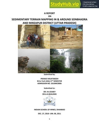
  • 1. 6 A REPORT ON SEDIMENTARY TERRAIN MAPPING IN & AROUND SONBHADRA AND MIRZAPUR DISTRICT (UTTAR PRADESH) Submitted by: PRANAV MUKTIBODH M.Sc.Tech (AGL) IInd SEMESTER ADMISSION NO. 2010MC0006 Submitted to: DR. R.K.DUBEY DR.A.K.BHAUMIK INDIAN SCHOOL OF MINES, DHANBAD DEC. 27, 2010- JAN. 06, 2011
  • 2. 7 Contents ACKNOWLEDGEMENT CERTIFICATE Aims and objectives of the field training and abstracts Abstracts Page Chapter 1 Introduction 1-5 Chapter 2. General geology of Lower Vindhyan supergroup 6-18 Chapter 3. Day 1 19-22 Chapter 4. Day 2 23-28 Chapter 5. Day 3 29-36 Chapter 6. Day 4 37-41 Chapter 7. Day 5 42-50 Chapter 8 Day 6 51-58 Chapter 9 Day 7 59-61 Chapter 10 Day 8 62-65 Chapter 11 Day 9 66-68 Chapter 12 Day 10 69-72 Chapter 13 Day 11 73-75 References 76
  • 3. 8 ACKNOWLEDGEMENTS I take this opportunity to pay my sincere reverence to Dr.R.K. Dubey and Dr.A.K.Bhaumik for their thorough guidance, constant care, affection and inspiration in the field that made it a memorable event. I feel grateful to Prof B.C. Sarkar, Head of the Department of Applied Geology for providing necessary facilities. I express my deep sense of gratitude to Prof T. Kumar, Director I.S.M University, for granting his kind approval for this field trip. I am thankful to the Manager of Tirupati Basera lodge, who provided us all an accommodation and cooperated with us during the entire field work. I am also thankful to the Singh travels for providing the bus facility to carry us from lodge to field, without which the field work, would not have been possible. Eventually, I express my thankfulness to all those who were directly or indirectly related in this training. I would like to ever remember cheerful company of my classmates throughout the training session. (Pranav Muktibodh) Admission No. 2010MC0006
  • 4. 9 CERTIFICATE This is to certify that Pranav Muktibodh (Admn.No-2010MC0006) a student of M.Sc.Tech IInd semester, Applied Geology Department, Indian School of Mines, Dhanbad has undergone an Sedimentary Terrain Mapping Training in and around Sonbhadra region, Uttar Pradesh during December 27, 2010- Jan 07, 2011 under our guidance. He has successfully completed this field-training programme. (Dr. R.K. Dubey) (Dr. A. K. Bhaumik) Associate Professor Assistant Professor Applied Geology Dept Applied Geology Dept ISM, Dhanbad ISM,Dhanbd Aims and objectives
  • 5. 10 The main aim of the Sedimentary terrain field training was to study the lithology , its formation, sedimentary structures and their analysis in field to study the paleocurrent direction and paleoenvironment of deposition. The details of which are briefed below:  To identify and mark the contact between different stratigraphic formations.  To study and identify litho logical pattern of different litho units and their spatial distribution.  To understand the contact between different lithounits and their depositional pattern in the field.  To identify the different planar and linear structures, their measurement to ocumentation of any regional variability.  To examine the characteristics of different sedimentary processes.  Establishment of product relationship and documentation of spatial and temporal packaging.  To detect the palaeoflow direction of each formation and document the change in palaeocurrent direction.  To describe the comprehensive geological picture or the sedimentation history of the area.  Concept of facies and theory behind facies construction  Methods of environmental identification; lithological composition, sedimentary structures, fossil content and ichnofacies  Vertical sequence facies analysis and application to construction of depositional models  Sedimentary Structures and Palaeocurrent Analysis  Sedimentary Rock Formation  Rock composition and classification (clastic and carbonate);  Textural and mineralogical indicators of maturity, provenance determination  Behaviour of minerals in the subsurface and their importance in assessing reservoir potential  Identification of Sedimentary Structures  Definition of bedform types  Development of bedforms, fundamental properties of sediment particles in fluid, hydrodynamic significance; concept of energetics, lower and upper flow regimes, flow variables  Bedforms and their relationships to sedimentary structures; types and preservation of ripples and dunes, plane beds, antidunes  Utility of sedimentary structures, sand body orientation, depositional environment, flow conditions, palaeoslope and source area  Measurement and interpretation of Palaeocurrent indicators in core using our proprietary Computer Aided Goniometry (CAG)  Identification of different cycle of sedimentation by preparing lithologs .
  • 6. 11 Abstracts DATE DAY DETAILS LOCATION(S) 27-12-2010 Day 1, Monday Made the litholog of a section of rocks along the Ghaghar river. Ghurma Village (L1) 28-12-2010 Day 2, Tuesday Prepared the Sedimentary litholog for the rock exposures near the Ghaghar river. Ghurma Village (L2 & L3) 29-12-2010 Day 3, Wednesday Mapping in Ghurma, Limestone Mines site Ghurma Village (L4, L5 & L6) 30-12-2010 Day 4, Thursday Prepared the lithologs near of 3 sections of rocks near the railway track. Markundi (L7, L8 & L9) 31-12-2010 Day 5, Friday Mapped the rock sections and observed various sedimentary structures including a herringbone cross bedding. Markundi (L10, L11, L12, L13, L14 & L15) 1-1-2011 Day 6, Saturday Prepared the lithologs of various well exposed rock sections Near Kawai Ghat (L16, L17, L18, L19) 2-1-2011 Day 7, Sunday Noted the Palaeo-current direction readings by observing various rib and furrow structures and later plotted them on a Rose Diagram. Near Kawai Ghat (L20) 3-1-2011 Day 8, Monday Noted the Palaeo-current direction readings by observing various rib and furrow structures and later plotted them on a Rose Diagram. Near Kawai Ghat (L21 & L22) 4-1-2011 Day 9, Tuesday Noted the Palaeo-current direction readings by observing various rib and furrow structures and later plotted them on a Rose Diagram. Near Kawai Ghat (L23) 5-1-2011 Day 10, Wednesday Noted the Palaeo-current direction readings by observing various rib and furrow structures and later plotted them on a Rose Diagram. Baba Siddhnath Mandir (L24 & L25) 6-1-2011 Day 11, Thursday Noted the Palaeo-current direction readings by observing various rib and furrow structures and later plotted them on a Rose Diagram. Lakhaniya Dari
  • 7. 12 Chapter 1 Introduction 1.1 Introduction We, the students of II Semester MSc. Tech and VIth semester (MSc. Tech integrated) Applied Geology were undergone for Sedimentary Terrain mapping (Dec 27 2010-Jan 6, 2011) in and around Sonbhadra district of Uttar Pradesh .This training was confined to some selected sites of Lower Vindhyan formation with a view to study (a) The lithology (b) Sedimentary Structures (c) Sedimentary terrain mapping (d) Paleocurrent analysis. Besides we were also taken to Siddhnathdari and Lakhania dari waterfalls located in the adjoining Mirzapur District. Geologically district of Sonbhadra and Mirzapur comprises of Rocks of lower Vindhyan formation Location and Accessibility It lies in the extreme southeast of the state, and is bounded by Mirzapur District to the northwest, Chandoli District to the north, Bihar state to the northeast, Jharkhand state to the east, Koriya and Surguja districts of Chhattisgarh state to the south, and Madhya Pradesh state to the west. The district headquarters is in the town of Robertsganj. It is the only district in India which borders four states namely Madhya Pradesh, Chhattisgarh, Jharkhand, and Bihar. It is located 82.72 & 83.33 East (longtude) & 23.52 & 25.32 North (Latitude) on the survey of India map. It is easily accessible from all parts of the country and well connected by Rail, Road & Air. The nearest airport for Sonbhadra is Babatpur which is in District Varanasi & 110 Kms from Robertsganj (District HQ.). There are direct flights from Varanasi to different major cities i.e. Delhi, Agra, Khajuraho, Kolkata, Mumbai, Lucknow & Bhubhneshwar etc. and vice-versa. It is also well connected by rail. The ea est ail ay statio fo Dist ict Head ua te is "ROBERTSGANJ” which is on the loop line from Chunar (Delhi-Howrah line). There are so many other stations in Sonbhadra District i.e. Chopan, Renukoot, Shaktinagar etc. The major trains passes through the Sonbhadra are (a) Moorie Express (8101/8102) (From Tatanagar to Pathankot) (b) Jharkhand Swarnjayanti Express(8603/8604)(from Hatia to Delhi) (c) Triveni Express(4269/4270)(From Lucknow to Shaktinagar/Singrauli) (d) Shaktipunj Express (Howrah to Bhopal) The Sonbhadra is well connected to Lucknow, Allahabad, Varanasi, Mirzapur etc by road. Buses are 24 hours available from Varanasi to Sonbhadra & it will take hardly 2 ½ hours to Robertsganj (Distrcit Headquarter). The easiest way to come Sonbhadra is by train/air upto Varanasi/ Mirzapur then take a bus/private taxi to Sonbhadra, which are available 24 hours from varanasi & Mirzapur.
  • 8. 13 Fig. 1.1 Map of India, showing the location of Sonbhadra district (Uttar Pradesh)
  • 9. 14 Fig.1.2 Map showing location of Sonbhadra district in Uttar Pradesh 1.2 Topography and drainage The district presents a undulating topography,several highlands and lowlands, the district headquarters at Robertsgunj is located at a topographic high, with its elevation higher than other blocks of he district. The Sone River flows through the district from east to west and its tributary the Rihand River, which rises to the south in the highlands of Surguja district of Chhattisgarh, flows north to join the Son in the center of the district. The Govind Ballabh Pant Sagar, a reservoir on the Rihand, lies partly in the district and partly in Madhya Pradesh. The district has historic, cultural, and ecological affinities with the Bagelkhand region. Obra a power project is located in this city. Robertsganj is the main town
  • 10. 15 The topographical map of Sonbhadra District, Uttar Pradesh
  • 11. 16 1.3 Climate Robertsganj has a relatively subtropical climate with high variation between summer and winter temperatures. The average temperature is 32°C–42°C in the summer and 2°C–15°C in the winter. Fig.1.4. Geological map of Central India (Vindhyan Basin)
  • 12. 17 Chapter 2 Lower Vindhyan 2.1 Introduction The Vindhyan basin is an intracratonic basin covers an aerial extent of 1,66,400 sq.km. Tectonically, the Vindhyan basin is bounded on the south by the Satpura orogenic belt and close to the boundary passes the Narmada-Son lineament which is a narrow zone of an echelonally arranged normal faults. Towards NW the Vindhyan rocks are separated from the Delhi-Aravalli orogenic belt by the Great Boundary Fault(steep diping reverse fault) trending roughly NE-SW. The western boundary is hidden under the Deccan traps but possibly the southern extension of Great Boundary Fault beneath the cover of Deccan basalt forms the boundary.The geophysical data, especially seismic and gravity, and sub-surface drilling data by ONGC suggest that the Vindhyan Basin extended from the present outcrop limit far to the north under the Gangetic Alluvium cover. The E-W trending Moradabad fault defines the probable northern limit of Vindhyan basin in the NW cover. The deepest part of the Vindhyan basin towards North, near the Himalayan foothill. Towards east, the exposed folded Satpura massive forms the limit of the basin .However, towards NE, the equivalent of the Vindhyan under the Gangetic Alluvium cover are limited by the sub-surface extension of Satpura massif, designated as Patna uplift. The Bundelkhand Massif together with its sub-surface extension towards NE, known as Faizabad ridge lies in the centre of the basin trending roughly NE-SW and divides the basin in two parts - the western Rajasthan part and the eastern Son valley part. The Rajasthan and the Son valley areas of Vindhyan outcrops were the sites of two separate basin atleast during the lower Vindhyan (Semri) time. Two sub-surface transverse ridges of Bundalkhand Massif, viz. Dholpur saddle on the NW side and Meja saddle in the SE side, also appear to have acted as barriers during the deposition of lower Vindhyan sediments. During the Vindhyan period, horst and graben tectonics was prevalent and several basement faults were formed which created many sub-basins within the master basin. The Vindhyan Supergroup of India is one of the largest and thickest sedimentary successions ofthe world. Deposited in an intra-cratonic basin, it is composed mostly of shallow marine deposits. It is believed to have recorded a substantial portion of Proterozoic time and therefore, likely to contain valuable information on the evolution of the atmosphere, climate, and life on our planet. It also contains some of the most disputed fossils of earliest animal life. Despite their importance, the absolute age of these rocks had remained unknown until recently. The Vindhyan Supergroup is the thickest Precambrian sedimentary succession of India and the duration of its deposition is one of the longest in the world. Since the earliest descriptions by Oldham (1856), Mallet (1869) and Auden (1933) the Supergroup has received a great deal of attention, and volumes of geological and geophysical data have been gathered. Many of these data have been reviewed at various times during the last 150 years (e.g., Valdiya et al 1982; Sastry and Moitra 1984; Bhattacharya 1996; Bose et al 2001). The importance of the Vindhyan sequences lies in the notion that because of its
  • 13. 18 ast ess i ti e a d space they co tai i po ta t i fo atio o the e olutio of the Ea th’s atmosphere, climate, sedimentary cover and life. However, even after decades of scrutiny we have not fully understood all the records that were uncovered from these rocks. The biggest challenge has been the difficulty in establishing links between the records found with global phenomena, because we have not yet determined with certainty the timings of the local events. Fig.2.1 A map showing the relative stratigraphic boundaries of the Vindhyan supergroup with other formations. 2.2 Stratigraphy On the basis of Lithostratigraphic and the chronostratigraphic studies, the entire Vindhyan Supergroup is divided into four groups as: 1. Semri Group, 2. Kaimur Group, 3. Rewa Group and 4. Bhander Group, The lithology, general trend and stragraphical relation to each other is described in details 2.2.1 Bhander Group Shikhaoda Formation (Sharda Formation)
  • 14. 19 The lower part of the formation is of mixed lithology containing sandstone beds encased within shale. The upper part is dominated by medium-grained sandstones.The lower part represents deposits of storm- influenced tidal flat system, whereas the upper sandstone-dominated part contains braidplain and eolian strata (Singh 1980;Chakraborty 2001; Bose et al 1999; Chakraborty and Chakraborty 2001). Sirbu Shale This formation begins with oolitic and stromatolitic limestones followed by shales with stringers of sandstone and siltstone. A lagoonal environment has been inferred(Singh 1980; Chakraborty 2001; Sarkar et al 2002). Bundihill Formation (Maihar Formation) The formation consists of sandstones with interlayers of reddish mudstone. The depositional system is considered as a tide-storm influenced coastal flat (Bose andChaudhuri 1990; Chakraborty 2001). Lakheri Formation (Dolni Limestone) This formation is characterized by limestones, at places stromatolitic, with an intervening unit of siliciclastics (sandstone-shale heterolithic unit). The depositionalenvironment has been inferred as a storm-influenced, homoclinal carbonate ramp (Sarkar et al 1996; Chakraborty 2004). Ganurgarh Formation The formation is represented by shales with intervening layers of siltstone and sandstone. A tide- affected, coastal flat system has been inferred for its deposition(Chakraborty et al 1998). 2.2.2 Rewa Group Govindgarh Sandstone Pebbly to coarse-grained sandstone representing deposits of a braidplain with patches of eolianites (Chakraborty and Chaudhuri 1990; Bose and Chakraborty 1994). Drammondgunj Sandstone Medium-grained sandstone deposited in shoreface environment (Chakraborty and Chaudhuri 1990; Bose and Chakraborty 1994). Rewa Shale (Panna Shale, Asan Sandstone, Jhiri Shale) Purple to green shale with sandstone interbeds up to several meters thick and meter thick and volcaniclastic beds (Chakraborty P et al 1996). The inferred depositionalenvironment is inner shelf with the sand interbeds emplaced by storm flows (Chakraborty and Chaudhuri 1990). 2.2.3 Kaimur Group Dhandraul Sandstone This formation is represented by medium to coarse-grained sandstones. The depositional environments include braidplain, aeolian sandsheet (upper part), braidplain delta(lower part) (Bhattacharyya and Morad 1993; Chakraborty 1993, 1996). Mangeswar Formation This formation is represented by fine to medium-grained, decimeter to meter-thick, tabular sandstone bodies with shale partings. The inferred depositional environment is storm-influenced inner shelf (Chakraborty and Bose 1992). Bijaygarh Shale
  • 15. 20 The lower part of this formation is characterized by a sandstone-shale intercalated unit with the sandstone/shale ratio decreasing upwards; whereas, the upper part is represented by claystones with significant pyrite concentration at Amjhor, Rohtas District, Bihar. The succession records gradual transition from inner shelf to outer shelf (Chakraborty 1995). At the top volcaniclastics occur locally (Chakraborty et al , 1996). Ghaghar Sandstone This is a medium-grained sandstone unit deposited in shoreface environment under the influence of wave and tide (Chakraborty 1999). Sasaram Formation This formation begins with medium-grained sandstone and is followed by a sandstone-shale intercalated unit. The lower part represents deposits of tide-affected shoreface environment and the upper part a storm influenced inner shelf setting (Chakraborty and Bose 1990). 2.2.4 Semri Group Rohtas Formation This formation begins with massive, plane-laminated and/or stromatolitic limestones followed by an intercalated unit of limestone and shale. In the western part at Jukehi, Satna District, M.P., the limestones of the formation are overlain by thick (30 m) volcaniclastic deposits. This volcaniclastic horizon thins towards east. The overall depositional environment is inferred to be a carbonate platform with a distally steepened ramp (Chakraborty, T et al 1996). Rampur Formation This formation consists of greenish shales with interbeds of sandstone representing deposits of storm- influenced inner and outer shelf (Sarkar et al 2002). Salkhan Formation This formation is well developed in the eastern part of the Son valley in Mirzapur district and is represented by stromatolitic as well as non-stromatolitic limestones. Thisformation is a lateral equivalent of Chorhat Formation. A peritidal envornment is inferred for its deposition (Banerjee and Jeevankumar 2003). Chorhat Formation This formation is represented by sandstones with and without mud partings and layers. The formation is well developed in the western part of Son valley in the Chorhatarea of Sidhi District, M.P. The inferred depositional environment varies from shoreface to tide-storm influenced coastal flat. The formation yielded some markings claimedto be of trails of triploblastic metazoans (Sarkar et al 1998; Seilacher et al 1998). Koldaha Formation The Koldaha Formation begins with a sandstone-shale intercalated unit and gradually becomes clayey. There are three distinct coarser units within the formation, thebottom-most of which is conglomeratic containing clasts of the underlying horizons; the other two units are coarse to medium-grained sandstones. There is also a thinlimestone band occurring below the top-most sandstone unit. The shales of this formation yielded some markings claimed to be of trails of metazoans (Sarkar et al 1998;Seilacher et al 1998). The shaly parts are products inner and outer shelf, whereas the encased coarser clastics have been interpreted as deposits of fan deltas (Banerjee 2000; Paikaray et al 2005; Banerjee and Jeevankumar 2005). Deonar Formation The Deonar Formation is entirely represented by volcaniclastic deposits. There are fine-grained tuffs along with infrequent thicker and coarser volcaniclastics depositedin outer shelf environment (Roy and Banerjee 2002).
  • 16. 21 Kajrahat Formation This formation is overwhelmingly represented by limestones, which are at places stromatolitic. However, a few interbeds of volcaniclastics and siliciclastics have also beenrecognized. The formation is best developed in the eastern part at Dala, Mirzapur District, U.P. In the western part, it again crops out at Kuteswar, Satna District, M.P.They dominantly represent peritidal to subtidal carbonate deposits of a carbonate platform (Bose et al 2001). Arangi Formation This formation is characterized by sandstone-shale intercalation followed by pure claystones. The formation also contains a few intercalated horizons of fine-grained volcaniclastics (tuffs). The overall environment of deposition is inner to outer shelf (Chakraborty and Bhattacharyya 1996; Bose et al 2001). Deoland Formation This is the bottom-most formation of the Vindhyan Supergroup. It starts with conglomerates followed by pebbly sandstone and sandstone representing deposits of alluvialfans and fan deltas (Chakraborty and Bhattacharya 1996; Bose et al 2001). Fig.2.2 Strike-wise stratigraphic column of the Vindhyan Supergroup in the Son valley prepared by combining several discrete logs constructed at different locations along the structural strike. The upper boundary of the column represents the present-day topography. Maihar town has been shown as a reference location on the topographic profile.
  • 17. 22 Fig. 2.3 A table showing generalized stratigraphic sequence of vindhyan supergroup
  • 18. 23
  • 19. 24 2.3 Geology and Correlations The Vindhyan basin is bounded to the west by the Aravalli Mountains along the Great Boundary Fault but is believed to continue uninterrupted beneath the Gangetic alluvial plain beyond the present northern outcrop limit (e.g., Verma 1991),and below the Deccan Traps in the southwest. The Bijawar Group borders the southeast margin of the basin. Figure 2.4 gives a geological map and a simple lithological framework of the Vindhyan Supergroup. The rocks of the Supergroup are exposed in two sectors: Rajasthan in the west and Son valley in the east. The general belief that many of the Vindhyan formations of Rajasthan are laterally correlatable with those in the Son valley is difficult to establish in the absence of physical continuity. Biostratigraphic correlation in the Vindhyans, like the Proterozoic sequences elsewhere in the world, is not robust. Existing data from carbon and strontium isotope stratigraphy in carbonate formations do not support this hypothesis (Ray et al 2003). A similar correlation problem exists between the Vindhyans of Chitrakut–Majhgawan sector and that of the Son valley (e.g., Ray et al 2003). The Vindhyan strata are unmetamorphosed and mostly undeformed. However, there exist largescale folds in the Son valley and several post depositional faults in Rajasthan (e.g., Verma1996; Srivastava and Sahay 2003; Chakraborty, this issue). The Upper Vindhyans in the Bundi– Sapotra–Karauli sector in Rajasthan are significantly affected by reactivations of the Great Boundary Fault (e.g., Verma 1996) and hence stratigraphic correlation is tricky. Evidence for any global or local event found in these formations must therefore be linked carefully with those reported elsewhere in the basin. The Vindhyan Supergroup is composed mostly of low dipping formations of sandstone, shale and carbonate, with a few conglomerate and volcaniclastic beds, separated by a major regional and several local unconformities (e.g., Bhattacharyya 1996). The regional unconformity occurs at the base of the Kaimur Group and divides the sequence into two units: the Lower Vindhyans (Semri Group) and the Upper Vindhyans (Kaimur, Rewa and Bhander Groups). The outcrop pattern of the Supergroup resembles a simple saucershaped syncline (figure 1). It is generally believed that the Vindhyan basin was a vast intra- cratonic basin formed in response to intraplate stresses (e.g., Bose et al 2001). Detailed stratigraphy of the Supergroup has been discussed in numerous contributions (see reviews in Bhattacharyya 1996).
  • 20. 25 T able 1. Summary of recent non-contentious geochronological information on the Vindhyan Supergroup.
  • 21. 26 Fig 2.4. A generalized geological map of the Vindhyan Supergroup showing the major lithological units and the sample locations for the age data that appear in table 1. The right hand side figure is a simplified stratigraphic log of the succession in the Son valley. GBF: Great Boundary Fault.
  • 22. 27 2.4 Structure and tectonics The Vindhyan rocks show a regional ENE-WSW trend between Sasaram in the east and Hosangabad in the west in the Son valley.In the eastern Rajasthan the regional trend is NE-SW and near the Great Boundary Fault(GBF) the trend is parallel to the trend of GBF.The Vindhyan rocks are folded to regional synclinorium with its general E-W axil trend in the eastern part and changes to ENE-WSW in the western part resulting in a broad northward curvature in the Son valley.Beyond Bhopal it is not traceable due toDeccan trap cover.In the eastern Rajasthan,the axial trend is NE-SW.In the Son valley area,the regional fault plunges 10° to 20° westward.The northern limb has gentle dip of 2° to 10° towards east.In eastern Rajasthan area,the amount of dip ranging from 5° to 15° in Kaimur and becomes almost horizontal in upper members except in the vicinity of the GBF where the Vindhyans are folded and faulted. The Vindhyan rocks are more deformed in the southern margin of the basin adjoining the Narmada and Son rivers and along the GBF in thE Rajasthan area.Along the GBF several large antiforms and synforms are mapped.Folding in the Southern margin of the basin is confined to a very narrow belt adjoining to Narmada and Son river.In the eastern and southern Son valley a number of ENE-WSW trending regional faults have been mapped.The Vindhyan rocks have suffered single phase of deformation.A number of domal structures have been mapped in the Vindhyan rocks.Conspicuous domal structures are the Jabera dome in the Son valley, Ramgarh dome in kota district, similar structures are also reported from west of Katni and north Hosangabad . ramgarh dome shows an average dip of beds ranging from 20° to 45°. It is dissected by number of faults causes this locations of circular outcrop of different litho unit. The actual region behind the formation is not clear. Faulting is pronounced in the vindhyan and generally restricted to zones along the Son-Narmoda lineament and the GBF. In the Son valley area a large number of ENE-WSW and NW-SE striking faults have been mapped. Sarkar(1981) has described 3 major faults named as Rohinian fault,Ghagra fault and Lami fault. The Rohinian fault marks the boundary between vindhyan and pre-vindhyan formation. Apart from the faults in the southern margin a number of faults have been recorded from within the basin. Extensive faulting is recorded near the GBF. This faults strike ENE-WSW. Two major faults have been recoded in the area------- one located right along the boundary towards the east and the other (Machilpur fault of Heron) situated well within the basin. From tectonic point of view it is suggested that the main vindhyan basin is bounded by two crustal fractures one along the course of Narmada-Son river and the other along theGBF which have got rejuvenated periodically. 2.5 Basin evolution The Aravalli craton stabilized a billion years before vindhyan sedimentation commenced on it. Vindhyan sediments dominantly marine deposited in an E-W elongated depository segmented in to smaller NW –SE elongated sub-basin formed under the combined influence of N S rifting and a dextral shear. After a transitory compression that was propagated from the southwestern plate margin, rifting ceased. The basin floor then sagged and flattened in unified fashion under orthogonal extension, although paleo-shoreline alignment sensed little. Throughout the vindhyan history, terrigenous sediments were derived from a low relief southern source. The source area occasionally uplifted , but almost never delivered any sediment coarser than granules. During upper vindhyan time, the E-W elongated basin tilted northward and this coincided with kimberlite intrusion and basin-wide volcanism albeit of limited scale.
  • 23. 28 The basin-wide unconformity bounded vindhyan supergroup is divided into two sequences by an unconformity that owes its origin to the transitory compression. Each of the sequences is punctuated by three MFSs (major flooding surfaces). Almost all this major flooding events coincided with magmatic activity, which was much larger in scale in the rift stage than in the sag stage. Flooding therefore took place due to tectonic subsidence of the basin. Short, decameter and meter scale depositional cycles were also terminated by paleo-seismic events. During the tectonic pulses the depositional sub-stratum tilted. This tilt is recognizable in the rift succession in systematic sense in northwesterly bed dips resulting in meter scale depositional cycles and complimentary senses in that thickness. In contrast in the sag stage, the tilt is generally recorded in cm scale slump folds or temporary sharp deflection of paleo- current direction consistently towards the NE. during the sag stage the landward party of the basin subsided differentially and resulted in development of parasequences and parasequence sets. The sediment epicenter however shifted through time. Despite landward differential subsidence, connection of the basin with the open sea was maintain. The frequency of the NE-SW extension decreased progressively but the orthogonal NW-SE extension, possibly propagated from the plate margin, maintained a uniform tempo. A relatively higher rate of the former extension possibly elongated the basin in a NW-SE direction. However with its gradual decline the basin tended to be relatively more circular or even elongated in NE-SW direction. As a consequence of overall decline in subsidence rate, the basin eventually filled up completely. Fig. 2.6 Downdip structural profiles of the Vindhyan succession in the Son valley 2.6 Depositional environments The environments of deposition for different lithounits vary from beach to barrier bar or shoal through tidal flat and lagoon, although all such variations remain within an overall shallow marine domain which is supported by : 1) Sheet like geometry of the sedimentary bodies. 2) High textural and mineralogical maturity of the sandstones 3) Glauconitic and Phosphatic accessory mineralogy 4) Presence of stromatolites (in Semri and Bhander groups) 5) Profuse development of shallow water structures such as current and wave ripples, desiccation marks, rain prints, halite casts, ooids, intraclasts, etc.
  • 24. 29 Although none of the criteria, taken alone is diagnostic of shallow marine origin, their profusion and association weigh heavily in favour of the above contention. The facies are found to be repeated vertically which signifies repeated shifting of shoreline through the whole span of Vindhyan sedimentation. 2.7 Sequence stratigraphy The sequences of the Vindhyan succession are composed of several systems tracts. The different paleogeographic settings characterizing the systems tracts within individual sequences are as follows: Sequence 1: • TST – alluvial fan–fan delta–shelf (Deoland and Arangi Formations) • HST – carbonate ramp (Kajrahat Formation) Sequence 2: • TST – shelf (Deonar Formation) • FSST to TST – braid/fan delta–shelf (Koldaha Formation) • HST – tidal flat–shoreface–shelf (Chorhat and Koldaha Formations) • TST – shelf (Rampur Formation)
  • 25. 30 • TST – carbonate ramp (Rohtas Formation) Sequence 3: • TST – shoreface–shelf (Sasaram Formation) • FSST – shoreface (Ghaghar Formation) • TST – shelf (Bijaygarh Formation) • HST – braidplain–braid delta–shelf (Mageswar and Dhandraul Formations) Sequence 4: • TST – shelf (Panna Formation) • FSST to TST – shoreface (Assan and Jhri Formations) • HST – braidplain–braid delta–shelf (Jhiri, Drammondgunj and Govindgarh Formations) Sequence 5: • TST – tidal flat (Ganurgarh Formation) • HST – carbonate platform (Bhander Formartion) • TST – tidal flat to coastal lagoon (Bundihill and Sirbu Formations) • FSST – tidal flat–braidplain–eolian (Shikhaoda Formation)
  • 26. 31 Chapter 3 DAY 1 Location 1 The study area was located about 12 kms north of District headquarters of Sonbhadra, Robertsganj at Meenabazar locality along Ghaghar River. N24o ’ . ” a dE o ’ . ”. Aims and Objectives (i) Identification of the different lithounits . (ii) Identification of the lithological features. (iii) Identification and study of different sedimentary structures present if any. (iv) Measurement of thickness of various lithounits and preparation of lithology of the section. Weather The weather was calm and moist during morning time when we reached the study area by bus, it became hotter as the day passed by. Lithology and Structure The lithology of the area is comprised mainly of Limestone and shale. The Limestones were very thick and blocky. The broken part of limestone exhibits a sharp edge. Shale is relatively very thin and is pinched out at places. Two intersecting sedimentary dykes (Sandstone dyke) were also noticed in the field, bearing a cross-cutting relationship with each other. The trend of the shale was measured as N320o /9o →N55o and the trend of limestone was N12o /11o →N100o . The overall thickness of the sedimentary succession was around 7.62 m as calculated by adding up the different layers. A minor stylolitic structure was found in the limestone bed, also the conversion of Calcite to limestone was noticed t places, where there were calcite veins. The lithology of the section was drawn as according to the thicknesses of different sedimentary units. The measurements are given in the Table 1. Table 1. Measured Thickness of different lithounits Lithounit Original Thickness Thickness converted to the Scale (1:25) Shale 22 0.8 Limestone 10 0.4 Shale 6 0.24 Limestone 38 1.5 Shale 2 0.1 Limestone 8 0.3 Shale 7 0.3 Limestone 15 0.6 Shale 4 0.16 Limestone 18 0.7
  • 27. 32 Shale 5 0.2 Limestone 120 4.8 Shale 5 0.2 Limestone 56 2.24 Shale 6 0.24 Limestone 10 0.4 Shale 2 0.1 Limestone 2 0.1 Shale 6 0.24 Limestone 23 0.9 Shale 4 0.16 Limestone 25 1 Shale 15 0.6 Limestone 50 2 Shale 2 0.1 Limestone 28 1.1 Shale 3 0.1 Limestone 20 0.8 Shale 5 0.2 Limestone 27 1 Shale 5 0.2 Limestone 30 1.2 Shale 5 0.2 Limestone Bottom not exposed Environment of deposition The Rohtas Limestone around Ghurma area represents a prograding shelf succession on a ramp. The colour variation in the limestone indicates the gradation. In this location, the limestone shows spindle shaped cross laminae within the wavy laminated limestone facies. The deposition occurs in shallow marine condition.
  • 28. 33 Ghaghar River Stratigraphy of the area The lithounits identified as Limestone and shales belonged to Stratigraphy of the area is as mentioned :- SUPERGROUP GROUP FORMATION STAGE Lower Vindhyan Semri Group Rohtas Formation Rohtas Limestone
  • 29. 34 Chapter 4 DAY 2 2.1 Location On 28.12.2010 we visited the same locality along the Ghaghar river section but the study area was located along the left bank of Ghaghar River. The area was located N24o ’ . ” a d E o ’ . ” o the map. The trends of the two piers of the bridge were measured as N 315 o and N 330o . The altitude of the area was around 133.5 ±19 m. 2.2 Aims and Objectives (i) Identification of the different lithounits. (ii) Identification of the lithological features. (iii) Identification and study of different sedimentary structures present if any. (iv) Measurement of thickness of various lithounits and preparation of lithology of the section. 2.3 Weather The weather was hot and sunny during the entire field day. Cold breezes were felt as we moved back from field to our lodge in evening. Location 2 Location of the Study Area The field of study area was Meenabazar, located at about 200m in the south of Ghurma Hospital. The site is about 250m in SE direction of the bridge on the Ghagar river. The position parameters of the very place are: Latitude : 240 35 51.85N Longitude : 830 4 7.16E Altitude : 147m above MSL Lithology and Structure The lithology of the area is comprised mainly of Limestone and shale. The Limestones were very thick and blocky. The broken part of limestone exhibits a sharp edge. Shale is relatively very thin and is pinched out at places. The general trend of the region was measured to be N300o /5o →N30o The overall thickness of the sedimentary succession was around 5 m as calculated by adding up the different layers. The conversion of Calcite to limestone was noticed at places, where there were calcite veins. Limestone and Shale constitute the typical lithology of the area. Mainly two types of lithounits are found , viz. limestone and shale. At the bottom part we found limestone beds intercalated with shale. As we move to the top the thickness of shale bed increase and eventually it is converted into clay at the top part. The beds are found to be disposed near-horizontally and generally not affceted by tectonic disturbances The lithology of the section was drawn as according to the thicknesses of different sedimentary units. The measurements are given in the Table 1.
  • 30. 35 Table 1. Measured Thickness of different lithounits Lithounit Original Thickness Thickness converted to the Scale (1:25) Shale 22 0.8 Limestone 10 0.4 Shale 6 0.24 Limestone 38 1.5 Shale 2 0.1 Limestone 8 0.3 Shale 7 0.3 Limestone 15 0.6 Shale 4 0.16 Limestone 18 0.7 Shale 5 0.2 Limestone 120 4.8 Shale 5 0.2 Limestone 56 2.24 Shale 6 0.24 Limestone 10 0.4 Shale 2 0.1 Limestone 2 0.1 Shale 6 0.24 Limestone 23 0.9 Shale 4 0.16 Limestone 25 1 Shale 15 0.6 Limestone 50 2 Shale 2 0.1 Limestone 28 1.1 Shale 3 0.1 Limestone 20 0.8 Shale 5 0.2 Limestone 27 1 Shale 5 0.2 Limestone 30 1.2 Shale 5 0.2 Limestone Bottom not exposed
  • 31. 36 Fig. 4.1 A lithology of the location 2 on left bank of Ghagar river. Stratigraphy Stratigraphically we were studying the rocks of lower vindhyan supergroup
  • 32. 37 VINDHYAN SUPERGROUP SEMRI GROUP ROHTAS FORMATION ROHTAS LIMESTONE INTERCALATED WITH SHALE Depositional Environment The thickness of the shale layer was showing an increasing trend from top to bottom indicating that the deposition of clay particles took place in shallow marine environment. Location No.3 Location of the study area The area was located nearly 400m away from the Ghurma Hospital and approximately 150 m SE of the location 2 . The position parameters are : Latitude : 240 37 51.8 N Longitude : 830 04 7.1E Altitude : 147m above MSL Lithology and Structure Mainly two types of lithounits are found viz., Limestone and shale. At the bottom part we found thin shale beds (around 1 cm) intercalated within massive limestone beds. As we moved progressively upward to the top, the thickness of shale bed showed an increasing trend and it is eventually converted to clay overburden on the top, while the limestone beds thinned out when traced upto the top. The attitude of the bed was measured to be N310/30 →N 0 Shale beds show pinched out structure. Stratigraphy The stratigraphy of the location 3 was same as location2. Cycle of deposition- One depositional cycle consists of a set of succession of the lithounits present in the area. By approximate measurement, we found that there were eleven distinct cycles of deposition Depositional Environment The progressively upward increasing thickness of the shale layers indicates shallow marine environment characterizing marine regression.
  • 33. 38 Fig.4.2 Litholog of the location3
  • 34. 39 Right Bank of Ghaghar River
  • 35. 40 Chapter 5 DAY 3 Location No.4 Date- 29-12-2010 Location The site was located around 1.5 km north-east of the Meenabazar bridge over Ghagar river, in Ghurma village. Latitude : ˚  54.2  N Lo gitude : ˚  10.25  E Altitude : 144.5 ± 25m above MSL Lithology and Structure The area mainly comprised alternate bedding of limestone and shale. At the bottom part lithology was dominated by limestone with thin shale beds. The genral trend of the area was measured to be N 3200 /110 →N 510 Fig. 5.1 Limestone and shale beds
  • 36. 41 Fig.5.2 Litholog of location 4 Location No.5
  • 37. 42 Location The site was located about 1.3 km NNE of the Meenabazar bridge on Ghghar river, Markundi town, Sonbhadra and about 500 m from Location 4. Lithology and structure The beds in the location-5 were mainly limestone and shale which were interbedded, but here the thickness of shale beds was comparatively more than that which was observed in Location 4. The average trend of the area was N 2950 /170 →N 250 Fig. 5.3 Alternate bedding of Limestone and shale in location 5.
  • 38. 43 Fig.5.4 Litholog of the location 5 Location No.6
  • 39. 44 Location The site was located about 200m from location 5 in the nort-east direction. Basically we moved on the lower vindhyans i.e, on the Rohtas Formation of Semri group and to a ds you ge ocks. Latitude : ˚  54.2  N Lo gitude: ˚  10.25  E Position accuracy: 16m Altitude : 144.5 ± 25m above MSL. Lithology and structure The area mainly consisted of parallel laminated beds of limestone. 5 major cycles of deposition were observed in the beds. A thick limestone bed was found to be massive. Mostly, the limestone beds were laminated and parallel to each other. Fig. 5.5 Limestone and shale beds
  • 41. 46 Location 7 was located adjacent to Location 6, around 500m away from it. Latitude : ˚ 25.53N Lo gitude : ˚ 24.57E Position accuracy : 10.21m Altitude: 227 ± 20.5m Lithology and structure The typical lithology of the area consisted of the sandstones. The sandstones observed had the following characteristics:- a) Coarse grained to fine grained b) Moderately cemented c) Properly sorted d) Ferruginous reddish spots. On the way to reach location no 7 a change of facies was clearly evident where Rohtas limestone terrain was overlain by shale beds (approx. 5m thick.) depicting a change in facies from limestone to shale. The shale was found to be weathered condition and hence most of it was weathered to soil. And at the top ie, at our location the area basically comprised of spotted sandstones which were pinkish in colour. Strike : ˚ Dip : ˚ to a ds N ˚ The common sedimentary features observed were :-  Ripple marks (only in one location)  Parallel bedding. Location No.8 Location The location 8 was reached after traversing down the rocks of sandstone and shale, which was about 2.5 km from Ghagar Bridge in the NE direction where again limestone beds were prominent in the area, which belonged to the upper part of the lower vindhyans. Latitude : ˚ ’ Lo gitude : ˚ ’ Altitude : 170m above MSL Lithology and structure Comprised basically of limestone beds with thick layers of shale on upper portion, which showed pinched out structure. ATTITUDE:- St ike : ˚ Dip : ˚ to a ds ˚N The shales in the site show pinched out structure.
  • 43. 48 Chapter 6 DAY 4 Location No.9 Date- 30-12-2010 Location The site was located about 1.5 km away from Agori Khas railway goomty towards North. Latitude- 240 37 N Longitude -830 3 E Lithology The site consisted of a 2.2m thick succession of interbedded Siltstone, massive sandstone and shale. The siltstone thickness showed a decreasing trendwhile the sandstone thickness increased as traced upwards . Here we got 6 major cycle of deposition. Local Structure Attitude-N2800 /220 →N 0
  • 45. 50 Location No.10 Location The field of study was located at about 100m away from the railway track in the NE direction. It was about 1.5km away from Agari Khas Gumti. Latitude-240 37N Longitude -830 3E Lithology and structure The site consisted of a 1.64m thick succession of interbedded limestone and shale. The limestone thickness is very less in the upper part and the shale thickness is increasing towards the upper part. We find 10 major cycle of deposition. Attitude-N700 /150 →N 0 The limestone is bedded and the shale is laminated. And the thickness is variable. Location No.11 Location The field of study was located on the right hand side of the railway line on Location 10, about 1.8km away from Agori Khas Gumti. Latitude-240 37N Longitude -830 3E Lithology A 5.46m thick succession of interbeded limestone and shale along coarse grained sandstone in the upper part was observed. We found 9 major cycle of sedimentation. Local Structure Attitude-N2500 /120 →N 0 The shale is laminated and the limestone is bedded. In sandstone the grain size varies from coarse to medium.
  • 46. 51 Fig.6.2 Interbedded Limestone and Shale at location 11 Location No.12 Location The field of study was located adjacent to Location 11, about 2 km away from Agori Khas Goomty. Latitude-240 3658.7N Longitude -830 0341.18E Attitude-169.5 ± 28.5m Position Accuracy- 10.64m A 5mt thick succession of shale was observed, known as the Suket shale which is underlain by Rohtas limestone and overlain by sandstone. Stratigraphy The lower side consisted of the rocks of Lower Vindhyans ( Rohtas Limestone ). The upper side consisted of the Bijaigarh shales, belonging to the Kaimur Group. Lithology and structures The area typically consisted of Sandstones. The basic characteristics of the sandstone as observed are hereby mentioned:- 1. Spotted with ferruginous materials. 2. Coarse to fine grained. 3. Fining upward sequence was observed. 4. Well sorted grains. 5. Moderately cemented grains. Attitude-N2550 /110 →N 0 Graded Bedding was observed at some places.
  • 47. 52 Location No.13 Location The field of study was located on the embankment of Ghaghra Dam. Latitude-240 365N Longitude-830 0341.1E Altitude-162.10±25mt Lithology and structures The area consisted basically of dumped rocks. Shales and sandstones were observed. Reddish to brownish coloured shale was also observed. Basically, at the site, the underlying shale is dugged out and is made the embankment. Attitude-2100 /150 → 0 In this location structures such as Graded bedding, Ripple marks, Planer tabular cross bedding and Herring bone cross bedding were observed. A fining upward sequence is found. Herringbone Structure Observed On day 4 we worked in lower as well as upper Vindhyan, we found traced the contact boundary between the lower and upper vindhyan boundary i.e. the boundary between Semri Group and Kaimur Group at an altitude of 160.18±28mt.
  • 48. 53 Chapter 7 DAY 5 Location No.14 Date- 31-12-2010 Location The field of study was located about the road cuts in the Markundi area. Latitude – 240 377.3 Longitude -830 0242.54 Altitude-160.5 ± 22.5mt Stratigraphy The regional stratigraphy consisted of the rocks of Upper Vindhyan. There are intercalations between Scarp sandstones and Bijaigarh shales. Lithology and structures There are thick successions of fine grained sandstone units overlained by siltstone. The sandstones are very hard and compact. Attitude-1100 /280 → 0 The Markundi Fault seperates the Lower and Upper Vindhyans. Along this fault, the Lower Vindhyan rocks (Hanging wall) have shifted down and the Upper Vindhyan rocks have stayed stationary (footwall). The fault is a Normal Fault. The units get thickened, show thinning from time to time. Sandstones are bedded not massive. Common structures are drift ripple, cross bedding and herringbone cross bedding. The sandstone have fining upward sequence. There are 8 major cycle of deposition. Depositional Environment The beds have formed under marine environment. Herringbone Structures show continuous change in current or wave directions.
  • 49. 54 Fig. 6.1 A litholog of location 14 Location No.15
  • 50. 55 Location The field of study was located in the Markundi area. Latitude – 240 377.3 Longitude -830 0242.54 Altitude-160.5 ± 22.5mt Stratigraphy The regional stratigraphy consisted of the rocks of Upper Vindhyan. There are intercalations between Scarp sandstones and Bijaigarh shales. Lithology and structures There are thick successions of alternate fine grained sandstone and siltstone. The sandstones bed thickness is large than that of siltstone. The sandstones are fine grained, compact and very hard. Attitude- N800 /200 →N 0 The common sedimentary structures are ripple marks, planer cross bedding, pinch and swell structure. We get 6 major cycle of deposition. Fig. 6.2 Sandstones with intercalation of siltstone
  • 51. 56 Fig. 6.3. Litholog of location 15
  • 52. 57 Location No.16 Location The field of study was located in the Markundi area. Latitude – 240 377.3 Longitude -830 0242.54 Altitude-160.5 ± 22.5mt Lithology and structures The area shows thick units of sandstones with intercalation of siltstone. Sandstones are fine grained, compact and very hard. Three major cycles of sedimentations were visible. Attitude-2800 /280 → Sedimentary structure includes parallel bedding, cross bedding, drift ripples and pinch and swells structure. Fig.6.4. Sandstones with intercalation of siltstone Location No.17 Location The field of study was located in the Markundi area. Latitude – 240 377.31 Longitude -830 0242.54 Altitude-160.5 ± 22.5mt Lithology and structures The lithology comprises of alternating layer of very fine grained sandstone and siltstone.We get 4 major cycle of sedimentation. Local Structure Attitude-2600 /280 → 0 The structures observed are drift ripples and herringbone cross bedding.
  • 53. 58 Fig.6.5. Litholog of Location 17
  • 54. 59 Fig.6.6 Sandstones with intercalation of siltstone Location No.18 Location The field of study was located in the Markundi area. Latitude – 240 377.31 Longitude -830 0242.54 Altitude-160.5 ± 22.5mt Lithology and structures Thick units of fine grained sandstone are found. Siltstones are also present but the thickness. Attitude - 2600 /250 → 0 . Among the common structures, Pinch and swell structures and asymptotic cross bedding are present. Typical Herringbone structure was also observed. This is due to continuous change in current or wave directions. Depositional Environment The beds have formed under marine environment. Herringbone Structures show continuous change in current or wave directions.
  • 55. 60 Fig.6.6.Cross Bedding Location No.19 Location The field of study was located in the Markundi area. Latitude – 240 377.31 Longitude -830 0242.54 Altitude-160.5 ± 22.5mt Lithology and structure The area consist of thick succession of fine grained sandstone, siltstone is almost indistinct. Fining upward sequence is seen. Attitude - N50 /180 →N 0 The common structures observed are herringbone cross bedding, asymptotic cross bedding and drift ripples. Depositional Environment The beds have formed under marine environment. Herringbone Structures show continuous change in current or wave directions.
  • 56. 61 Fig.6.8. A litholog of location 19.
  • 57. 62 Chapter 8 DAY 6 Location No.20 Date- 01-01-2011 Location It is situated in the Markundi area, 500m away from the Veer lorik patthar memorial gate on Markundi national highway. Latitude-240 3713.31N Longitude-830 0222.09E Positon accuracy-11.29 mt Altitude- 214 ± 15.5 mt Lithology and structure The area typically consists of sandstone and siltstone. A 7m thick succession of sandstone and shale was observed. The common characteristics of the sandstones are:- (i) fine grained, (ii) well sorted, (iii) well cemented, and (iv) Very hard. (v) cross beddings Lamina of very fine grained sandstone are also found. Attitude - Upper bed-1650 /160 → 0 Lower bed-3100 /260 → 0 In this location, common structures observed were Mega ripples, Drift ripples and Herringbone cross bedding. Depositional Environment The beds have formed under marine environment. Herringbone Structures show continuous change in current or wave directions.
  • 58. 63 Fig.8.1 Litholog of location 20
  • 59. 64 Location No.21 Location It is situated in the Markundi area, 300m away from the highway direction. Latitude-240 3713.31N Longitude-830 0222.09E Attitude- 214 ± 15.5 mt Lithology and structure The area typically consists of sandstone. A 8m thick succession of sandstone was observed. The common characteristics of the sandstones are: (i) fine grained, (ii) well sorted, (iii) well cemented, and (iv) very hard, comparable to quartzites. (v) Whitish, spotted with ferruginous materials. Lamina of very fine grained sandstone are also found. Attitude - N2700 /50 →N3500 In this location we observed Ripples, Drift ripples and Herringbone cross bedding. Fig.8.2 Interference Ripples
  • 60. 65 Fig.8.3 Litholog of location 22
  • 61. 66 Location No.22 Location It is situated in the Markundi area, 1mt away from the highway direction. Latitude-240 3713.31N Longitude-830 0222.09E Attitude- 214 ± 15.5 mt Lithology The area typically consists of sandstone. A 8mt thick succession of sandstone was observed. These common characteristics of the sandstones are:- (i) fine grained, (ii) well sorted, (iii) well cemented, and (iv) very hard. (v) Spotted with ferruginous materials Lamina of very fine grained sandstone are also found. Local Structure Attitude - N550 /50 →N 0 In this location we got Ripples, Cross beddings, Drift ripples and Herringbone cross bedding. Very good exposures of cross beddings are observed. Fig. 8.4 Ripples
  • 62. 67 Fig.8.5 Litholog of location 22
  • 63. 68 Location No.23 Location It is situated in the Markundi area, 1mt away from the highway direction. Latitude-240 3713.31N Longitude-830 0222.09E Attitude- 214 ± 15.5 mt Lithology and structures The area typically consists of sandstone. A 5mt thick succession of sandstone was observed. These common characteristics of the sandstones are:- (i) fine grained, (ii) well sorted, (iii) moderately cemented, (iv) Very hard, and (v) Spotted with ferruginous materials Attitude - N550 /50 →N 0 In this location we got Ripples, especially , Drift ripples Cross beddings and Herringbone cross bedding. Fig. 8.6 Herringbone cross bedding.
  • 64. 69 Fig. 8.7. Litholog of location 23
  • 65. 70 Chapter 9 DAY 7 Location No.24 Date- 02-01-2011 Location The field of study was the hilly areas lying on the right side of the main road between Robertsganj and Markundi, near Veer Lorik Stone Monuments Latitude- 243717.78 N Longitude- 83257.59 E Position Accuracy- 29m Altitude- 267m ± 28m Lithology The area typically consists of QUARTZITIC SANDSTONES, which were medium to fine grained and were well cemented. These sandstones resemble high energy conditions prevailing at the time of their deposition. This is also shown by the changes in the Paleocurrent directions over the entire area. Quartzite- It is the metamorphic equivalent of sandstone. It is rich in quartz, and characterized by thorough induration, either through cementation with silica or through recrystallisation, that is essentially homogeneous and breaks with vitreous surfaces. Structural Features The typical structural features of the area consisted of the ripple marks. Lingoid ripples, Cross bedding and Rib and furrow structure were seen. From rib & furrow structure, we can determine the palaeocurrent direction. RIPPLE MARKS- These are small ridges formed on sediment surfaces, exposed to moving wind or water. The ridges form perpendicularly to the direction of motion of current. RIPPLE MORPHOLOGY 1. Ripple Length / Wavelength- It is the distance between two successive hinge points. (L) 2. Ripple Height- It is the distance between the hinge at trough and the hinge at the crest part of Ripple. (H) 3. Ripple Index- It is also known as vertical form index. It is defined as the ratio of length to the height of the ripple. i.e R.I.= L / H, where L= Ripple Length & H= Ripple Height Ripple Indexes measured on the site 1. L = 1.2cm H = 0.2cm R.I. = L / H =0.6 Paleocurrent data taken on the site:
  • 66. 71 260 295 360 305 350 322 220 345 265 300 355 338 240 345 290 290 280 308 250 350 310 315 253 359 250 340 310 310 255 318 265 350 260 310 280 322 280 335 290 360 340 342 285 310 305 340 310 327 290 335 320 340 270 350 285 290 310 320 240 321 265 350 310 345 230 353 310 355 30 350 235 262 315 345 350 350 295 305 335 315 350 300 330 291 305 315 10 290 345 256 310 360 360 260 240 295 315 330 360 270 355 268 335 330 5 250 358 225 315 355 330 325 326 324 335 350 340 295 328 276 315 355 345 250 332 330 305 265 265 250 315 358 305 270 345 245 210 332 305 320 290 240 220 325 330 260 270 240 224 255 290 330 330 250 357 278 305 360 290 330 305 332 310 275 310 270 336 348 315 260 290 230 329 350 340 295 305 270 314 325 345 340 315 270 230 320 330 330 310 320 230 320 335 240 350 230 320 320
  • 67. 72
  • 68. 73 Chapter 10 DAY 8 Location No.25 Date- 03-01-2011 Location The field of study was the hilly areas lying on the right side of the main road between Robertsganj and Markundi. Latitude- 243717.78 N Longitude- 83257.59 E Position Accuracy- 29m Altitude- 267m ± 28m Lithology The area typically consists of QUARTZITIC SANDSTONES, which were medium to fine grained and were well cemented. These sandstones resemble high energy conditions prevailing at the time of their deposition. This is also shown by the changes in the Paleocurrent directions over the entire area. Quartzite- It is the metamorphic equivalent of sandstone. It is rich in quartz, and characterized by thorough induration, either throug cementation with silica or through recrystallisation, that is essentially homogeneous and breaks with vitreous surfaces. Structural Features The typical structural features of the area consisted of the ripple marks. Assymetric Ripple marks and Cross bedding are seen. RIPPLE MARKS- These are small ridges formed on sediment surfaces, exposed to moving wind or water. The ridges form perpendicularly to the direction of motion of current. RIPPLE MORPHOLOGY a) Ripple Length / Wavelength- It is the distance between two successive hinge points. (L) b) Ripple Height- It is the distance between the hinge at trough and the hinge at the crest part of Ripple. (H) c) Ripple Index- It is also known as vertical form index. It is defined as the ratio of length to the height of the ripple. i.e R.I.= L / H, where L= Ripple Length & H= Ripple Height d) Lee Side- It is the side of the ripple away from the direction of flow of wind. It is generally steeper. (Ls) e) Stoss Side- It is the side towards the direction of motion of wind. It is gentler in slope. (Ss) Ripple Indexes measured on the site 1 L = 3.8cm H = 0.5cm R.I. = L / H =7.6 Ls = 0.5cm
  • 69. 74 Ss = 3.5cm Ripple Assymetric Index (R.A.I.) = Ss / Ls = 7cm Thus, we can can conclude that the ripple is a Current Ripple since the R.A.I. is 7. It is characterised by assymetrical feature. 2 L = 3cm H = 0.3cm R.I. = L / H =10 Ls = 2.2cm Ss = 0.2cm Ripple Assymetric Index (R.A.I.) = Ss / Ls = 11cm Hence, these are also Assymetrical Current Ripples. 3 Ls =0.5 cm Ss =3.5 cm Ripple Assymetric Index (R.A.I.) = Ss / Ls =3.5/0.5=7 Palaeocurrent analysis data 10 260 240 280 282 20 265 240 280 250 215 265 240 280 250 215 265 240 280 250 220 265 240 280 250 220 265 240 281 250 220 265 240 282 250 220 265 240 283 250 223 265 240 285 250 223 265 240 285 253 225 265 242 285 254 225 268 242 285 255 225 270 242 285 255 225 270 242 285 255 225 270 242 285 255 228 270 242 285 255 230 270 243 286 255 230 270 245 286 255 230 270 245 290 255 230 270 245 290 255 230 270 245 290 256 230 270 245 290 258 230 270 245 290 258 230 270 245 292 258 230 271 245 292 259 234 272 245 293 259
  • 70. 75 235 273 245 294 260 235 274 245 295 260 235 275 245 295 260 235 275 245 295 260 235 275 245 298 260 235 275 245 300 260 235 275 245 300 260 235 275 248 305 260 235 275 248 306 260 235 275 248 308 260 235 276 248 310 260 237 276 248 310 260 240 278 250 310 260 240 279 250 310 250 240 280 250 310 250 240 280 250 315 250 240 280 250 315 250 350 250 250 315 250 360 250 250 315 335 360 250 250 319 340 250 319 250 320 345 250 319 250 250 319
  • 71. 76
  • 72. 77 Chapter 11 DAY 9 Location No.26 Date- 04-01-2011 Location The position parameters of the site are: Latitude : 240 37 28.55N Longitude : 830 03 94.92E Altitude : 214+37m above MSL. Lithology and structures Ferruginous Sandstone is the dominant rock type of the concerned area.  The sandstones are coarse-grained, well-sorted and well-cemented.  The sandstones become white in colour towards the top of the succession.  At places sandstones are found to be altered into laterite. Attitude – N2340 /50 →N 0 The beds pervasively show planar cross stratification. Herringbone cross stratifications are present at places. Rib and furrow structures are present abruptly and from their presence on tilted beds , sense of paleocurrent is analysed. Depositional Environment Planar and herringbone cross-stratification envisages shallow marine and tidal environment of deposition. Paleocurrent data taken on the site 360 258 289 297 336 20 254 285 298 318 10 252 245 355 341 310 260 280 340 339 315 262 300 315 343 10 256 282 280 352 250 270 275 250 347 295 295 300 275 336 285 310 295 282 338 250 292 289 265 327 265 270 285 240 310 260 295 245 255 330 250 310 250 240 345 248 292 235 258 297 255 270 210 255 314 270 262 305 245 324 235 265 325 305 355 245 255 295 330 338
  • 73. 78 254 245 210 325 317 266 280 235 320 338 255 300 230 325 317 278 282 236 322 322 267 275 235 310 336 255 300 282 338 355 275 295 330 324 348 360 360 350 352 350 328 350 270 352 270 356 356 295 355 295 352 360 350 357 350
  • 74. 79 Chapter 12 DAY 10 Location No.27 Date- 05-01-2011 Location The site of visit was about 35-40 km from Robertsganj main town, in Mirjapur District, on the right and left side of the State Highway. Lithology and structures The area basically consisted of quartzitic sandstones, which were basically pink in colour. Sedimentary structures observed were :- Rib and furrow structures were abundantly present, which were used to determine the paleocurrent direction, some ripples were also observed. Paleocurrent data taken on the site 10 250 265 282 300 325 347 10 250 265 285 282 325 348 20 250 266 285 305 325 350 210 250 267 289 310 305 350 210 252 270 289 285 328 327 230 254 270 292 310 330 352 235 254 270 292 310 330 352 235 255 270 295 310 330 352 235 255 270 295 310 336 352 235 255 275 295 314 336 355 236 255 275 295 315 336 355 240 255 275 295 315 338 355 240 255 275 295 317 338 355 245 256 278 295 317 338 356 245 258 280 297 318 338 356 245 258 280 297 320 339 357 245 260 280 298 322 340 360 245 260 282 300 322 341 360 248 262 282 300 324 343 360 250 265 262 300 324 345 360
  • 76. 81 The site of visit was Siddhnath ki darri (waterfall), located at around 6 km from location 27 on the road side. Lithology The area basically consisted of sandstones, which were subjected to weathering and erosion by the action of river. Paleocurrent data taken on the site 308 340 300 295 323 330 300 298 298 323 318 292 293 315 327 289 295 294 312 323 325 285 300 340 327 295 310 300 338 319 320 295 293 323 316 328 292 330 325 305 335 305 332 328 315 340 285 334 325 295 328 331 293 323 298
  • 77. 82
  • 78. 83 Chapter 13 DAY 11 Location No.29 Date- 06-01-2011 Location The site of visit was LAKHANIA DARI CAVE. On the final day of our sedimentary field while returning from Robertsganj to Banaras , enroute we took a halt at Lakhaniya Dari waterfalls located in Mirzapur district. The position parameters of the site are: Latitude - 240 35 51.86N Longitude - 830 04 07.16E Altitude -158 m above MSL Lithology The area typically consists of sandstones. The characteristics are hereby mentioned :-  The lower beds show ferruginous bands, which are a result of weathering and iron leaching . The iron enrichment was high so that bands were formed.  The upper beds were however not so enriched in iron. This is because they show slight leaching of iron, marked by slight reddish colour of sandstone.  Well cemented and Well sorted  The sandstones were medium to fine grained.  Quartz content was high. Mica particles were also present Structural Features Attitude- N3200 /40 →N 0 Herringbone cross-stratifications are common indicating the shallow marine depositional environment. Pot-holes are also abundant. Depositional Environment Presence of Herringbone cross-stratification indicates the shallow marine depositional environment.
  • 79. 84 Fig. 13.1 Litholog of location 29
  • 80. 85 Fig.13.2 Weathered Sandstone Beds in Lakhaniya Dari  Fig. 13.3 Lakhania dari Waterfall