#6 - Comp Plan - Surface Water
•
0 likes•261 views

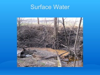
This document summarizes information about surface water in the Coon Creek watershed district. It reviews hydrologic budget data and stream flow variation over 100 years. Analysis of rainfall data from 1985, 1999, and 2009 shows that less than 1 inch of rain did not cause much runoff in 1985, the fate of 1 inch of rain needs to be managed now, and water levels increase substantially with each inch of rain currently. Graphs show increasing water levels over time at three locations. The implications are that the lower watershed remains prone to flooding and shows some independence from the rest of the watershed. Increased erosion and water quality issues are expected in the lower watershed going forward.
Report
Share
Report
Share
![Review Of Current Chapter ,[object Object],[object Object],[object Object],[object Object],[object Object],[object Object]](data:image/gif;base64,R0lGODlhAQABAIAAAAAAAP///yH5BAEAAAAALAAAAAABAAEAAAIBRAA7)
Recommended
GEOG3839.20, Paleofloods
Major losses from natural disasters in 2010 were as follows:
- Storms: $20.1 billion
- Earthquakes: $12.9 billion
- Floods: $6.4 billion
- Cold/frost: $0.4 billion
- Droughts: $0.01 billion
Tree ring studies have been used to reconstruct past flood levels on the Red River over the past 350 years, helping to better understand the size and frequency of historical floods. Paleoflood evidence from tree scars provides a longer-term context for current flood risks than instrumental records alone.
Jayric
This document discusses several types of water pollution. It begins by noting that as the human population grows, we are putting increasing pressure on water resources. This leads to poorer water quality and pollution of oceans, rivers and other bodies of water. It then discusses specific types of pollution, including arsenic pollution, and mentions the wide-ranging effects pollution can have on living organisms. The document also discusses surface water pollution, noting that surface water sources like reservoirs, rivers and lakes in the US are vulnerable to multiple sources of pollution including runoff from land.
Properties of water and its global distribution
The total volume of water on Earth is estimated at 1.386 billion km³ (333 million cubic miles), with 97.5% being salt water and 2.5% being fresh water. Of the fresh water, only 0.3% is in liquid form on the surface. In addition, the lower mantle of inner earth may hold as much as 5 times more water than all surface water combined (all oceans, all lakes, all rivers).
Petallana, mark anthony
The water cycle, also known as the hydrological cycle, describes the continuous movement of water on, above, and below the surface of the Earth. Water can change between liquid, solid, and gas states as it moves from one reservoir to another via evaporation, condensation, and precipitation processes. The sun provides the energy needed to drive this cycle by powering evaporation from oceans, lakes, and vegetation before water vapor condenses into clouds and falls back to the Earth as rain or snow.
L6 Causes Of Flooding
Rivers flood due to both physical and human causes. Physical causes include prolonged or heavy rainfall, snowmelt, soil conditions, relief of the land, and previous weather conditions. Human causes include building on floodplains, deforestation, and urbanization which decrease infiltration and increase surface runoff. Flooding appears to be increasing in frequency in the UK over the past 20 years due to these factors.
Groundwater Science 101, TAGD Leadership Training, September 2014: George Ozuna
Groundwater Science 101, TAGD Leadership Training, September 2014: George OzunaTexas Alliance of Groundwater Districts
This document discusses groundwater and drought in Texas. It begins by reviewing the hydrologic cycle and focusing on groundwater. It then defines an aquifer and describes the principal types that supply groundwater. It also distinguishes between confined and unconfined aquifers and discusses how water levels are monitored. The document concludes by examining the current drought in Texas and defining four types of drought: meteorological, hydrological, agricultural, and socioeconomic.GEOGRAPHY Cape '09 u1 p2#4b
The document discusses the major effects of dams, irrigation, urbanization, and deforestation on the hydrological cycle. Dams can increase evaporation and groundwater levels. Irrigation modifies natural hydrological processes by increasing runoff and evaporation from irrigated areas. Urbanization reduces infiltration and evapotranspiration, increasing surface runoff and flood peaks while decreasing groundwater levels. Deforestation decreases total runoff by increasing transpiration and interception, while also increasing flood runoff and peaks by reducing infiltration.
CAPE Geography Cape '06 u1 p2- #5
The document discusses the formation of beaches and cliffs through geological processes. It explains that:
1) Beach composition influences slope, with shingle beaches typically steeper than sandy beaches due to differences in percolation rates. Coarse shingle allows for rapid water drainage, while compact sand hinders drainage.
2) Cliffs form through both subaerial and marine erosion processes. Marine processes like wave pounding and hydraulic pressure undermine cliff bases, while subaerial processes like weathering from precipitation, freeze-thaw cycles, and evaporation cause mass failures and recession.
3) Cliffs are constantly changing features as coastal and atmospheric forces cause unpredictable rockfalls and large-scale collapses over various time
Hydrocycle
The document discusses the hydrologic cycle, which describes the continuous movement and storage of water between the atmosphere, oceans, lakes, soils and land. Water is evaporated from oceans and land surfaces, transported by winds, condensed into rain or snow clouds, and precipitated back onto the Earth where it collects in streams, rivers and lakes before returning to the oceans, completing the cycle. The hydrologic cycle is powered by solar energy and influences climate patterns and variability across different timescales. It is an important process linking the water, energy and carbon cycles.
Hydrologic cycle
Hydrologic Cycle is also called as Water Cycle. It basically deals with transformation of water in different forms starting from gaseous stage (water vapor) to liquid state (water on earth's surface), and water inside soil as underground water.and again back to gaseous stage. The cycle has no starting or end.
A presentation on tidal current & it’s mechanism
This document presents information on tidal currents and their mechanism at the mouth of an estuary. It defines an estuary and explains that tidal currents are horizontal water movements caused by the gravitational pull of the moon and sun during tidal changes. At the mouth of an estuary, tidal currents are strongest where salinity matches the adjacent sea. The tidal current pushes river water back up the estuary, and the penetration of salt depends on the relative volumes of salt and fresh water. If salt water volume is much greater, a salinity wedge will form, but if freshwater volume is greater, the fresh water will flow over the salt water in two distinct layers.
Antarctic melting (with proof from diff. articles)
Antarctic glaciers are experiencing rapid changes due to climate change. Satellite observations show glaciers in the Amundsen Sea sector of West Antarctica retreating rapidly, with Pine Island Glacier retreating 31 km and Thwaites Glacier retreating 14 km between 1992 and 2011. This sector contributes significantly to sea level rise and contains enough ice to raise sea levels by 1.2 meters. Reconstructing ice sheet changes during the Last Glacial Termination has shown that Antarctic ice sheet mass loss was sustained by feedbacks from warm Circumpolar Deep Water, and similar feedbacks today could accelerate sea level rise. If emissions continue unabated, Antarctica has the potential to contribute over 1 meter of sea level rise by 2100 and
Sergio Celaya Unccd
The document discusses the relationship between climate change and water resources. It notes that climate change is expected to cause more frequent and severe droughts, reduced water availability, and changes in rainfall patterns. This will negatively impact dryland regions and small islands in particular. The UNCCD aims to address drought and desertification issues related to climate change in drylands.
Sea level rise science
Sea level rise on the Hudson Estuary: Sacha Spector, PhD, director of conservation science, Scenic Hudson share impacts associated with sea level rise including SLAMM, Sea Level Rise Affecting Marshes Model.
Climate change isotopes and ice house
The document discusses oxygen isotopes and how they can be used to study climate change during the Carboniferous Period. Oxygen isotopes are recorded in the calcite shells of microorganisms and preserved in limestone. Heavier oxygen isotopes are concentrated in the shells of microorganisms and limestone during glacial periods due to fractionation processes. Analyzing the ratio of oxygen isotopes over time in limestone reveals alternating warm and cold periods during the Carboniferous, dominated by the Carboniferous Ice Age when vast ice sheets covered the southern polar continents.
Global Climate Change- THE EFFECTS
Global climate change is caused by a buildup of carbon dioxide and other greenhouse gases in the atmosphere that trap heat from the sun and warm the planet. There is physical evidence of climate change from rising temperatures recorded since the 1920s, retreating glaciers, decreasing Arctic sea ice, and changes in vegetation and animal populations due to warming. Climate change has also been linked to the collapse of past civilizations through archaeological and historical records.
L2 morphology and oceanic water
1) The document describes various features of ocean morphology including seamounts, guyots, abyssal plains, continental slopes, submarine canyons, ocean trenches, and mid-ocean ridges.
2) It also discusses variations in ocean temperature with latitude, depth, and between surface and deeper waters. The thermocline and pycnocline are boundaries where temperature and density rapidly change with depth.
3) Salinity also changes with depth and latitude, being higher in warm tropical waters due to evaporation and lower in polar waters due to freshwater input from rivers.
Oceanography2 1
The document discusses the composition and properties of seawater. It notes that seawater consists of approximately 3.5% dissolved mineral salts. The average salinity of seawater is 35 parts per thousand. The primary sources of these dissolved substances are the chemical weathering of rocks and volcanic outgassing from Earth's interior. Salinity, temperature, and density vary spatially and temporally in the ocean and influence water layering and circulation patterns.
Sea Level Rise in the Hudson Valley
Power Point presentation by Kate Brill, Scenic Hudson. Presented at Teaching the Hudson Valley's 2015 summer institute.
Bp
The document discusses various topics related to water including its composition, the water cycle, ocean topography, ocean currents and tides, and how humans affect water. It notes that water is essential to life, the majority of Earth and the human body is made of water, and water is recycled through evaporation and precipitation. Less than 1% of water on Earth is drinkable.
Water & it's circulation
learn about water, water cycles, tsunamis, fresh and saline water, high and low tides and many more valuable knowledge.
Jc
Water is a chemical substance with the formula H2O that can exist as a solid, liquid, or gas. It is transparent and allows sunlight to reach aquatic plants and is the major component of cells. The water cycle is driven by the sun and involves evaporation, condensation, precipitation, runoff, infiltration, groundwater discharge and springs. Ocean surface topography varies in a similar way to land topography and influences ocean currents, heat transport, and sea level changes. Tides are caused by gravitational forces from the moon and sun, resulting in two high and two low tides daily in most coastal areas. Human pollution and development are deteriorating ocean ecosystems.
Global hydrological cycle
The global hydrological cycle describes the continuous movement of water on, above, and below the Earth's surface. It is powered by solar energy and is a closed system that circulates water in a continual loop. While 70% of the Earth's surface is covered in water, 97.5% of it is salt water found in oceans. Fresh water makes up only 2.5% of the planet's water, with 1% located on the Earth's surface in lakes, rivers, and 20% in groundwater and 79% in ice caps and glaciers. The hydrological cycle involves processes like evaporation, condensation, transportation, precipitation, groundwater, transpiration, and runoff that move and distribute water around the
Sea Level Rise in South Florida
The document summarizes research correlating qualitative observations with quantitative data on sea level rise in Florida Bay. Monthly mean sea level trends from a NOAA gauge station show annual fall flood heights from the 1980s are now average heights, equivalent to a 0.91 foot rise in 100 years. Qualitative observations by local guides also indicate longer flooding durations and more frequent high tide flooding. Climate models project 0.6-4.7 feet of additional sea level rise for the area by 2100. Major impacts are expected to population centers, infrastructure, and coastal development from accelerated sea level rise.
Water availability pecs
This document summarizes the effects of global warming on water availability and precipitation patterns. As CO2 concentrations and global temperatures rise by 2050 and 4xCO2 levels, the document predicts increases in annual mean precipitation, evaporation, and runoff globally of 5.3%, 7.3%, and 5.5% respectively for 2050 levels, and 12.7%, 14.8%, and 5.5% for 4xCO2 levels. Regionally, water-rich areas will see more water availability through increased precipitation and river discharge, while water-poor regions will experience more severe drought and a gradual outward expansion of deserts, enhancing contrasts between wet and dry regions of the world. Improved water management strategies are
Chapter 2 hydrologic cycle
1. The document discusses key concepts in hydrology including the hydrologic cycle, water budget equation, and groundwater components.
2. The hydrologic cycle describes the continuous movement of water on, above, and below the surface of the Earth, including evaporation, transpiration, precipitation, and subsurface flow.
3. The water budget equation expresses the principle of conservation of mass by equating water inputs such as precipitation to outputs like evapotranspiration and changes in storage over a given time period for a defined catchment area.
sea level-paleoocean
This document discusses sea level processes and changes. It aims to provide an understanding of mean sea level, the factors that influence sea level changes, and measurements of sea level change. Key points covered include the difference between geoids and ellipsoids, processes that control mean sea level and cause its changes over various timescales, measuring sea level using tide gauges and satellite altimetry, sea level rise in the last century linked to global warming, and the economic implications of sea level changes. Graphs and tables are presented showing records of sea level change from tide gauge stations over the last century.
Obstr hearing only
The Coon Creek Watershed District Board held a hearing to determine if an obstruction in County Ditch 58-6 should be removed. The ditch experiences flooding due to an undersized culvert on Polk Street installed in 1964-1970. Three properties are affected by the flooding. The Board considered inspection reports from 2011 showing flooding, as well as safety and flood damage concerns from the landowners. Engineers recommended replacing the culvert with a longer, larger diameter culvert to reduce flooding and safety issues. Cost estimates were provided and two contractors provided quotes for the work.
Crooked lake plot study 2011
A small Lake research project to determine what would grow if Eurasian water milfoil was not present.
Crooked lake public input workshop
This document outlines the 2014-2018 management plan public input workshop for Crooked Lake. It discusses the status of the current management plan and identifies key issues from the previous plan around invasive species, water clarity, muck, water quality, garbage, water levels, and implications for the future. Data on trends related to these issues is presented. The document concludes that water quality has improved but invasive species remain a challenge and effects of groundwater on water levels needs continued attention. The local water management district outlines ongoing and planned activities to monitor the lake and watershed and develop new management plans and studies.
More Related Content
What's hot
Hydrocycle
The document discusses the hydrologic cycle, which describes the continuous movement and storage of water between the atmosphere, oceans, lakes, soils and land. Water is evaporated from oceans and land surfaces, transported by winds, condensed into rain or snow clouds, and precipitated back onto the Earth where it collects in streams, rivers and lakes before returning to the oceans, completing the cycle. The hydrologic cycle is powered by solar energy and influences climate patterns and variability across different timescales. It is an important process linking the water, energy and carbon cycles.
Hydrologic cycle
Hydrologic Cycle is also called as Water Cycle. It basically deals with transformation of water in different forms starting from gaseous stage (water vapor) to liquid state (water on earth's surface), and water inside soil as underground water.and again back to gaseous stage. The cycle has no starting or end.
A presentation on tidal current & it’s mechanism
This document presents information on tidal currents and their mechanism at the mouth of an estuary. It defines an estuary and explains that tidal currents are horizontal water movements caused by the gravitational pull of the moon and sun during tidal changes. At the mouth of an estuary, tidal currents are strongest where salinity matches the adjacent sea. The tidal current pushes river water back up the estuary, and the penetration of salt depends on the relative volumes of salt and fresh water. If salt water volume is much greater, a salinity wedge will form, but if freshwater volume is greater, the fresh water will flow over the salt water in two distinct layers.
Antarctic melting (with proof from diff. articles)
Antarctic glaciers are experiencing rapid changes due to climate change. Satellite observations show glaciers in the Amundsen Sea sector of West Antarctica retreating rapidly, with Pine Island Glacier retreating 31 km and Thwaites Glacier retreating 14 km between 1992 and 2011. This sector contributes significantly to sea level rise and contains enough ice to raise sea levels by 1.2 meters. Reconstructing ice sheet changes during the Last Glacial Termination has shown that Antarctic ice sheet mass loss was sustained by feedbacks from warm Circumpolar Deep Water, and similar feedbacks today could accelerate sea level rise. If emissions continue unabated, Antarctica has the potential to contribute over 1 meter of sea level rise by 2100 and
Sergio Celaya Unccd
The document discusses the relationship between climate change and water resources. It notes that climate change is expected to cause more frequent and severe droughts, reduced water availability, and changes in rainfall patterns. This will negatively impact dryland regions and small islands in particular. The UNCCD aims to address drought and desertification issues related to climate change in drylands.
Sea level rise science
Sea level rise on the Hudson Estuary: Sacha Spector, PhD, director of conservation science, Scenic Hudson share impacts associated with sea level rise including SLAMM, Sea Level Rise Affecting Marshes Model.
Climate change isotopes and ice house
The document discusses oxygen isotopes and how they can be used to study climate change during the Carboniferous Period. Oxygen isotopes are recorded in the calcite shells of microorganisms and preserved in limestone. Heavier oxygen isotopes are concentrated in the shells of microorganisms and limestone during glacial periods due to fractionation processes. Analyzing the ratio of oxygen isotopes over time in limestone reveals alternating warm and cold periods during the Carboniferous, dominated by the Carboniferous Ice Age when vast ice sheets covered the southern polar continents.
Global Climate Change- THE EFFECTS
Global climate change is caused by a buildup of carbon dioxide and other greenhouse gases in the atmosphere that trap heat from the sun and warm the planet. There is physical evidence of climate change from rising temperatures recorded since the 1920s, retreating glaciers, decreasing Arctic sea ice, and changes in vegetation and animal populations due to warming. Climate change has also been linked to the collapse of past civilizations through archaeological and historical records.
L2 morphology and oceanic water
1) The document describes various features of ocean morphology including seamounts, guyots, abyssal plains, continental slopes, submarine canyons, ocean trenches, and mid-ocean ridges.
2) It also discusses variations in ocean temperature with latitude, depth, and between surface and deeper waters. The thermocline and pycnocline are boundaries where temperature and density rapidly change with depth.
3) Salinity also changes with depth and latitude, being higher in warm tropical waters due to evaporation and lower in polar waters due to freshwater input from rivers.
Oceanography2 1
The document discusses the composition and properties of seawater. It notes that seawater consists of approximately 3.5% dissolved mineral salts. The average salinity of seawater is 35 parts per thousand. The primary sources of these dissolved substances are the chemical weathering of rocks and volcanic outgassing from Earth's interior. Salinity, temperature, and density vary spatially and temporally in the ocean and influence water layering and circulation patterns.
Sea Level Rise in the Hudson Valley
Power Point presentation by Kate Brill, Scenic Hudson. Presented at Teaching the Hudson Valley's 2015 summer institute.
Bp
The document discusses various topics related to water including its composition, the water cycle, ocean topography, ocean currents and tides, and how humans affect water. It notes that water is essential to life, the majority of Earth and the human body is made of water, and water is recycled through evaporation and precipitation. Less than 1% of water on Earth is drinkable.
Water & it's circulation
learn about water, water cycles, tsunamis, fresh and saline water, high and low tides and many more valuable knowledge.
Jc
Water is a chemical substance with the formula H2O that can exist as a solid, liquid, or gas. It is transparent and allows sunlight to reach aquatic plants and is the major component of cells. The water cycle is driven by the sun and involves evaporation, condensation, precipitation, runoff, infiltration, groundwater discharge and springs. Ocean surface topography varies in a similar way to land topography and influences ocean currents, heat transport, and sea level changes. Tides are caused by gravitational forces from the moon and sun, resulting in two high and two low tides daily in most coastal areas. Human pollution and development are deteriorating ocean ecosystems.
Global hydrological cycle
The global hydrological cycle describes the continuous movement of water on, above, and below the Earth's surface. It is powered by solar energy and is a closed system that circulates water in a continual loop. While 70% of the Earth's surface is covered in water, 97.5% of it is salt water found in oceans. Fresh water makes up only 2.5% of the planet's water, with 1% located on the Earth's surface in lakes, rivers, and 20% in groundwater and 79% in ice caps and glaciers. The hydrological cycle involves processes like evaporation, condensation, transportation, precipitation, groundwater, transpiration, and runoff that move and distribute water around the
Sea Level Rise in South Florida
The document summarizes research correlating qualitative observations with quantitative data on sea level rise in Florida Bay. Monthly mean sea level trends from a NOAA gauge station show annual fall flood heights from the 1980s are now average heights, equivalent to a 0.91 foot rise in 100 years. Qualitative observations by local guides also indicate longer flooding durations and more frequent high tide flooding. Climate models project 0.6-4.7 feet of additional sea level rise for the area by 2100. Major impacts are expected to population centers, infrastructure, and coastal development from accelerated sea level rise.
Water availability pecs
This document summarizes the effects of global warming on water availability and precipitation patterns. As CO2 concentrations and global temperatures rise by 2050 and 4xCO2 levels, the document predicts increases in annual mean precipitation, evaporation, and runoff globally of 5.3%, 7.3%, and 5.5% respectively for 2050 levels, and 12.7%, 14.8%, and 5.5% for 4xCO2 levels. Regionally, water-rich areas will see more water availability through increased precipitation and river discharge, while water-poor regions will experience more severe drought and a gradual outward expansion of deserts, enhancing contrasts between wet and dry regions of the world. Improved water management strategies are
Chapter 2 hydrologic cycle
1. The document discusses key concepts in hydrology including the hydrologic cycle, water budget equation, and groundwater components.
2. The hydrologic cycle describes the continuous movement of water on, above, and below the surface of the Earth, including evaporation, transpiration, precipitation, and subsurface flow.
3. The water budget equation expresses the principle of conservation of mass by equating water inputs such as precipitation to outputs like evapotranspiration and changes in storage over a given time period for a defined catchment area.
sea level-paleoocean
This document discusses sea level processes and changes. It aims to provide an understanding of mean sea level, the factors that influence sea level changes, and measurements of sea level change. Key points covered include the difference between geoids and ellipsoids, processes that control mean sea level and cause its changes over various timescales, measuring sea level using tide gauges and satellite altimetry, sea level rise in the last century linked to global warming, and the economic implications of sea level changes. Graphs and tables are presented showing records of sea level change from tide gauge stations over the last century.
What's hot (19)
Antarctic melting (with proof from diff. articles)
Antarctic melting (with proof from diff. articles)
Viewers also liked
Obstr hearing only
The Coon Creek Watershed District Board held a hearing to determine if an obstruction in County Ditch 58-6 should be removed. The ditch experiences flooding due to an undersized culvert on Polk Street installed in 1964-1970. Three properties are affected by the flooding. The Board considered inspection reports from 2011 showing flooding, as well as safety and flood damage concerns from the landowners. Engineers recommended replacing the culvert with a longer, larger diameter culvert to reduce flooding and safety issues. Cost estimates were provided and two contractors provided quotes for the work.
Crooked lake plot study 2011
A small Lake research project to determine what would grow if Eurasian water milfoil was not present.
Crooked lake public input workshop
This document outlines the 2014-2018 management plan public input workshop for Crooked Lake. It discusses the status of the current management plan and identifies key issues from the previous plan around invasive species, water clarity, muck, water quality, garbage, water levels, and implications for the future. Data on trends related to these issues is presented. The document concludes that water quality has improved but invasive species remain a challenge and effects of groundwater on water levels needs continued attention. The local water management district outlines ongoing and planned activities to monitor the lake and watershed and develop new management plans and studies.
Water resources planning in hp 1 karnataka surface water
The document summarizes the Hydrology Project - Phase II in Karnataka, India. It established a real-time data acquisition system to monitor rainfall and weather data from 1010 rain gauge stations and 16 automatic weather stations using GSM technology. The data is hosted on public websites and can be viewed by basin, district, and taluk. It also set up a system to measure river water levels and flows at 20 locations using radar, bubbler, and acoustic Doppler sensors. Installation of sensors in 15 additional reservoirs is underway. The project developed a GIS-based web portal to publicly display hydrological information and data.
Z claa2011 fall meeting planupdatev 2.0
This document provides a summary of the 2011 update to the Crooked Lake Comprehensive Management Plan. It outlines issues affecting Crooked Lake such as invasive species, water levels, and water quality. Actions taken in recent years to address these issues are also summarized, including invasive species treatment, water level and quality monitoring, and educational efforts. Upcoming plans to further address water usage, shoreline restoration, and prevention of aquatic invasive species are mentioned as well.
Rolling meadows ccwd general presentation
The document discusses the Coon Creek Watershed District and its roles and responsibilities. It describes what a watershed is, defines a watershed district as a special purpose local government, and outlines Coon Creek's mission to prevent property damage, maintain hydrologic balance, and protect water quality for citizens and wildlife. It also discusses the district's ditch system, property rights and easements, management of outlots, and roles in regulating development and maintaining drainage infrastructure.
Ccwd nsc pervious pavement- for meca
1. The National Sports Center in Blaine installed a pervious concrete parking lot section in October 2009 with a grant from CCWD, but it began raveling after 4.5 months.
2. Inspections and testing found the lack of proper curing due to cool fall temperatures caused weakening of the material.
3. The section was reinstalled in August 2010 with involvement from contractors and experts, but more raveling occurred by 2011, requiring repeat inspections and testing to determine the cause and potential solutions.
2013 winter meeting crooked lake management plan
This document summarizes the management of a shallow lake from 2008 to 2013. Key issues included invasive species, water clarity, muck, water quality/pollution, and water levels. Water quality showed improvements from 2008-2012 in metrics like phosphorus and clarity. Invasive aquatic plants remained a challenge. Future plans included continued monitoring, updating management plans, studying groundwater impacts, and assessing the lake berm.
Managing Water Resources under Scarcity and Climate Change, Gloria Abouzeid a...
Managing Water Resources under Scarcity and Climate Change, Gloria Abouzeid a...IFAD International Fund for Agricultural Development
The document discusses managing water resources under conditions of scarcity and climate change. It notes that water scarcity projections are alarming and climate change is leading to drier conditions and more extreme events. This reduces the amount of water available for agriculture at a time when more food is needed. The document discusses strategies like increasing water use efficiency and productivity, as well as policies and institutions to support integrated water and land management. It outlines ICARDA's new strategy of focusing on increasing agricultural water productivity, risk management related to drought and climate change, and integrated land and water management. Approaches discussed include partnerships with national agricultural research systems and community-based participatory methods.Viewers also liked (9)
Water resources planning in hp 1 karnataka surface water
Water resources planning in hp 1 karnataka surface water
Managing Water Resources under Scarcity and Climate Change, Gloria Abouzeid a...
Managing Water Resources under Scarcity and Climate Change, Gloria Abouzeid a...
Similar to #6 - Comp Plan - Surface Water
Overview: The Functions & Values of Rivers
This document discusses the functions and values of rivers. It defines a river and explains that a river's characteristics are influenced by its watershed area, surficial geology, soils, land use, vegetation, and stormwater management. Urbanization can negatively impact rivers by increasing impervious surfaces and altering natural hydrologic responses. Proper stormwater management and maintaining floodplains and natural corridors are important for preserving river ecosystems and habitats. The document stresses using accurate precipitation data to properly design infrastructure like culverts that affect river flows.
River overview 2012
This document discusses the functions and values of rivers. It defines a river and explains that rivers are dependent on their watershed characteristics like geology, soils, land use, vegetation and stormwater management. Urbanization can negatively impact rivers by increasing impervious surfaces and altering natural hydrologic patterns. To maintain natural river conditions, development must balance pre- and post-development flows through techniques like floodplain preservation, stormwater basins, and using accurate precipitation data. Overall, the document emphasizes that rivers are complex ecosystems that require consideration of their full watershed to support natural hydrologic and ecological functions.
September 1 - 1030 - Joe Magner
This document discusses climate change, agricultural drainage, and water storage in Minnesota. It notes that precipitation in Minnesota has become more variable and extreme rainfall events have increased in size. This challenges the assumption of stationarity used for drainage system design. The document explores how increased precipitation interacts with fixed geology to potentially enlarge drainage pathways and change channel forms. It also discusses Minnesota statutes related to adequate drainage outlets and maintaining water quality and storage. The question is posed of whether both improved agricultural drainage and water storage can be accomplished with increased precipitation under climate change.
Impacts of Urbanization - Part 1
This is only the first half of the presentation. Size constraints limited posting of entire presentation.
Dr. Doug Smith - Blind Inlets - Agronomic And Water Quality Performance
This document discusses research on blind inlets, an alternative drainage practice to tile risers. Studies have found that blind inlets can significantly reduce sediment and nutrient losses compared to tile risers, with reductions of up to 79% for sediment, 72% for soluble phosphorus, and 78% for total phosphorus. Blind inlets also showed lower losses of pesticides like atrazine. When blanketed across a 300-ha watershed, blind inlets reduced the relationship between discharge and total phosphorus concentrations. Additionally, blind inlets had no negative impacts on crop yields of oats, soybeans and wheat. Blind inlets help reduce direct connectivity of contaminants to streams compared to tile risers.
climatechangevswaterresources-170920132520.ppt
Climate change will negatively impact water resources in several ways. Increased precipitation in some areas may lead to more runoff and flooding, while other areas face declines in precipitation and greater risks of drought. Higher temperatures will also cause more evaporation and reduced water supplies. These changes will place additional stress on people, agriculture, and the environment. Conflicts over scarce water resources could increase as a result. Improved water management is needed to reduce vulnerabilities.
Projecting Climate Change Impacts on Water Resources in Regions of Complex To...
The title describes it all. Jeremy Pal's student Brianna Pagàn and coworkers put an impressive set of tools to estimate the impacts of land use and climate change on water resources of south California.
Seminar_EWRE
This document summarizes a site assessment and restoration plan for a property owned by New Braunfels Utilities near a spring head that feeds into the Comal River. It identifies consultants who assisted with the project and provides hydrologic data and historical discharge rates for the river. The restoration goals are to protect the spring from stormwater and flood impacts and restore infiltration. Strategies include reducing and treating stormwater runoff through vegetation, bioswales, and rainwater harvesting from building roofs to redirect water away from the spring head.
Chapter3surfacewaterhydrology 130630055657-phpapp02
This document provides an overview of key concepts in surface water hydrology. It defines surface water hydrology and discusses watersheds, overland flow, rivers, lakes, sediment transport, water measurement, flood events, and the use of GIS mapping. Key terms are defined such as runoff, infiltration, discharge, flood frequency. Methods for measuring river flow rate and discharge are presented. The largest lakes in the world are listed and components of the hydrologic cycle are depicted in figures.
Chapter 3 surface water hydrology
This document provides an overview of key concepts in surface water hydrology. It defines surface water hydrology and discusses watersheds, overland flow, rivers, lakes, sediment transport, water measurement, flood events, and the use of GIS mapping. Key terms are defined such as runoff, infiltration, river morphology, lake zones, discharge measurement, flood frequency, and probable maximum precipitation. Diagrams illustrate watersheds, hillslope flow, river cross-sections, lake layers, and more. Equations for rational formula and discharge calculation are also presented.
Diana Allen, SFU - Water Science Research: Challenges and Success Stories in ...
Diana Allen, SFU - Water Science Research: Challenges and Success Stories in ...BC Water Science Symposium
The document discusses several case studies of water science research projects in BC that aimed to further the understanding of groundwater systems and highlight both the successes and challenges of knowledge translation. It provides details on projects focused on the Grand Forks, Gulf Islands, and Okanagan Basin regions that developed conceptual models, conducted vulnerability analyses, and assessed potential climate change impacts. However, the document notes that while some academic research has informed policy, often the findings are not effectively communicated to decision makers.Thomas Uva, "Upper Narragansett Bay Water Quality
Sins of the Past, Present...
Thomas Uva, Director of Planning, Policy and Regulation, Narragansett Bay Commission
Topic: Shellfish and Water Quality
Catastrophic floods and flow declines in the Upper Colorado basin, Texas
The document discusses catastrophic floods and declining flows in the Upper Colorado River basin. It notes that while the basin experienced extreme flooding in the 1930s, inflows to Lake Buchanan have significantly declined, with a 59% reduction in average annual inflow between 1957 and 2011. This is largely attributed to increased development of ponds and reservoirs across the basin, which has led to higher evapotranspiration rates. Though rainfall in the basin has increased 12%, the proliferation of over 70,000 ponds has intercepted runoff and increased ET by more than the current inflow volume to Lake Buchanan. The declines are projected to continue as additional ponds are constructed across the developed landscape.
Soil erosion and water storage
The document summarizes a study on the impacts of soil erosion on flooding in Iowa watersheds. The researchers found that:
1) Soil erosion over the past 200 years has reduced Iowa's water storage capacity in cropland topsoil by 1/3, at a rate 10 times faster than topsoil formation.
2) Modeling different erosion scenarios showed losses in available water storage from the A-horizon soil layer of hundreds of thousands to tens of millions of cubic meters across four Iowa watersheds over 10 years.
3) These water storage losses equate to fractions of days to a few days of average daily river discharge, and minutes to tenths of days of peak flood discharge.
August 31 - 0330 - Mark Williams
This document summarizes research on nutrient delivery to tile drains from various water sources. The objectives were to determine dominant water flow paths to tile drains, quantify dissolved reactive phosphorus (DRP) fluxes, and assess linkages between water flow paths and nutrient delivery. Field data from 2017-2019 showed tile water was mostly groundwater, with some soil water and precipitation. DRP concentration was higher when more water was from near the soil surface. Fertilizer application timing and placement affected DRP loss. Understanding both preferential flows and groundwater dynamics is important for effective phosphorus management.
Biodiversity Offsetting - Groundwater Update
This document provides an overview and update on several special projects related to groundwater in the region. It discusses data gaps regarding 12 Mile Creek and its groundwater flows, an Ontario Geological Survey study of sediment layers, and a Niagara WaterSmart study of bedrock aquifers. Wetland hydrology concepts are introduced, including how the hydroperiod is determined by inflows, outflows, basin features, and subsurface conditions. Monitoring instruments and existing groundwater monitors that could be used to better understand wetland hydroperiods are also mentioned. The presentation aims to inform the public on these technical groundwater and wetland hydrology studies.
WRD - The Importance of Groundwater in Southern Los Angeles County
Groundwater provides 40% of the total water demand for over 4 million people in an area of 420 square miles in Southern Los Angeles County. The Water Replenishment District of Southern California manages two major groundwater basins and works to replenish groundwater supplies through spreading grounds, monitor water quality and levels, and implement conservation programs to protect this critical local water source. Historical overdraft in the 1900s-1950s caused water levels to plunge and wells to go dry, demonstrating the importance of the District's active basin management.
WATERSHED NOTES IN BOTH HYDROLOGY AND GEOMORPHOLOGY COURSES.pptx
This document discusses different types of watersheds based on size, land use, and geography. It describes:
1) Watersheds are classified by size as small (<250 km2), medium (250-2500 km2), or large (>2500 km2). Small watersheds have more land phase runoff while large watersheds have more developed channel networks.
2) Watersheds can also be classified by land use as urban, agricultural, forested, mountainous, desert, coastal, or mixed. Each land use type influences the watershed's hydrology differently.
3) Additional factors like geography, vegetation, soil type, and rainfall patterns determine a watershed's runoff and
IMPACT OF SILTATION AND RECLAMATION ON AQUATIC HABITAT.pptx
Silt is a granular material between sand and clay that can exist as soil or sediment suspended in water. High levels of silt in rivers, known as siltation, is caused by erosion and human activities like agriculture, mining, and construction. Siltation decreases light penetration in water and inhibits photosynthesis, reducing primary productivity and harming aquatic plants and algae. It can also damage gills of fish and kill them. Siltation ultimately harms aquatic ecosystems by reducing food sources and degrading habitat for fish and invertebrates.
Integridade Biótica: Revitalização do Rio Willamette
The document discusses the history of pollution and restoration efforts in the Willamette River in Oregon. It describes how the river was once declared an "open sewer" but water quality has improved due to various regulatory actions from the 1930s onward. However, the river and its fish populations still face threats including invasive species, pollution, and lack of access to cold water refuges during heat waves. Overall restoration progress depends on coordinated long-term efforts to improve habitat complexity and allow natural floodplain dynamics.
Similar to #6 - Comp Plan - Surface Water (20)
Dr. Doug Smith - Blind Inlets - Agronomic And Water Quality Performance
Dr. Doug Smith - Blind Inlets - Agronomic And Water Quality Performance
Projecting Climate Change Impacts on Water Resources in Regions of Complex To...
Projecting Climate Change Impacts on Water Resources in Regions of Complex To...
Chapter3surfacewaterhydrology 130630055657-phpapp02
Chapter3surfacewaterhydrology 130630055657-phpapp02
Diana Allen, SFU - Water Science Research: Challenges and Success Stories in ...
Diana Allen, SFU - Water Science Research: Challenges and Success Stories in ...
Thomas Uva, "Upper Narragansett Bay Water Quality
Sins of the Past, Present...
Thomas Uva, "Upper Narragansett Bay Water Quality
Sins of the Past, Present...
Catastrophic floods and flow declines in the Upper Colorado basin, Texas
Catastrophic floods and flow declines in the Upper Colorado basin, Texas
WRD - The Importance of Groundwater in Southern Los Angeles County
WRD - The Importance of Groundwater in Southern Los Angeles County
WATERSHED NOTES IN BOTH HYDROLOGY AND GEOMORPHOLOGY COURSES.pptx
WATERSHED NOTES IN BOTH HYDROLOGY AND GEOMORPHOLOGY COURSES.pptx
IMPACT OF SILTATION AND RECLAMATION ON AQUATIC HABITAT.pptx
IMPACT OF SILTATION AND RECLAMATION ON AQUATIC HABITAT.pptx
Integridade Biótica: Revitalização do Rio Willamette
Integridade Biótica: Revitalização do Rio Willamette
More from Coon Creek Watershed District
2011 Crooked Lake Plant Study
Pictorial supplement to a presentation on testing the capability of aquatic native plants to grow when Eurasian watermilfoil presence is reduced significantly.
2011 Winter Meeting Lake Comp Plan update
The document summarizes the 2011 update to the Crooked Lake Comprehensive Management Plan. It outlines the plan's approach of developing strategies to address issues, implementing solutions, monitoring results, and adapting the management plan. Key issues identified include invasive species, water clarity, muck, nonpoint source pollution, and water levels. The document reviews activities from 2009-2012 to address these problems and questions from the public workshop.
7 14-2010 cp resource assessment
A look at the trends for water resources in teh Coon Creek watershed in Anoka County, MN. This is part of our 10-year planning process.
Comp Plan 2020 Public Input Summary
The document discusses water resource issues in the Coon Creek Watershed District. It provides background on the district and outlines its mission to manage water resources. Key issues discussed include declining water supply from groundwater and surface water sources. Changing precipitation patterns are exacerbating supply concerns. Demand for water is increasing for uses like drainage and recreation. Flood control and water quality are also indirect demand issues. The document classes water resource issues as serious, deteriorating, or sustainable based on the threat level and availability of management strategies. Input is sought from attendees on resource needs and management expectations going forward.
#13 - Comp Plan - Trends & Implications -continued
The document discusses various demands on and trends affecting mining, recreation, public lands, flood control, groundwater recharge, and water quality in a watershed district. Mining is expected to use alternative water sources and change pumping rates to reduce impacts. Recreation is increasing but management of lands and water remains limited. Public land uses impact water quality and management challenges may rise. Flood control focuses on maintaining existing profiles but climate change could increase atypical floods. Groundwater recharge may become a larger district focus. Water quality faces threats from development and storms, and portions of watersheds lack needed infrastructure.
#12 - Comp Plan - Trends & Implications
1) Population in the area is projected to increase by 14% by 2020 and housing is projected to increase by 24%. This will result in increased demand for services like water management and recreation.
2) Agricultural and vacant land is expected to decrease by 7,500 acres by 2020, increasing impervious surfaces. This will impact drainage and water quality.
3) Drainage demands are expected to decrease slightly as drainage dependent lands decrease by 642 acres. Maintenance standards for drainage systems will need reevaluation and inspection of critical reaches will be important.
#11 - Comp Plan - Wetland Management
The document discusses trends in wetland loss and implications for management. Over 5,137 acres of wetlands have been lost due to drying of the landscape. An additional 8,375 acres, or 52% of wetlands, have lost hydroperiods classified as temporarily flooded or saturated. This drying is causing organic soils to decompose, invasive species to spread, and upland species to colonize wetland areas. The loss of hydrology and wetland functions implies a probable permanent loss of 52% of wetland stock and potential removal from 60-80% of the county due to land subsidence and hydrophobic soils. Managers can expect more delineation challenges and fewer areas meeting jurisdictional wetland definitions going forward.
#10 - Comp Plan - Wildlife Management
The document summarizes wildlife and fisheries in a watershed district. It found that habitats and populations were generally in good condition, though endangered, threatened, and special concern species continue to increase, concentrated in the eastern portion. It identifies rare plant communities that require awareness of habitat needs for critical species, and habitat management plans may be developed.
#9 Comp Plan Mission & Commitments Review
The Coon Creek Watershed District has statutory and regulatory obligations to administer activities affecting water resources, regulate such activities, plan projects, operate and maintain infrastructure, and inform and educate the public. Its mission is to manage groundwater and surface water, maintain hydrologic balance, prevent property damage, protect water quality, and provide for public safety, enjoyment, and resource preservation and enhancement through programs in administration, development regulation, operations and maintenance, planning, information/education, and research/monitoring. The District carries out its business through budgets, staff, land management, provision of services, contracts, cooperation, and collaborative efforts.
#8- Comp Plan - Water Quality
This document reviews water quality data from 7 studies in the Coon Creek watershed. It found high levels of suspended solids that exceeded standards once, as well as impaired dissolved oxygen levels in Sand Creek. Trend analyses showed impairments for turbidity, total suspended solids, and phosphorus. The lower portion of the watershed lacks infrastructure needed for water quality improvements.
#7 - Comp Plan - Lakes
The document summarizes water quality trends in three lakes - Crooked, Ham, and Netta - located within the Coon Creek Watershed District in Minnesota. It finds that while Crooked Lake has seen significant improvements in water quality from 1983 to 2009, Ham and Netta Lakes have shown no clear trends over the long term for parameters like total phosphorus and chlorophyll-a. Declining water levels pose the biggest threat and risk lower levels that could negatively impact fish and water quality. Water levels are expected to continue dropping with potentially more invasive species issues.
#2- Comp Plan - Issues input
This document summarizes discussions from a meeting regarding a 2010-2020 comprehensive water management plan. It identifies state and local agencies in attendance and their initial issues and concerns. These include balancing water quantity and quality, challenges from physical resource limitations, and effectively enforcing regulations. The document also outlines projected rule and permit revisions, program requirements, and a proposed implementation schedule for the comprehensive plan.
#4- Comp Plan - Evaporation & Evapotranspiration
This document discusses trends in evapotranspiration and evaporation in the Coon Creek Watershed District over the past decade. It shows that excess precipitation from evapotranspiration and evaporation has decreased based on Thornthwaite and evaporation coefficient models. This decrease in excess precipitation is expected to result in less natural recharge and loss of lakes and wetlands in the watershed district.
#3 - Comp Plan - Climate & Precipitation
The document outlines a plan to update the climate and precipitation chapter of the Coon Creek Watershed District's 2020 Comprehensive Plan. It recommends analyzing updated data sets to bring statistics and trends up to date for the district, reviewing implications of changes in precipitation, and considering increasing volume management requirements to 1.5 inches to address expectations of changes in precipitation volume and support surficial aquifer and water quality management needs.
#1 - Comp Plan 2010–2020 Intro
The 2010-2020 Comprehensive Plan outlines requirements to protect water quality, prevent soil erosion, and reduce pollution over the next decade. It proposes an education program, regulatory inspections, BMP maintenance, and water monitoring. The plan approach involves developing strategies around management, social, and physical factors, then implementing, monitoring, evaluating needs, and using adaptive management over the 10 year period.
#5 - Comp Plan - Groundwater
This document discusses groundwater storage and flux in the Coon Creek Watershed District. It outlines the surficial geology including lake deposits and river terrace deposits. The generalized geology profiles from west to east and in the upper 120 feet are presented. Implications are discussed such as more available groundwater storage, more infiltration, difficulty maintaining surface water resources, and groundwater resources behaving differently. Expectations for management include increased irrigation demand, and increased recreational/aesthetic use concerns.
CLAA 2010 Winter Meeting Plan Update
The Crooked Lake Comprehensive Management Plan Update 2010 outlines strategies to address key issues impacting Crooked Lake. It reviews water quality, which is currently good due to prevention of turbid conditions. Main issues are Eurasian water milfoil, stormwater pollution, and water levels. The plan develops and implements strategies to continue annual milfoil treatment, encourage buffers and infiltration to reduce pollution, and educate stakeholders on groundwater issues to help manage water levels.
Crooked Lake Comp Plan Summary For CCWD Board Adoption
The document is a management plan for Crooked Lake that outlines issues affecting the lake, goals for addressing those issues, and funding from various organizations to implement management activities from 2009-2013. Key points include invasive species as a major issue, with funding for annual chemical treatment and plant surveys. Other issues are water clarity, muck, nonpoint source pollution, and water levels. The plan describes monitoring and best practices to address these problems and protect water quality over time through adaptive management.
Crooked Lake Comp Plan Summary for 2009 CLAA Winter Meeting
The document outlines a comprehensive management plan for Crooked Lake. It identifies key issues affecting the lake such as invasive species, water clarity, muck, water quality, water levels, and trash. For each issue, it discusses the problem, implementation strategies, and estimated costs for agencies to address the issues from 2009-2013. The plan's goal is to improve the lake's health and water quality through coordinated management efforts.
CLAA component of Crooked Lake Management Plan
The Crooked Lake Area Association drafted a comprehensive management plan to address issues affecting Crooked Lake such as invasive species, muck, nonpoint source pollution, and trash. The plan's goals are to develop a 3D map of the lake substrate, identify strategies to restore lakeshore habitat, increase native plants, reduce impacts of milfoil and curly leaf pondweed, reduce siltation and pollution. Activities include chemical treatments, plant restoration, buffer strips, boat inspections, and increased garbage collection. The estimated costs range from $6,000 to $16,400 annually from 2009-2013. Potential funding sources include membership dues, city contributions, grants, taxes.
More from Coon Creek Watershed District (20)
#13 - Comp Plan - Trends & Implications -continued
#13 - Comp Plan - Trends & Implications -continued
Crooked Lake Comp Plan Summary For CCWD Board Adoption
Crooked Lake Comp Plan Summary For CCWD Board Adoption
Crooked Lake Comp Plan Summary for 2009 CLAA Winter Meeting
Crooked Lake Comp Plan Summary for 2009 CLAA Winter Meeting
Recently uploaded
Natural birth techniques - Mrs.Akanksha Trivedi Rama University
Natural birth techniques - Mrs.Akanksha Trivedi Rama UniversityAkanksha trivedi rama nursing college kanpur.
Natural birth techniques are various type such as/ water birth , alexender method, hypnosis, bradley method, lamaze method etcবাংলাদেশ অর্থনৈতিক সমীক্ষা (Economic Review) ২০২৪ UJS App.pdf
বাংলাদেশের অর্থনৈতিক সমীক্ষা ২০২৪ [Bangladesh Economic Review 2024 Bangla.pdf] কম্পিউটার , ট্যাব ও স্মার্ট ফোন ভার্সন সহ সম্পূর্ণ বাংলা ই-বুক বা pdf বই " সুচিপত্র ...বুকমার্ক মেনু 🔖 ও হাইপার লিংক মেনু 📝👆 যুক্ত ..
আমাদের সবার জন্য খুব খুব গুরুত্বপূর্ণ একটি বই ..বিসিএস, ব্যাংক, ইউনিভার্সিটি ভর্তি ও যে কোন প্রতিযোগিতা মূলক পরীক্ষার জন্য এর খুব ইম্পরট্যান্ট একটি বিষয় ...তাছাড়া বাংলাদেশের সাম্প্রতিক যে কোন ডাটা বা তথ্য এই বইতে পাবেন ...
তাই একজন নাগরিক হিসাবে এই তথ্য গুলো আপনার জানা প্রয়োজন ...।
বিসিএস ও ব্যাংক এর লিখিত পরীক্ষা ...+এছাড়া মাধ্যমিক ও উচ্চমাধ্যমিকের স্টুডেন্টদের জন্য অনেক কাজে আসবে ...
DRUGS AND ITS classification slide share
Any substance (other than food) that is used to prevent, diagnose, treat, or relieve symptoms of a
disease or abnormal condition
How to Fix the Import Error in the Odoo 17
An import error occurs when a program fails to import a module or library, disrupting its execution. In languages like Python, this issue arises when the specified module cannot be found or accessed, hindering the program's functionality. Resolving import errors is crucial for maintaining smooth software operation and uninterrupted development processes.
How to Manage Your Lost Opportunities in Odoo 17 CRM
Odoo 17 CRM allows us to track why we lose sales opportunities with "Lost Reasons." This helps analyze our sales process and identify areas for improvement. Here's how to configure lost reasons in Odoo 17 CRM
ANATOMY AND BIOMECHANICS OF HIP JOINT.pdf
it describes the bony anatomy including the femoral head , acetabulum, labrum . also discusses the capsule , ligaments . muscle that act on the hip joint and the range of motion are outlined. factors affecting hip joint stability and weight transmission through the joint are summarized.
Executive Directors Chat Leveraging AI for Diversity, Equity, and Inclusion
Let’s explore the intersection of technology and equity in the final session of our DEI series. Discover how AI tools, like ChatGPT, can be used to support and enhance your nonprofit's DEI initiatives. Participants will gain insights into practical AI applications and get tips for leveraging technology to advance their DEI goals.
CACJapan - GROUP Presentation 1- Wk 4.pdf
Macroeconomics- Movie Location
This will be used as part of your Personal Professional Portfolio once graded.
Objective:
Prepare a presentation or a paper using research, basic comparative analysis, data organization and application of economic information. You will make an informed assessment of an economic climate outside of the United States to accomplish an entertainment industry objective.
Chapter 4 - Islamic Financial Institutions in Malaysia.pptx
Chapter 4 - Islamic Financial Institutions in Malaysia.pptxMohd Adib Abd Muin, Senior Lecturer at Universiti Utara Malaysia
This slide is special for master students (MIBS & MIFB) in UUM. Also useful for readers who are interested in the topic of contemporary Islamic banking.
How to Add Chatter in the odoo 17 ERP Module
In Odoo, the chatter is like a chat tool that helps you work together on records. You can leave notes and track things, making it easier to talk with your team and partners. Inside chatter, all communication history, activity, and changes will be displayed.
Advanced Java[Extra Concepts, Not Difficult].docx
This is part 2 of my Java Learning Journey. This contains Hashing, ArrayList, LinkedList, Date and Time Classes, Calendar Class and more.
How to Build a Module in Odoo 17 Using the Scaffold Method
Odoo provides an option for creating a module by using a single line command. By using this command the user can make a whole structure of a module. It is very easy for a beginner to make a module. There is no need to make each file manually. This slide will show how to create a module using the scaffold method.
Advantages and Disadvantages of CMS from an SEO Perspective
Advantages and Disadvantages of CMS from an SEO Perspective
Recently uploaded (20)
Natural birth techniques - Mrs.Akanksha Trivedi Rama University
Natural birth techniques - Mrs.Akanksha Trivedi Rama University
বাংলাদেশ অর্থনৈতিক সমীক্ষা (Economic Review) ২০২৪ UJS App.pdf
বাংলাদেশ অর্থনৈতিক সমীক্ষা (Economic Review) ২০২৪ UJS App.pdf
Film vocab for eal 3 students: Australia the movie
Film vocab for eal 3 students: Australia the movie
How to Manage Your Lost Opportunities in Odoo 17 CRM
How to Manage Your Lost Opportunities in Odoo 17 CRM
Executive Directors Chat Leveraging AI for Diversity, Equity, and Inclusion
Executive Directors Chat Leveraging AI for Diversity, Equity, and Inclusion
Chapter 4 - Islamic Financial Institutions in Malaysia.pptx
Chapter 4 - Islamic Financial Institutions in Malaysia.pptx
Digital Artefact 1 - Tiny Home Environmental Design
Digital Artefact 1 - Tiny Home Environmental Design
How to Build a Module in Odoo 17 Using the Scaffold Method
How to Build a Module in Odoo 17 Using the Scaffold Method
Advantages and Disadvantages of CMS from an SEO Perspective
Advantages and Disadvantages of CMS from an SEO Perspective
#6 - Comp Plan - Surface Water
- 4. Coon Creek at Coon Rapids Bld 1999
- 5. Coon Creek at Coon Rapids Bld 2009
- 9. Questions? Thank You Coon Creek Watershed District