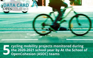
5 cycling projects monitored in the 2020-2021 school year by At the School of OpenCohesion teams
•
0 likes•95 views

This document summarizes information from 4 monitoring reports on cycling mobility projects in Italy. It provides details on the projects such as location, costs, beneficiaries, progress status. The projects involved creating cycling and pedestrian routes connecting various cities and municipalities in Italy. The monitoring teams found the projects to be useful and effective in improving mobility and connectivity according to their reports.

Recommended
Recommended
More Related Content
What's hot
What's hot (10)
Similar to 5 cycling projects monitored in the 2020-2021 school year by At the School of OpenCohesion teams
Similar to 5 cycling projects monitored in the 2020-2021 school year by At the School of OpenCohesion teams (20)
More from OpenCoesione
More from OpenCoesione (20)
Recently uploaded
Recently uploaded (20)
5 cycling projects monitored in the 2020-2021 school year by At the School of OpenCohesion teams
- 1. cycling mobility projects monitored during the 2020-2021 school year by At the School of OpenCohesion (ASOC) teams 5 DATA CARD
- 2. IThe route runs 5.27 km from Piazza 9 Novembre 1989 and the entrance to the M3 underground station in San Donato Milanese to Via Carducci (Laghetto Azzurro) in Peschiera Borromeo. 4 km of the route are in San Donato Milanese and 1.2 km in Peschiera. The cycling route follows the Caviaga-Piadena-Bellincioni- Cefalonia-Europa roadway before turning east along Via Maritano. After the parklands along the banks of the Lambro river, the route enters Peschiera across a single-span bridge (parallel to the Paullese) that is 35 metres long and 4 metres wide. On the other side of the Lambro, the path joins the Peschiera bike-route network, which features popular stops for cyclists and families, including Idroscalo, Forlanini Park, and Borromeo Castle. The project falls within the scope of the objectives of the 2020 Agenda of the City of Milan. Cycling route connecting Peschiera Borromeo (MI) and San Donato Milanese (MI) Public cost > € 1.389.998,64 Beneficiary > Municipality San Donato M. Programme > ROP ERDF Lombardy Programming period > 2014-2020 75% Project progress The project was monitored by the team Sulla Buona Strada from Vincenzo Benini Secondary School in Melegnano (MI). According to the report Monithon, the project is “very useful and effective: there is a preponderance of positive aspects and it is effective on the whole from the point of view of the end user”.
- 3. IThe project aims to create a 300-metre cycling and pedestrian path connecting Via Torino with a future underpass for bicycles to the Porto Marghera station. The project is part of a series of broader initiatives for the creation of safe, convenient cycling routes connecting the various sections of the city, so as to promote alternative forms of mobility to the privately- owned car in order to improve the quality of urban living. The project is crucial to completion of the 8.35 km route connecting Venice and Mestre. Phase 3 of BICIPLAN called for connecting the historical city of Venice with the mainland. As approved, the project called for and funded the creation of the 3 sections that now exist: -the 2 km mainland “Ai Pili” section; - the 3 km section down the middle of the Ponte della Libertà bridge; -the 750 m section down from the bridge Public cost > € 277.037,70 Beneficiary > Municipality of Venezia Programme > NOP ERDF ESF METROPOLITAN CITIES Programming period > 2014-2020 Cycling route connecting Forte Marghera and the Porto Marghera (VE) train station The project was monitored by Bike Team from Ugo Morin Secondary School in Venice. According to the report Monithon, “It was not possible to assess the efficacy of the project,” as it was still under way, so it “has not yet produced results that can be evaluated.” 0% Project progress
- 4. 75% Over the course of nearly 48 months, the project saw the creation of two cycling routes connecting the provinces of Venice and Padua: one in the direction of the existing route along the Brenta River and the other connecting the Euganean Hills loop with a route that runs along the Bacchiglione River. The project falls within the scope of a broader plan of interventions for the creation, by the Region of Veneto, of 24 cycling routes with the goal of resolving issues of mobility and urban connectivity. The projects take account of the provisions of the region’s Master Plan. This project contributed to completing an important connection between the provinces of Padua and Venice, a route that can now be done safely by bike or on foot. The cycling route connects the towns of Cadoneghe, Cervarese Santa Croce, Noventa Padovana, and Vigonza. Public cost> € 1.142.437,44 Beneficiary > Province of Padua Programme > PAR FSC Veneto Programming period > 2007-2013 Cycling routes connecting the Brenta River, the province of Venice, the Euganean Hills loop, and the Bacchiglione River The project was monitored by the team Sportify from Ugo Morin Secondary School in Venice. According to the report Monithon, the project is “very useful and effective: there is a preponderance of positive aspects and it is effective on the whole from the point of view of the end user”. Project progress
- 5. 84% Project progress Over a period of four and a half months, the project saw the environmental development of an 840 sq m plot of land that can now be used by local residents and tourists thanks to the creation of a cycling and pedestrian path in front of the decommissioned industrial area of the former Società Aeronautica Italiana, as well as refurbishment of the public park Parco del Pidocchietto across from the path. The project included both the creation of the bike and pedestrian path and the following successfully executed works: -consolidation of the concrete ramp and ramp shoulders -general clean-up of the area -demolition of a small building near the lake shore -lowered roadway for maintenance vehicles serving the park. Public cost > € 445.000,00 Beneficiary > Municipality Passignano sul Trasimeno (PG) Programme > ROP ERDF Umbria Programming period > 2014-2020 Environmental development and creation of cycling and pedestrian routes - Ex SAI The project was monitored by the team Check Point SAI from Magione Secondary School (PG). According to the report Monithon, the project is “very useful and effective: there is a preponderance of positive aspects and it is effective on the whole from the point of view of the end user”.
- 6. The cycling and pedestrian path makes use of about 3.5 km of a decommissioned section of railway in Acireale. By creating its new system of mobility, the town has set the goal of connecting its urban and suburban areas, while promoting cycling as an ecological alternative to motor vehicles and developing the territory by creating routes of natural and environmental value. The route includes sections of tunnel that feature LED lighting. In order to construct the cycling and pedestrian path, it is necessary to expropriate a number of areas, pave for bicycles, provide railway bridges with protective railing, and repair surfaces for foot and bike traffic. Public cost > € 919.881,53 Beneficiary > Municipality Acireale (CT) 33% Project progress Programme > PAC Sicily Programming period > 2007-2013 Bike and pedestrian path along the route of the decommissioned railway in Acireale (CT) The project was monitored by the team Jacicuduroti from IS Archimede Secondary School in Acireale (CT). According to the report Monithon, “It was not possible to assess the efficacy of the project,” as it was still under way, so it “has not yet produced results that can be evaluated.”