3.8 IUKWC Workshop Freshwater EO - Rajiv Sinha - Jun17
•
1 like•814 views

Monitoring water pollution in the River Ganga with innovations in airborne remote sensing and drone technology. Rajiv Sinha (Indian Institute of Technology Kanpur)

Recommended
Recommended
More Related Content
What's hot
What's hot (20)
Viewers also liked
Viewers also liked (10)
Similar to 3.8 IUKWC Workshop Freshwater EO - Rajiv Sinha - Jun17
Similar to 3.8 IUKWC Workshop Freshwater EO - Rajiv Sinha - Jun17 (20)
More from India UK Water Centre (IUKWC)
More from India UK Water Centre (IUKWC) (20)
Recently uploaded
Recently uploaded (20)
3.8 IUKWC Workshop Freshwater EO - Rajiv Sinha - Jun17
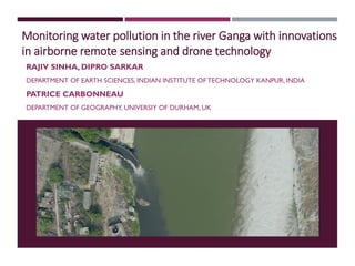
- 1. Monitoring water pollution in the river Ganga with innovations in airborne remote sensing and drone technology RAJIV SINHA, DIPRO SARKAR DEPARTMENT OF EARTH SCIENCES, INDIAN INSTITUTE OF TECHNOLOGY KANPUR, INDIA PATRICE CARBONNEAU DEPARTMENT OF GEOGRAPHY, UNIVERSIY OF DURHAM, UK
- 2. AIRBORNE REMOTE SENSING (Lavender, 2005). Airships Aeroplanes UAVs Helicopters FixedWing UAV Advantage Efficient aerodynamics Greater coverage High speed, Natural gliding – w/o power Mildly wind /rain resistant Greater payload Disadvantage Needs a runway/launcher Cannot stay stationary Rotary Wing UAV Advantage Vertical take-offs Agile manoeuvrings Payload configurable Can stay stationary Disadvantage Smaller coverage More maintenance due to more moving parts Susceptible to damage during wind /rain
- 3. WATER QUALITY ASSESSMENT Water quality refers to the chemical, physical, biological, and radiological characteristics of water. • Limitations of prevailing Water Quality measurements methods: • The techniques are labour intensive, time consuming, and costly. • Involves long term commitment on local infrastructure. • Low awareness of the social importance of water quality leads to lower priority in funding leading to operational budget cuts. • Point data source seldom reveals the big picture when it comes to assessing large waterbodies. • Site inaccessibility can hinder the acquisition of data. • Field error during sample acquisition and laboratory error during processing affects the result. (El-Din et al, 2013; Ritchie, 2003; Chipman,2009.)
- 4. REMOTE SENSING METHOD OF WATER QUALITY ASSESSMENT Advantages of Remote Sensing method: Provides a synoptic view of large waterbodies which is more effective in monitoring the temporal and spatial changes Takes lesser time to get a comprehensive idea. Variation in concentration are more prominent due to continuous data. Less costly. (Seyhan et al,1974, Kallio 2000) Optically active parameters - Chlorophyll a, Temperature, Coloured Dissolved Organic Matters, Total Suspended Matters, Dissolved Organic Carbon, Turbidity, Sea Surface Salinity. Reflectance vs wavelength
- 5. GENERAL METHODOLOGY Empirical Approach: Y =A+BX or Y = ABX Where, Y = Reflectance value A & B = empirically derived factors determined statistically from the spectral value and in-situ measurements. (Seyhan et al,1986, Conrad et al, 1971)
- 6. MULTISPECTRALVS HYPERSPECTRAL Multispectral Hyperspectral • In a single observation a multispectral sensor generate 3-10 spectral bands • Covers large spectral bands • Images are captured in snapshot • Until a mechanical shutter is used, electronic shutter creates geometric distortion. • In a single observation a hyperspectral sensor can observe more than 100 spectral bands • Covers narrow spectral bands • Images are captured in single digital array ensuring larger instantaneous view. • Lowest possible geometrical distortion Observations • Water is optically active only in a small part of the spectrum. • Due to very low concentration of the heavy metals, the bulk of the reflective spectra constitutes of those reflected by suspended sediments and chlorophyll. • Spaceborne sensors provides multispectral images with large band gaps and large swath. (Siegmund, Menz, 2005. Jensen,2007. Ferrato, 2012)
- 7. RESEARCH OBJECTIVES ANDTOOLS Water quality mapping of large rivers for airborne platforms – Cessna Aircraft and UAVs Identifications of major hotspots of water pollution Characterisation of pollutants based on spectral characteristics Tools Cessna Aircraft UAVs (UX5, Phantom 4) Cameras and filters Cessna Aircraft UAV – UX5 Hyperspectral CameraDJI Phanton 4 Multispectral Camera Single band cameras
- 8. DESIGN OF MOUNT FORTHE CESSNA AIRCRAFT Four cameras – nearly co-axial Filters: 520, 650, 800, 852 nm Video capture
- 9. FLIGHT PLAN AND IMAGES 520 nm 650 nm 800 nm 852 nm Flight path: Bithur to Jajmau (25km) Height: 1100 ft Speed: Variable Image resolution: 1 mp GSD: ~ 1m Filters: 520,650,800,852 (nm)
- 10. Results: Spectral characteristics of different parts of channel Id Class 1 Dense crops 2 Sparse crops 3 Inland Water bodies 4 Dry Sand Bar 1 6 5 4 3 2 7 Colour Band Red 520 Green 650 Blue 800 Id Class 5 Damp Sand Bar 6 Wet Sand Bar 7 Water Body Brightness (DN) 12830
- 11. Along the channel variation in water quality due to pollutants (394,520,650 nm) DownstreamUpstream Flight path Frame 1 Frame 2 Frame 3 Frame 1 Frame 2 Frame 3 Red 520 nm Green 650 nm Blue 800 nm Major drain Blue band shift, sensitive to metallic ions Infrared signal- two peaks due to turbidity Three bands have distinct signals, respond to different parameters (Blue – metals, green- chlorophyll, infrared- turbidity) Similar to Frame 1, a little darker due to difference in illumination Effect of the pollutants added by the drain
- 12. Identifying a source of pollution through multispectral camera at Kanpur • Flight height: 1100 feet (335m) • Image resolution: 20cm (Gopro), 40cm(FCC) • Bit Depth: 32bit (GoPro 4), 8-bit (Multispectral Camera System) • Bands Used: RGB (Go Pro 4), 520,652,800nm and 852 nm (MCS). • The 852 nm band did not captured any reproducible image. • Base image : Bing World Map Service RGB GoPro 4 image FCC Multispectral Camera System (MCS) City Outlet City Outlet
- 13. City Outlet 1 2 3 Identifying source of pollution using a multispectral camera • Blue band shifting to left, darker, not much metallic ions • Green band most affected, chlorophyll concentration may be higher due higher flux of N and P • Red band very sharp at the outlet – higher particulate matter, and therefore very high turbidity 1. Fresh Water 3. D/s of outlet 2. At outlet Legend: Red ~ 800nm Band Green ~ 650nm Band Blue ~ 520nm Band * All bands are have ±5nm tolerance Brightness (DN number) No.ofpixels Histogram comparison of RGB and multispectral image (520, 650 & 800 nm band) 30 128
- 14. Spectral variation in a stretch of stagnant water Zone 1 Zone 2 Zone 3 Zone 4 Zone 5 No.ofpixels Input from drain Brightness (DN number)
- 15. 1.No Pollution 5. Highly Polluted Water 3 & 4. Medium Mixing 2.Light mixing Legend: Arrows 1.Yellow – Primary drain; 2.Green – Small drains; 3.Red – Medium sized drain Drone flights: Imaging and Histogram analysis over an outlet in Ganga 6A. Discharge from first drain 6B. Discharge from multiple small drain 6C. Discharge from multiple small drain Images from left to right: Original image with inputs from drains; After removing sandbar and then applying histogram equalization on PC1 image; Zonation of the area. 6D. Discharge from medium size drain Total stretch: 4 km Flight height: 273 m Image capturing: 20 m Camera: RGB PCA analysis of three band data (PC1 image shown) 30 12870 No.ofpixels
- 16. 1.No Pollution (DJI) 6. Discharge from outlet (DJI) 3 & 4. Medium Mixing (DJI) Histograms of RGB and multispectral image (520, 650 & 800 nm band) Comparisons: Cessana and Drone flights 1.No Pollution (Cessna) 3 & 4. Medium Mixing (Cessna) 6. Discharge from outlet (Cessna) * All filters in multispectral camera is having ±5nm tolerance Cessna images: Red ~ 800nm Band Green ~ 650nm Band Blue ~ 520nm Band DJI images: Standard RGB Shivrajpur Kanpur Jajmau Sultanpur
- 17. NEXT STEPS Design and customization of the UAV for the Multispectral and hyperspectral imaging payload Multispectral imaging Trace pollution plume back to the source Relate spectal characteristics to specific pollutants Hyperspectral imaging Needs designing of a gimbal to carry the payload High resolution data in narrow spectral bands Should allow better differentiation of specral response of clean and polluted water Ground measurements and community participation Ground sampling and laboratory analysis for validating the UAV based measurements Training the community for water quality measurements using portable kits LALE UAS developed by IIT Kanpur