This document provides an overview of a "lightning talk" presentation on the Transportation Framework for the Nation (TFTN). The presentation discusses:
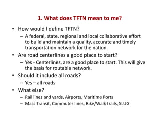
1) Defining TFTN as a collaborative effort to build and maintain an accurate transportation network, including all roads, rail, airports, ports, and trails.
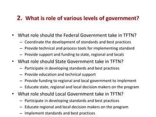
2) The roles of different levels of government, with the federal government coordinating standards, states providing support and funding, and locals implementing standards.
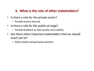
3) The roles of other stakeholders like the private sector providing lessons and the public providing feedback.
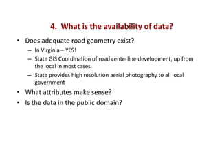
4) The availability of road data in Virginia from local to state coordination and high resolution imagery.
5) How existing programs around highway