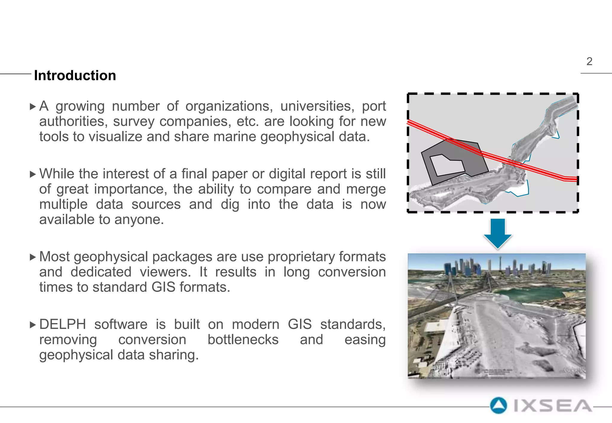
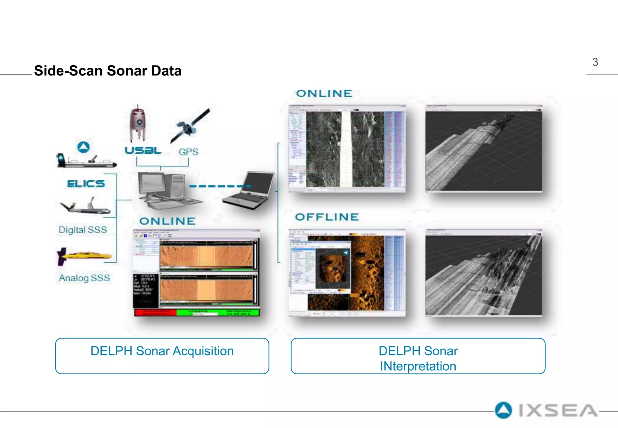
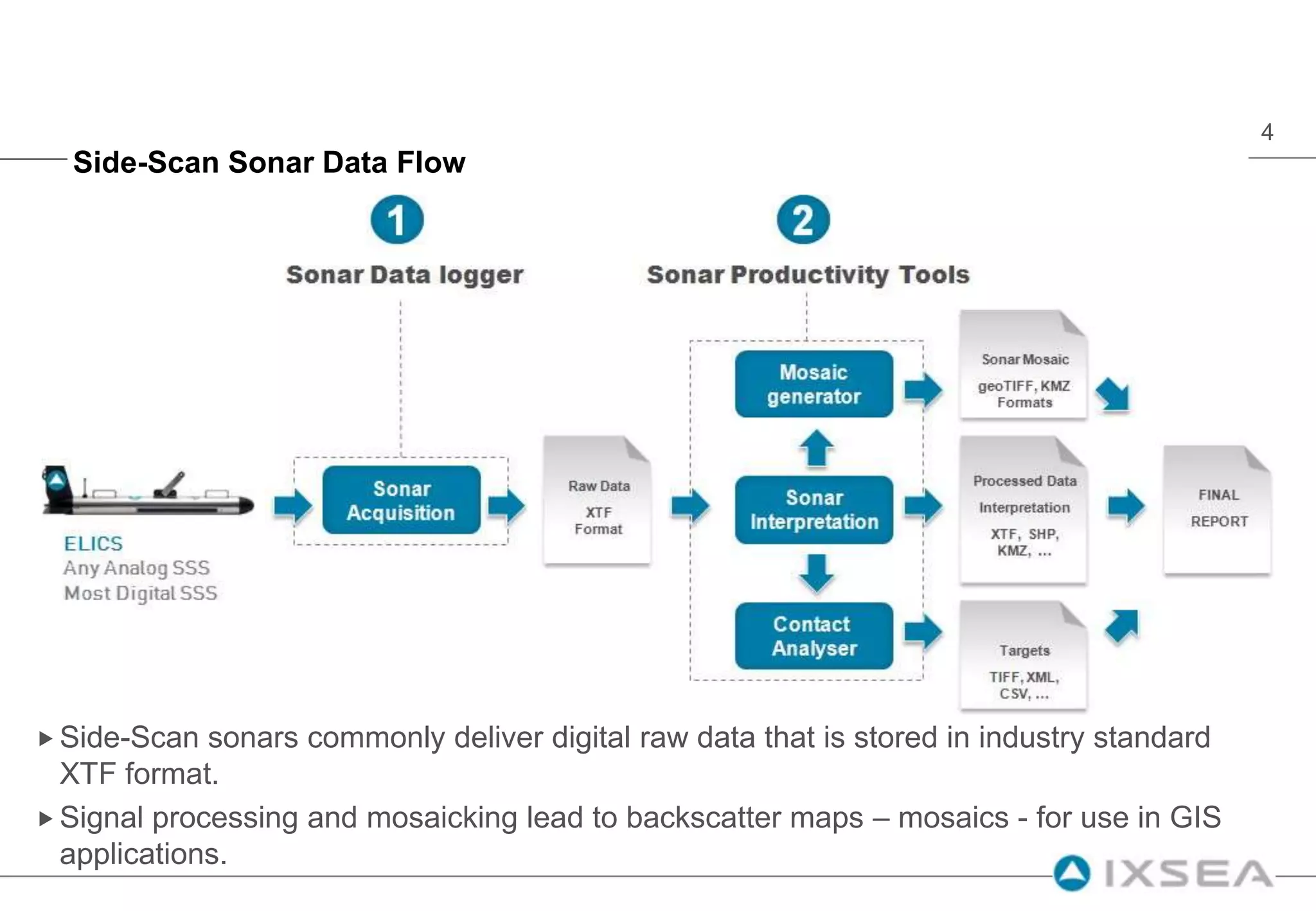
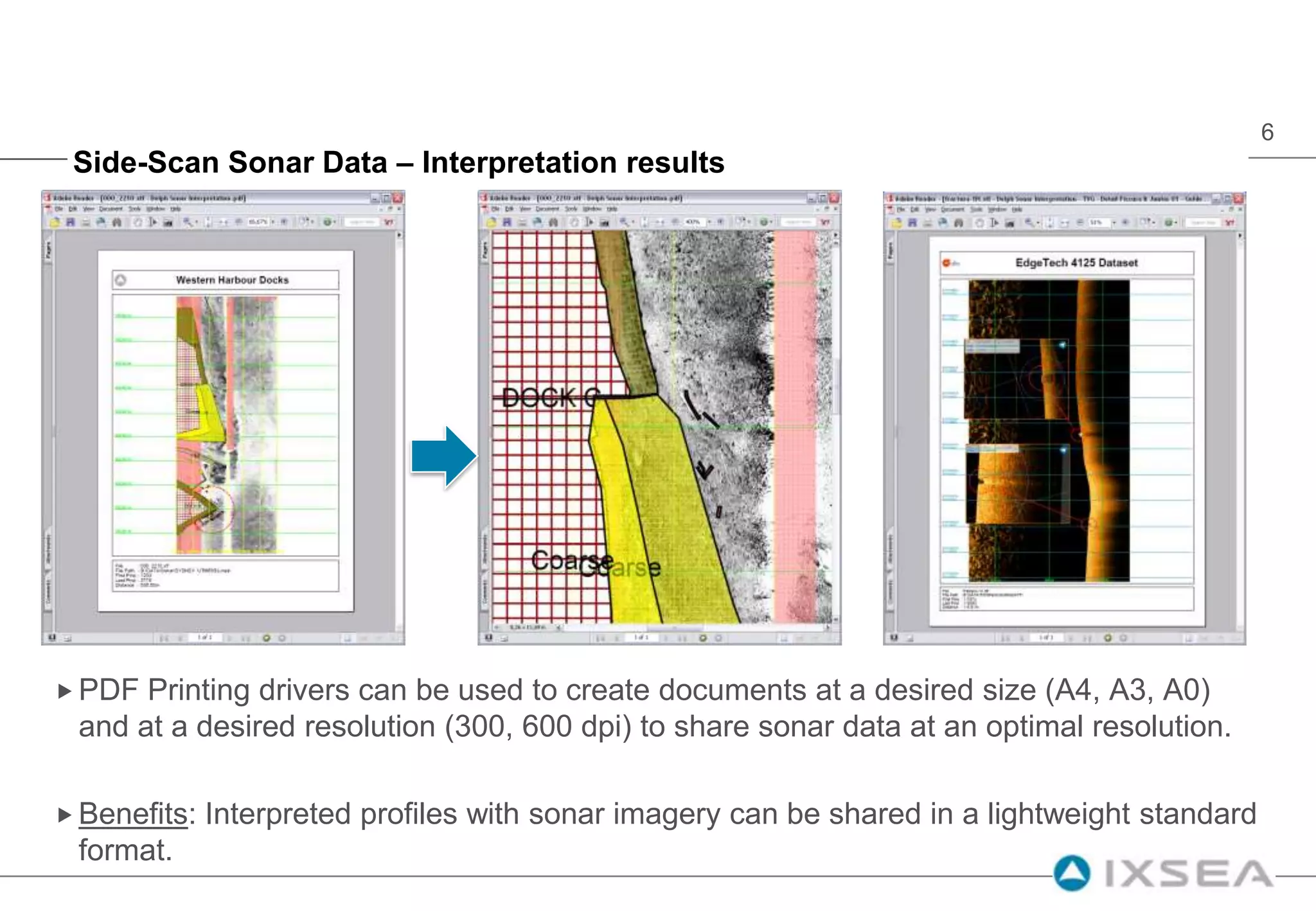
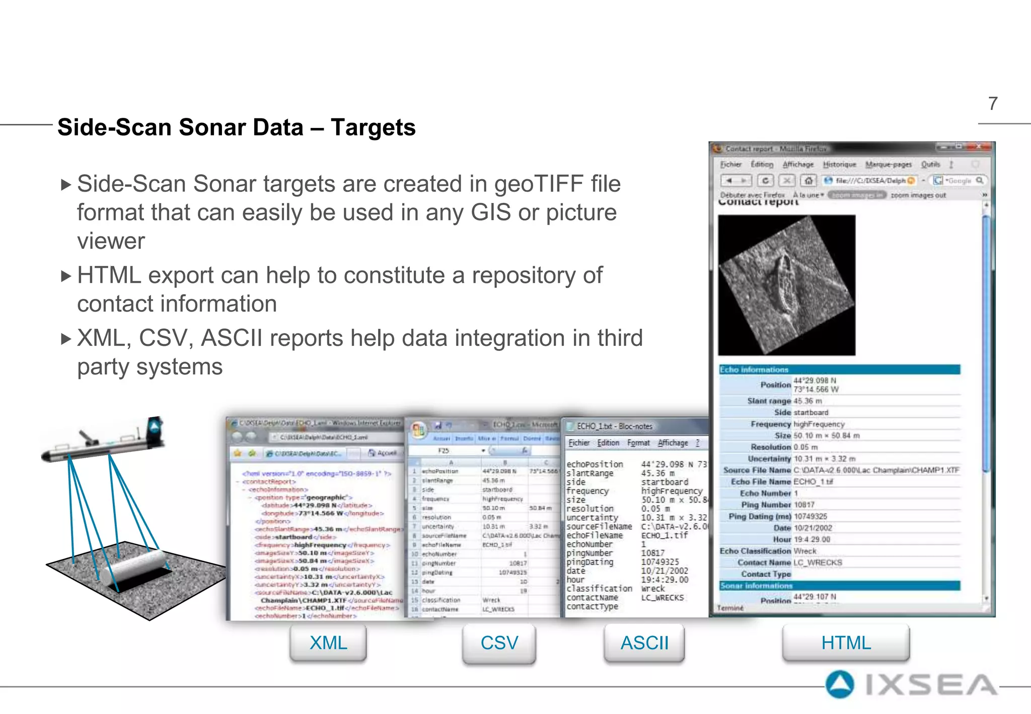
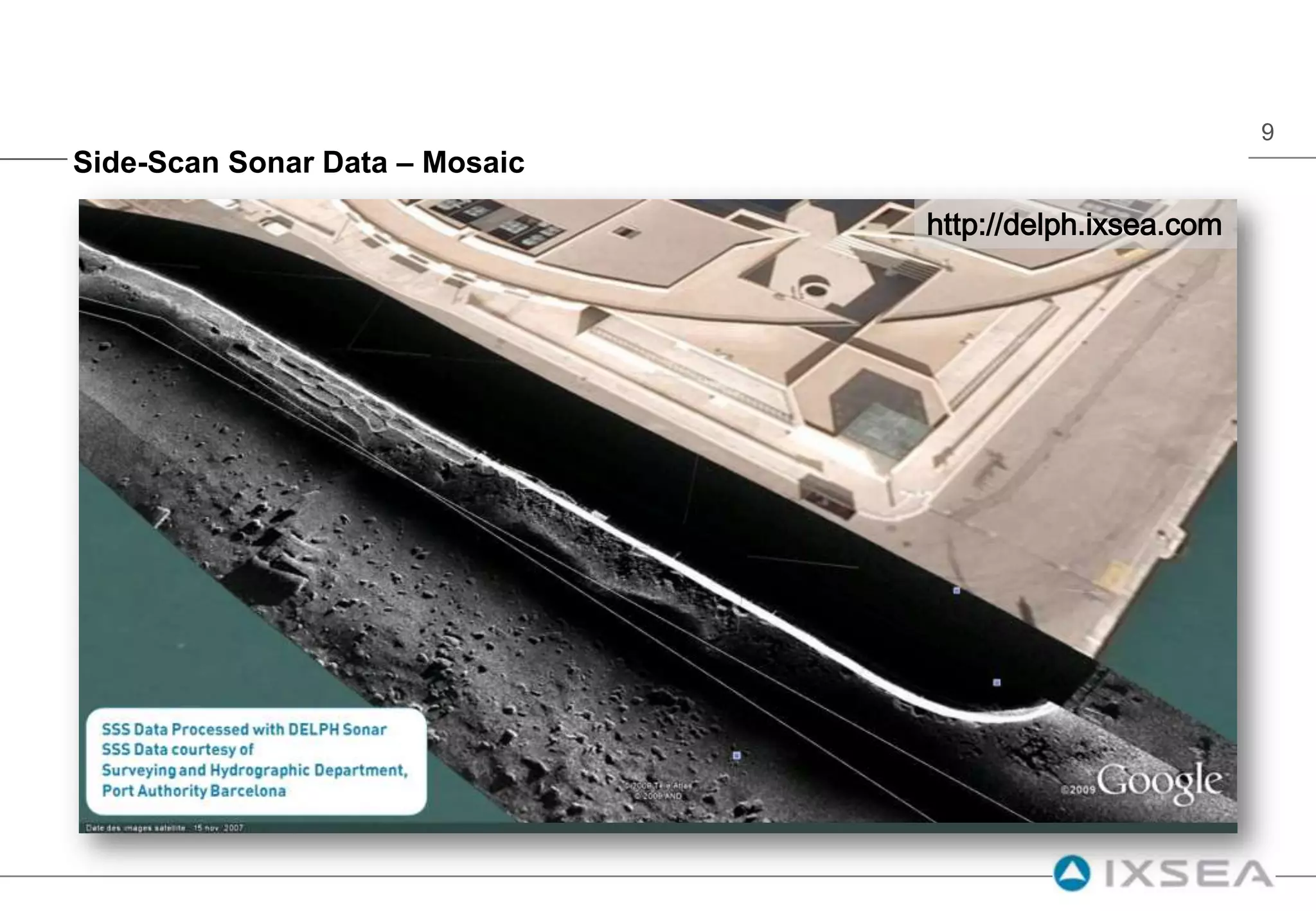
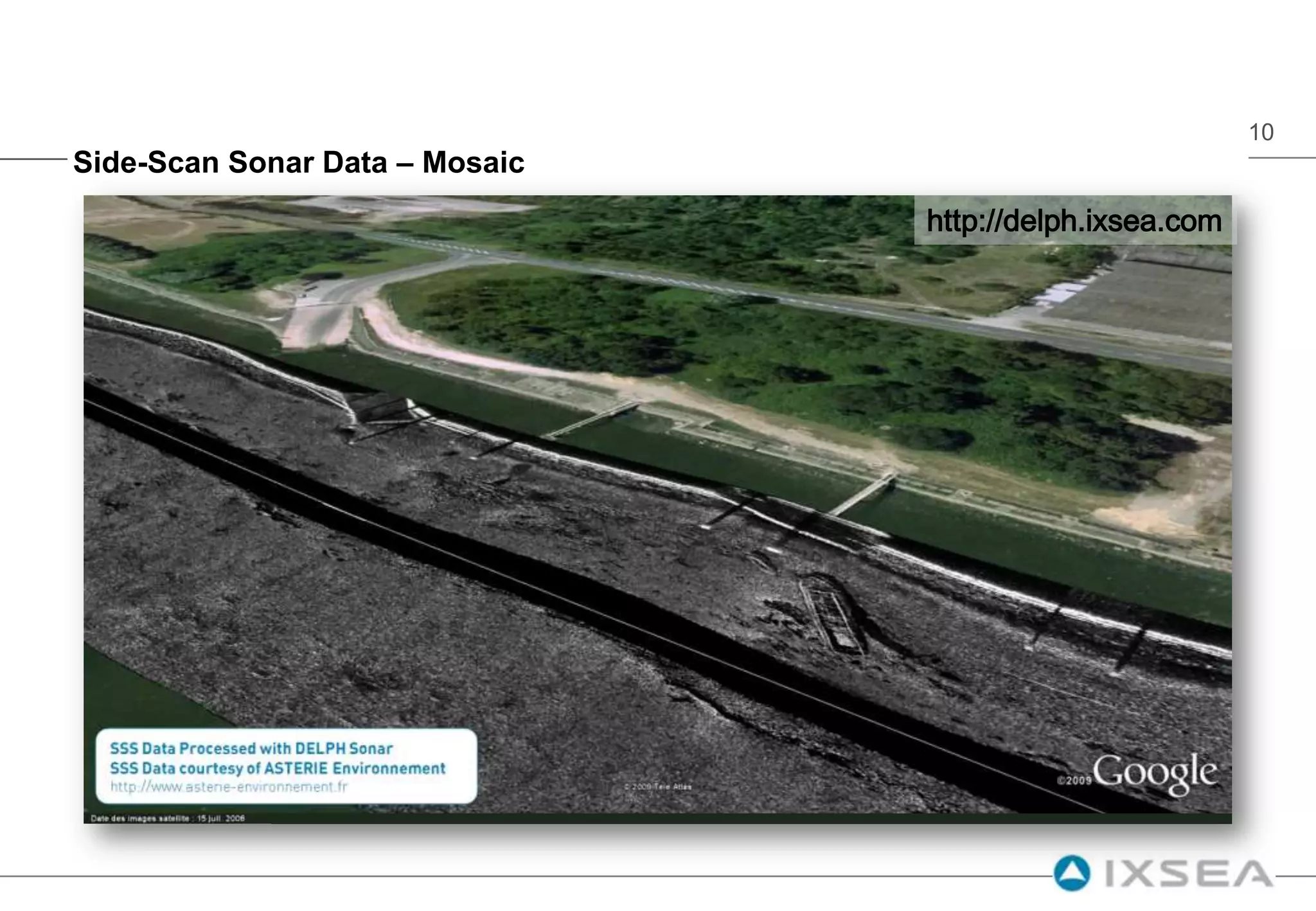
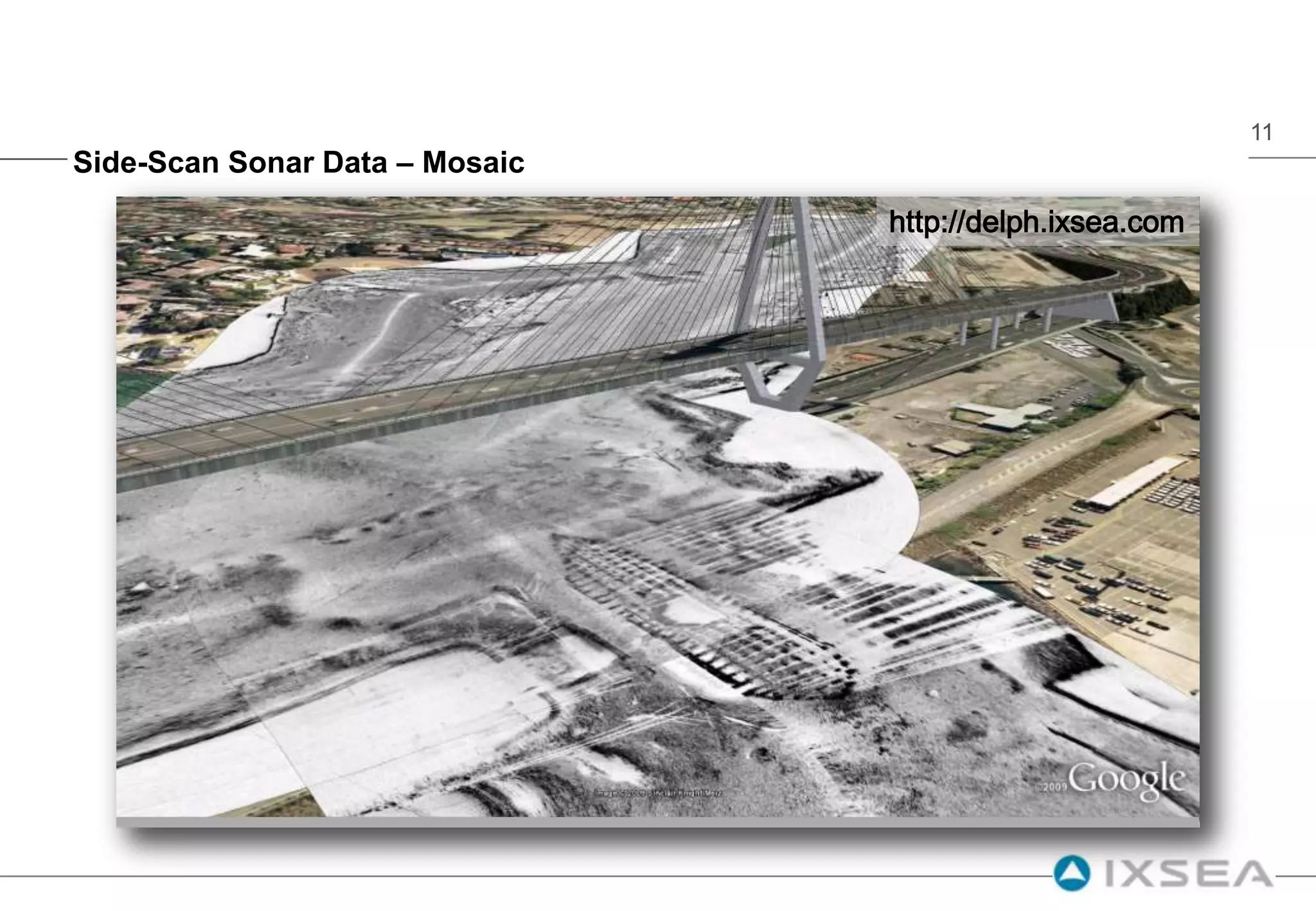
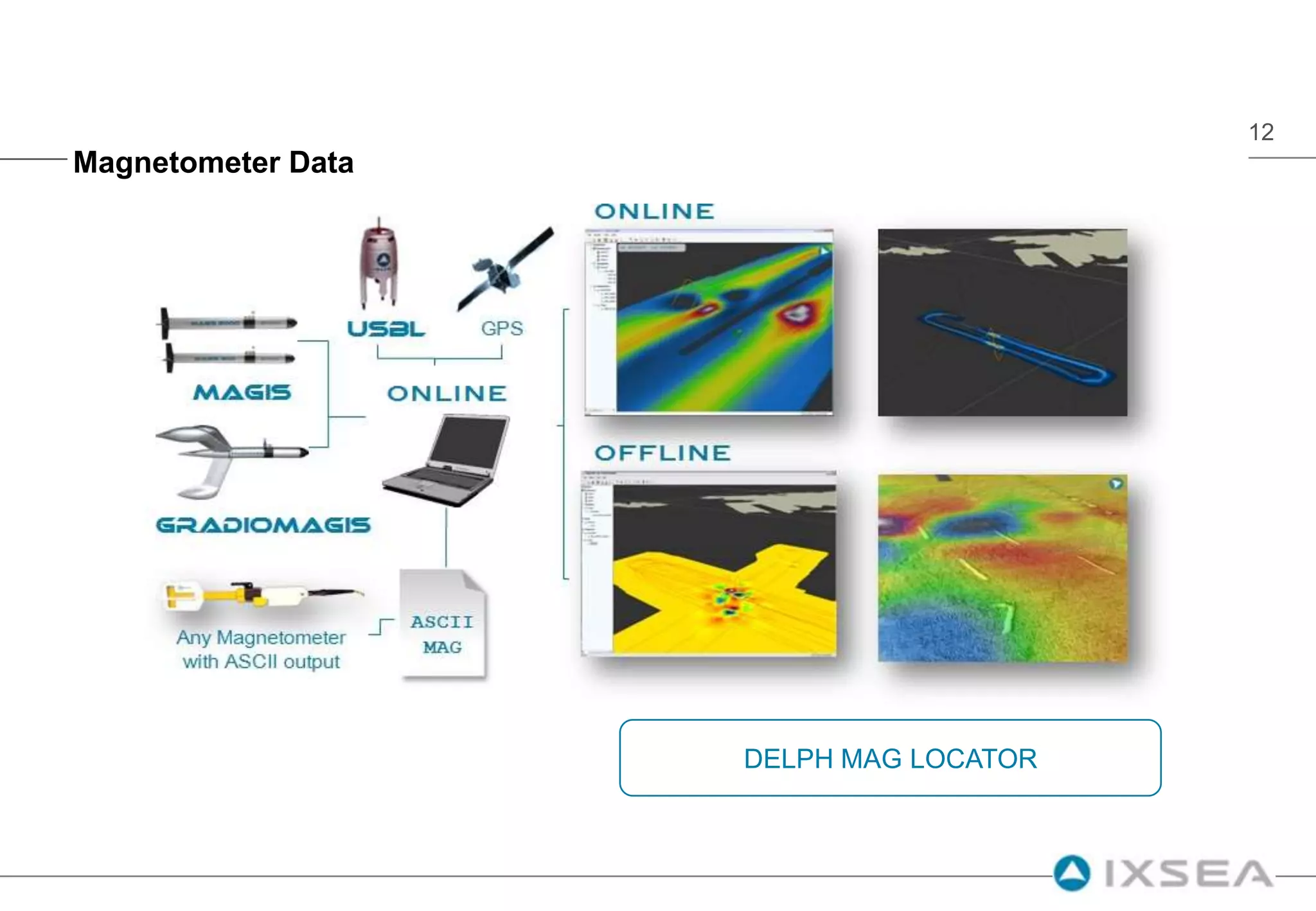
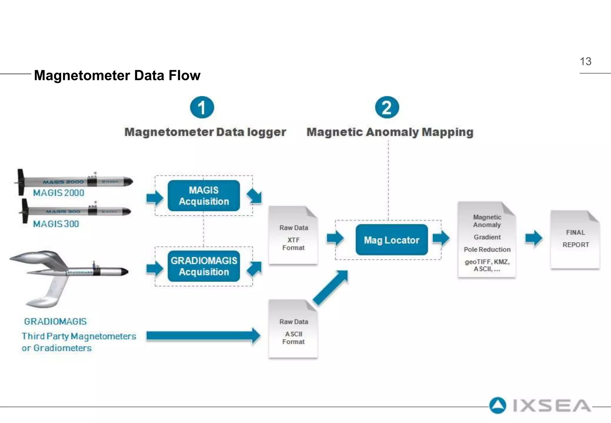
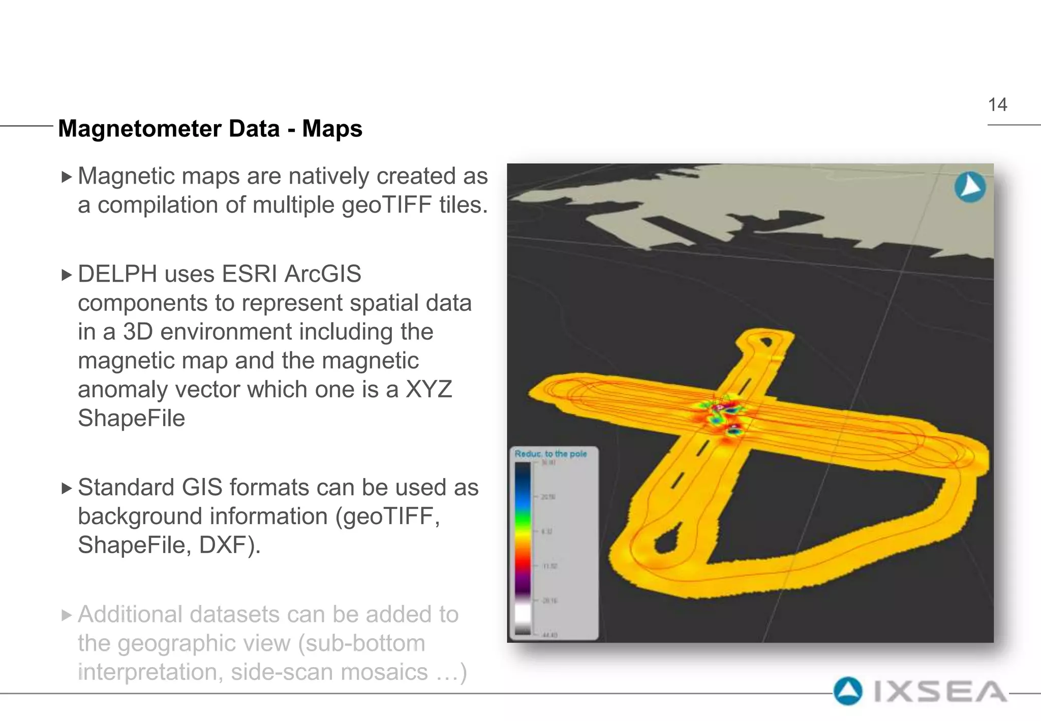
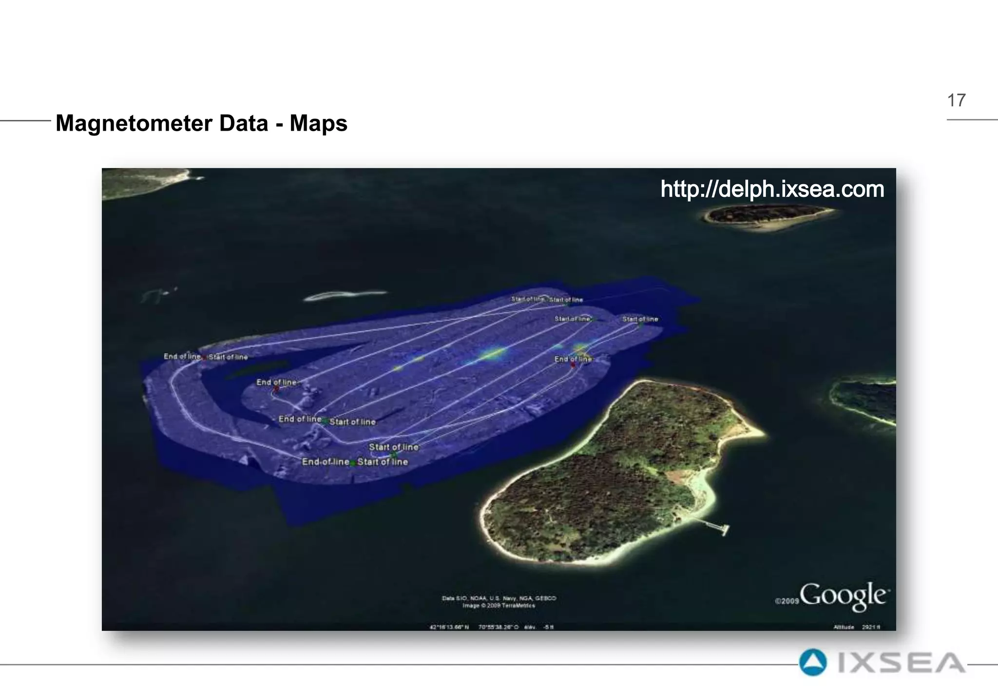
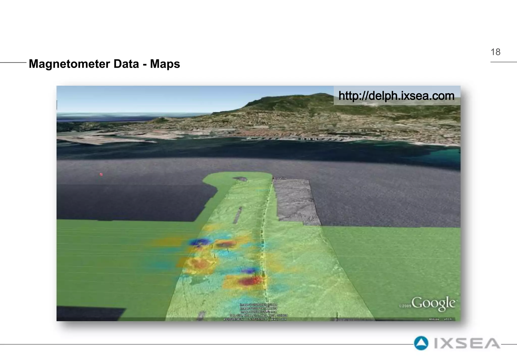
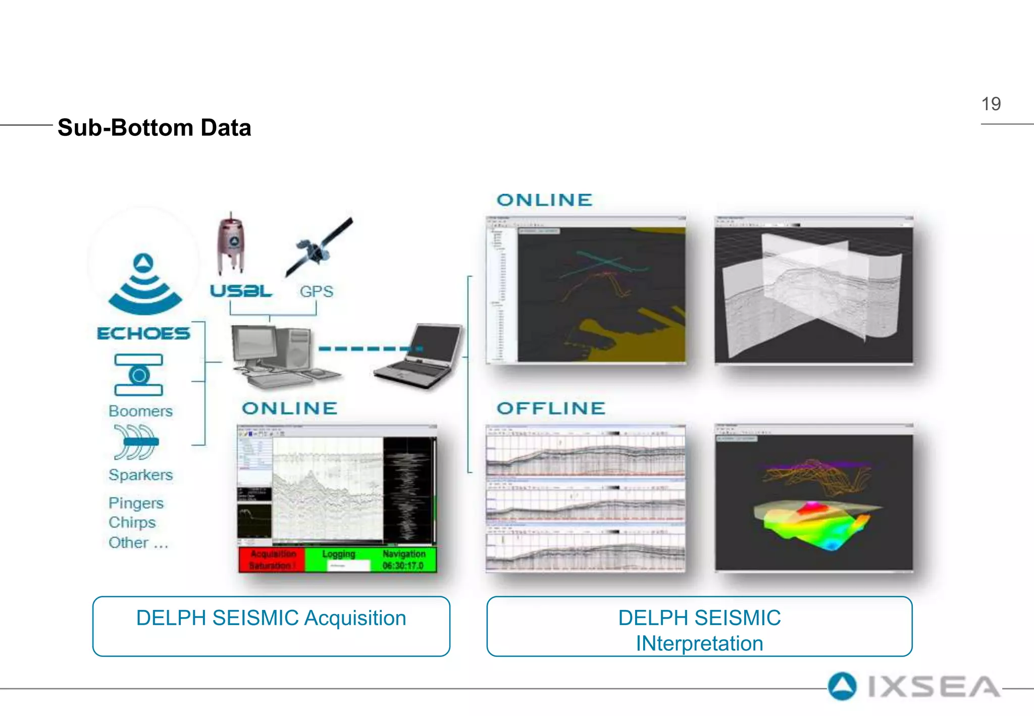
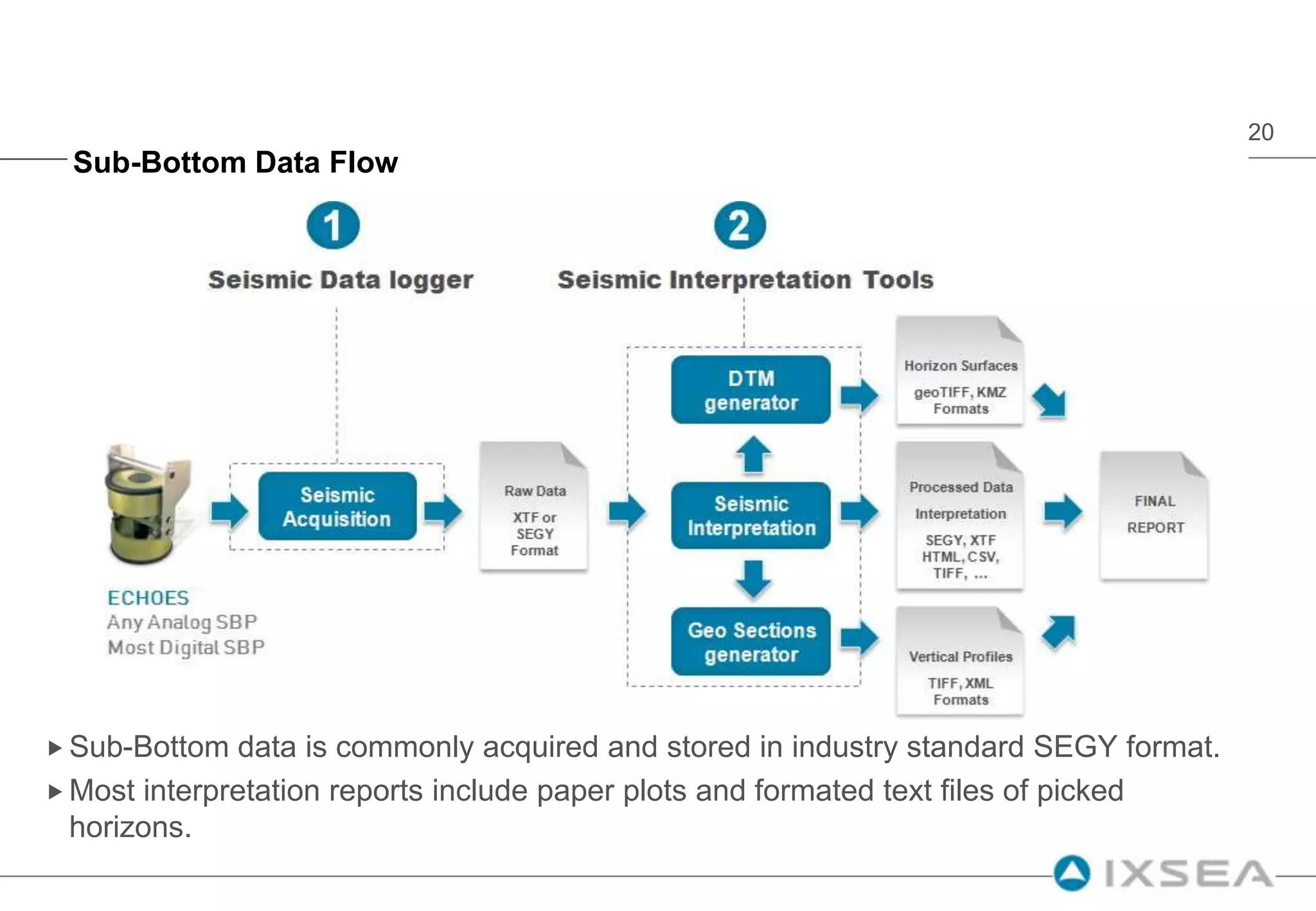
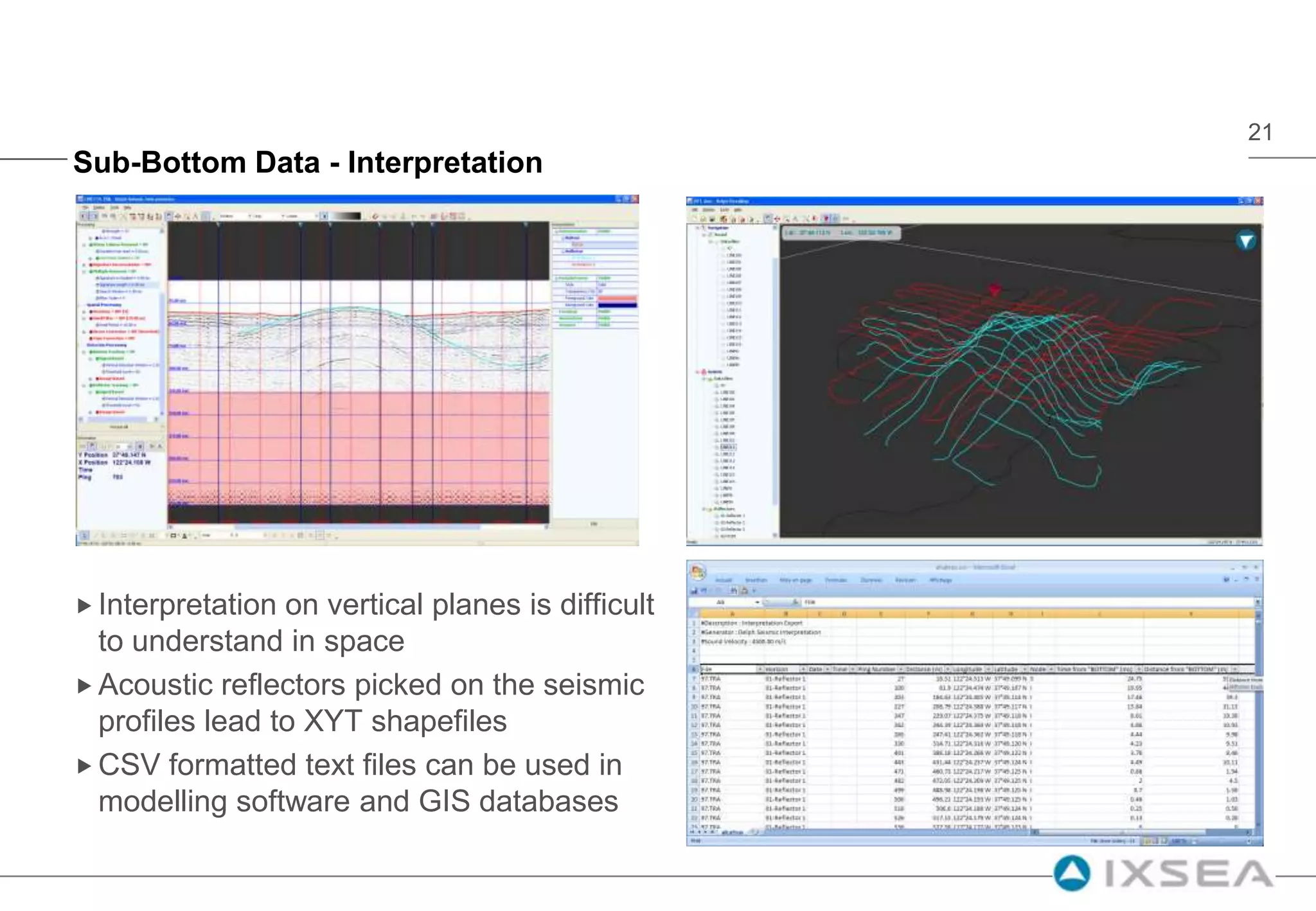
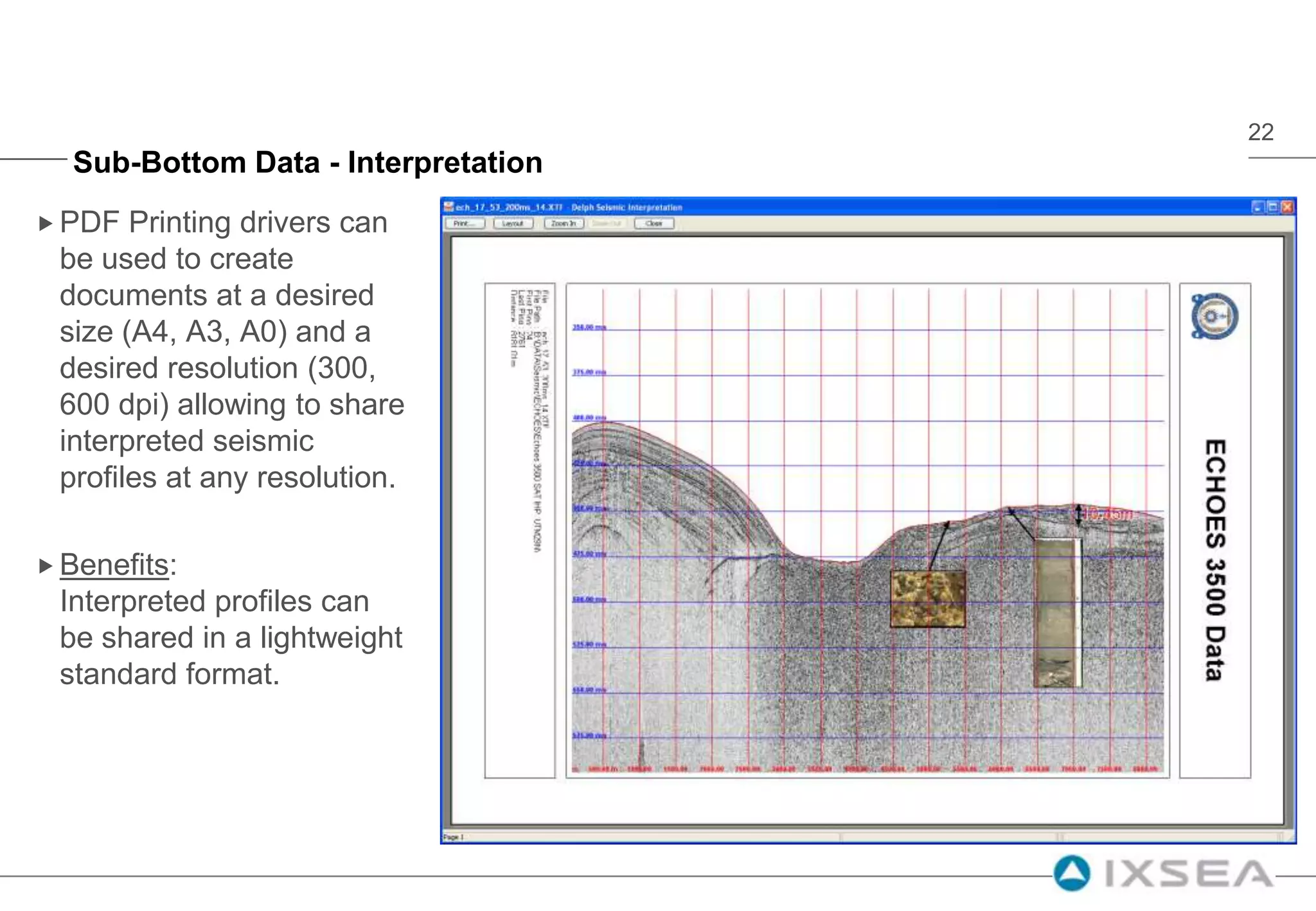
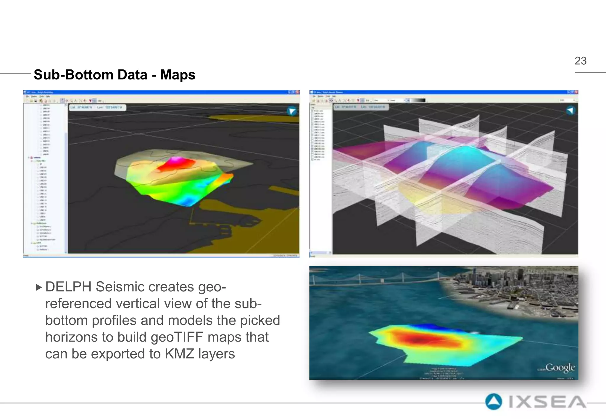
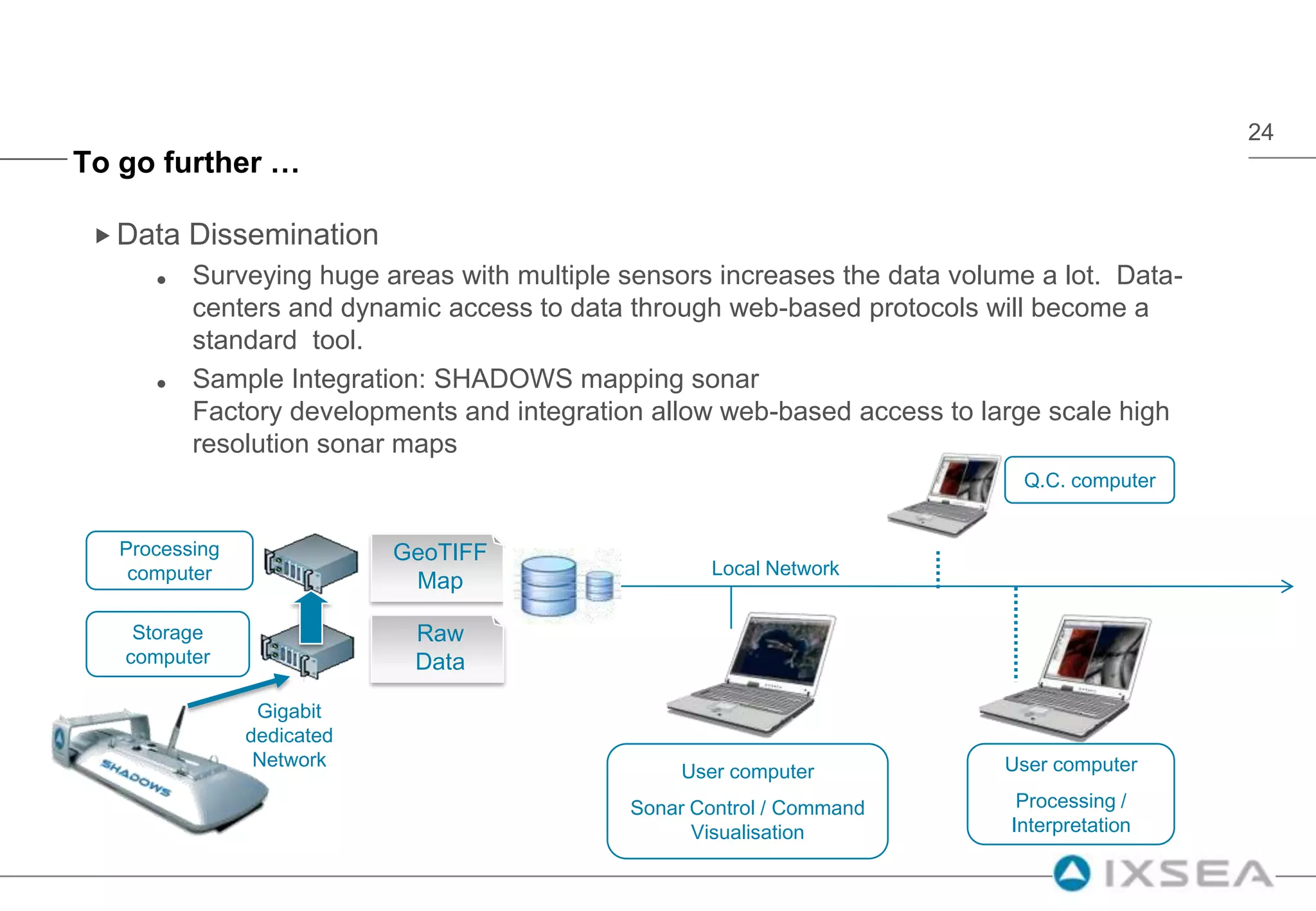
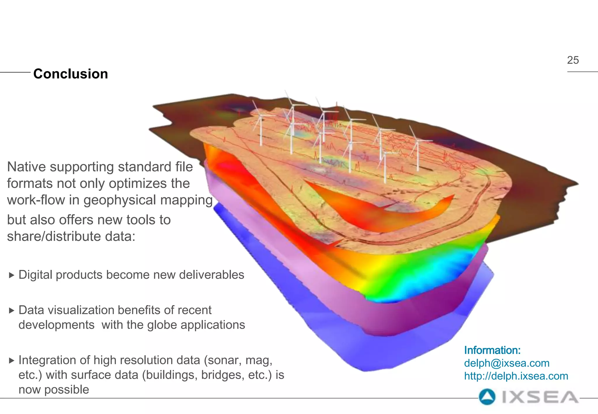
This document discusses new tools for visualizing and sharing marine geophysical data. It describes how the DELPH software uses standard GIS formats and viewers to remove bottlenecks in converting proprietary geophysical data formats. DELPH allows for side-scan sonar data, magnetometer data, and sub-bottom data to be acquired, processed, interpreted and exported to formats like KMZ and geoTIFF to facilitate sharing the data in applications like Google Earth. These new capabilities provide digital deliverables and improve data visualization, integration and dissemination.