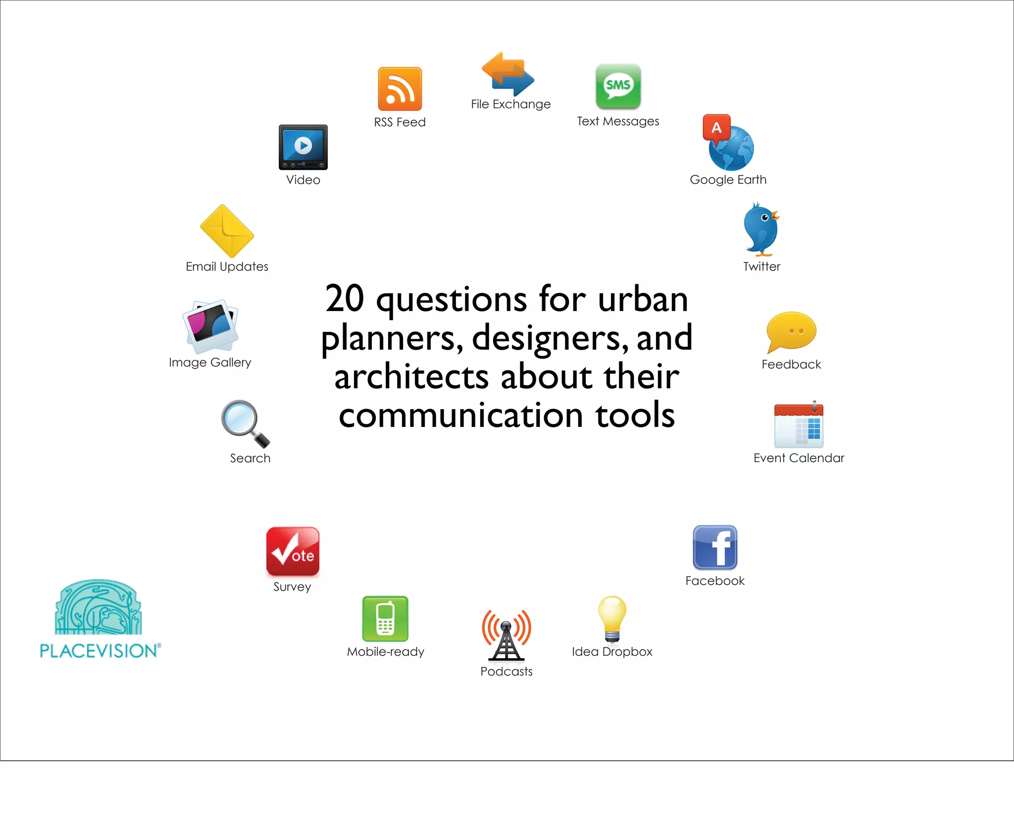
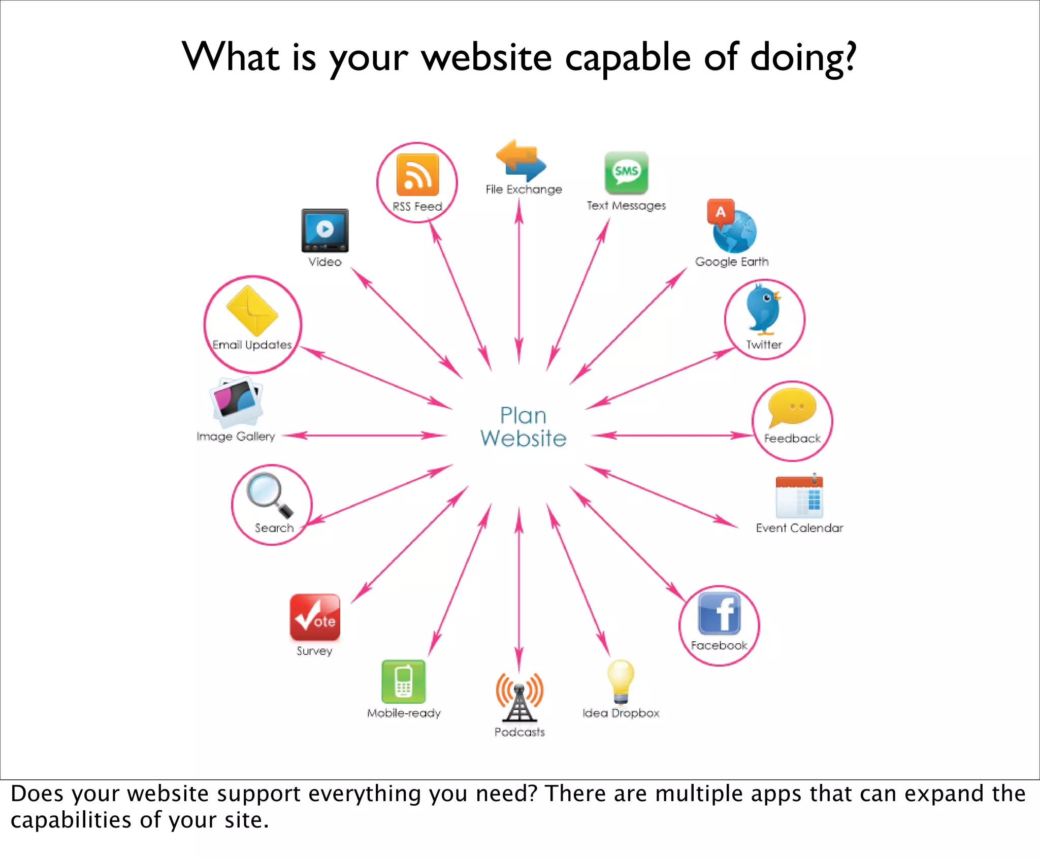
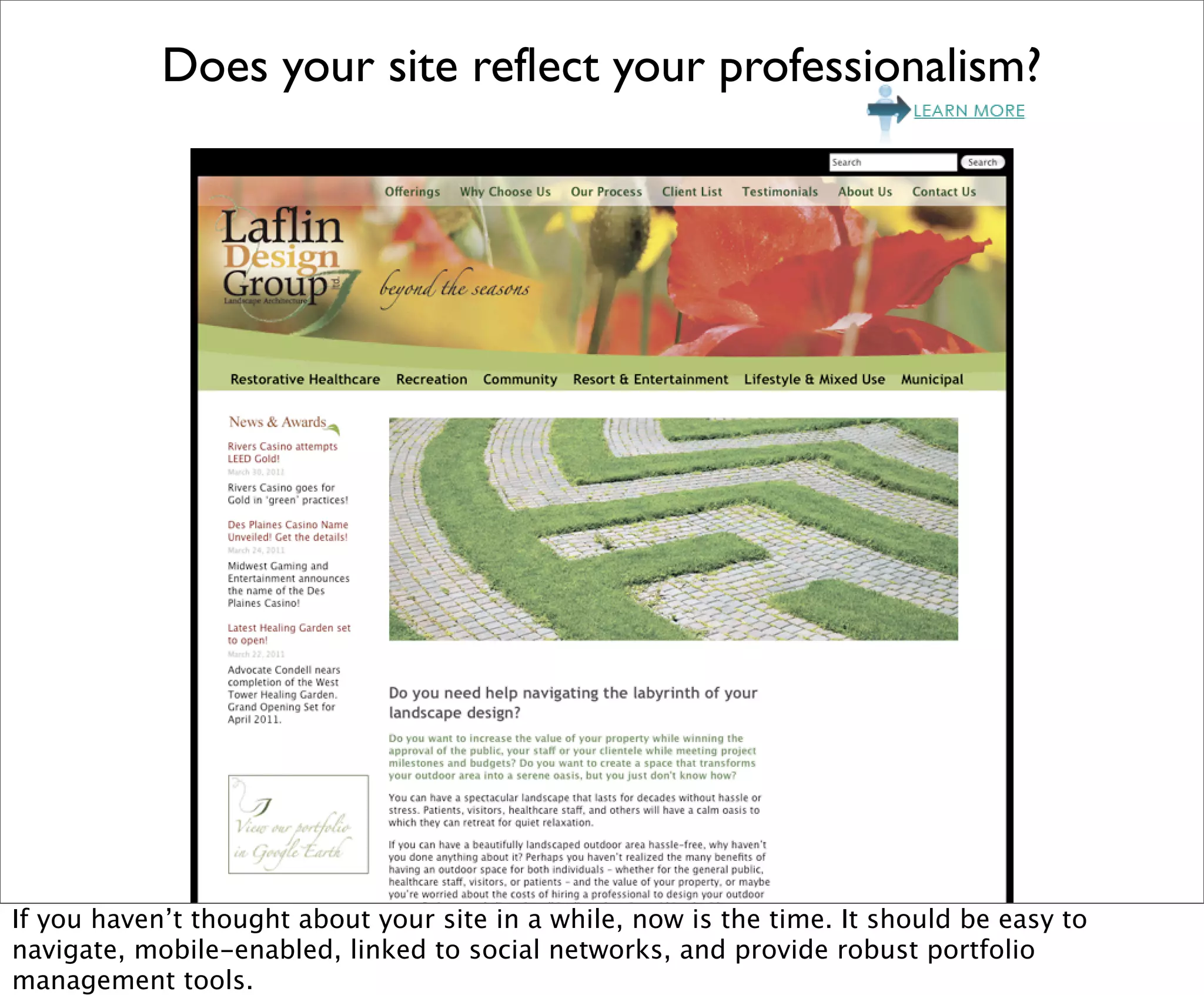
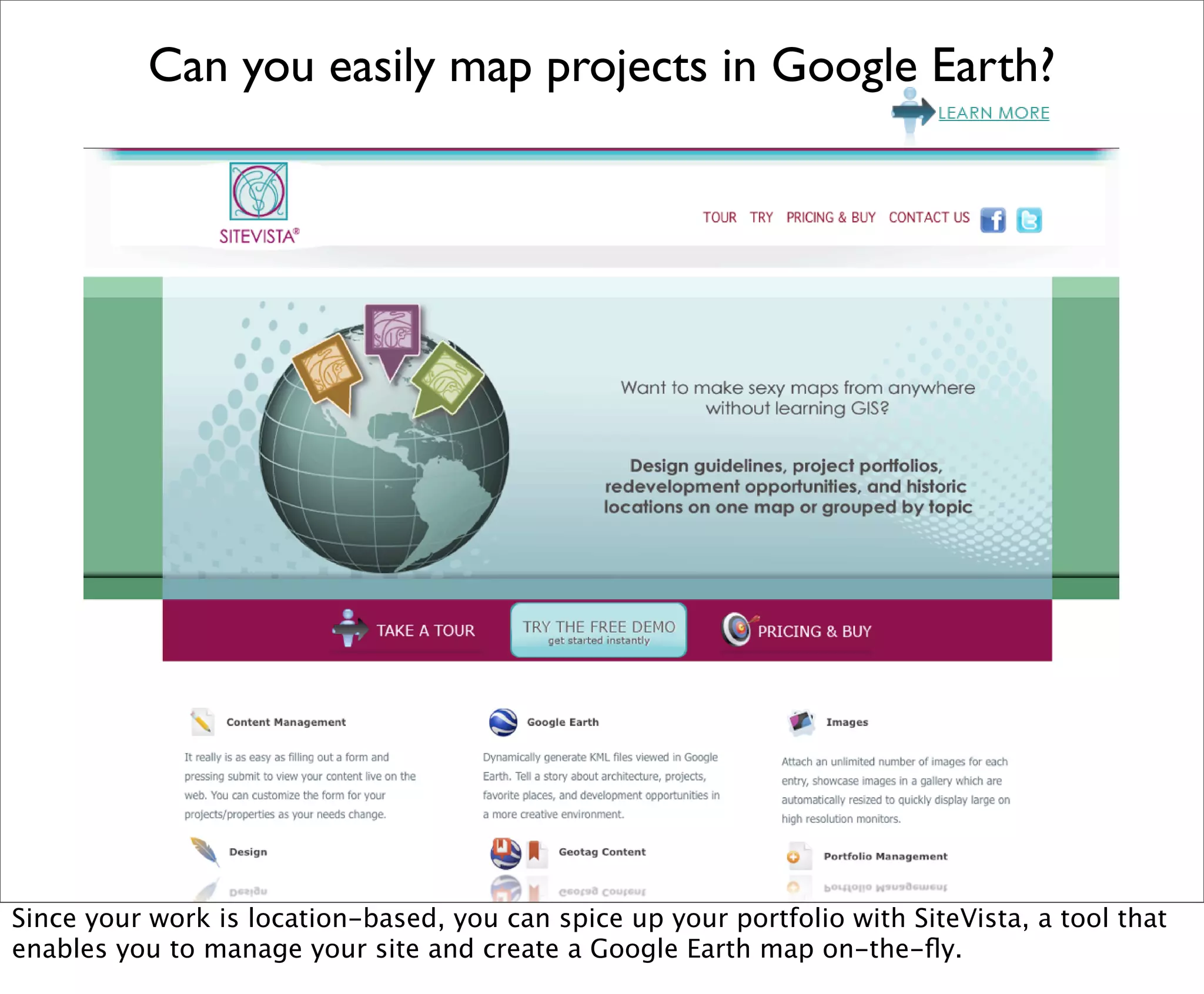
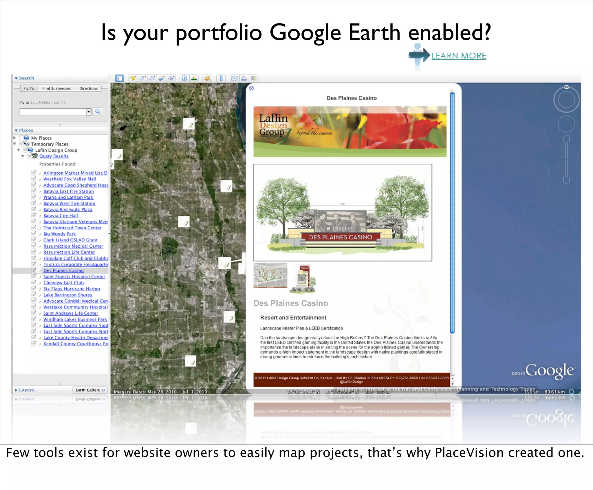
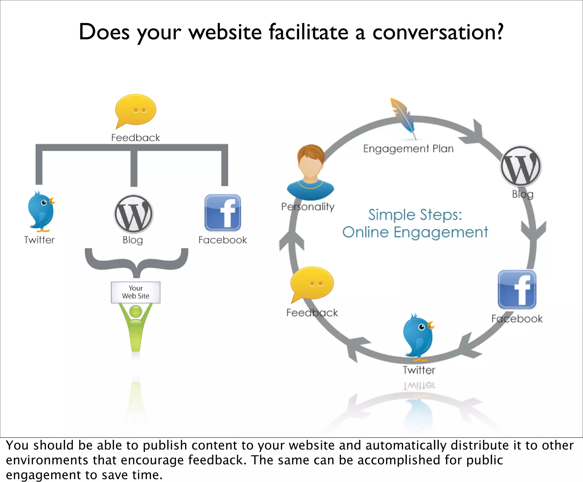
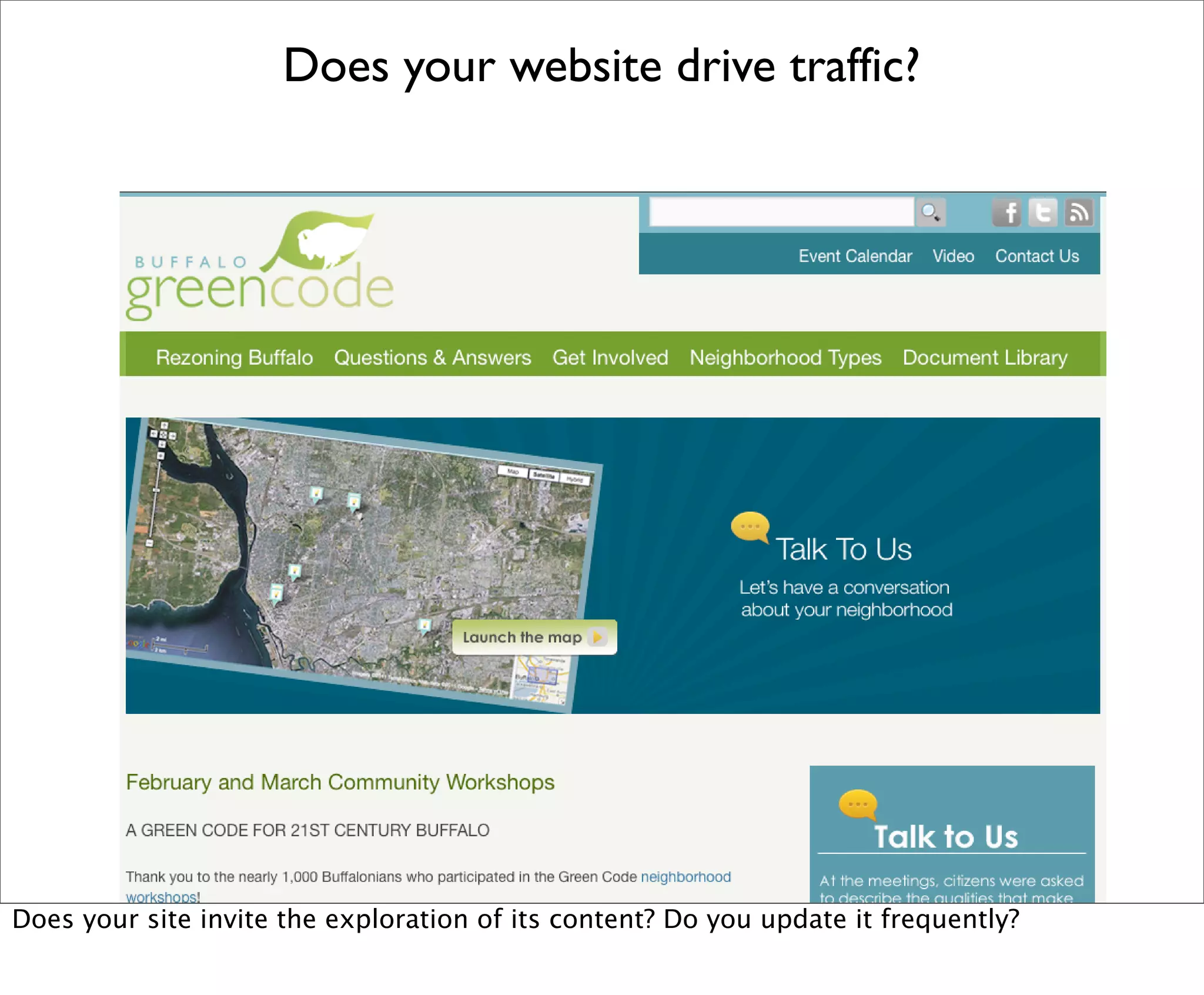
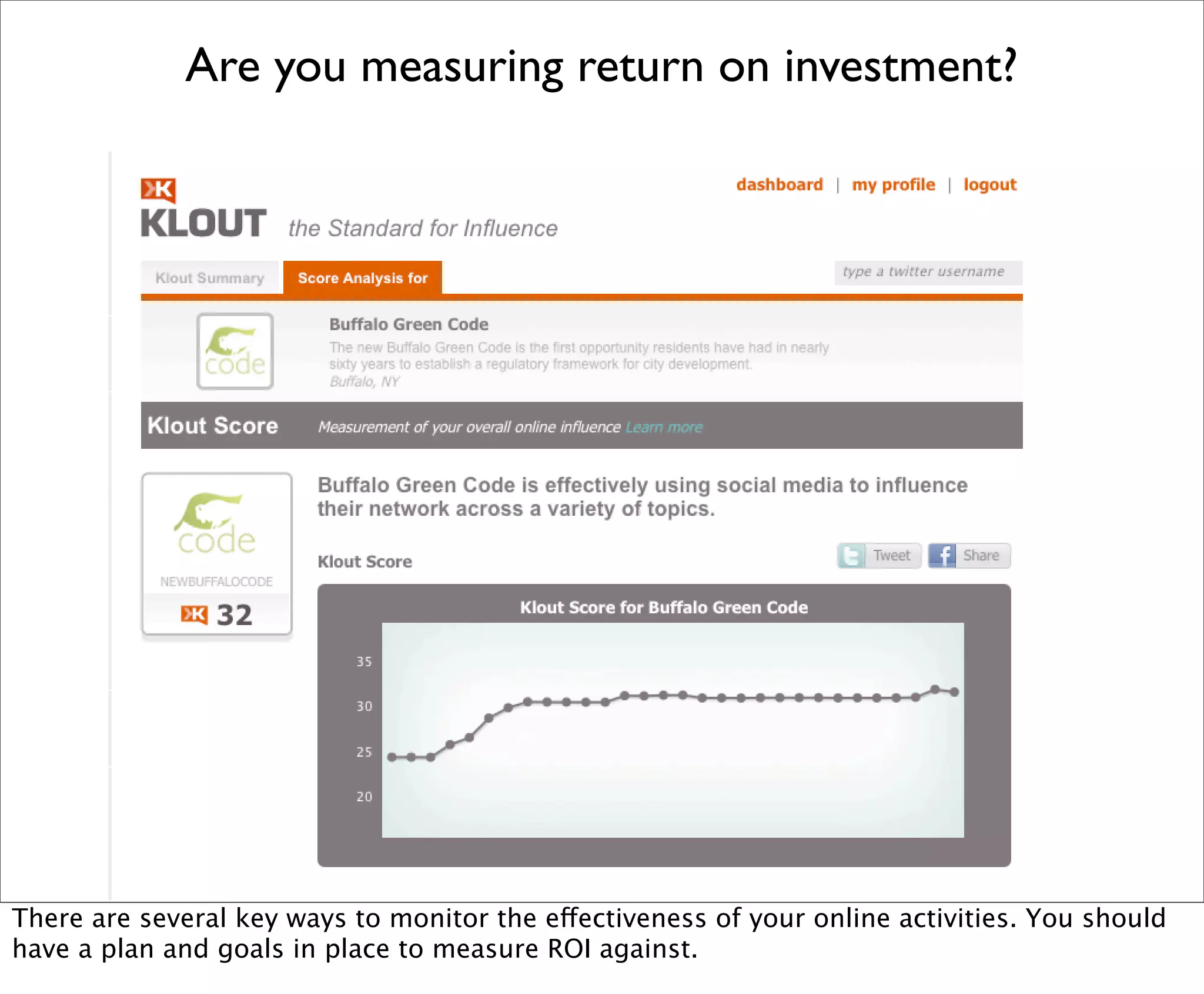
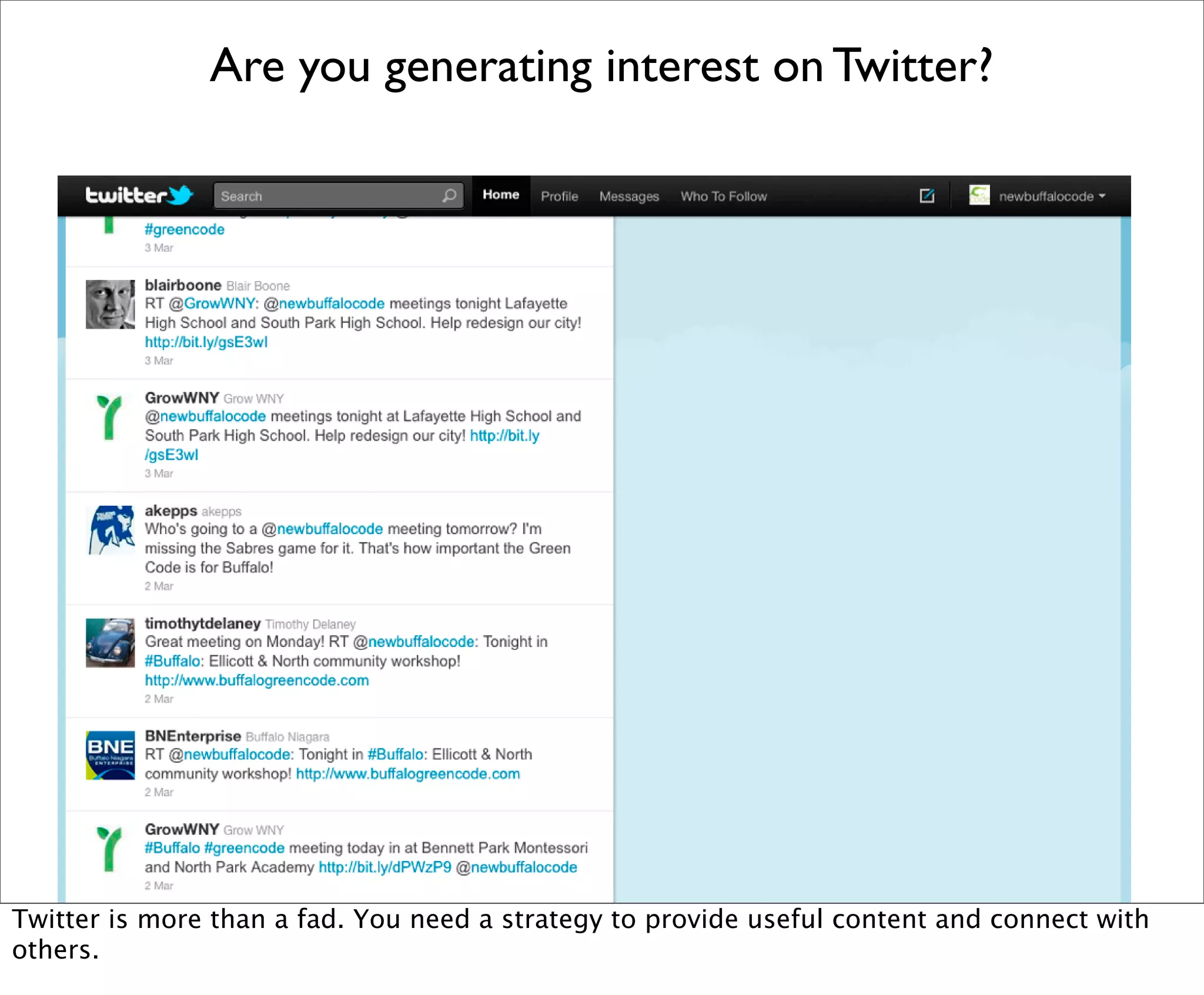
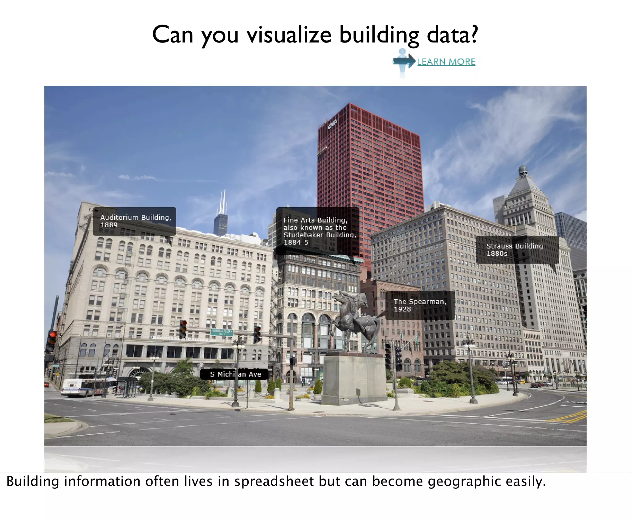
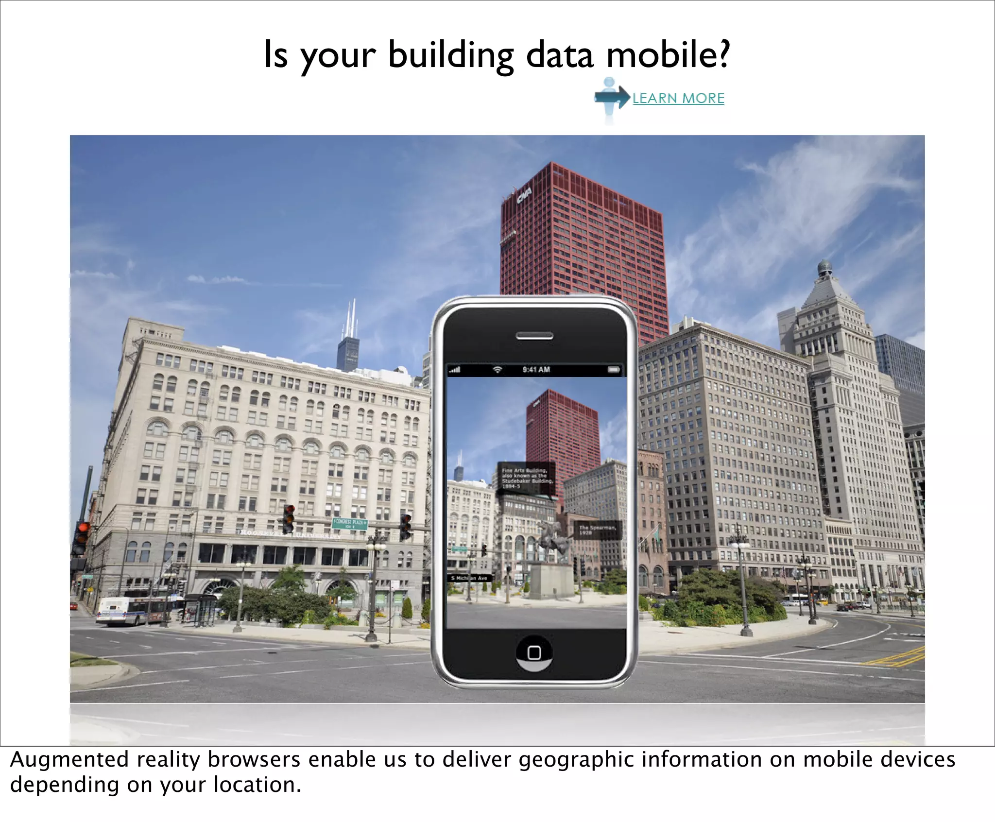
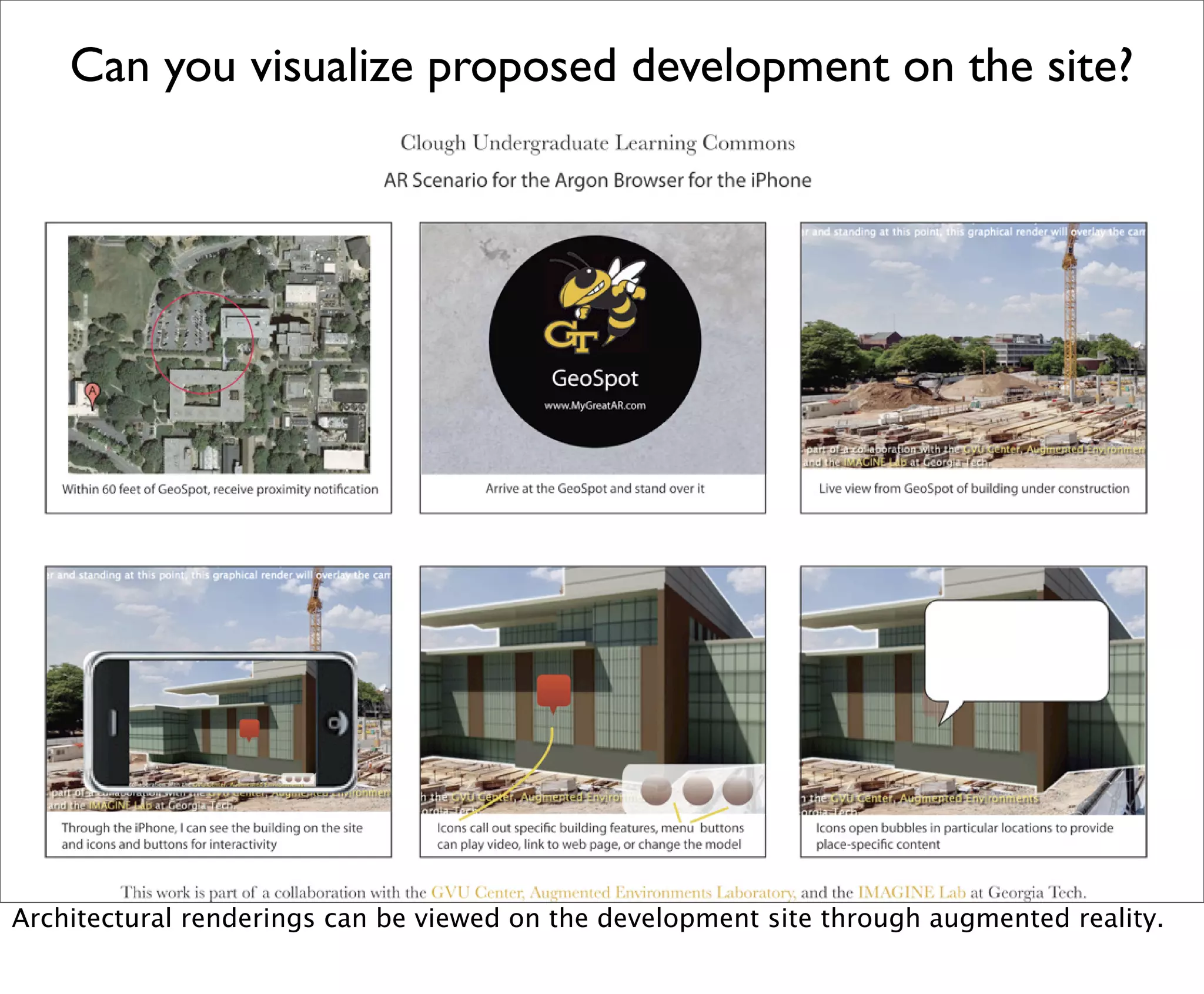
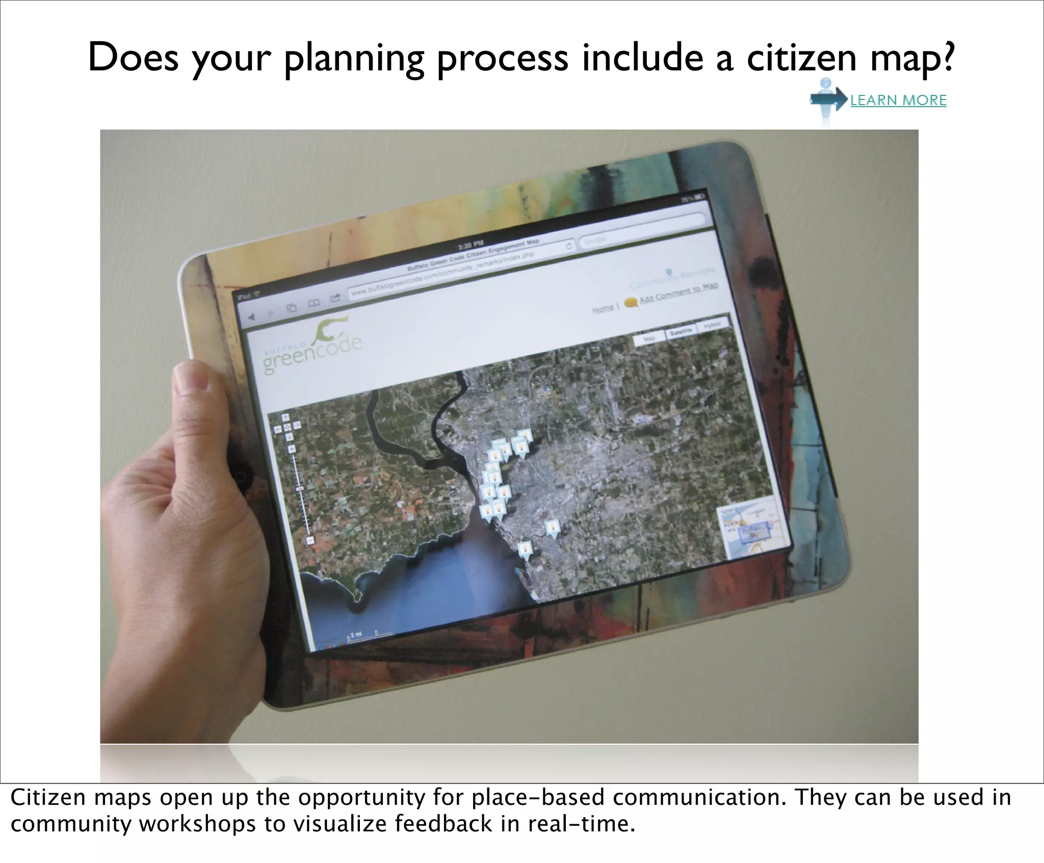
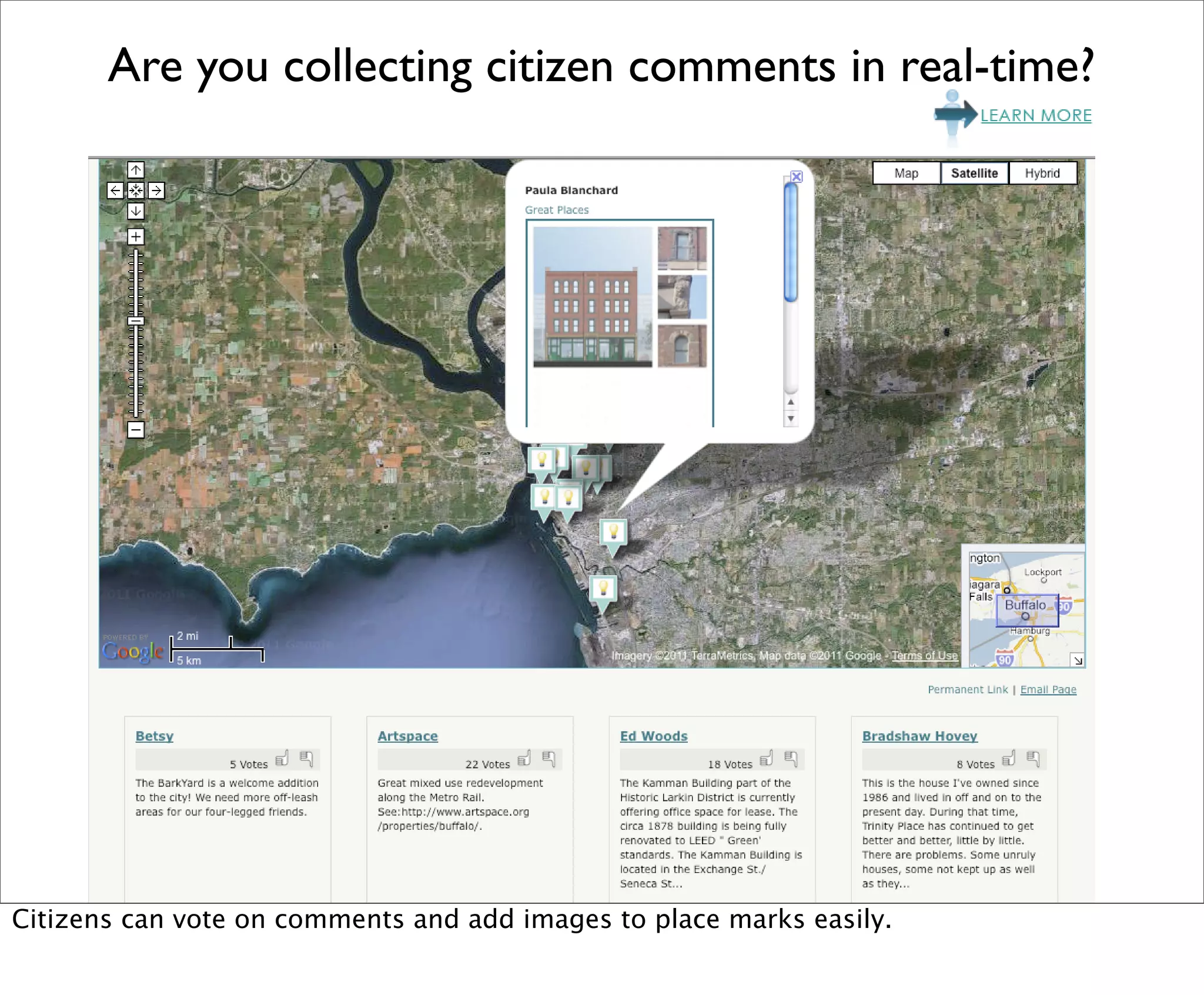
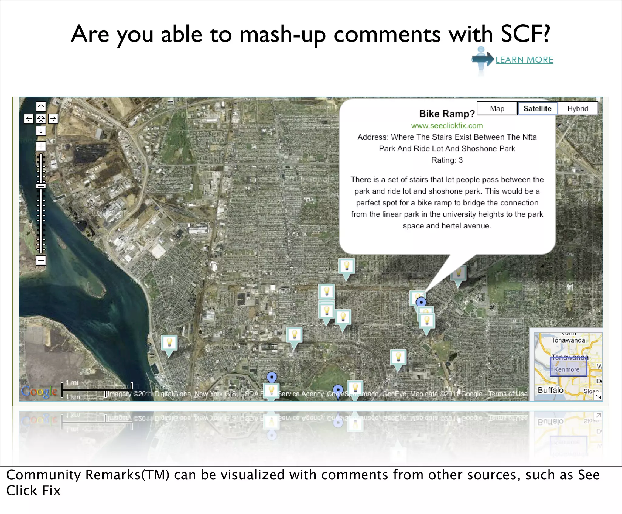
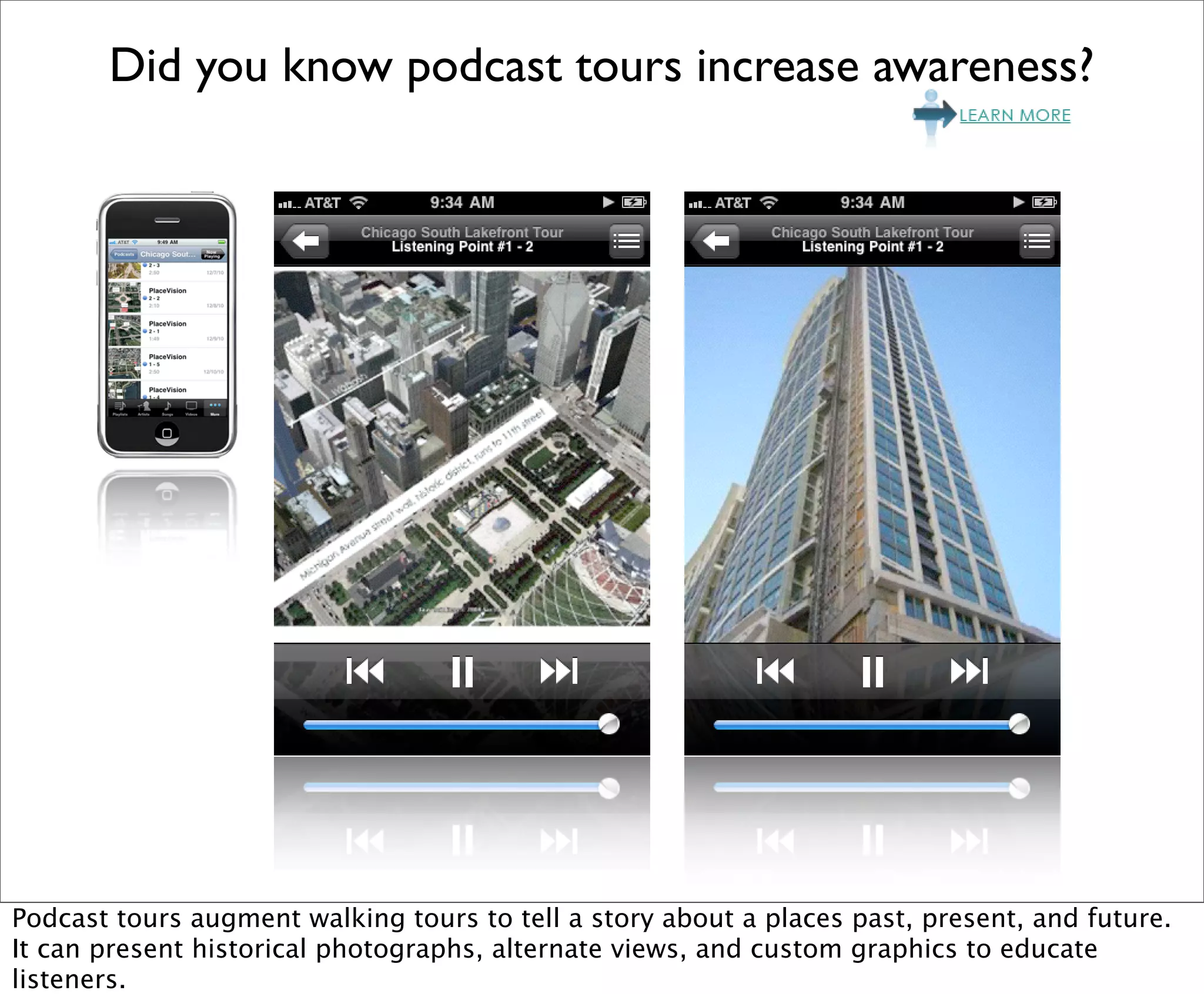
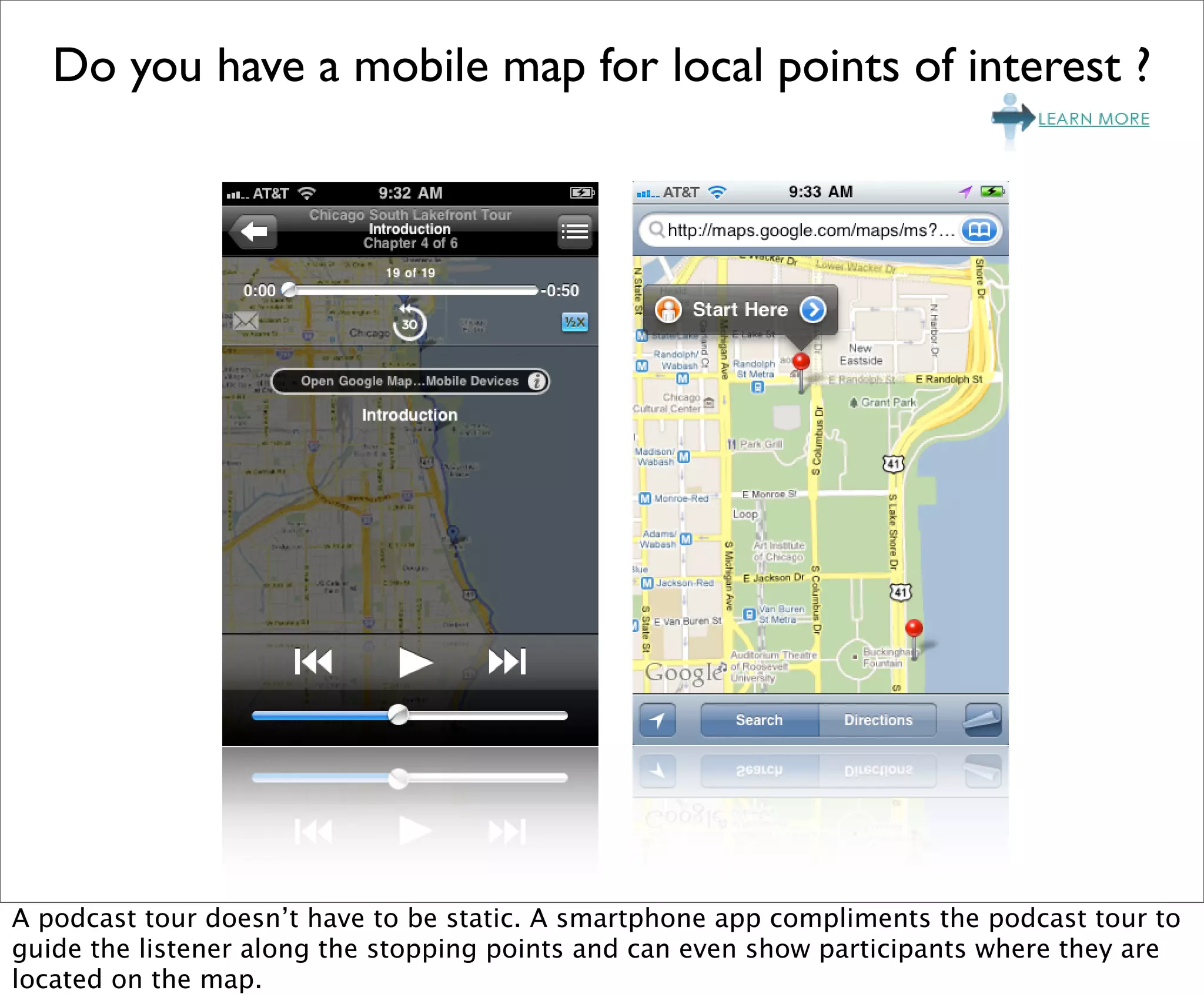
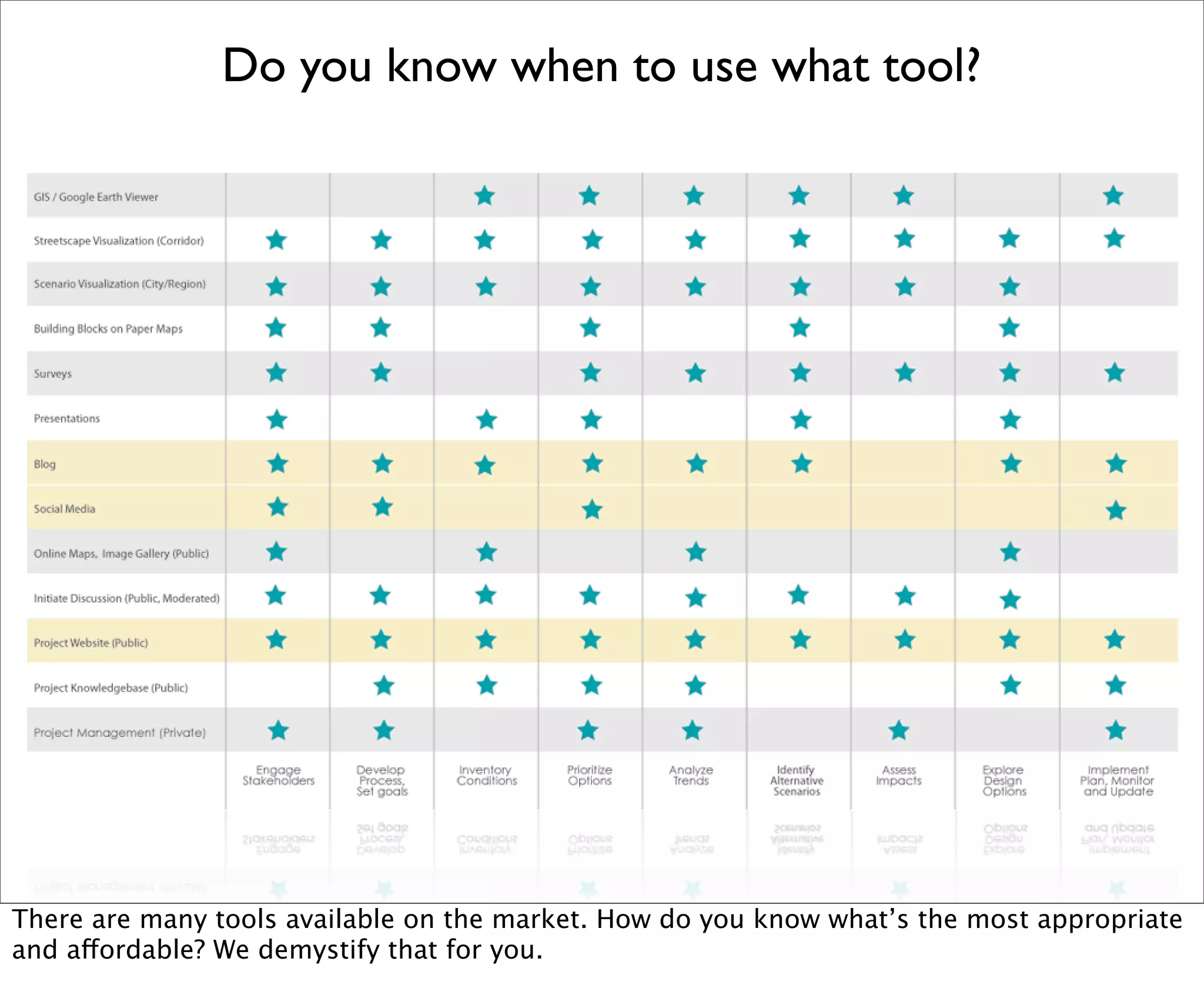
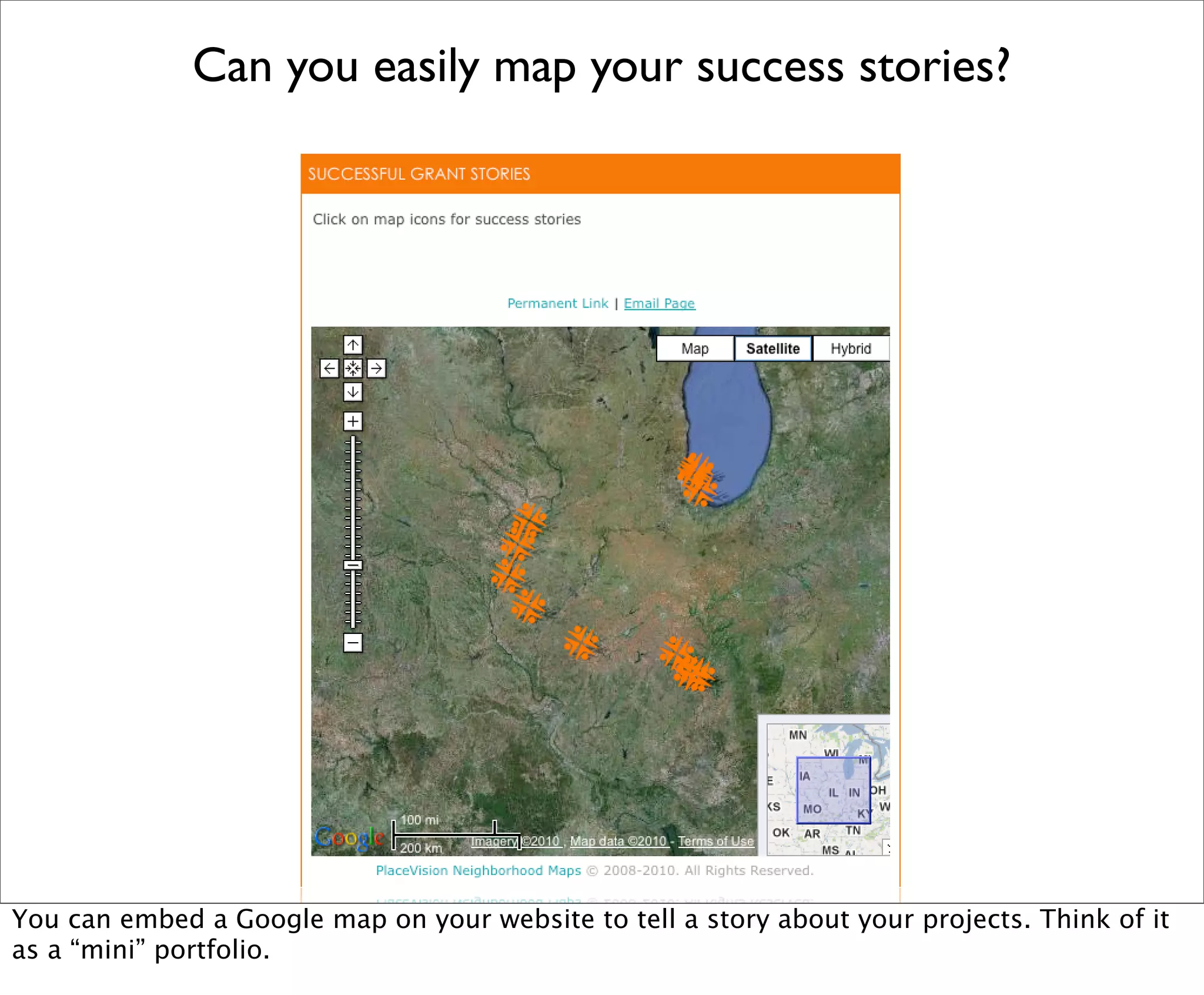
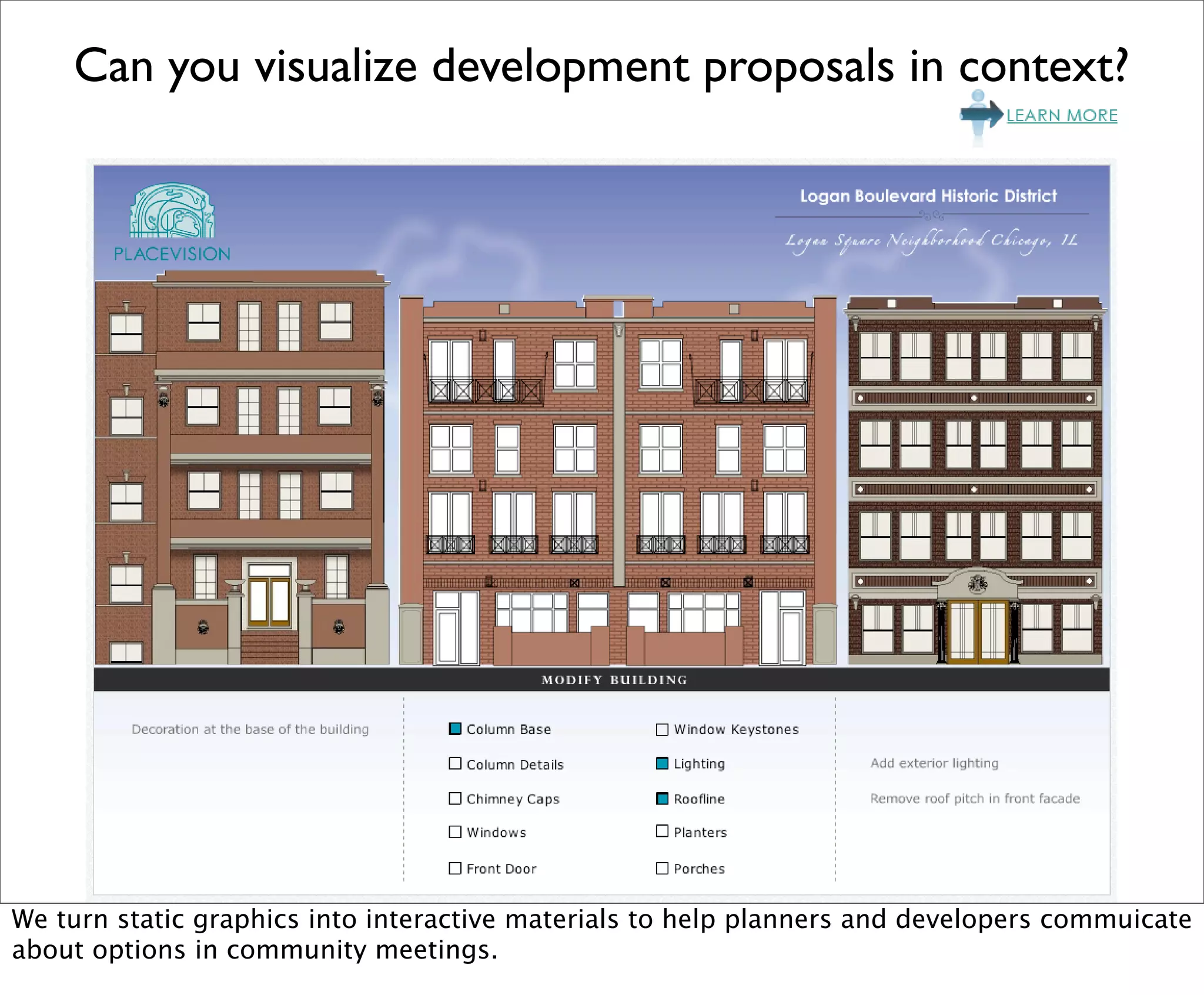
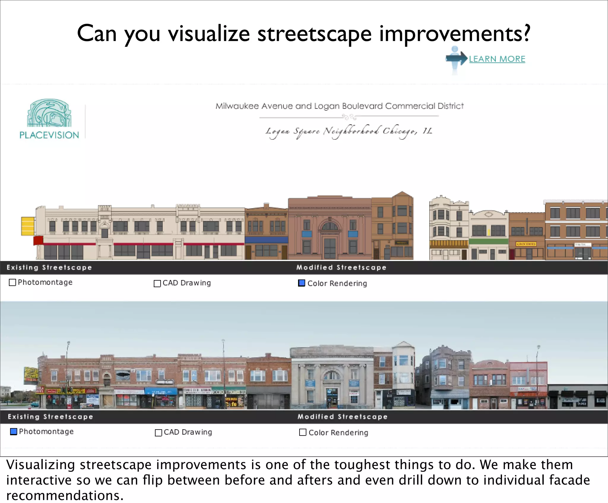
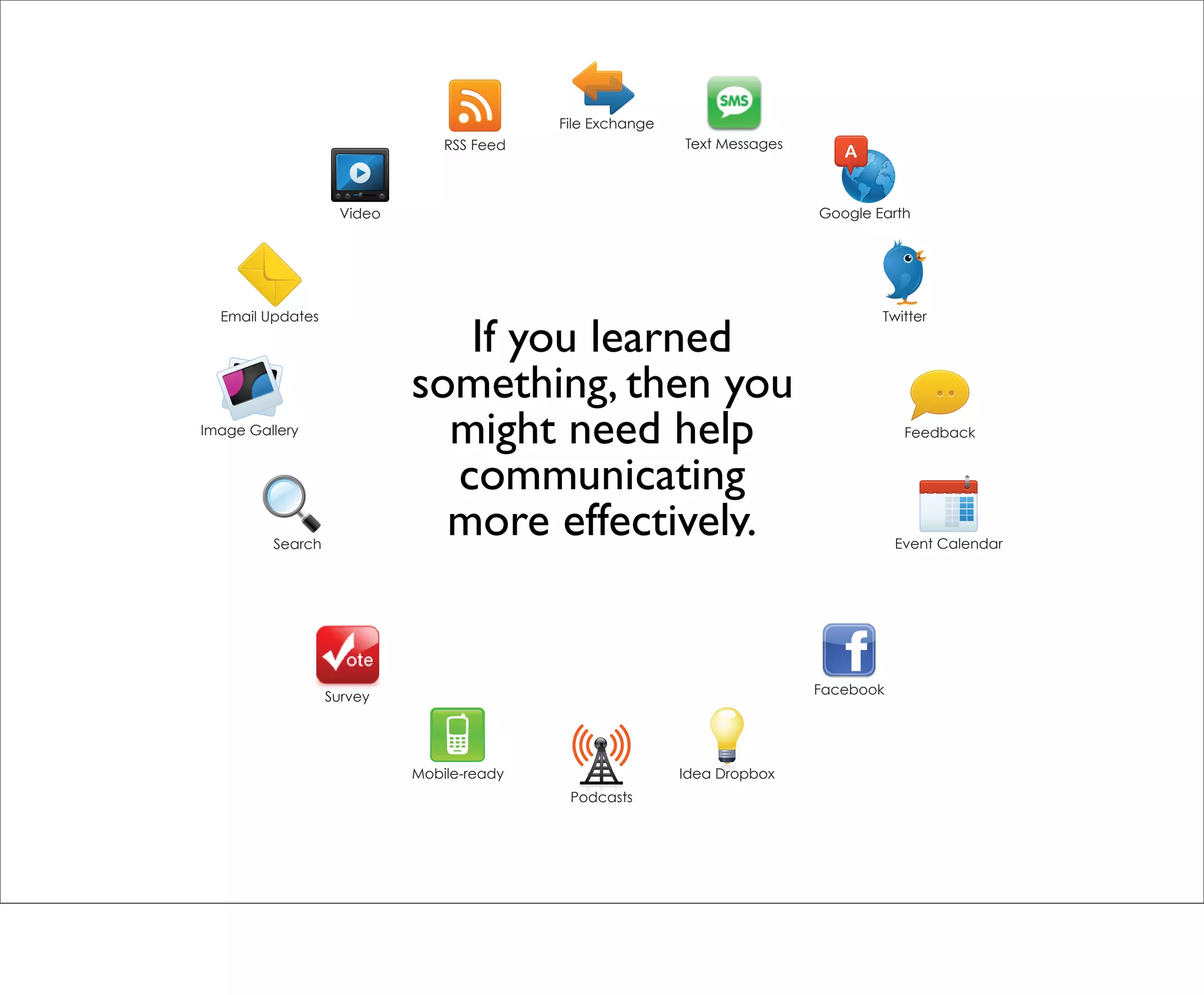
File Exchange
                                RSS Feed                   Text Messages


                   Video                                                   Google Earth


  Email Updates                                                                    Twitter


                           20 questions for urban
Image Gallery
                           planners, designers, and                                    Feedback
                            architects about their
                            communication tools
         Search                                                                       Event Calendar


                                                                           Facebook
                  Survey


                            Mobile-ready                   Idea Dropbox
                                            Podcasts
What is your website capable of doing?


Does your website support everything you need? There are multiple apps that can expand the
capabilities of your site.
Does your site reflect your professionalism?


If you haven’t thought about your site in a while, now is the time. It should be easy to
navigate, mobile-enabled, linked to social networks, and provide robust portfolio
management tools.
Can you easily map projects in Google Earth?


Since your work is location-based, you can spice up your portfolio with SiteVista, a tool that
enables you to manage your site and create a Google Earth map on-the-fly.
Is your portfolio Google Earth enabled?


Few tools exist for website owners to easily map projects, that’s why PlaceVision created one.
Does your website facilitate a conversation?


You should be able to publish content to your website and automatically distribute it to other
environments that encourage feedback. The same can be accomplished for public
engagement to save time.
Does your website drive traffic?


Does your site invite the exploration of its content? Do you update it frequently?
Are you measuring return on investment?


There are several key ways to monitor the effectiveness of your online activities. You should
have a plan and goals in place to measure ROI against.
Are you generating interest on Twitter?


Twitter is more than a fad. You need a strategy to provide useful content and connect with
others.
Can you visualize building data?


Building information often lives in spreadsheet but can become geographic easily.
Is your building data mobile?


Augmented reality browsers enable us to deliver geographic information on mobile devices
depending on your location.
Can you visualize proposed development on the site?


Architectural renderings can be viewed on the development site through augmented reality.
Does your planning process include a citizen map?


Citizen maps open up the opportunity for place-based communication. They can be used in
community workshops to visualize feedback in real-time.
Are you collecting citizen comments in real-time?


Citizens can vote on comments and add images to place marks easily.
Are you able to mash-up comments with SCF?


Community Remarks(TM) can be visualized with comments from other sources, such as See
Click Fix
Did you know podcast tours increase awareness?


Podcast tours augment walking tours to tell a story about a places past, present, and future.
It can present historical photographs, alternate views, and custom graphics to educate
listeners.
Do you have a mobile map for local points of interest ?


A podcast tour doesn’t have to be static. A smartphone app compliments the podcast tour to
guide the listener along the stopping points and can even show participants where they are
located on the map.
Do you know when to use what tool?


There are many tools available on the market. How do you know what’s the most appropriate
and affordable? We demystify that for you.
Can you easily map your success stories?


You can embed a Google map on your website to tell a story about your projects. Think of it
as a “mini” portfolio.
Can you visualize development proposals in context?


We turn static graphics into interactive materials to help planners and developers commuicate
about options in community meetings.
Can you visualize streetscape improvements?


Visualizing streetscape improvements is one of the toughest things to do. We make them
interactive so we can flip between before and afters and even drill down to individual facade
recommendations.
File Exchange
                               RSS Feed                   Text Messages


                   Video                                                  Google Earth


  Email Updates                                                                   Twitter

                              If you learned
                           something, then you
Image Gallery
                             might need help                                          Feedback


                             communicating
         Search
                             more effectively.                                       Event Calendar


                                                                          Facebook
                  Survey


                           Mobile-ready                   Idea Dropbox
                                           Podcasts
www.PlaceVision.net
Creative Viewing of the Built Environment

20 questions for designers of the built environment w/notes

  • 1.
    File Exchange RSS Feed Text Messages Video Google Earth Email Updates Twitter 20 questions for urban Image Gallery planners, designers, and Feedback architects about their communication tools Search Event Calendar Facebook Survey Mobile-ready Idea Dropbox Podcasts
  • 2.
    What is yourwebsite capable of doing? Does your website support everything you need? There are multiple apps that can expand the capabilities of your site.
  • 3.
    Does your sitereflect your professionalism? If you haven’t thought about your site in a while, now is the time. It should be easy to navigate, mobile-enabled, linked to social networks, and provide robust portfolio management tools.
  • 4.
    Can you easilymap projects in Google Earth? Since your work is location-based, you can spice up your portfolio with SiteVista, a tool that enables you to manage your site and create a Google Earth map on-the-fly.
  • 5.
    Is your portfolioGoogle Earth enabled? Few tools exist for website owners to easily map projects, that’s why PlaceVision created one.
  • 6.
    Does your websitefacilitate a conversation? You should be able to publish content to your website and automatically distribute it to other environments that encourage feedback. The same can be accomplished for public engagement to save time.
  • 7.
    Does your websitedrive traffic? Does your site invite the exploration of its content? Do you update it frequently?
  • 8.
    Are you measuringreturn on investment? There are several key ways to monitor the effectiveness of your online activities. You should have a plan and goals in place to measure ROI against.
  • 9.
    Are you generatinginterest on Twitter? Twitter is more than a fad. You need a strategy to provide useful content and connect with others.
  • 10.
    Can you visualizebuilding data? Building information often lives in spreadsheet but can become geographic easily.
  • 11.
    Is your buildingdata mobile? Augmented reality browsers enable us to deliver geographic information on mobile devices depending on your location.
  • 12.
    Can you visualizeproposed development on the site? Architectural renderings can be viewed on the development site through augmented reality.
  • 13.
    Does your planningprocess include a citizen map? Citizen maps open up the opportunity for place-based communication. They can be used in community workshops to visualize feedback in real-time.
  • 14.
    Are you collectingcitizen comments in real-time? Citizens can vote on comments and add images to place marks easily.
  • 15.
    Are you ableto mash-up comments with SCF? Community Remarks(TM) can be visualized with comments from other sources, such as See Click Fix
  • 16.
    Did you knowpodcast tours increase awareness? Podcast tours augment walking tours to tell a story about a places past, present, and future. It can present historical photographs, alternate views, and custom graphics to educate listeners.
  • 17.
    Do you havea mobile map for local points of interest ? A podcast tour doesn’t have to be static. A smartphone app compliments the podcast tour to guide the listener along the stopping points and can even show participants where they are located on the map.
  • 18.
    Do you knowwhen to use what tool? There are many tools available on the market. How do you know what’s the most appropriate and affordable? We demystify that for you.
  • 19.
    Can you easilymap your success stories? You can embed a Google map on your website to tell a story about your projects. Think of it as a “mini” portfolio.
  • 20.
    Can you visualizedevelopment proposals in context? We turn static graphics into interactive materials to help planners and developers commuicate about options in community meetings.
  • 21.
    Can you visualizestreetscape improvements? Visualizing streetscape improvements is one of the toughest things to do. We make them interactive so we can flip between before and afters and even drill down to individual facade recommendations.
  • 22.
    File Exchange RSS Feed Text Messages Video Google Earth Email Updates Twitter If you learned something, then you Image Gallery might need help Feedback communicating Search more effectively. Event Calendar Facebook Survey Mobile-ready Idea Dropbox Podcasts
  • 23.