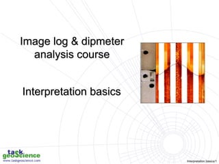
2 - Interpretation basics.ppt
•Download as PPT, PDF•
0 likes•10 views
The document discusses various techniques for interpreting borehole images and dipmeter data, including: 1) Using borehole images and dipmeters to analyze features from 15 meters to 3D seismic scale. 2) Understanding the difference between apparent and true dip and how deviations impact viewing perspective. 3) The importance of integrating local knowledge from core samples and petrography to calibrate interpretations. 4) Key plots for sedimentology, fractures, faults, and dip summaries that are useful for interpretation.
Report
Share
Report
Share

Recommended
Hydrocarbon Exploration Activities Offshore Cyprus.ppt
The document summarizes hydrocarbon exploration activities offshore Cyprus and plans for developing a natural gas discovery. It notes that Noble Energy discovered an estimated 7 trillion cubic feet gas field in 2011 (Block 12) and plans to conduct appraisal drilling in 2013. It outlines next steps for upstream development, pipelines to transport gas to Cyprus by 2017-2018, and plans to establish an onshore LNG plant by 2019 to export gas to Europe and beyond. The discovery could significantly change Cyprus' energy profile if additional discoveries are made through a second offshore licensing round.
Ore_Deposits_and_Ore_Forming_Processes.ppt
This document discusses key concepts related to ore deposits and ore-forming processes. It defines mineralization as the geological formation of economic minerals in a lithological unit through natural earth processes. For a mineralization to be considered a mineral deposit, it must meet minimum thresholds for metal quantity and grade. Ore deposits are classified based on characteristics like host rock, mineral assemblage, size, and geological formation process. Metals are sourced from crustal or mantle rocks, transported by aqueous fluids complexed with ligands, and concentrated at deposition sites where drastic changes in pressure, temperature, or fluid composition occur. Driving forces include heat from volcanic or plutonic activity and fluid flow influenced by topography or geothermal gradients.
Geological Digressions.pptx
The document discusses subaerial unconformities visible in outcrops and provides examples from various locations around the world. Key criteria to identify subaerial unconformities include evidence of exposure like paleosols, erosion and truncation of underlying strata, paleotopography, and onlap of overlying strata. Photos show unconformities with regolith development, karst features, and basal conglomerates that onlap eroded surfaces. Forced regressive surfaces of marine erosion are also discussed and depicted in outcrops showing scoured contacts and shoreface sandstone wedges.
leaves.ppt
The document describes several landforms produced by wave erosion along coastlines, including headlands, bays, wave-cut notches, wave-cut platforms, arches, caves, stacks, and blowholes. Headlands are areas that jut out into the sea, often ending in cliffs, while bays are wide curved inlets. Wave action can erode cliffs from below, forming platforms, notches, arches that eventually collapse into stacks and stumps. Blowholes form through joints in cliff rocks exposed to hydraulic action inside wave-eroded caves.
Formation of headlands and bays.ppt
Waves eroding a coastline of varying rock resistance will form headlands of harder rock separated by bays in weaker rock. Landforms produced by wave erosion include headlands, bays, stacks, caves, arches, pillars, and wave-cut platforms and notches. Caves can develop into blowholes if joints in the rock connect the cave to the cliff top.
bedding planes.ppt
The document describes several landforms produced by wave erosion along coastlines including:
- Stacks, which are pillars of rock isolated from the cliff due to wave erosion.
- Headlands, which are parts of the coastline that jut out into the sea, often ending in cliffs.
- Bays, which are wide curved inlets formed along coastlines with weaker, more erodible rock.
- Arches and caves, which are openings formed when waves erode through headlands or into cliffs.
leaves a stump..ppt
Waves erode cliffs and headlands through various processes, forming different coastal landforms. Caves form where waves attack both sides of headlands. Arches may form if caves erode all the way through. Stacks and stumps are left when arches and stacks eventually collapse. Over time, this differential erosion of harder and weaker rocks creates a series of alternating headlands and bays along the coastline.
Formation of headlands and bays.ppt
This document describes several landforms produced by wave erosion along coastlines:
- Headlands jut out into the sea at the end of cliffs. Bays form sheltered inlets in weaker coastal rocks between headlands.
- Arches form when waves erode caves completely through headlands. Stacks are isolated pillars that remain when arches collapse.
- Other landforms include caves undercut at the base of cliffs, wave-cut platforms of gently sloping land left after cliff retreat, and blowholes which form when joints in cliff rocks connect eroded caves to the surface.
Formation of headlands and bays.ppt
The document describes various landforms produced by wave erosion along coastlines including headlands, bays, wave-cut notches, wave-cut platforms, arches, caves, stacks, and blowholes. It explains how waves erode harder and softer rocks at different rates, forming headlands in harder rocks and sheltered bays in weaker rocks. Arches form when waves erode caves through headlands, and stacks remain when arches collapse, eventually becoming stumps.
vdocument.in_pptintroduction-to-sequence-stratigraphy-jackson-viewstratigraph...
Stratigraphic principles and sequence stratigraphy are methods used to analyze sedimentary rock layers and impose a temporal dimension. Key concepts include:
- Steno's laws of superposition, original horizontality, and lateral continuity which describe how sedimentary layers are deposited.
- Sequence stratigraphy subdivides strata using surfaces that represent changes in relative sea level, including sequence boundaries, maximum flooding surfaces, and systems tracts like transgressive and highstand.
- Facies describe the characteristics of sediment deposited in different environments, and sequence stratigraphy studies the geometric relationships between facies belts to interpret depositional history.
vdocument.in_submarine-canyons-and-fans-submarine-canyons-major-conduits.ppt
Submarine canyons cut across continental shelves and slopes, carrying sediment from rivers and coastal areas to deep ocean basins. Submarine fans form at the mouths of canyons, accumulating sediment across the continental slope in a fan-shaped pattern. Sediment transport within submarine fans occurs through various mechanisms like debris flows, density currents, and turbidity currents, resulting in deposition of turbidite sequences that can be studied to understand ancient submarine fan environments.
vdocument.in_the-floridan-aquiferchipola-river-system-study-the-floridan-aqui...
This document summarizes a study of the Floridan Aquifer/Chipola River System funded by the USGS and FDEP. The objectives are to identify nutrient sources to the aquifer, characterize hydrologic transport processes using modeling, and match nitrate concentrations in springs using the model. The study area includes the Dougherty Karst Plain where the Floridan Aquifer is recharged through sinkholes and rivers. A MODFLOW model is being used to simulate nitrate tracking from recharge areas and calibrate to spring discharge concentrations. Local grid refinement is being added to improve flow path and travel time estimates in key springs.
vdocument.in_unit-1-introduction-to-sedimentology-and-stratigraphy.pptx
Sediments form through the weathering and erosion of rocks, followed by transportation and deposition. There are three main types of sediments: mechanical (clastic), chemical, and organic. Sedimentary rocks form through the compaction and cementation of sediments via the process of diagenesis. Sedimentology involves the study of sediment formation and depositional environments, while stratigraphy examines the temporal and spatial relationships between sedimentary strata. Key methods used in sedimentology include facies analysis, particle size and shape analysis, lithological analysis, and stratigraphic mapping and description.
vdocument.in_petrophysical-properties-of-reservoir-rocks.pptx
This document discusses key petrophysical properties of hydrocarbon-bearing reservoir rocks including porosity, permeability, saturation, and capillarity. It defines porosity as the ratio of pore space to total volume, permeability as the ability of rocks to allow fluid flow through interconnected pores, saturation as the volume of pore space occupied by a fluid, and capillarity as the pressure difference between fluids across curved interfaces in rock pores. Accurate analysis and modeling of these petrophysical properties is important for estimating petroleum reserves and recovery efficiency from reservoirs.
vdocument.in_sedimentary-geology-geos-240-chapter-6-facies-analysis.ppt
This document provides an overview of facies analysis and depositional environments in sedimentary geology. It discusses different facies interpretations of successive units in non-marine sandstones, including planar and trough cross-bedding, asymmetric scour surfaces, and rippled sandstone and mudstone. It also examines a transect of a Permian reef margin and hierarchy of depositional units, including migrating dunes, changes in hydraulic regime, lag accumulation, bar migration, channel erosion, and allogenic events driven by tectonics, eustasy, climate. Adjacent environments can result in vertical successions with different sedimentary structures.
vdocument.in_reservoir-petrophysics-pete-311-petrophysics-petrophysics-is-the...
The document discusses reservoir petrophysics, which is the study of rock properties and interactions with fluids. It describes a course on reservoir petrophysics that systematically studies physical rock properties including porosity, permeability, fluid saturation, and fluid-rock interactions. The course objectives are to define key concepts and demonstrate techniques for determining properties like porosity, permeability, and fluid saturation through experiments and calculations.
formation pressure (2).pptx
The document discusses various methods used to prevent sloughing during well drilling operations. Specifically:
1. Circulating refrigerating fluid through the well below the freezing point of the formation to freeze it and prevent sloughing.
2. Circulating brine through the well below the freezing point of water to freeze the formation.
3. Circulating mud-laden fluid through the well below the freezing point of water to freeze the formation.
4. Circulating an emulsion through the well below the freezing point of water to freeze the formation.
5. Causing fluid to flow into the well to seep into the formation, then circulating it below the freezing point of water to freeze the formation
abnormal pressure.pptx
The document discusses methods for drilling wells through formations containing sloughing shale to prevent borehole collapse.
It describes 6 methods:
1. Circulating refrigerated fluid through the well to freeze the formation, with the refrigerant having a freezing point below that of the formation fluid.
2. Circulating brine through the well and cooling it to freeze the formation, with the brine's freezing point below that of water.
3. Circulating mud-laden fluid through the well in the same way as method 2.
4. Circulating an emulsion through the well in the same way as methods 2 and 3.
5. Causing fluid to flow into the well to contact
sloughing formation.pptx
The document discusses the problem of sloughing shale during drilling operations. Sloughing shale occurs when the mud weight is not adequate to control subsurface pressure or the mud salinity causes undesirable osmotic pressure, leading to borehole collapse and stuck drill pipes or bottom hole assembly (BHA). It states that sloughing shale is one of the mechanical issues that can cause stuck pipes. The author provides a personal anecdote about experiencing BHA getting stuck in sloughing shale for the first time and seeing large cuttings, which was shocking. While shale formations can be drilled quickly when conditions are right, sloughing shale turns it into a stressful problem similar to kicks, losses, and other drilling hazards. Close
Carbonate lithofacies.ppt
This document discusses carbonate sedimentology and classification. It summarizes two early carbonate classification systems by Dunham (1962) and Folk (1962). It also notes that while interpretation techniques used for clastic reservoirs can be applied to carbonates, carbonates differ in their importance of biogenic processes and susceptibility to diagenesis. The document stresses that the ultimate goal is understanding carbonate lithofacies and correlating them with well log and core data.
Fractures in carbonates.ppt
This document discusses carbonate sedimentology and classification. It notes that while interpretation techniques used for clastic reservoirs can also be applied to carbonates, carbonates differ in their emphasis on biogenic processes and susceptibility to diagenesis. It outlines carbonate classification schemes by Folk and Dunham and notes that carbonates can exhibit all primary sedimentary structures seen in clastics as well as unique biogenic and diagenetic structures. The ultimate goal of carbonate sedimentology is discussed.
Mudstone facies.pptx
1. The document discusses different types of deltas including braid deltas, fan deltas, and their subfacies.
2. Braid deltas form in lacustrine basins where the slope is gentle in the short axis direction. Fan deltas form where rivers enter lakes at a steep slope and transition to braid deltas where the slope becomes more gentle.
3. Fan delta subfacies include the topset (fan delta plain), foreset (fan delta front), and front (fan) delta. The foreset is the most developed part and contains subaqueous distributary channels and front bars.
conglomerate facies.pptx
The document discusses the classification of bounding surfaces and lithofacies in continental deltas. It divides bounding surfaces into 6 hierarchical levels that control sedimentation and reservoir development. Continental lacustrine basin deltas can be divided into 14 basic lithofacies types including various conglomerate, sandstone, siltstone, and mudstone facies. Braid deltas form in lacustrine basins and can be distinguished from normal deltas and fan deltas based on their sediment source, particle size, and sedimentary characteristics.
sequence characteristic.pptx
This document summarizes sedimentary features of different types of deltas. It describes:
1) A marine fan delta formed by an alluvial fan or braided river depositing sediment into the sea. Coarse beach ridges can form protected lagoons.
2) Marine deltas are classified based on sediment supply and energy levels that control their morphology.
3) Braid deltas form in narrow lake basins where steep mountain slopes enter the lake, depositing coarse sediments.
channel margin bars or levees.ppt
Deltaic systems are subdivided into subaerial plain, delta front, and prodelta facies associations. River-dominated deltas coarsen upward from offshore mud through distributary and beach sands to fluvial deposits. Deltas form thick accumulations of terrigenous sediment that interfinger with fluvial and marine deposits. Characteristics such as channel bifurcation, splay development, and lobe switching occur as deltas prograde basinward over time.
Degree of bioturbation.ppt
The document discusses sediment samples that show:
1) Intensely bioturbated mudstone with a high diversity of burrows including Phycosiphon, Teichichnus, Planolites, Chondrites, and Rhizocorallium.
2) Cross-bedded sediments with clay draped foresets, bidirectional flow, and thick bottomsets that are flaser bedded with variable bioturbation and burrows including Planolites, Macaronichnus, Ophiomorpha, and Thalassinoides, indicating a tidal channel environment.
3) Bioturbated mudstone and laminated mudstone that is sparsely or intensely bioturbated with
Large-scale ripples.pptx
This document discusses the use of sedimentary structures and flow regimes to interpret ancient sedimentary environments. It describes different types of sedimentary structures formed under lower and upper flow regimes by unidirectional and reversing currents. Point bar models are shown to predict structure types from depth-velocity-grain size conditions. The Bouma sequence is interpreted to record a decreasing flow velocity in a turbidity current. Wave-formed structures are related to shoreline processes under different wave conditions. Together, these flow-regime concepts allow detailed reconstruction of depositional processes and paleoenvironmental conditions.
fluvial point-bar depo-sits.pptx
This document discusses the use of flow regime concepts and sedimentary structures to interpret ancient sedimentary environments. It provides examples of how different bedforms relate to flow conditions and produce distinct sedimentary structures. Megaripples produce planar cross-bedding while 3D dunes produce trough cross-bedding. Bouma sequences represent a succession of structures deposited from turbidity currents as flow velocities decrease upwards. Wave structures also relate to flow regime, ranging from ripples to planar beds as energy increases shoreward. These relationships allow ancient strata to be interpreted in terms of processes like river channel migration or turbidity currents.
AI + Data Community Tour - Build the Next Generation of Apps with the Einstei...
AI + Data Community Tour - Build the Next Generation of Apps with the Einstei...Paris Salesforce Developer Group
Build the Next Generation of Apps with the Einstein 1 Platform.
Rejoignez Philippe Ozil pour une session de workshops qui vous guidera à travers les détails de la plateforme Einstein 1, l'importance des données pour la création d'applications d'intelligence artificielle et les différents outils et technologies que Salesforce propose pour vous apporter tous les bénéfices de l'IA.FULL STACK PROGRAMMING - Both Front End and Back End
This ppt gives details about Full Stack Programming and its basics.
More Related Content
More from SaadTaman
Formation of headlands and bays.ppt
The document describes various landforms produced by wave erosion along coastlines including headlands, bays, wave-cut notches, wave-cut platforms, arches, caves, stacks, and blowholes. It explains how waves erode harder and softer rocks at different rates, forming headlands in harder rocks and sheltered bays in weaker rocks. Arches form when waves erode caves through headlands, and stacks remain when arches collapse, eventually becoming stumps.
vdocument.in_pptintroduction-to-sequence-stratigraphy-jackson-viewstratigraph...
Stratigraphic principles and sequence stratigraphy are methods used to analyze sedimentary rock layers and impose a temporal dimension. Key concepts include:
- Steno's laws of superposition, original horizontality, and lateral continuity which describe how sedimentary layers are deposited.
- Sequence stratigraphy subdivides strata using surfaces that represent changes in relative sea level, including sequence boundaries, maximum flooding surfaces, and systems tracts like transgressive and highstand.
- Facies describe the characteristics of sediment deposited in different environments, and sequence stratigraphy studies the geometric relationships between facies belts to interpret depositional history.
vdocument.in_submarine-canyons-and-fans-submarine-canyons-major-conduits.ppt
Submarine canyons cut across continental shelves and slopes, carrying sediment from rivers and coastal areas to deep ocean basins. Submarine fans form at the mouths of canyons, accumulating sediment across the continental slope in a fan-shaped pattern. Sediment transport within submarine fans occurs through various mechanisms like debris flows, density currents, and turbidity currents, resulting in deposition of turbidite sequences that can be studied to understand ancient submarine fan environments.
vdocument.in_the-floridan-aquiferchipola-river-system-study-the-floridan-aqui...
This document summarizes a study of the Floridan Aquifer/Chipola River System funded by the USGS and FDEP. The objectives are to identify nutrient sources to the aquifer, characterize hydrologic transport processes using modeling, and match nitrate concentrations in springs using the model. The study area includes the Dougherty Karst Plain where the Floridan Aquifer is recharged through sinkholes and rivers. A MODFLOW model is being used to simulate nitrate tracking from recharge areas and calibrate to spring discharge concentrations. Local grid refinement is being added to improve flow path and travel time estimates in key springs.
vdocument.in_unit-1-introduction-to-sedimentology-and-stratigraphy.pptx
Sediments form through the weathering and erosion of rocks, followed by transportation and deposition. There are three main types of sediments: mechanical (clastic), chemical, and organic. Sedimentary rocks form through the compaction and cementation of sediments via the process of diagenesis. Sedimentology involves the study of sediment formation and depositional environments, while stratigraphy examines the temporal and spatial relationships between sedimentary strata. Key methods used in sedimentology include facies analysis, particle size and shape analysis, lithological analysis, and stratigraphic mapping and description.
vdocument.in_petrophysical-properties-of-reservoir-rocks.pptx
This document discusses key petrophysical properties of hydrocarbon-bearing reservoir rocks including porosity, permeability, saturation, and capillarity. It defines porosity as the ratio of pore space to total volume, permeability as the ability of rocks to allow fluid flow through interconnected pores, saturation as the volume of pore space occupied by a fluid, and capillarity as the pressure difference between fluids across curved interfaces in rock pores. Accurate analysis and modeling of these petrophysical properties is important for estimating petroleum reserves and recovery efficiency from reservoirs.
vdocument.in_sedimentary-geology-geos-240-chapter-6-facies-analysis.ppt
This document provides an overview of facies analysis and depositional environments in sedimentary geology. It discusses different facies interpretations of successive units in non-marine sandstones, including planar and trough cross-bedding, asymmetric scour surfaces, and rippled sandstone and mudstone. It also examines a transect of a Permian reef margin and hierarchy of depositional units, including migrating dunes, changes in hydraulic regime, lag accumulation, bar migration, channel erosion, and allogenic events driven by tectonics, eustasy, climate. Adjacent environments can result in vertical successions with different sedimentary structures.
vdocument.in_reservoir-petrophysics-pete-311-petrophysics-petrophysics-is-the...
The document discusses reservoir petrophysics, which is the study of rock properties and interactions with fluids. It describes a course on reservoir petrophysics that systematically studies physical rock properties including porosity, permeability, fluid saturation, and fluid-rock interactions. The course objectives are to define key concepts and demonstrate techniques for determining properties like porosity, permeability, and fluid saturation through experiments and calculations.
formation pressure (2).pptx
The document discusses various methods used to prevent sloughing during well drilling operations. Specifically:
1. Circulating refrigerating fluid through the well below the freezing point of the formation to freeze it and prevent sloughing.
2. Circulating brine through the well below the freezing point of water to freeze the formation.
3. Circulating mud-laden fluid through the well below the freezing point of water to freeze the formation.
4. Circulating an emulsion through the well below the freezing point of water to freeze the formation.
5. Causing fluid to flow into the well to seep into the formation, then circulating it below the freezing point of water to freeze the formation
abnormal pressure.pptx
The document discusses methods for drilling wells through formations containing sloughing shale to prevent borehole collapse.
It describes 6 methods:
1. Circulating refrigerated fluid through the well to freeze the formation, with the refrigerant having a freezing point below that of the formation fluid.
2. Circulating brine through the well and cooling it to freeze the formation, with the brine's freezing point below that of water.
3. Circulating mud-laden fluid through the well in the same way as method 2.
4. Circulating an emulsion through the well in the same way as methods 2 and 3.
5. Causing fluid to flow into the well to contact
sloughing formation.pptx
The document discusses the problem of sloughing shale during drilling operations. Sloughing shale occurs when the mud weight is not adequate to control subsurface pressure or the mud salinity causes undesirable osmotic pressure, leading to borehole collapse and stuck drill pipes or bottom hole assembly (BHA). It states that sloughing shale is one of the mechanical issues that can cause stuck pipes. The author provides a personal anecdote about experiencing BHA getting stuck in sloughing shale for the first time and seeing large cuttings, which was shocking. While shale formations can be drilled quickly when conditions are right, sloughing shale turns it into a stressful problem similar to kicks, losses, and other drilling hazards. Close
Carbonate lithofacies.ppt
This document discusses carbonate sedimentology and classification. It summarizes two early carbonate classification systems by Dunham (1962) and Folk (1962). It also notes that while interpretation techniques used for clastic reservoirs can be applied to carbonates, carbonates differ in their importance of biogenic processes and susceptibility to diagenesis. The document stresses that the ultimate goal is understanding carbonate lithofacies and correlating them with well log and core data.
Fractures in carbonates.ppt
This document discusses carbonate sedimentology and classification. It notes that while interpretation techniques used for clastic reservoirs can also be applied to carbonates, carbonates differ in their emphasis on biogenic processes and susceptibility to diagenesis. It outlines carbonate classification schemes by Folk and Dunham and notes that carbonates can exhibit all primary sedimentary structures seen in clastics as well as unique biogenic and diagenetic structures. The ultimate goal of carbonate sedimentology is discussed.
Mudstone facies.pptx
1. The document discusses different types of deltas including braid deltas, fan deltas, and their subfacies.
2. Braid deltas form in lacustrine basins where the slope is gentle in the short axis direction. Fan deltas form where rivers enter lakes at a steep slope and transition to braid deltas where the slope becomes more gentle.
3. Fan delta subfacies include the topset (fan delta plain), foreset (fan delta front), and front (fan) delta. The foreset is the most developed part and contains subaqueous distributary channels and front bars.
conglomerate facies.pptx
The document discusses the classification of bounding surfaces and lithofacies in continental deltas. It divides bounding surfaces into 6 hierarchical levels that control sedimentation and reservoir development. Continental lacustrine basin deltas can be divided into 14 basic lithofacies types including various conglomerate, sandstone, siltstone, and mudstone facies. Braid deltas form in lacustrine basins and can be distinguished from normal deltas and fan deltas based on their sediment source, particle size, and sedimentary characteristics.
sequence characteristic.pptx
This document summarizes sedimentary features of different types of deltas. It describes:
1) A marine fan delta formed by an alluvial fan or braided river depositing sediment into the sea. Coarse beach ridges can form protected lagoons.
2) Marine deltas are classified based on sediment supply and energy levels that control their morphology.
3) Braid deltas form in narrow lake basins where steep mountain slopes enter the lake, depositing coarse sediments.
channel margin bars or levees.ppt
Deltaic systems are subdivided into subaerial plain, delta front, and prodelta facies associations. River-dominated deltas coarsen upward from offshore mud through distributary and beach sands to fluvial deposits. Deltas form thick accumulations of terrigenous sediment that interfinger with fluvial and marine deposits. Characteristics such as channel bifurcation, splay development, and lobe switching occur as deltas prograde basinward over time.
Degree of bioturbation.ppt
The document discusses sediment samples that show:
1) Intensely bioturbated mudstone with a high diversity of burrows including Phycosiphon, Teichichnus, Planolites, Chondrites, and Rhizocorallium.
2) Cross-bedded sediments with clay draped foresets, bidirectional flow, and thick bottomsets that are flaser bedded with variable bioturbation and burrows including Planolites, Macaronichnus, Ophiomorpha, and Thalassinoides, indicating a tidal channel environment.
3) Bioturbated mudstone and laminated mudstone that is sparsely or intensely bioturbated with
Large-scale ripples.pptx
This document discusses the use of sedimentary structures and flow regimes to interpret ancient sedimentary environments. It describes different types of sedimentary structures formed under lower and upper flow regimes by unidirectional and reversing currents. Point bar models are shown to predict structure types from depth-velocity-grain size conditions. The Bouma sequence is interpreted to record a decreasing flow velocity in a turbidity current. Wave-formed structures are related to shoreline processes under different wave conditions. Together, these flow-regime concepts allow detailed reconstruction of depositional processes and paleoenvironmental conditions.
fluvial point-bar depo-sits.pptx
This document discusses the use of flow regime concepts and sedimentary structures to interpret ancient sedimentary environments. It provides examples of how different bedforms relate to flow conditions and produce distinct sedimentary structures. Megaripples produce planar cross-bedding while 3D dunes produce trough cross-bedding. Bouma sequences represent a succession of structures deposited from turbidity currents as flow velocities decrease upwards. Wave structures also relate to flow regime, ranging from ripples to planar beds as energy increases shoreward. These relationships allow ancient strata to be interpreted in terms of processes like river channel migration or turbidity currents.
More from SaadTaman (20)
vdocument.in_pptintroduction-to-sequence-stratigraphy-jackson-viewstratigraph...
vdocument.in_pptintroduction-to-sequence-stratigraphy-jackson-viewstratigraph...
vdocument.in_submarine-canyons-and-fans-submarine-canyons-major-conduits.ppt
vdocument.in_submarine-canyons-and-fans-submarine-canyons-major-conduits.ppt
vdocument.in_the-floridan-aquiferchipola-river-system-study-the-floridan-aqui...
vdocument.in_the-floridan-aquiferchipola-river-system-study-the-floridan-aqui...
vdocument.in_unit-1-introduction-to-sedimentology-and-stratigraphy.pptx
vdocument.in_unit-1-introduction-to-sedimentology-and-stratigraphy.pptx
vdocument.in_petrophysical-properties-of-reservoir-rocks.pptx
vdocument.in_petrophysical-properties-of-reservoir-rocks.pptx
vdocument.in_sedimentary-geology-geos-240-chapter-6-facies-analysis.ppt
vdocument.in_sedimentary-geology-geos-240-chapter-6-facies-analysis.ppt
vdocument.in_reservoir-petrophysics-pete-311-petrophysics-petrophysics-is-the...
vdocument.in_reservoir-petrophysics-pete-311-petrophysics-petrophysics-is-the...
Recently uploaded
AI + Data Community Tour - Build the Next Generation of Apps with the Einstei...
AI + Data Community Tour - Build the Next Generation of Apps with the Einstei...Paris Salesforce Developer Group
Build the Next Generation of Apps with the Einstein 1 Platform.
Rejoignez Philippe Ozil pour une session de workshops qui vous guidera à travers les détails de la plateforme Einstein 1, l'importance des données pour la création d'applications d'intelligence artificielle et les différents outils et technologies que Salesforce propose pour vous apporter tous les bénéfices de l'IA.FULL STACK PROGRAMMING - Both Front End and Back End
This ppt gives details about Full Stack Programming and its basics.
Applications of artificial Intelligence in Mechanical Engineering.pdf
Historically, mechanical engineering has relied heavily on human expertise and empirical methods to solve complex problems. With the introduction of computer-aided design (CAD) and finite element analysis (FEA), the field took its first steps towards digitization. These tools allowed engineers to simulate and analyze mechanical systems with greater accuracy and efficiency. However, the sheer volume of data generated by modern engineering systems and the increasing complexity of these systems have necessitated more advanced analytical tools, paving the way for AI.
AI offers the capability to process vast amounts of data, identify patterns, and make predictions with a level of speed and accuracy unattainable by traditional methods. This has profound implications for mechanical engineering, enabling more efficient design processes, predictive maintenance strategies, and optimized manufacturing operations. AI-driven tools can learn from historical data, adapt to new information, and continuously improve their performance, making them invaluable in tackling the multifaceted challenges of modern mechanical engineering.
Sri Guru Hargobind Ji - Bandi Chor Guru.pdf
Sri Guru Hargobind Ji (19 June 1595 - 3 March 1644) is revered as the Sixth Nanak.
• On 25 May 1606 Guru Arjan nominated his son Sri Hargobind Ji as his successor. Shortly
afterwards, Guru Arjan was arrested, tortured and killed by order of the Mogul Emperor
Jahangir.
• Guru Hargobind's succession ceremony took place on 24 June 1606. He was barely
eleven years old when he became 6th Guru.
• As ordered by Guru Arjan Dev Ji, he put on two swords, one indicated his spiritual
authority (PIRI) and the other, his temporal authority (MIRI). He thus for the first time
initiated military tradition in the Sikh faith to resist religious persecution, protect
people’s freedom and independence to practice religion by choice. He transformed
Sikhs to be Saints and Soldier.
• He had a long tenure as Guru, lasting 37 years, 9 months and 3 days
Object Oriented Analysis and Design - OOAD
This ppt gives detailed description of Object Oriented Analysis and design.
Accident detection system project report.pdf
The Rapid growth of technology and infrastructure has made our lives easier. The
advent of technology has also increased the traffic hazards and the road accidents take place
frequently which causes huge loss of life and property because of the poor emergency facilities.
Many lives could have been saved if emergency service could get accident information and
reach in time. Our project will provide an optimum solution to this draw back. A piezo electric
sensor can be used as a crash or rollover detector of the vehicle during and after a crash. With
signals from a piezo electric sensor, a severe accident can be recognized. According to this
project when a vehicle meets with an accident immediately piezo electric sensor will detect the
signal or if a car rolls over. Then with the help of GSM module and GPS module, the location
will be sent to the emergency contact. Then after conforming the location necessary action will
be taken. If the person meets with a small accident or if there is no serious threat to anyone’s
life, then the alert message can be terminated by the driver by a switch provided in order to
avoid wasting the valuable time of the medical rescue team.
Ericsson LTE Throughput Troubleshooting Techniques.ppt
Ericsson LTE Throughput Troubleshooting Techniques
Prediction of Electrical Energy Efficiency Using Information on Consumer's Ac...
Energy efficiency has been important since the latter part of the last century. The main object of this survey is to determine the energy efficiency knowledge among consumers. Two separate districts in Bangladesh are selected to conduct the survey on households and showrooms about the energy and seller also. The survey uses the data to find some regression equations from which it is easy to predict energy efficiency knowledge. The data is analyzed and calculated based on five important criteria. The initial target was to find some factors that help predict a person's energy efficiency knowledge. From the survey, it is found that the energy efficiency awareness among the people of our country is very low. Relationships between household energy use behaviors are estimated using a unique dataset of about 40 households and 20 showrooms in Bangladesh's Chapainawabganj and Bagerhat districts. Knowledge of energy consumption and energy efficiency technology options is found to be associated with household use of energy conservation practices. Household characteristics also influence household energy use behavior. Younger household cohorts are more likely to adopt energy-efficient technologies and energy conservation practices and place primary importance on energy saving for environmental reasons. Education also influences attitudes toward energy conservation in Bangladesh. Low-education households indicate they primarily save electricity for the environment while high-education households indicate they are motivated by environmental concerns.
Particle Swarm Optimization–Long Short-Term Memory based Channel Estimation w...
Paper Title
Particle Swarm Optimization–Long Short-Term Memory based Channel Estimation with Hybrid Beam Forming Power Transfer in WSN-IoT Applications
Authors
Reginald Jude Sixtus J and Tamilarasi Muthu, Puducherry Technological University, India
Abstract
Non-Orthogonal Multiple Access (NOMA) helps to overcome various difficulties in future technology wireless communications. NOMA, when utilized with millimeter wave multiple-input multiple-output (MIMO) systems, channel estimation becomes extremely difficult. For reaping the benefits of the NOMA and mm-Wave combination, effective channel estimation is required. In this paper, we propose an enhanced particle swarm optimization based long short-term memory estimator network (PSOLSTMEstNet), which is a neural network model that can be employed to forecast the bandwidth required in the mm-Wave MIMO network. The prime advantage of the LSTM is that it has the capability of dynamically adapting to the functioning pattern of fluctuating channel state. The LSTM stage with adaptive coding and modulation enhances the BER.PSO algorithm is employed to optimize input weights of LSTM network. The modified algorithm splits the power by channel condition of every single user. Participants will be first sorted into distinct groups depending upon respective channel conditions, using a hybrid beamforming approach. The network characteristics are fine-estimated using PSO-LSTMEstNet after a rough approximation of channels parameters derived from the received data.
Keywords
Signal to Noise Ratio (SNR), Bit Error Rate (BER), mm-Wave, MIMO, NOMA, deep learning, optimization.
Volume URL: https://airccse.org/journal/ijc2022.html
Abstract URL:https://aircconline.com/abstract/ijcnc/v14n5/14522cnc05.html
Pdf URL: https://aircconline.com/ijcnc/V14N5/14522cnc05.pdf
#scopuspublication #scopusindexed #callforpapers #researchpapers #cfp #researchers #phdstudent #researchScholar #journalpaper #submission #journalsubmission #WBAN #requirements #tailoredtreatment #MACstrategy #enhancedefficiency #protrcal #computing #analysis #wirelessbodyareanetworks #wirelessnetworks
#adhocnetwork #VANETs #OLSRrouting #routing #MPR #nderesidualenergy #korea #cognitiveradionetworks #radionetworks #rendezvoussequence
Here's where you can reach us : ijcnc@airccse.org or ijcnc@aircconline.com
3rd International Conference on Artificial Intelligence Advances (AIAD 2024)
3rd International Conference on Artificial Intelligence Advances (AIAD 2024) will act as a major forum for the presentation of innovative ideas, approaches, developments, and research projects in the area advanced Artificial Intelligence. It will also serve to facilitate the exchange of information between researchers and industry professionals to discuss the latest issues and advancement in the research area. Core areas of AI and advanced multi-disciplinary and its applications will be covered during the conferences.
Tools & Techniques for Commissioning and Maintaining PV Systems W-Animations ...
Join us for this solutions-based webinar on the tools and techniques for commissioning and maintaining PV Systems. In this session, we'll review the process of building and maintaining a solar array, starting with installation and commissioning, then reviewing operations and maintenance of the system. This course will review insulation resistance testing, I-V curve testing, earth-bond continuity, ground resistance testing, performance tests, visual inspections, ground and arc fault testing procedures, and power quality analysis.
Fluke Solar Application Specialist Will White is presenting on this engaging topic:
Will has worked in the renewable energy industry since 2005, first as an installer for a small east coast solar integrator before adding sales, design, and project management to his skillset. In 2022, Will joined Fluke as a solar application specialist, where he supports their renewable energy testing equipment like IV-curve tracers, electrical meters, and thermal imaging cameras. Experienced in wind power, solar thermal, energy storage, and all scales of PV, Will has primarily focused on residential and small commercial systems. He is passionate about implementing high-quality, code-compliant installation techniques.
Beckhoff Programmable Logic Control Overview Presentation
This presentation is to describe the overview of PLC Beckhoff for beginners
Properties of Fluids, Fluid Statics, Pressure Measurement
Properties of Fluids: Density, viscosity, surface tension, compressibility, and specific gravity define fluid behavior.
Fluid Statics: Studies pressure, hydrostatic pressure, buoyancy, and fluid forces on surfaces.
Pressure at a Point: In a static fluid, the pressure at any point is the same in all directions. This is known as Pascal's principle. The pressure increases with depth due to the weight of the fluid above.
Hydrostatic Pressure: The pressure exerted by a fluid at rest due to the force of gravity. It can be calculated using the formula P=ρghP=ρgh, where PP is the pressure, ρρ is the fluid density, gg is the acceleration due to gravity, and hh is the height of the fluid column above the point in question.
Buoyancy: The upward force exerted by a fluid on a submerged or partially submerged object. This force is equal to the weight of the fluid displaced by the object, as described by Archimedes' principle. Buoyancy explains why objects float or sink in fluids.
Fluid Pressure on Surfaces: The analysis of pressure forces on surfaces submerged in fluids. This includes calculating the total force and the center of pressure, which is the point where the resultant pressure force acts.
Pressure Measurement: Manometers, barometers, pressure gauges, and differential pressure transducers measure fluid pressure.
Supermarket Management System Project Report.pdf
Supermarket management is a stand-alone J2EE using Eclipse Juno program.
This project contains all the necessary required information about maintaining
the supermarket billing system.
The core idea of this project to minimize the paper work and centralize the
data. Here all the communication is taken in secure manner. That is, in this
application the information will be stored in client itself. For further security the
data base is stored in the back-end oracle and so no intruders can access it.
Determination of Equivalent Circuit parameters and performance characteristic...
Includes the testing of induction motor to draw the circle diagram of induction motor with step wise procedure and calculation for the same. Also explains the working and application of Induction generator
Recently uploaded (20)
AI + Data Community Tour - Build the Next Generation of Apps with the Einstei...
AI + Data Community Tour - Build the Next Generation of Apps with the Einstei...
FULL STACK PROGRAMMING - Both Front End and Back End
FULL STACK PROGRAMMING - Both Front End and Back End
Applications of artificial Intelligence in Mechanical Engineering.pdf
Applications of artificial Intelligence in Mechanical Engineering.pdf
comptia-security-sy0-701-exam-objectives-(5-0).pdf
comptia-security-sy0-701-exam-objectives-(5-0).pdf
UNIT-III- DATA CONVERTERS ANALOG TO DIGITAL CONVERTER
UNIT-III- DATA CONVERTERS ANALOG TO DIGITAL CONVERTER
Ericsson LTE Throughput Troubleshooting Techniques.ppt
Ericsson LTE Throughput Troubleshooting Techniques.ppt
Prediction of Electrical Energy Efficiency Using Information on Consumer's Ac...
Prediction of Electrical Energy Efficiency Using Information on Consumer's Ac...
Particle Swarm Optimization–Long Short-Term Memory based Channel Estimation w...
Particle Swarm Optimization–Long Short-Term Memory based Channel Estimation w...
3rd International Conference on Artificial Intelligence Advances (AIAD 2024)
3rd International Conference on Artificial Intelligence Advances (AIAD 2024)
Tools & Techniques for Commissioning and Maintaining PV Systems W-Animations ...
Tools & Techniques for Commissioning and Maintaining PV Systems W-Animations ...
Beckhoff Programmable Logic Control Overview Presentation
Beckhoff Programmable Logic Control Overview Presentation
SENTIMENT ANALYSIS ON PPT AND Project template_.pptx
SENTIMENT ANALYSIS ON PPT AND Project template_.pptx
Properties of Fluids, Fluid Statics, Pressure Measurement
Properties of Fluids, Fluid Statics, Pressure Measurement
Determination of Equivalent Circuit parameters and performance characteristic...
Determination of Equivalent Circuit parameters and performance characteristic...
2 - Interpretation basics.ppt
- 1. Interpretation basics/1 Image log & dipmeter analysis course Interpretation basics
- 2. Interpretation basics/2 Borehole images and dipmeters 15 m 1 cm Core 10000 100 1 0.01 3D seismic 0.01 1 100 10000 Fault throw (m) Cumulative fault density (faults per km) Walsh, Watterson & Yielding 1991 Scale of features
- 3. Interpretation basics/3 Hole deviation True dip Apparent dip Apparent and true dip
- 4. Interpretation basics/4 Vertical and deviated wells
- 5. Interpretation basics/5 Fracture Bedding Plane Vertical Fracture Bedding Plane 45° Deviation Bedding Plane Fracture Horizontal Bedding plane Fracture Viewing perspective
- 6. Interpretation basics/6 Local knowledge and calibration Use local/regional knowledge, core & petrography
- 9. Interpretation basics/9 Dip Tadpole plots 1:500 Image/core plots 1:5 Tadpole/image plots 1:20 Key interpretation displays
- 11. Interpretation basics/11 N Top of well Bottom of well Major cross-bedding azimuth change - change in palaeotransport Top Base Dip azimuth vector plots
- 13. Interpretation basics/13 Undifferentiated Azimuthal histograms Cross-bedding Parallel lamination Scours Differentiated by surface type
- 14. Interpretation basics/14 Dip sticks & seismic plots
- 16. Interpretation basics/16 Turbidites - shale bedding - sandstone bedding - bed boundary - sand bed base - scours - slumps - axial plane Fluvial - shale bedding - cross-bedding - parallel lamination - erosion surface - reactivation surface - bounding surface Fractures - deformation band - microfault - fault - joint - (resistive/conductive?) Fit-for-purpose classifications Dip classification schemes