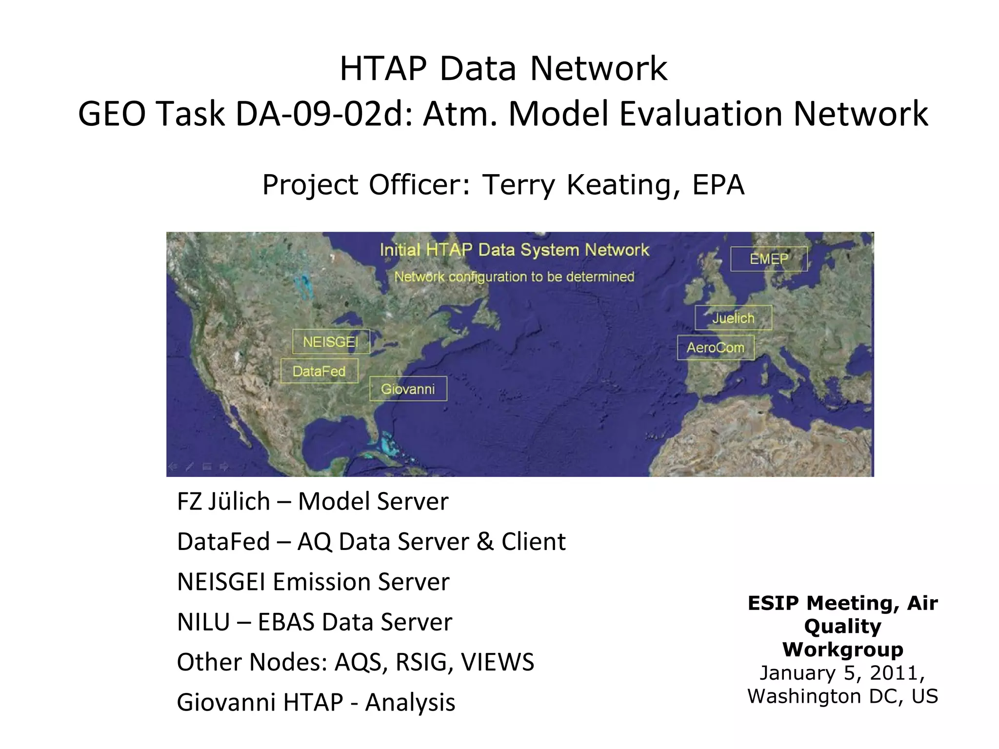
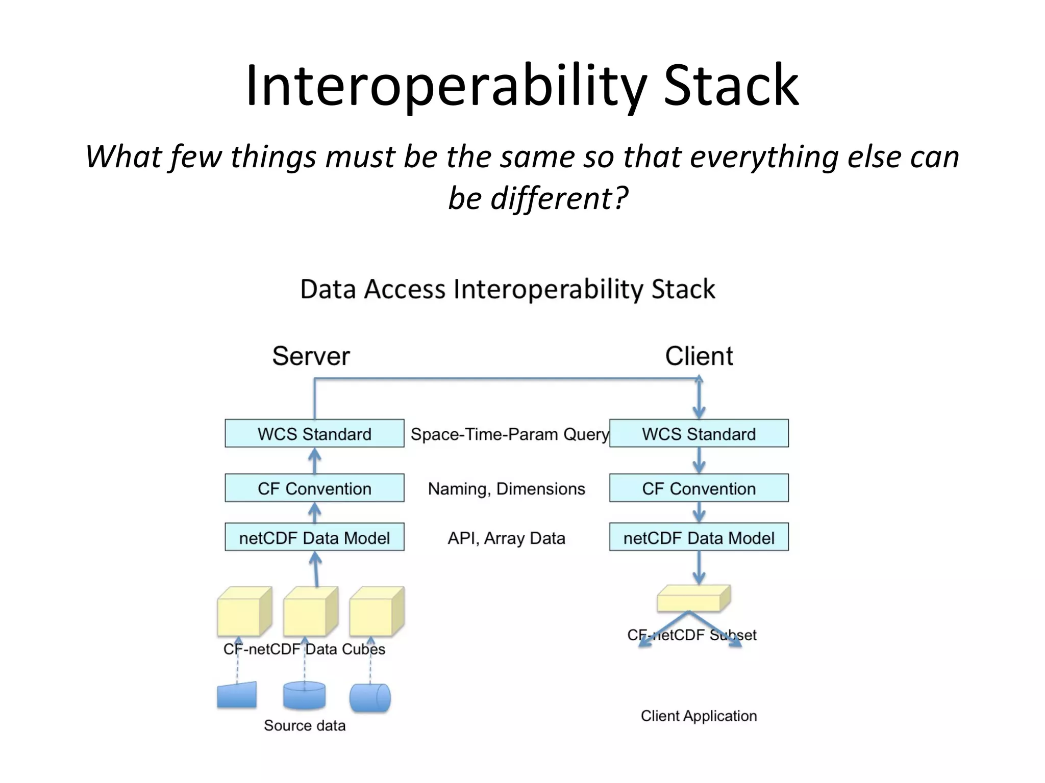
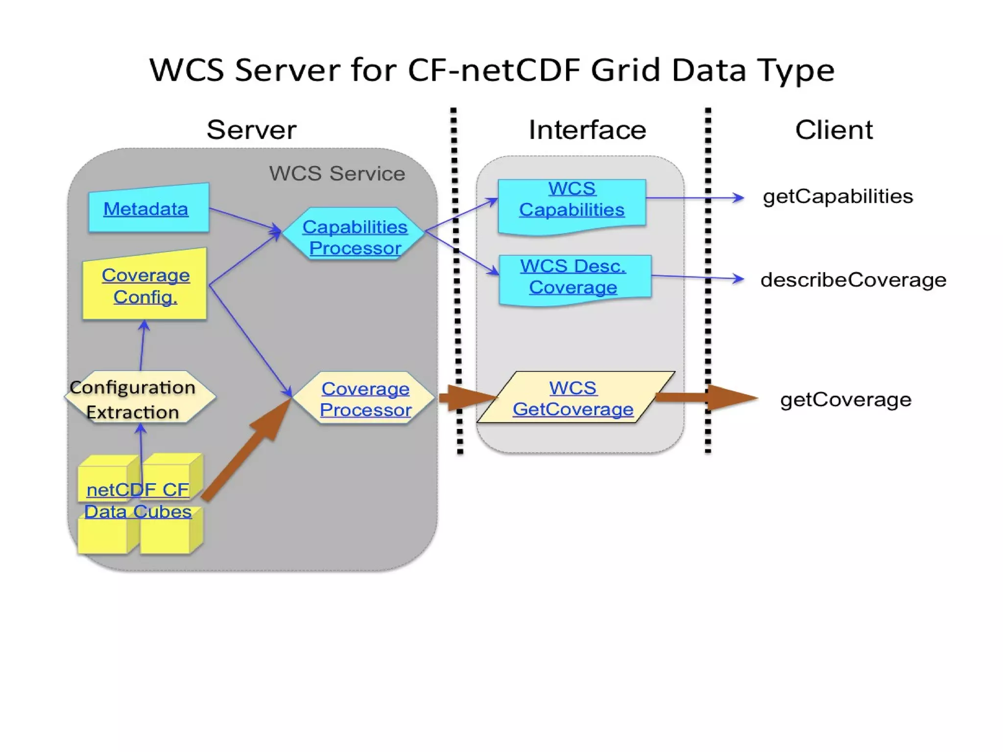
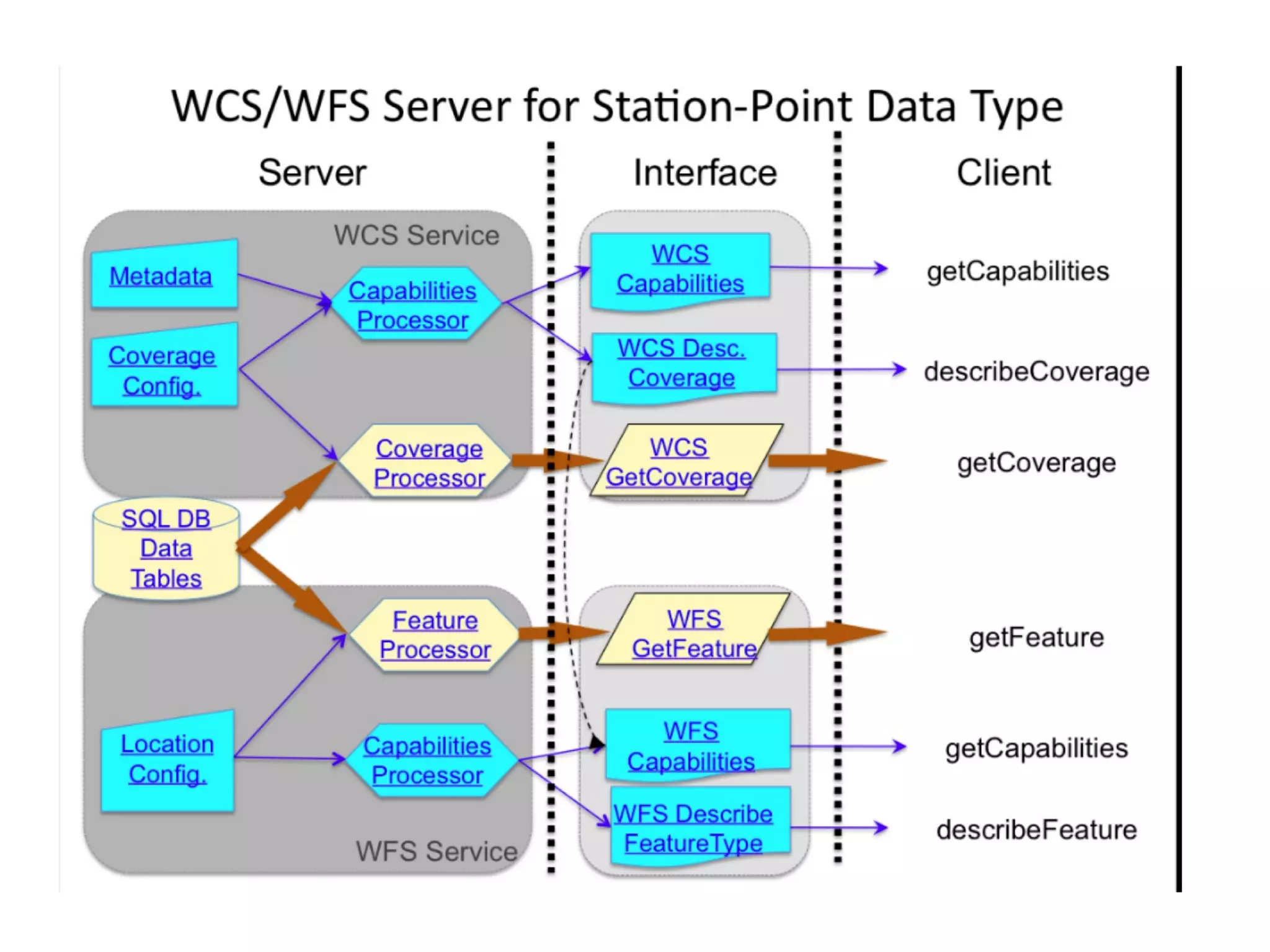
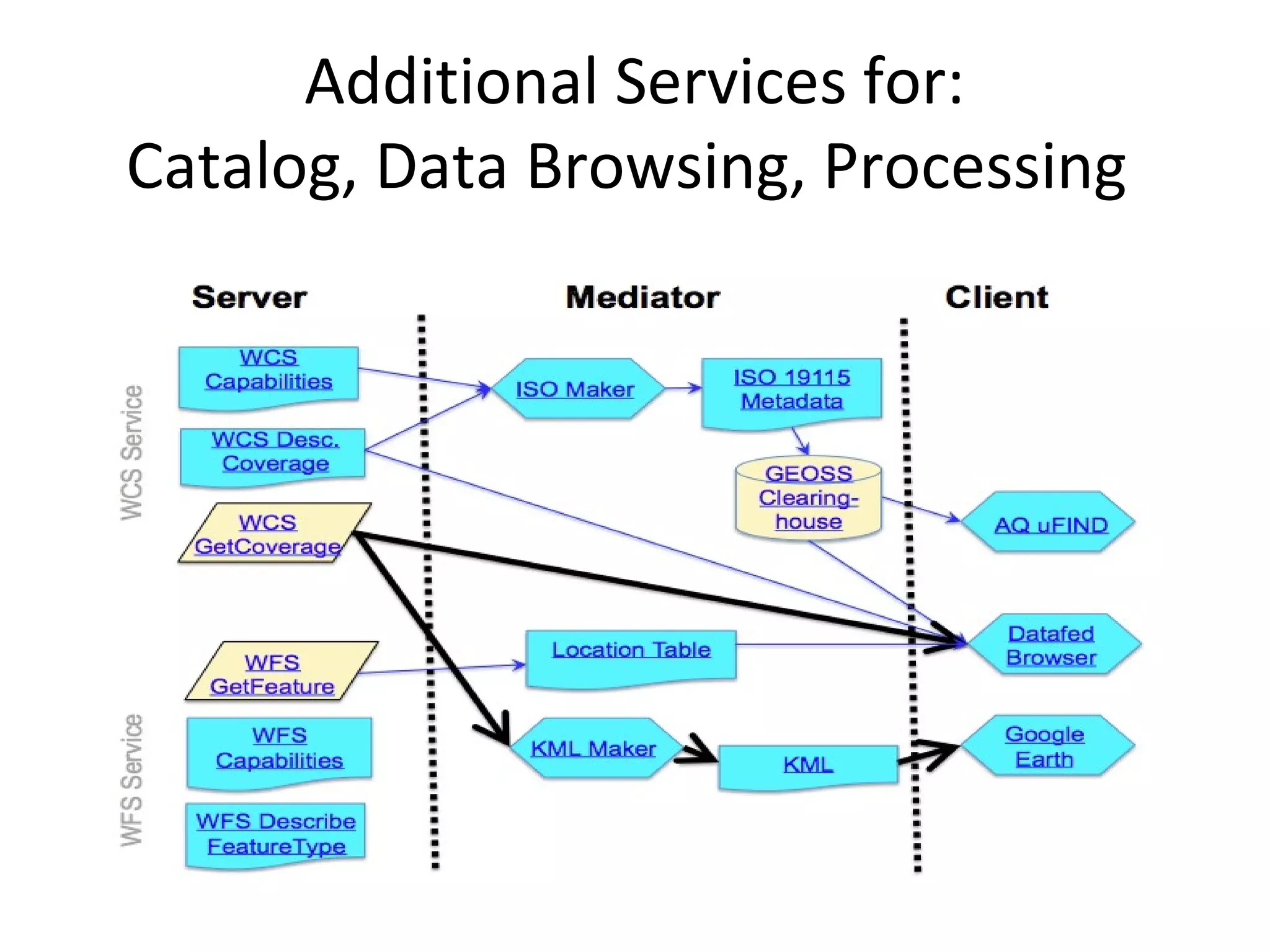
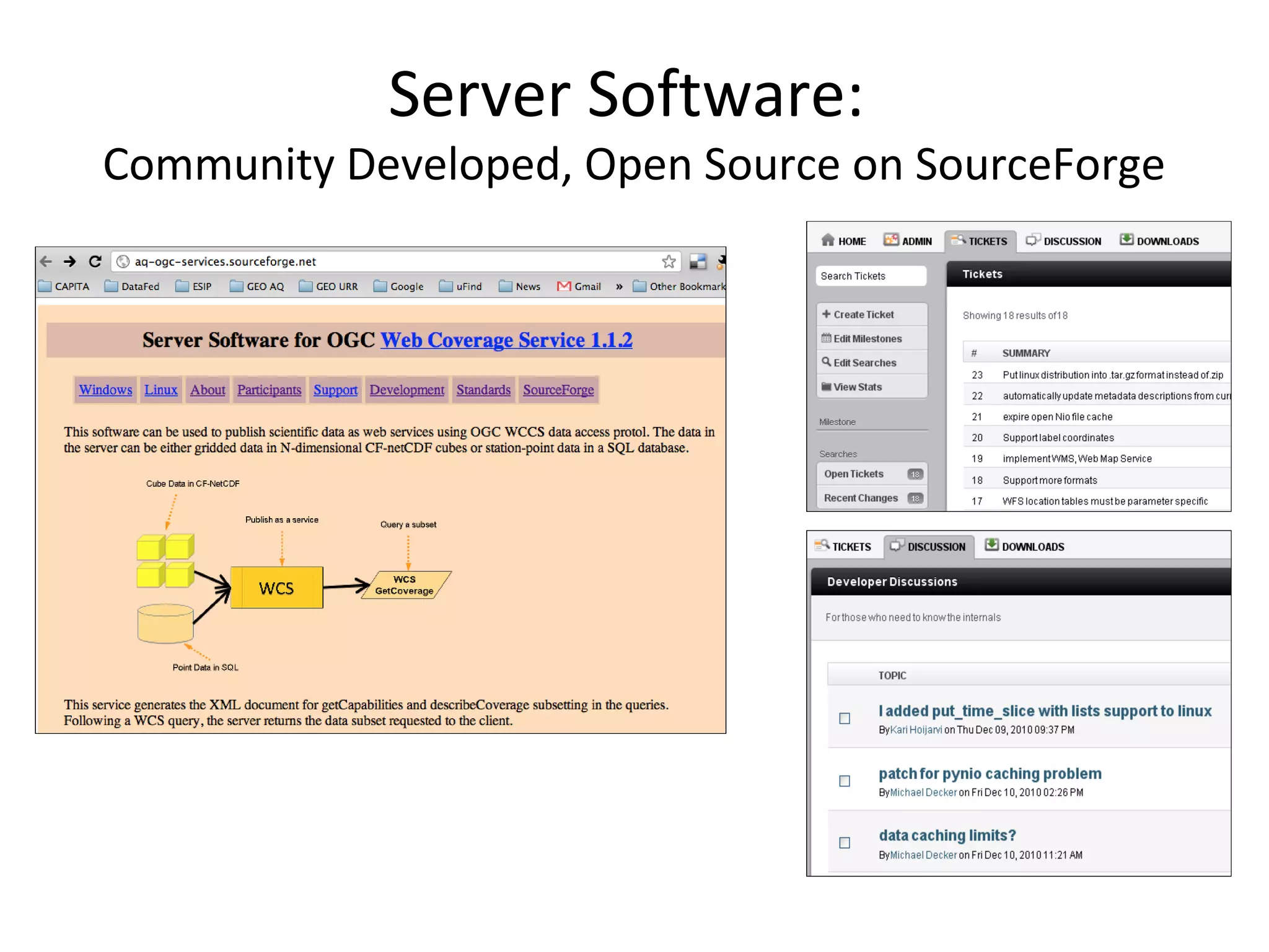
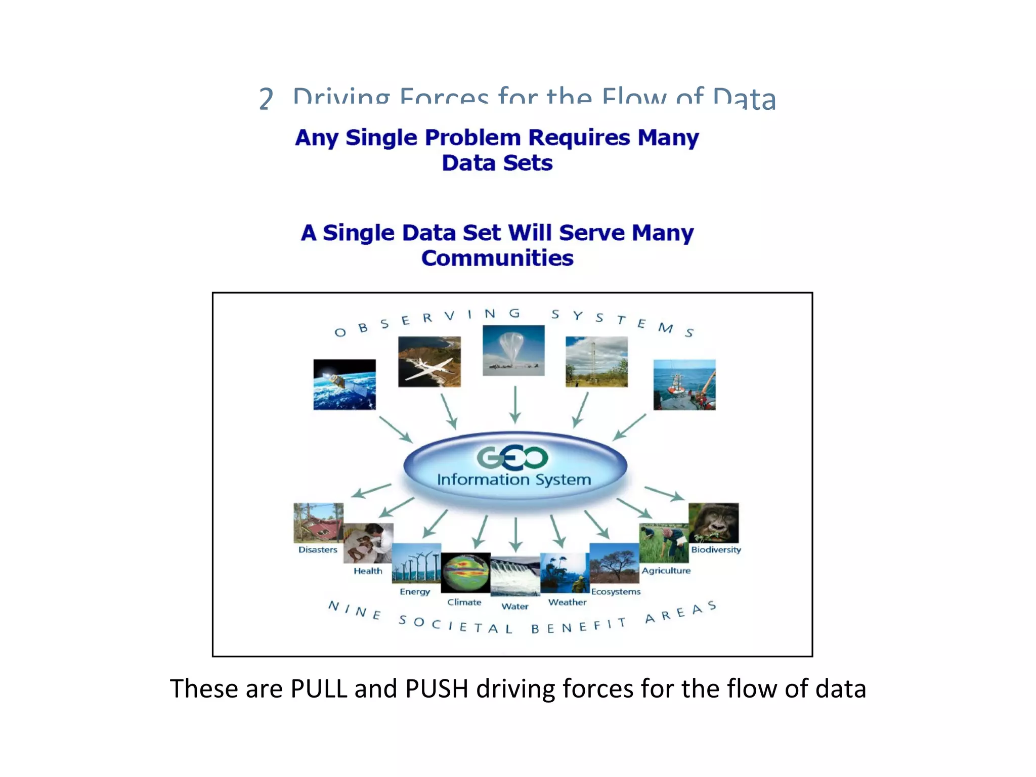
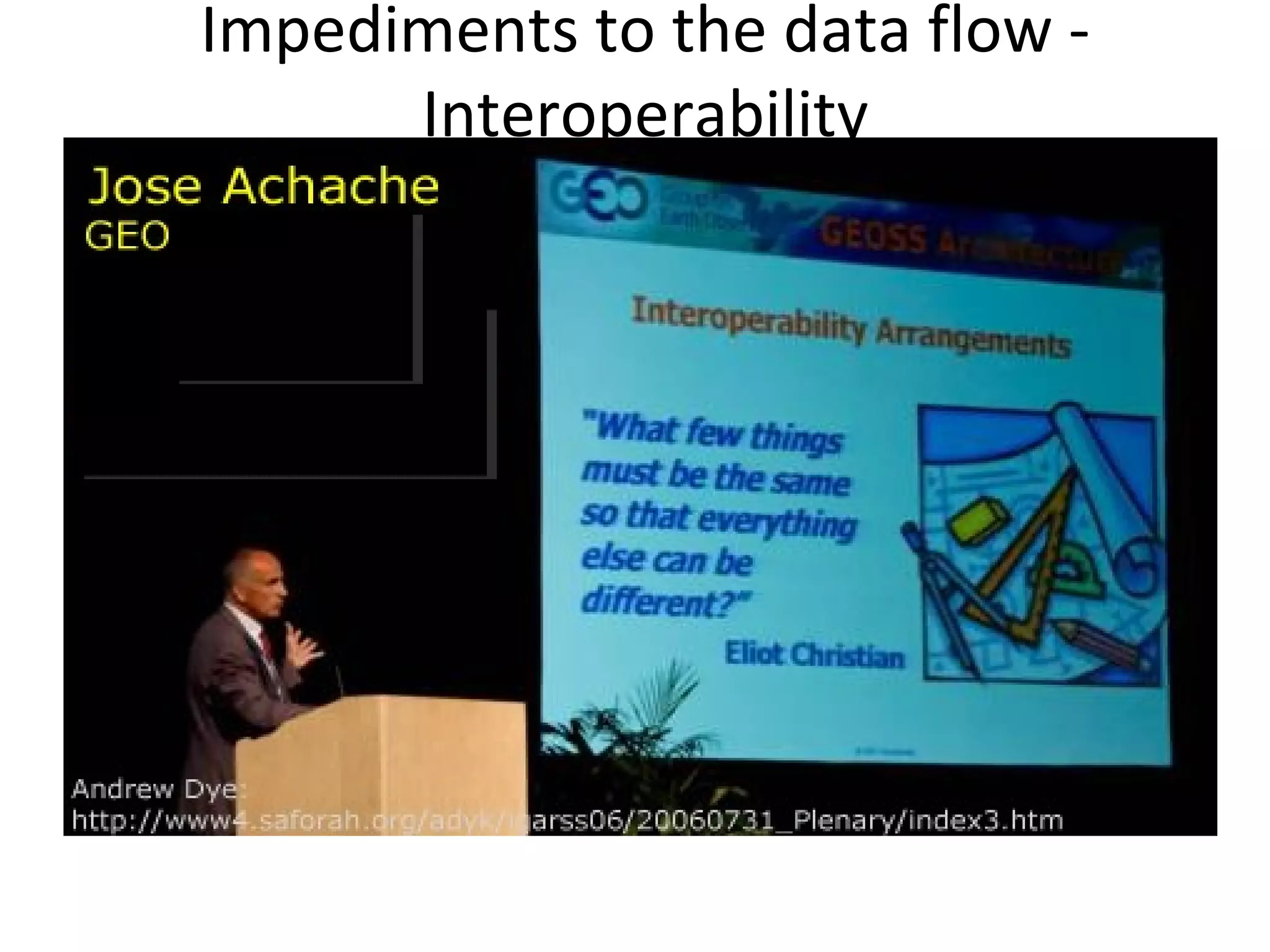
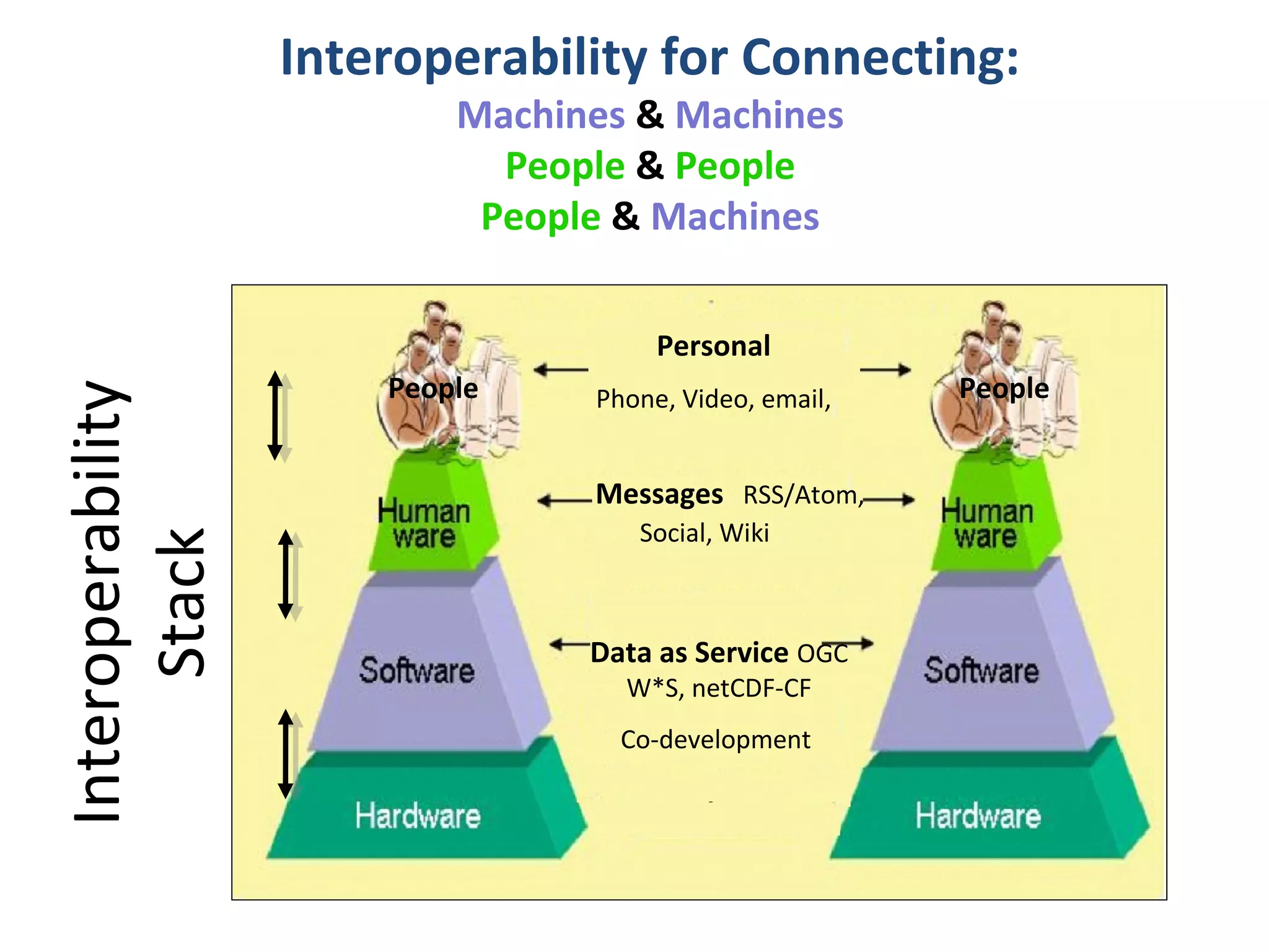
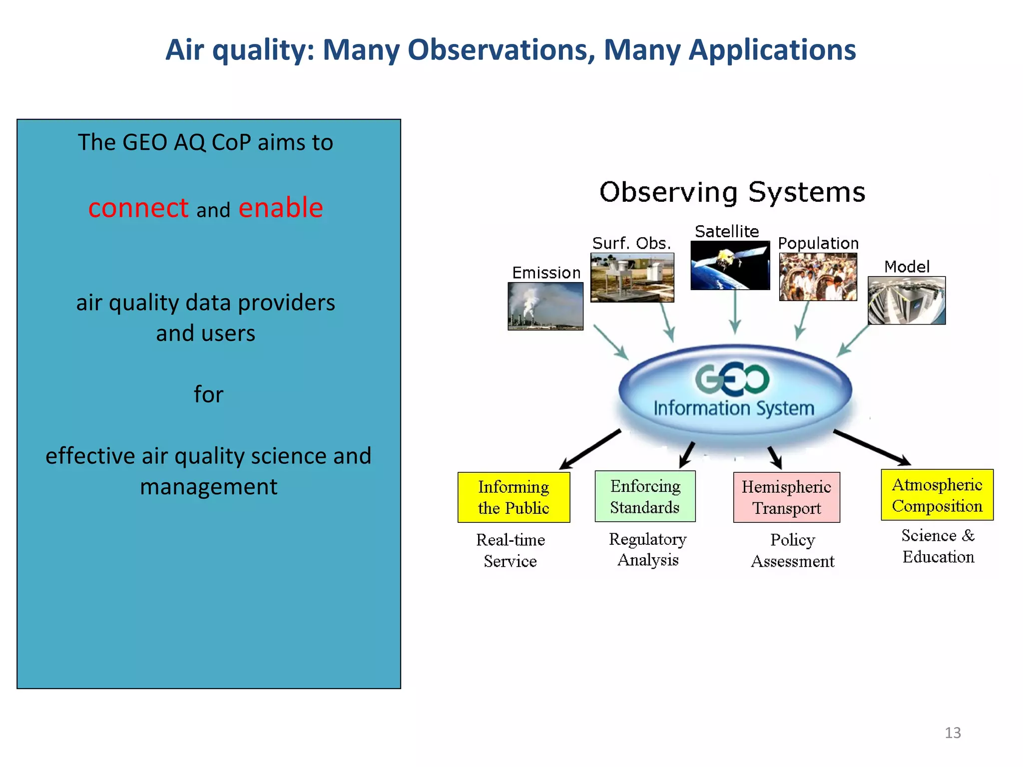
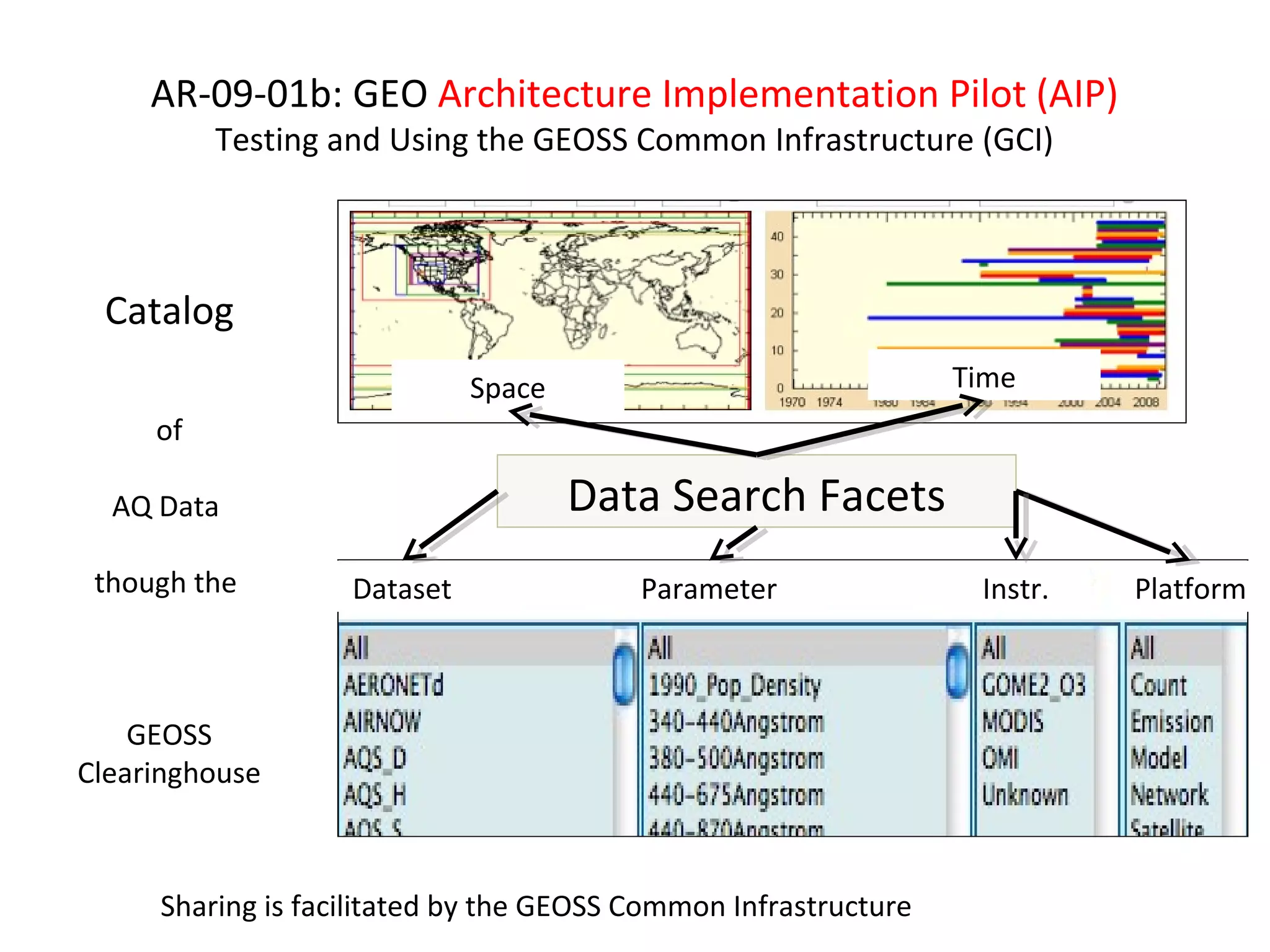
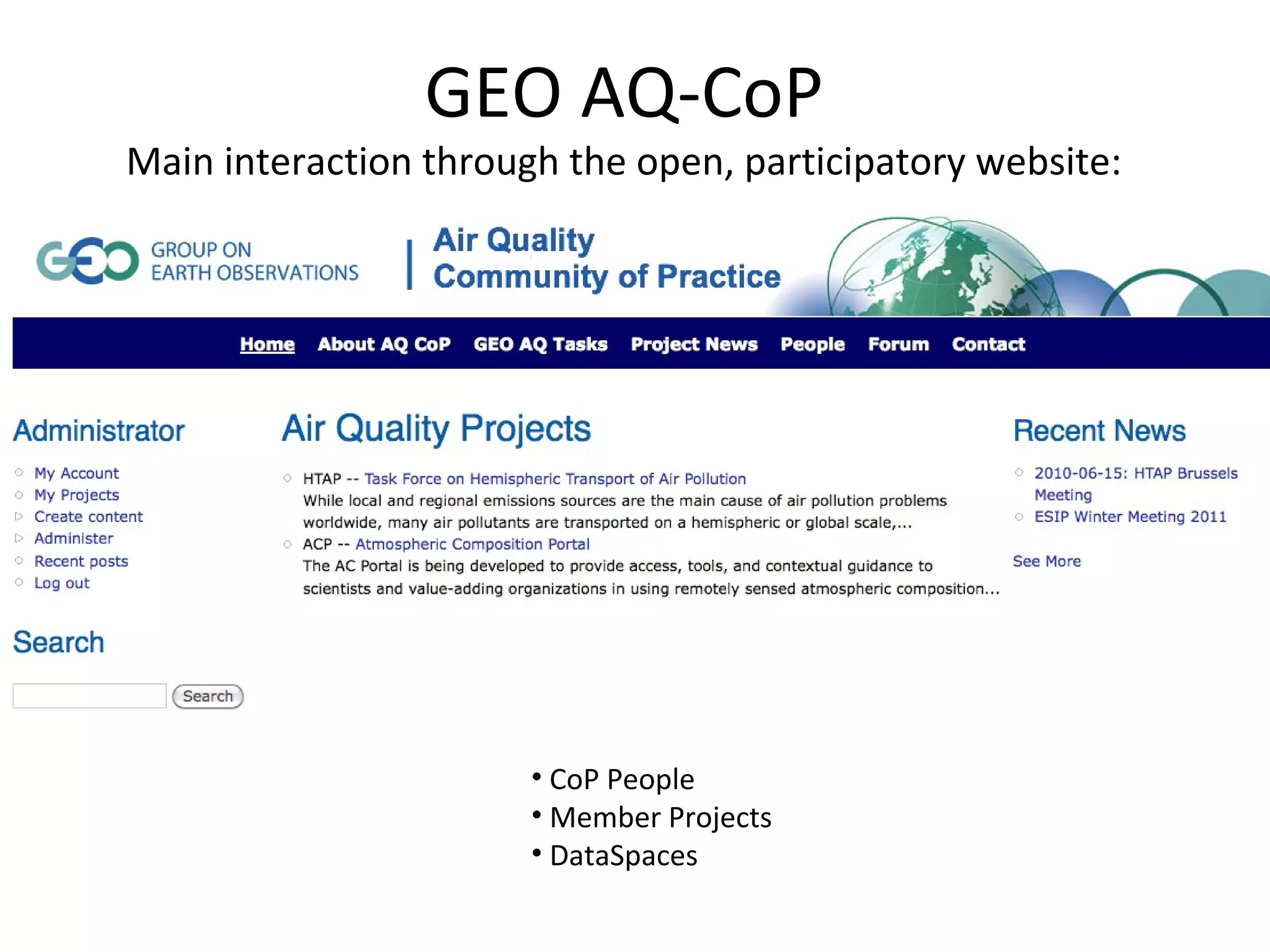
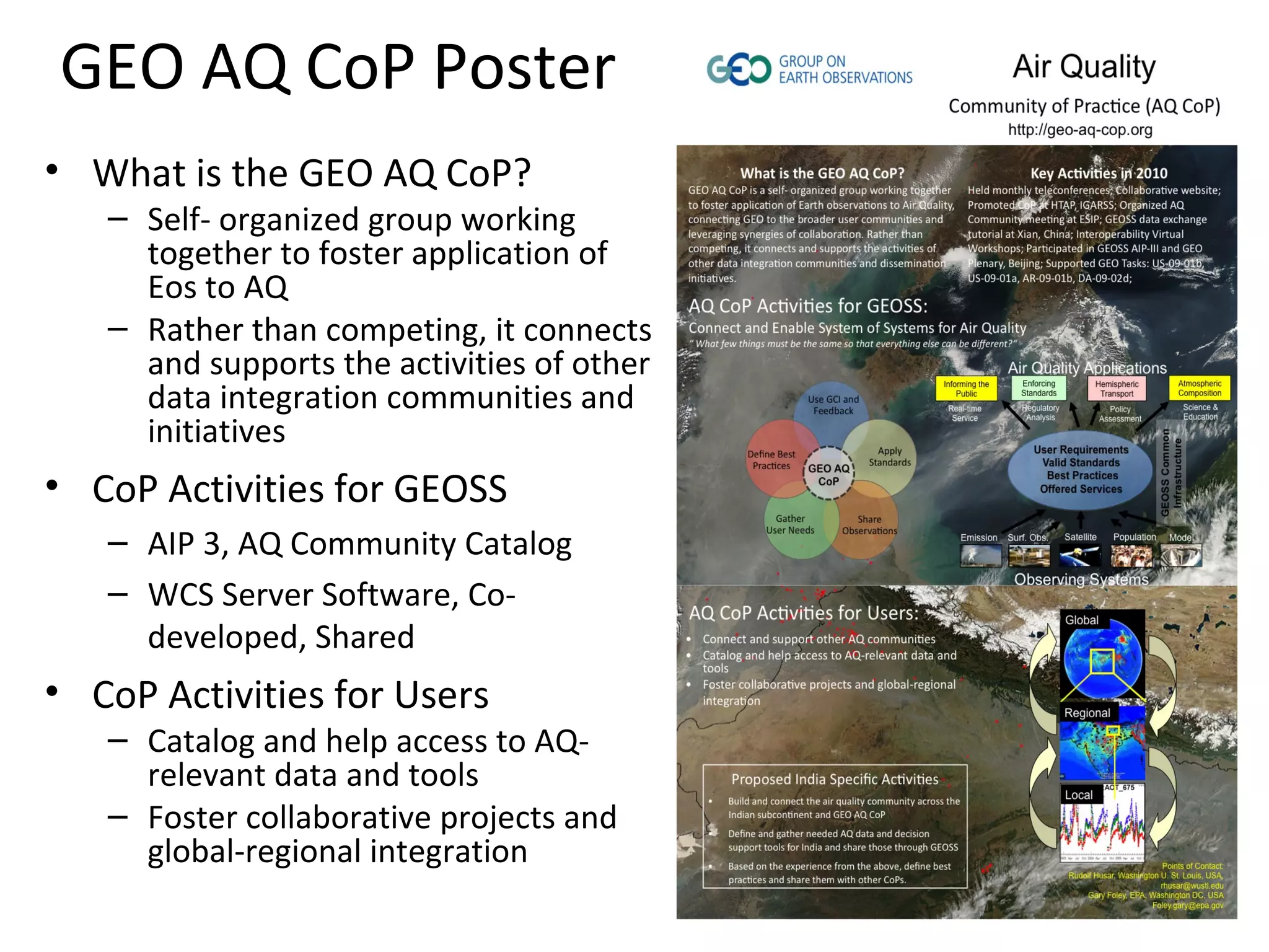
The document describes the HTAP Data Network, which demonstrates a service-oriented approach to sharing atmospheric model outputs and air quality observations between various data servers using open standards. The main output is open-source WCS data server software and tools that allow different organizations to publish, find, and access distributed air quality data holdings in a interoperable way as part of the GEO Task DA-09-02d: Atmospheric Model Evaluation Network. The network aims to connect air quality data providers and users to enable effective air quality science and management.
EarthCube All Hands Meeting Outcomes: Architecture Forum EarthCube
The EarthCube All-Hands Meeting, held in Washington, DC June 24-26, had a large emphasis community discussion about coming to convergence on architecture for EarthCube.
This presentation, given at the EarthCube Townhall at ESIP Summer Meeting (July 8-11) outlines the outcomes of the Architecture discussions and how the technology projects and teams are using these outcomes to move forward with EarthCube.
Parts 3 and 4 of a comprehensive look at the Geoweb, based on well defined web2.0 patterns and examples as well as organice buzz within the Geoweb community. For a detailed summary, see http://blog.gishacks.com/2009/09/comprehensive-look-at-geoweb-part-3-and.html.
EarthCube Monthly Community Webinar- Nov. 22, 2013EarthCube
This webinar features project overviews of all EarthCube Awards (Building Blocks, Research Coordination Networks, Conceptual Designs, and Test Governance), followed by a call for involvement, and a Q&A session.
Agenda:
EarthCube Awards – Project Overviews
1.. EarthCube Web Services (Building Block)
2. EC3: Earth-Centered Community for Cyberinfrastructure (RCN)
3. GeoSoft (Building Block)
4. Specifying and Implementing ODSIP (Building Block)
5. A Broker Framework for Next Generation Geoscience (BCube) (Building Block)
6. Integrating Discrete and Continuous Data (Building Block)
7. EAGER: Collaborative Research (Building Block)
8. A Cognitive Computer Infrastructure for Geoscience (Building Block)
9. Earth System Bridge (Building Block)
10. CINERGI – Community Inventory of EC Resources for Geoscience Interoperability (BB)
11. Building a Sediment Experimentalist Network (RCN)
12. C4P: Collaboration and Cyberinfrastructure for Paleogeosciences (RCN)
13. Developing a Data-Oriented Human-centric Enterprise for Architecture (CD)
14. Enterprise Architecture for Transformative Research and Collaboration (CD)
15. EC Test Enterprise Governance: An Agile Approach (Test Governance)
A Call for Involvement!
Open Science and GEOSS: the Cloud Sandbox enablersterradue
As part of the European project GEOWOW, Terradue was invited to present views at the GEO-X event on future endeavors to serve data democracy & science literacy in GEOSS (http://www.earthobservations.org/geoss.shtml)
Science Services and Science Platforms: Using the Cloud to Accelerate and Dem...Ian Foster
Ever more data- and compute-intensive science makes computing increasingly important for research. But for advanced computing infrastructure to benefit more than the scientific 1%, we need new delivery methods that slash access costs, new sustainability models beyond direct research funding, and new platform capabilities to accelerate the development of new, interoperable tools and services.
The Globus team has been working towards these goals since 2010. We have developed software-as-a-service methods that move complex and time-consuming research IT tasks out of the lab and into the cloud, thus greatly reducing the expertise and resources required to use them. We have demonstrated a subscription-based funding model that engages research institutions in supporting service operations. And we are now also showing how the platform services that underpin Globus applications can accelerate the development and use of an integrated ecosystem of advanced science applications, such as NCAR’s Research Data Archive and OSG Connect, thus enabling access to powerful data and compute resources by many more people than is possible today.
In this talk, I introduce Globus services and the underlying Globus platform. I present representative applications and discuss opportunities that this platform presents for both small science and large facilities.
2004-09-12 Data and Tools for Air Quality Management:
110105 htap pilot_aqco_p_esip_dc
1. HTAP Data Network
GEO Task DA-09-02d: Atm. Model Evaluation Network
Project Officer: Terry Keating, EPA
FZ Jülich – Model Server
DataFed – AQ Data Server & Client
NEISGEI Emission Server
ESIP Meeting, Air
NILU – EBAS Data Server Quality
Workgroup
Other Nodes: AQS, RSIG, VIEWS January 5, 2011,
Giovanni HTAP - Analysis Washington DC, US
2. HTAP Data Network
GEO Task DA-09-02d: Atm. Model Evaluation Network
• Demonstration of a service-oriented, loosely coupled air
quality data sharing network.
• Implemented using standards and conventions for publishing,
finding and accessing distributed holdings of atmospheric
model outputs and observations.
• The main output is a portable open-source WCS data server
software and tools.
• The HTAP Pilot is a contributions to GEOSS through GEO Task
DA-09-02d: Atmospheric Model Evaluation Network.
8. Project Status on the Collaboration Continuum:
Between Cooperation and Collaboration
9. The GEO Air Quality Community of Practice
Report to ESIP AQ WG, Jan 2011, Washington DC
based on
6th Annual Meeting of Task force on Hemispheric Transport of Air Pollutants (TF HTAP)
Brussels, June 15, 2010
Report and Presentations at GEO Plenary, Beijing, November 5, 2010
Point of Contact: Rudolf Husar (rhusar@wustl.edu)
10. 2. Driving Forces for the Flow of Data
These are PULL and PUSH driving forces for the flow of data
12. Interoperability for Connecting:
Machines & Machines
People & People
People & Machines
Personal
People People
Interoperability
Phone, Video, email,
Messages RSS/Atom,
Social, Wiki
Stack
Data as Service OGC
W*S, netCDF-CF
Co-development
13. Air quality: Many Observations, Many Applications
The GEO AQ CoP aims to
connect and enable
air quality data providers
and users
for
effective air quality science and
management
13
14. Other AQ CoP Ativities
AQ CoP Participation in GEO Tasks
• US-09-01b: Development of Communities of Practice
• US-09-01a: Identifying User Requirements for Earth Obs.
AR-09-01b: GEO Architecture Implementation Pilot (AIP)
•DA-09-02d: Atmospheric Model Evaluation Network
•…..
Meeting & Coordination Activities, 2010
May 2010: GEO Decision Support Concept Proposal (Falke)
June 2010: AQ Participation in the GEOSS AIP 2,3. (Falke, Robinson)
Sep 2010: Report to UIC (Husar)
Nov 2010: Presentations at GEO Plenary, Beijing (Sethi, Menon)
Monthly: Telecons, Wiki workspace (Falke, Robinson)
15. AR-09-01b: GEO Architecture Implementation Pilot (AIP)
Testing and Using the GEOSS Common Infrastructure (GCI)
Catalog
Space Time
of
AQ Data Data Search Facets
though the Dataset Parameter Instr. Platform
GEOSS
Clearinghouse
Sharing is facilitated by the GEOSS Common Infrastructure
16. GEO AQ-CoP
Main interaction through the open, participatory website:
• CoP People
• Member Projects
• DataSpaces
17. GEO AQ CoP Poster
• What is the GEO AQ CoP?
– Self- organized group working
together to foster application of
Eos to AQ
– Rather than competing, it connects
and supports the activities of other
data integration communities and
initiatives
• CoP Activities for GEOSS
– AIP 3, AQ Community Catalog
– WCS Server Software, Co-
developed, Shared
• CoP Activities for Users
– Catalog and help access to AQ-
relevant data and tools
– Foster collaborative projects and
global-regional integration
18. GEO AQ CoP Active Participants
Technologists:
Michael Decker, FZ Julich; Oleg Goussev (DLR); Kari Hoijarvi, WUSTL; Erin Robinson,
WUSTL.. and others.
Facilitators:
Stefan Falke, NGC; Dave McCabe, EPA/CAC); Frank Lindsey, NASA; Rudy Husar, WUSTL;
Martin Shulz, FZ Juelich .. and others.
Agency Executives:
Gary Foley, EPA; Terry Keating, EPA; Lawrence Friedl, NASA .. and others.
Point of Contact: Rudolf Husar (rhusar@wustl.edu)
Editor's Notes
We will start out by highlighting significant trends in air pollution monitoring and management Next we will describe an agile information system architecture for air quality decision support Finally, we will show the application of this architecture and technologies for two use cases: a real time smoke event analysis and a long-term model evaluation
The HTAP Data Network Pilot is a demonstration of a service-oriented, loosely coupled air quality data sharing network. It is implemented using international standards and conventions for publishing, finding and accessing distributed holdings of atmospheric model outputs and observations. The portable WCS data server software and the tools developed and used in this HTAP Pilot are contributions to GEOSS through GEO Task DA-09-02d: Atmospheric Model Evaluation Network.
First a recap of tree basic ideas for GEOSS. Any single problem requires many datasets Any dataset will serve many communities The PULL by data users and the PUSH by data providers are driving forces for the flow of data
However, there are also strong impediments to the flow of data, both technological and social. A guiding principle for interoperability is “What few things must be the same so that everything else be different?” Whats the minimum set of protocols should we agree on so that we have an “Internet” for data?