Bio-physical impact analysis of climate change with EPIC
Presented by Christine Heumesser at the AGRODEP Workshop on Analytical Tools for Climate Change Analysis
June 6-7, 2011 • Dakar, Senegal
For more information on the workshop or to see the latest version of this presentation visit: http://www.agrodep.org/first-annual-workshop
Socio-ecological valuation of ecosystem services along the West Antarctic Pen...Jeff Bowman
The Palmer Long Term Ecological Research (LTER) project is located along the West Antarctic Peninsula (WAP), one of the most rapidly warming regions on the planet. Despite its remoteness the WAP supports a variety of social and economic activities, most notably in the fishing and tourism industries and in international scientific research. Because of the growing pressures imposed by these activities, the rapid rate of environmental change, relatively pristine nature of the environment, its trophic complexity, and rich scientific record, the WAP is an ideal place to explore the impact of climate change on marine and terrestrial ecosystems and the services and benefits they provide. Here we present a schema to conduct an initial assessment of WAP marine and terrestrial ecosystem services that will serve as a critical baseline for future studies, and that is broadly applicable to other LTER sites. We will combine social valuation and qualitative, expert-based modelling to identify relevant ecosystem services and to conduct an initial assessment and valuation of ecosystem service supply for the WAP region. The Palmer LTER team of investigators includes experts in topics ranging from physical oceanographic processes, to microbiology, to marine avian and mammal ecology. Through interviews and an online survey we will evaluate the views and perceptions of Antarctic ecosystem services and their changes among this group of experts. Our focus will be on biophysical ecosystem services, but we will include cultural ecosystem services and the impacts of changes on ecosystem functioning and ecosystem service supply in the expert elicitations. This qualitative, socio-ecological valuation will guide an expanded future assessment of WAP ecosystem services that include economic and socio-cultural realms of ecosystem service as perceived and valued by an expanded pool of experts and stakeholders.
Use of Unmanned Aerial Systems for Hydrological MonitoringSalvatore Manfreda
Invited presentation given during the EGU General Assembly at the session entitled "Advances in river monitoring and modelling: data-scarce environments, real-time approaches, Inter-comparison of innovative and classical frameworks, uncertainties, Harmonisation of methods and good practices"
Presented by Daniel Murdiyarso and Sigit Sasmito, CIFOR, at Online Workshop Capacity Building on the IPCC 2013 Wetlands Supplement, FREL Diagnostic and Uncertainty Analysis, April 14th, 2020
Seagrass Mapping and Monitoring Along the Coasts of Crete, GreeceUniversität Salzburg
This research proposal introduces MSc thesis research. Study object is seagrass Posidonia oceanic (P. oceanica) along the coast of Crete, Greece. The most important facts about seagrass: endemic Mediterranean seagrass, P. oceanica is a main species in marine coastal environment of Greece. P. oceanica is the largest, the most widespread, homogeneous, dense “mattes” forming meadows between 5-40 m in Mediterranean Sea. Seagrass is a component of coastal ecosystems of high importance for the marine life, playing important functions in the marine environment. Seagrasses are subjects to external factors and therefore have environmental vulnerability. The study area is located in General research area: Island of Crete, Greece. Seagrass sampling will be performed at three stations at a depth of 6-7 m: Heraklio, Agia Pelagia, Xerokampos, Crete Island, Greece. The general research objectives of the MSc research includes GIS and environmental analysis: 1) Mapping the extent of the spatial distribution of seagrass P. oceanica along the northern coast of Crete; 2) Monitoring environmental changes in seagrass meadows in the selected fieldwork sites (Agia Pelagia, Xerokampos) over the 10-year period (2000-2010). There are various multi-sources data proposed for using in spatial analysis. data of the previous measurements received during the last year fieldwork, to analyze whether P.oceanica is spectrally distinct from other sea floor types, using the differences in the spectral signatures on the graphs in a WASI, the Water Color Simulator software. Other data include satellite images from the open sources (Landsat TM), aerial images, Google Earth; underwater videographic measurements of 3 cameras Olympus ST 8000 made during the ship route (ca 20 total in the selected areas of the research places) resulting in series of consequent images, completely covering the area under the boat path; in-situ measurements of the seagrass in selected spots, using measurement frame and other devices for marine biological research for the validation of the results. Arc GIS vector layers of Crete island and surroundings (.shp files). Hypothesis testis is formulated for the proposed research, questions defined, methods prepared and planned. The research work is expected to have following results : Over the northern coasts of Crete: thematic maps showing seafloor types and seagrass P.oceanica spatial distribution along the coasts of Crete. Within the fieldwork locations, Ligaria beach: monitoring the environmental changes, based on the classification of the satellite and aerial imagery and fieldwork video camera footage. Within the fieldwork locations : maps of the sea floor cover types, based on the fieldwork measurements and UVM. Results of the WASI spectral analysis illustrating graphs of the spectral reflectance of different sea floor types (sand, P.oceanica, rocky, etc) at various depths (0.5-4 m), based on the results of 20.Precise, correct and up-to-date information about th
La presentazione del Progetto SmartGeo a cura di Guido Satta, in occasione dell'evento "Bonifiche ambientali e potenzialità delle imprese" che si è tenuto a Cagliari il 7 novembre 2014.
Mangrove emission factors: Scientific background on key emission factorsCIFOR-ICRAF
Presented by Sigit Sasmito and Daniel Murdiyarso, CIFOR, at Online Workshop Capacity Building on the IPCC 2013 Wetlands Supplement, FREL Diagnostic and Uncertainty Analysis, April 14th, 2020
A knowledge-based model for identifying and mapping tropical wetlands and pea...ExternalEvents
This presentation was presented during the 2 Parallel session on Theme 3.1, Managing SOC in: Soils with high SOC – peatlands, permafrost, and black soils, of the Global Symposium on Soil Organic Carbon that took place in Rome 21-23 March 2017. The presentation was made by Mr. Thomas Gumbricht, from Center for International Forestry Research – Indonesia, in FAO Hq, Rome
This preview presents a summary of four selected research on remote sensing drought assessment and impacts at both the regional and global levels as part of the course requirement for remote sensing for global environmental change. The papers are presented by Richard MacLean, graduate student in Geographic Information Systems for Development and Environment and Jenkins Macedo, graduate student in Environmental Science and Policy.
Presentation by ICOS DG Werner Kutsch at the UNFCCC Earth Information Day in UN COP22 on Tue 8 November 2016.
See the Earth Information Day programme: http://unfccc.int/science/workstreams/items/9949.php
C6.05: New ocean-colour products for the user community - Shubha Sathyendrana...Blue Planet Symposium
The ocean-colour component of the Climate Change Initiative of the European Space Agency has generated a time series of bio-optical products from late 1997 to mid 2012. The products are based on data from SeaWiFS, MODIS-A and MERIS sensors, band shifted (to bring data to a common set of wavebands), corrected for inter-sensor bias, and then merged. Products include remote-sensing reflectances at SeaWiFS wavelengths, chlorophyll concentration, diffuse attenuation coefficient at 490 nm, and inherent optical properties (components of absorption and back-scattering coefficients). Practically all the products have uncertainties (root-mean-square difference and bias) associated with them on a pixel-by-pixel basis, based on validation using in situ data. The first version of the products are available freely at www.oceancolour.org and at www.esa-oceancolour-cci.org. A second version is expected to be released prior to the Blue Planet Symposium in Australia in 2015. Furthermore, plans are underway to add to the product suite through a number of related ESA projects. New products envisaged include primary production, photosynthesis parameters, components of the carbon pool in the ocean and photosynthetically active radiation (PAR) at the sea surface. User consultation and serving the user community are very much a part of these projects, and the Blue Planet provides a useful forum for reaching users from a variety of backgrounds. The work reported here contribute to components C2 (Sustained Ecosystems and Food Security) and C5 (Ocean Climate and Carbon) of the “Oceans and Society: Blue Planet” initiative of the Group on Earth Observations (GEO).
Presented by Choi Hyung Soon, Director of Global Forestry Research Division, National Institute of Forest Science (NIFoS) – Republic of Korea, on the ITPC side event “Could a virtual collaborative platform help to preserve tropical peatlands?” at the XV World Forestry Congress, Seoul, Republic of Korea, 5 May 2022.
As part of the GSP’s capacity development and improvement programme, FAO/GSP have organised a one week training in Izmir, Turkey. The main goal of the training was to increase the capacity of Turkey on digital soil mapping, new approaches on data collection, data processing and modelling of soil organic carbon. This 5 day training is titled ‘’Training on Digital Soil Organic Carbon Mapping’’ was held in IARTC - International Agricultural Research and Education Center in Menemen, Izmir on 20-25 August, 2017.
Day 1_Session3_TRIPS_WASDS_ICRISAT - This presentation outlines planned ICRISAT activities for the CGIAR Research Program on Dryland Systems for the West African Sahel and Dry Savannas region.
''Copernicus for sustainable land management'' by Markus Erhard, European Environment Agency (EEA)
Sustainable Land Management Session - EU Space Week 2018, Marseille
"Environmental performance tools: How ceramic PCRs contribute to a better env...Cerame-Unie
"Environmental performance tools: How ceramic PCRs contribute to a better environment" by Dr Pere Fullana i Palmer, UNESCO Chair in Life Cycle and Climate Change.
Presentation made at the Construction conference organised by Cerame-Unie on 26 November as part of the Ceramic Days 2013.
Similar to Earth Observation for Climate - Julian Wilson, Joint Research Centre, institute for Environment and Sustainability, Italy (20)
Jenny Deakin from the EPA Catchments Unit gave a Teagasc Signpost Seminar on April 20 2021. The seminar covered water quality, focused on the agricultural sector, and the solutions needed to improve water quality, and new tools to target the right measure in the right place. This includes upgraded Pollution Impact Potential Maps for Nitrogen and Phosphorus, together with overland flow and focused delivery points.
On 25 November 2020 the EPA published Ireland’s Environment - An Integrated Assessment 2020 which provides an assessment of the overall quality of Ireland's environment, the pressures being placed on it and the societal responses to current and emerging environmental issues.
This plain English fact sheet outlines the work done by the EPA in monitoring Ireland’s rivers.
Ireland has more than 73,000 km of river channels. If placed end-to-end, they could encircle the Earth almost twice. Three-quarters of these channels are very small streams that typically flow into larger rivers.
Biological monitoring has been carried out in Irish rivers since 1971. The current national river monitoring programme covers more than 13,000 km of river channel.
The national monitoring programme is run by the EPA and focuses on the main river channels rather than the smaller streams. The programme includes more than 2,800 sites sampled for biology, with almost half of these being sampled for physical and chemical parameters.
This plain English fact sheet outlines the work done by the EPA in monitoring phytoplankton in Ireland's marine environment.
The EPA and the Marine Institute sample phytoplankton in estuaries and coastal waters around Ireland. They carry out sampling three times during the summer and once during winter. At each location, they take water samples just below the surface and above the seabed. They use the samples to assess how much phytoplankton is in the water and what species are present.
Phytoplankton are tiny, free-floating plants found suspended in the world’s oceans. Their name comes from Greek and means ‘plant drifter’. They are carried along by ocean currents and are usually found floating near the surface of the water. Like all plants they need sunlight to grow.
The main sources of nutrients around Ireland’s coast are discharges from wastewater treatment plants and run off from agricultural land. Phytoplankton in the estuaries and coastal waters around Ireland are monitored by the EnvironmentalProtection Agency (EPA) and the Marine Institute. They monitor phytoplankton to assess the quality (status) of our marine environment. They must do this as part of the requirements of the European Water Framework Directive.
This plain English fact sheet outlines the work done by the EPA in monitoring Ireland’s marine environment.
Ecologically healthy marine waters are a valuable natural resource. They support a rich and diverse range of ecosystems, habitats and species, and they are also a source of food – from wild fisheries and aquaculture. They are also important for recreational activities and tourism.
Transitional and coastal waters are assessed under the European Water Framework Directive (WFD) and the Marine Strategy Framework Directive (MSFD). Having coordinated frameworks for water quality for all the water bodies in Ireland, and across Europe, allows us to compare our results with other countries. It allows us to see what works to help us make sure all our water bodies achieve at least ‘good’ status, and no deterioration occurs.
This plain English fact sheet outlines the work done by the EPA in monitoring Ireland’s lakes.
A total of 225 lakes are currently included as part of the national surface waters monitoring programme run by the EPA, this covers around 80% of the surface area of all lakes in Ireland.
This includes:
• all lakes greater than 50 hectares
• lakes that are used for supplying drinking water
• lakes that are of regional, local or scientific interest
This Plain English fact sheet outlines the work done by the EPA in monitoring aquatic plants in Irish lakes.
Aquatic plants are good at showing if the quality of the water is good or bad and play an important role in lake ecology by providing food and a habitat for many smaller plants, animals and birds.
They also:
• provide shelter for young fish
• help to improve the clarity of the water
• help stabilise lake shore banks
• reduce the amount of sediment being suspended in the water
The Environmental Protection Agency (EPA) monitors these aquatic plants at more than 10,000 sites in over 200 lakes once every three years.
On 17 and 18 June 2020 the EPA held its National Water Event as an online conference.
This year's theme was 'Restoring our waters'.
This years event was free to attend. It was the EPA's largest water event ever, with over 1250 attending.
To everyone who joined us: thanks for attending; thanks for your probing questions; thanks for your passion; thanks for caring about our waters. We can achieve more working together.
Special thanks to all our presenters and the team who worked behind the scenes to make sure this years conference happened.
For science and stories about water quality in Ireland, check out www.catchments.ie
On 17 and 18 June 2020 the EPA held its National Water Event as an online conference.
This presentation was by Con McLaughlin, Donegal County Council and Andy Griggs, Armagh City, Banbridge and Craigavon District Council.
This year's theme was 'Restoring our waters'.
This years event was free to attend. It was the EPA's largest water event ever, with over 1250 attending.
To everyone who joined us: thanks for attending; thanks for your probing questions; thanks for your passion; thanks for caring about our waters. We can achieve more working together.
Special thanks to all our presenters and the team who worked behind the scenes to make sure this years conference happened.
For science and stories about water quality in Ireland, check out www.catchments.ie
On 17 and 18 June 2020 the EPA held its National Water Event as an online conference.
This year's theme was 'Restoring our waters'.
This years event was free to attend. It was the EPA's largest water event ever, with over 1250 attending.
To everyone who joined us: thanks for attending; thanks for your probing questions; thanks for your passion; thanks for caring about our waters. We can achieve more working together.
Special thanks to all our presenters and the team who worked behind the scenes to make sure this years conference happened.
For science and stories about water quality in Ireland, check out www.catchments.ie
More from Environmental Protection Agency, Ireland (20)
Neuro-symbolic is not enough, we need neuro-*semantic*Frank van Harmelen
Neuro-symbolic (NeSy) AI is on the rise. However, simply machine learning on just any symbolic structure is not sufficient to really harvest the gains of NeSy. These will only be gained when the symbolic structures have an actual semantics. I give an operational definition of semantics as “predictable inference”.
All of this illustrated with link prediction over knowledge graphs, but the argument is general.
Essentials of Automations: Optimizing FME Workflows with ParametersSafe Software
Are you looking to streamline your workflows and boost your projects’ efficiency? Do you find yourself searching for ways to add flexibility and control over your FME workflows? If so, you’re in the right place.
Join us for an insightful dive into the world of FME parameters, a critical element in optimizing workflow efficiency. This webinar marks the beginning of our three-part “Essentials of Automation” series. This first webinar is designed to equip you with the knowledge and skills to utilize parameters effectively: enhancing the flexibility, maintainability, and user control of your FME projects.
Here’s what you’ll gain:
- Essentials of FME Parameters: Understand the pivotal role of parameters, including Reader/Writer, Transformer, User, and FME Flow categories. Discover how they are the key to unlocking automation and optimization within your workflows.
- Practical Applications in FME Form: Delve into key user parameter types including choice, connections, and file URLs. Allow users to control how a workflow runs, making your workflows more reusable. Learn to import values and deliver the best user experience for your workflows while enhancing accuracy.
- Optimization Strategies in FME Flow: Explore the creation and strategic deployment of parameters in FME Flow, including the use of deployment and geometry parameters, to maximize workflow efficiency.
- Pro Tips for Success: Gain insights on parameterizing connections and leveraging new features like Conditional Visibility for clarity and simplicity.
We’ll wrap up with a glimpse into future webinars, followed by a Q&A session to address your specific questions surrounding this topic.
Don’t miss this opportunity to elevate your FME expertise and drive your projects to new heights of efficiency.
Slack (or Teams) Automation for Bonterra Impact Management (fka Social Soluti...Jeffrey Haguewood
Sidekick Solutions uses Bonterra Impact Management (fka Social Solutions Apricot) and automation solutions to integrate data for business workflows.
We believe integration and automation are essential to user experience and the promise of efficient work through technology. Automation is the critical ingredient to realizing that full vision. We develop integration products and services for Bonterra Case Management software to support the deployment of automations for a variety of use cases.
This video focuses on the notifications, alerts, and approval requests using Slack for Bonterra Impact Management. The solutions covered in this webinar can also be deployed for Microsoft Teams.
Interested in deploying notification automations for Bonterra Impact Management? Contact us at sales@sidekicksolutionsllc.com to discuss next steps.
JMeter webinar - integration with InfluxDB and GrafanaRTTS
Watch this recorded webinar about real-time monitoring of application performance. See how to integrate Apache JMeter, the open-source leader in performance testing, with InfluxDB, the open-source time-series database, and Grafana, the open-source analytics and visualization application.
In this webinar, we will review the benefits of leveraging InfluxDB and Grafana when executing load tests and demonstrate how these tools are used to visualize performance metrics.
Length: 30 minutes
Session Overview
-------------------------------------------
During this webinar, we will cover the following topics while demonstrating the integrations of JMeter, InfluxDB and Grafana:
- What out-of-the-box solutions are available for real-time monitoring JMeter tests?
- What are the benefits of integrating InfluxDB and Grafana into the load testing stack?
- Which features are provided by Grafana?
- Demonstration of InfluxDB and Grafana using a practice web application
To view the webinar recording, go to:
https://www.rttsweb.com/jmeter-integration-webinar
Securing your Kubernetes cluster_ a step-by-step guide to success !KatiaHIMEUR1
Today, after several years of existence, an extremely active community and an ultra-dynamic ecosystem, Kubernetes has established itself as the de facto standard in container orchestration. Thanks to a wide range of managed services, it has never been so easy to set up a ready-to-use Kubernetes cluster.
However, this ease of use means that the subject of security in Kubernetes is often left for later, or even neglected. This exposes companies to significant risks.
In this talk, I'll show you step-by-step how to secure your Kubernetes cluster for greater peace of mind and reliability.
Dev Dives: Train smarter, not harder – active learning and UiPath LLMs for do...UiPathCommunity
💥 Speed, accuracy, and scaling – discover the superpowers of GenAI in action with UiPath Document Understanding and Communications Mining™:
See how to accelerate model training and optimize model performance with active learning
Learn about the latest enhancements to out-of-the-box document processing – with little to no training required
Get an exclusive demo of the new family of UiPath LLMs – GenAI models specialized for processing different types of documents and messages
This is a hands-on session specifically designed for automation developers and AI enthusiasts seeking to enhance their knowledge in leveraging the latest intelligent document processing capabilities offered by UiPath.
Speakers:
👨🏫 Andras Palfi, Senior Product Manager, UiPath
👩🏫 Lenka Dulovicova, Product Program Manager, UiPath
Generating a custom Ruby SDK for your web service or Rails API using Smithyg2nightmarescribd
Have you ever wanted a Ruby client API to communicate with your web service? Smithy is a protocol-agnostic language for defining services and SDKs. Smithy Ruby is an implementation of Smithy that generates a Ruby SDK using a Smithy model. In this talk, we will explore Smithy and Smithy Ruby to learn how to generate custom feature-rich SDKs that can communicate with any web service, such as a Rails JSON API.
State of ICS and IoT Cyber Threat Landscape Report 2024 previewPrayukth K V
The IoT and OT threat landscape report has been prepared by the Threat Research Team at Sectrio using data from Sectrio, cyber threat intelligence farming facilities spread across over 85 cities around the world. In addition, Sectrio also runs AI-based advanced threat and payload engagement facilities that serve as sinks to attract and engage sophisticated threat actors, and newer malware including new variants and latent threats that are at an earlier stage of development.
The latest edition of the OT/ICS and IoT security Threat Landscape Report 2024 also covers:
State of global ICS asset and network exposure
Sectoral targets and attacks as well as the cost of ransom
Global APT activity, AI usage, actor and tactic profiles, and implications
Rise in volumes of AI-powered cyberattacks
Major cyber events in 2024
Malware and malicious payload trends
Cyberattack types and targets
Vulnerability exploit attempts on CVEs
Attacks on counties – USA
Expansion of bot farms – how, where, and why
In-depth analysis of the cyber threat landscape across North America, South America, Europe, APAC, and the Middle East
Why are attacks on smart factories rising?
Cyber risk predictions
Axis of attacks – Europe
Systemic attacks in the Middle East
Download the full report from here:
https://sectrio.com/resources/ot-threat-landscape-reports/sectrio-releases-ot-ics-and-iot-security-threat-landscape-report-2024/
Transcript: Selling digital books in 2024: Insights from industry leaders - T...BookNet Canada
The publishing industry has been selling digital audiobooks and ebooks for over a decade and has found its groove. What’s changed? What has stayed the same? Where do we go from here? Join a group of leading sales peers from across the industry for a conversation about the lessons learned since the popularization of digital books, best practices, digital book supply chain management, and more.
Link to video recording: https://bnctechforum.ca/sessions/selling-digital-books-in-2024-insights-from-industry-leaders/
Presented by BookNet Canada on May 28, 2024, with support from the Department of Canadian Heritage.
Transcript: Selling digital books in 2024: Insights from industry leaders - T...
Earth Observation for Climate - Julian Wilson, Joint Research Centre, institute for Environment and Sustainability, Italy
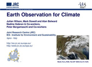
1. FP7 – Environment – National Information Day, Dublin 6th October 2010 1
Earth Observation for Climate
Julian Wilson, Mark Dowell and Alan Belward
Nadine Gobron & Co-workers,
Peter Bergamaschi and Co-workers
Joint Research Centre (JRC)
IES - Institute for Environment and Sustainability
Ispra - Italy
http://ies.jrc.ec.europa.eu/
http://www.jrc.ec.europa.eu/
Modis Terra, RGB, Feb 28th 2009 (from R. Hoff)
2. Topics
FP7 – Environment – National Information Day, Dublin 6th October 2010 2
• European capacity for space-based observations of
climate study
• JRC Research on Essential Climate Variables
• CH4 emission inversions using SCIAMACHY
• 12 year time series of fAPAR derived from two
different sensors (MERIS & SeaWiFS)
3. Background
FP7 – Environment – National Information Day, Dublin 6th October 2010 3
• Space Council 5# and 6#
– Recognised space & Climate
Change as key priority
– Called on EC to define how
GMES services and European
space observation archives
can contribute most effectively
to the provision of data
• Competitiveness Council
December 2008 Cox and Stephenson 2007, Science Vol 317
– invited EC to foster the Observations
implementation of the GMES
climate change monitoring to
support the EU policies
4. European capacity for monitoring and assimilating
space based climate change observations
FP7 – Environment – National Information Day, Dublin 6th October 2010 4
• Study published as JRC
Science and Technical
Report
• Includes:
1. overview of European capacity
2. gap analysis
3. infrastructure issues
4. programmatic and governance
adequacy discussion
• Provides a European
perspective: participants
& contributors included
ESA, EUMETSAT, Met
Office, ECMWF, national
• agencies
5. ECV Gap analysis table
FP7 – Environment – National Information Day, Dublin 6th October 2010 5
6. Europe has the capacity to deliver FCDRs/ECVs
FP7 – Environment – National Information Day, Dublin 6th October 2010 6
• Proven capacity in space hardware
development / construction, algorithm
development and operational
generation of a subset of ECVs (gaps
do exist)
• World-leading capabilities in the
reanalysis of climate data and
assimilation of these and satellite
derived observations to provide high
quality analysis of climate and climate
change
• Relevant and capable institutions, with
complementary (though not always
synergistic) modes of operation
7. Current Capacity for FCDR/ECVs
FP7 – Environment – National Information Day, Dublin 6th October 2010 7
• 31 of the GCOS ECVs are measurable through space-based observations
• European capacity currently available or commissioned to measure 29 of
these ECVs
• Around 40% of these 29 are available through end-to-end production (e.g.
CCI, some EUMETSAT SAF and GMES Services) – but long-term
guarantees for operational production still have to be secured.
However:
• FDCR/ECV provisioning and reanalysis/assimilation in Europe is based
on research funding or performed in the margins of numerical weather
prediction (NWP)
• Because funding is not from an operational budget line Europe is unable
to make the move from research to operations
• We are having to de-scope planned activities, even where these are
essential and based on proven world-class science. This underplays
European scientific capacity, is a handicap to joint implementation and
makes it impossible for a climate service to deliver sustained information,
as required in any legal or operational setting
8. The way forward to operational systems
FP7 – Environment – National Information Day, Dublin 6th October 2010 8
• Joint Programme implementation is needed to fill gaps, avoid
overlap and promote synergy
• Domain-based approaches (atmosphere, ocean and land) should
be enhanced by an integrated approach using dedicated
assimilation schemes
• Increased computing power (computational/storage, bandwidth
and skilled personnel) is needed to ensure that coupled Earth
System models can be run, and that the spatial and temporal
resolution of these can be improved
• The improvements should build on established skills centres
nationally & at the European level.
Effective provisioning of data and information needs a stable
financial platform which guarantees sustained support for
– a) the space segment making measurements
– b) for the processing, product generation and their QA/QC
– c) for reanalysis and assimilation strategies to turn these data
into policy relevant information
9. What Next ?
FP7 – Environment – National Information Day, Dublin 6th October 2010 9
• Because activities are funded from many sources the
overall amount is difficult to establish. A dedicated
study is needed to identify the current levels of public
expenditure on climate information provision. From this
we can then estimate the budget needed to secure
operational climate information services in Europe.
• A gap analysis performed on the basis of sensor
capacity this may be VERY different to one based on
product availability, this will be a topic for future work
(maybe in the context of CEOS)
• There is a notable difference between the availability of
climate relevant products and generation of systematic
time-series of GCOS compatible ECVs, future initiatives
should acknowledge this and strive to achieve the
demanding GCOS standards
10. basic principles + objectives of inverse modelling
FP7 – Environment – National Information Day, Dublin 6th October 2010 10
monitoring of global and
regional CH4 cycle
● anthropogenic sources
● natural sources and their
feedback to climate change
top down estimates of emissions
monitoring of global and regional CH4 cycle
● anthropogenic sources
● natural sources and their feedback to climate
change
verification
Kyoto protocol
11. SCIAMACHY - Scanning Imaging Absorption spectroMeter
for Atmospheric CartograpHY
FP7 – Environment – National Information Day, Dublin 6th October 2010 11
absorption spectra of solar radiation (near-IR)
-> high sensitivity also in PBL
SCIAMACHY
Absorption Kernel
12. XCH4 and emissions - seasonal variation
FP7 – Environment – National Information Day, Dublin 6th October 2010 12
SCIA
TM5
[Bergamaschi et al., J. Geophys. Res., 2009]
13. Asia - seasonal XCH4 and emissions
FP7 – Environment – National Information Day, Dublin 6th October 2010 13
SCIA
TM5
[Bergamaschi et al., J. Geophys. Res., 2009]
14. Global Changes in Biosphere Vegetation
Dynamics Using MERIS & SeaWiFS data
FP7 – Environment – National Information Day, Dublin 6th October 2010 14
• Operational MERIS Level2 products (i.e. MGVI) provide
FAPAR daily values at 1.2 km since April 2002.
• The retrieval algorithm is physically based using TOA
BRF in blue, red and NIR bands as inputs (Gobron et al.,
1999, 2001).
• Time-composite assigns one representative value over
10-days or monthly period (Pinty et al., 2002).
• Remapping code is used by averaging available FAPAR
values within 0.5º x 0.5º grid-cell to make global
products (Taberner et al., 2004).
• MERIS global products are processed at G-POD (ESRIN).
• FAPAR from SeaWiFS data from 09/1997 are produced at
JRC following same way (Gobron et al., 2001, Mélin et al., 2002).
15. 12 years of global monthly
FP7 – Environment – National Information Day, Dublin 6th October 2010 15
16. Global View
FP7 – Environment – National Information Day, Dublin 6th October 2010 16
Annual 2009 FAPAR anomalies at the global scale relative to the period 1998
to 2009 average: The strongest positive anomalies are found in Eastern Brazil
and South Africa whilst South America and East Africa exhibit the strongest
negative anomalies; the persistent droughts in Southern America, East Africa
and Australia are clearly manifest in poor vegetation growth and vigour.
2009 Anomaly
Gobron et. al, 2010, FAPAR in ‘State of the Climate in 2009’, M. Willett, L. V. Alexander, and P. W. Thorne, Eds., BAMS
17. Global View
FP7 – Environment – National Information Day, Dublin 6th October 2010 17
Time series of monthly anomalies averaged along lines of longitude: the
presence of a negative trend occurring over a latitude band 30º to 50º in
the Southern Hemisphere. This trend is strong enough to yield global
monthly negative anomalies for the most recent years.
+90
+45
Latitude
0
-45
-90
98 99 00 01 02 03 04 05 06 07 08 09 10
Year
Gobron et. al, 2010, FAPAR in ‘State of the Climate in 2009’, M. Willett, L. V. Alexander, and P. W. Thorne, Eds., BAMS
18. Global View
FP7 – Environment – National Information Day, Dublin 6th October 2010 18
Monthly fAPAR spatially averaged
over the globe from 1998 to 2009.
0.015
0.010
0.005
Anomalies
0.000
-0.005
-0.010
-0.015
98 99 00 01 02 03 04 05 06 07 08 09 10
Year
Gobron et. al, 2010, FAPAR in ‘State of the Climate in 2009’, M. Willett, L. V. Alexander, and P. W. Thorne, Eds., BAMS
19. FP7 – Environment – National Information Day, Dublin 6th October 2010 19
Thank You!