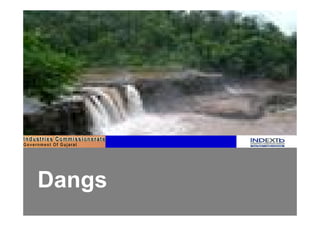
Dangs - District Profile
•
2 likes•3,718 views

Vibrant Gujarat Summit 2011 - District Profile : Dangs

Recommended
More Related Content
What's hot
What's hot (20)
Viewers also liked
Viewers also liked (20)
Similar to Dangs - District Profile
Similar to Dangs - District Profile (14)
More from Our Vibrant Gujarat
More from Our Vibrant Gujarat (20)
Dangs - District Profile
- 1. Dangs
- 2. INDEX 1 Dangs: A Snapshot 2 Economy and Industry Profile 3 Support Infrastructure 4 Social Infrastructure 5 Tourism 6 Investment Opportunities 7 Annexure 2
- 3. 1 Dangs: A Snapshot 3
- 4. Introduction: Dangs Map1: District map of Dangs with major towns § Dangs is a tribal district located in southern Gujarat § The district shares its border with the State of Maharashtra and is covered with high hills and dense forests § The district headquarter is Ahwa § Girmal, Waghai, Saputara, and Mahal are the major towns of the district § The reserved forests in Dangs are amongst the richest forests in the State § Dangs district is gradually emerging into an agro Girmal processing and tourism hub Mahal § Saputara is an important tourist destination in the district Ahwa Waghai § Rich wildlife, gardens, ropeway, sunrise point and echo Saputara District point are some of the main tourist attractions in Dangs Headquarter Towns 4
- 5. Fact File 73.29º to 73.51º East (Longitude) Geographical Location 20.39º to 21.05º North (Latitude) 37º Centigrade (Maximum) Temperature 6º Centigrade (Minimum) Average Rainfall 3,048 mm Rivers Purna, Gira, Khapri and Ambika Area 1,764 sq. km. District Headquarter Ahwa Population 1,86,712 (As per 2001 Census) Population Density 81 Persons per sq. km Sex Ratio 986 Females per 1000 Males Literacy Rate 59.06% Languages Gujarati, Hindi and English Seismic Zone Zone III Source: Dangs District Profile & Socio-economic review 2006-07 5
- 6. 2 Economy and Industry Profile 6
- 7. Economy and Industry Profile § In Dangs, 50% of population is working § Majority of population is dependent on agriculture for their livelihood § Animal husbandry and bamboo cutting are the other economic activities in the region § There are approximately 100 small scale industries in Dangs § Average landholding per household in the district is 1.58 hectares § Firewood accounts for fuel requirement of 91% of the households, which is mostly collected from the forests Source: Dangs District Collectorate 7
- 8. Agriculture Fig. 1 Food Crop Production (MT) 2006-07 § Major food crops and fruits produced in the 31,300 district are rice, ragi, kharsani, tuver, groundnut, mangoes, custard apple, and others 52,000 20,400 § 66% of the agricultural land in Dangs is situated on slopes, with uneven terrain Rice Pulses Maize § Local traditional crops like ragi are best adapted for Fig. 2 Fruits, Spices, & Vegetable Crops Production cultivation in Dangs as it can grow in rain-fed areas (MT) 2006-07 on sloppy land 1,294 § The agricultural production pattern is slowly 11,359 changing from traditional coarse grains like ragi, 13,165 kharsani, and tuver to rice Fruits Vegetables Spices Source: Department of Agriculture, Government of Gujarat, 2007 8
- 9. Forests § 59% of the area in Dangs is covered with forestland Map 2: Wildlife Sanctuaries (1,062 sq.km.) § The forestland predominantly falls under reserve forests, and is the richest forest in Gujarat Purna Sanctuary § The forests of Dangs are resources for medicinal plants, such as Mardasingi (Helicteres ixora) and Dangs Baheda (Tecome stans microcarpa). Besides these, Vansada National Sag (Tectona grandis), Khakro (Butea monosperma), Park Umbero (Ficus racemora), and bamboo trees are also present § The Purna Wildlife Sanctuary and the Vansda National Park present in the district are home to wildlife such as hyena, sambar, chital, barking deer, and monkey Source: Dangs District Collectorate 9
- 10. Small Scale Industry Clusters Map 3: Small Scale Industry Clusters Girmal Mahal Ahwa Waghai Saputara z Farm-based industries Bamboo furniture Plantation and nursery development Food-based industries Source: Dangs District Collectorate 10
- 11. Economy Drivers § Forestland provides maximum opportunities to generate sustainable livelihood and employment for the villagers § Animal husbandry and dairy production have increased business opportunities for the local population § Agro-processing and tourism are the supporting pillars of the economy § Plantation and nursery development activities have the potential to generate maximum wage employment § The district also owns a few small and large waterfalls, rich forests, beautiful landscapes, and a tribal culture which account for huge influx of tourists in the district 11
- 12. 4 Support Infrastructure 12
- 13. Road, Rail and Airport Connectivity Map 4: Dangs Road & Rail Network Road and Rail Connectivity § Dangs is well connected with Maharashtra state by roads § A railway line connects Waghai with Navsari district Table1: Distance of Dangs from Major Industrial Centers Major Talukas Distance (km) * Major Indian Cities Distance (km)* Ahmedabad 349 Valsad 100 Kolkata 1609 Rajkot 570 Chennai 1278 Mehsana 479 Surat 139 Hyderabad 732 Vadodara 266 Delhi 1111 Jamnagar 660 Ankleshwar 190 Mumbai 297 Airport § Nearest airport from Ahwa is at Surat situated at a distance of 139 km, which is well connected to Delhi, Ahmedabad, and Jaipur * All distances are measured from Ahwa Source: Dangs District Profile Booklet, 2007 13
- 14. Water Supply Water § Water supply for industrial purposes in the district can be obtained from two main sources, viz Gujarat Water Supply and Sewerage Board (GWSSB) and irrigation Canals § Almost all water supply systems in the district are based on groundwater reserves Table 2: Centralised Water Supply Infrastructure Facilities Available No. of villages Drinking water tanks 167 Stand Post 154 Pipeline 98 Cattle trough 168 Washing facilities 6 Source: Dangs District Collectorate 14
- 15. 5 Social Infrastructure 15
- 16. Education Education: Table 3: Educational Infrastructure § There are 412 primary schools and 32 secondary and higher Educational Total Institutes secondary schools in the district Primary Schools 412 § The Anganwadi is the primary service centre for integrated child Secondary development are present in 210 out of 311 villages Schools 32 § A Government Arts & Commerce College is located at the district Higher Secondary headquarter Ahwa Schools § The Industrial Training Institute in the district imparts training in Polytechnic 1 College diverse areas such as cutting and sewing, armature and motor ITI 1 rewinding, computer operating and programming assistance, wireman, hair and skin care, electrician, fitting and stenography Other Colleges* 1 Healthcare: *Other Colleges: Arts and Commerce College § The district has one community healthcare centers, seven primary healthcare centers, and forty seven sub-centers § There is one Central Government Hospital present at Ahwa § The district also has one Government Ayurvedic Hospital and nine Ayurvedic dispensaries 16
- 17. 6 Tourism 17
- 18. Tourism § Saputara, also known as “Abode of Serpents”, is a hill resort on a plateau of the Sahyadri range of mountains that offers rich wildlife for tourists § Saputara Museum contains interesting information about the topography and anthropology of Dangs § Hatgarh Fort situated 60 km from Saputara was built by Maratha Purna Wildlife Sanctuary Leader Chhatrapati Shivaji and is a beautiful piece of architecture § Gira Falls (3 km from Waghai) is a 30 meter natural drop into Ambika River and offers solace and relaxation § Purna Wildlife Sanctuary in the district has the thickest forest cover in the State and is filled with canopies of teak and stands of bamboo § Girmal Falls is the most picturesque sight in the district § Vansda National Park in Dangs, harbors large mammals including the leopards, hyena, jungle cat, macaques and barking deer. It is also Gira Falls home to the endangered Great Indian Squirrel Source: Gujarat India Guide 18
- 19. 7 Investment Opportunities 19
- 20. Investment Opportunities Agriculture § Farm based products § Forest based products § Cattle feed § Food processing industries Animal Husbandry § Dairy production § Poultry § Tannery business Tourism § Eco-tourism § Hotels § Campsites § Rural tourism * Detailed Sector/ Project Profiles for investment opportunities available at www.indextb.com 20
- 21. Annexure I Maps Figures Tables Map 1: District Map of Dangs with Major Figure 1: Food Crop Production 2005 – 06 Table1: Distance of Dangs from Major Towns Industrial Centers Map 2: Wildlife Sanctuaries Figure 2: Fruits, Vegetables, and Spices Table 2: Centralised Water Supply Production 2006-07 Infrastructure Map 3: Small Scale Industry Clusters Map 4: Dangs Road & Rail Network Table 3: Educational Infrastructure 21
- 22. Annexure II : Abbreviations SSI : Small Scale Industries GWSSB: Gujarat Water Supply and Sewerage Board ITI : Industrial Training Institute 22